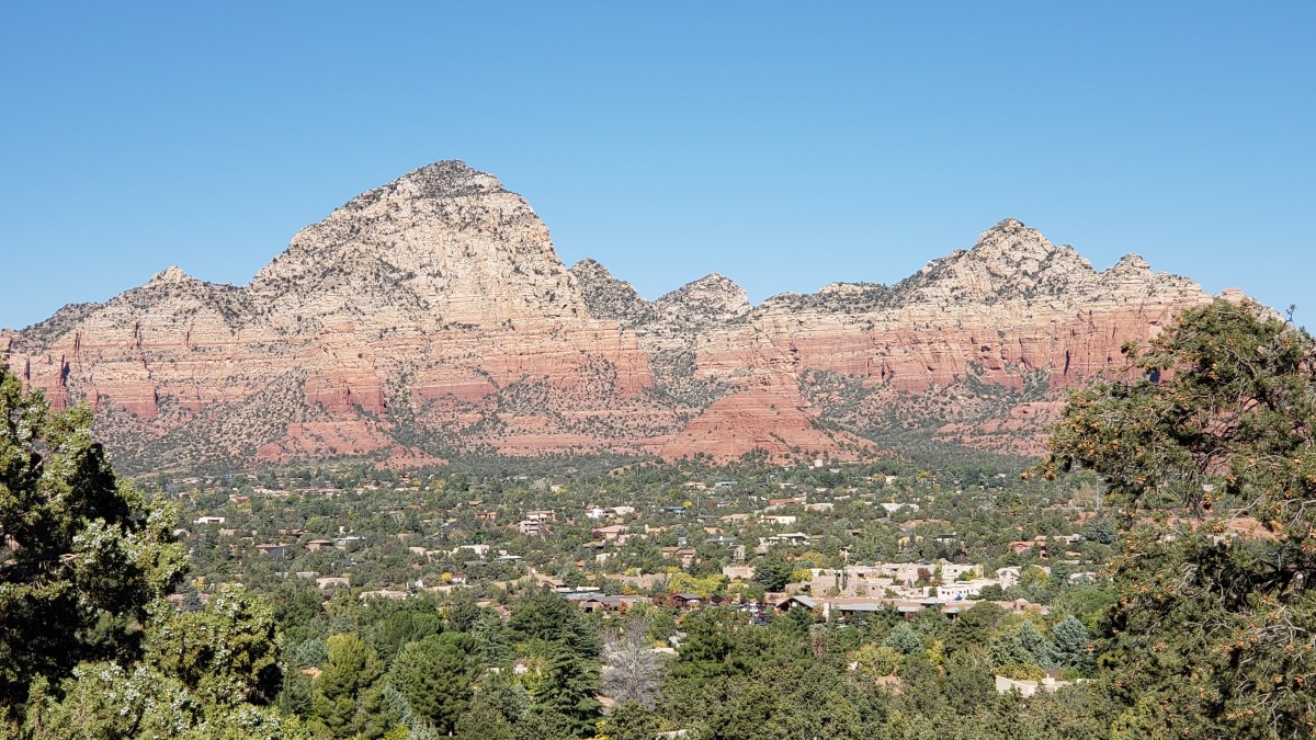
Here’s another look at our recently-completed RV adventure across the US from our exclusive series for The Independent, highlighting the section of the journey across southern Arizona and into New Mexico, with amazing sights that included Sedona, Tucson, Tombstone and the stunning migratory sandhill cranes of the Willcox Playa Wildlife Area:
The journey itself might be over, and our “A Year On The Road” RV adventure is officially in the books, but you can still catch up with all the excitement and intrigue on our YouTube channel, which now has almost 100 snapshot videos of different aspects of the trip in the bag.
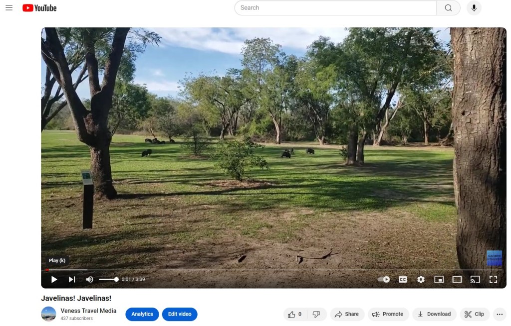
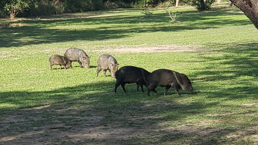
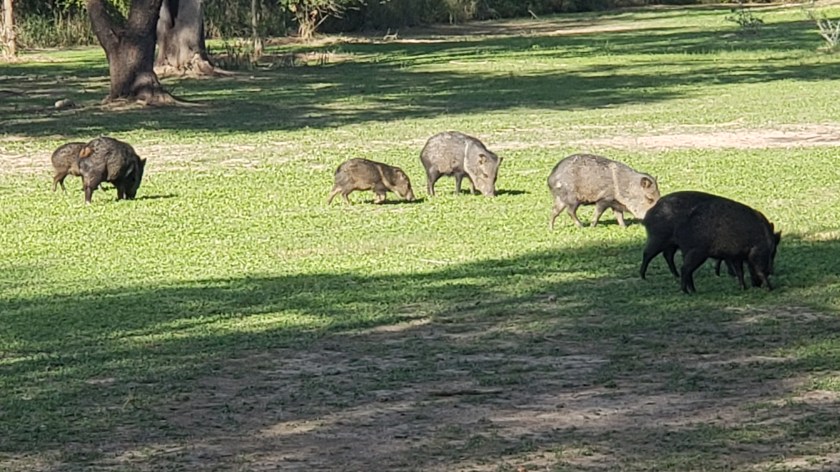
Javelinas! Jevelinas! Finally, we get to see Javelinas!
From Pictured Rocks National Seashore in Michigan to Yellowstone and the Grand Canyon, plus dozens of fascinating places and experiences in between, this is our chance to wow you with the visuals of this epic RV journey across 23 states.
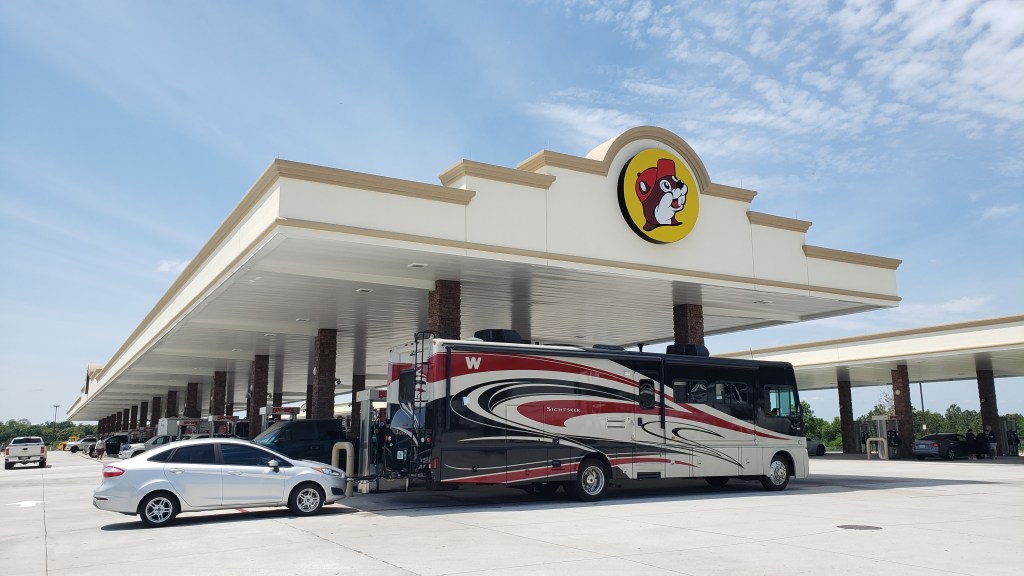
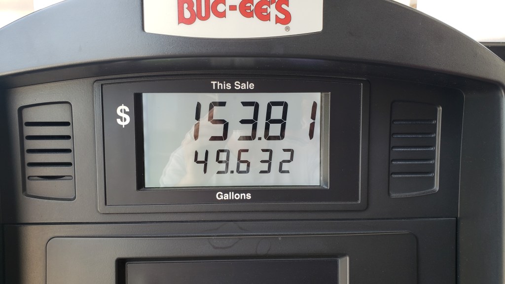
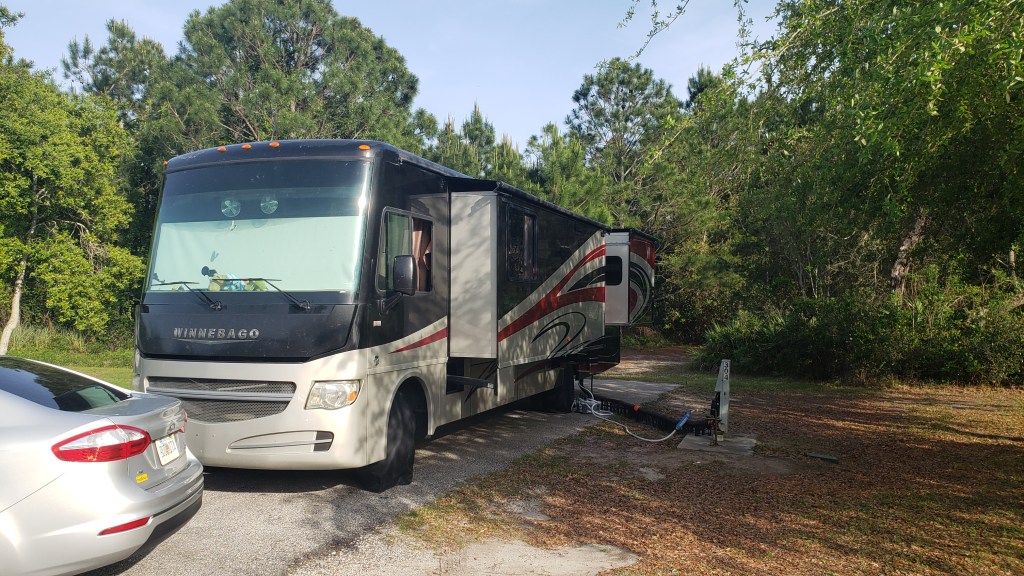
How do you burn through five hours when you’ve only got a 90-minute drive between campgrounds, you have to leave the first one at 11 a.m., you can’t check in at the second one until 4 p.m., and you have no idea where to find a place big enough to park a 36-foot rig and its tow car? You stop at a massive Buc-Ee’s, that’s how!
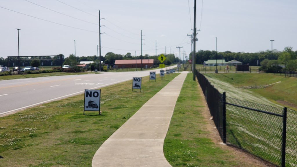
We were pretty tired of Buc-Ee’s sandwiches, but salad is always a good choice, so we gassed up Fati, grabbed two Cobb Salads, sat in the parking lot for a very long time (with a couple dozen other RVers), and on the way out we took a photo of Buc-Ee’s “No (trucks)” signs we’d seen when we stopped on our way to Tallahassee ahead of the storm. At that time, there were about 20 signs crammed into a long row just outside the parking lot, which read like, “No, no, no, no, no, no, no, no, no, no, no, no, no, no, no……” and made us laugh. Some of them got knocked down in the wind, so the joke wasn’t quite as funny anymore.
This was not for our salads and tea. It’s for 3/4 of a tank of gas.
Imagine 20 of these, just a foot or two apart. Is it just us, or is that funny?
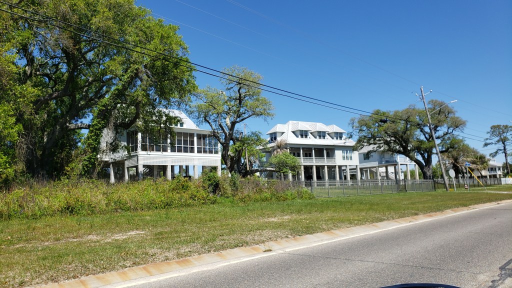
Over the course of the week, we took several drives along the Gulf and its bays, taking in the magnificent (expensive) homes between Point Clear and Daphne, and Fairhope’s lovely little downtown. One of the stoppers for us is the hurricane risk. And that’s a big stopper, right up there with snow. And dust storms.
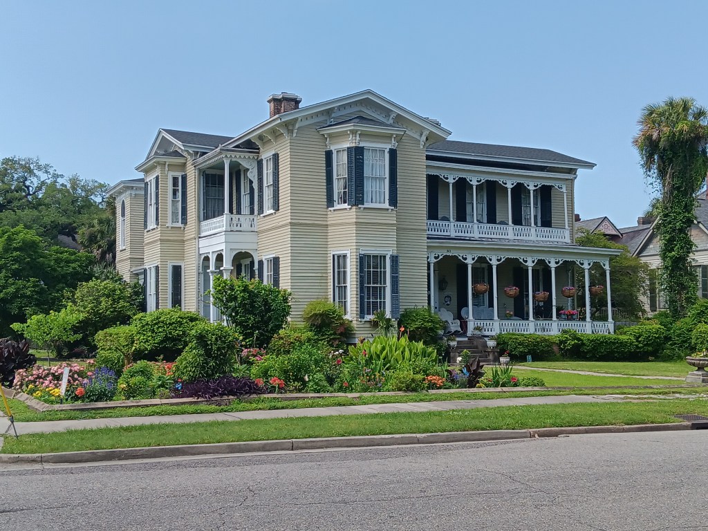
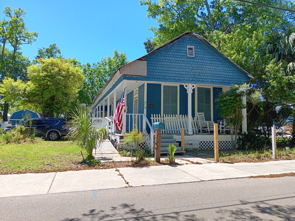
Our campground was south of Mobile, but we took a drive to the city and were surprised, once again, by the giant houses, many of which were just a street or two away from very modest homes. There is a lot to like about Mobile. Pretty parks, lots of history, and an interesting downtown with lots of personality. If Savannah and New Orleans had a baby, it would be Mobile.
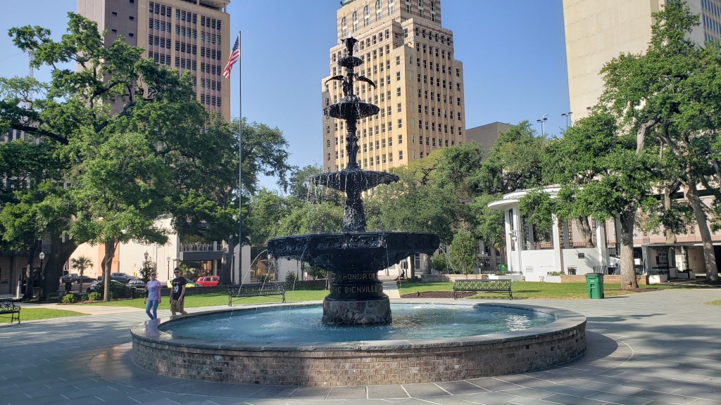
We felt pretty special when we came upon a park that had just that very day re-started its fountain after a long refurbishment. A couple of representatives were walking around asking people how they liked it, so we assured them it was a mighty fine fountain indeed.
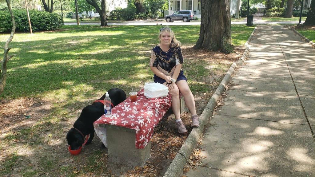
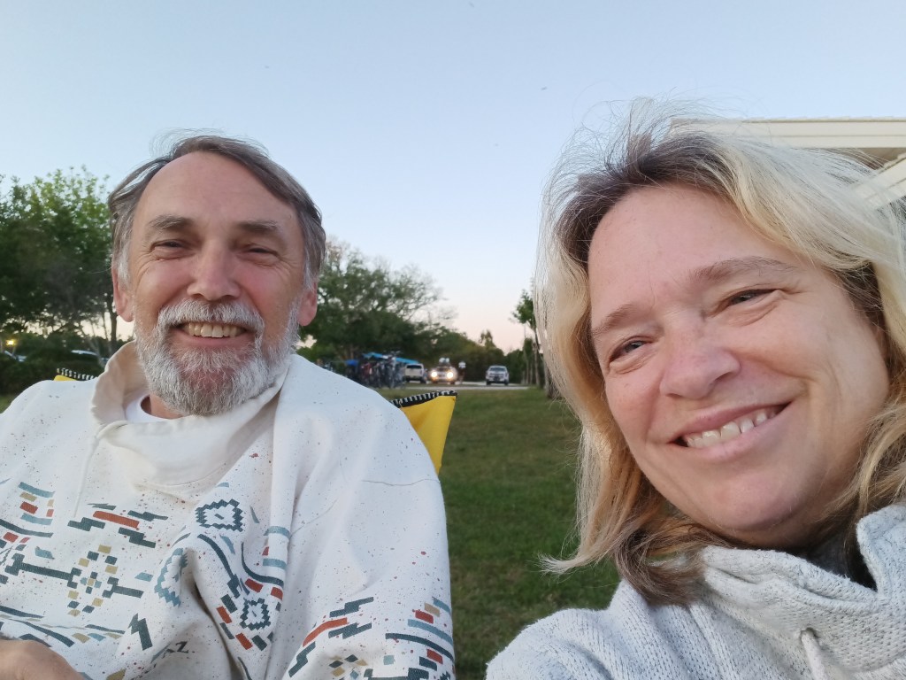
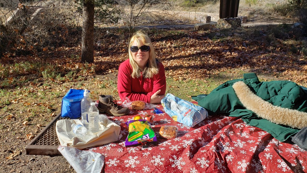
We grabbed lunch from an Irish pub that had come highly recommended, and laid our tablecloth down on a grubby bench (the only seating in an otherwise beautiful park) for a picnic. Here is my “social media” face from our al fresco lunch.
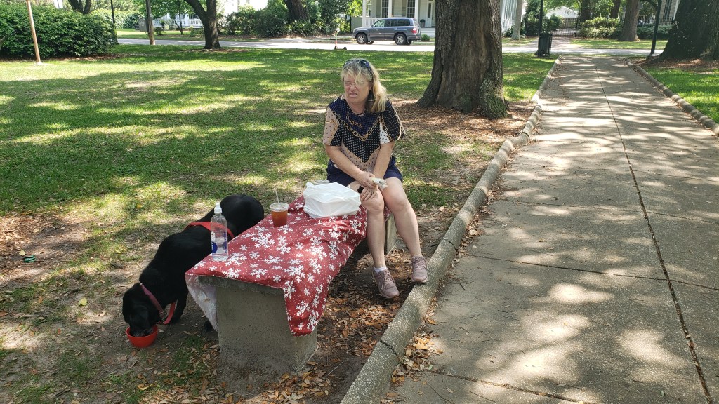
This is how I really felt about that bench.
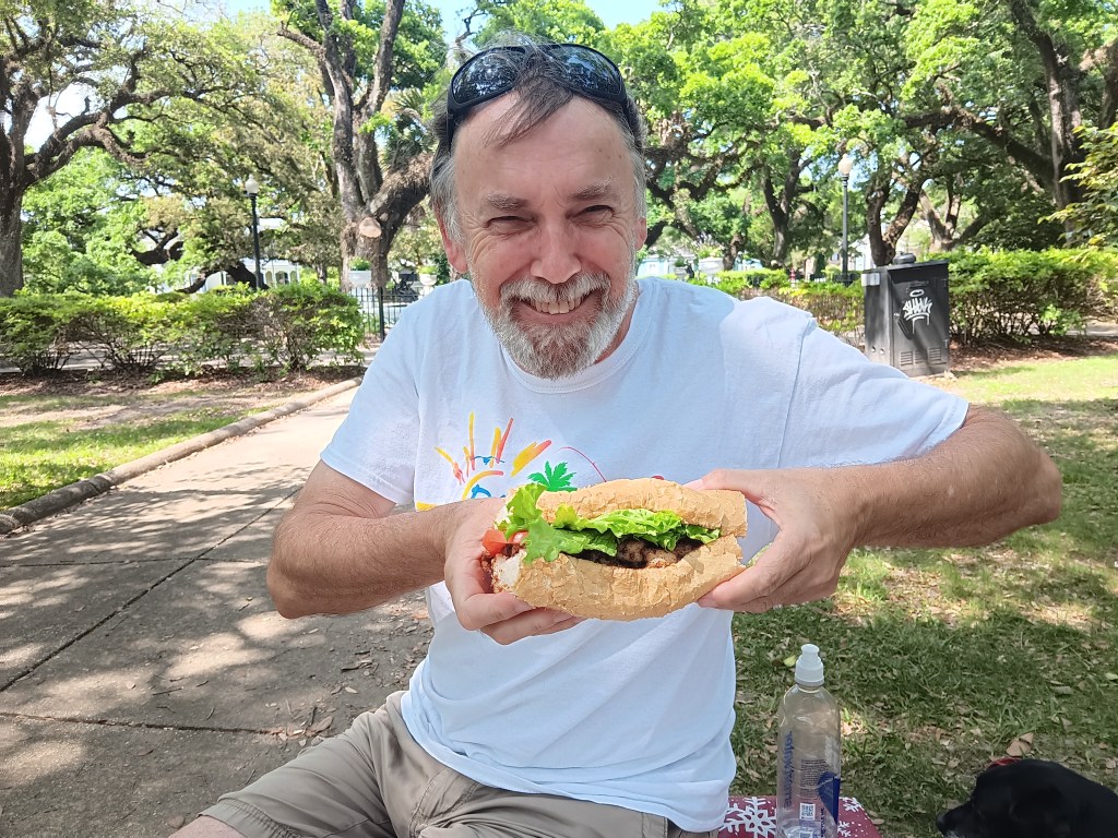
This is Simon eating a Shrimp Po’Boy that’s as big as his head (yes, he ate it all).
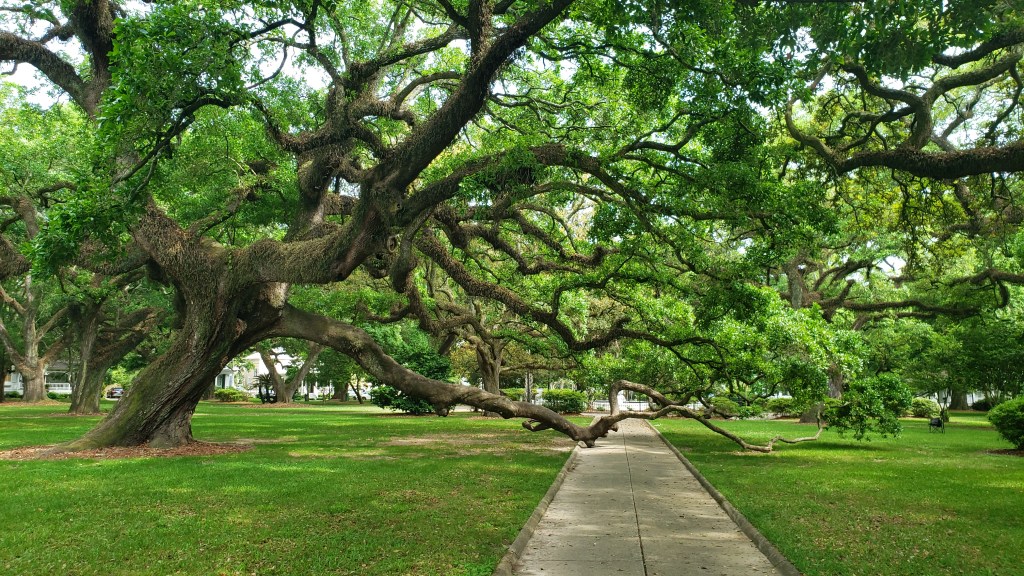
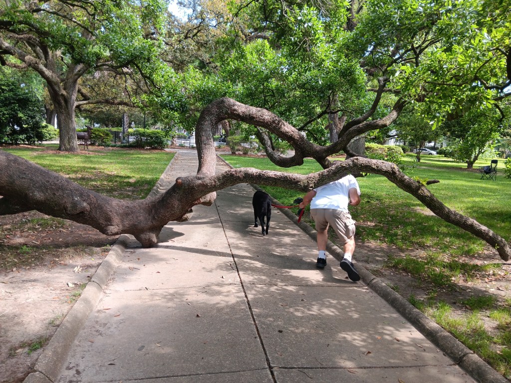
And this is a Live Oak in the park that waves its hands in the air like it just don’t care, but is also so old it has to balance itself a bit by holding on to the sidewalk.
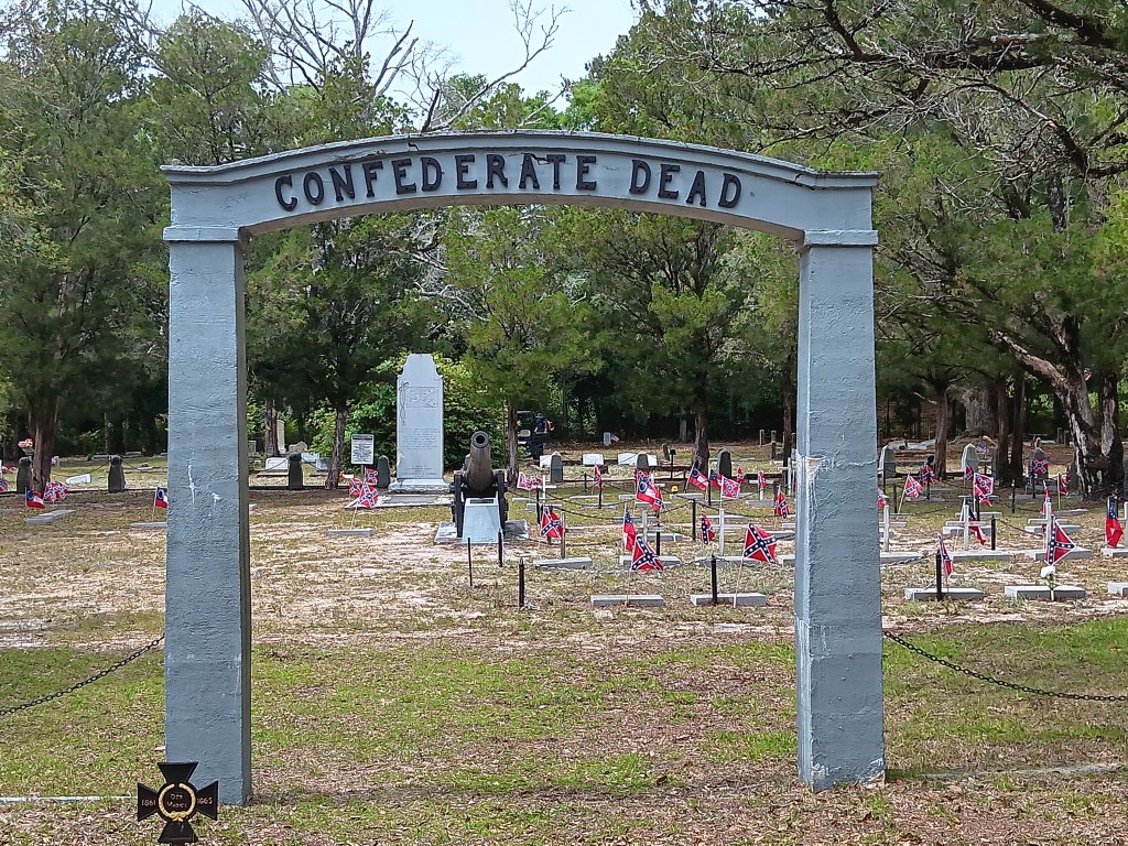
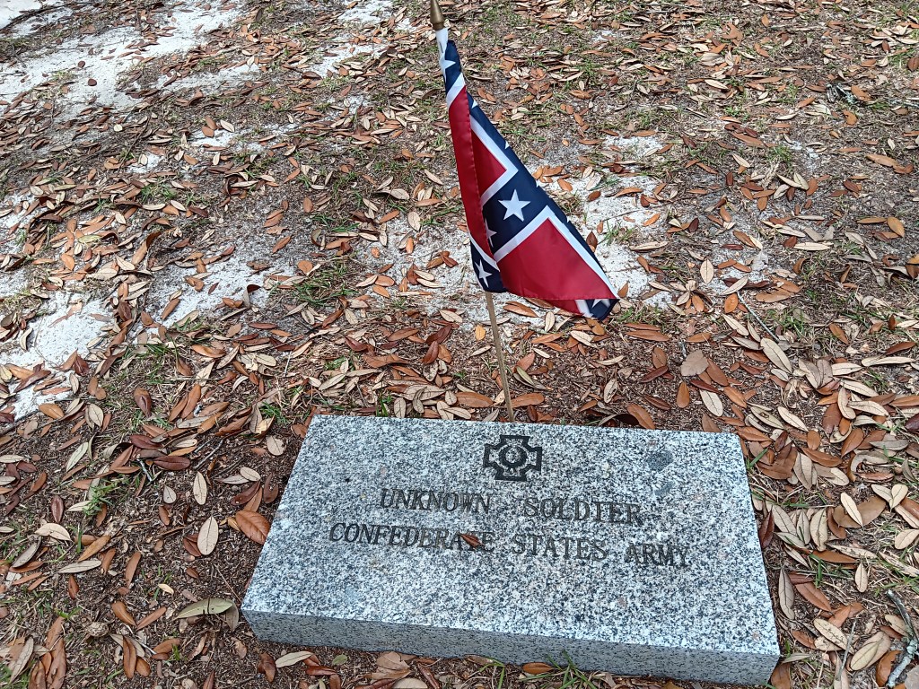
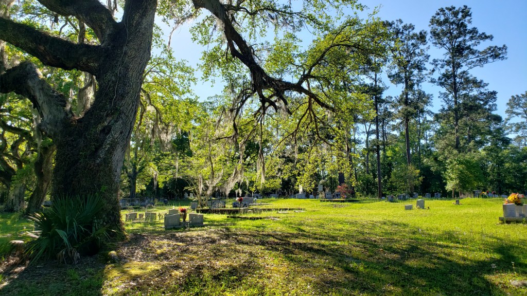
At the risk of sounding like we’re on some cemetery kick lately, we did visit the Confederate Rest Cemetery for its historical value. It is unquestionably right and fitting to remember your glorious dead (each one of them some mother’s son), and to keep their sacrifice in mind, and the cemetery certainly does that.
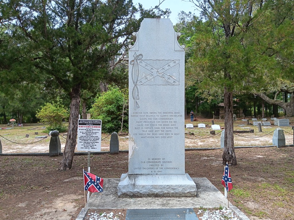
We did stare in mild disbelief as we read the monument put up by the United Daughters of the Confederacy, which reads:
Forever now, among the immortal dead, whose dust belongs to glory’s dreamland, sleeps the fair Confederacy. Right principles can never die. No cause for which the brave have bled in virtue’s name, for which the true have kept the faith, for which the dead have died in holy martyrdom, was ever lost.
Ummm….so much to unpack about that, isn’t there, starting with exactly what those “right principles” were all about.
On the back, it reads:
Furled in our conquered banner, but its folds, rich in immortal memories, bore no stain save the blood of her matchless heroes.
The monument went up in 1941. 1941! We have big feelings about that, but will leave you to your conclusions.
We’d been passing billboards for Lambert’s Cafe – and the actual restaurant itself – a few times, and decided to drop by to see what all the “throwed rolls” fuss was about. And yes, indeed, they do throw hot rolls at diners. Want one? Just put your hand up when the roll guy (or gal) comes by, and he (or she, or they) will whip one at you. Brilliant!
Hot rolls! Who wants hot rolls!
The area’s best attraction, however, was our campground. Gulf State Park is ginormous. Its hugeness is part of its charm, though, because it offers the largest amount of space between sites that we have seen on this trip. And, like Biloxi Bay, it feels like traditional camping, with pine trees, 28 miles of well-used walking and biking trails, and campfires around us each night. We could get used to this!
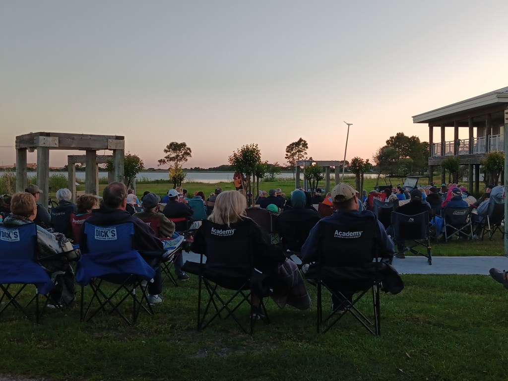
There are also a lot of activities, making it feel resort-like rather than just a campground. Simon loves live music, and one of the events was a free outdoor concert, so we packed up our chairs, poured a couple of G&Ts into our travel mugs, loaded up Ruthie, and spent a thoroughly enjoyable hour listening to a musician who plays Gordon Lightfoot music, having been a good friend of that artist. He also told us the real stories behind each of Lightfoot’s songs, many of them quite heart-wrenching. There may also have been tears when he sang Wreck of the Edmund Fitzgerald, a tragedy that happened in Susan’s home state of Michigan.
We had to move sites part-way through our visit, but the 50 yards it took to get to the second site was child’s play. Yes, we had to pack up the rig as we normally would (with a few exceptions, like not putting away our stuff in the bathroom, and bringing Starlink into the kitchen area rather than boxing it up), but we had a corner lot, which meant even more privacy, and also a view of the main road through the campground, which allowed for exceptional rig-watching.
Our second site. Look at all that room!
Now that we’re in the final month of our Grand Adventure, we’re doing a lot of rig-watching. We’re ready to stop for a while, but not ready to stop forever, so we’re eying smaller rigs we could be comfortable in for a few months at a time. We’re not sure we’re ready to trade in Fati yet, though. Decisions, decisions!
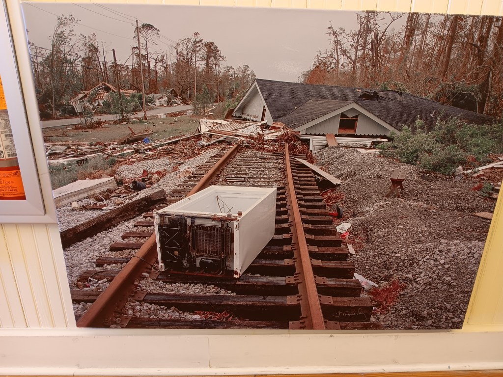
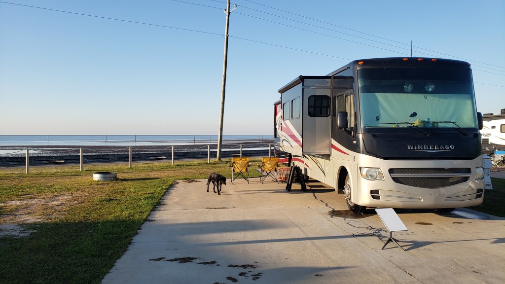
The name Waveland, Mississippi should have rung a loud and distinct bell for us, but as we pulled into our campsite at pretty Buccaneer State Park, with the Gulf of Mexico as our view, we were none the wiser. Over the next few days we’d discover reminders of the great trauma Waveland suffered at the hands of Hurricane Katrina were everywhere, primarily through how the tiny town fought its way back to recovery.
This photo is from the Ground Zero Museum, and it was taken right after Katrina hit.
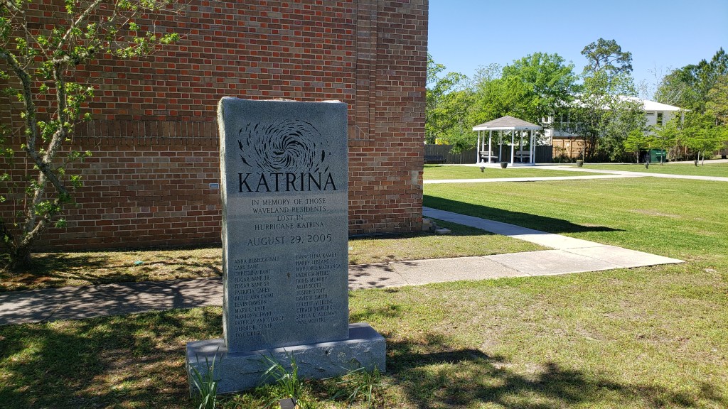
When Katrina passed and its 30-foot storm surge subsided, next to nothing was left of this once-peaceful seaside community. Homes? Gone. Businesses? Flattened. The railroad tracks running through Waveland? Bent and useless metal. It was one of the worst-hit places along the coast. New Orleans got the press, but Waveland also suffered immensely. Twenty-five of her residents lost their lives, including four in just one family.
Memorial to the twenty-five residents.
Our first stop after settling in was the Ground Zero Museum, which remembers that terrible time through photos, artefacts, and a short movie featuring survivor testimony.
Also from the Ground Zero Museum.
The railroad tracks a mile or more inland acted as a mini levee, and some of the homes on the north side of it survived. Everything south of the tracks was washed away.
Many plots that obviously once had homes on them still sit vacant.
But we found the town’s recovery even more interesting. A long line of huge, expensive homes has gone up along the waterfront (with a road between them and the Gulf), which speaks either to the indomitable human spirit or reckless optimism, and we’re not in a position to make the call on which one it is.
Next-door neighbor, Bay St. Louis, recovered relatively quickly. Settled by the French in 1699 under the name Shieldsborough, Bay St. Louis was held by the Spanish, then the British, and only received its current name in 1875. At one time it was earmarked to be Mississippi’s capital city, but Natchez won, only to lose their title to Washington, which lost the honor to Jackson.
It is now a somewhat touristy area, with shops and restaurants and a fun self-guided tour that takes you past 24 historic sites and buildings, some of which survived Katrina.
Built in 1929, this artist’s co-op was once a grocery store. It’s said to be haunted.
Alice Moseley, who became a famous folk artist at the age of 60, lived here.
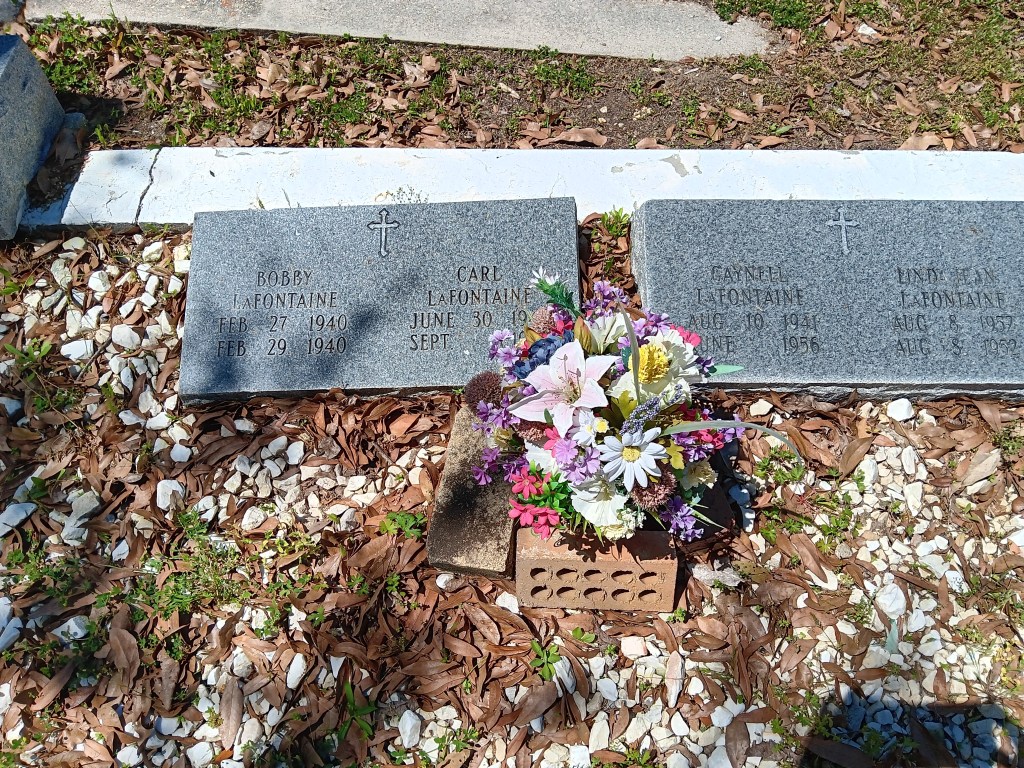
Cedar Rest Cemetery is also on the tour. Here, we found one of the most heartbreaking plots we’ve ever seen. A couple’s four children passed, one on the day of her birth, one on his third day of life, one in his third month, and one in his fifteenth year. Unbearable.
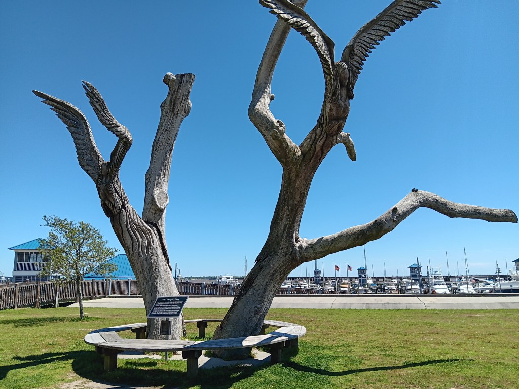
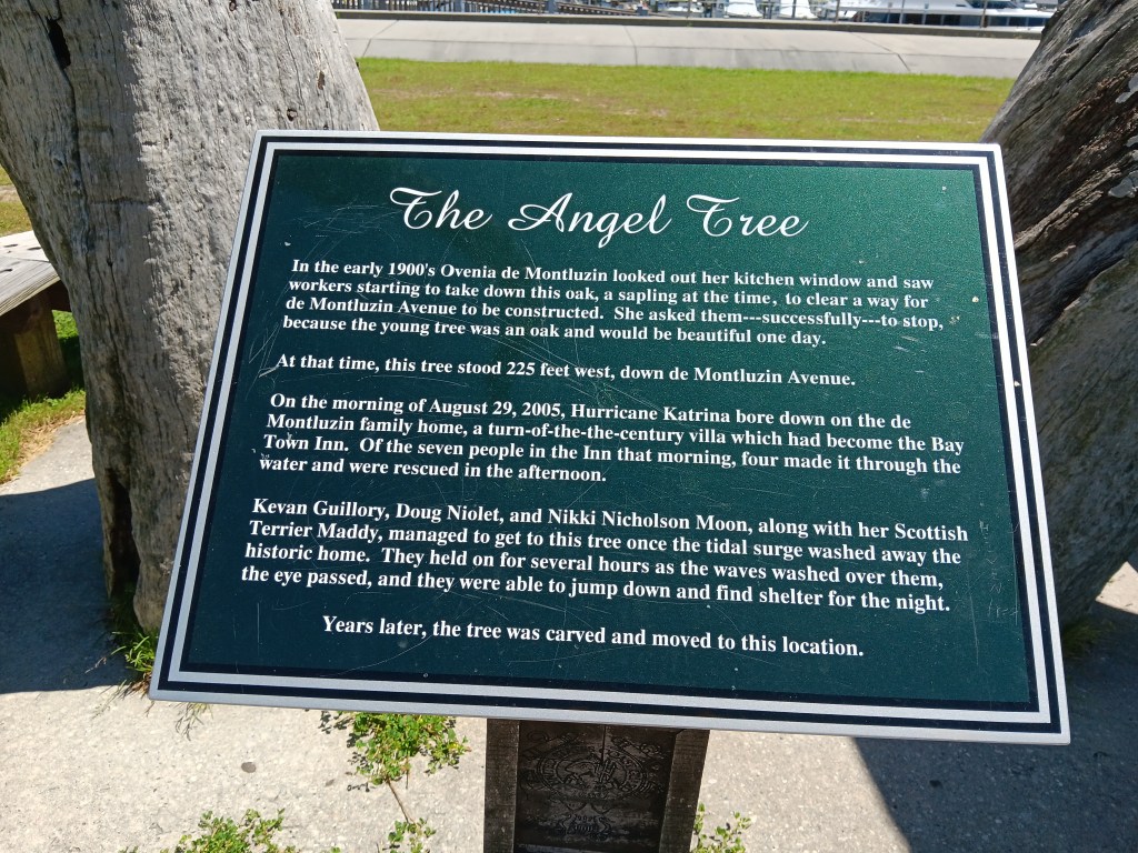
Also located here is the Angel Tree. We’ll let its marker tell you the story.
Look carefully and you’ll see two angels carved into the branches. Their wings are obvious, but their faces less so.
We took a drive out to Kiln on the suggestion there was an interesting historical downtown to explore, but if there was an actual downtown at all, we never found it. And we tried!
We did find a lovely road lined with Live Oak trees, and a marker for Logtown, founded in 1848 as a community supporting one of the United States’ largest lumber mills. Of course, its 250 citizens still living there in 1961 were “removed” so that the John G. Stennis Space Center could take over the land for NASA’s Apollo Moon Mission Program. *Sigh*
All that remains near the marker is a small cemetery.
We only had four days in Waveland, but we were so glad we added it to our itinerary. Hearing the waves from the Gulf at night, seeing the locals out fishing, and enjoying the laid-back vibe, especially at sunrise and sunset, revived us after our time in the Big Easy. But we weren’t finished with the beach just yet.
Simon (whispering): Javelina! There’s one walking right out into the park!
Susan (looking): Why would you lie to me like tha…..Ohhhhhhhhhh!! OHHHHHHHHH!
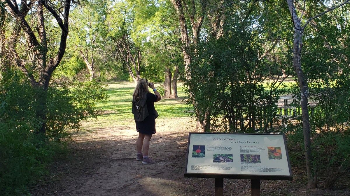
We interrupt our regularly scheduled blog to announce that Texas gave us a wonderful, unexpected sighting of eleven javelina at the Bentsen-Rio Grand State Park bird refuge in the southwestern corner of the state. It then gave us six more rooting around in a ditch along the road.
Clap three times if you believe javelina exist, because we do (clap, clap clap)!
We’ve been looking for them nearly every day for four months and in three states. Texas comes through!
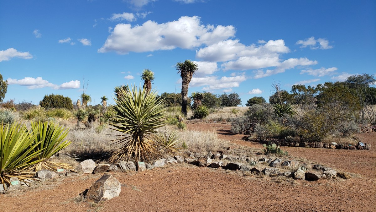
We’d been in North America’s largest desert for weeks, and in eight other deserts for the past six months. Cactus and pronghorn and the swirling dance of dust devils had been our near-constant companions. Our next destination would take us into the plains, then to the Gulf coast, so a final farewell to the arid wilderness was on our dance card.
The things you see in the desert when you haven’t got your gun…
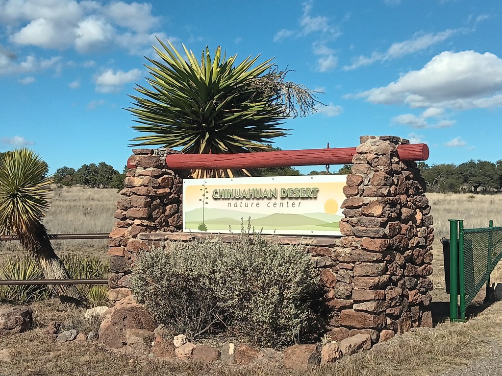
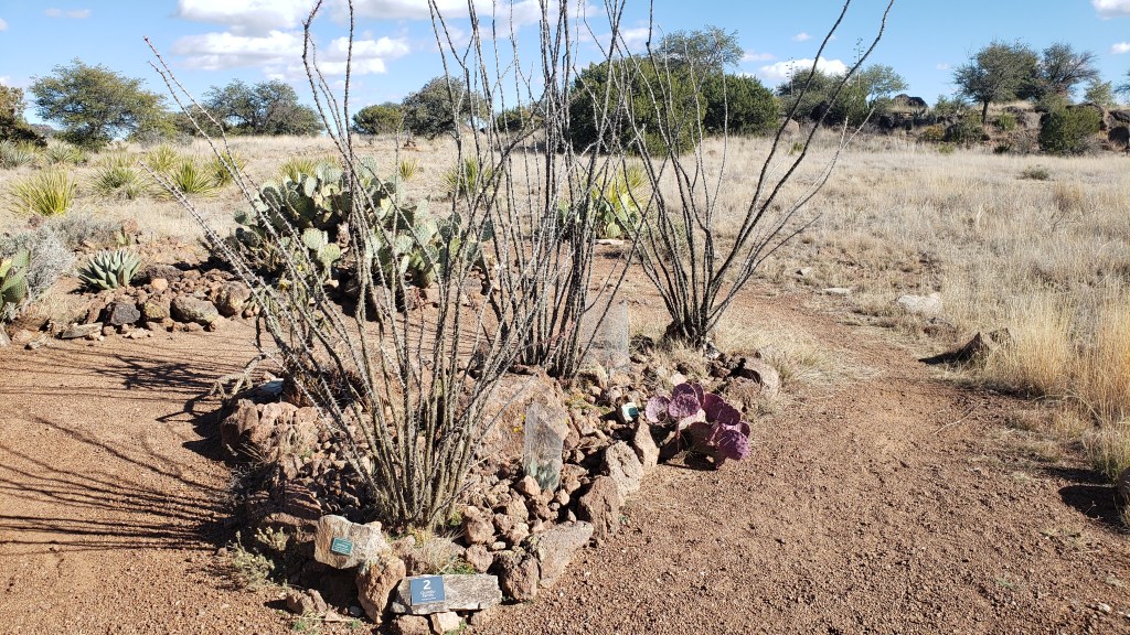
Ninety percent of the Chihuahuan Desert is in Mexico, but it also extends from Alamogordo, New Mexico to just beyond Alpine, Texas in the U.S.. Like a gateway to its northbound entry or southbound exit, the Chihuahuan Desert Nature Center was just up the road from our Alpine campground, so we paid a good-bye visit.
Really, this was the kind of place we should have been to months ago. All of our questions about “What’s THAT” would have been answered. Even so, we spent a happy hour wandering the pathways pointing at plants and remembering where we saw them in our travels.
Ocotillo is used for building fences in the western U.S. in the same way thorny brush is used in places we visited in Africa. Fascinating.
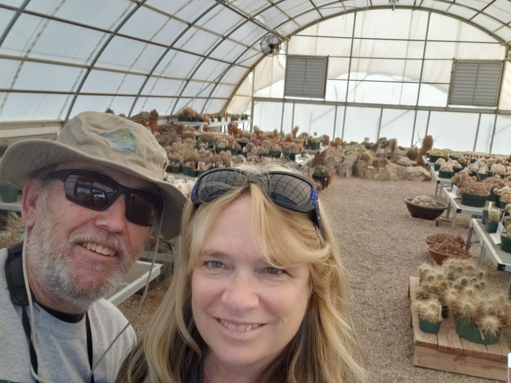
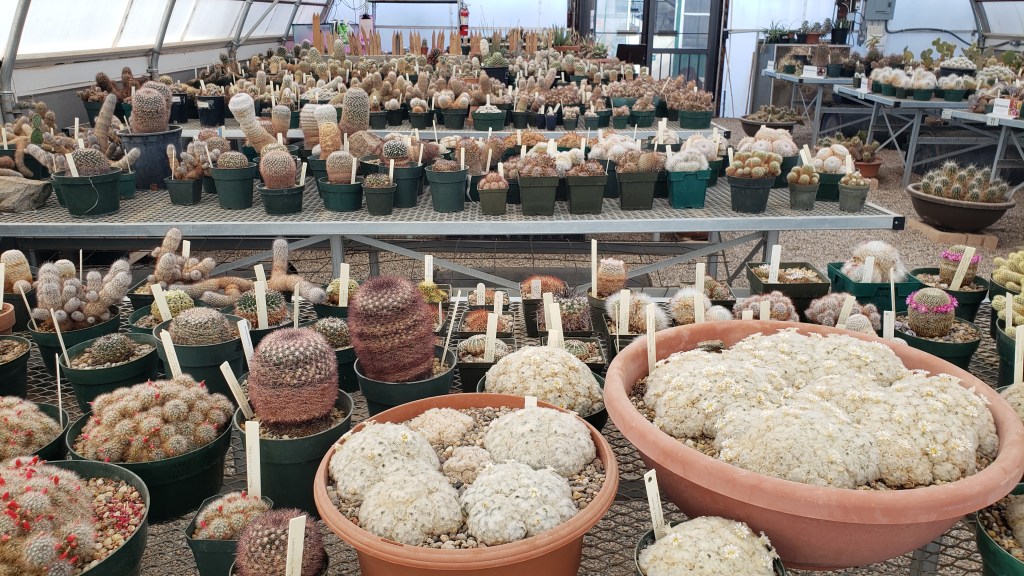
We knew most of the big cactuses and several types of agaves, but the Cactus Museum offered a trip down Memory Lane for Susan, whose parents were Master Gardeners and kept quite a few indoor cactuses over the years.
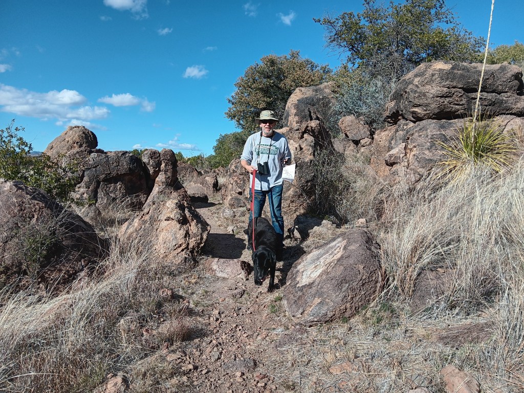
Ruthie had to wait outside the museum, and she wasn’t happy about it. At all.
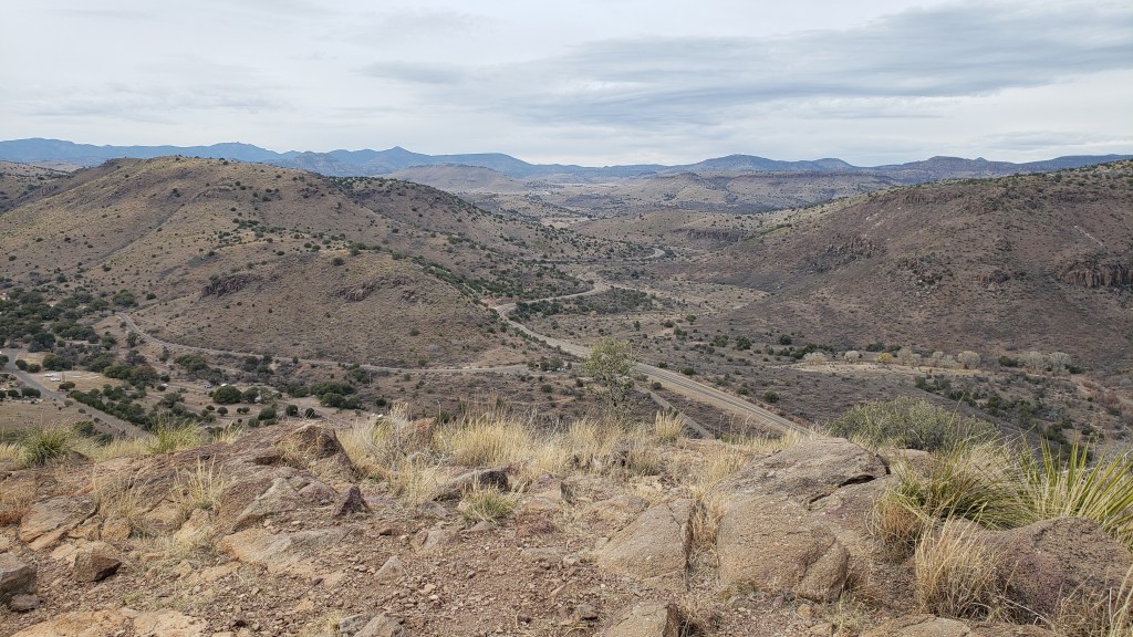
Davis Mountains State Park in the town of Fort Davis was not far away, so Simon pointed Nippy in that direction the next day, for a low-key last-look at Texas’s mountainous landscape.
Primarily a spot for hiking and camping, this little state park also had two bird blinds, one of which was in the interpretive center. Here, we saw birds we’d never seen before, though we didn’t see the main draw for visitors, which is the elusive Montezuma quail. Apparently, we were so captivated by what bird life we did see that neither of us thought to take a photo.
Throughout our trip, we’d both been fascinated by the varying geology we were passing (you’ve guessed that if you’ve been following our blogs), and today there was a Ranger talk specific to the volcanic mountains we were in, so he joined the group while Susan continued to bird-watch and keep an eye on Ruthie.
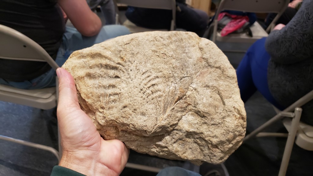
As with all of the southwest, the Alpine area has its share of fossils, this time imprinted in limestone.
This metamorphic rock has been molded and shaped by volcanic activity into a little work of art.
We then drove up the Davis Mountain to see some of the features the ranger spoke about, and to get a good view of the surrounding ranges.
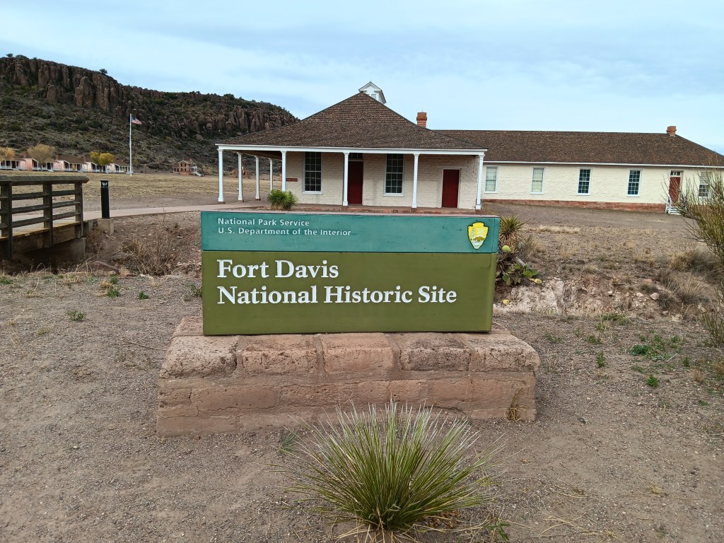
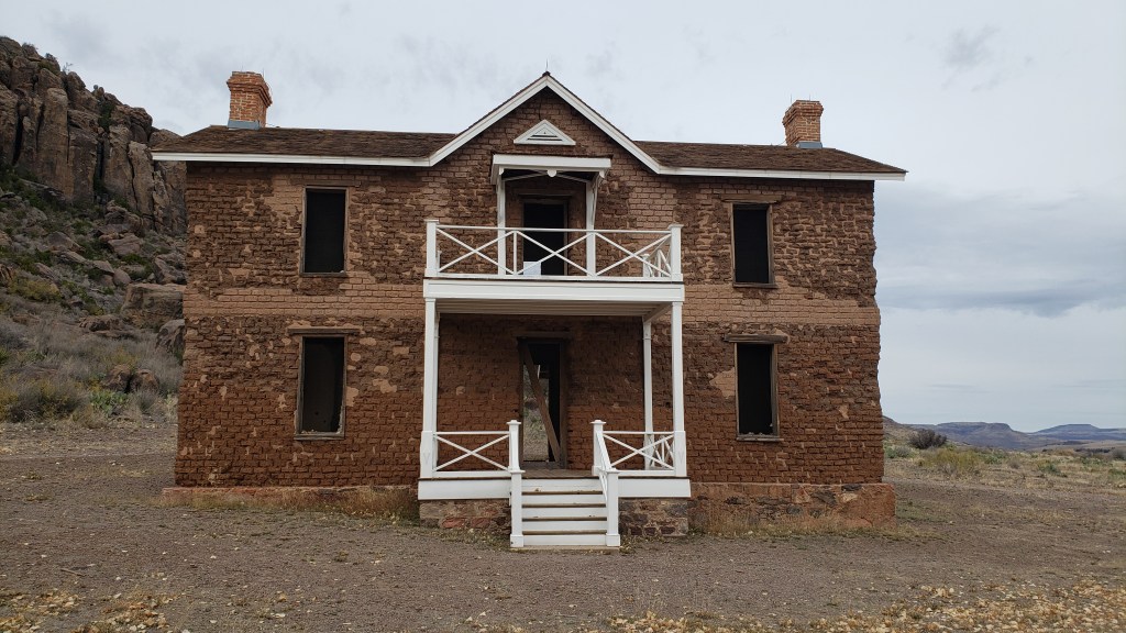
While we were in Fort Davis, a wander around Fort Davis National Historic Site was in order. The compound, established in 1854, wasn’t strictly a military outpost. It was also strategically placed to help protect the mail route and emigrants traveling through this part of Texas.
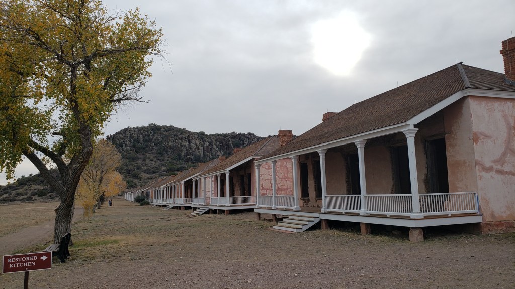
Several original buildings constructed from hand-made bricks are now in ruins, but many have been restored.
Officers’ homes.
Enlisted persons’ barracks.
Somebody fancy lived here.
A small museum told the area’s story, including the role of the “Buffalo Soldiers” who, among their other duties, were assigned to deal with Apache and Comanche tribes that were not amused by having their hunting grounds overtaken.
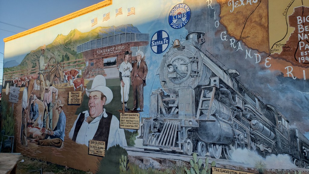
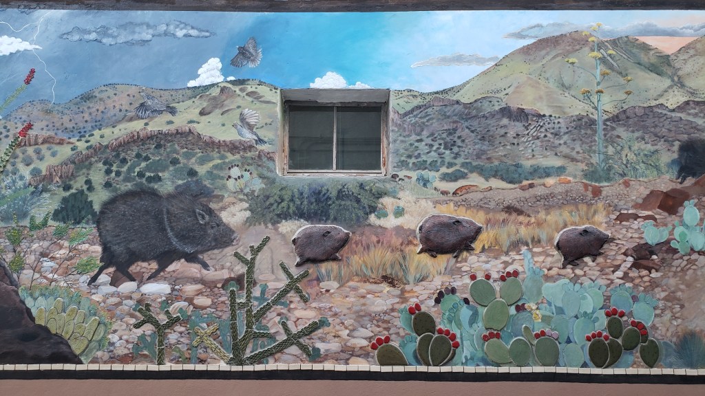
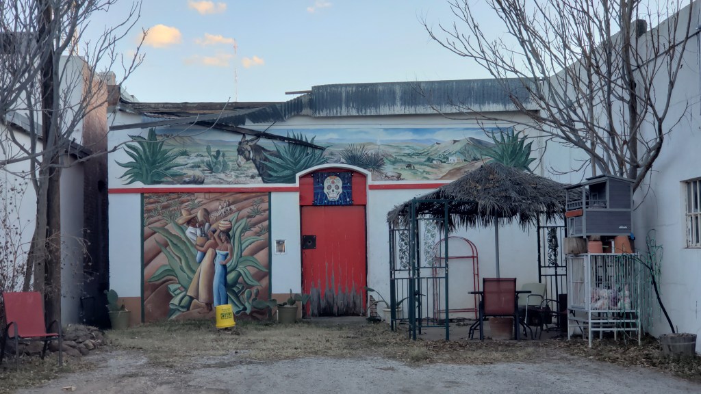
Road-weariness was catching up with us, so the next day we stayed local and did a tour of Alpine’s gorgeous murals.
Susan has fond childhood memories of sitting on her Papa’s lap watching the TV show Bonanza, and her favorite character was Hoss. Who knew he came from tiny Alpine?
Lies!
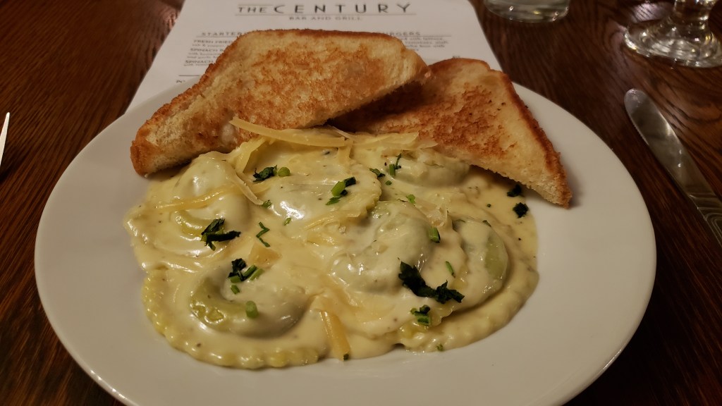
With our evening free, we freshened up and put on real clothes for an elegant dinner at The Century Bar & Grill in the historic Holland Hotel, built in 1928. Knowing we had our pup with us, they reserved a private room for us, but someone arrived before we did and snuck in, so instead we had our own table in the hotel lobby.
It’s a big, comfy lobby.
We started with the Alfredo Spinach Ravioli, which was so creamy and delicious we could easily have made it our entire meal.
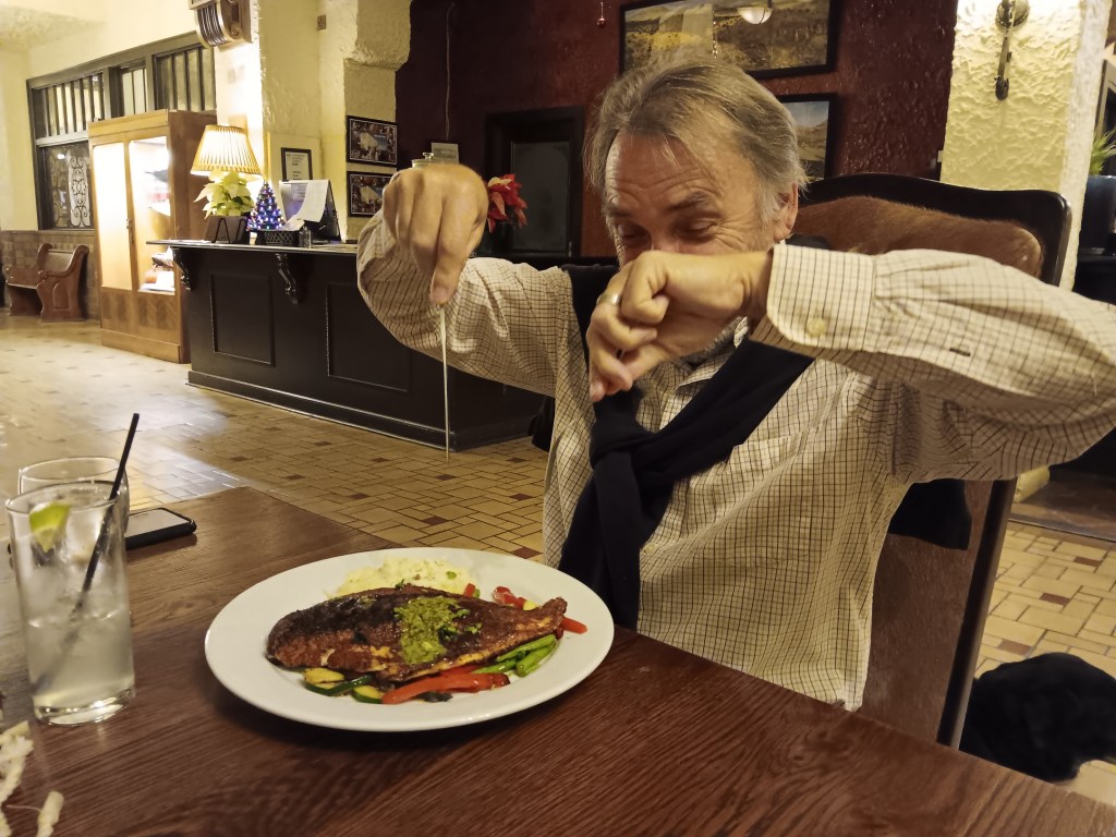
While we were still making “Yummy” noises about the pasta, our entrees arrived. Simon opted for the Cajun Blackened Redfish served with vegetables, smashed potatoes, and house-made remoulade. He declared it one of the best pieces of fish he’d had in forever; nicely spicy without being overpowering, and oh, so succulent.
Let the devouring begin!
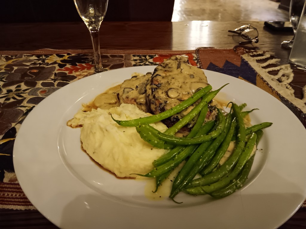
Unable to share in the delights of that spicy dish, which would have been her first choice, Susan went for the pork chops, knowing full well it would become three meals instead of one, since it was huge, with two chops and a mountain of potato. Indeed, the leftovers fed both of us the next day.
Someone wasn’t talking to us after she offered to eat anything we couldn’t finish, but was given NOTHING. Unthinkable!
Finally, we had time to spare and were in an area where we could enjoy Dark Sky at our leisure. Alpine is known for it and we were blessed with a cloudless night, so we headed out after dinner with a view of the Milky Way on our minds. The full moon that shone like a beacon was both beautiful and our undoing. It was so bright, nary a star could be seen. We stood along the roadside in light so effective we could see sad tears rolling down each other’s cheeks (not really).
There would be other chances, and with Christmas fast approaching our moods remained festive in this surprising little town that had captured our hearts.
The latest instalment of our excusive series for The Independent featuring our “Year On The Road” RV adventure is now online, highlighting Month 5 as we reached Idaho and Utah, and the incredible scenery of places like Craters of the Moon National Monument and Bryce Canyon State Park.
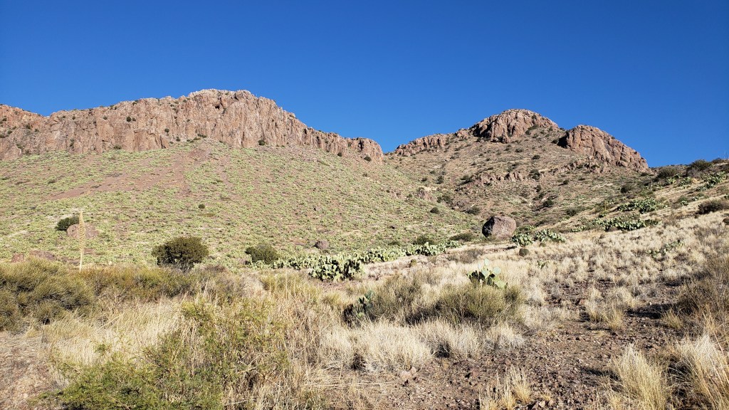
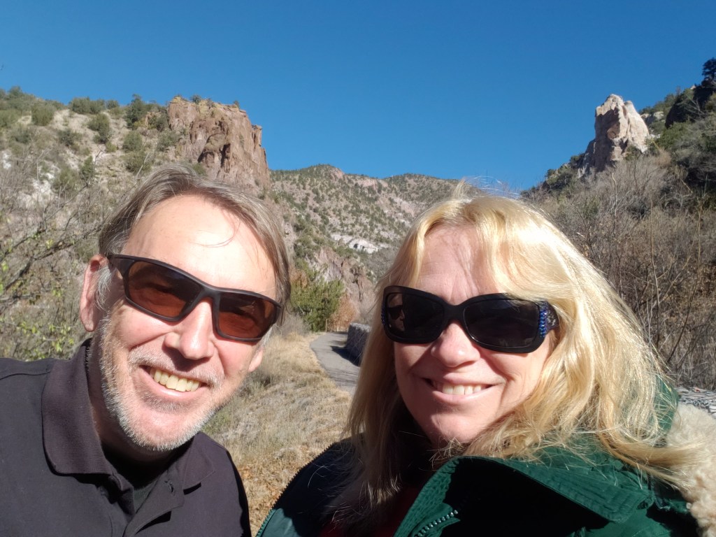
A new day, a new state! We made our way into New Mexico just as the temperature began to plummet, but we had a lot of touring planned, so we added a third layer to our clothing and a fifth layer to our bedding, and made Deming our base for visiting Gila National Forest and a drive to the Mexico/U.S. border.
With a late start to our first full day, we chose San Lorenzo as our afternoon destination. We knew nothing about it except that it was a ghost town, but that was enough for us, and up the Whitehorse Mountain we went.
Deer and another deer. Such excitement!
While the drive along the mountain was filled with trees gloriously changing color, grazing deer, and little glimpses of actual water in an actual river, the town itself was not exactly dynamic.
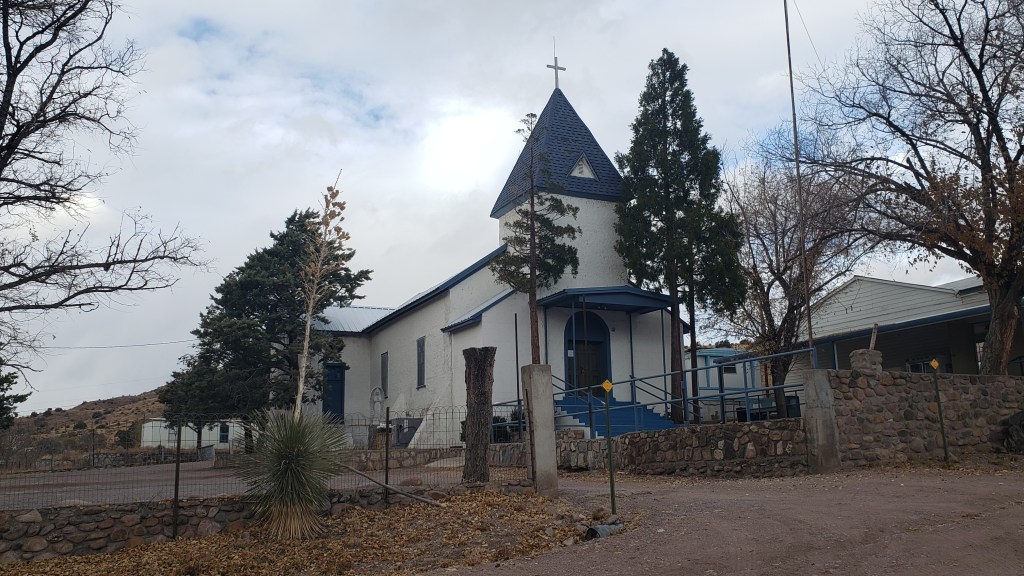
The area was originally home to the Apache Nation. Fewer than 100 people live there now, an adobe church whose original construction dates to 1899 sits at its heart, and an enormous horse ranch that looks like the only money in town takes up most of the land.
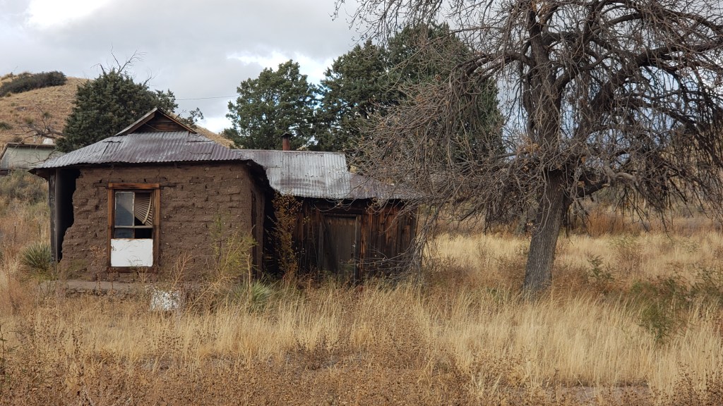
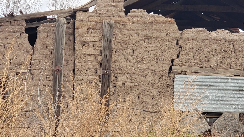
Miners from Silver City and Pino Altos founded the tiny town, and their hand-made brick structures still stand. Most of the buildings in town are abandoned, hence its “ghost town” fame, while the locals prefer (and achieved) the designation “Historic District.”
The hand-made bricks tell such a story. Fascinating to see bits of straw and little rocks in their construction.
We crossed the valley into the next small town because Simon was eager to find a Starbucks, or at least a decent coffee shop, but you already know the outcome of that forlorn hope.
Our next excursion was Rockhound State Park in the Little Florida Mountains (here pronounced Flow-REED-uh from its Spanish influence) just south of Deming, and the park’s information center lady showed us the various rocks that visitors are allowed to collect, from obsidian and quartz to sparkly geodes and the wonderfully named “thunder eggs,” which, of course, Susan was determined to find.
For perspective, that boulder in the semi-foreground, on the right, is about as high as Ruthie would be if she stood on her hind legs on Simon’s shoulders.
Once we were in the dry wash where geodes and thunder eggs are typically found, we immediately realized all rocks look like rocks and we hadn’t a hope in hell of finding anything interesting without cracking them all open.
After a short wander, we drove over to next-door neighbor Spring Canyon Recreation Area, where we were told we might find gigantic-horned Persian Ibex, which were brought to the area from Iran way back when, and had recently been spotted. We didn’t see any (of course we didn’t!), but we did marvel at the 17% grade into and out of the park, which was like a roller coaster hill in Nippy, but would have been a horror in Fati.
The 17% grade doesn’t look nearly as daunting in a photo as it does in real life. It’s a LONG way down!
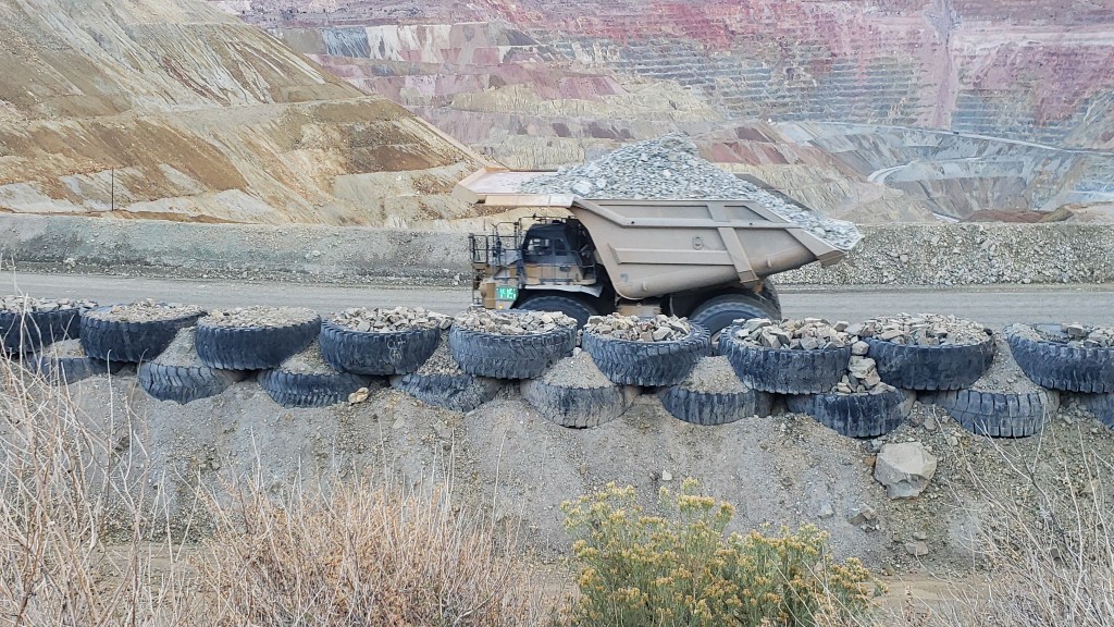
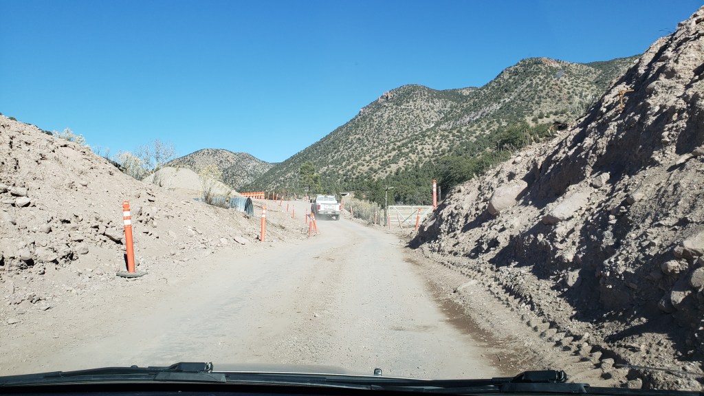
Minor attractions done, our next journey took us to Gila National Forest, the reason we were staying in Deming in the first place. It was a 236-mile round-trip drive, via Silver City, and the Visitor Center lady in Silver City told us we should not miss Catwalk Recreation Area on our way to the Gila Cliff Dwellings. Just head up U.S.-180 to the western side of Gila, and be ready for a short delay due to construction.
Silver City is a mining town, and that dump truck is gigantic. Its tires are 6 feet tall, maybe a bit taller.
We had already noted a sign in town that indicated the Cliff Dwellings were just 44 miles away, and our good lady mentioned Catwalk Recreation Area would come up first, so off we went.
New Mexico has to be the artsiest state we’ve been in so far. Even their license plates are pretty.
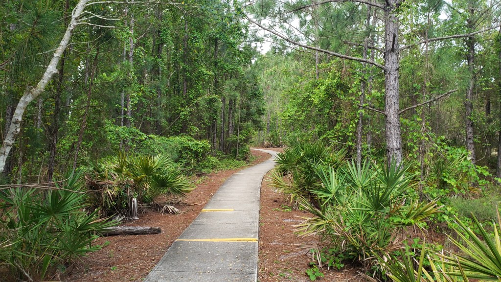
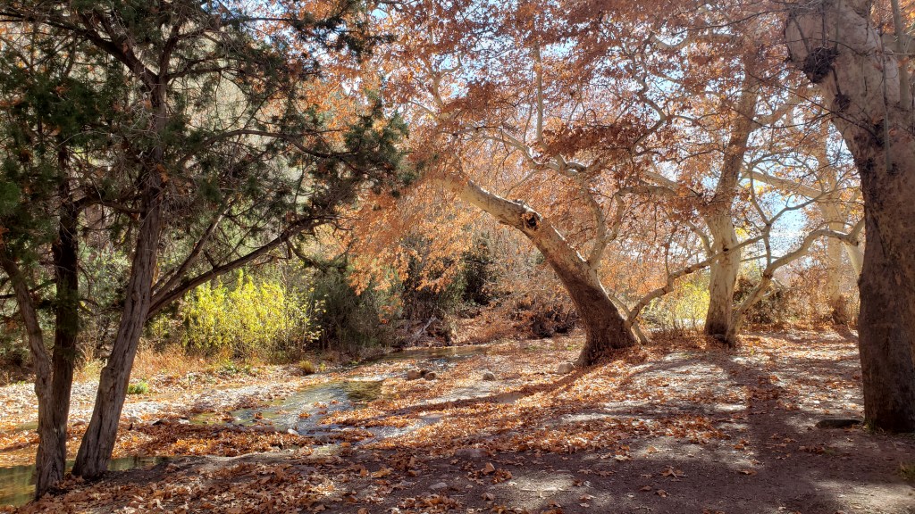
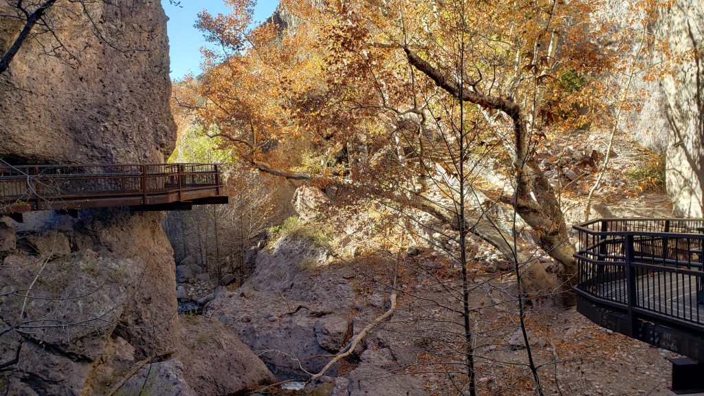
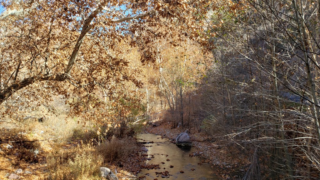
Sixty-five beautiful but confused miles later we saw the first sign for Catwalk, along with an extensive construction area that required us to follow a Pilot car along a couple of miles of torn-up road. Half an hour later we were walking through crunchy leaves along a fall-scented trail in Gila National Forest toward the metal catwalks that are the modern-day descendants of the original wooden planks over Whitewater Canyon creek, which gave the area its name.
Not Simon’s favorite kind of road.
But it would be worth it in a few minutes.
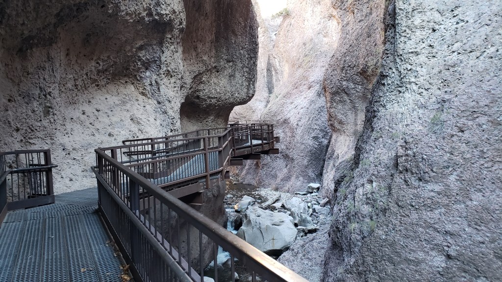
Silver and gold were discovered above the canyon, and mined for ten years, starting in the late 1890s. A pipe transporting water up to the processing plant ran through the canyon, and that’s the area visitors are now allowed to explore via catwalks.
Obligatory Selfie
Catwalk starts with a trail along the river, and it was nice to see water, which is scarce around here.
Part of the walkway wound through rocky areas above the river.
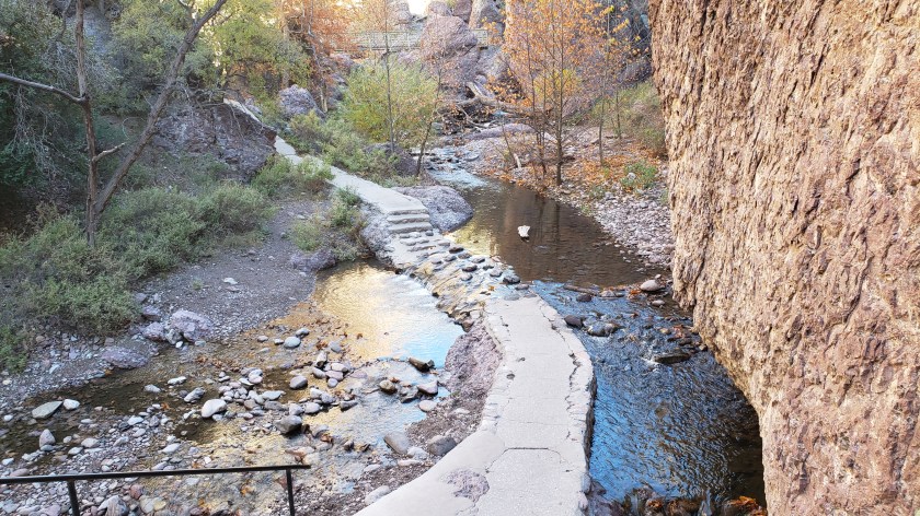
Just beauty, everywhere.
We spent more than an hour walking through the canyon and having a picnic lunch amid a scent that reminded us of Michigan in autumn. What an incredible surprise the experience had been, and how grateful we were for the recommendation. We absolutely would not have wanted to miss it.
It’s not a picnic without the Boot.
As we picnicked, we programmed Gila Cliff Dwellings into our GPS. It couldn’t be far away, since we’d already gone 21 miles further than that sign back in town indicated we would.
But wait. GPS showed another 111 miles to the dwellings. What the….?!
We were on the wrong road. U.S.-180 did indeed lead to Catwalk, but the cliff dwellings were up highway 15, on the eastern side of Gila National Park. We’ll say no more about the matter, other than that we consoled ourselves with the fact that dogs are not allowed on the trail to the dwellings, so we wouldn’t have to leave Ruthie in the car, and that we found superb dessert-flavored coffees at Javalina Coffee Shop back in Silver City to take the edge off our misery on the way back to Deming.
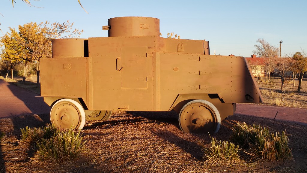
We were definitely on the right road when we made the trip south to Pancho Villa State Park, a little nod to America’s first (and only) armed invasion, compliments of General Francisco “Pancho” Villa, who ordered his soldiers to wreak havoc way back in 1916. General Pershing (of WWI fame) unleashed a massive can of whoop-ass, leading 3.000 soldiers 5,000 miles into Mexico in pursuit of Pancho Villa, only to fail miserably. Villa got his comeuppance a few years later, assassinated in an ambush in Chihuahua.
Tanks have evolved a bit since Pancho’s day.
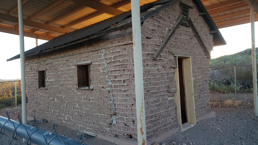
The last remaining homestead at the park. It’s pretty much the only thing here, besides the museum and the tank. And cactus. And rocks.
Deming claims the park as its own, but it’s really located in Columbus, smack on the border with Mexico. While we were there, why not take a look at the crossing? We’d seen it in Douglas, Arizona, while we were staying in Willcox, and in that instance we drove along the wall until we saw the crossing area, where a big gap was open in the wall to allow those working in the U.S. but living in Mexico to move between countries.
Here, the only road for 33 miles led directly to the crossing, which we obviously could not do, especially with a dog. We had no options other than turning around and heading back to Fati, and common sense told us not to take photos.
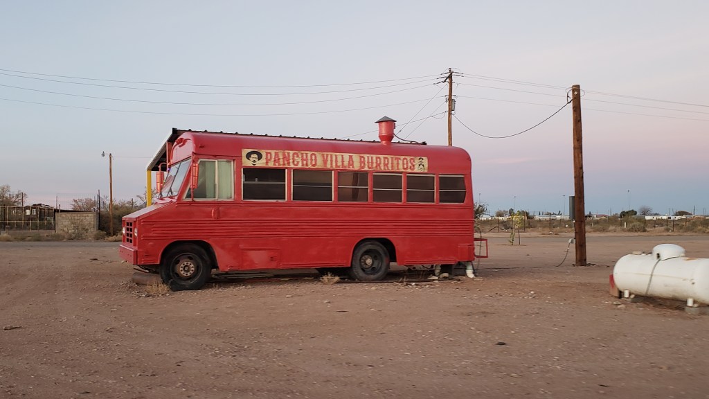
Instead, here are a few rather unusual sites in Douglas.
Ummmm…metal sculptures. Not sure why.
Hands up anyone who would order a burrito from a bus in the middle of nowhere!
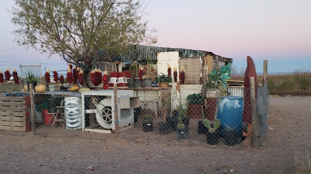
Strings of red chili peppers are such a wonderful constant in the places we’ve been. Susan’s parents brought one back from their travels to New Mexico and had it hanging next to the kitchen, so emotions were felt when we saw them.
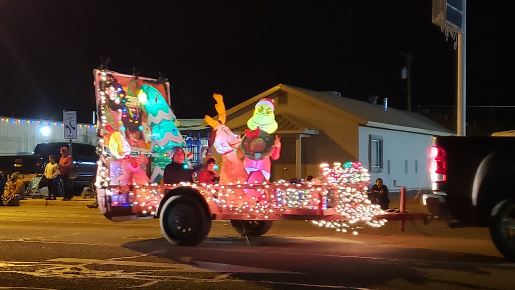
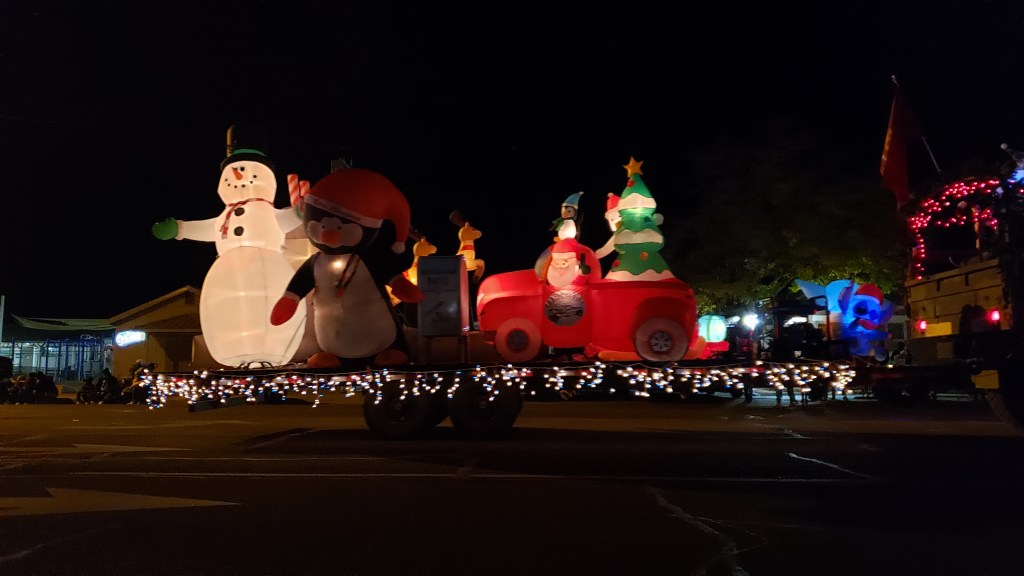
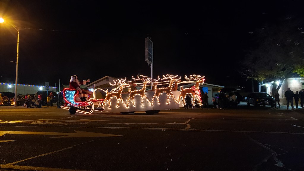
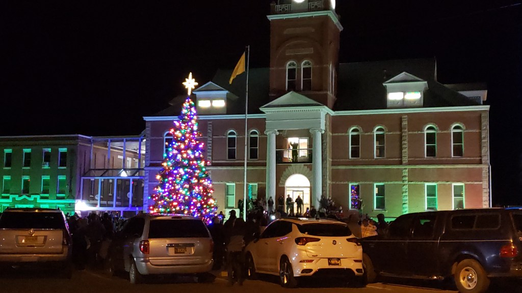
Deming had one more gift in store. Along with a string of multi-colored lights we bought at Walmart to decorate our fireplace in Fati, we got into the holiday spirit by attended the city’s Christmas Market in the afternoon (a short experience, with only a small handful of vendors and even fewer visitors) and attending the Christmas parade and Tree Lighting that evening.
Ruthie did some low-grade “wooooooo”-ing when the police car and fire engine sirens passed by, kicking off the parade.
The Grinch featured heavily. He was in the parade five or six times.
Santa was on hand to wish everyone a very Merry Christmas!
The parade was so charming and homespun and nostalgic, it may have been our favorite surprise of the whole week. We attended the Christmas Tree Lighting afterwards, and departed Deming the next day feeling very much in the holiday spirit.
Throughout our journey, we’ve had to modify our plans around Ruthie, and we’ve done so happily, since one of our goals was to give her the best of what time she has left. Another one of our goals was to see as many National Parks as possible, and in Southern Utah those two desires collided.
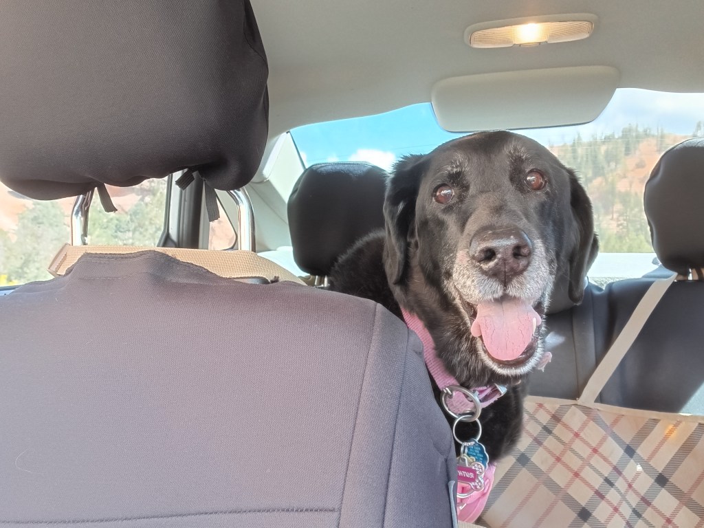
“I’ll go wherever you take me!”
From our base in Cedar City, we were 77 miles from Bryce Canyon National Park, and just 20 miles from Zion National Park, two places that were high on our list of must-do experiences. They were places Susan’s parents had really enjoyed and, because of that, they had an emotional pull, too.
Grand Staircase Escalante National Monument and Capital Reef National Park were also on our radar, but after much discussion we came to the conclusion we couldn’t do everything or we’d end up frazzled and exhausted…again. So Bryce and Zion were “it.”
But not so fast.
Before we visit a place (usually months or, in some cases, years) we do our research. When it came to Zion, however, we’d dropped the ball. In some places, rules changed with the pandemic and, from March to November, Zion can only be visited via shuttles. No-dog shuttles.
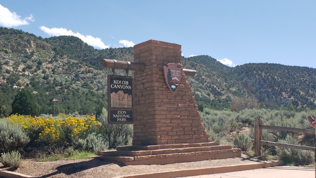
The single exception was Zion’s Kolob Canyons on the north end of the park, and with that, the plan fell into place.
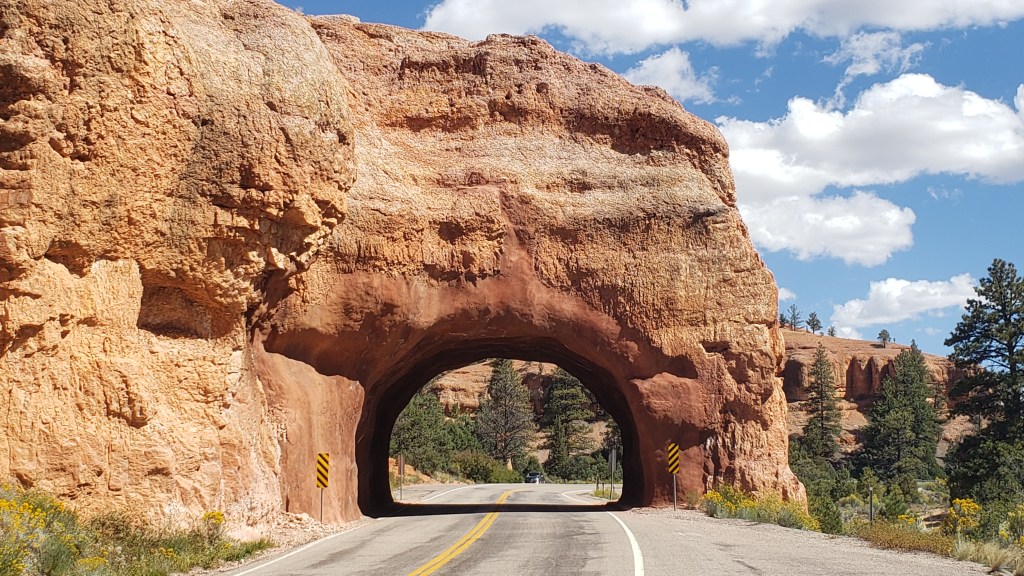
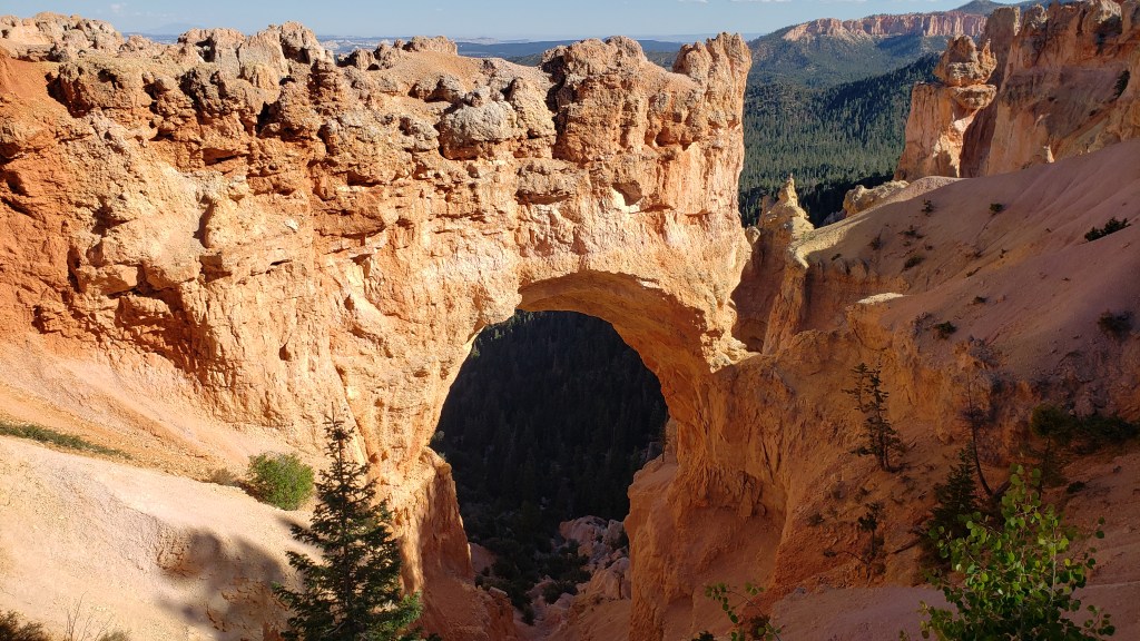
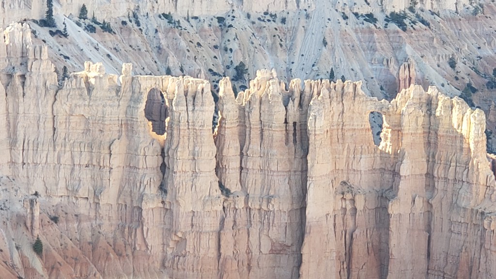
Bryce Canyon contains the largest collection of hoodoos in the world, and while we’d seen a LOT of canyons over the past weeks, this one promised something different. Even before we reached the park, we passed through the ridiculously gorgeous Red Canyon on Scenic Byway 12, which almost would have been enough on its own.
Not as small as Needles Eye, but still rather exciting.
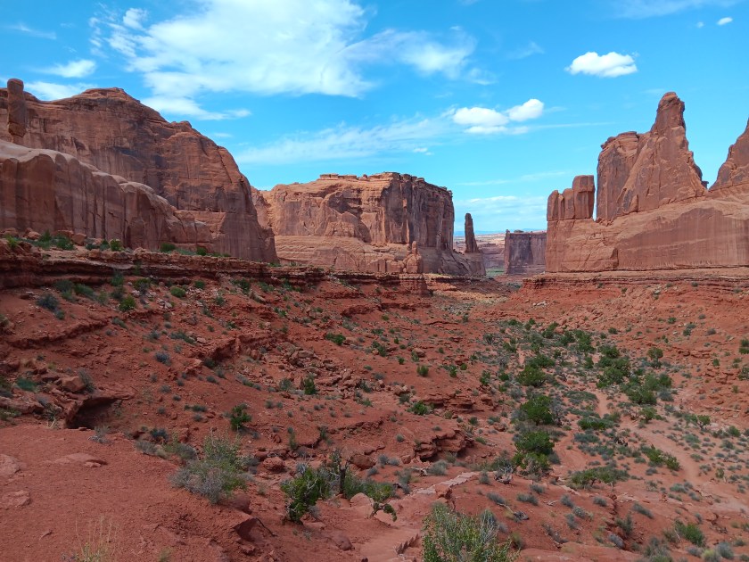
From the Badlands in North Dakota to Utah’s magnificent landscapes, we’ve repeatedly said, “How did that happen?” The short answer is, wind, water, and time. The longer answer in Bryce is, its distinctive formations began as flat rock on an ancient sea bed, uplift of land that created plateaus, which then weathered into “walls” with vertical gaps between them, then into “windows” (big holes in the rock, like we saw in Arches), and finally into the oddly-shaped, sticky-uppy hoodoos we see today.
Each of the park’s overlooks offered a different perspective:
Natural Bridge (elevation 8,627 feet) is an example of the “window” phase of the plateau’s erosion.
Obligatory selfie.
Hoodoos taking on their distinctive shape.
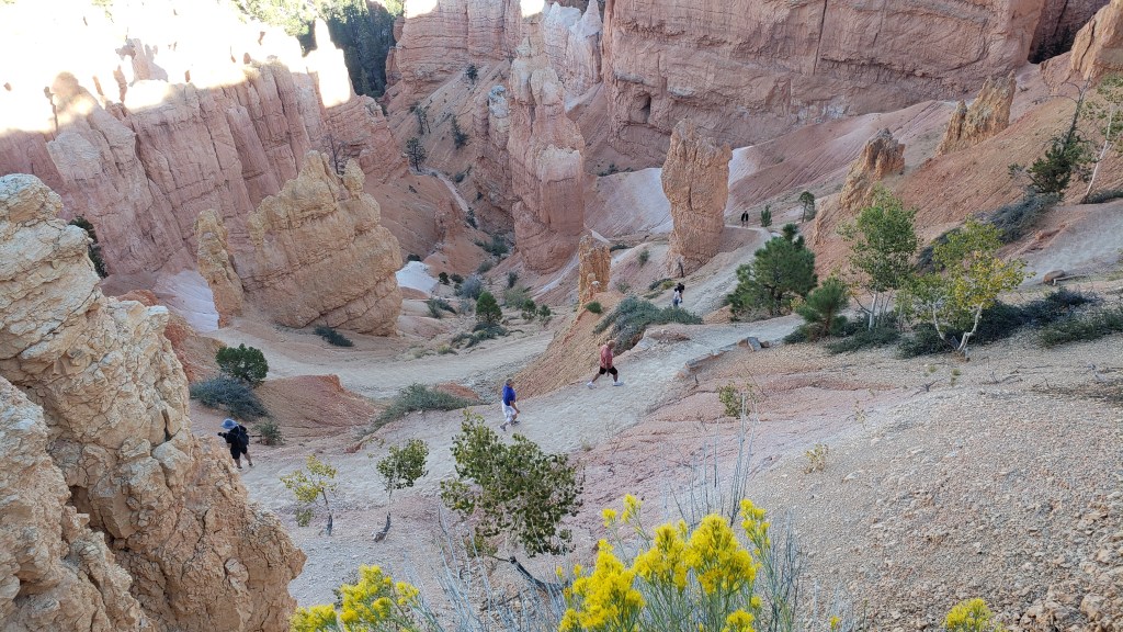
The park’s crownlng glory, Bryce Amphitheater. Click on photo for video
A pathway leads to the floor of the Amphitheater, but with temperatures at the summit in the 90sF, neither of us were prepared to endure the heat in the canyon.
We were put to shame when we caught sight of a bride and her groom hiking back up, with a photographer in tow. Anyone who has ever worn a wedding gown knows what a feat this was for the bride.
Everyone at the overlook clapped and wished them well as they rejoined their wedding party.
Kolob Canyons in Zion National Park was even more straightforward. An easy drive, entry with our America the Beautiful pass, and we were in. But only for three miles, as the scenic-drive road in the park was damaged due to a weather-related rock slide.
Ruthie really appreciated the cooler wind blowing through the canyon.
These 2000-feet-high canyon walls were pretty much all we could see, having walked a short stretch of the road beyond the barriers that were put up to prevent car travel.
It was a very limited way to appreciate Zion, but sometimes that’s how it goes, and with all the rock walls we’d seen in Utah, life was still worth living.
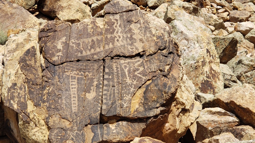
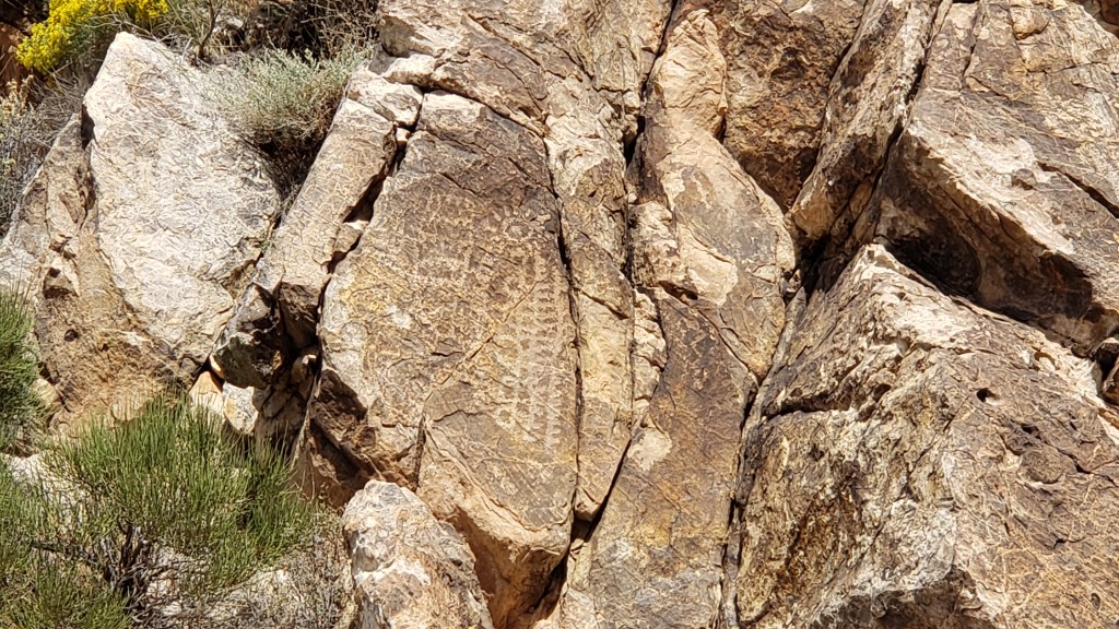
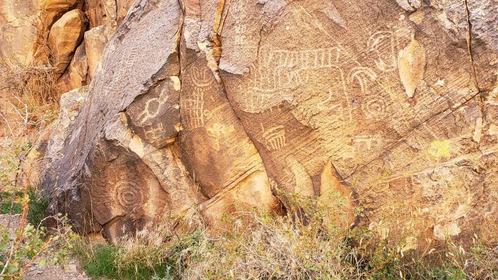
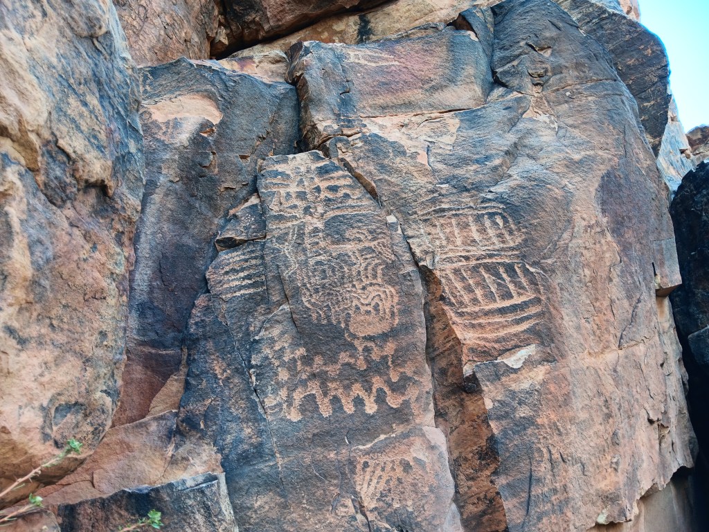
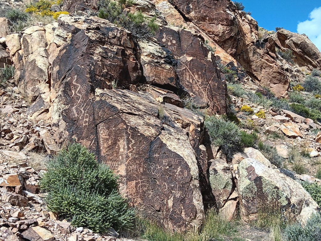
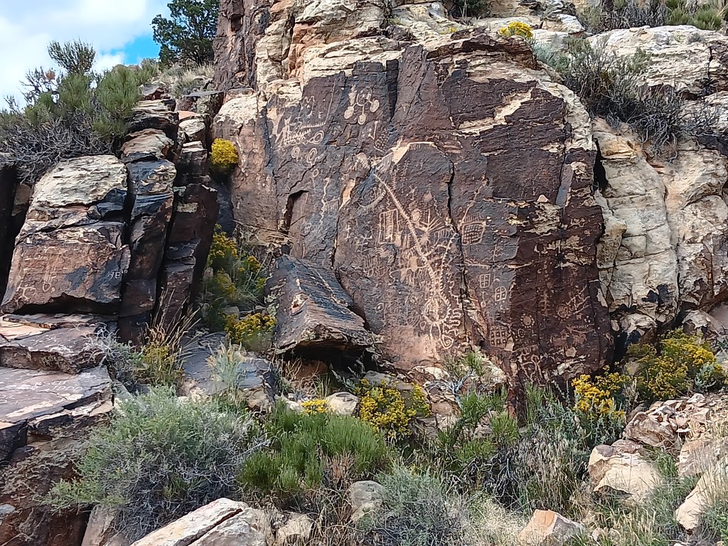
The next day we pointed Nippy north for a trip to Parowan Gap, a wind-and-water-created hole through a mountain that was used by Native Americans who left their stories etched into the deep crimson walls. And it was these petroglyphs that drew us to the area.
Other than three kids on motorbikes racing down the road, the gap was absolutely still and silent. We clambered around enjoying the petroglyphs, wondering at their meaning, and, in that stillness, it was easy to imagine nomadic tribes pausing to rest, play, soak up the beauty, and go about their daily lives.
The petroglyph roughly in the center of the photo is now called the Zipper Glyph, for obvious reasons. Its meaning isn’t known, but it’s thought to be a marker of travel days, first one way then another, from the summer solstice (the circle at the bottom). It may have been used as a means of tracking where game would be throughout the seasons.
As we stood admiring a particularly large set of petroglyphs, the most haunting, soul-stirring sounds of an ancient flute melody gently caressed the breeze, and for a moment we could imagine it was an echo of the people who used the area for a thousand years.
Turn your volume up, listen closely, and you can hear the flute. Click on photo for video
Instead, it was Michael. Michael comes to the gap now and then to play his hand-carved flute, because, he says, he likes the acoustics.
The spirits of those who once passed through here like Michael’s playing, and he has had several encounters with them, he told us. It was easy to believe. Even Simon, who holds no particular belief in such things, agreed there was something special –and spiritual – happening in the gap.
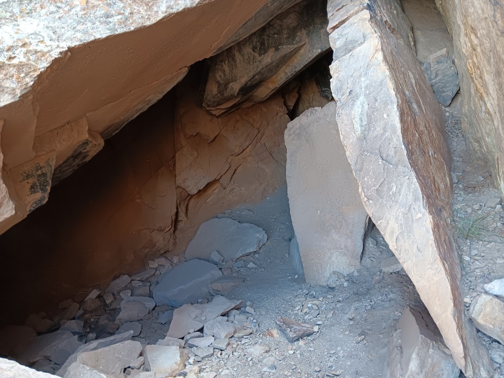
This cave entry leads to a place where the tribes’ shamans meditated during their time here.
I’m tempted to stop this blog here, and just bask in the memory of such an extraordinary experience. We did have a rather startling return trip that included an unexpected climb up a mountain range to a ski resort town called Brian Head (elevation 10K+) and a journey through Cedar Breaks National Monument…
…but let’s just let the memory of the flute music sooth us into a happy stupor, and call it a day.
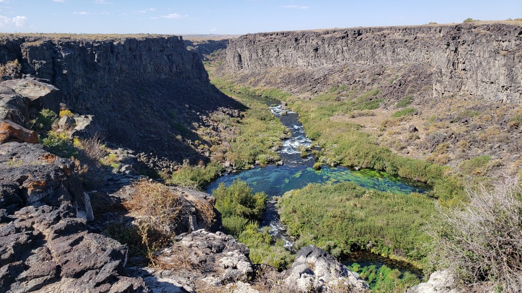
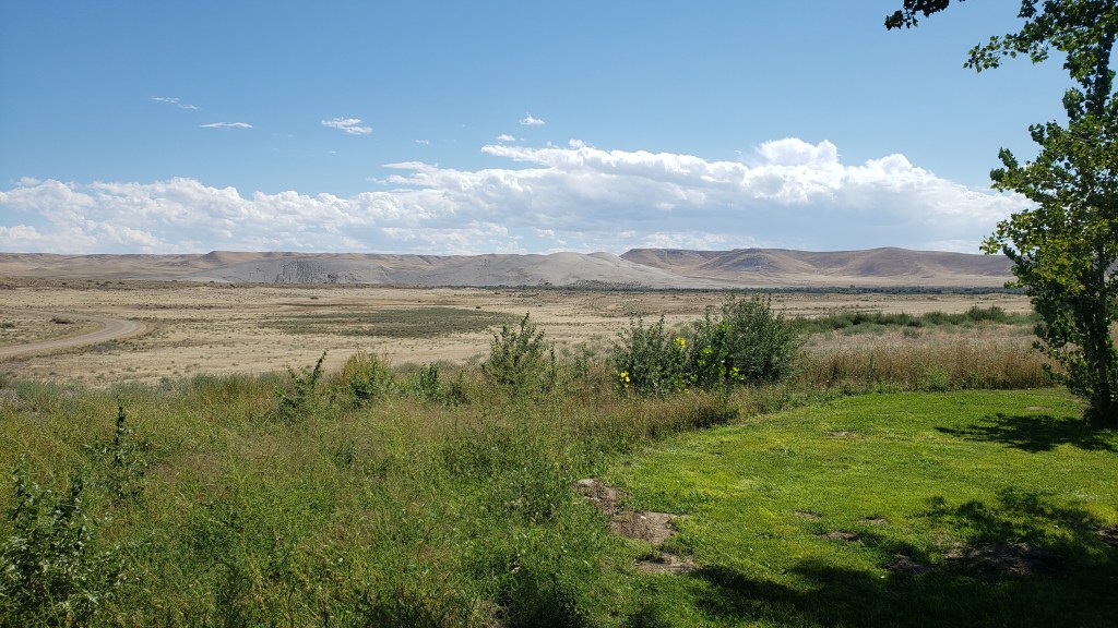
If there’s a massive crack in the earth, Simon wants to explore it. Southern Idaho seemed to be riddled with them, from the modest Box Canyon to the gargantuan gorge in Twin Falls, a rift so long and deep it had become a world-renowned location for the extreme sport of Base Jumping.
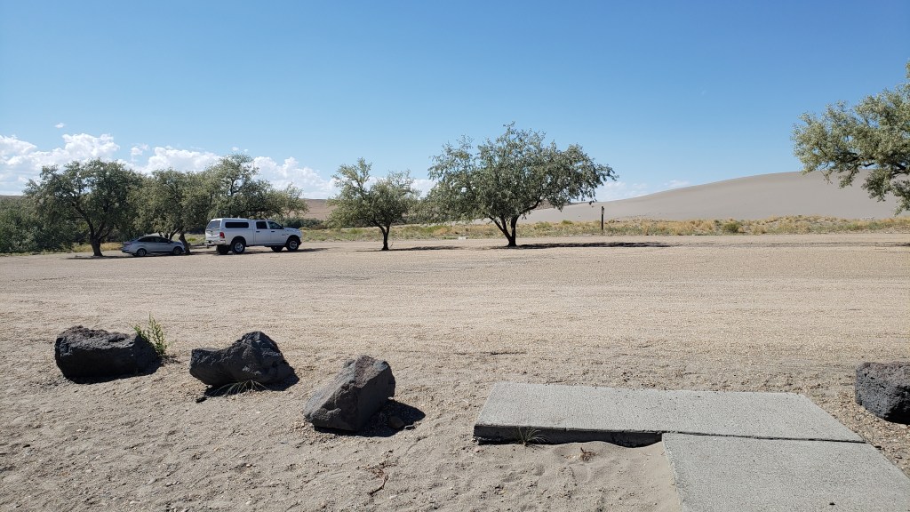
We had a long day in store as we left Fati at the campground and drove west, with Box Canyon State Park, Thousand Springs State Park, and Bruneau Dunes (the tallest single-structure sand dune in North America) as our goals.
Box Canyon State Park proved to be more of an overlook than an actual park, what with being surrounded by cow farms and having nothing but a porta-potty at the dirt parking lot, though if we’d had the inclination we could have hiked from the top of the canyon to the clear, bright-aqua waters of the river below. But you already know that’s not something we could (or would) do with a senior dog in tow.
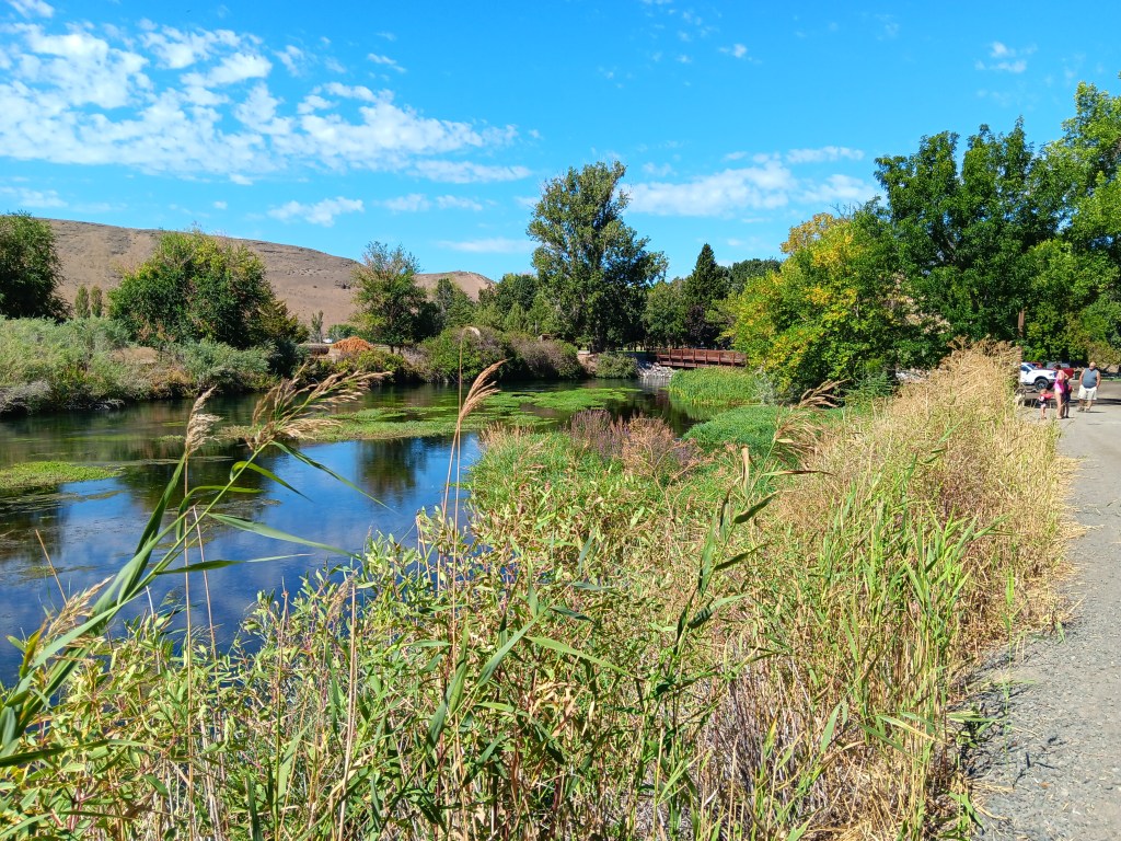
Thousand Springs also found us wandering aimlessly. The road down to the springs was steep and winding, and either a thrill or unpleasant, depending on which one of us you ask. But as so many locations we’d visited in Idaho had done, this one closed on Labor Day, which was the day before our visit.
We enjoyed the falls, just to say we’d done something, then headed to the day’s headliner attraction.
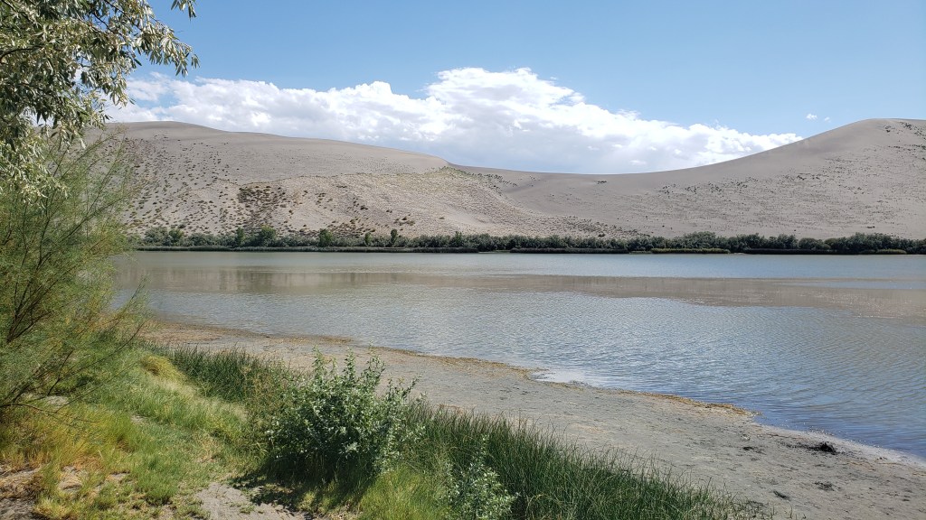
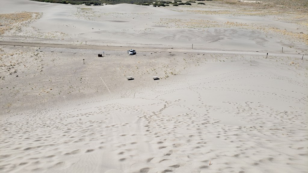
Along with Craters of the Moon, one of our original must-see locations in Idaho was Bruneau Dunes State Park, where our plan was to rent a couple of sand sleds, climb to the top of the dunes, and freewheel our way back down, with me sitting on a board with Ruthie on my lap and Simon taking the plunge wakeboard-style.
The dry, gravely landscape and fascinating trees reminded us of our trip to Botswana, where Simon went to school for a few years.
It was a ridiculous idea. Sure, the sand would probably prevent any broken bones when we came crashing down, but one of us was bound to get injured, and Ruthie would never tolerate the walk up, or the slide back down. We were saved from ourselves when the early afternoon temperature edged up to 90F, ten degrees hotter than it had to be for the Visitor Center to suspend all sled rentals.
The trip wasn’t a waste, though. We had a nice picnic in the shade of a pavilion by the river, then sweated our whatsits off with a climb up the smallest dune.
Oh, look! Another lunch whose components have nothing to do with one another!
Ruthie doesn’t like it when we’re not all huddled together in a group, and we knew she’d want to follow whoever went up the dune first. So we put her booties on to save her paws from the blistering sand, and told her to climb as high as she wanted to, and no higher.
Click on photo for video
Click on photo for video
View of Nippy from the top of the dune.
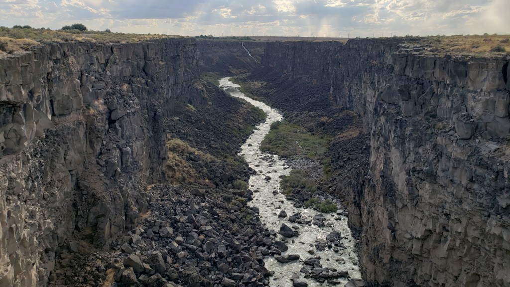
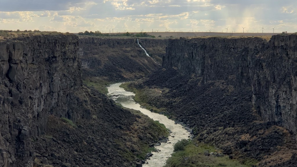
We weren’t exactly batting a thousand in terms of WPM (Wows Per Minute), though we definitely enjoyed what we’d been able to do, so Simon decided a quick detour to Malad State Park was in order, for one more chance to stand on the precipice of a deep crevasse and lean out over it as far as possible.
Here you get some small idea of the length of this gorge, with the tiny white line at the back being a waterfall.
Zoomed in a bit more, you can see the waterfall a little more clearly. We’re constantly amazed at what rivers can do to solid rock, given time.
Happily, there was a long, metal bridge spanning the gaping fissure, which gave him an excellent view of the river below. Ruthie joined him, and her bravery was rewarded with a little butt scritch.
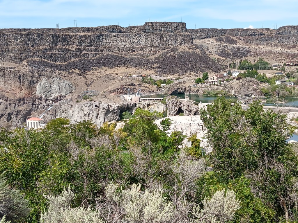
But it was our next day’s trip out to Twin Falls that cranked the thrill factor up to eleven. We knew we wanted to see the famous Perrine Memorial Bridge, and we hoped with all our hearts there would be a base jumper or two.
The bridge spans the Snake River, a waterway made famous by the Lewis and Clark Expedition as they journeyed west in an effort to discover what, exactly, the country had gained through the Louisiana Purchase, and where, exactly, that land purchase ended.
That isn’t why it’s famous now, though, at least not with extreme thrill seekers. Today, it has a well-earned reputation as hallowed ground, being the only place in North American where it’s legal to base jump, year-round.
Our hopes of seeing someone jump were met twenty-fold. All day long there are jumpers taking the dive into Snake River Canyon, either as singles or in tandem, some of them longstanding pros, some entering into it for the first time. Some dove in head-first, others did somersaults, but however they left that ledge, it was massively impressive to spectators lining the stone wall along the edge of the gorge.
Click on photo for video
You can feel the anxiety in this person before jumping. Click on photo for video
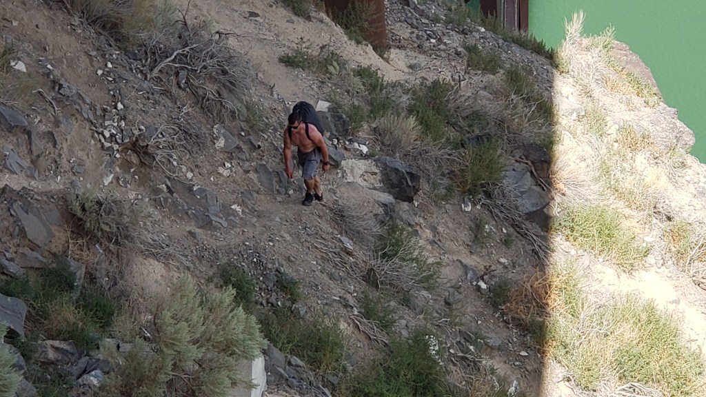
We made it a point to speak with a few jumpers, and hit absolute gold when we met Sam.
Former military paratrooper Sam never said anything about being Tom Cruise’s stunt double, but if he’s not, I’ll eat a pound of liver and onions from a filthy truck stop deli (no I won’t; I’d never do that). He looks like Tom’s twin, he speaks as if he’s dealt with media all his adult life, and he’s possibly the best advertisement for fitness and extreme sports you will ever find.
We chatted for about half an hour, then watched him walk out to the middle of the bridge, climb over the railing, stand on the narrow ledge, and swan-dive into the gorge. His parachute opened, and he soared effortlessly to the target point on the side of the river.
It was an astounding feat, but even more incredible was that jumpers then have to repack their parachutes and climb the rocky cliff out of the canyon. Sam scaled the cliff as we looked on, and gave us a final comment as we waved goodbye. “That’s the hard part,” he said.
This is Sam. Sam just jumped. Sam is now hiking up a 5,500-foot gorge. Strive to be like Sam in all your endeavors.
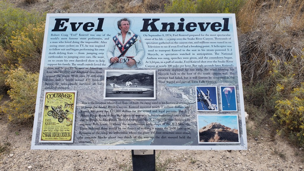
We could have watched all day, but it was getting a bit too hot for Ruthie, so we cranked up Nippy’s A/C and drove to the nearby Evel Knievel Jump Site. Those of us with birth years starting with the number 1 probably all remember the crazy daredevil whose unrealistic motorcycle stunts led to 433 broken bones over the course of his 15-year career as a performer.
You probably can’t see this photo large enough to read the panel, but somehow we only took a few photos of the site, so this will have to do.
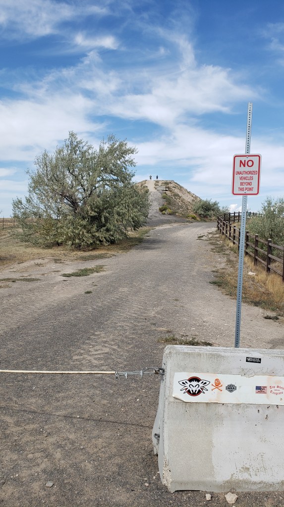
The dirt ramp he used for a jump over the Snake River Canyon in his X-2 Skycycle steam-powered rocket is still there. He didn’t make it from one side to the other, of course, and, as we stood at the top of the jump, we were pretty sure he never really intended to make it.
That hill in the background is the ramp.
He blamed it on his parachute opening right after take-off. We blamed it on the fact that no one with an ounce of knowledge about physics could ever think that ramp was going to be enough to launch him one-quarter mile across the canyon. But never mind; it was an epic stunt, and we were delighted to discover our visit was exactly 49 years, to the day, since that fateful jump which, although he survived it, proved to be his last.
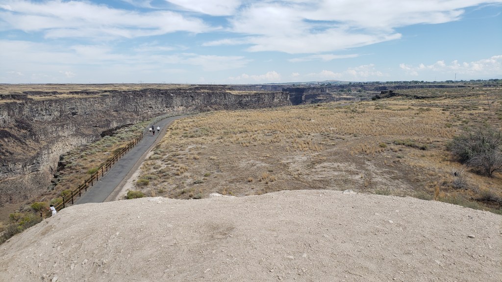
View from the top of the ramp, looking over the right side. The gorge is that dark part, with a walking path to its right.
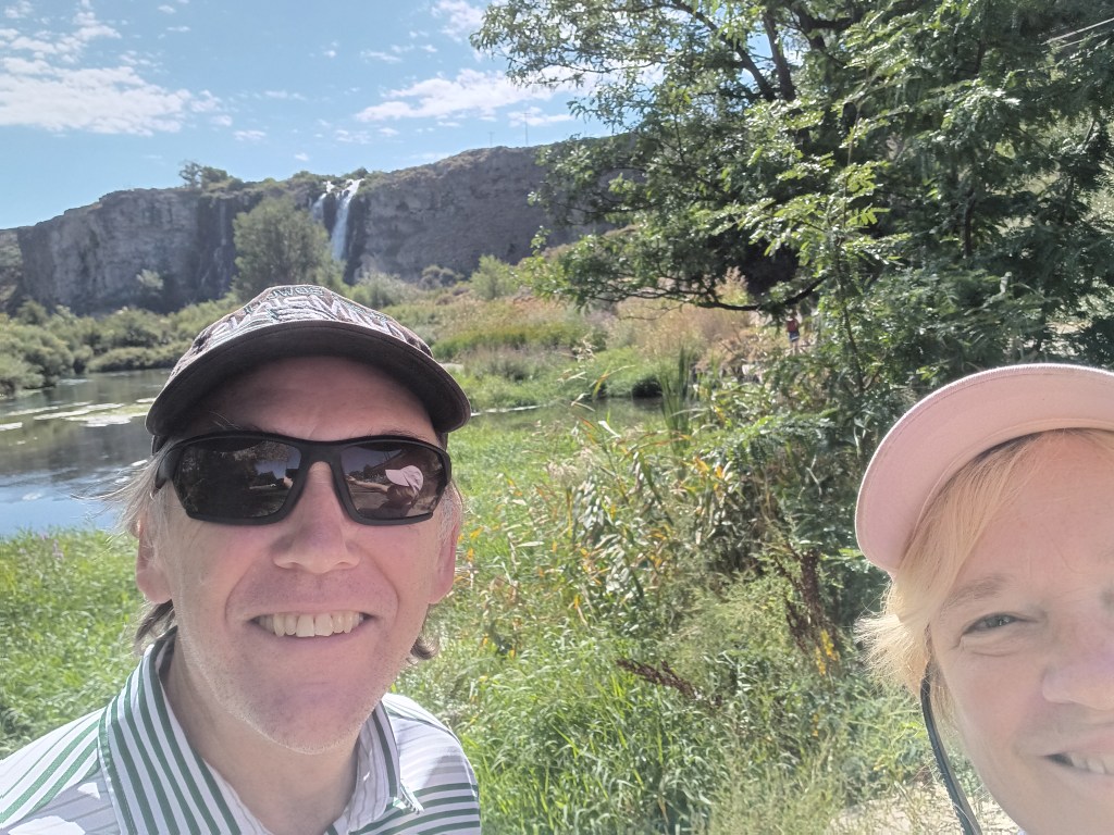
Shoshone Falls was our final stop of the day. Dubbed the “Niagara of the West,” the 212-foot-tall, 900-foot-wide, horseshoe-shaped falls are the largest natural falls in North American (yes, bigger than Niagara). They caught the attention of travelers along the Oregon Trail, and are still a tourist attraction today.
How it started. Photo from Wikipedia
How it’s going. The falls should be flowing over those two white rocky areas immediately below the long, horizontal white building in the center of the photo.
Unfortunately, due to a dry summer, the water level was too low for the falls to flow, so we skipped the drive down into the park, looked at the bare rock from above, and rewarded our day with a cold beer, shrimp tacos, and a hearty salad on our way back to the campground, before leaving Idaho and returning to Utah for its grand National Parks the next day.