Staying Alive In Joshua Tree National Park


Signs pleading “Do Not Die Today” served as a grim introduction to Joshua Tree National Park, but, like most visitors, we made a mental note to avoid death and joyfully headed into the desert where succulents beseeching God and the un-huggable “Teddybear” cactus both live.

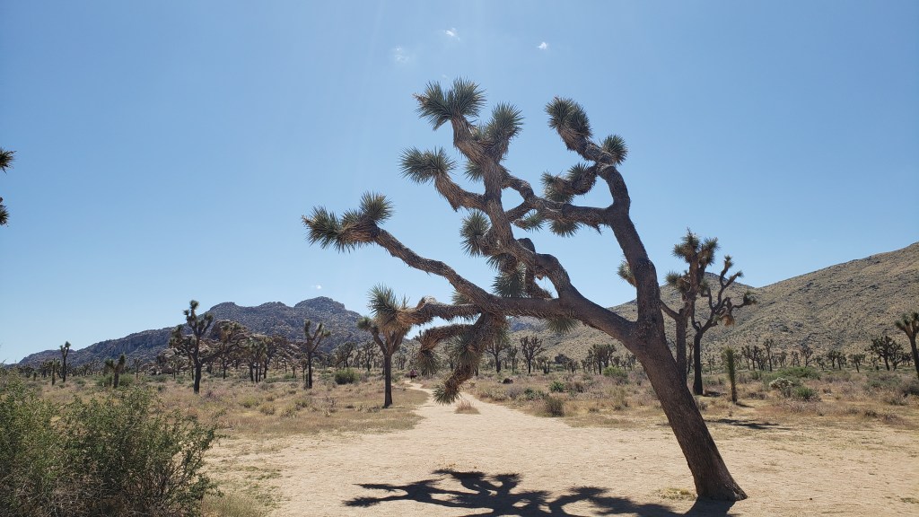
Joshua Tree National Park’s star attractions – named by 19th-century Mormon settlers who decided they looked like the Old Testament’s tribal leader, Joshua, with his arms raised toward his Heavenly Father – aren’t trees. They’re a type of Agave, the genus responsible for tequila, which, when imbibed in quantity, can also make you see God.

Other agave.

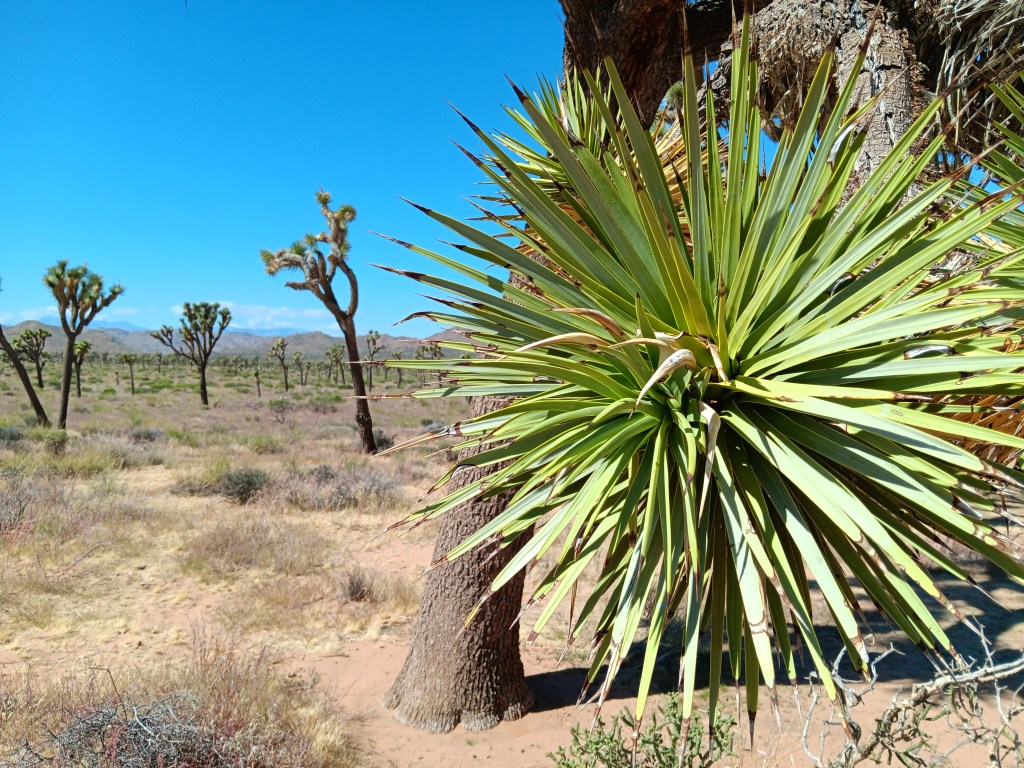
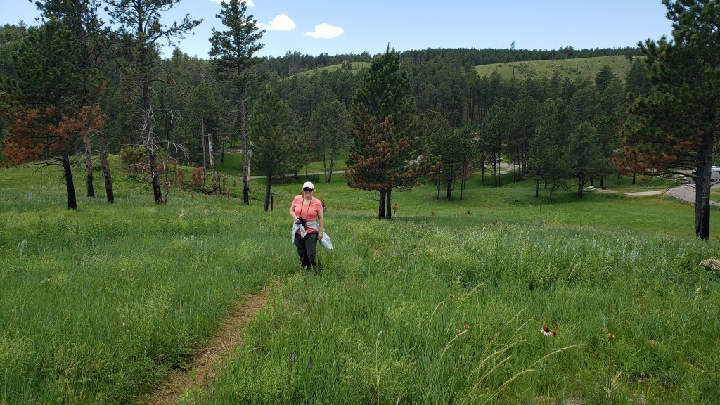
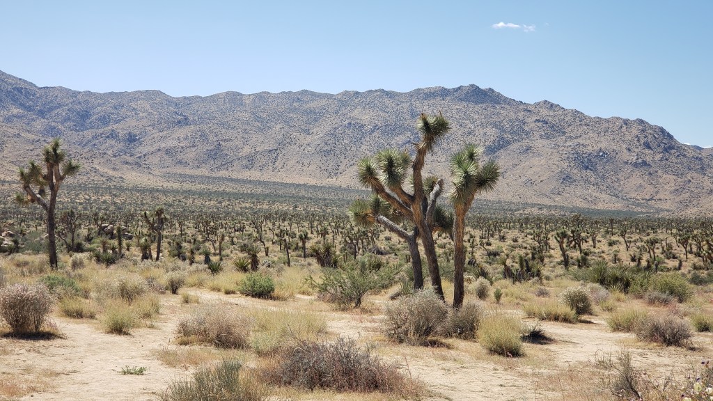
Joshua Tree National Park contains the greatest number of its namesake specimens in the world, and their importance to the ecosystem has earned them well-deserved protection by law. Visitors are allowed to walk the sandy trails between the plants, and a quick touch of their spiky appendages is all the incentive needed to leave them alone.


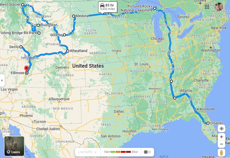
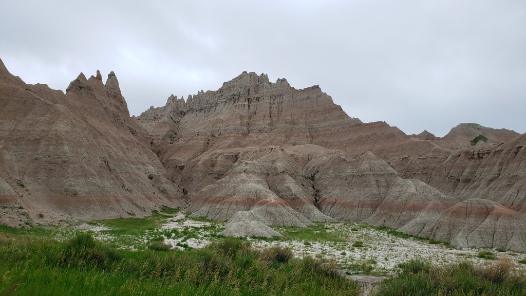
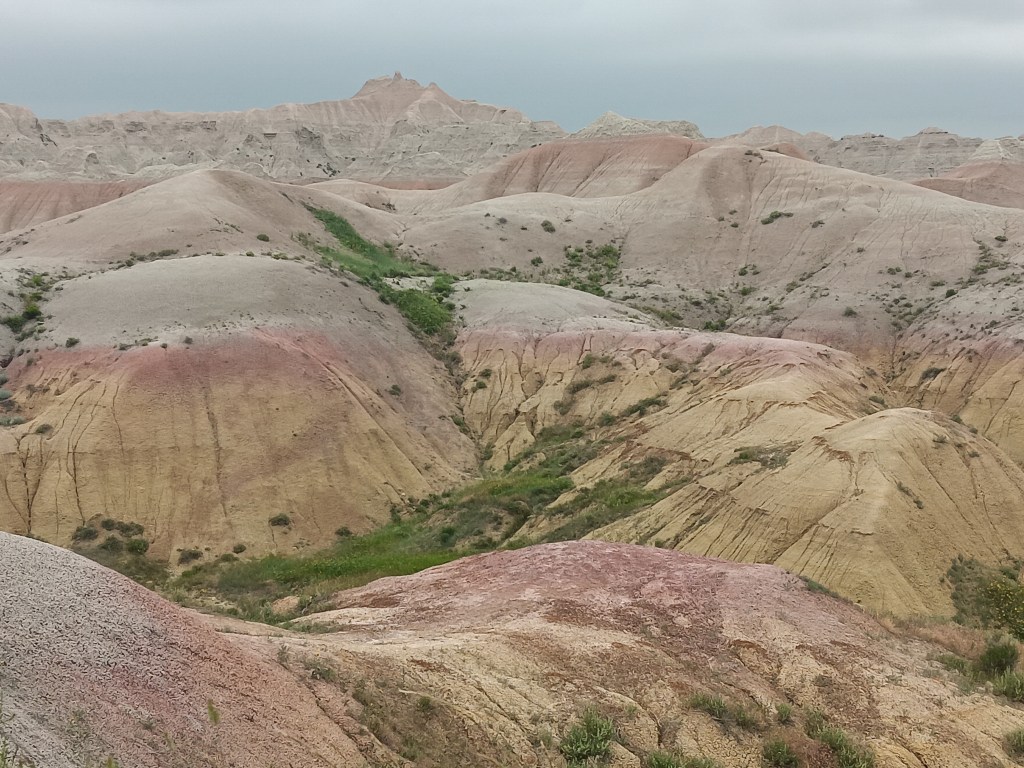
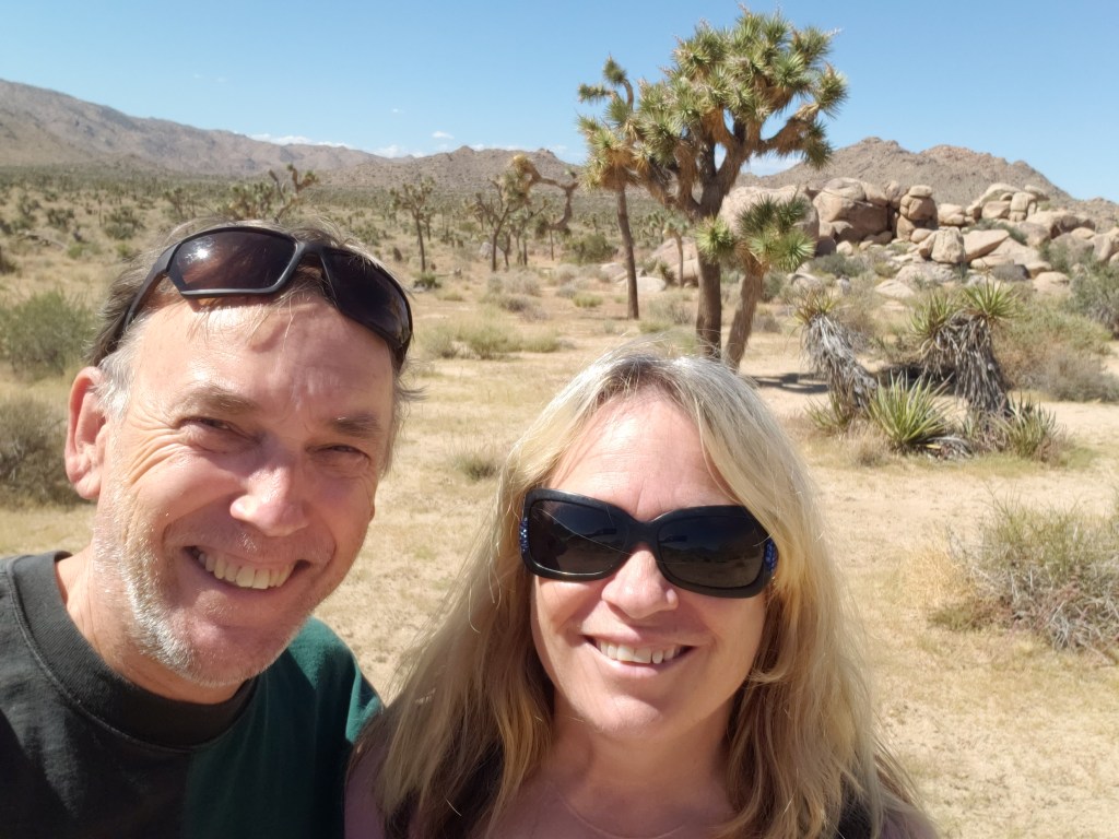
Having driven in via the West Entrance (located on the north side of the park), we had at least two hours of good scenic driving, with plenty of stops to enjoy each elevations’ unique topography.

Every time I turned around he was poking his finger on a plant.


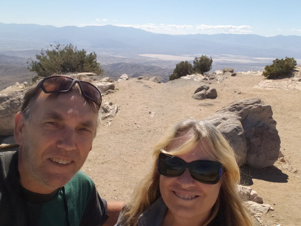
Among the highlights were an unexpected view of Palm Springs (our next destination) from the 5,185-foot-high Keys View overlooking the Coachella Valley, and the shocking realization we were also looking at the infamous 750-mile-long San Andreas Fault Line, an unsettling uprising where the Pacific and North American tectonic plates collide, with dramatic results (earthquakes).

The long, thin, dark mound stretching across the valley just below the furthest mountain range is the San Andreas Fault Line. Who knew?

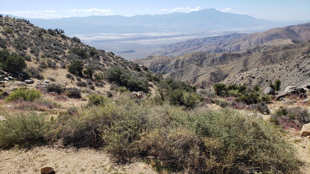
Also visible from Keys View are the Salton Sea, which we’d visit the next day, Signal Mountains on the U.S./Mexico border, and Mount San Jacinto, rising 10,831 feet above the valley.

Obligatory Selfie.

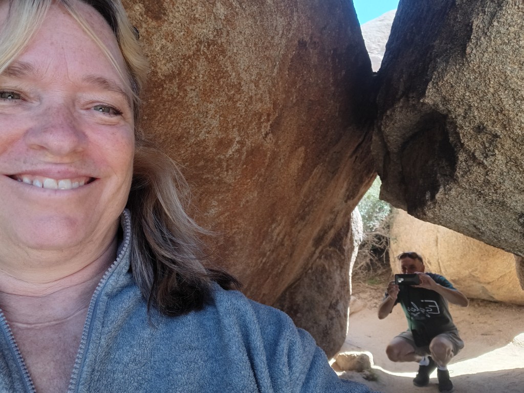
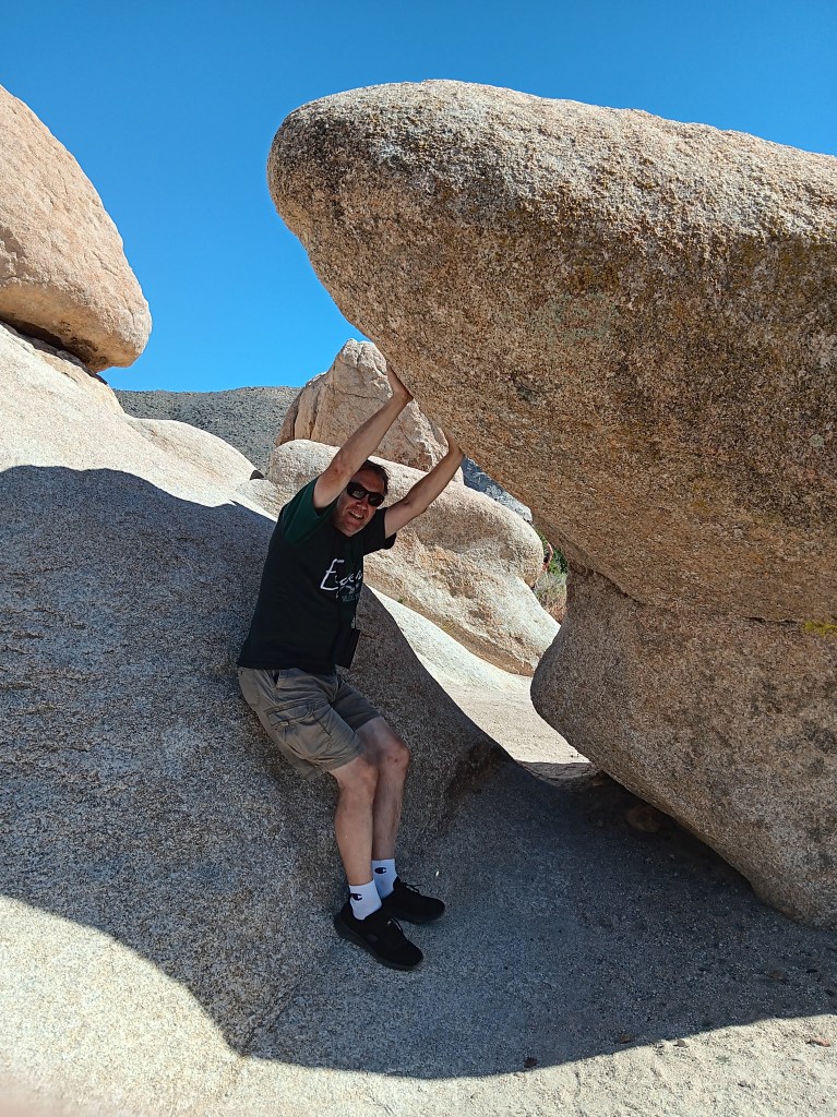
Returning to a lower elevation, we paid a visit to Hall of Horrors and its freaky rock mounds before taking a detour south to Cholla Cactus Garden.

How artsy are we!

Some shots look so real in your mind, but maybe not quite as real when you take them,

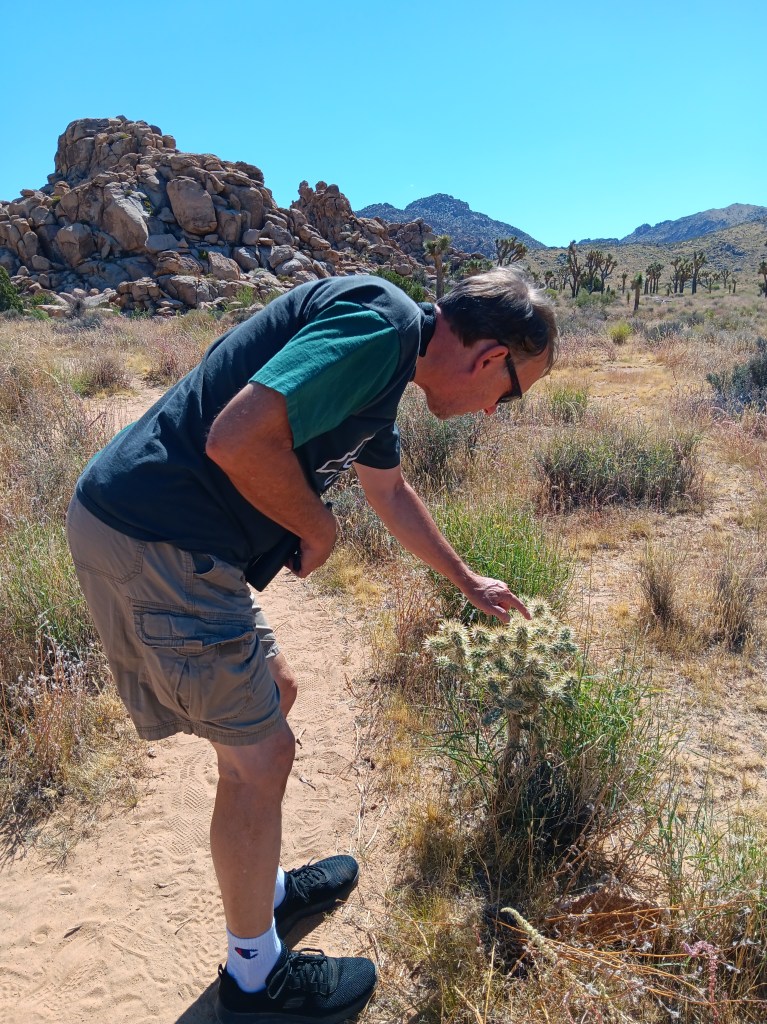
As much as we enjoyed the delightfully wonky Joshua Trees, we were even more taken by the ten-acre grove of Teddybear Cholla cactuses that only grow between 600 and 3,300 feet above sea level. Their name is misleading. This isn’t the sort of thing you’d want your toddler to snuggle down with for a good night’s sleep.

They look so cute and fuzzy, don’t they? They’re not.

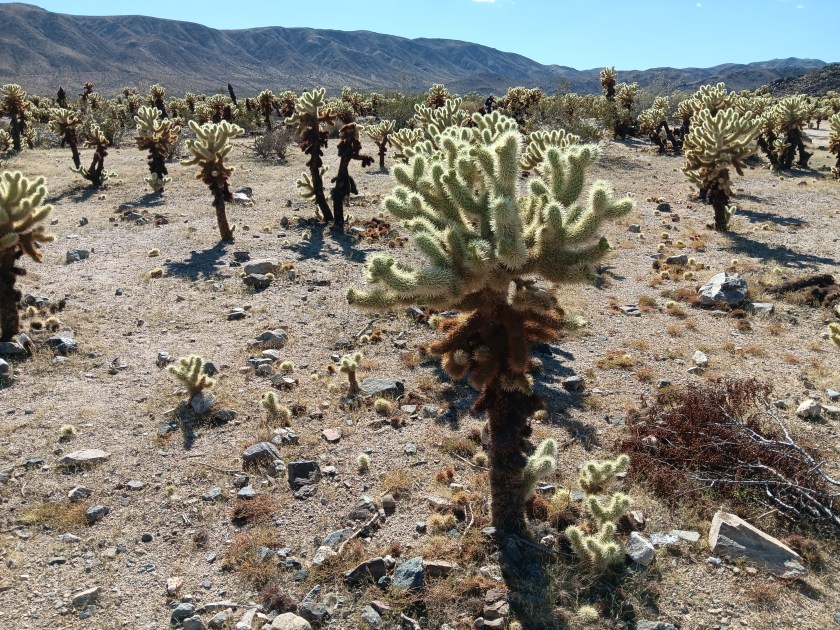
Adorable as they are, they also have a super-power that allows their needles to readily attach to anything that brushes by them, and not in a good way. Simon was tempted to give them a poke, but, somehow, he resisted. We have special tweezers in the car for just such emergencies (tick tweezers for dogs, really, but they’ll pull needles, too), but thankfully we didn’t have to use them.


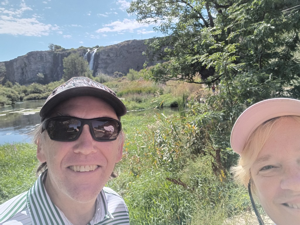
We returned to Joshua Tree after our visit to Palm Springs, but in the interest of efficiency I’m going to include that visit here and cover Palm Springs separately. We ate a lot of real food while experiencing the tucked-away haven for celebrities, wealthy second-homers, and the hard-working people who keep the whole place going, and that deserves its own blog.

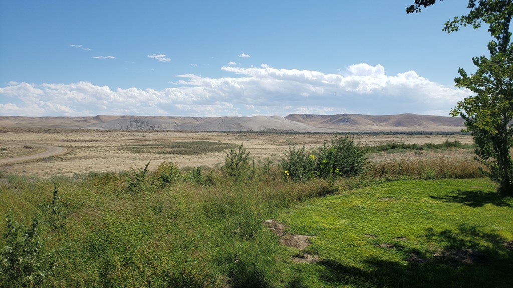
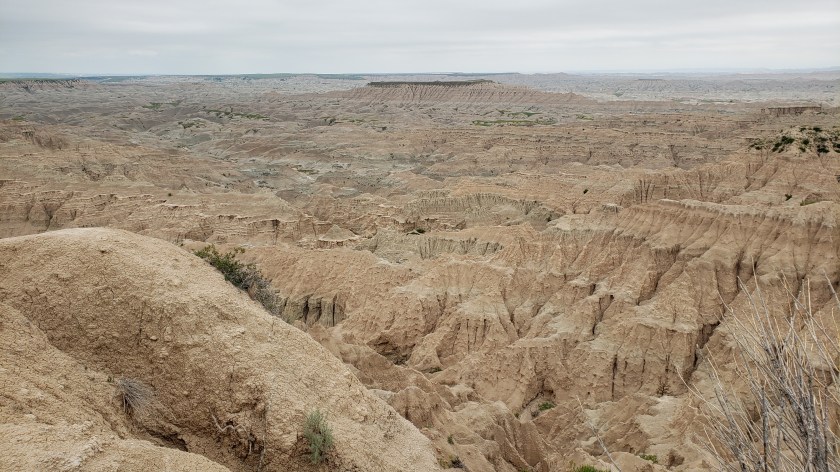
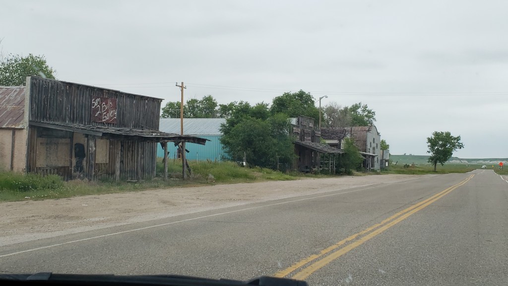
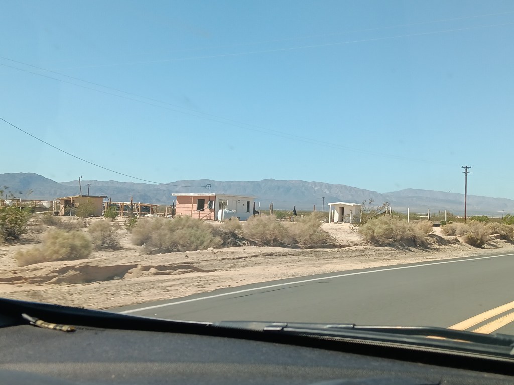
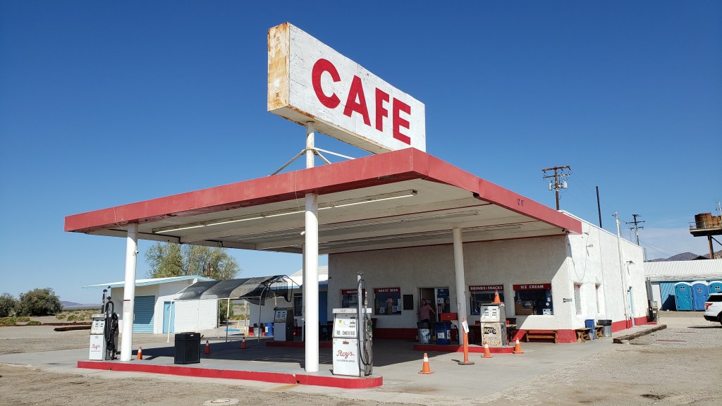
On our way through California from Nevada we took the northern route to Joshua Tree, traveling along roads that were not only desolate, they also featured tiny towns that were mostly abandoned, and a single gas station/café that we thought would have a restroom for bursting bladders, but didn’t.

This, but for three hours.

There may have been about 50 buildings here, but only a handful were occupied.

Need a bathroom with a flushable toilet? Too bad. Not doin’ it here!

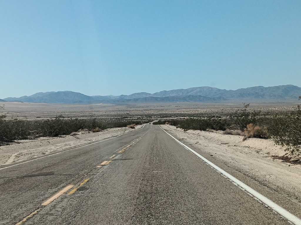
Not wanting a repeat of that crushing emptiness and full bladders, and also wanting to see the southern side of Joshua Tree National Park, we opted for Highway 10 east, blissfully unaware of what the northern leg of the journey along connecting Highway 177 would bring.

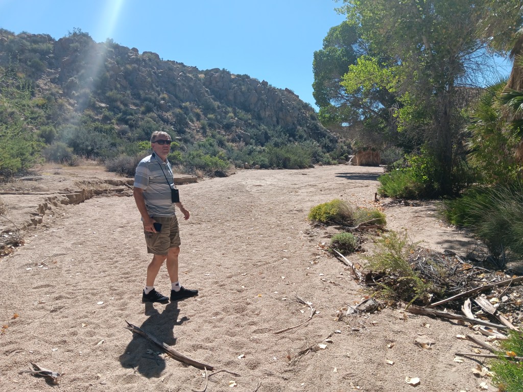
We only needed a moderate detour into the park for Cottonwood Spring, a literal oasis in the desert. Instead of the shimmering mirage that promised a palm tree-line water hole to movie and cartoon characters who didn’t pay attention to the Do Not Die Today signs and pack enough water and their own shade, this oasis did exist, and provided cooling cover, though all of its water had dried up.

A real live oasis. I’m not even sure I knew these existed.

Tiny Simon.

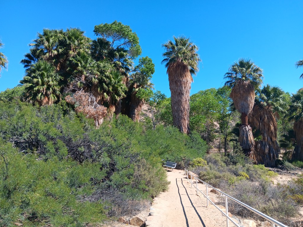
With so much dense foliage around, and this being a desert, we did wonder what might be lurking in the underbrush or clinging to tree branches, but we set that aside and had a nice little wander, admiring the dry wash that ran through it while also bearing all the Flash Flood Danger signs in mind.

As pretty as the oasis was, it must be even more spectacular when this wash is flowing.

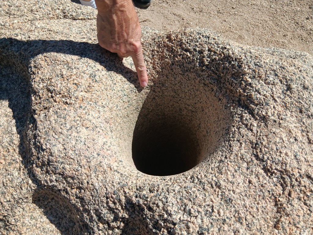
Fascinating signs along the oasis’ pathway described how the Cahuilla Indians who lived here used desert plants for food and medicine, and evidence of their daily lives remains, through mortar holes ground into granite rocks. The holes are so deep we could put our hands into them, nearly up to the elbow. Imagine how long it would take to form a hole that deep when grinding seeds for food.


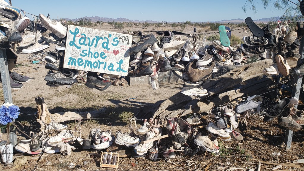
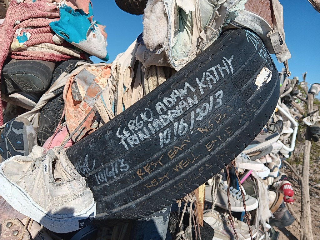
On the return journey back to Laughlin, we had the same mind-numbing emptiness along Highway 177 as we’d had on Highway 62 on our way out, with two major exceptions. Out in the middle of absolutely nowhere were two roadside curiosities. Hundreds of shoes, most tied together in pairs by their laces, some just singles, and some nothing more than the sole of a shoe, were thrown over a metal structure and a fence, or strewn across the ground as if blown down by the wind or left by a careless owner.

There’s no way you can drive by something like this without stopping.

Fledgling shoe tree.

One side of the big shoe fence.

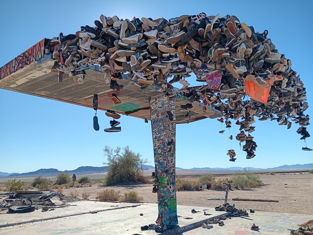
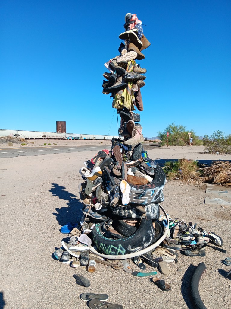
Other travelers had stopped, too, and we all wondered what it could mean. The trash and broken glass scattered around the place suggested a festival of some sort had taken place, but signs and signed objects indicated grief. Many shoes were signed with, presumably, their owner’s name, but other objects included comments such as “Rest easy,” or “R.I.P., Forever in our hearts” or the grief-ridden, “I love you, my boy, my son.”


It began to dawn on us that these could be memorials to young people who had passed during their school years, or shortly after, and the shoes were a way to show respect for their memory.


There were no schools nearby, and no town, nor even any buildings. Was the road a hazard? Did local teens dare each other to take on the desert the way only those who feel they have lots of time and are somewhat invincible could do? What happened here?

When we returned to our dear Fati we looked it up, and it turns out these shoe memorials are mainly just due to people passing by who throw their footwear over the metal “tree” or fence, presumably to combat the utter boredom of driving along that vacuous road. No one perished along the highway, though some deaths were remembered there.


We could see how people might die in Mojave, however, if they’re ill-informed or careless. At the same time, the desert held a quiet beauty for us; a beauty that was subtle and odd and blistering. We left thankful that we did not die that day in that fierce and wonderful place.

A Year On The Road: The 4-Month Map

Highlighting our fourth month on the road and the route so far – all 5,929 miles of it

After three months of fairly hectic traveling, our four-month mark shows that we have come the shortest distance for any month of the grand RV trip to date, from Wheatland in Wyoming to Fillmore in Utah (via what looks like a strange detour to Declo in Idaho, but which was the best way to see some of Idaho without putting too many miles on our RV).

Our mileage for Month Four was therefore just 868 miles, compared to 1,318 last month, 1,239 in Month Two and a whirlwind 2,504 in the opening month.

The total distance in Indefatigable (or Fati for short) since we left Orlando is now 5,929 miles.

The slower pace has been deliberate, of course. We realized that we were trying to pack too much in to this crazy 10-wheeled adventure and we have purposely changed both our itinerary and our pace of travel to avoid the mental and physical breakdowns we experienced in the first two months.

The key has been to identify an area that allows us to explore in multiple directions for a week or so, and then use our tow car, Nippy, to do more of the exploration.

To that end, we have actually gone an additional 9,621 miles in Nippy in those four months, almost 3,000 of them in the past month alone. That total includes a spur-of-the-moment trip into Canada from Montana, our overnight excursion to Rocky Mountain State Park in Colorado and an extensive day trip to the Flaming Gorge in Utah, both from Wyoming.

Our total mileage for the trip so far is therefore a whopping 15,550, or 3,887.5 a month!

The next month could see us top that record for Nippy, too, as we plan on basing ourselves in southern Nevada for trips into Southern California. As ever, this is an – ahem – moveable feast, but you can be sure to read all about it here!

Exploring Gorge-ous Idaho


If there’s a massive crack in the earth, Simon wants to explore it. Southern Idaho seemed to be riddled with them, from the modest Box Canyon to the gargantuan gorge in Twin Falls, a rift so long and deep it had become a world-renowned location for the extreme sport of Base Jumping.

We had a long day in store as we left Fati at the campground and drove west, with Box Canyon State Park, Thousand Springs State Park, and Bruneau Dunes (the tallest single-structure sand dune in North America) as our goals.

Box Canyon State Park proved to be more of an overlook than an actual park, what with being surrounded by cow farms and having nothing but a porta-potty at the dirt parking lot, though if we’d had the inclination we could have hiked from the top of the canyon to the clear, bright-aqua waters of the river below. But you already know that’s not something we could (or would) do with a senior dog in tow.


Thousand Springs also found us wandering aimlessly. The road down to the springs was steep and winding, and either a thrill or unpleasant, depending on which one of us you ask. But as so many locations we’d visited in Idaho had done, this one closed on Labor Day, which was the day before our visit.


We enjoyed the falls, just to say we’d done something, then headed to the day’s headliner attraction.


Along with Craters of the Moon, one of our original must-see locations in Idaho was Bruneau Dunes State Park, where our plan was to rent a couple of sand sleds, climb to the top of the dunes, and freewheel our way back down, with me sitting on a board with Ruthie on my lap and Simon taking the plunge wakeboard-style.


The dry, gravely landscape and fascinating trees reminded us of our trip to Botswana, where Simon went to school for a few years.

It was a ridiculous idea. Sure, the sand would probably prevent any broken bones when we came crashing down, but one of us was bound to get injured, and Ruthie would never tolerate the walk up, or the slide back down. We were saved from ourselves when the early afternoon temperature edged up to 90F, ten degrees hotter than it had to be for the Visitor Center to suspend all sled rentals.

The trip wasn’t a waste, though. We had a nice picnic in the shade of a pavilion by the river, then sweated our whatsits off with a climb up the smallest dune.


Oh, look! Another lunch whose components have nothing to do with one another!


Ruthie doesn’t like it when we’re not all huddled together in a group, and we knew she’d want to follow whoever went up the dune first. So we put her booties on to save her paws from the blistering sand, and told her to climb as high as she wanted to, and no higher.

Click on photo for video

Click on photo for video

View of Nippy from the top of the dune.

We weren’t exactly batting a thousand in terms of WPM (Wows Per Minute), though we definitely enjoyed what we’d been able to do, so Simon decided a quick detour to Malad State Park was in order, for one more chance to stand on the precipice of a deep crevasse and lean out over it as far as possible.

Here you get some small idea of the length of this gorge, with the tiny white line at the back being a waterfall.

Zoomed in a bit more, you can see the waterfall a little more clearly. We’re constantly amazed at what rivers can do to solid rock, given time.

Happily, there was a long, metal bridge spanning the gaping fissure, which gave him an excellent view of the river below. Ruthie joined him, and her bravery was rewarded with a little butt scritch.


But it was our next day’s trip out to Twin Falls that cranked the thrill factor up to eleven. We knew we wanted to see the famous Perrine Memorial Bridge, and we hoped with all our hearts there would be a base jumper or two.

The bridge spans the Snake River, a waterway made famous by the Lewis and Clark Expedition as they journeyed west in an effort to discover what, exactly, the country had gained through the Louisiana Purchase, and where, exactly, that land purchase ended.


That isn’t why it’s famous now, though, at least not with extreme thrill seekers. Today, it has a well-earned reputation as hallowed ground, being the only place in North American where it’s legal to base jump, year-round.

Our hopes of seeing someone jump were met twenty-fold. All day long there are jumpers taking the dive into Snake River Canyon, either as singles or in tandem, some of them longstanding pros, some entering into it for the first time. Some dove in head-first, others did somersaults, but however they left that ledge, it was massively impressive to spectators lining the stone wall along the edge of the gorge.

Click on photo for video

You can feel the anxiety in this person before jumping.
Click on photo for video

We made it a point to speak with a few jumpers, and hit absolute gold when we met Sam.

Former military paratrooper Sam never said anything about being Tom Cruise’s stunt double, but if he’s not, I’ll eat a pound of liver and onions from a filthy truck stop deli (no I won’t; I’d never do that). He looks like Tom’s twin, he speaks as if he’s dealt with media all his adult life, and he’s possibly the best advertisement for fitness and extreme sports you will ever find.

We chatted for about half an hour, then watched him walk out to the middle of the bridge, climb over the railing, stand on the narrow ledge, and swan-dive into the gorge. His parachute opened, and he soared effortlessly to the target point on the side of the river.

It was an astounding feat, but even more incredible was that jumpers then have to repack their parachutes and climb the rocky cliff out of the canyon. Sam scaled the cliff as we looked on, and gave us a final comment as we waved goodbye. “That’s the hard part,” he said.

This is Sam. Sam just jumped. Sam is now hiking up a 5,500-foot gorge. Strive to be like Sam in all your endeavors.

We could have watched all day, but it was getting a bit too hot for Ruthie, so we cranked up Nippy’s A/C and drove to the nearby Evel Knievel Jump Site. Those of us with birth years starting with the number 1 probably all remember the crazy daredevil whose unrealistic motorcycle stunts led to 433 broken bones over the course of his 15-year career as a performer.

You probably can’t see this photo large enough to read the panel, but somehow we only took a few photos of the site, so this will have to do.

The dirt ramp he used for a jump over the Snake River Canyon in his X-2 Skycycle steam-powered rocket is still there. He didn’t make it from one side to the other, of course, and, as we stood at the top of the jump, we were pretty sure he never really intended to make it.

That hill in the background is the ramp.

He blamed it on his parachute opening right after take-off. We blamed it on the fact that no one with an ounce of knowledge about physics could ever think that ramp was going to be enough to launch him one-quarter mile across the canyon. But never mind; it was an epic stunt, and we were delighted to discover our visit was exactly 49 years, to the day, since that fateful jump which, although he survived it, proved to be his last.

View from the top of the ramp, looking over the right side. The gorge is that dark part, with a walking path to its right.

Shoshone Falls was our final stop of the day. Dubbed the “Niagara of the West,” the 212-foot-tall, 900-foot-wide, horseshoe-shaped falls are the largest natural falls in North American (yes, bigger than Niagara). They caught the attention of travelers along the Oregon Trail, and are still a tourist attraction today.

How it started.
Photo from Wikipedia

How it’s going.
The falls should be flowing over those two white rocky areas immediately below the long, horizontal white building in the center of the photo.

Unfortunately, due to a dry summer, the water level was too low for the falls to flow, so we skipped the drive down into the park, looked at the bare rock from above, and rewarded our day with a cold beer, shrimp tacos, and a hearty salad on our way back to the campground, before leaving Idaho and returning to Utah for its grand National Parks the next day.

A Year On The Road – The First Three Months

On August 14 we celebrated the third month of our grand ‘A Year On The Road’ RV adventure, with a chance to tot up our mileage and chart the latest course of the scenic route we are forging across the US.

Having ended Month Two at Fishing Bridge RV Park in the heart of Yellowstone National Park, we have basically undergone a bit of an about-face on our original planned route and gone “freelance” for a few weeks. Our third month covered a total of 1,318 miles, giving us a whopping 5,061 for the trip to date.

Month Three – 1,318 miles, starting in Yellowstone and reaching El Rancho Village RV & Cabins in Wheatland, Wyoming, via Glacier National Park in Northwest Montana

As you’ll see from the map, we continued north from Yellowstone to Glacier National Park, but then broke away from the proposed westward trek to Washington and Oregon via a bit of Idaho in favor of seeing more of Montana and Wyoming, two states which we have found utterly enchanting.

We have tried not to cover any of the previous route, apart from a few miles along I-90 in Montana, and have dived much deeper into Wyoming in particular, including side trips to Cheyenne and Laramie – very much the heart of the Old West – in Nippy to avoid putting too many miles on Fati. From here, we’re looking to turn West again, with each of Colorado, Idaho and Utah on our radar – and more of the magnificent Rocky Mountains.

The first two months – and 3,743 miles

Reaching Back in Time: Mammoths and the Wild, Wild West

South Dakota is considered the Midwest, along with states like Michigan, Ohio, and Minnesota, but its relationship to those states ends at the invisible division. It’s not really the West, either, though larger-than-life historical characters spent an awful lot of time there. We were eager to get to know some of them, and to see their stomping grounds.

But first, we were off to discover the remains of the state’s long-gone wooly mammoths at the indoor museum and archeological dig, The Mammoth Site, home to the world’s largest collection of mammoth bones.

Originally, we weren’t going to bother, since Ruthie couldn’t go inside and the wild west was calling. But the day was plenty cool enough for her to spend a quick half-hour in the car with the windows rolled down, and the museum’s sign was very appealing.


We’d heard the curators had all been very excited about a recent find among the bones already uncovered at the indoor dig site, and who doesn’t want to see something that’s just been unearthed after spending time underground since the last Ice Age?


The bones are all in-situ, left in a sinkhole just as they were found so that they can tell the story of the animal just before and at the point of their death, along with how their bones rearranged as the earth moved and the ice retreated.

Mammoth skull and tusks

One such mammoth died with its head slumped against a hill, tusks up. When the wall collapsed, the mammoth’s bones disarticulated and moved backward, so that its head was now near its butt.

It’s hard to tell what’s going on here, but one tusk is on the left, the rest of the skull is near the rump

Another is Napoleon Bone-A-Part, the oldest mammoth in the sinkhole, as evidenced by his teeth and the depth at which he was found. He shuffled off this mortal coil at the age of 49, a relatively early demise for an animal that can live to age 60, but life was harsh then, so he may have been fairly lucky…until he fell into that sinkhole and his luck ran out.


The museum deserved more than 30 minutes of our time, but we wouldn’t leave Ruthie any longer, so we gave her a good walk around the grounds, then made our way toward Wind Cave National Park, which we’d missed when we got distracted by the bison herd along Custer State Park’s wildlife loop.


A visit to Wind Cave itself was not to be. The Visitor Center was packed, and the dog-friendly route we were told to take down to the cave was nowhere to be found. Instead, we took a one-mile hike up a hill, just to get some exercise, and hoped Wind Cave was boring enough that we hadn’t really missed anything.

A brewery in Custer had our name on it for lunch, with a dog-friendly back porch and an interesting menu. Simon opted for the bratwurst made with rattlesnake, rabbit, and pork, and Susan chose the wedge salad. No one cares what a wedge salad tastes like, so I’ll get straight to the interesting part: the rattlesnake and bunny brat tasted “like chicken,” Simon joked, but admitted it really just tasted like a meaty sausage, with no odd flavors. “I’d have it again,” he insists.

Would you eat this?

The town of Keystone held some appeal on paper, but the reality didn’t strike us as overly interesting when we arrived, so we drove around a little bit, then got some nice frozen coffee drinks, which captured the full attention of the family dog, who happens to be a whipped cream fanatic.

“Give me that.”

We would make a move to Sturgis Campground and RV Park in Sturgis, South Dakota, the next morning, just an hour or so drive up the highway. But not before a mobile tech showed up to fix our electric hot water situation. His comment, “You’re pretty lucky,” when he pulled out the charred remains of some wiring and the fried electric coil started a downward trend in our thinking, which would ramp up to 11 in the coming days.

Fried

But before that, we still had some interesting exploring to do, on the trail of long-gone wild west heroes.

Deadwood is such an iconic name in U.S. history, and we were eager to see it. The modern version, however, is so filled with tourist shops and slot machines that we found no real reason to give it any more time than a quick walk around the main street before heading up a rather steep hill to the town’s cemetery.

Deadwood. The first thing you see when you arrive is a Starbucks

Now, it’s probably not normal, but Susan loves cemeteries. Each headstone tells a story in miniature, like the gargoyles on European churches, and they set off a spark in her brain that is both enjoyable and convoluted. The story of the two people whose gravesites we came to see needs no imagination. Wild Bill Hickock and Mrs. M. E. Burke, also known as Martha Jane Canary but best known as Calamity Jane, have gone down in U.S. history as well-known and beloved figures.

After paying a whopping Senior rate of $2 each to get into the Mount Moriah Cemetery, we hiked up the hill to find their grave sites.

Even without any real interpretation, it was fascinating to see the place in which they found final rest. The gunslinger Wild Bill was shot while gambling in Saloon #10, which is still in Deadwood (sort of), though the name of the bar has been transferred to another bar across the street from the original. The pairs of aces and eights he was holding in his hand when he was shot in the back of the head is now known as the “Deadman’s Hand.”


Frontierswoman and sharpshooter Calamity Jane died of pneumonia and bowel inflammation after a hard-living, hard-drinking life. Finding any two sources that agree on the facts of her life is a daunting task indeed.


A bit further along in the hilltop cemetery, we found the overview of Deadwood Gulch, and several headstones for babies who departed life far too soon, some at or just before birth.

Deadwood Gulch

Sad as these tiny headstones’ stories were, another story of woe was about to play out back in town, and we grabbed a couple of curbside seats to watch it. I’m going to be very honest here and say I (Susan) have no idea at all what the story was about, beyond a little gunfight during which neither of the principles were hit, but the bartender took it in the leg. Still, the kids enjoyed it, and that’s what counts.


The real highlight of Deadwood, for us, was a visit to Chubby Chipmunk, recommended to us by our dear neighbors from back home. We did buy a six-pack, with Susan having reigned Simon in after his eye-wateringly expensive truffle debacle in Minnesota.


We devoured two of them right away, but doled out the rest over the course of a week. Truffles have never been a habit we want to get into, but so far, we appear to be failing miserably.


An enormous storm was rolling in as we departed Deadwood, but we’d gotten used to the changeable weather, and slept through the drama to awaken to the prospect of a fresh new day, and a whole new state.

Native Americans and Four Dead Presidents

Mount Rushmore with entry plaza
Mount Rushmore

The more we’ve toured, the more questions we’ve had, but that’s part of the point of travel, isn’t it? The boring stuff you learned in school was the hook on which you hung little bits of information that, hopefully, act as a starting point when you’re out in the world exploring.

Susan had constant flickers of those schooltime factoids when it came to places like South Dakota’s Wounded Knee and the events that happened all across this part of the country, but it was all told through the side that “won.” Simon’s point of reference was Westerns from television and movies. Neither of us felt we had a well-rounded story, and we were eager to learn more.

theater road sign
At times, things as simple as a sign had us scratching our heads. What the heck IS this? A roller coaster? A prisoner bus? What?!*

Our next-door neighbors from back home in Florida have a place in Rapid City, and they were there while we were in town and invited us over for dinner. They do a great deal of work with the tribes, teaching them how to play and appreciate music, and we spent several happy hours in their company, learning more about the local tribes and their history. They recommended a visit to The Journey Museum, and that was our next day’s morning stop.

The museum is thoughtfully presented, and while it includes sections on paleontology, geology, and archeology, we were there primarily for the Native American exhibits.

the journey museum tipi exhibit

We’d been told it was difficult to get any kind of reliable history, as the tribes tended not to keep written records in the past, and nobody seemed to agree on what really happened versus what is perceived or idealized to have happened.

Like much of the area’s history, the museum’s Native American and Pioneer sections intersect. It was difficult in most cases to get a well-rounded understanding of the two culture’s realities when they came together or clashed, when the focus is inevitably more on their separate experiences than on a realistic view of “how we got to now.”

the journey museum exhibit

the journey museum native american exhibit

winter count buffalo hide journey museum
This is an example of a Native American “Winter Count,” which is a series of pictographs on buffalo hide that records important events that commemorate each year.

Even so, we really enjoyed the museum’s displays, and Susan was especially happy to see women represented as much as men (almost), with a heart-tugging exhibit that featured (in video style) an older woman talking about how girls were welcomed into womanhood within the tribe. She even sang a lullaby. So beautiful.

journey museum tipi with old womam

Today’s scenic drive was Iron Mountain Highway on our way to one of the country’s most iconic sites.

iron mountain highway statistics

We won’t bore you with the outrageous “shortcut” our GPS took us on to get to Iron Mountain Highway, which was so long we began to wonder if we were already on that highway. Instead, we’ll show you a couple of examples of the grand views we had once we were on the right path again.

iron mountain highway landscape

iron mountain highway pigtail
This is a small part of one of the “pigtail” bridges that wind you down the hillside. They’re shaped like…well…a curly pig tail.

iron mountain highway rock formations

Iron Mountain Highway doesn’t end with the view you’re about to see, but WOW! What a spectacular “reveal” for our next destination!

iron mountain highway tunnel
Can’t see it yet…

iron mountain highway tunnel mount rushmore reveal
Aaaannnndddd…NOW!

Neither of us ever thought we’d ever be in a position to see Mount Rushmore, and standing there in front of George, Tom, Teddy, and Abe felt just a bit surreal. Considering their human rights records (not you, Abe), we had some mixed feelings before we got there. Once there, we felt a surge of pride and patriotism (in the best sense of that word).

mount rushmore selfie

We probably took 40 or 50 photos of the monument itself, but we’ll just share a few here, including a side view of our first President taken from a cut-out along the road once we left the park.

mount rushmore plaza

mount rushmore 1

mount rushmore 2
The weather was, shall we say, changeable.

mount rushmore side view
That’s George, in the middle of the photo

A second drive along Needles Highway was a welcome journey as we made our way down into Custer National Park again, with a stop at one of its visitor centers to get a steer on where to see Bighhorn Sheep (we’d nearly given up on the elk, who, we were told, were spooked by the last few evenings’ thunderstorms and were in hiding), and the docent was right on target with her suggestion.

custer state park bighorn sheep roadside

custer state park bighorn sheep

custer state park bighorn sheep closeup

Squeezing the last drops out of Custer State Park, we drove one side of the Wildlife Loop again on our way back to Hermosa, and buffalo and pronghorn herds’ reliability held up.

custer state park bison in evening

custer state park pronghorn male closeup

But tonight we were treated to a spotting we didn’t expect at all. We watched this coyote for about fifteen minutes as he/she/they hunted, and our patience was rewarded with an up-close view as the coyote came up to the road, gave us a good look, then trotted away.

custer state park coyote closeup
No zoom lens needed

It wasn’t an elk, but we felt, yet again, we’d been treated to something rare and special. What a great way to cap off a great day!

custer state park coyote walking away

*That sign that had us wondering what it was trying to communicate is for a little tiny theater in the middle of absolutely nowhere. Cute!

South Dakota’s Badlands And The Results Of Effective Billboard Marketing

Badlands National Park selfie
South Dakota’s windy Badlands

We entered the new-to-us state of South Dakota on June 19, eager to see more of the Dakotas after a fantastic stay in the northernmost state in the Midwest. We’ve got a week in Hermosa, then 3 full days in Sturgis, to see Custer State Park, Crazy Horse, the town of Custer, Deadwood, Badlands National Park, Needles Highway, and Six Grandfathers, now known as Mount Rushmore.

To break up the long trip from Medora to Hermosa, we had an overnight stop at Harvest Host location, Belle Valley Ancient Grains in Newell, SD, which felt incredibly rural but was just minutes off the highway heading south.

Belle Valley Ancient Grains

We learned about the ancient grains owner Brian is farming, and came away with whole Spelt and White Sonora Wheat that we’ll make into grain bowls and hot cereal.

Belle Valley Ancient Grains grain machine
The 1950s machine Brian uses to separate the grain from the waste, before putting it through high-tech machines that finish the job.

Belle Valley Ancient Grains sunset
It’s hard to beat a stunning sunset over pastoral land

Then it was on to Hermosa, with a butt-clenching 11 miles through construction cones on a highway with a speed limit of 75mph. You can imagine the number of cars that passed us after the construction zone ended. We’ve decided their honking and single-finger salutes are congratulatory celebrations of how well we navigated a tight lane with harrowing twists and turns, and we felt very special indeed.

But enough of that, and on to the touring. We settled in at Heartland RV Park, enjoyed a pizza and live music at the campground’s event center, and had a relatively quiet night (rain is loud when you’re in a metal can), then made our way to Badlands National Park the next morning.


It was quite cloudy and windy all day, but that didn’t deter us.  We were on a mission to see something other than the rolling hills we’ve been driving over, and even before we reached the park, the landscaped changed. Immediately off the highway, the hillsides on either side of us opened to two massive valleys, with structures completely different to the ones we saw in Theodore Roosevelt.

Badlands National Park valley
For scale, that teeny tiny white dot you can barely see at the end of the dirt pathway on the far edge of the plateau is Simon, and a lady who had just come from the Black Hills is in the foreground.

Badlands National Park valley up close

We made a quick stop at the Visitor Center, where they told us we could find gas in the appealingly-named town of Scenic if we needed any, but when we found it, it had obviously been a dead town for years. Decades maybe. The gas station had a price of $5.55 per gallon, so we’re guessing the place drew its last breath back when Jimmy Carter was President. Luckily, Nippy is very sippy, so we didn’t need to fill up until evening.

Scenic South Dakota
Is Scenic scenic? You decide!

Scenic South Dakota 2

Once we reached the first outcroppings, it was obvious we were in an entirely new landscape. The peaks were sharper at the top and more angular as they descended, with a softer, more “melted” look when we got up close.

Badlands National Park peaks

Badlands National Park Bands of Time
We were given a guide that showed what each later represented, moving from the oldest layers at the bottom to the youngest at the top.

Badlands National Park range

The badlands here were created by runoff that washed into an inland sea as Colorado’s Rocky Mountains rose into existence. We could see the layers when we took a short hike into a wide canyon, and the ground we were walking on was primarily the finest silt imaginable. Just like walking on talcum powder.

Badlands National Park simon and ruthie
The white pathway feels exactly like talcum powder

Other areas in the same canyon were like petrified mud, hard enough to create hills you could stand on but also dry and cracked on some surfaces.

Badlands National Park simon mud mound
This ancient sediment is described as “popcorn” rock

Badlands National Park flower
Even on that barren surface, the most delicate flowers have taken hold.

Another surprise were the “yellow mounds” (called paleosols) that were left when the inland sea drained away and chemicals from its plants left staining of yellow, red, purple, and gray. Against the cloudy sky, they’re less striking, but when sunlight hits them they positively shine.

Badlands National Park yellow mounds
Some yellow mounds we saw were only yellow, while most were multi-colored. We missed the sunlight photos, but you can imagine.

We could post a few hundred photos from the park, but we’ll spare you that and instead share a few from the absolutely bizarre town of Wall, our exit point from the park as we headed north to Hermosa.

Normally, commercials on TV and billboards along highways have zero impact on us. But Wall Drug Store is too smart for that, and the sheer number of billboards they’ve installed made it inevitable Simon would have to see what all the fuss was about.

Wall South Dakota
Our introduction to Wall

Like Buc-ee’s, if you’ve been there, you know. Wall Drug Store is just…massive. Like, a full city block massive.

Wall Drug Store facade
Not all of these storefronts are Wall Drug Store, but most of them are

Want a billion shot glasses, T-shirts, cups, mugs, magnets, and every other form of tourist crap you can imagine, all wrapped up in interactive stuff that includes a jackalope the kiddies can sit on, a gorilla animatronic playing a piano, and an insane trio-plus-one of mechanical cowboys singing in a wild-west setting of howling coyotes and an upset bear? Wall Drug Store has all of it and much, much more.

wall drug store interior

wall drug store mechanical band
This is a terrible photo, but there was no way to avoid the glare. Still, it softens the full horror.

wall drug store jackalope

wall drug store gorilla
Why?

We didn’t buy anything. We didn’t even try the “free water” the store so proudly advertises on the front façade. But we’ll remember Wall Drugs with the same fondness we remember that wacky gas station with a beaver as its mascot.

wall drug store front

Tomorrow (subject of our next blog) would see us making the first of many trips into Custer State Park, and we’ll just say that at $20 for a seven-day pass, we absolutely got our money’s worth.

Custer National Park male pronghorn
Hello, handsome!

Fargo: It’s So Much More Than A Wood Chipper

Fargo wood chipper
Nobody should be smiling when encountering a sight like this

Simon loves the dark comedy movie, Fargo, with its relentlessly evil villains, the dogged heroine Marge, and that chipper no one who has ever seen the movie can forget. The Chipper prop now lives at the Fargo-Moorehead Visitor Center, and it was the reason we put Fargo on our Grand Adventure route.

We stayed at a Harvest Host in Minnesota the night before, celebrating Simon’s birthday in high style with cheese and bikkies (crackers for us U.S. folks) and a beer, since we had no access to electricity and didn’t want to use up our batteries (generators aren’t usually allowed at Harvest Hosts), plus we’d had a celebratory lunch and were too full for much more.

Birthday beer
Birthday beer out there on the edge of the prairie (okay, right ON the prairie)

The host location was a farm with horses, goats, chickens, cats with newborn kittens, and a gangly, year-old dog named Pooh Bear.

Harvest Host baby goat
It’s so soft!

We got to hold a three-day-old baby goat, meet the newborn kittens, and Simon, always ready to try his hand at something new, milked a mama goat.


We then spent the evening sitting on the front porch chatting with the owners, and felt it was exactly the kind of experience we were hoping to have during this journey.

The next morning we made the short trip into North Dakota, where we had another Harvest Host stay, this time at a winery, and while the sweet wines weren’t to our taste (neither was the eyelid tick), the food was good and we met another RVing couple who had come in from Oregon, which passed a happy couple of hours before heading back to the rig for the night, with a strong wind whipping through the prairie grasses as a small storm rolled past, which we loved.

Harvest Host 4e winery
Moody sky, but we only had a little bit of rain as the storm went past

Bismarck was our next destination, with a detour off the highway into Jamestown to see the World’s Largest Buffalo.

Largest buffalo in the world
Imagine the droppings….

The roadside attraction included a touristy town with stagecoach rides, and it made for a nice diversion on our way to Bismarck.


We woke up early and headed back to Fargo for a photo op with the infamous Chipper. If you don’t know the movie Fargo, it’s the means through which the hapless main character gets turned into the human equivalent of ground beef, thanks to a crazy man with a passion for gruesome murders [Note: Leg in Chipper = hint].

simon with wood chipper
Non-gory recreation of a very gory scene

The Coen brothers (Fargo’s producers and directors) signed the Chipper, but there was no way to get a photo of their signatures without glare, so here they are, just as obscure and unfathomable as the movie the brothers created.

wood chipper signatures
Appropriately scrawled across the “exit”” end of the chipper, where whatever you shove into it blows out. Across the snow. All bloody.

Our next campground (with full hookups!) was Hillcrest Acres in Bismarck, a small, pretty place appropriately located on a hill, a forerunner to the scenery we’d see as we drove around the area for the next few days.

Hillcrest acres campground
Fati getting comfortable

Countless times, we wondered how those hills (variously called “buttes,” “hills,” “points,” and “ridges”) formed, why most were grassy but some were bare, and why glacial movement made North Dakota so undulating, but Michigan so flat. Wind and water played their part, but we’d like to talk with a geologist to find out more. That’s one of the beauties of travel; it inspires curiosity.

north dakota butte
These odd outcroppings are everywhere

Our first full day took us to Washburn, where we discovered the restored Fort Mandan, in an area the Lewis and Clark expedition spent the winter of 1804. The fort had various tiny rooms, such as quarters for soldiers, interpreters, and the captain, plus a smokehouse, blacksmith, and storage room.

Fort Mandan

Fort mandan interpreter room

fort mandan room

fort mandan room details

Ruthie was absolutely captivated by the Sargent of the Guard’s quarters and didn’t want to leave. We don’t know why, but she was very clear about wanting to stay.

ruthie fort mandan
We tried not to read too much into it, but “past lives” certainly came to mind

She was less captivated by the statue remembering Seaman, the faithful Newfoundland dog who traveled with the expedition, but she dutifully sat for a quick picture.

seaman statue

A short stroll beyond the statue rewarded us with our first up-close view of the Missouri River, whose waters were low and many big sandbars could be seen. We would cross over the Missouri several times in the following days.

missouri river

Just a short drive away from the fort was the Knife River Indian Villages National Historic Site (using their cultural terminology, not the terminology we might have chosen), with a recreation of a Native American earthlodge that marks the area many tribes used as a trading center.

A buffalo hide acts as the doorway into the lodge, and inside the temperature is about 10 degrees cooler. A deep, smokey smell permeates, which gave us a small sense of what living inside it would have been like. Ruthie lost her mind in there, loving all the new sniffs.


The visitor center here was superb, giving an excellent overview of two tribes and their lifestyles. Although the day was cool and we could safely leave Ruthie in the car for a short time, we had to turn down the host’s offer to watch a movie, as our Floridian sensibilities made us uncomfortable leaving her for very long. But the exhibits were terrific, and we felt we learned more about the people who once lived there.

We drove further west for Lake Sakakawea (pronounced here as Sah-KAH-kuh-WEE-uh, not Sack-a-juh-WAY-uh), a huge lake set below stark cliffsides, which must be ideal for boating on summer weekends. The history of the lake is, predictably, one of eminent domain, force, and the subsequent throwing-of-a-bone in naming it after a famous figure who (it is my opinion) probably had as little say in her destiny as the land that now holds the lake named for her did.

lake sakakawea
A small slice of Lake Sakakawea

This is the site of two-mile-long Garrison Dam, a three-part set of structures built by the U.S. Corp of Engineering in 1953, that includes a pump station…

garrison dam pump house

…the dam itself…

garrison dam

…and a spillway that helps route water back into the Missouri when levels get too high. Neither of us are geeky in that way, but it was truly fascinating, and we spent a fair bit of time pointing and saying, “I wonder what that’s for….”

garrison dam spillway

North Dakota’s oldest state park, Fort Abraham Lincoln State Park ($7 to enter), was our next stop, with three re-created blockhouses overlooking the Missouri River. On breezy summer days, the many narrow lookout windows must have afforded an excellent breeze. In winter, it must have been cold enough to freeze the brass whatsits off a monkey.

Fort Abraham Lincoln blockhouse
One of the three blockhouses

fort abraham lincoln window
There are several of these narrow windows all around the blockhouse, some with fabulous views

On-A-Slant Indian Village was within the park’s boundaries, too, and the earthlodges here were beautifully displayed, along with panels that described life in the Mandan tribe village from 1575-1781.

On-A-Slant Village

We were captivated by the idea that boys in the Mandan culture learned to shoot with accuracy by playing a game that involved throwing a hoop into the river and shooting an arrow into its moving center. According to an exhibit we saw, it was their belief that the dead buffalo they found floating in the river with each spring thaw were a result of these games. All of the children would have been treated to funny stories that told important tales.

Old Man Coyote and the Wild Potota legend

On the way out of the park, Simon made a quick right turn when he saw a sign for Custer’s House. We couldn’t take Ruthie in it, so we agreed Simon would check out the house while Ruthie and I waited in the car with the air conditioner on.

Custer's house
Spot the docent? No, you don’t, and neither did Susan

Twenty minutes later he was still standing on the house’s porch, so the following phone call ensued:

Susan: Hey. What’s going on?
Simon: Oh. Yes. It’s nice to hear from you. Uh-huh. I’ll let you know when I’m there.
Susan: What the hell are you talking about? I can see you standing on the porch, so I’ll certainly see you when you get back.
Simon: Okay, thanks! All the best. Bye for now.

When he got back to the car, he detailed the conversation a docent sitting on the porch (whom I couldn’t see) had at him. Not with him, at him. Simon asked what rank Custer was during the war, and 20 minutes later he knew everything from Custer’s blood type to his favorite dessert and whether he preferred tighty-whities or boxer-briefs. (Okay, not really, but the docent talked for a full 20 minutes, and Simon had to pretend I was someone important so as to break off the dissertation gently and with respect).

For those who cannot bear not knowing, it turns out Custer was a Lieutenant Colonel during the battle at Little Bighorn, but was a General during the Civil War and was allowed to keep that designation as an honorary title when that bloody war ended.

We finished the day at Standing Rock, an important stop along the Native American Scenic Byway. Our goal was to visit Sitting Bull’s burial site, which we found after many wrong turns, having blown past it on the way into town. Most people probably do that, too. There is only a small sign on the side of the road that indicates where this great man’s resting place is (or rather, was; he’s since been moved at the request of his grandchildren).

Sitting Bull burial site

The grand brochure we were given at the Fargo visitor center did not prepare us for what we found at Standing Rock. Perhaps we missed the highlights, though we’re not quite sure how we could have. Instead – and we’re assuming a LOT, all of which may be wrong – we found a town completely void of energy, as if a total lack of opportunity and a heaping helping of injustice held the place and its people in a state of downcast limbo. We’ll end our sweeping assumptions there, and, with heavy hearts filled with compassion, put our energy into hoping all good things come to the people who, by choice or by historical force, make it their home.

A Year On The Road – Weeks 2-3; 691 miles

After our indecently hasty first-week charge through the center of the USA, our pace has (deliberately) slowed in weeks two and three. Instead of 1,289 miles in 7 days, we covered “just” 691 in 14 days; i.e. half the distance in twice the time. That’s still probably more than most dedicated RVers will travel in that time, but a better realization of what RV travel is all about.

We gave ourselves a day in Gaylord, three days in northern Michigan at Mackinaw City, seven in the Upper Peninsula in Munising for the superb Pictured Rocks National Lakeshore, one day in Crystal Falls, and then another seven as we crossed over into Minnesota at Duluth and pitched camp in Saginaw, just to the north-west.

The map of our route from Lansing, Michigan, to Saginaw, Minnesota, 14 days of excellent RV travel

That’s where we are right now, prior to our next major move – west through Minnesota and into the “undiscovered country” of North Dakota, Fargo, Bismarck and all. This will be entirely new territory for both of us, and we can’t wait to discover new adventures…

PS: The map shows it would take 11hr 33min (by car, non-stop) to cover the route that took us 2 weeks!

A Return to Ancestral Ground

Gooseberry Falls selfie

The Land of Ten Thousand Lakes. Home to wolves, bobcat, coyote, bears, and, a long time ago, woolly mammoths, Minnesota is also the birthplace of Susan’s grandfather, a descendant of Slovenian immigrants seeking life and work in a place similar to home. And that means mining, a distinct accent, and winters harsh enough to freeze your bollocks off.

But our arrival was much more temperate, once we got past Duluth.

Duluth minnesota
Duluth, Minnesota

Those Steep Grade warnings on our GPS were the first test of our nerve before we head into mountain territory, and while Simon was eager to give it a try (with a healthy dose of respect), Susan was not so sure. Perhaps the person holding the steering wheel with their foot on the gas or the brake has a mental advantage over the helpless passenger.

Whatever the case, the downward grade proved to be a doddle. We’d had worse coming through the Appalachian foothills on our way up from Florida. The upward grade, however, would be a different matter.

Leaving Wisconsin meant crossing the St. Louis River into Duluth, where the unexpected sight of the John A. Blatnik Memorial Bridge brought on the heart-pounding terror of the Mackinaw Bridge crossing for one of us (Susan, obviously), with its massive rise and certain death by drowning if the rig went over.

In the end, it was butt-clenching but do-able, much more so than the Mighty Mack due to its higher sidewall and less visibility straight down to the river.

We could see the uphill Steep Grade we’d been warned about when we reached the end of the bridge. From there, it looked incredibly daunting – a nearly straight-up pitch with its full horror hidden by sweeping upward curves. Simon downshifted into second gear, checked that we were already in Tow Haul mode, and let Fati’s engine take the brunt of it.

We have no photos of it, of course, since Simon’s hands were gripping the wheel and Susan’s hands were gripping the armrests.

Our 11-ton rig performed magnificently, and once we were at the top of the hill we (and she) breathed a sigh of relief. The rest of the trip was pretty and uneventful, though we were immensely curious about the foggy pall that lay over Duluth, a meteorological phenomenon caused by air hitting the warm land after passing over Lake Superior’s deep, notoriously cold waters, which we’d encounter repeatedly over the next few days.

We were thrilled to be upgraded from a 30-amp back-in site to a 50-amp pull-thru when we checked in at Red Pine Campground in Saginaw, Minnesota, about 28 minutes north-west of Duluth. We parked between two fragrant pine trees with an Airstream RV on one side and nobody on the other, hooked up to water, electric, and sewer, then set off to see the sights.

Having learned our lesson with a tick scare on Ruthie after hiking in Michigan, the first order of business was to find some hiking clothes, ideally the kind that has tick and bug repellant built in. Menards – that vast warehouse of all things outdoors in Michigan – wasn’t far away. It also wasn’t anything like the ones in Michigan, and was really a gigantic Home Depot. Strike One. Walmart was Strike Two. In the land of outdoor adventure, either the locals never went outdoors, were far heartier than us, or already had hiking clothes.

Susan refused to go into any more stores that didn’t have the words Sporting Goods on them, and to our great joy we came upon Dick’s. But this wasn’t a big Dick’s. It was a little Dick’s. And no offense intended to anyone, but we were pretty sure we’d hate little Dick’s.

Simon waited in the car with Ruthie (again), while Susan dealt with the little Dick’s. Long story short, it wasn’t a little Dick’s, it was a big shopping mall with a little Dick’s. Apparently, women don’t hike, so half an hour later we both had a set of men’s hiking pants and shirts (and a massive cha-ching on our credit card), and we were off to the North Shore Scenic Drive with Gooseberry Falls as our turn-around point.

First up was a pull-off viewing area that led down to a small river that emptied into Lake Superior where, it seems, something spawns.

Roadside oddity Toms Logging Camp (no apostrophe needed, it seems) was our next discovery, and while they don’t allow dogs on the camp trail, we took a few minutes to explore the wacky gift shop and it’s homespun signs that explained the “décor” on the walls, from the type of timber used to build the shop to the mountain goat’s head and a grim description of how long it took to die after it was shot.

Simon in hat at Toms Logging Camp
The most gorgeous cowboy in Minnesota!

Susan had been hoping to find a small bag of long-grain wild rice, and we found it here, then we headed north again. Our packed-lunch stop was the lighthouse in Two Harbors, where the fog on Lake Superior was starting to roll in. We made it to the end and back, but during that walk the temperature dropped by about ten degrees, then rose again when we reached land.

Two Harbors Lighthouse
You can see the fog in the background, which would be in the foreground soon.

Even the over-achiever Canadian Goose couple with their 27 (!!) goslings were unimpressed.

Geese with goslings

Simon had too much blood in his caffeine stream, and we seriously needed warming up, so we popped in at Burlington Station, where he added eight hand-made truffles to the bill without asking how much they were. The total for the truffles and two mocha coffees came to $46, and the look on his face was priceless as he tried to hide his shock and horror.

Truffles

In all fairness, they are absolutely scrummy, and we’re making them last as long as possible. But damn…that’s some serious cash for a couple of pounds of chocolate. You could buy a whole new check valve for your water pump for that price!

Gooseberry Falls was the most magnificent of all the falls we’d seen so far, so we’ll just let you enjoy them, as we did.

Gooseberry Falls 1
Gooseberry Falls 2
Susan and Ruthie at Gooseberry Falls
Gooseberry Falls 3
Gooseberry Falls 4
Gooseberry Falls 5

Fog followed us back along the coastline until we turned west and headed home again, where one of us flopped onto their bed, so exhausted by the day they couldn’t even close their mouth all the way before they fell into a deep, contented sleep.

Ruthie sleeping
That little tongue!

Next up: A surprising and sentimental discovery!