

When it comes to mind-blowing scenery, Utah looks at all the other states and says, “Hold my beer.”
From its gargantuan red-rock mountains that glow as if lit from within to world-class National Parks featuring formations you can hardly get your head around, Utah takes the WPM (Wows Per Minute) and cranks them up to eleven.
Warning: There will be a lot of photos of rocks in this blog. Get coffee or tea, or something stronger. We’ll wait.
After a Wallydocking in a Walmart parking lot the night before, our next stop was a golf course campground in Payson, Utah, where we parked Fati for four days, two of which we spent 150 miles away with a couple of nights in a Green River hotel within striking distance of Arches National Park, Moab, and Canyonlands National Park.
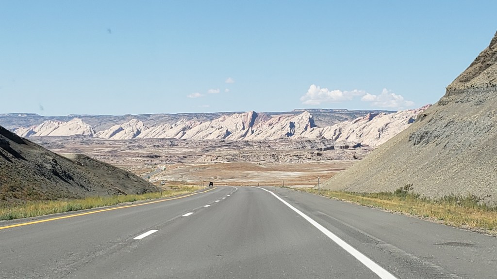
The drive to Green River was every bit as scenic as anything we would see beyond the paid-for side of a National Park entry gate. Highway 6 goes through the Wasatch Mountains, delighting us with a dazzling array of towering rock formations in endless shades of red; rolling yellow hillsides; and bare-rock mountain tops.
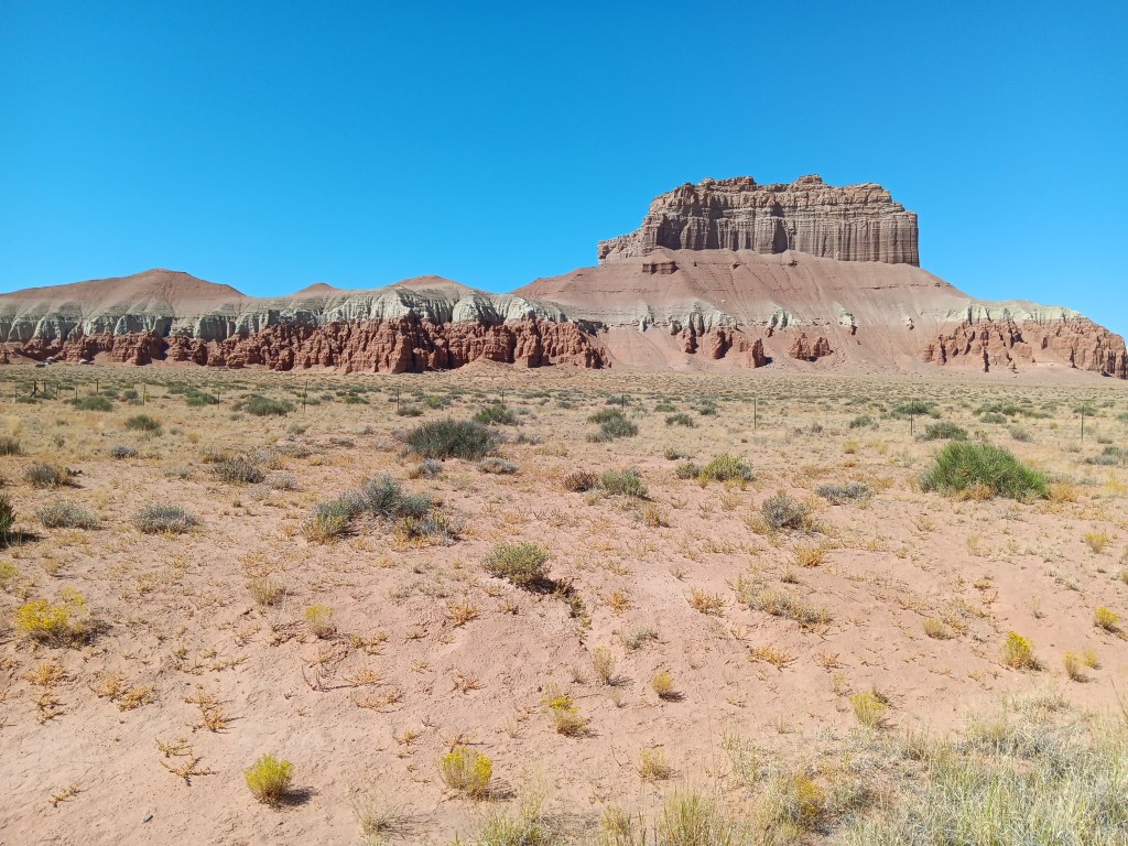
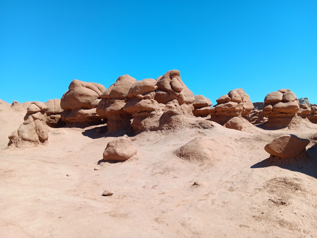
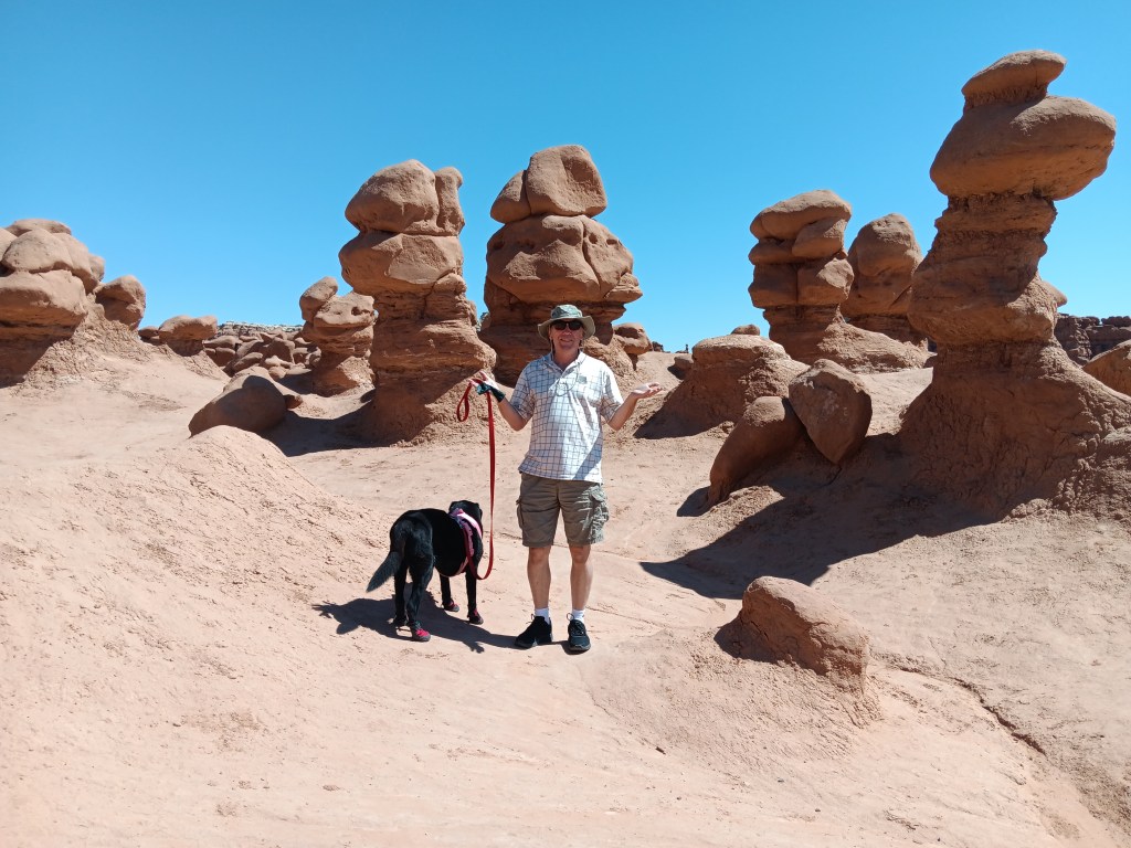
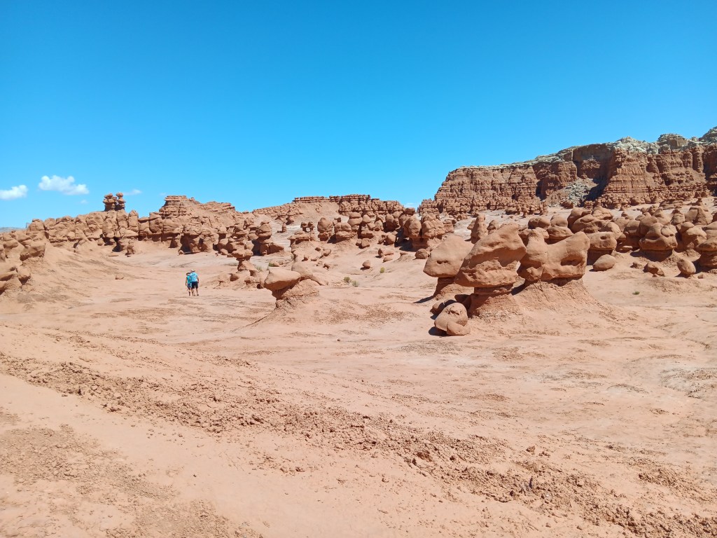
Before checking in to the hotel for two nights, we made a detour to the charmingly named Goblin Valley State Park, a three-square-mile valley filled with adorable Entrada sandstone “goblins.” Their official name is “hoodoos,” but the formations that don’t look like giant potatoes do have a sense of bulbous-headed gremlins about them.
As we drove down the road toward the park, one rock feature in particular caught our attention. From far away, it looked like the Ritz Carlton hotel in Orlando. Closer up, it morphed into the Jedi Temple from the Star Wars movies. Ancient, abandoned, filled with a quiet sadness, it told a story that spoke to something in Susan’s psyche in a way other mountains had not.

Once in the park, the temperature was too hot for Ruthie to go hiking for long, but we spent some time wandering the first of three valleys, and felt we’d more than gotten our money’s worth.
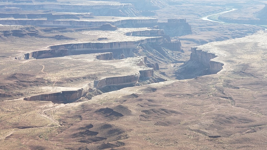
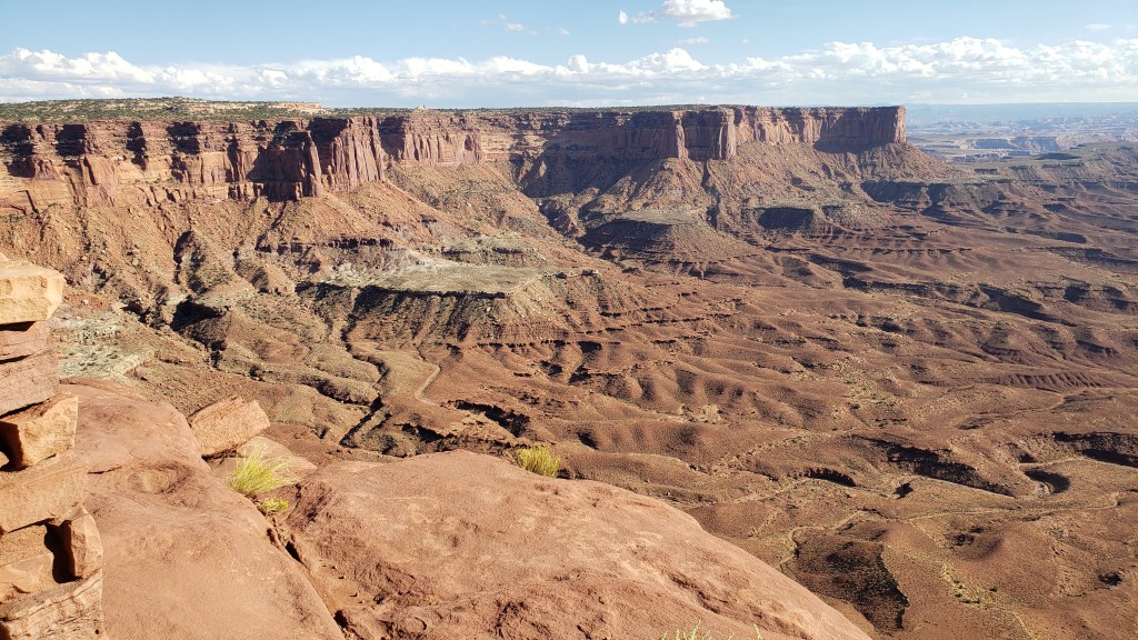
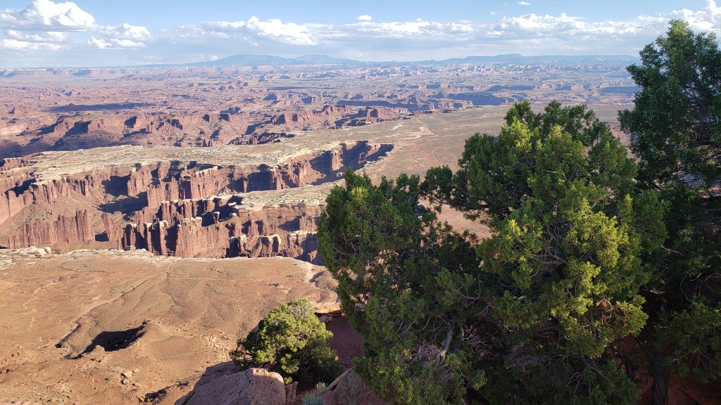
From the valley floor to the heights of a butte far above the Colorado River, Canyonlands National Park was our next stop, for its Islands in the Sky scenic drive.
By now you know this sort of territory is pure bliss for one of us and extremely challenging for the other, but we didn’t come all this way not to see these spectacular parks, so we each enjoyed the views from within our personal comfort zones.
The road you see in the second video, above, is the Shafer Trail, and it’s not a walking trail. It’s a crazy-person driving trail, and we have reliably heard that one man’s wife nearly jumped out of their truck from pure fear when they mistakenly took that road instead of the tourist-friendly scenic drive. Thrill seeker? This is your road!
Simon will post a video of that road in use on our YouTube channel (Veness Travel Media), so be sure to look for it soon (and subscribe!). You may want to put on brown pants before you watch, because…d@mn!
We’ll let you enjoy the overlooks as we saw them.
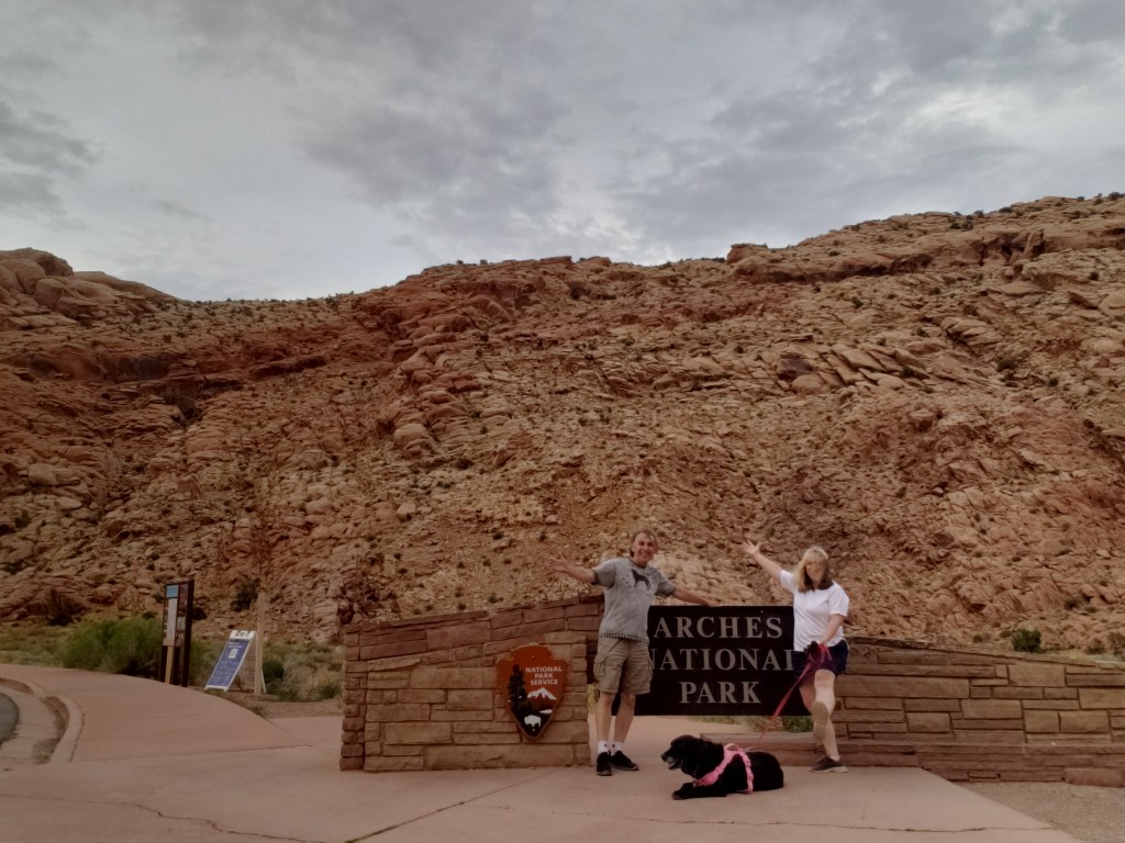
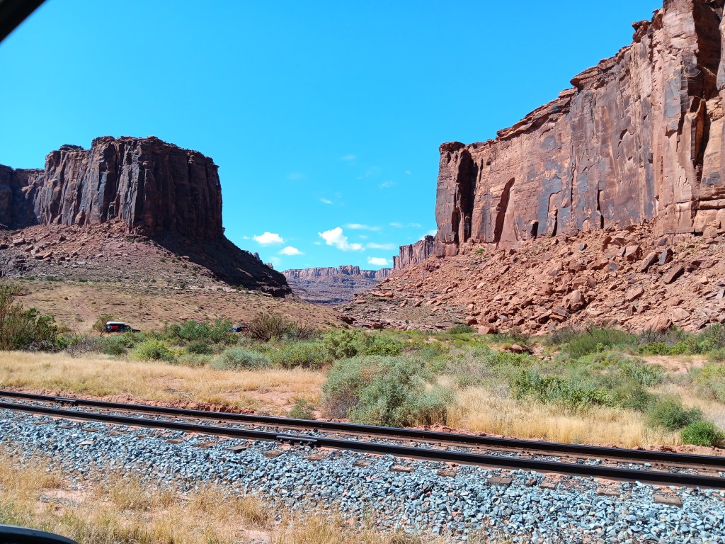
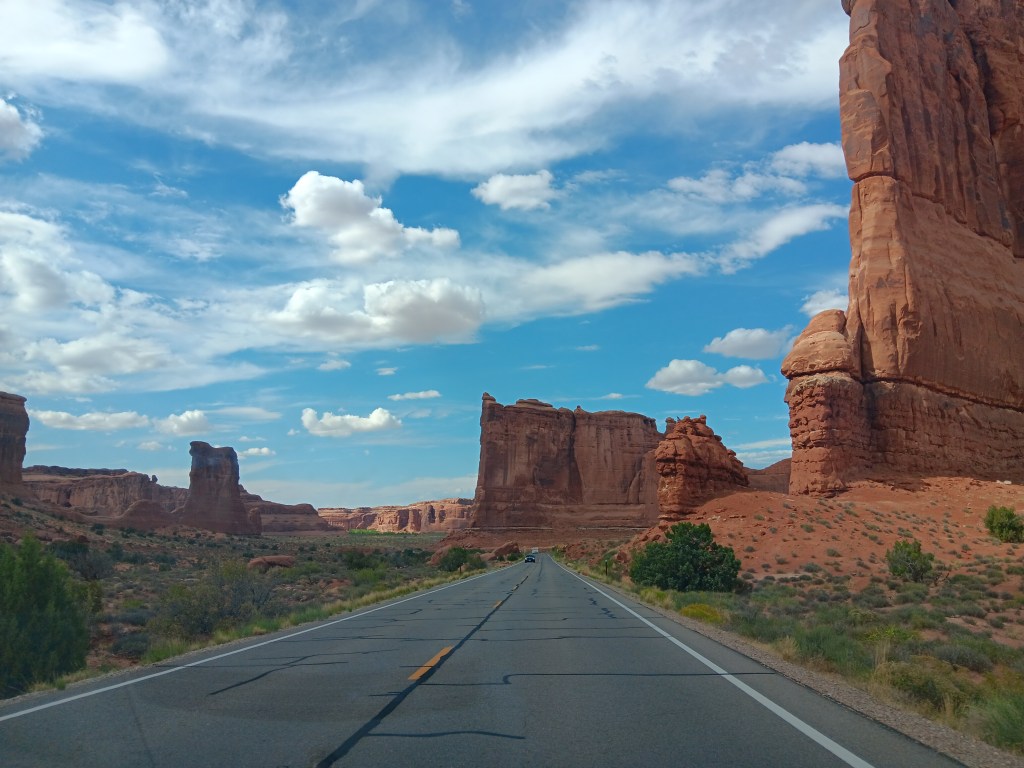
The next morning we set off for the town of Moab, just on the edge of Arches National Park. We couldn’t enter the park until 3 p.m. due to its timed-entry reservation system, and our time was later than we would have liked. We had previously scored a morning entry for another date, but had to give it up when we changed our original itinerary.
But the Moab Visitor Center lady not only showed us how to modify our reservation on our phone, which got us in an hour earlier, she also recommended we visit Potash Canyon until our entry time arrived. And golly Bob howdy, were we ever thankful for her recommendation!
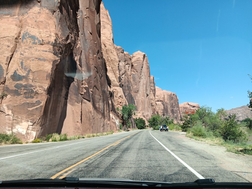
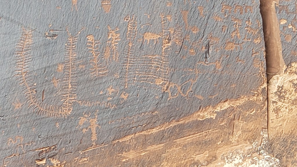
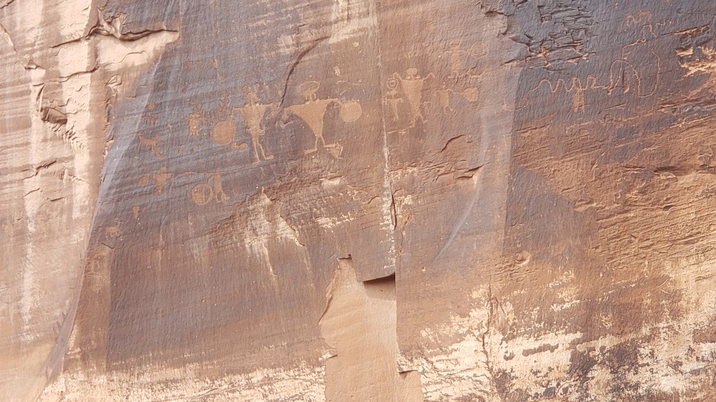
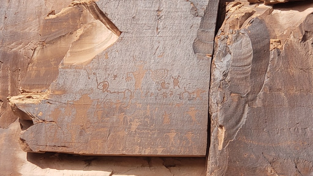
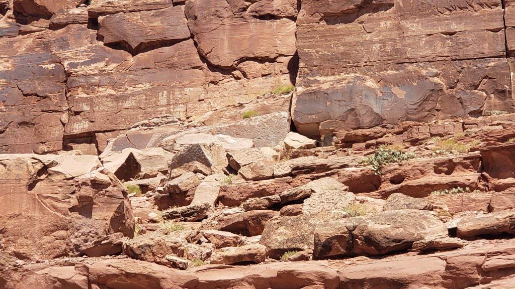
The Potash Road drive was a “trip back in time,” to use a very overused phrase. Turnouts along the road allowed people to stop and admire the petroglyphs etched into the sandstone mountainside, primarily by the Freemont tribe, between 600 and 1300 A.D.
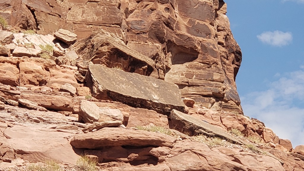
Further along we found Poison Spider Dinosaur Track site, where a scramble up the boulders rewarded scramblers with up-close views of dinosaur tracks left during the Jurassic era. It was much too hot for a long hike, and Ruthie couldn’t even do a short hike over those boulders, so we experienced the footprints through our binoculars, and snapped a photo of the ones that were easiest to see from the parking area.
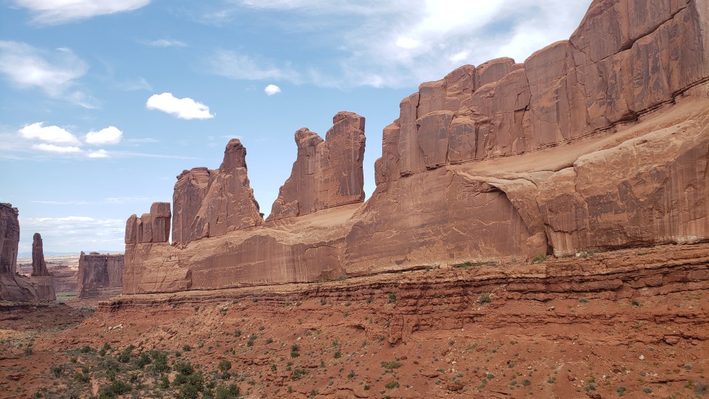
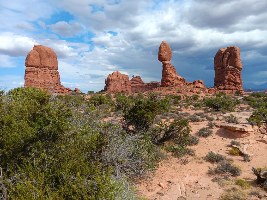
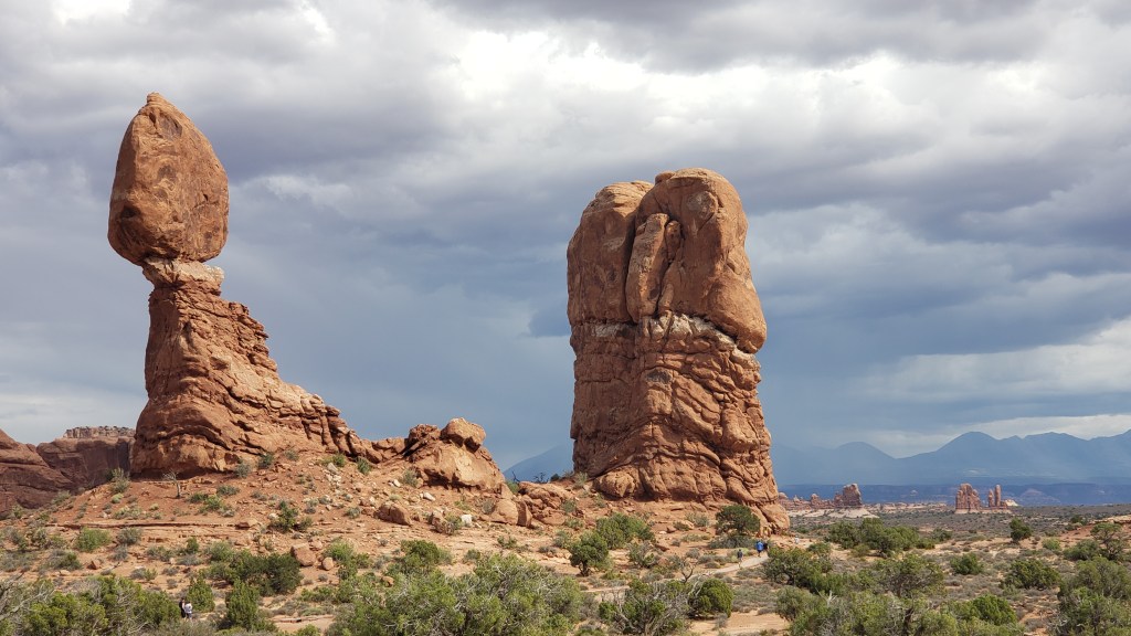
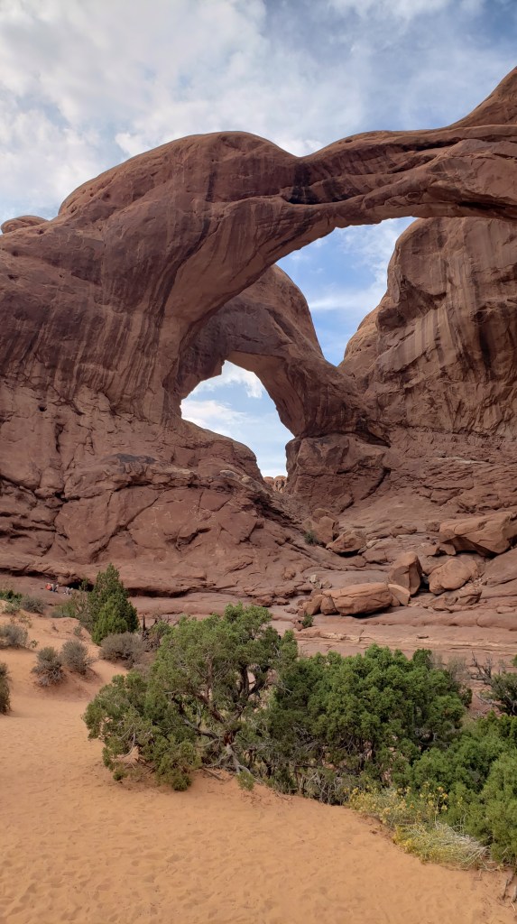
When our Arches timed entry arrived, we made the winding trip up to the plateau from which the park’s features could be seen. We’ll leave you to enjoy the highlights…
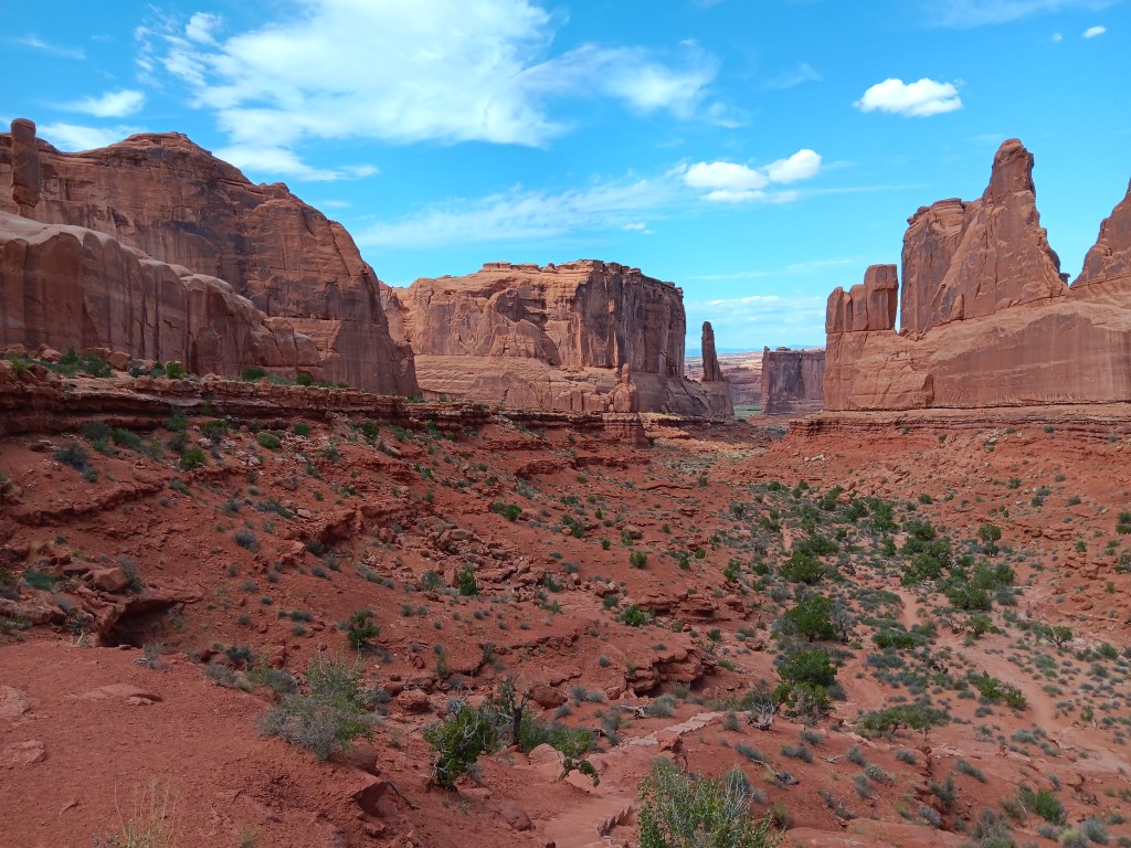
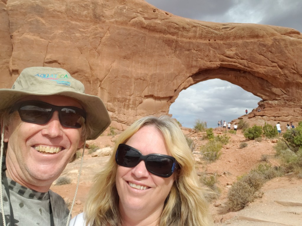


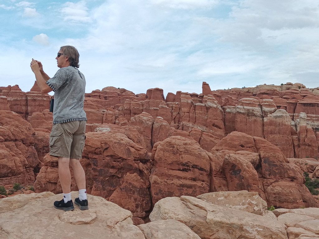


We spent a long time in the park, doing little hikes and marveling at the immensity of it all. But something even more immense was on our radar, if we could just make it happen.

Super read. This is stone central! The whole area is just amazing and you are so right to say it takes your breathe away. Oh and in answer to your question , it is of course just Susan!
LikeLiked by 1 person
Yeah, it’s probably just Susan. 😉
Utah was as dramatic as it gets. We did love our time there.
LikeLike
This is just so breathtakingly beautiful that words fail me. It is nice to see that some people at visitor centres are actually helpful and not try to kill you.
LikeLiked by 1 person
LOL! It was a delight to feel “heard” by a PR person.
Ready to book that trip to Utah now?
LikeLike
Not far off. We are fully booked through the end of 2024, but there always is 2025.
LikeLiked by 1 person