

Michigan’s Upper Peninsula takes everything that makes the lower peninsula gorgeous, then doubles down, straight into spectacular. Blue skies, green pine trees, and the sparkling, silvery waters of Lake Superior.
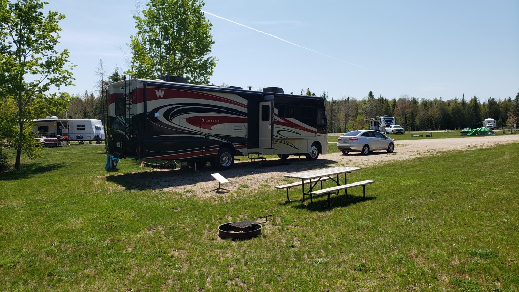
Our goal today was Christmas, Michigan, immediately west of Munising and a pretty drive along the lake to Marquette. We’re making our first “long” campground stay, not moving Fati for the next six nights. It’s a much-needed break from the fast pace, and we’ll tour the area in our car, Nippy.
It was nearly 4pm by the time we arrived, set up, took blissfully hot showers at the campground’s facilities (Clean hair! YAY!!), and then set off for Pictured Rocks National Lakeshore, the major tourist destination in the area.
There came a point when we had to veer left or veer right, and, knowing our track record so far, you know we made the wrong choice. In our defense, the signage here is…unhelpful. We saw all the signs for Pictured Rocks National Lakeshore Visitor Center, Miners Beach, Miners Castle – all the hotspots. None had mileage showing how far away they were, nor any arrows or other pointers indicating where to turn.
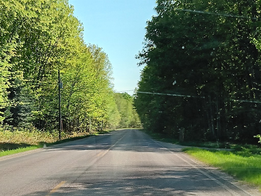
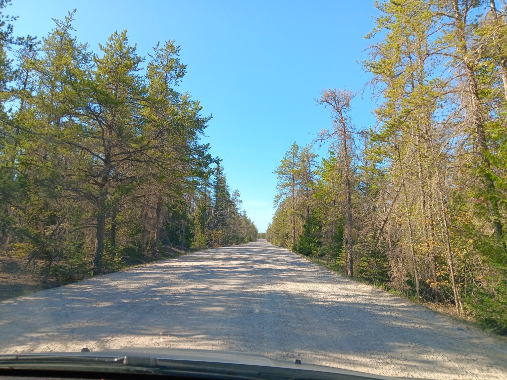
So we drove. And we drove and we drove and we drove. And this is what we saw:
Eventually (20 miles later) we turned around. Our GPS couldn’t get a signal, but we knew 20 is more than 11, and 11 is the milage Susan saw when planning the journey from the campground to the visitor center, many long months ago.
Long story short, we did eventually find it all, no thanks to the area signage.
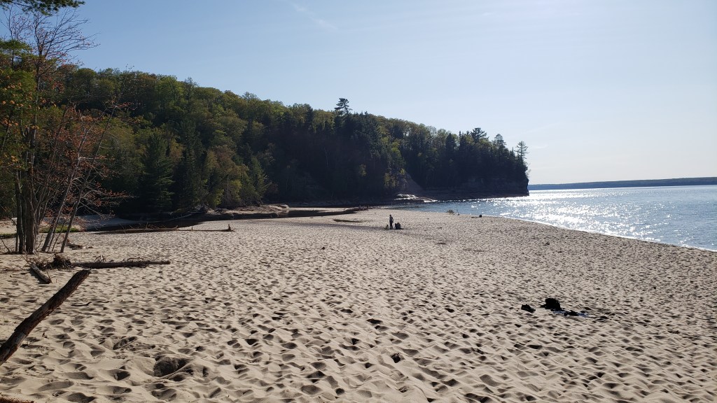
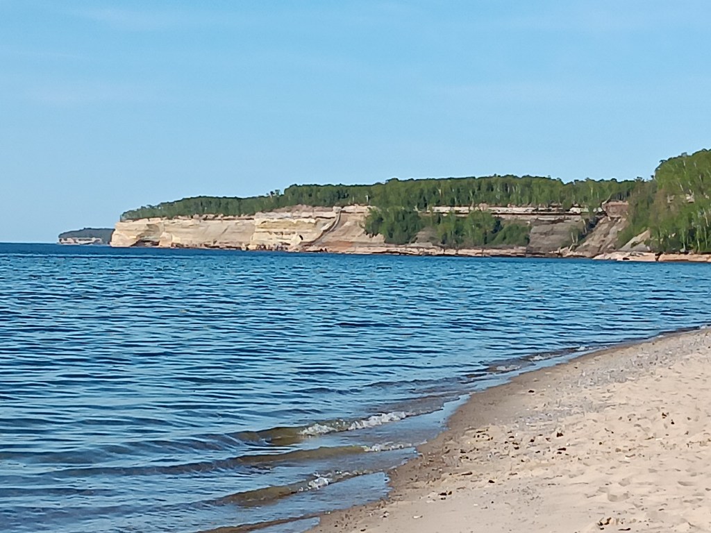
We stopped at Miners Beach first, a place of incredible beauty with its wide, sandy beach, variegated rocky cliffs, and a leaf-tannin stained river that flowed into the lake’s blue waters.
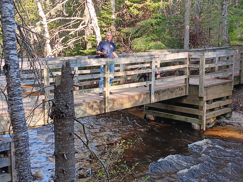
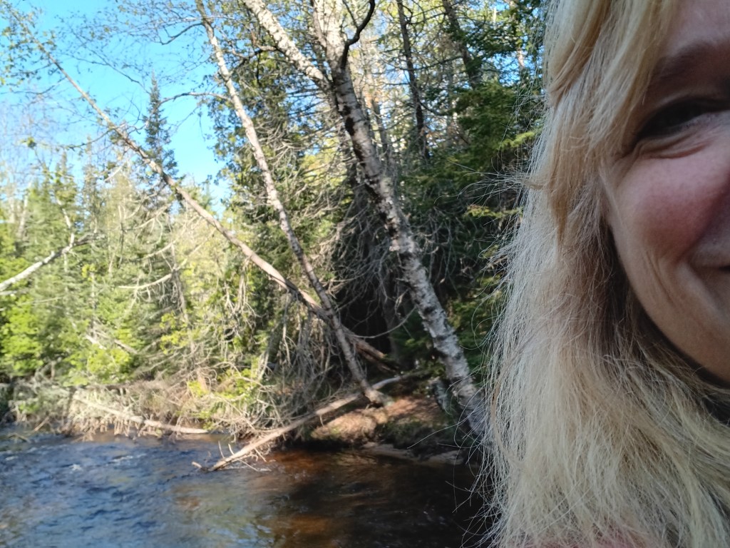
Ruthie made it absolutely clear she hates and detests sand, so we decided to venture down a hiking trail that was supposed to lead to Miners Falls, but the hike appeared to be quite a bit longer than we thought Ruthie could manage, so we enjoyed the pretty river that emptied out into a wading pool at Miners Beach, and moved on.
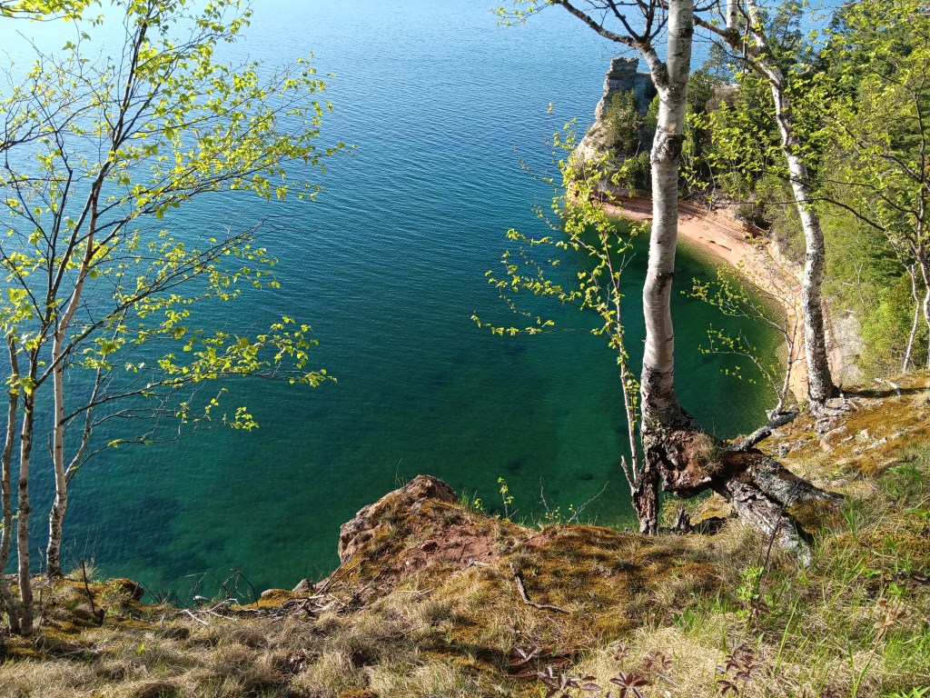
Next we discovered (pretty much by accident) the Visitor Center, which, of course, had long-since closed. But Miners Castle – a fascinating rock formation – was our reward for a journey filled with user error.
So much mental energy demanded a gin and tonic and a hearty dinner. All we had was Kogel hot dogs (the only hot dogs we’ll go out of our way to find!), since the local grocery store was closed, and we were unwilling to turn on the propane (again, given our current track record of breaking everything we touch) so we boiled them in the microwave and made a side dish of some bizarre Maple and Bacon chips and a small handful of odd Mexican Street Corn Cheetos we found at a convenience store as our vegetable.


Today we’ll head along the shoreline to Marquette, where we’re assured there is a Meijer’s, Michigan’s big grocery store.

Maybe a paper map back up if you are out in the middle of nowhere?
LikeLike
We do have a great paper map. This was total user error.
LikeLike
The beauty of the UP has many rewards when directions sidetrack us, as they tend to many times, it’s a moment to absorb it’s tranquility!!
LikeLike
How true! Some of the best experiences we’ve had while traveling have come from “getting lost.”
LikeLike
This looks absolutely beautiful and well worth the false start.
LikeLike
It was definitely worth the false start. We’ll go back again today and do it justice!
LikeLike
Your pictures of the roads bring back happy memories of a visit to my family in Iowa and being taken to visit family.
Not far outside of the city we turned onto a straight dirt road through cornfields and we were amazed when we were told that there is/was (this was back just in the 80’s) miles of these roads and when high summer arrived they would spray them with tar to keep the dust down.
But back to your trip, that scenery is truly spectacular and I’d have to have a paddle at some stage.
LikeLike
Simon always marvels at how long and straight some of the roads are, with miles and miles of seemingly nothing. I wonder if Iowa is a lot like Kansas, but with corn. You drive forever and never see a single thing other than flat land and mule deer.
LikeLike
I’m convinced that we drove for hours and didn’t see a living thing 😃 but I think driving from Chicago to Cedar Rapids is one of the most boring roads (I8O) I have ever driven.
One thing that sticks in my mind is going under a bridge that had a sign saying Main Street, but you couldn’t see a barn, let alone a house, so where it was Main Street to, I have no idea as this was pre satnav days 😂
LikeLike
I haven’t done that specific trip, but Detroit to Utah via Kansas has gone down in my personal history as the single most boring drive I have ever made. Same highway — I-80. YAWN!!
LikeLike