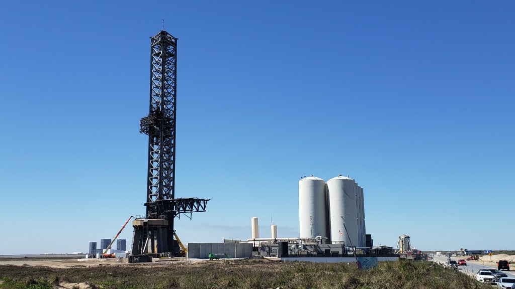
The mind-boggling SpaceX Starbase Complex in Boca Chica Beach, Texas
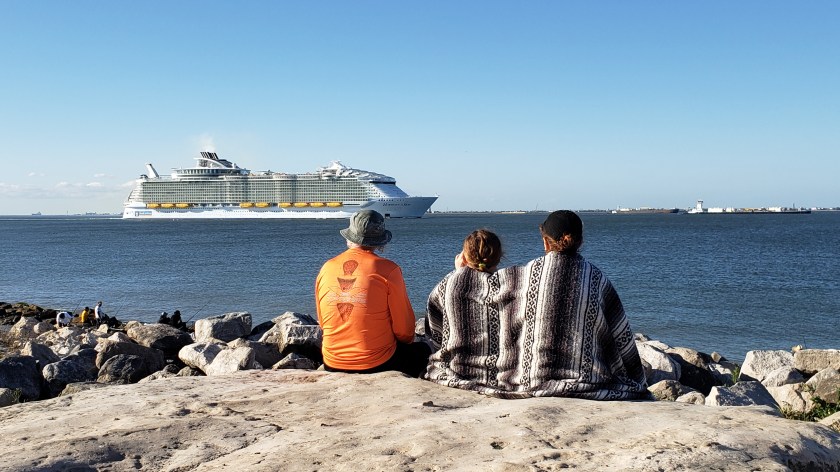
Our latest feature (Part 10 of 12) for The Independent is now online, highlighting the blissful winter section of our epic RV adventure along the Texas coast and into Louisiana, a 600-mile stretch of superb beaches, cute towns, and bayou wetlands. It included discovering Elon Musk’s Starbase, chic Corpus Christi, bustling Galveston and the surprising city of Lafayette. You can read all about it on this link:
Catching up on the first five months of our Ultimate American Road Trip, being serialized in The Independent
Keen readers of our road-trip blog will know we are also serializing the whole trip, month by month, in The Independent newspaper in the UK, and you might like to see the story so far, Months 1 through 5.
It all started back on May 14 with our departure from Orlando and then a month heading north as far as Minnesota…
After arriving in Montana, Part Three of our year-long epic saw us focus on Yellowstone National Park and Glacier National Park for two of the undoubted highlights of the trip…
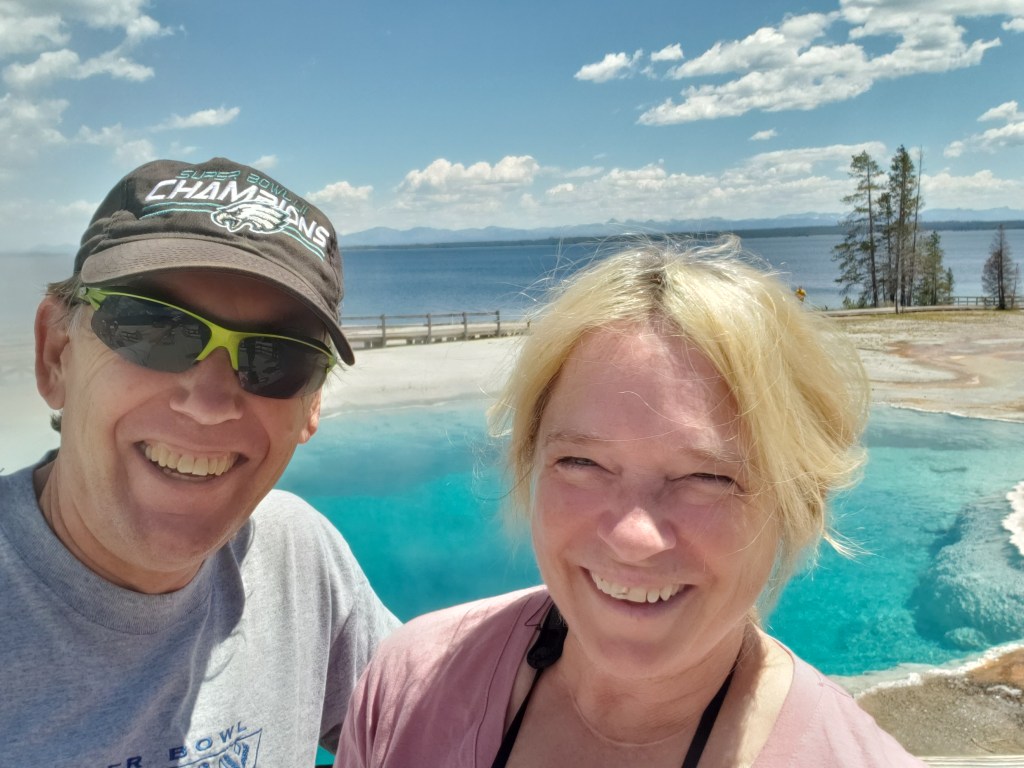
Taking time for the geothermal marvel of West Thumb Geyser Basin in Yellowstone
The latest instalment of our excusive series for The Independent featuring our “Year On The Road” RV adventure is now online, highlighting Month 5 as we reached Idaho and Utah, and the incredible scenery of places like Craters of the Moon National Monument and Bryce Canyon State Park.
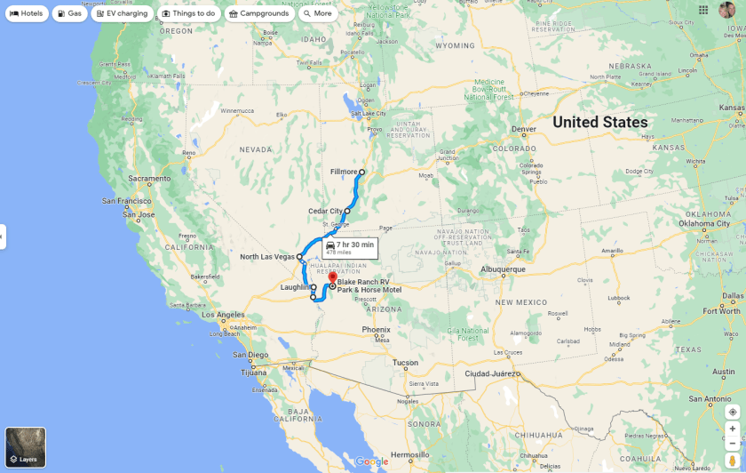
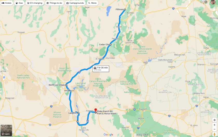
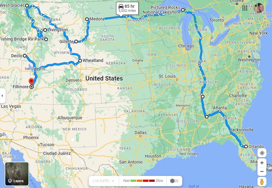
Having just hit the 5-month mark on our grand RV adventure, it is especially illuminating to see that we had by FAR our lowest month for mileage in Fati, with just 474 miles covered from Fillmore in Utah to Kingman here in Arizona.
Month 5 – picking up in Fillmore, Utah, and traveling to Kingman, Arizona
Showing more detail of our Month 5 route from Utah, through Nevada, to Arizona
The main reason for such a low total for the full month (as opposed to the 868 miles in Month 4 and the mind-boggling 2,504 we travelled in the first month!) was because we spent two full weeks in one location (Laughlin, Nevada) , and used our tow car, Nippy, for our more extensive travelling once we were settled.
We haven’t been sluggards, though. Our mileage in Nippy was a whopping 3,718 for this month, which included trips from Cedar City to the Grand Canyon (North Rim) and Palm Springs from Laughlin, as well as our just-completed 779-mile 3-day round-trip from Kingman to the Grand Canyon (South Rim), Monument Valley and Flagstaff.
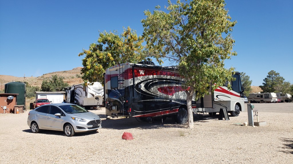
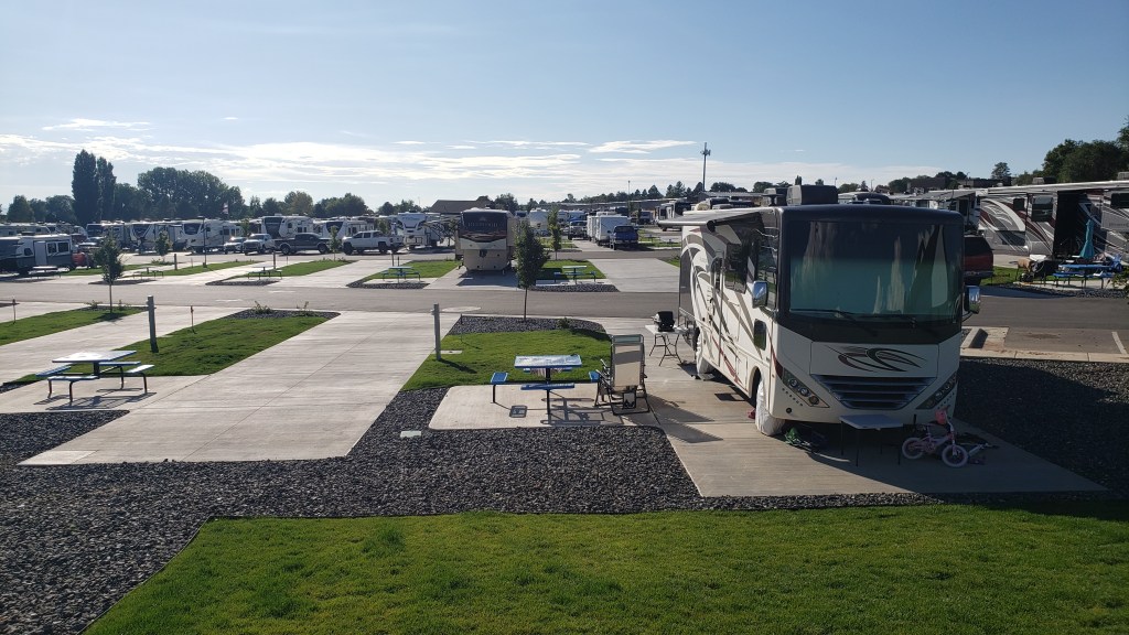
Fati and Nippy in our current campground, the Blake Ranch RV Resort in Kingman, AZ
Highlights of the last month include Las Vegas, the Mojave Desert, both North and South visitor centers of the Grand Canyon, the Colorado River, Monument Valley, and the city of Flagstaff, which really caught our attention, in addition to a fascinating section of Route 66.
When all added up, we have travelled 6,403 miles from home in Florida in Fati, and another 13,339 sight-seeing in Nippy from our various RV campgrounds.
The first 4 months – from home in Florida to Fillmore, Utah, a total of 5,929 miles
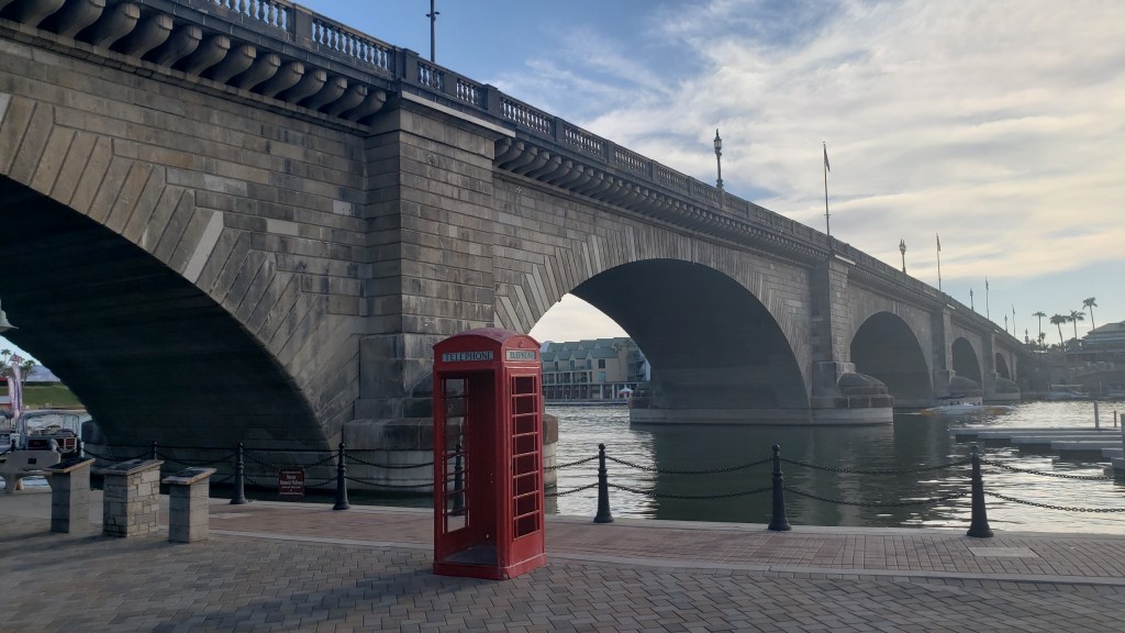
That’s a total of 19,742 miles in and around the US since we left home. And we’re still hungry for more! We do still have another 7 months to explore this half (or two-thirds) of the country, though, and the next month will include more iconic stop-overs, notably Lake Havasu and London Bridge, the RV Mecca of Quartzite, Phoenix, Sedona and Tucson. Stay tuned…
Throughout our journey, we’ve had to modify our plans around Ruthie, and we’ve done so happily, since one of our goals was to give her the best of what time she has left. Another one of our goals was to see as many National Parks as possible, and in Southern Utah those two desires collided.
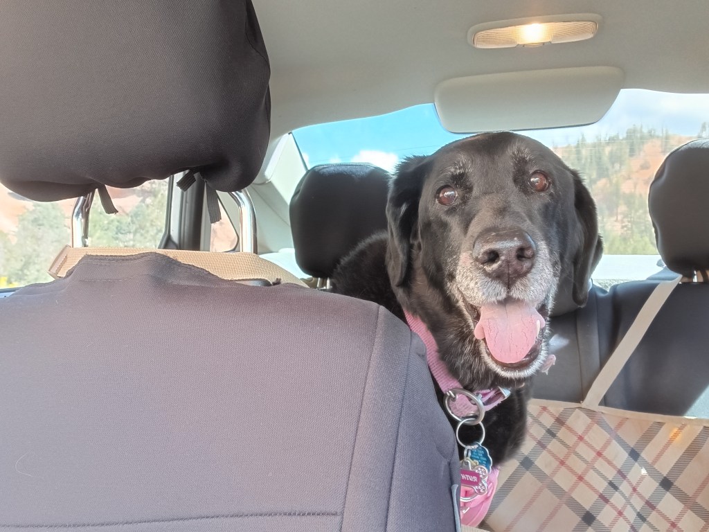
“I’ll go wherever you take me!”
From our base in Cedar City, we were 77 miles from Bryce Canyon National Park, and just 20 miles from Zion National Park, two places that were high on our list of must-do experiences. They were places Susan’s parents had really enjoyed and, because of that, they had an emotional pull, too.
Grand Staircase Escalante National Monument and Capital Reef National Park were also on our radar, but after much discussion we came to the conclusion we couldn’t do everything or we’d end up frazzled and exhausted…again. So Bryce and Zion were “it.”
But not so fast.
Before we visit a place (usually months or, in some cases, years) we do our research. When it came to Zion, however, we’d dropped the ball. In some places, rules changed with the pandemic and, from March to November, Zion can only be visited via shuttles. No-dog shuttles.
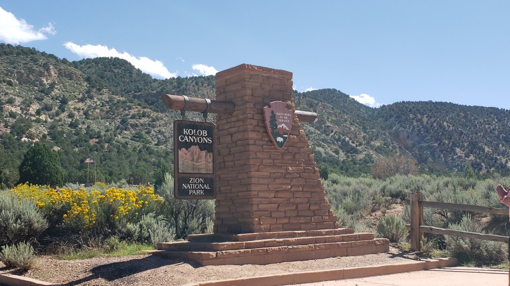
The single exception was Zion’s Kolob Canyons on the north end of the park, and with that, the plan fell into place.
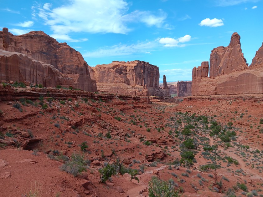
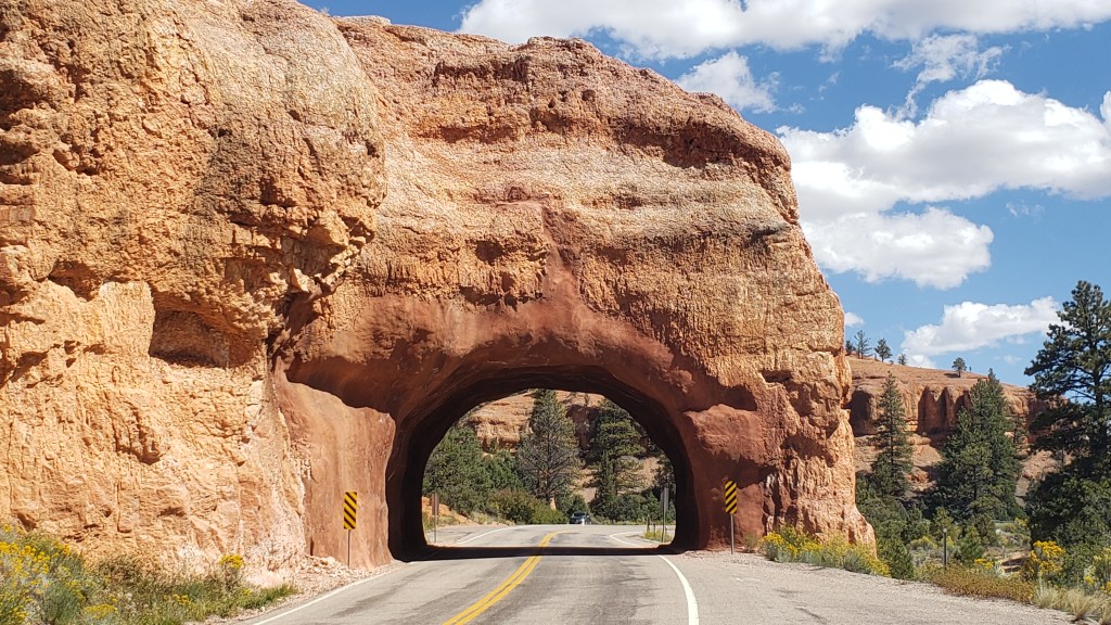
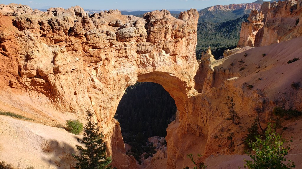
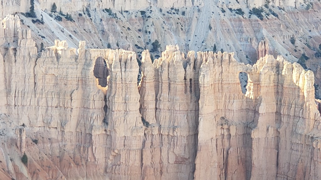
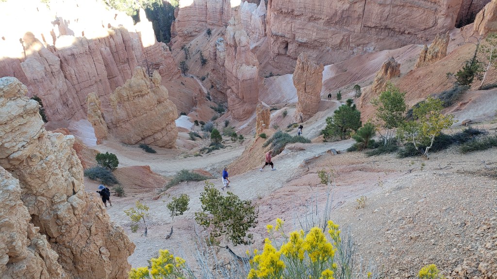
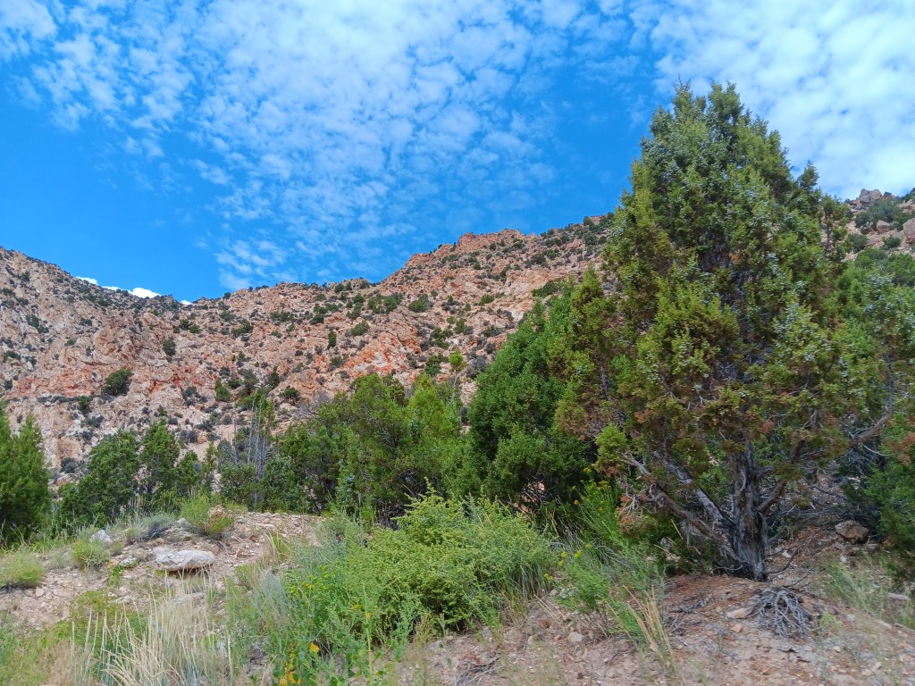
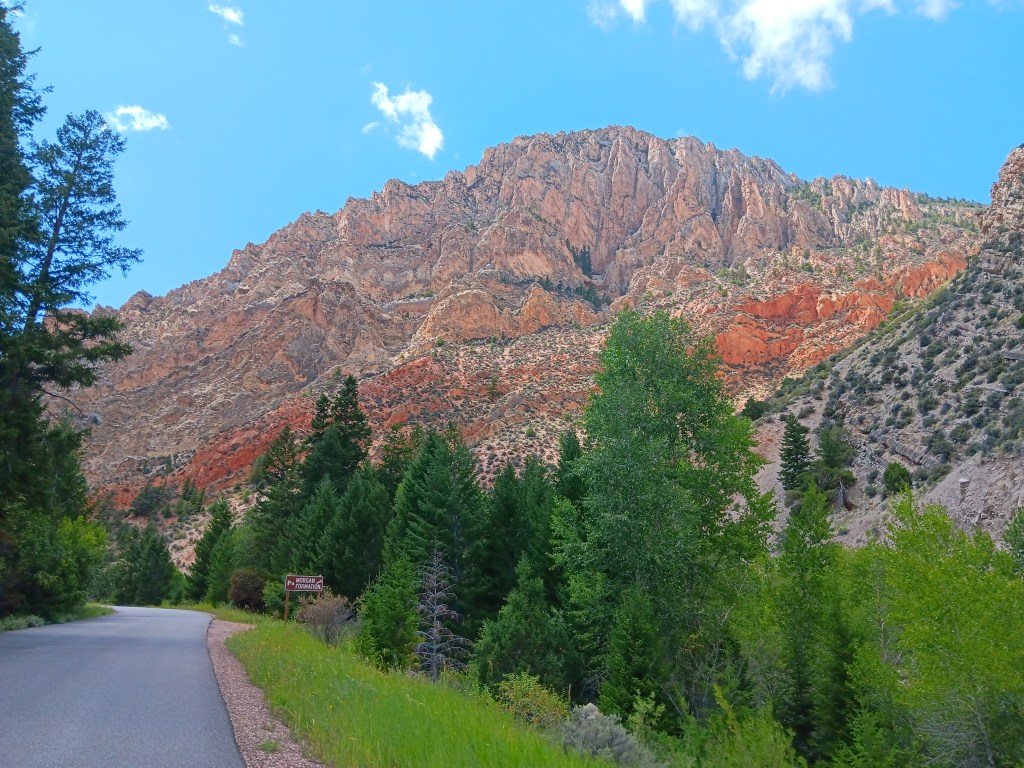
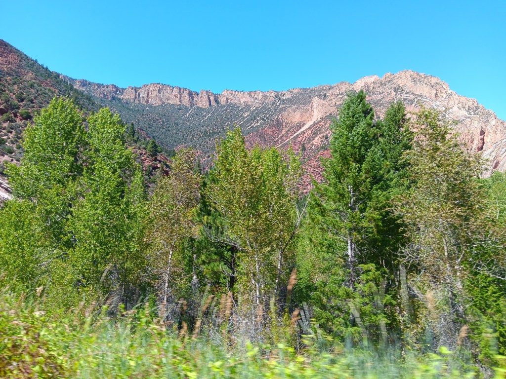
Bryce Canyon contains the largest collection of hoodoos in the world, and while we’d seen a LOT of canyons over the past weeks, this one promised something different. Even before we reached the park, we passed through the ridiculously gorgeous Red Canyon on Scenic Byway 12, which almost would have been enough on its own.
Not as small as Needles Eye, but still rather exciting.
From the Badlands in North Dakota to Utah’s magnificent landscapes, we’ve repeatedly said, “How did that happen?” The short answer is, wind, water, and time. The longer answer in Bryce is, its distinctive formations began as flat rock on an ancient sea bed, uplift of land that created plateaus, which then weathered into “walls” with vertical gaps between them, then into “windows” (big holes in the rock, like we saw in Arches), and finally into the oddly-shaped, sticky-uppy hoodoos we see today.
Each of the park’s overlooks offered a different perspective:
Natural Bridge (elevation 8,627 feet) is an example of the “window” phase of the plateau’s erosion.
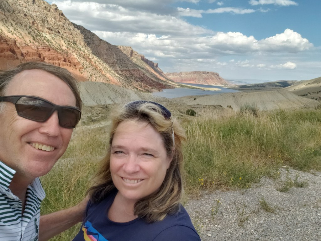
Obligatory selfie.
Hoodoos taking on their distinctive shape.
The park’s crownlng glory, Bryce Amphitheater. Click on photo for video
A pathway leads to the floor of the Amphitheater, but with temperatures at the summit in the 90sF, neither of us were prepared to endure the heat in the canyon.
We were put to shame when we caught sight of a bride and her groom hiking back up, with a photographer in tow. Anyone who has ever worn a wedding gown knows what a feat this was for the bride.
Everyone at the overlook clapped and wished them well as they rejoined their wedding party.
Kolob Canyons in Zion National Park was even more straightforward. An easy drive, entry with our America the Beautiful pass, and we were in. But only for three miles, as the scenic-drive road in the park was damaged due to a weather-related rock slide.
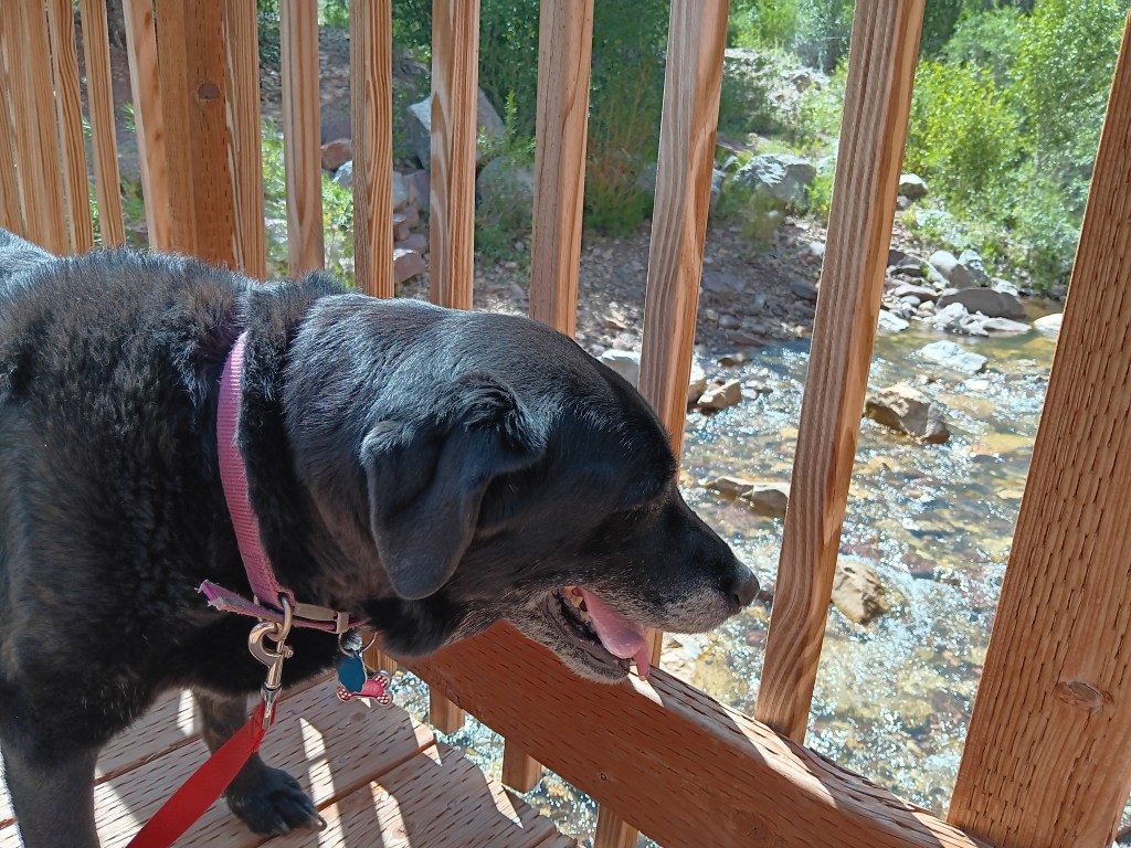
Ruthie really appreciated the cooler wind blowing through the canyon.
These 2000-feet-high canyon walls were pretty much all we could see, having walked a short stretch of the road beyond the barriers that were put up to prevent car travel.
It was a very limited way to appreciate Zion, but sometimes that’s how it goes, and with all the rock walls we’d seen in Utah, life was still worth living.
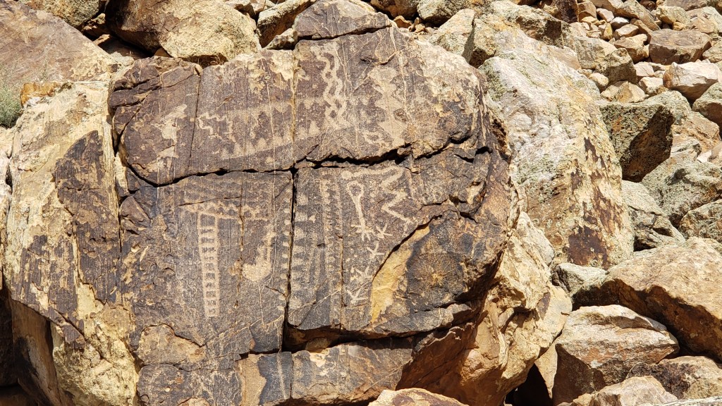
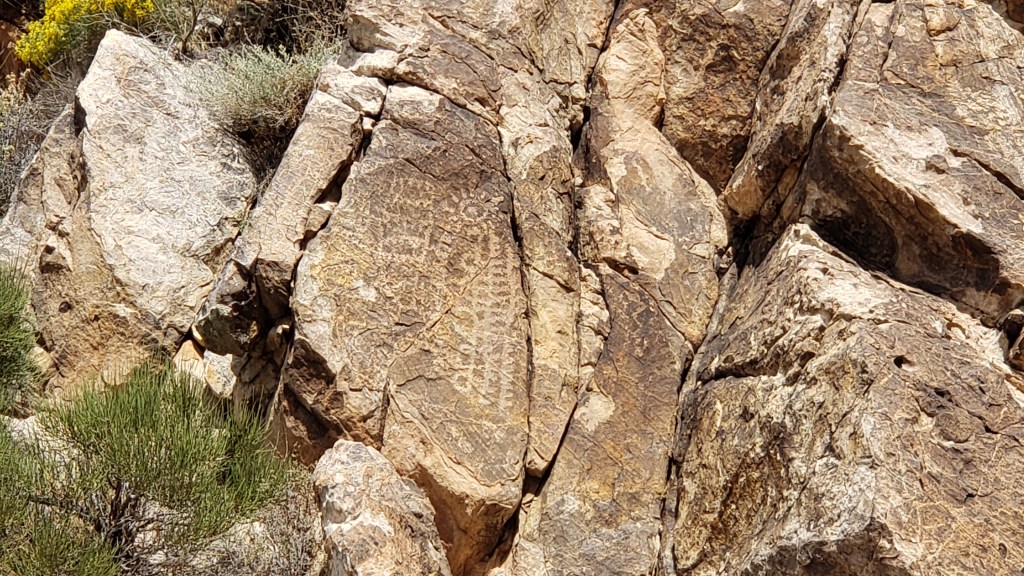
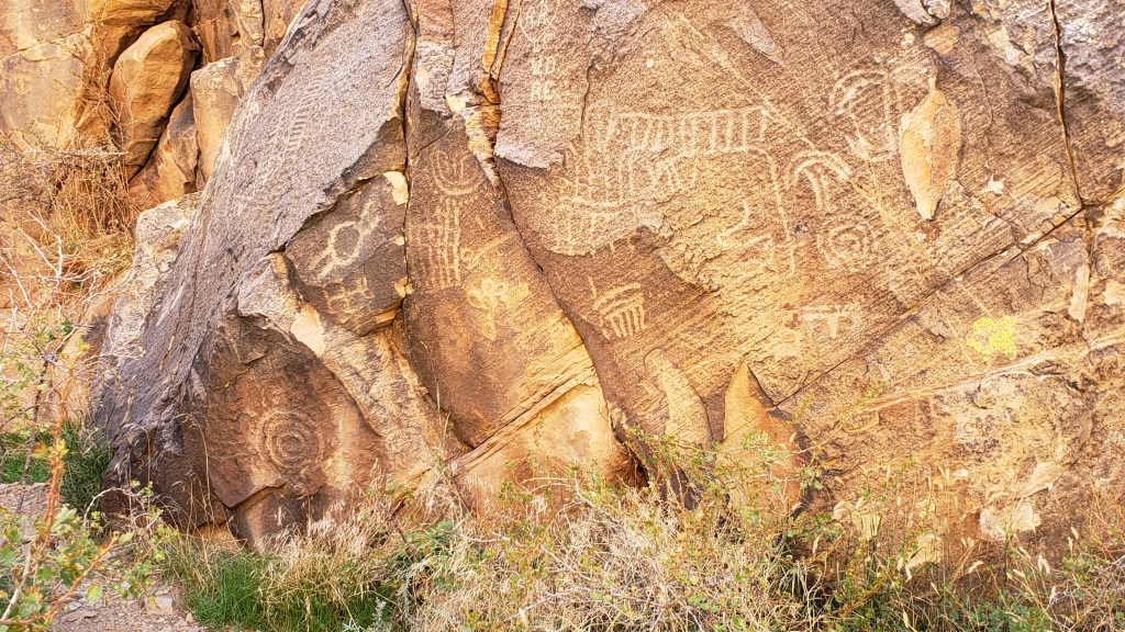
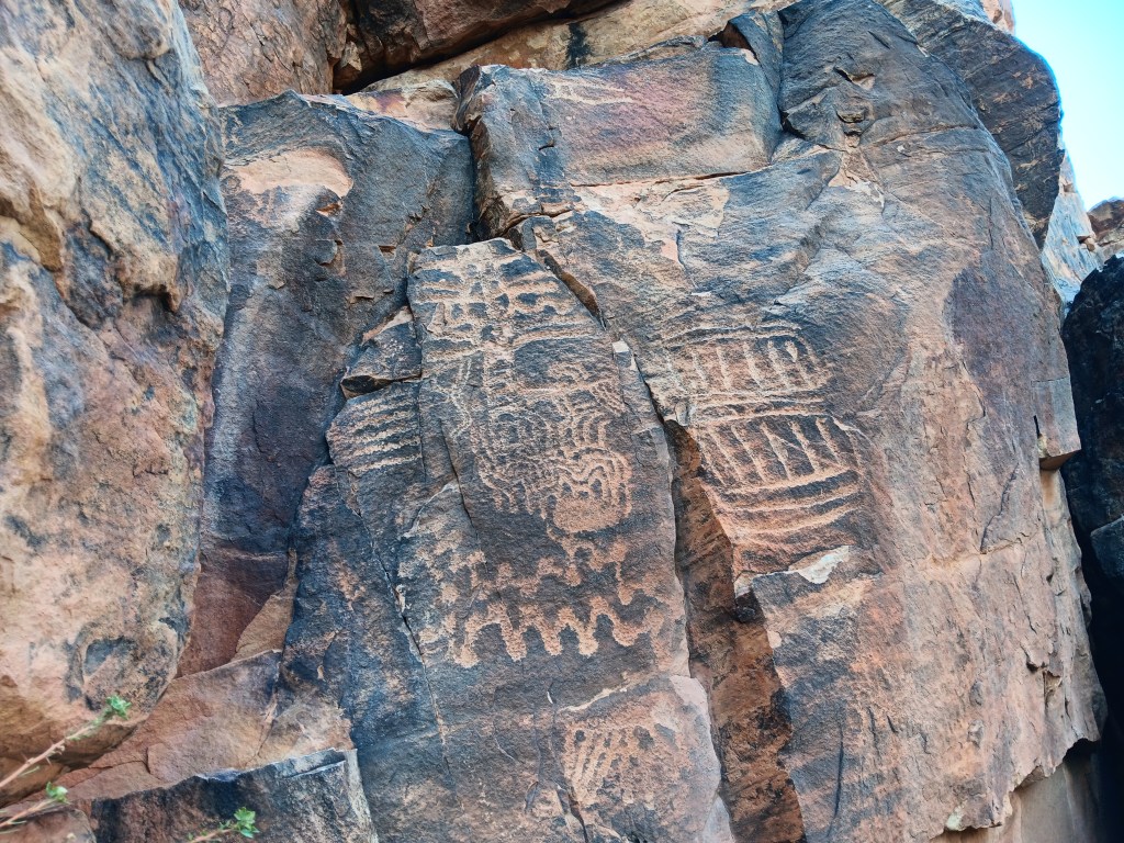
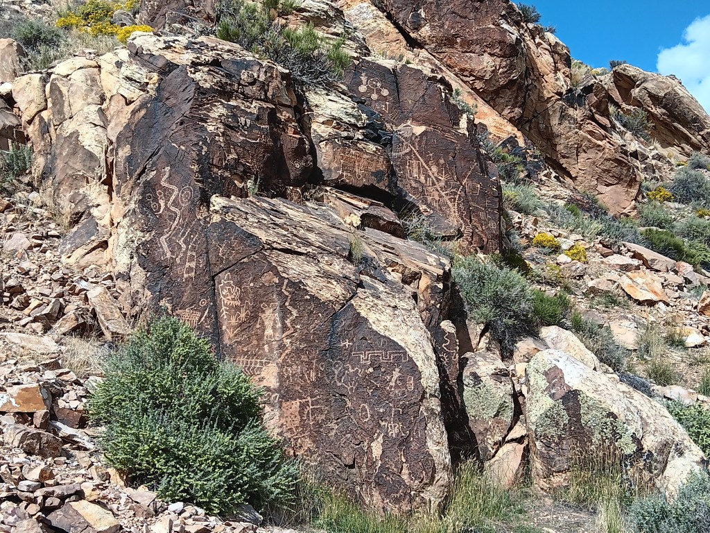
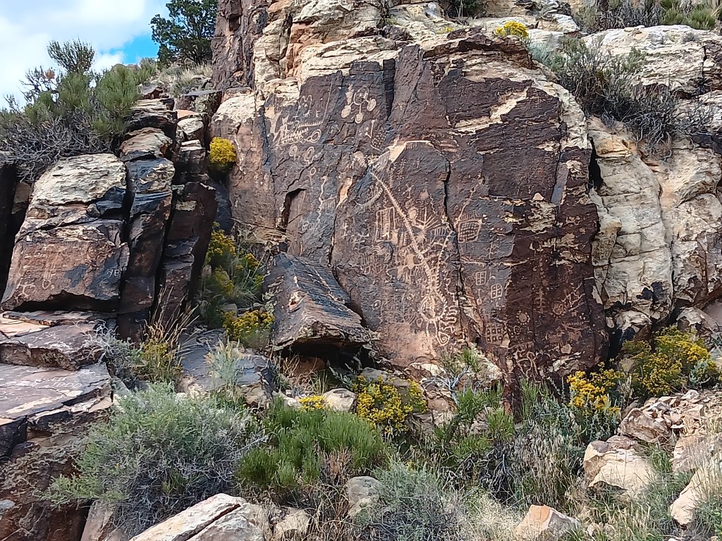
The next day we pointed Nippy north for a trip to Parowan Gap, a wind-and-water-created hole through a mountain that was used by Native Americans who left their stories etched into the deep crimson walls. And it was these petroglyphs that drew us to the area.
Other than three kids on motorbikes racing down the road, the gap was absolutely still and silent. We clambered around enjoying the petroglyphs, wondering at their meaning, and, in that stillness, it was easy to imagine nomadic tribes pausing to rest, play, soak up the beauty, and go about their daily lives.
The petroglyph roughly in the center of the photo is now called the Zipper Glyph, for obvious reasons. Its meaning isn’t known, but it’s thought to be a marker of travel days, first one way then another, from the summer solstice (the circle at the bottom). It may have been used as a means of tracking where game would be throughout the seasons.
As we stood admiring a particularly large set of petroglyphs, the most haunting, soul-stirring sounds of an ancient flute melody gently caressed the breeze, and for a moment we could imagine it was an echo of the people who used the area for a thousand years.
Turn your volume up, listen closely, and you can hear the flute. Click on photo for video
Instead, it was Michael. Michael comes to the gap now and then to play his hand-carved flute, because, he says, he likes the acoustics.
The spirits of those who once passed through here like Michael’s playing, and he has had several encounters with them, he told us. It was easy to believe. Even Simon, who holds no particular belief in such things, agreed there was something special –and spiritual – happening in the gap.
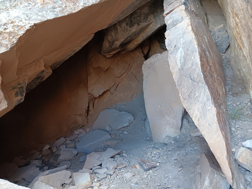
This cave entry leads to a place where the tribes’ shamans meditated during their time here.
I’m tempted to stop this blog here, and just bask in the memory of such an extraordinary experience. We did have a rather startling return trip that included an unexpected climb up a mountain range to a ski resort town called Brian Head (elevation 10K+) and a journey through Cedar Breaks National Monument…
…but let’s just let the memory of the flute music sooth us into a happy stupor, and call it a day.
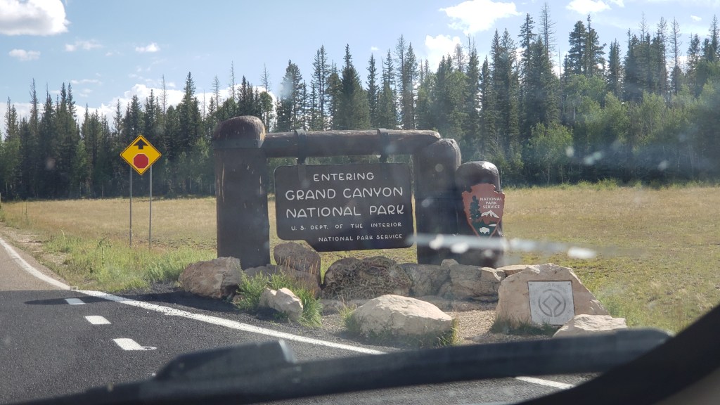
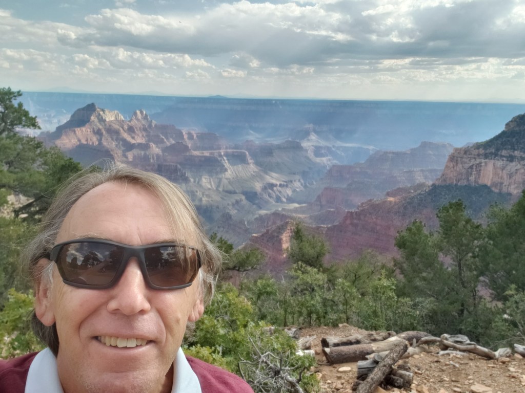
Simon had been to the Grand Canyon, but Susan had not. The South Rim was on our schedule, but with the change in our itinerary in Month Two, we now had the option to fit in the North Rim as well. Could we make it happen from 156 miles away? You know we could!
Donkey’s years ago (“a long time ago” for our U.S. readers), Simon visited the South Rim during his first trip to the States. We had heard the North Rim was pretty special, and much less crowded. While it would be a very long day, we agreed to make the trip, reckless vagabonds that we are!
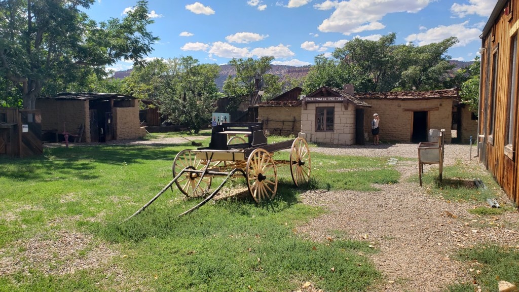
Our dear friend Richard recommended a stop at Little Hollywood Land in Kanab on the way to the North Rim, for its Western movie props. Simon was all in; he absolutely loves that sort of thing.
Little Hollywood is as kitschy as it comes. Homespun, quirky, it’s a curiosity for those who don’t know the old Westerns well, and if the AARP-aged man visiting with his son and pointing out all the little details is anything to go by, it’s a delight for those who do.
Some of the movie location props we saw were:
The backdrop for Kenny Loggins Live from the Grand Canyon concert in 1991
The barn and homestead sets used in the Clint Eastwood movie, Outlaw Josey Wales
The barn
Inside the homestead
Simon, pointing at the cross-shaped window that featured in the movie’s final, dramatic gun battle.
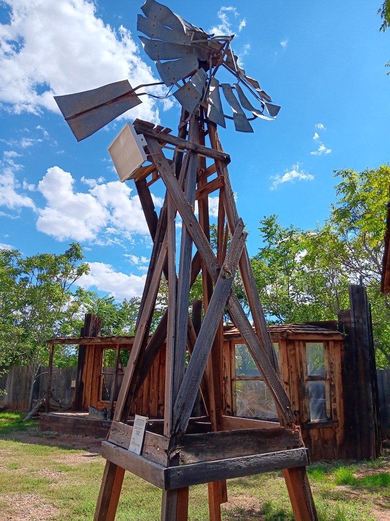
And many more, along with a smattering of atmosphere props
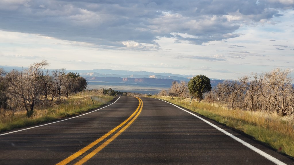
The drive to the Grand Canyon felt like it took forever once we left Kanab. This is pretty much what we saw the whole way:
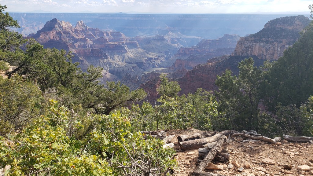
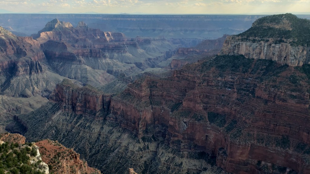
But once we arrived, the WPM (Wows Per Minute) cranked right up. We took the advice of previous visitors and made the drive from the entry straight to the end of the scenic road, then drove back and stopped at the overlooks, which were now on the right-hand side of the road, saving us from having to cross traffic to get to them.
It was the right decision. There was some pretty dicey roadway those last four miles, with big drop-offs and no guard rails, so it was better to get that over with quickly so that Susan could enjoy the rest of the visit.
Again, it’s impossible to get the scale. You’ll see people part-way into this video, which helps give some perspective.
Click on photo for video
The “mood” of the canyon changes, depending on how the light hits it, and this has always been something that intrigues me (Susan). Some might say I relate to “moody,” but that’s a discussion for another time.
Simon scampered around the park like a squirrel on a mission, taking all the narrow pathways and leaning out over all the railings, and as part of his exploration he discovered a room inside the lodge where guests staying at North Rim check in for their accommodation.
The room had huge windows overlooking the canyon, and while it was right on the edge of a drop-off, like most overlooks are, he took me by the hand when I returned from getting Ruthie settled in the car with some water, and said, “Come see this.” I’m SO grateful for that loving gesture, which gave me a view with a sense of safety.
This is an incredibly proud moment. Tears may have happened.
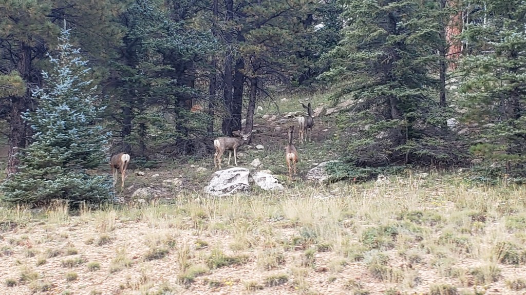
On the way out of the park we were treated to a wildlife sighting, which capped off the day just right.
Mule deer doing mule deer stuff
We had two more major National Park experiences coming up, and one unexpected mini canyon. While it was nowhere near as grand as the Grand Canyon, the emotional impact of little Parowan Gap would prove immense.
Highlighting our fourth month on the road and the route so far – all 5,929 miles of it
After three months of fairly hectic traveling, our four-month mark shows that we have come the shortest distance for any month of the grand RV trip to date, from Wheatland in Wyoming to Fillmore in Utah (via what looks like a strange detour to Declo in Idaho, but which was the best way to see some of Idaho without putting too many miles on our RV).
Our mileage for Month Four was therefore just 868 miles, compared to 1,318 last month, 1,239 in Month Two and a whirlwind 2,504 in the opening month.
The total distance in Indefatigable (or Fati for short) since we left Orlando is now 5,929 miles.
The slower pace has been deliberate, of course. We realized that we were trying to pack too much in to this crazy 10-wheeled adventure and we have purposely changed both our itinerary and our pace of travel to avoid the mental and physical breakdowns we experienced in the first two months.
The key has been to identify an area that allows us to explore in multiple directions for a week or so, and then use our tow car, Nippy, to do more of the exploration.
To that end, we have actually gone an additional 9,621 miles in Nippy in those four months, almost 3,000 of them in the past month alone. That total includes a spur-of-the-moment trip into Canada from Montana, our overnight excursion to Rocky Mountain State Park in Colorado and an extensive day trip to the Flaming Gorge in Utah, both from Wyoming.
Our total mileage for the trip so far is therefore a whopping 15,550, or 3,887.5 a month!
The next month could see us top that record for Nippy, too, as we plan on basing ourselves in southern Nevada for trips into Southern California. As ever, this is an – ahem – moveable feast, but you can be sure to read all about it here!
Utah is known as the “beehive state,” honoring that industrious bug’s reputation as a hard worker, and its state of mind unexpectedly became our state of mind, too, with a project that had us tied to our 36-foot home for several days. We took a breather from touring in Nippy, with a few breaks that saw us “hiking” in a mountain canyon and braving a gawd-awful stench to reach an island surrounded by a lake that’s nine times saltier than the ocean.
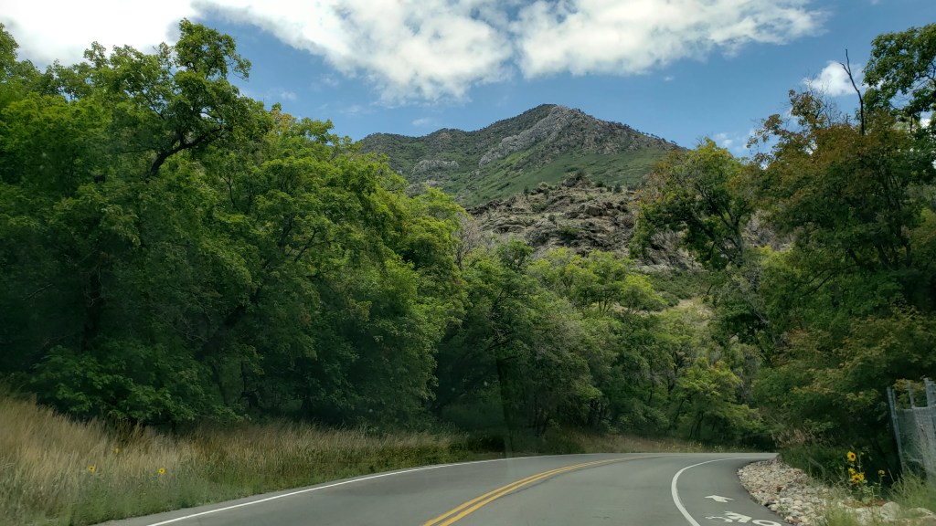
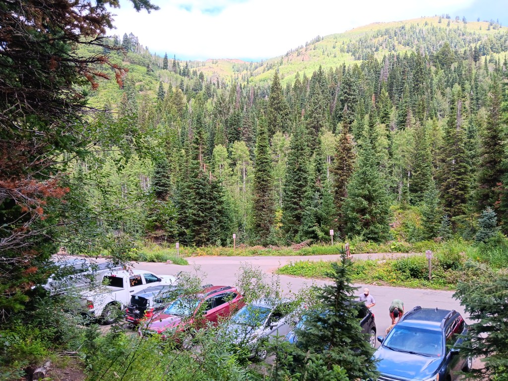
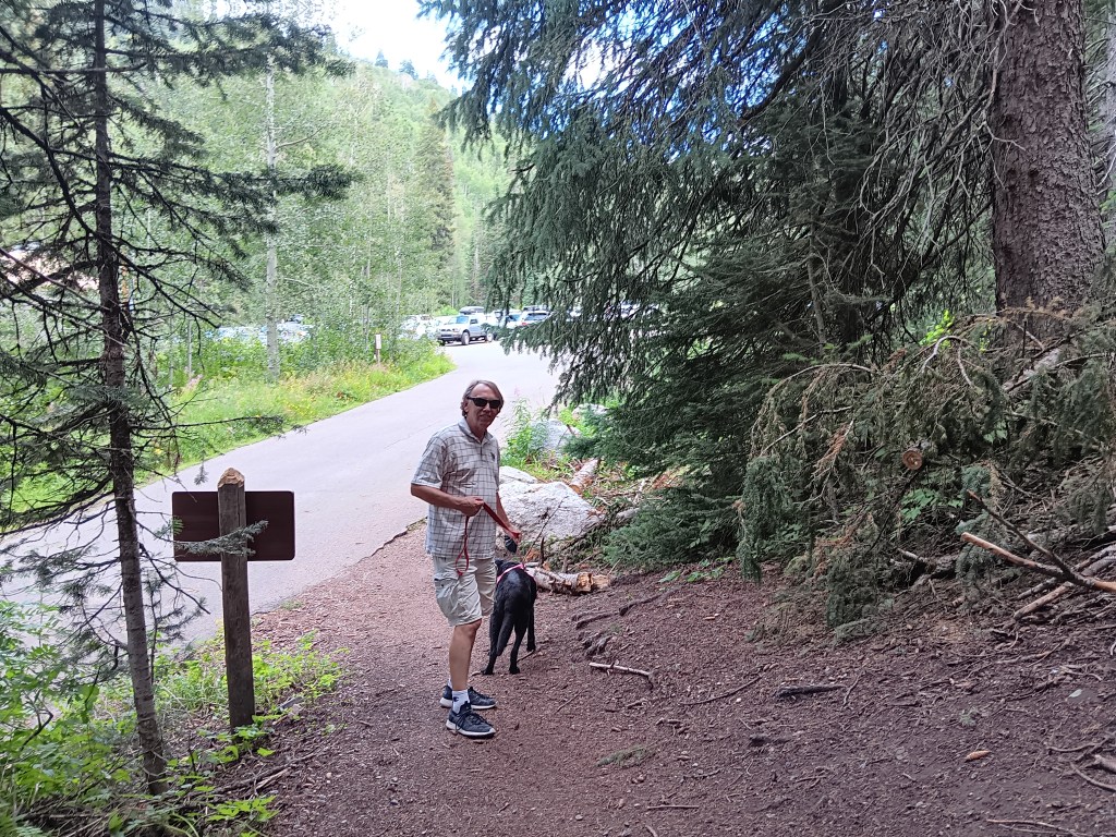
Layton, Utah, our base for eight days, was having a heat wave. Fati’s innards reached a temperature high enough to be uncomfortable in mid-afternoon, so we headed Nippy toward Salt Lake City for a drive up Millcreek Canyon in the Wasatch Mountains, the only canyon that allows dogs, we were told by the Visitor Center.
It was a scenic canyon, if somewhat unremarkable, unfortunately overshadowed by the immensity of the canyons we’d already toured in Montana and Wyoming, but the scent of pine trees and the cooler temperatures made it a perfect outing for a couple of hours.
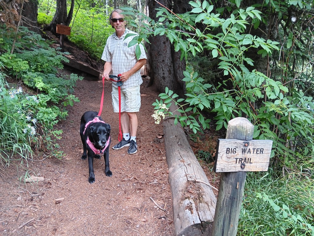
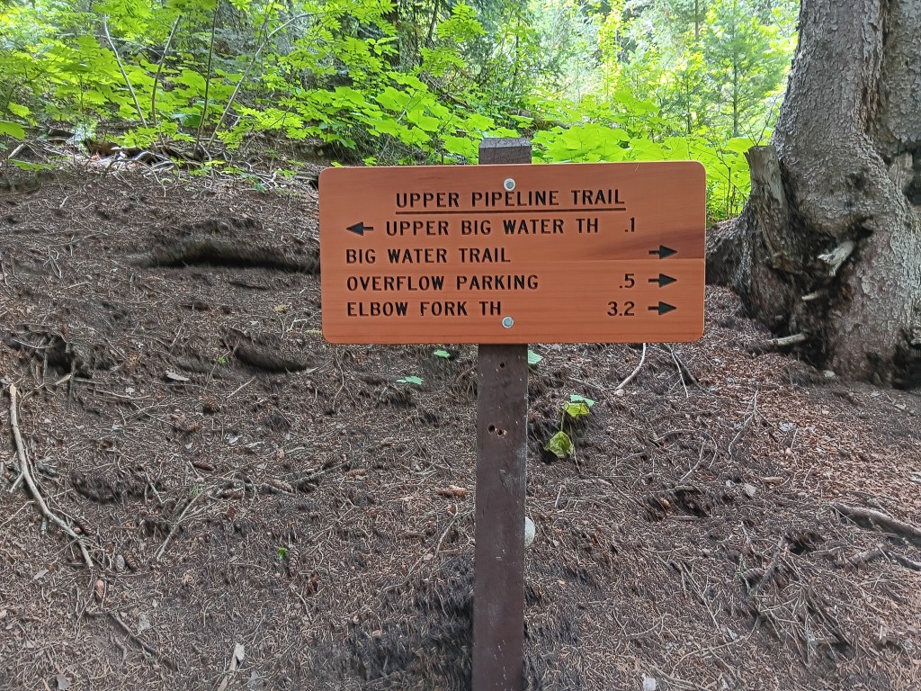
We stopped for a short hike near the top of the mountain, mainly to stretch our legs a bit. And short it was. We saw the sign indicating Big Water Trail (elevation 7,900 feet), which seemed to be just about right for Ruthie; a mile is pretty much her limit.
We started off, loving the sound of crunching pine needles under our feet.
Within a few steps, the trees opened to reveal the parking lot where we’d just left Nippy, and the mountainside beyond.
Three minutes later we reached the end of the trail. What the…….!
Shortest hike in the history of hikes, and we should have noticed the sign indicated 1/10 of a mile, not 1 mile. But we’d been prepared to walk the full mile, so it still counts as healthy exercise, right?
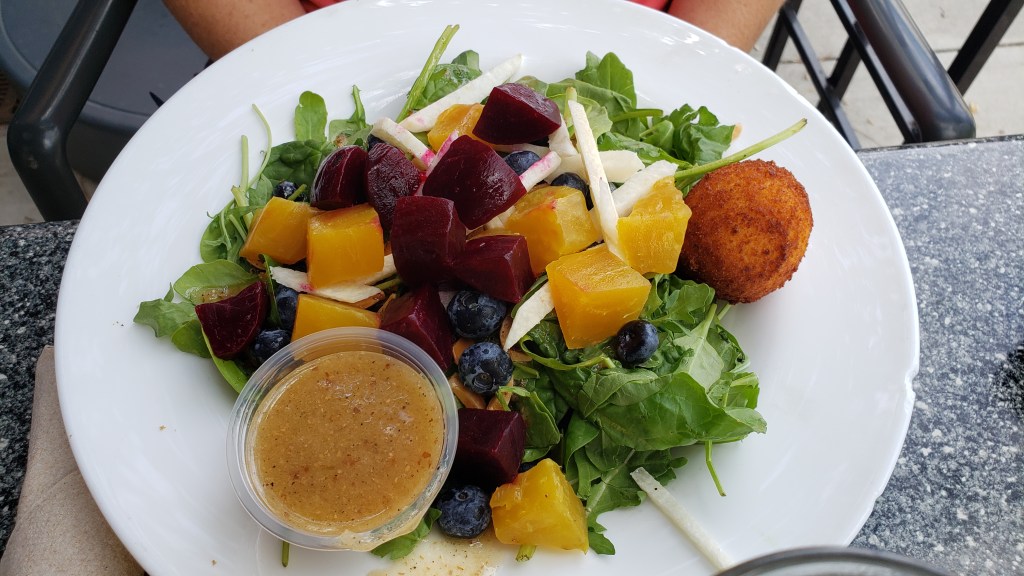
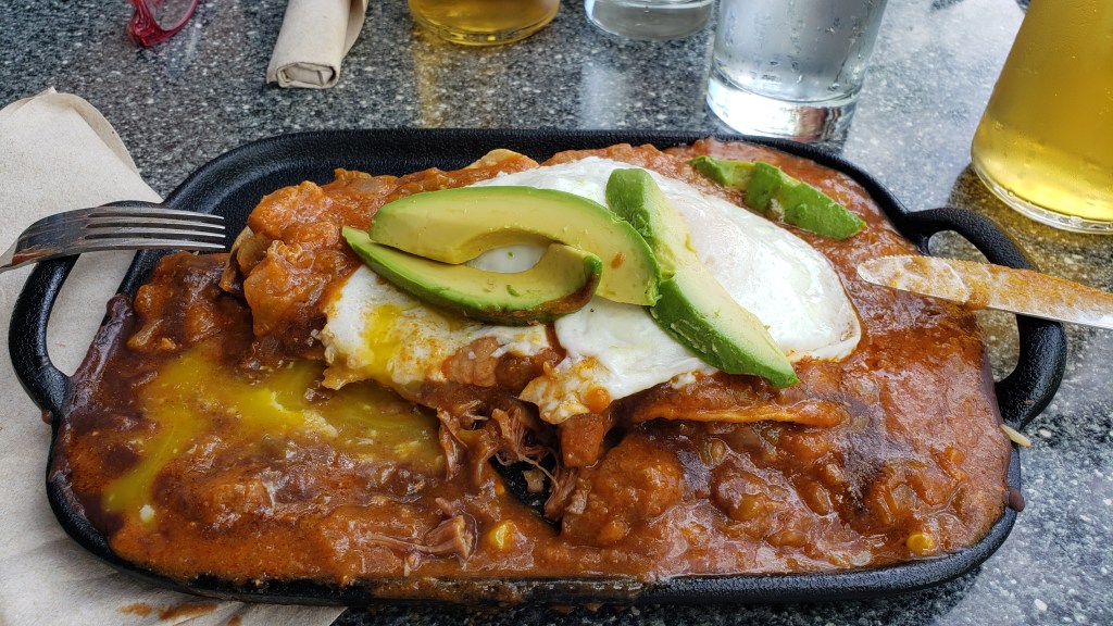
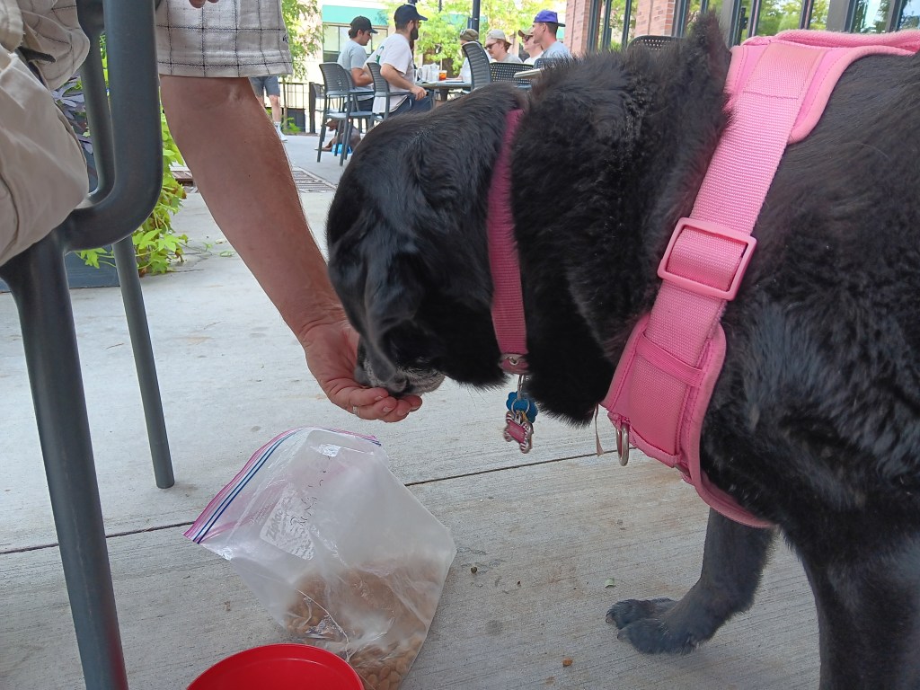
We toasted our athleticism with a visit to Wasatch Brew Pub, where Susan had the Superfood Beet Salad and Simon had the Huevos Rancheros, an unholy assemblage of pork chili, refried beans, queso fresco, lemon crema, and corn tortillas, with two eggs and fiesta rice. Ruthie had dog food.
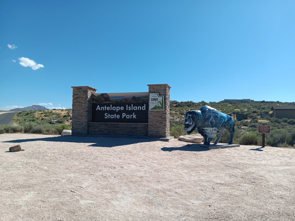
Another afternoon outing saw us taking the long Davis County Causeway out to Antelope Island State Park, situated in the Farmington Bay arm of the Great Salt Lake.
It was close enough to Layton for us to still have Nippy’s windows rolled up and the A/C on High when we arrived, but we soon had them rolled down, enjoying the small breeze wafting across the salt flats, where a billion birds were going about their daily bird stuff.
Click on photo for video
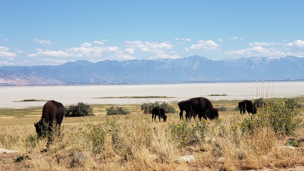
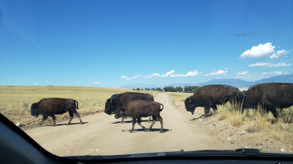
Although the island (really a peninsula) was (wrongly) named for its antelope (pronghorn) population, bison are the dominant mammal now, due to their importation thanks to a conservation effort, after wild horses, thousands of sheep, the Church of the Latter Day Saint’s grazing cattle, and a plague of grasshoppers ate up all the foliage.
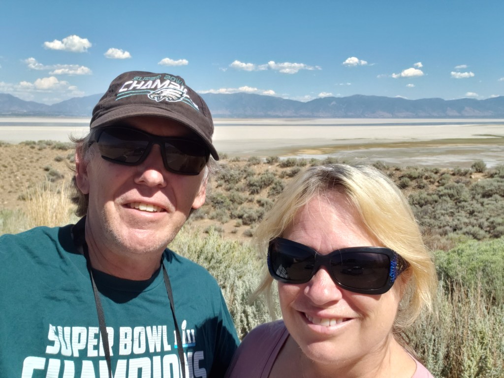
It was fascinating looking out over the Great Salt Lake, marveling at how low the water was and how many migratory birds were filling up on brine flies and other bugs. It was no wonder the area was (or, at least, used to be) a sought-after birding spot.
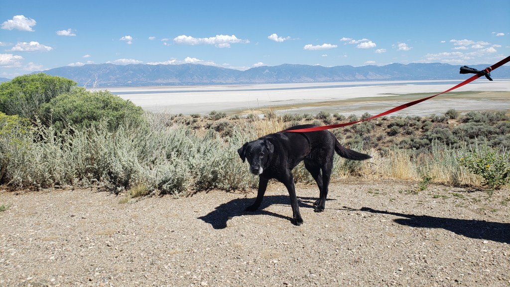
This isn’t birds or bugs. This is us, with the mostly-dried-up Great Salt Lake behind us.
Before we left the island, Simon wanted to “have a paddle” in the water (for our U.S. readers, that’s “go in up to your ankles” in U.K.-speak), so we drank some water, gave Ruthie some water, felt the sand to be sure it wasn’t hot, and agreed we’d turn around if we thought it would be too much for our sweet old dog.
The water was much further away than it appeared from the parking lot, and it really was just too hot to be out in the sun for long, so about 2 minutes into it, we turned around and went back to the car.
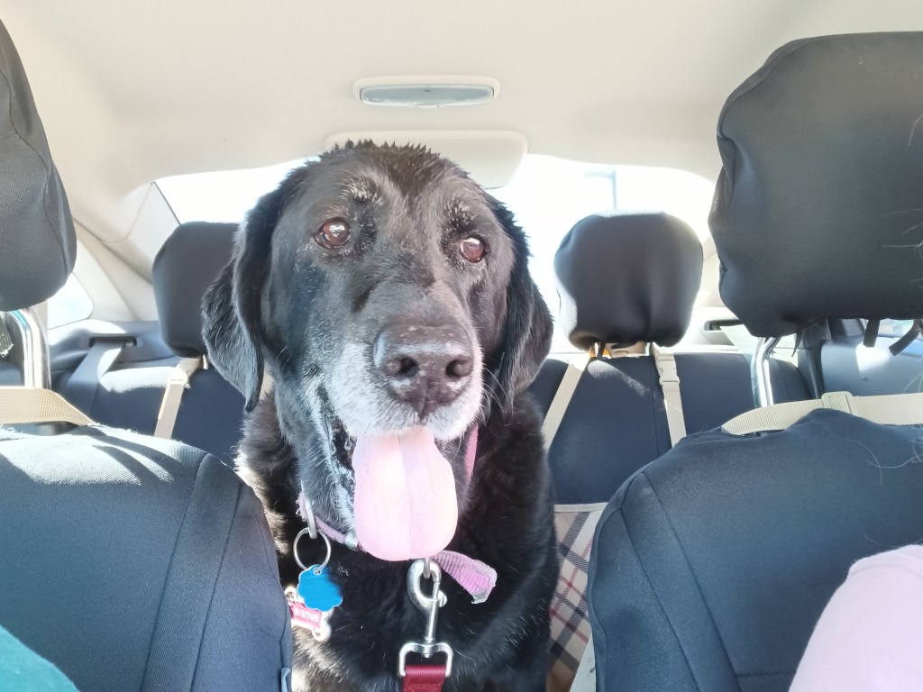
Ruthie, pre-beach-walk, weighing up her options if she’s forced to hike on the sand.
It was then that Ruthie had a full-blown attack, flailing around the back seat, dropping to her belly, trying to jump back up but falling down again, and shaking her legs as if in agony. It looked like she was having some kind of seizure, and we were afraid her brain had fried from the heat.
We quickly felt her fur to see how hot it was, checked her paws for burns, looked between her toes to see if anything was lodged there, and reassured her again and again that she’d be okay and we were there for her. Then, we rushed her over to a hose at the nearby shower station and doused her with cold water in an attempt to cool her down quickly and save her life.
Once the sand was washed off her paws, she bounced around like a joyful puppy, skipping and smiling all the way back to the car. We gave each other looks that showed we both realized the diva side of her personality had come out, and she just didn’t like the sand on her feet.
Ruthie with a fancy hose-water hairdo.
As we crossed the causeway again, this time with our windows rolled down, the most nasal-nauseating smell wafted into poor Nippy. Like the seal-covered rocks we boated around in Chilean Patagonia, those billions of birds stank to high heaven, and we cried out in horror at the assault on our senses.
Ruthie’s dramatic spasms and the bird stink notwithstanding, it had been a fabulous afternoon, and a good way to say goodbye to Utah for a week while we explored what southern Idaho had to offer.
In the last six weeks we have dipped in and out of the Rocky Mountains in each of Montana, Wyoming, and Colorado, but we hadn’t driven through them. Until reaching Utah.
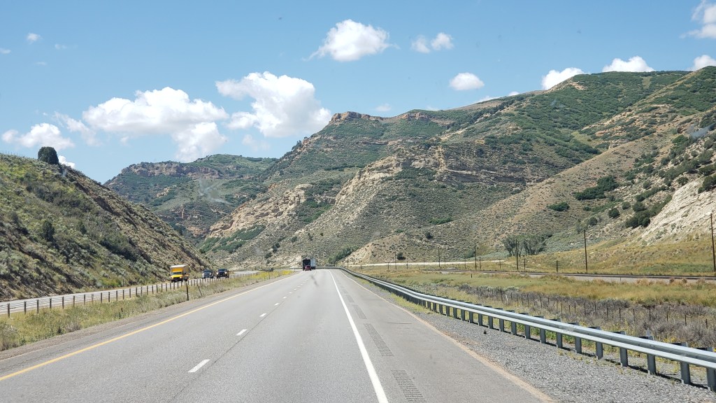
Driving west along I-80, what was initially a dark smudge on the horizon rapidly transformed into a formidable vertical barrier as the Uinta Range loomed into imposing view.
From the relatively flat southwest plain of Wyoming, the Rockies suddenly provide a formidable barrier to the west
The highest peaks of the Uintas reach 13,534ft above sea level, which is only 42nd in terms of the overall peaks in the Rockies, but Colorado has fully 39 of those, and Wyoming two, so Utah actually comes in third of all the states that feature the Rockies. More significantly, it is ninth when it comes to the prominence, or highest vertical rise, at 6,358ft.
Looking up at that 6,000-plus feet of mountain ahead of us was a sobering prospect. We were supposed to drive through there?
Thankfully, the highway into Utah was simpler than it looked and our Fati coped admirably with the winding mountain pass route from Wahsatch to Emory, where we branched northwest on the lower elevation of I-84. Still, surrounded by the massive bulk of peaks reaching almost 10,000 feet put our WPMs (Wows Per Minute) back into high gear.
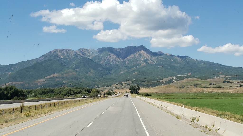
This is the bulk of Thurston Peak, which reaches 9,705 feet above sea level, with a vertical rise of almost 5,000 feet. Small, it isn’t
Amazingly, I-84 dropped our overall elevation to just below 5,000 feet, meaning Thurston Peak on our immediate left towered almost 5,000 feet above us. It made us feel incredibly small.
We were heading for Layton, Utah, just north of Salt Lake City, where the spectacular Valley View RV Resort awaited us. However, it had to wait a bit longer than expected as our GPS systems (two of them) decided to play silly buggers with us, not for the first time.
Our Garmin wanted us to turn off the highway onto a road that did not exist, while our Samsung phone’s system couldn’t locate us at all. A quick call to the RV resort revealed that we needed to turn off at Antelope Drive, but we then found ourselves in a quiet residential area with our Garmin telling us the road had a six-ton limit. At fully 11 tons, Fati was potentially just a teeny bit over that limit, so we pulled over.
Someone who’s name begins with Simon tends not to handle GPS malfunctions terribly well. It usually includes lots of words beginning with F in a tirade of angry invective. For once, this didn’t reach DEFCON 1 thanks to Susan volunteering to unhitch Nippy and scope out the road ahead, which appeared to drop off the edge of a cliff.
Sure enough, she found the way in, which didn’t involve any cliff-hanging, and, communicating by phone, guided the RV safely to its intended port.
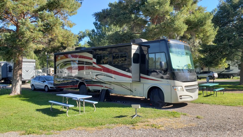
Valley View RV campground is a genuine high-caliber resort, with lots of facilities and a wonderfully modern, clean look
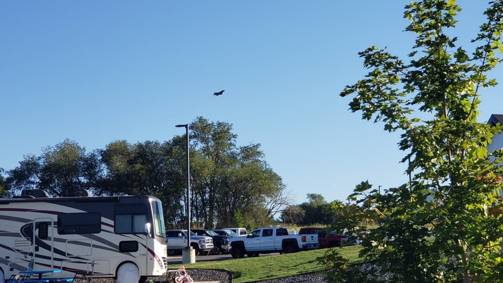
Our new home for the next 8 days is a slick, modern and feature-packed RV resort, with 121 berths for RVs of all types, plus facilities like a swimming pool, clubhouse with fitness center, pickleball courts, and a dog park. Food trucks visit periodically to provide a handy dinner option while the clubhouse also offers complimentary coffee, just like a hotel (much to Simon’s liking). To one side, we have a view of the Uintas; to another it is the Great Salt Lake and Antelope Island.
Oh, and we are half a mile from Hill Air Force Base. Who fly F-18s. Every weekday. From 8 a.m. So, there’s that….
Our 8 a.m. alarm call, courtesy of the US Air Force
Next, we’re off to see Salt Lake City, more of the Uintas, and Antelope Island. We have a truly excellent base to explore from and the views of the mountains are truly spectacular. This is yet another scenic wonder in what has been a string of them since we hit Upper Michigan back in June, and we are eager for more.
Antelope Island lies to our west, full of intrigue and scenic promise. This is another epic location…and we’ll take you there soon!
We had two days left in Wyoming before heading into a brand-new state for Simon, and we were determined to end our time in the state of never-ending surprises on a high note. Little did we know how high we’d get!
Not THAT kind of high; this isn’t Colorado. But our final day’s trip did end with a long, long, drive at nearly 10,000 feet, with plenty of steep drop-offs, long ascents and descents, roads slick from the rain, and not a guardrail in sight.
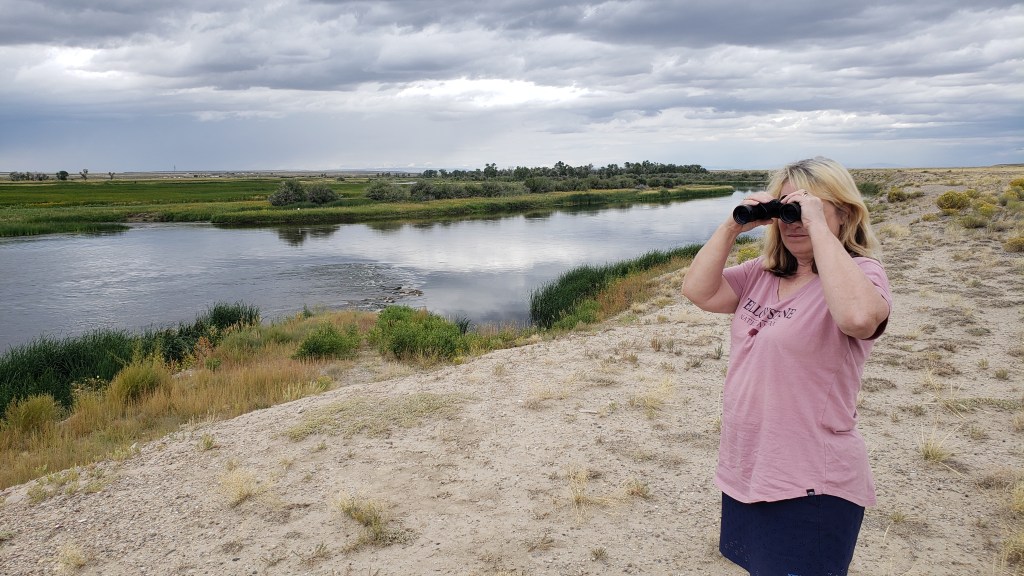
Let’s forget about that part and start with the drive we took out to the Seedskadee National Wildlife Refuge, with its tongue-twister of a name and its wonderful visitor center. The refuge claims to have more than 300 species of birds, mammals, and fish, some of which are taxidermized and on display so you get excited about what awaits.
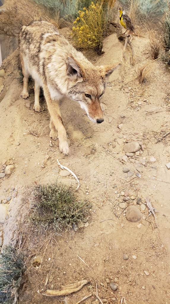
We saw exactly two eagles, a couple of trumpeter swans, one grouse, and a small handful of kangaroo rats (more appealingly called “gerbils” when you buy them at a pet shop). No moose, no coyote, no rabbits, no badgers, over the course of three passes along the main wildlife road (two during the day, one near dusk).
Ruthie found plenty to sniff, so she was happy.
It may have been just a bit windy.
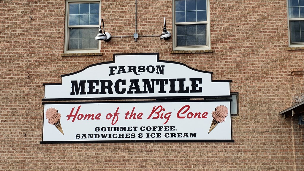
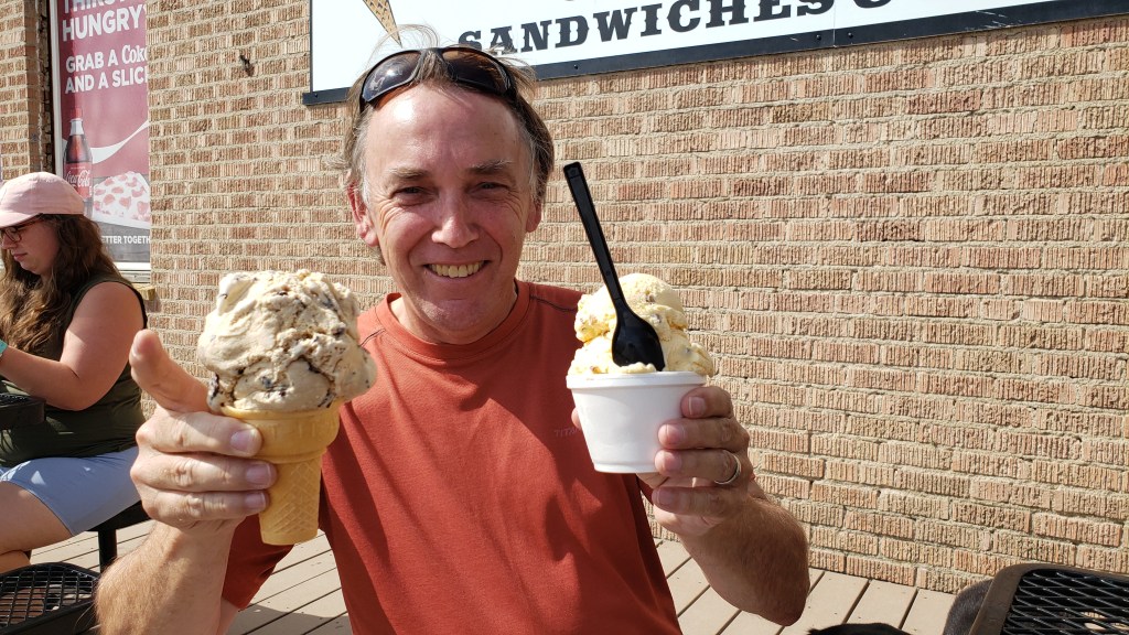
After getting skunked (not by a skunk) during our first pass in mid-afternoon, we decided to head into Farson, where the visitor center guy told us we’d find the “best ice cream,” and a single-serving would be “enormous.”
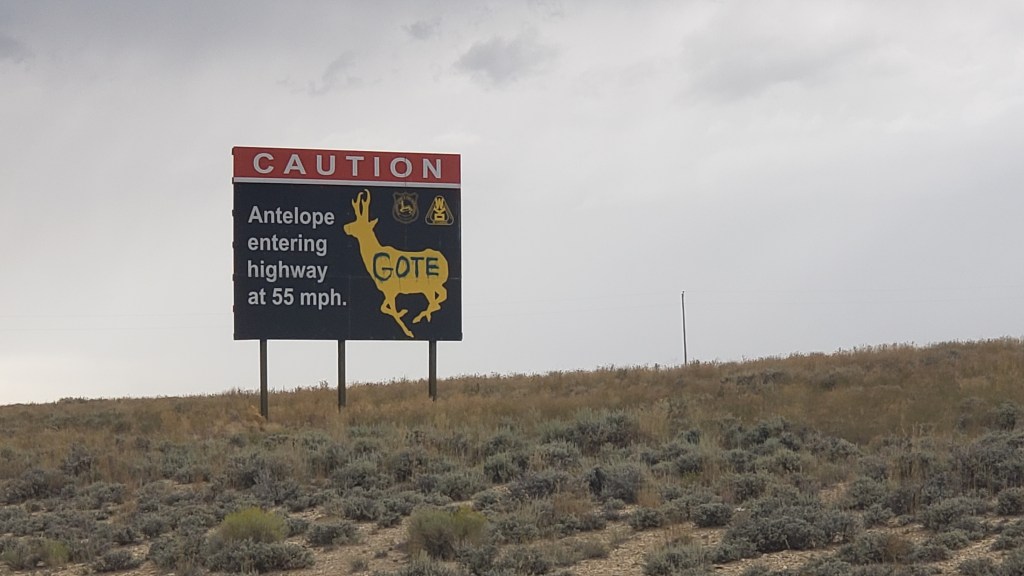
We saw lots of wacky signs warning of local dangers, such as cows and speedy “antelope,” (which aren’t antelope at all, they’re pronghorn, but that’s an argument for another day).
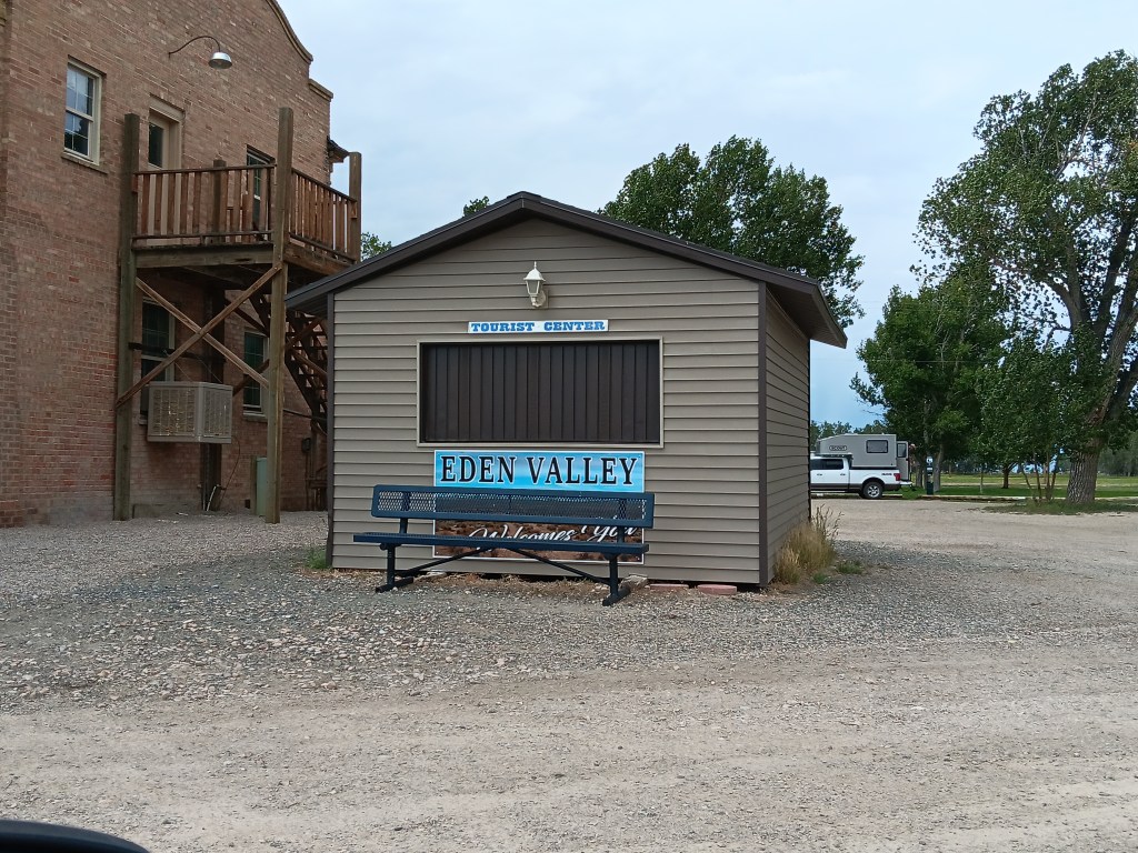
Farson’s Visitor Center, right next to the only other thing in town, the Mercantile, with its big ice cream cones.
He wasn’t wrong. The place was hopping, and everyone was buying ice cream. We split a sandwich first, having skipped breakfast, and judging by the outrageous size of the ice creams we saw coming out of the building, we both opted for the Baby Scoop.
Turns out, that’s what nearly everyone else had, too.
Simon originally asked for a Single, but when the girl scooping it up started to mound a second massive scoop on top of the first massive scoop, he balked, and retreated to Baby Scoop.
Susan ate less than half of hers, Simon powered through his, and we spent a happy hour talking to the locals who joined us on the patio. One was a rancher having a treat with his grandson, and he told us all about his farm, and how he’d never been to Florida because he had no desire to “go to the other side of the world.” All the people we met were just passing through the tiny town, but insisted you “have to stop for an ice cream” when you’re here.
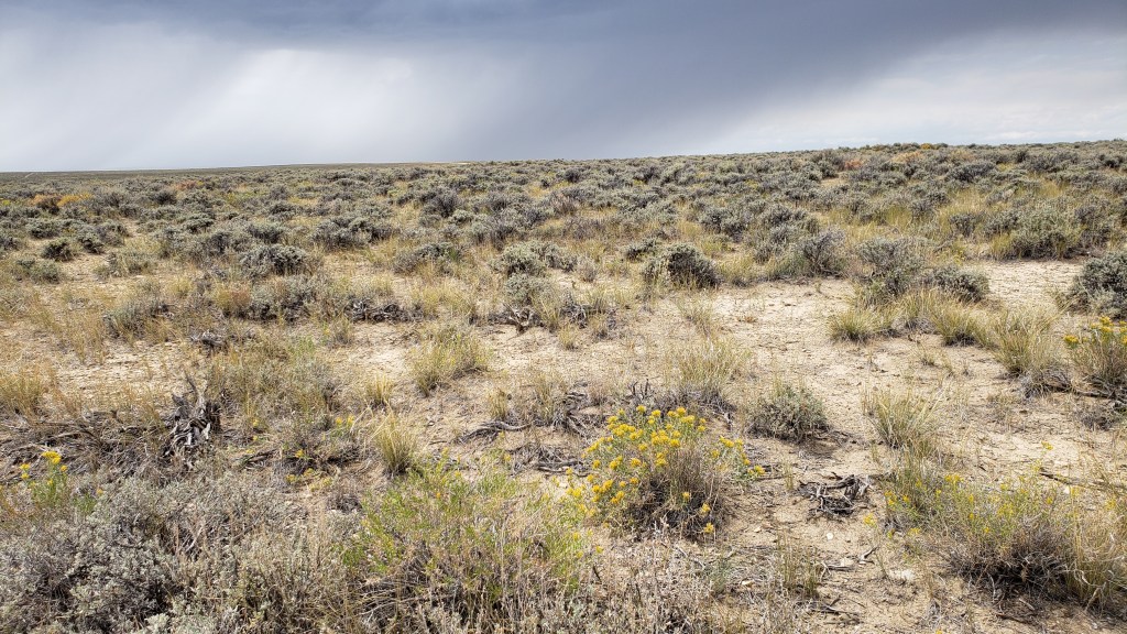
Our return trip to the wildlife refuge had the disadvantage of being right after a big rainstorm, and we were right in thinking we’d see less wildlife (meaning, none) because of it.
Lots and lots of looking, but not a lot of seeing.
Somewhere along the wildlife road we also missed our turn-off to the highway, and as darkness began to threaten, we had a choice to make. There had been no obvious roads turning off the wildlife road, so should we push on? Or should we go with a sure thing and make the many-miles trip back along the road we already knew would lead out of the refuge?
This is pretty much what we saw most of the way.
In this instance, we chose to backtrack, mainly because we’d passed a wreck of an RV that was camped on the side of the road, its owners were probably packing heat, and we’d be held captive if we didn’t get out before dark, since we’d been told the DNR closes the gates shortly after dusk.
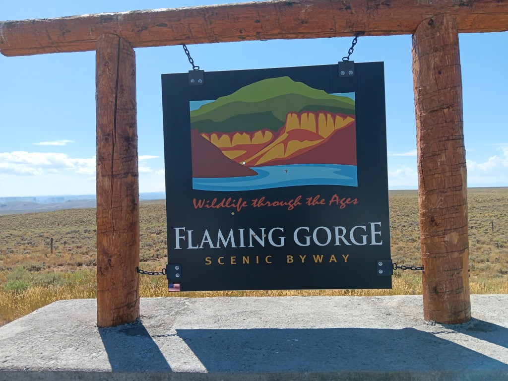
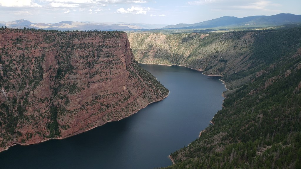
The next day made up for any small disappointment we’d had, as we pointed Nippy south out of Wyoming and into the Flaming Gorge in northern Utah.
I’m a bit tired as I type this, both of us having been awake most of the night with a big thunderstorm and an antsy dog, so we’re going photo-heavy here, with captions that will do most of the work for me.
I’m putting this photo here first, and I’ll use it as a reference for how BIG the mountains we passed were, and how high the canyons walls were. This is nothing more than a large mound of rock, hardly worth noticing, but it gives you an idea of size.
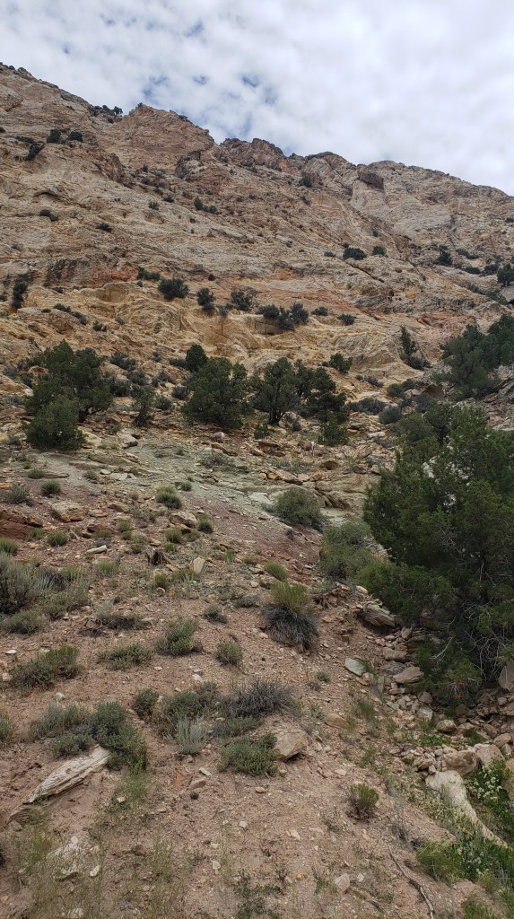
On our way through Flaming Gorge National Recreation Area, we detoured down a road that led to the Sheep Creek Canyon Geological Area, a name that intrigued us, and we’re so glad it did. It turned out to be in our Top Two of astounding canyons.
It started slowly, but even so, that boulder with Nippy in front of it is about the size of a single rock at the top of this mountain.
You wouldn’t be able to see the boulder without binoculars if it were at the top of this mountain. It would just be too small.
A creek ran alongside the geological loop throughout our entire drive.
“How cool and babbling and refreshing on this hot summer’s day! Too bad I hate water so much.”
The tiny points at the top of this massive, massive mountain are enormous pine trees.
The smallest rocks sticking up at the top of this mountain – whose structure looks like it was bent in on itself – are about the size of the boulder.
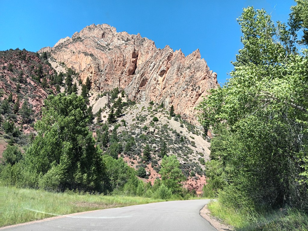
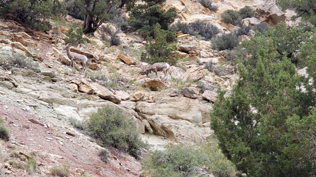
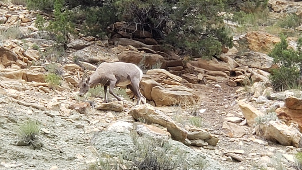
We took hundreds of mountain photos, as you can imagine, but we’ll stop there. Instead, enjoy these two Bighorn Sheep, who blend into the landscape so well it was surprising we saw them at all.
This is without zooming in. You can JUST make out their white butts below the trees in the middle of the photo. That’s how hard they are to see.
This is zoomed WAY in.
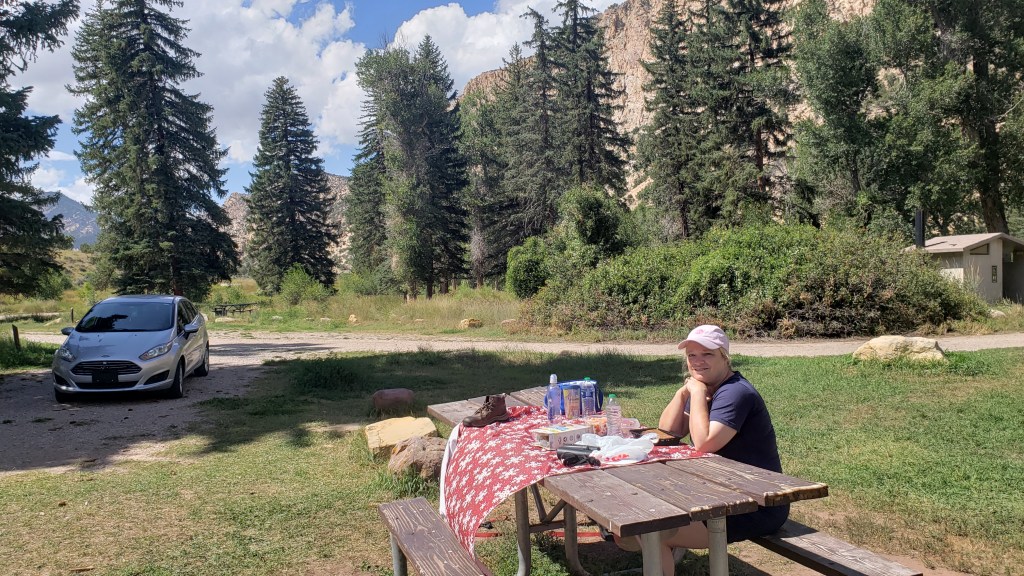
We pulled off into a tent-camping area before leaving the canyon, and had the kind of lunch we were growing used to (meaning, odd). This time it was frozen carrots, cherry tomatoes, Paul Newman Italian Dressing in a packet we picked up at the lodge in Yellowstone, Triscuits, bread, and sausages.
Why? Just, why?
Finally, we reached the Red Canyon, and while we didn’t get the best light of the day, the deep red of the rock and the depth of the canyon were still incredibly impressive.
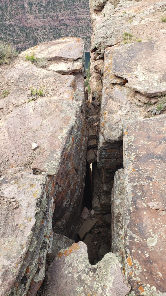
There are warnings to avoid the deep fissures all around the walkway that leads out to the overlooks.
You can just see two people on the ledge just past the small pine tree (the white dot is one person’s shirt), which gives you an idea of scale.
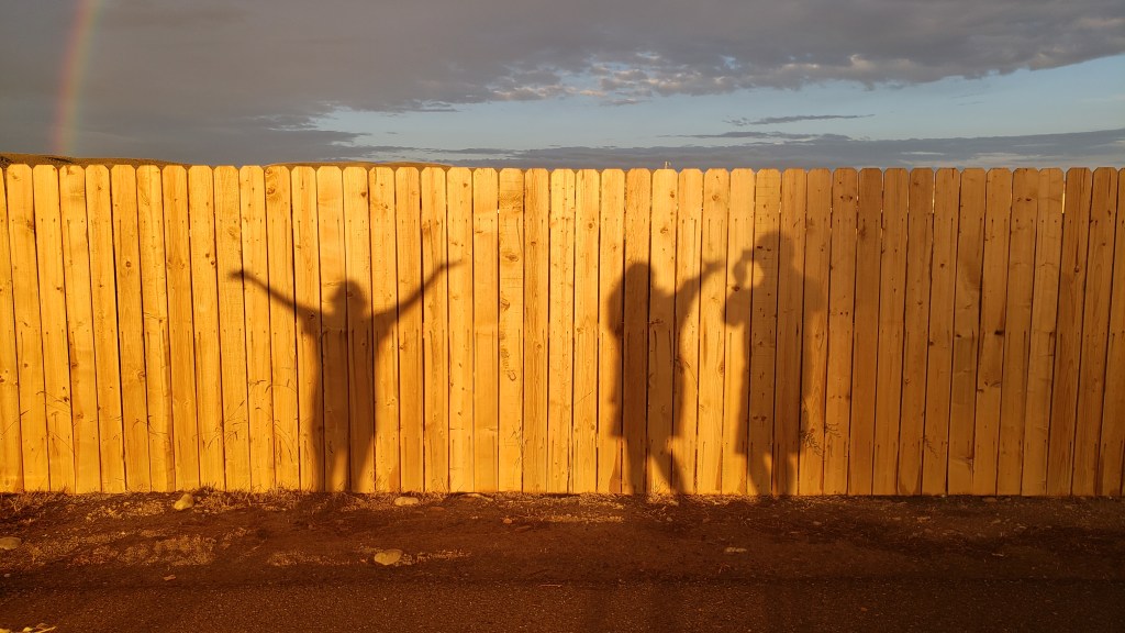
Our final evening in Wyoming was celebrated with a glorious, full rainbow, and some fun with a fellow camper when we noticed our shadows on the fence. Isn’t life great sometimes?