As keen-eyed blog readers will know, we have just hit the 11 month mark in our grand “A Year On The Road” RV trek across the US. After Louisiana, we arrived in coastal Mississippi, our 23rd state in this epic voyage.
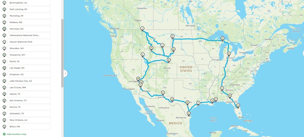
The story so far – 11 months on the road (NB: The pin-points are not our only stopping points – there are more than 60 of those so far!)
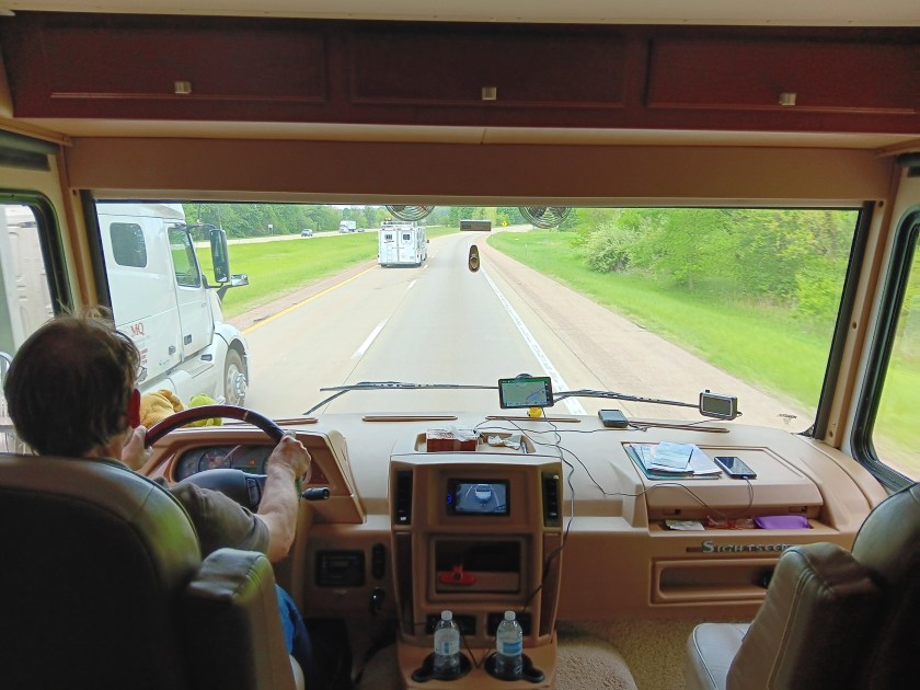
Since our last monthly update, we have covered another 181 miles – a totally sedate travel distance at this stage of our journey (especially when we covered more than 2,200 in the first month!).
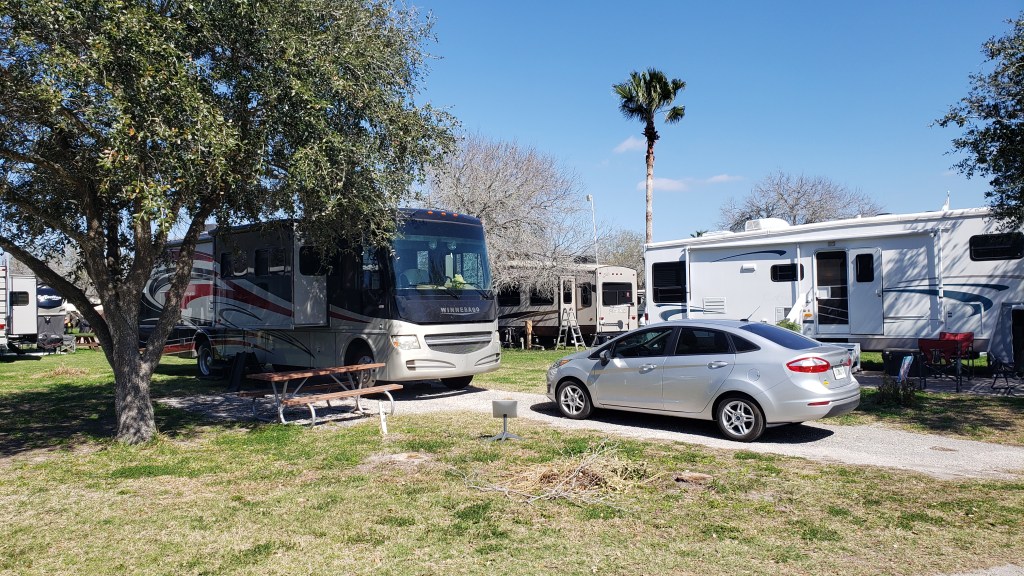
In the last month we have moved from Baton Rouge, Louisiana, to Biloxi, Mississippi, and our traveling has been a lot more focused on the areas close by, rather than trying to cover vast distances quickly. Even including the last two months, we have only gone a total of 672 miles in our trusty Winnebago, Indefatigable (or Fati for short).
The last two full months of our journey, from Port Aransas in Texas all the way along the Gulf Coast to Biloxi via Louisiana
Mind you, we have still covered some territory in our trusty tow car, Nippy, putting an additional 2,534 miles on our little Ford Fiesta (and 3,991 in the past two months), which shows that we’ve completely changed the balance of our touring – going shorter distances in Fati but doing more exploration in Nippy.
Now, with just a month left of our travels (but still more than 550 miles from home), it definitely feels like the end of our grand adventure is firmly in sight, which is very hard to contemplate after such a prolonged – and intense – period of traveling.
In total, we have come 9,225 miles in Fati since leaving home, and another 24,604 in Nippy, for a grand total of 33,829 around this amazing country. Eat your heart out, Hardest Geezer!
Today marks eleven months since we locked the door to our house in Florida and set off for a year-long adventure in an RV. Here’s what we learned during the past month:
When you’re crouched down in front of the outdoor water spigot getting ready to do your final hand-wash, make sure you know whether the lever goes up or down to turn it on. If you get that wrong, you’re going to walk away with your shoes, your T-shirt, and the crotch of your jeans soaking wet. It’s way worse, too, when your neighbors are out there watching you.
There are times when the weather is forecast to be so dangerous that your only smart choice is to bug out and stay in a hotel until the threat passes. Sometimes, that means driving 300 miles to get past the storm’s reach, which is too far to get an RV out of the way in time. When that happens, you’ll get all teary as you say goodbye – out loud – to your rig, and assure her you’ll be back. It’s truly like leaving a friend, and you’ll worry about her until you get back and know she’s okay. It’s an awful feeling.
When you’re staying in that hotel overnight to ride out the storm in safety, don’t freak out the first time you turn on a water faucet. You haven’t seen that much water come out of a faucet for a long, long time, and it’ll look and sound like a fire hose in action. Remind yourself this is normal.
When you return to your rig after the storm passes, and you find she’s okay, there is a sense of euphoria that reminds you how precious your traveling home and this lifestyle really are.
PJ’s Coffee. Specifically, their Strawberry Rose White Chocolate Latte. This is what coffee should be, and from this moment on Starbucks should be ashamed of themselves.
There are towns where some roads are called “historic,” but what it really means is, the road itself is history. Drive it at your peril.
If there’s a beach road you can take instead of an interstate, and your GPS doesn’t have an almighty conniption about some terrible fate that will befall you if you take it, take it (we’re looking at you, glorious Highway 90 between Waveland and Biloxi!).
We’ve reached the point in our adventure where our Florida license plate isn’t the furthest state away. It feels weird and sad and just a little bit exciting to realize we’re getting so close to home.
Equally, it is impossible to believe we have one month left in this incredible journey. How? How is that possible? (Insert loud crying here.)
The moment may come when you meet brand-new RVers who are trying to find their way back to sanity, having endured one setback after another. Now is your moment. You’ve been there, you understand, you got through it, and you can talk them off the ledge and assure them it’s normal and it’s going to get so much better. Your reward is the relief on their faces. Their reward is, they don’t feel so alone anymore. How perfect is that?
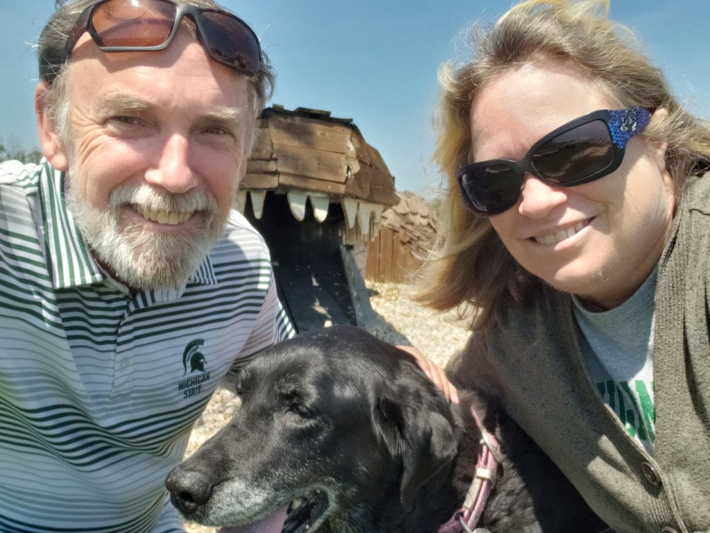
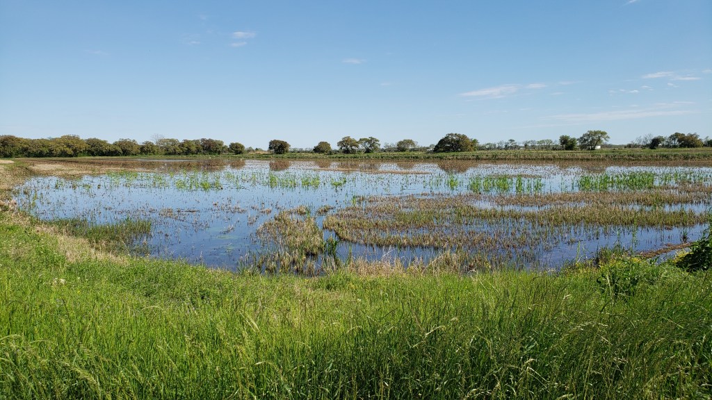
Hello, Louisiana! Home to vast acres of rice fields and crawfish farms, and weird, sticky-uppy stalks that we discovered were sugar cane, one of the state’s primary crops. Hello, Covid, too, which put a major damper on our touring, with its ferocious exhaustion and coughing that had Susan bedridden for four days straight.
These fields are everywhere. Some are rice fields, some are crawfish ponds, and some are both.
The virus’s nasty symptoms hit the night before we moved from Beaumont, Texas to the peaceful oasis of Parkside RV Resort in Broussard, Louisiana, but at that point we thought it was a bad cold, or maybe allergies. We’d been so careful; didn’t dine in restaurants, our touring was all outside and just the two of us (plus Ruthie), so Covid wasn’t at the top of our minds. It was only two days later, when Susan said, “I’d better test to rule it out,” that we knew the awful truth.
Dammit.
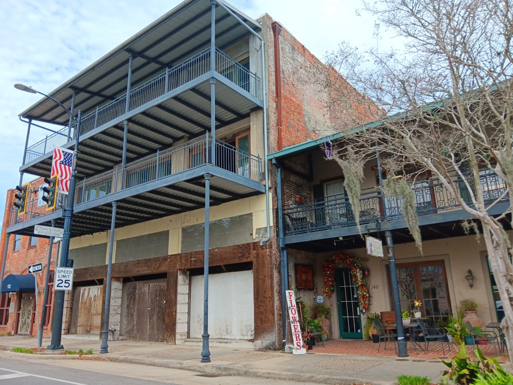
During our pre-test time of innocence we took a little drive around Broussard, exploring the downtown area by car. It’s a cute city center, very compact and approachable, and we liked the small-town feel in a place we thought would be much, much bigger. It also offered a hint at the transition Lafayette seems to be going through.
The historic area is going through a change, but certainly retains its small-town charm.
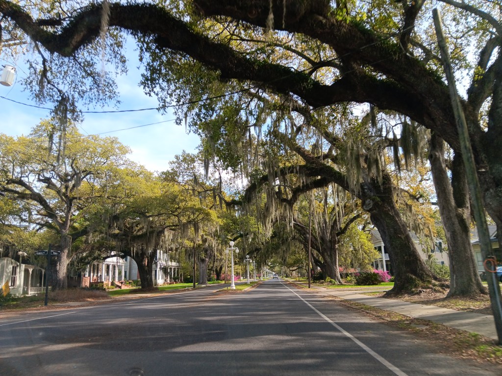
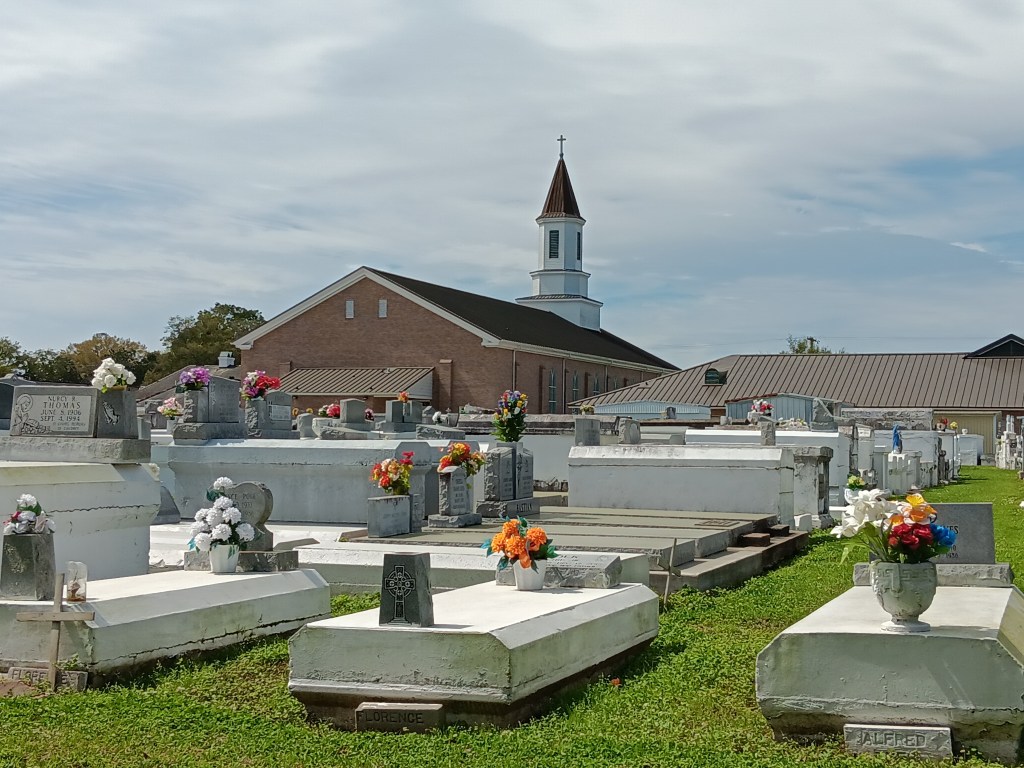
Two features really stood out for us as we drove around: the Giant Live Oak trees and the above-ground cemeteries. We’d seen this sort of cemetery during a visit to New Orleans years ago, but they still stand out as curiosities, especially as so many of them seem to be in the back end of nowhere, or smack in the middle of the city.
The Live Oaks are so dramatic, and incredibly beautiful.
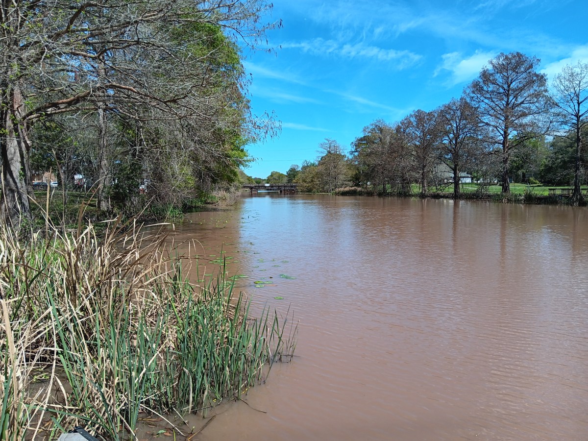
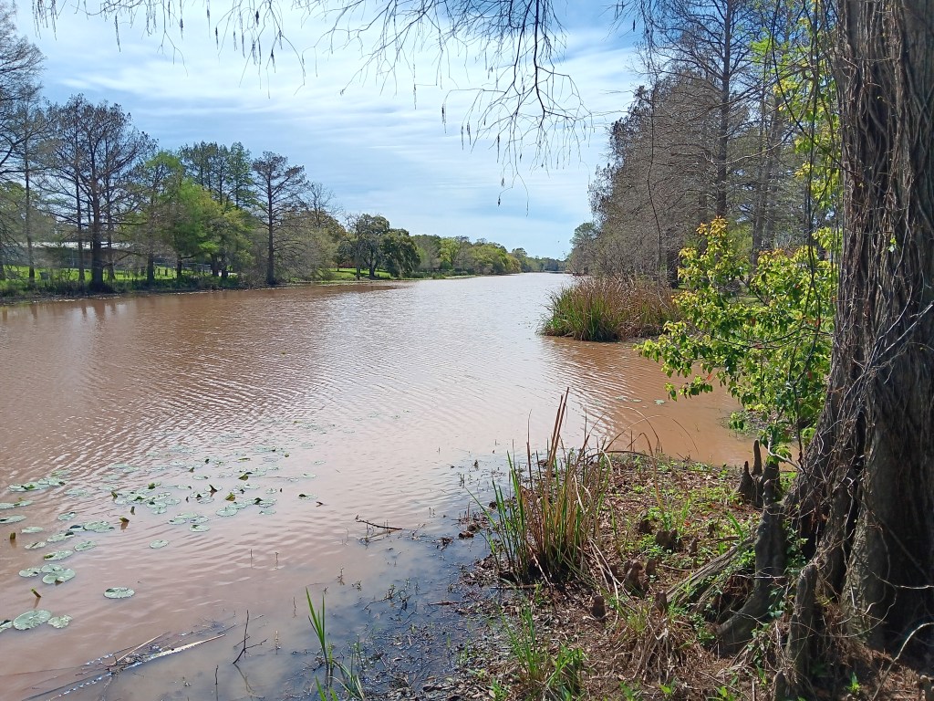
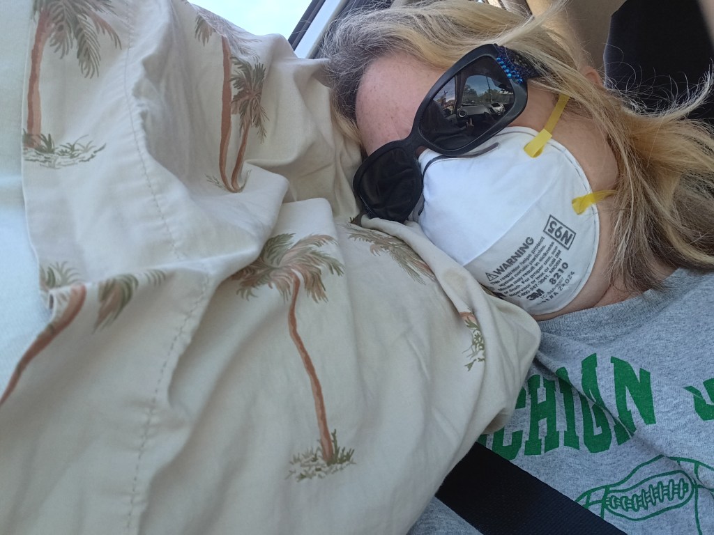
Susan had a little rally five days into it, so, with her fully masked up in an N95, we hit the road for the Bayou Teche National Byway to Morgan City. We had been wondering exactly what “bayou” meant, since we thought it meant a big, swampy waterway with cypress trees in and around it, but very back-woodsy, dark, and mysterious due to all the trees. The kind of place Huckleberry Finn would have been born and grown up, where ‘possum and squirrel were always on the menu.
Instead, it’s a French version of the Choctaw word “bayuk,” meaning (roughly) a creek or small river, which was what we were seeing every time we saw a marker for a bayou, including Bayou Teche (literally, river snake, or “snaking river”), which was once the original course of the mighty Mississippi River a few thousand years ago.
Bayou Teche
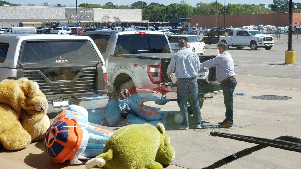
There may be those among you who have unexpectedly encountered the transfer of illegal goods from one car to another, as we have seen on occasion, but only in Louisiana would that transfer of goods involve crawfish and shrimp. And that’s exactly what we saw while waiting to gas up Fati at a Walmart. These two fellas negotiated the sale of crustation packages tucked in a cooler full of ice for quite some time, while holding up everyone in line behind them waiting to get gas.
The next day, Susan was free from the feeling of having been kicked in the face by a donkey, but still coughing and incredibly tired, so we opted for a drive along the Cajun Corridor Byway that runs between Delcambre and Kaplan, south of Lafayette.
This is how Susan did most of our touring, when she wasn’t flat-out asleep in the rig.
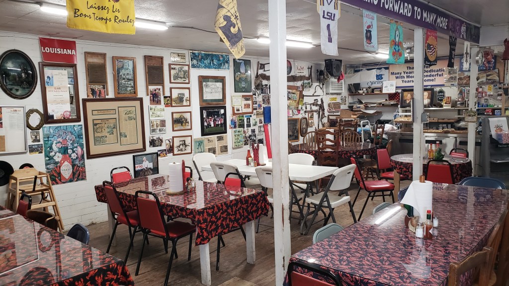
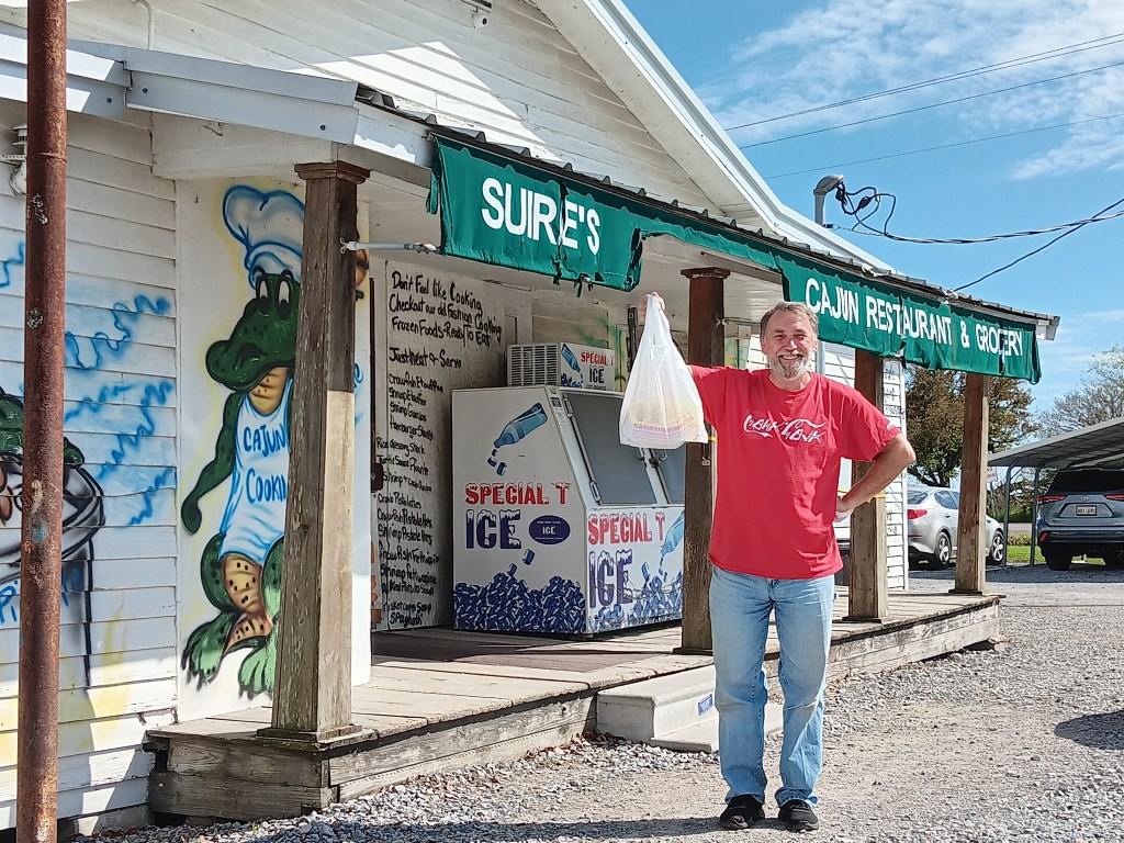
Simon’s appetite made up for Susan having none at all, so a visit to Suire’s Cajun Restaurant and Grocery Store for lunch was in order, being somewhat of a local institution. We knew before we even started the trip that Louisiana would be a non-starter for Susan, food-wise, due to a rather nasty shellfish allergy, so having no desire to eat was a blessing in disguise.
Some of the best food we’ve had has come from some of the humblest places.
He’s got the goods!
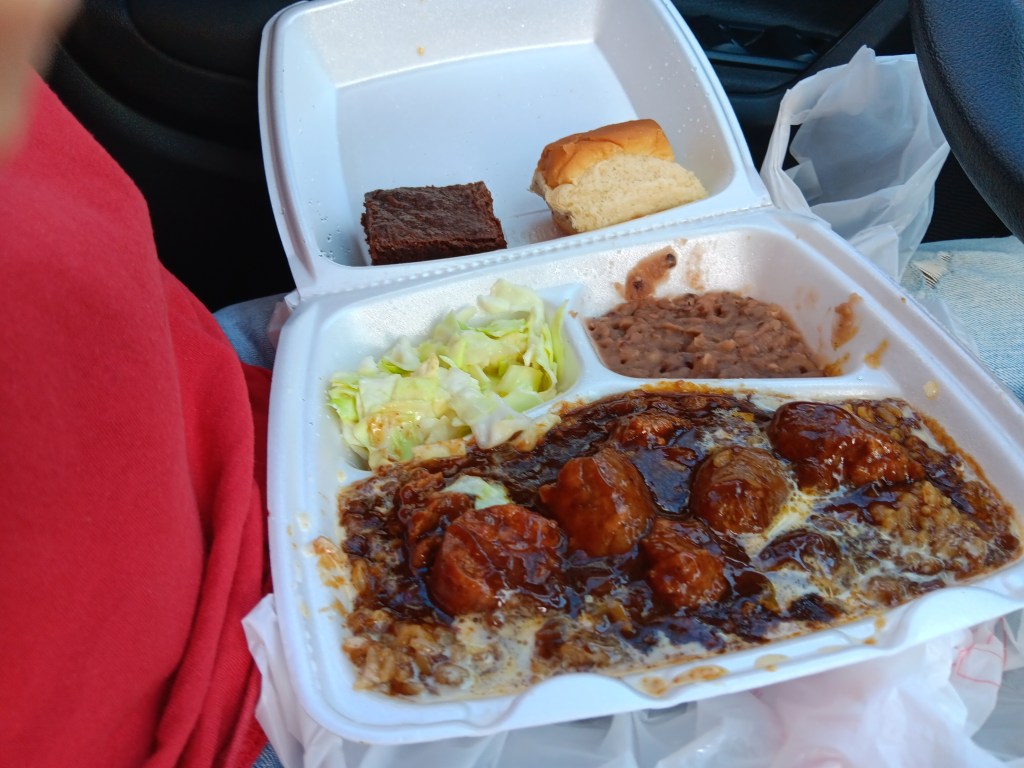
Simon had no such restrictions, and went for the Boudin Plate, a homey assemblage of Boudin sausage, rice, gravy, a dinner roll, slaw, beans, and a brownie. Delicious perfection!
The kind of food you scarf down, then sop up the tattered remains with a biscuit.
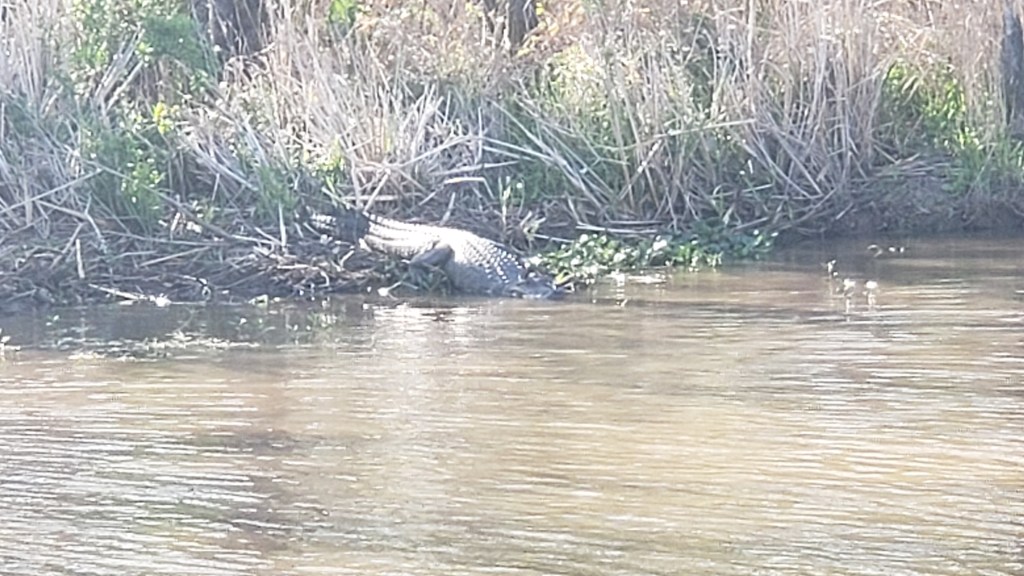
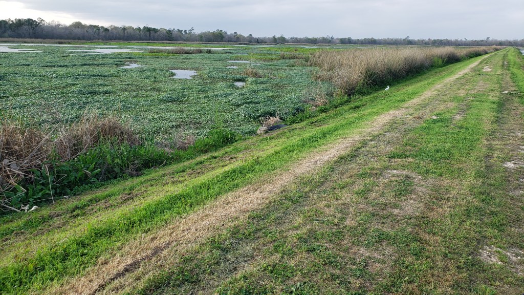
We detoured further south for a drive along the White Lake Birding Trail after lunch, and while we couldn’t do any of the walking trails, the road through it rewarded us with wildlife sightings and reminded us of our beloved Apopka Wildlife Drive in Florida. We saw lots of gators, some deer, hundreds of birds, and a mammal that was either a muskrat, a beaver, or a woodchuck. Probably a beaver, possibly a woodchuck, but we’ll never know for sure.
This is definitely a gator.
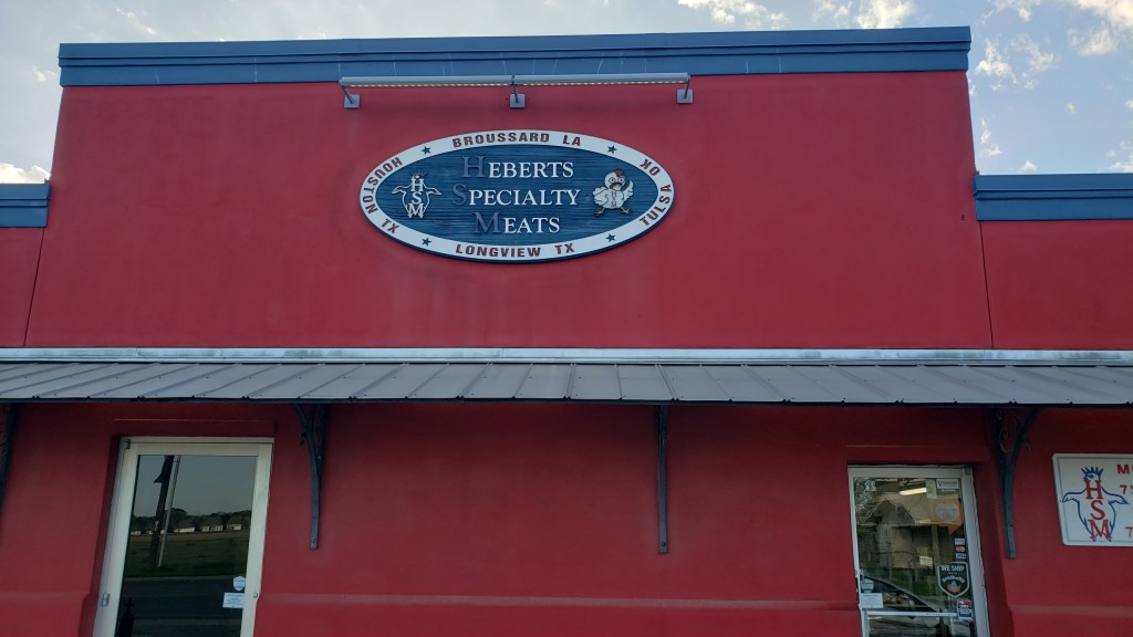
Cooking dinner was out of the question, so we made a quick stop at Hebert’s Meats for pre-made Etouffee and sausages, which Simon could dine on for the next couple of days. Somehow, we only have one photo of the outside of the store, and none of the fine offerings within.
Susan’s rally was short-lived. The next morning her oximeter was showing some worrying numbers, so it was off to Urgent Care, just a quarter-mile from our campground. Two chest X-rays later (mercifully, both clear), we were sent home with a six-day course of steroids, an antibiotic for a brewing secondary infection, and a coupon from the doctor to help us afford a $500 inhaler.
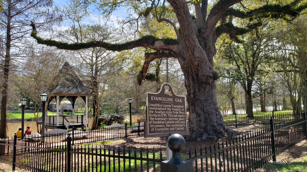
While Susan slept the rest of the day away, Simon went back to St. Martinville to see the Evangeline Monument and the Acadian Museum. The monument is a plaque in front of a massive Live Oak tree, the fourth representative of the original tree made famous in Henry Wadsworth Longfellow’s tragic poem, Evangeline: A Tale of Acadie about the exile of Acadians from Nova Scotia in 1755.
When we set out on this year-long adventure, our perception of Louisiana was that it was a less prosperous state, but as we drove around we began to see a pattern. Big houses and mini-mansions were rising up right next door to the most humble of homes, mobile homes, and RVs being used as homes, both in the towns and perhaps especially in the more rural areas. Something was clearly happening (gentrification; it’s gentrification), and when we arrived in Baton Rouge a week later, our curiosity about this trend kicked into high gear.
Our week in Broussard and Lafayette was far too short, especially given the days “wasted” by sleep, but we thoroughly enjoyed what we did see. Louisiana’s southern coast had definitely impressed us so far, as did the Southern kindness and generosity we’d encountered, and we were eager to see more.
Simon’s problem is that he rarely sees the problematic side of anything. Susan’s problem is that she sees the problematic side of most things, but hates to squash Simon’s natural enthusiasm. It gets us into trouble sometimes, and our visit to Cattail Marsh in Beaumont, Texas was one of those times.
It all started so well. A lovely little boardwalk led out to viewings of interesting waterfowl, and we’d become exceptionally good at identifying birds, meaning, we could see them and say, “There’s a bird! There’s another bird!”
But we were up for a longer wander, and there were two gravel paths along the marsh-front to choose from. Our walk began with the following conversation:
Simon: Let’s head over to the far side and see what’s there.
Susan: You know it’s at least an hour to make the full circuit, probably more, right?
Simon: Nah, it’s not an hour.
Susan: Well…okay. It is, but, okay.
That tree line in the background is the boundary of the reserve. Less than an hour, or more? You decide.
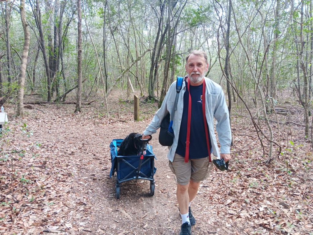
One-quarter of the way around, it occurred to Simon it was at least an hour to make the full circuit, probably more, and it wasn’t easy to pull Ruthie in her wagon over the gravely path. What happened next was this:
Simon: Let’s take the short-cut through the middle.
Susan: You know that isn’t a walking path, right?
Simon: Sure it is! See? It’s flat and grassy.
Susan: It isn’t. It’s a maintenance road. But, okay.
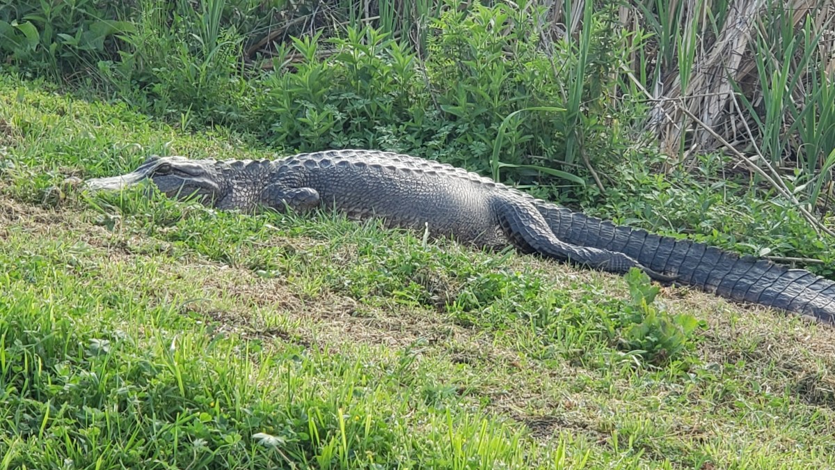
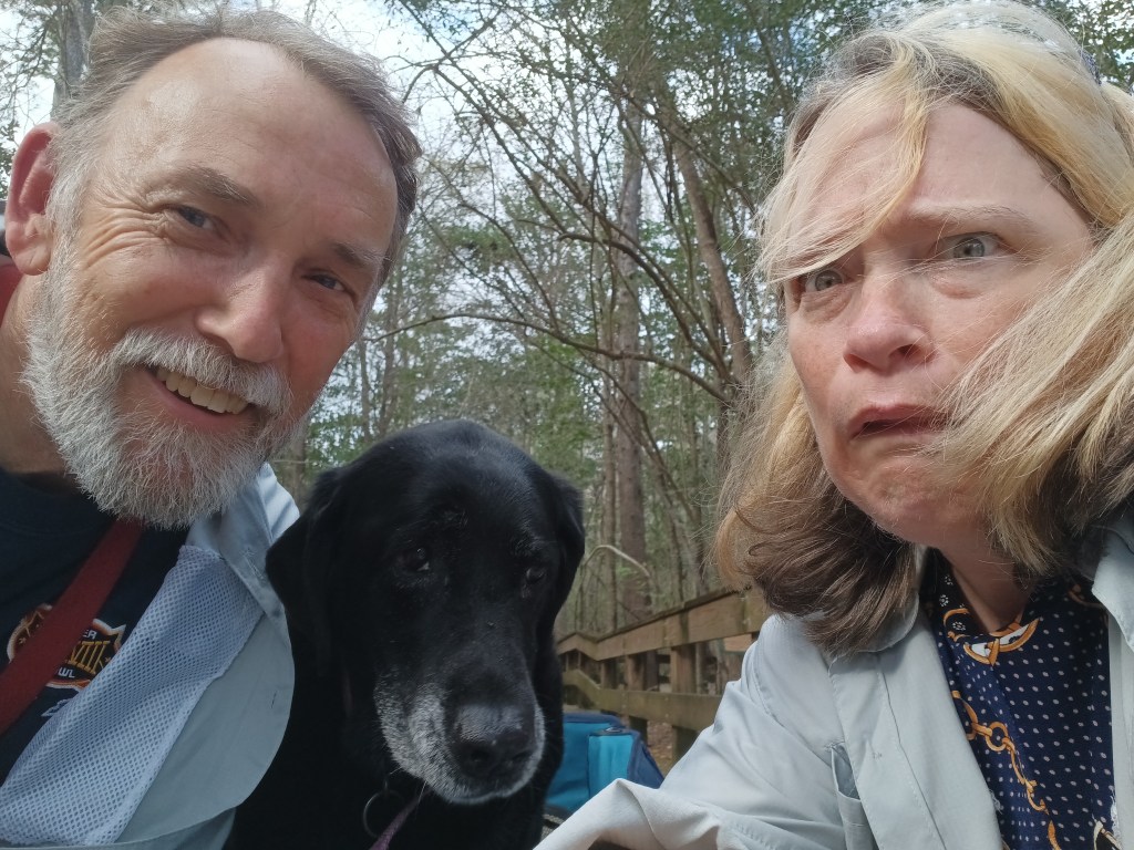
Now, those among you who have ever been in a wetland in the South know what’s going to happen next. And sure enough, not quite half-way into it, we were met by a 10-foot-long alligator sunbathing on the bank. Even Ruthie could see the “problematic” situation we were in, so she sat quietly in her wagon as we slowly, non-threateningly walked past the gator, with the wagon between it and us.
There’s a great big gator in this photo, laying just in front of that small mound of reeds in the center of the photo. You probably can’t see it, just as we couldn’t really see it until we were nearly on it.
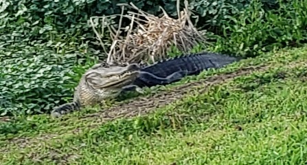
Here. This actual blow-up of said gator will help.
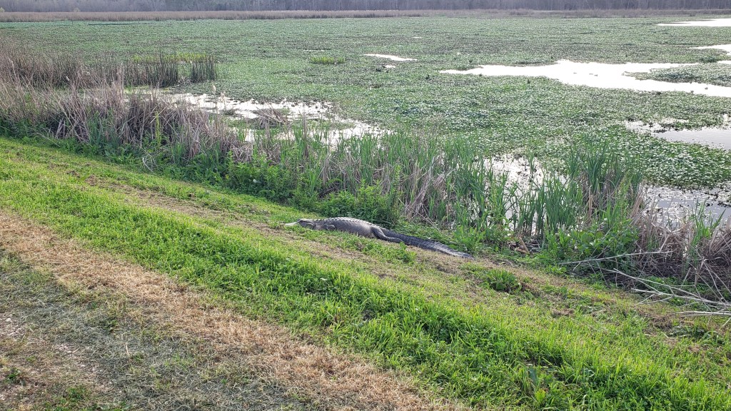
This guy (or gal) was easier to see.
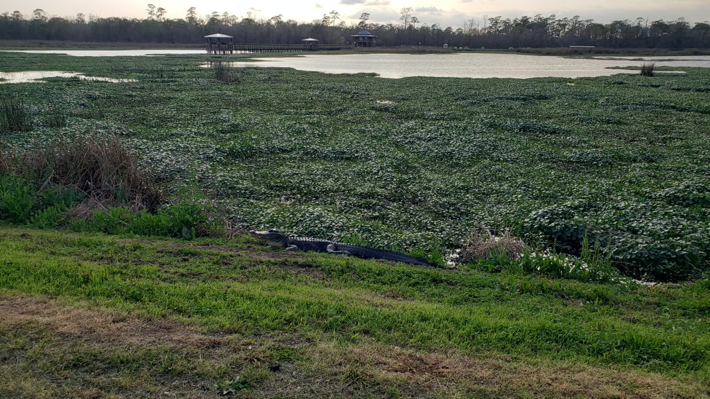
And another.
And this one. And on and on….
Long, “problematic” story made short, after several huge gators, lots of sweat, plenty of bugs, a horrible sewage smell, and more than an hour pulling that damned wagon over gravely ground we stumbled back to the car, where Simon grudgingly admitted we “probably shouldn’t have done that.”
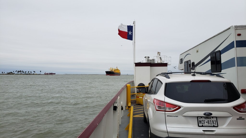
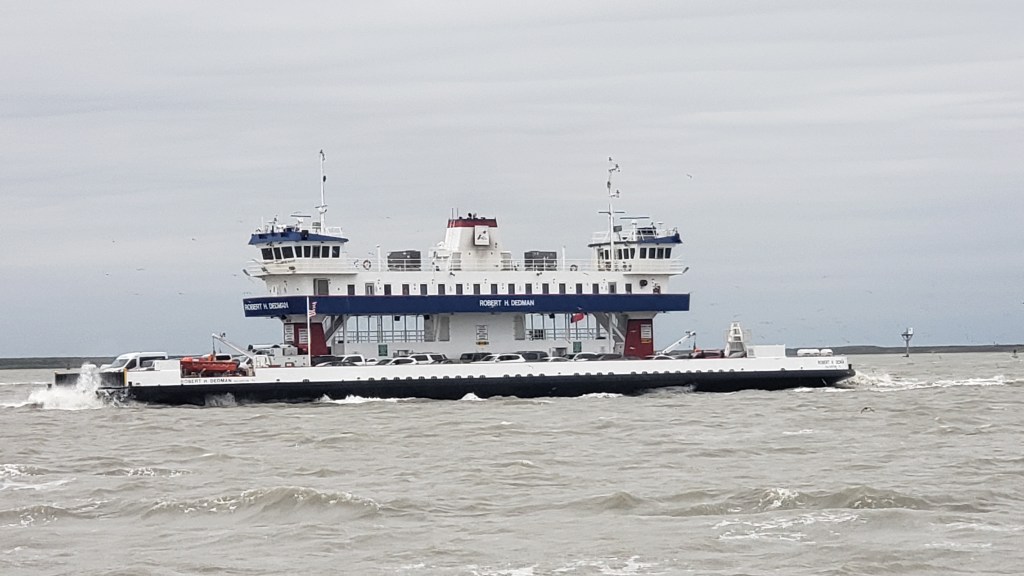
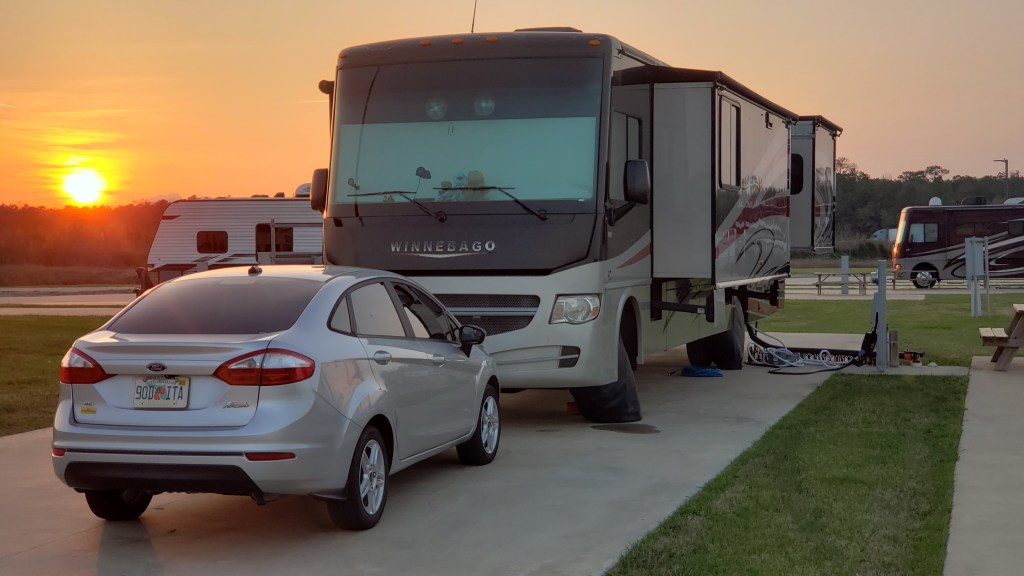
The rest of our time in Beaumont was tame and enjoyable. We had taken the ferry over from Galveston, which in itself is a novel adventure, and were camped out at the wonderful Grand Pines of Texas, with a lovely pond, nature walk, and (unbelievably!) free laundry. Clean and quiet, it was the perfect base for Fati while we toured the area.
Simon’s view. Susan was further up, in Nippy.
This is the kind of ferry we were on.
We had such good sunsets in Texas!
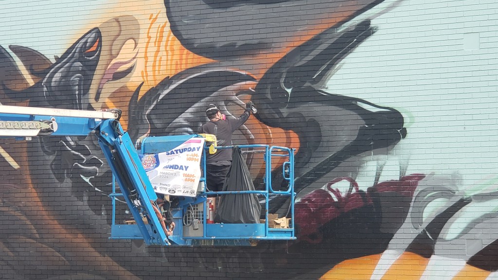
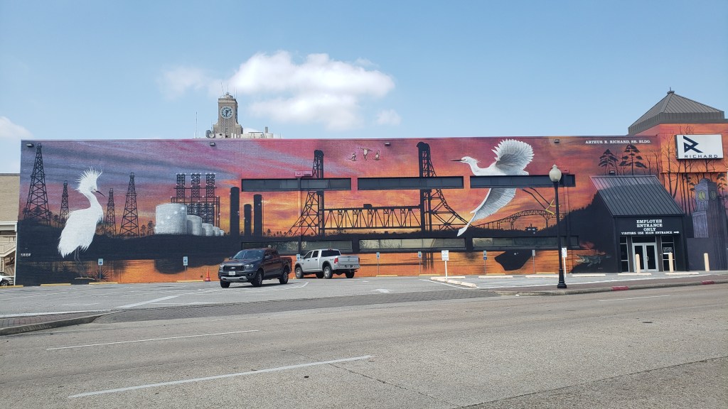
There was a big Mural Fest going on, so we headed into downtown Beaumont for a look. Some of the murals had been created previously, but many were being worked on, and it was nice to see how many locals came out to support the artists.
This guy was working on his mural.
This one had been done for some time.
There were quite a few artists contributing to the mural count on four-sided blocks like this one.
In the same park as the four-sided blocks (and a bunch of vendors, bounce-houses, food trucks, etc), one big building was getting a make-over, with three massive paintings. This is one of them.
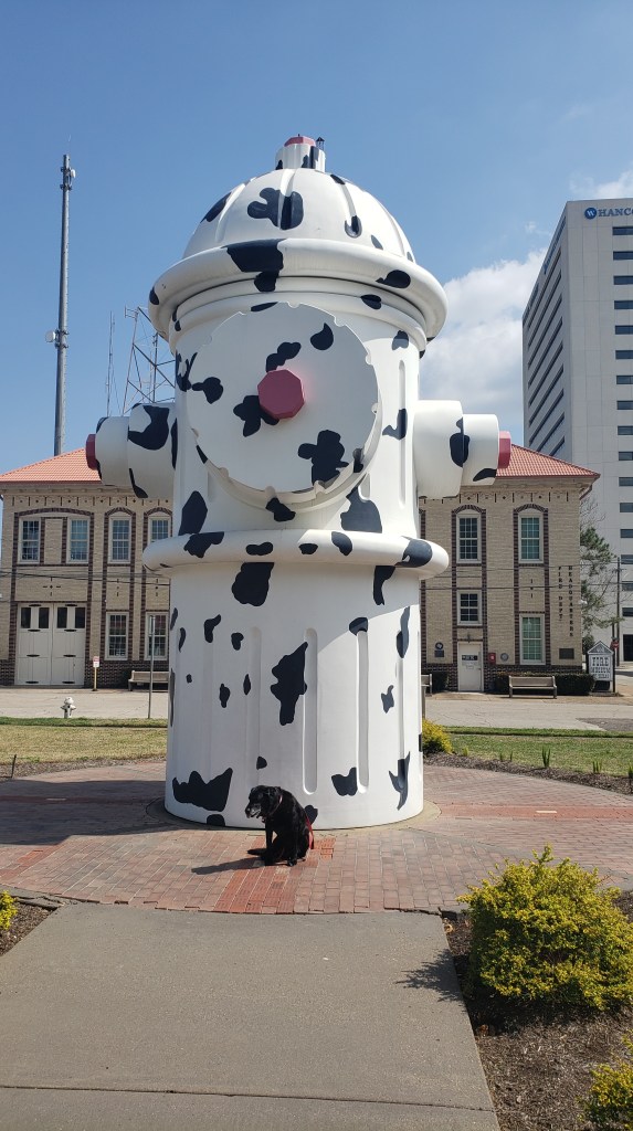
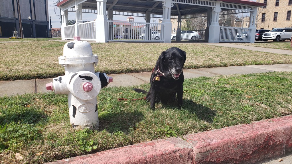
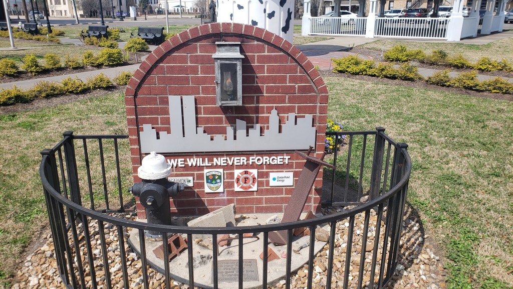
Downtown Beaumont also boasts the World’s Largest Fire Hydrant, and even if we didn’t have a dog with us, that’s something we had to see. Honoring firefighters everywhere, the park includes a memorial to the heroes who lost their lives trying to save others during the horrendous September 11 tragedy.
Intimidating!
Much more my size.
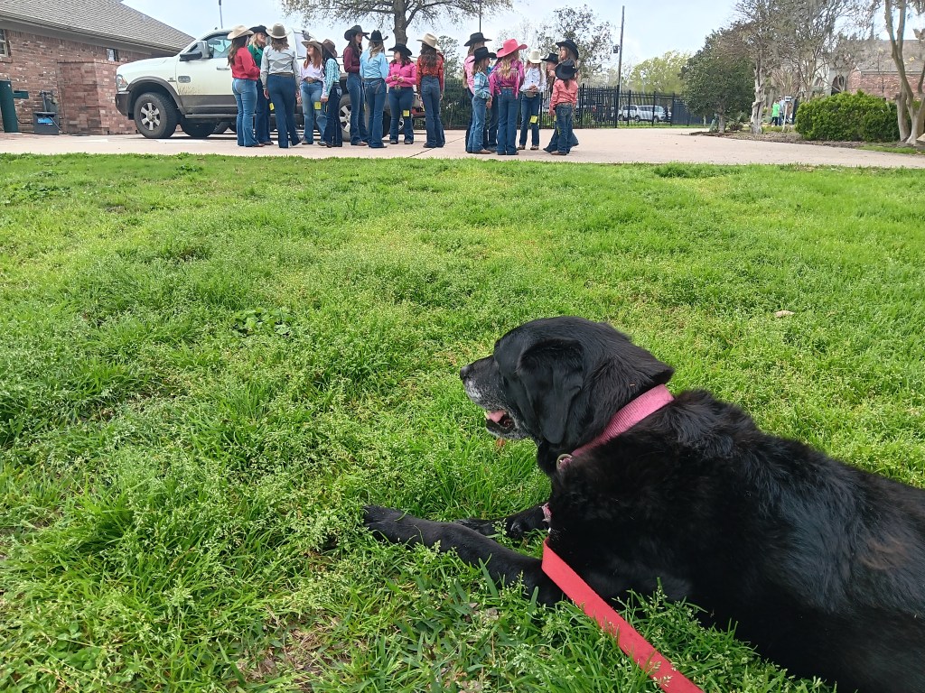
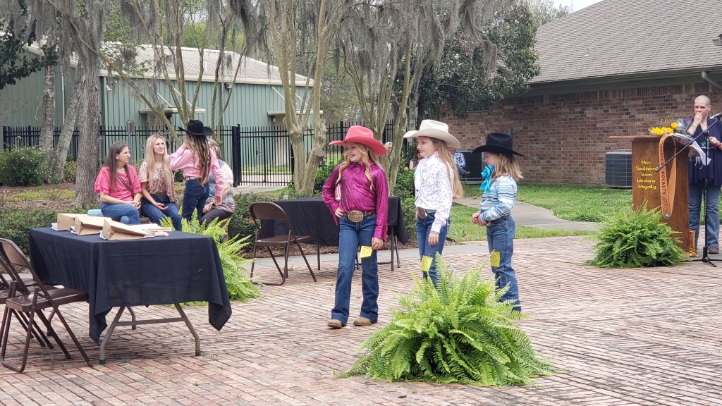
Another local event we stumbled on was a cowgirl pageant at the Beaumont Botanical Gardens. Girls of all ages could sign up for the pageant, which isn’t based on anything particularly “cowgirly,” and certainly isn’t a typical “beauty contest,” but is meant to build self-confidence and, I think, offers some sort of scholarship to winners.
Ruthie wishing she could join the cowgirl pageant. Instead, she did a butt-scoot on the grass right in front of these potential cowgirl queens. We’re so proud (no, we’re not).
Getting ready to face the judges.
We also took a day-trip down to Port Arthur, aiming for the McFadden National Wildlife Refuge, which sounds like a big deal, and maybe it is at other, better times of year, but we only saw a small handful of standard-issue birds, and not a whole lot else.
Look! A bird!
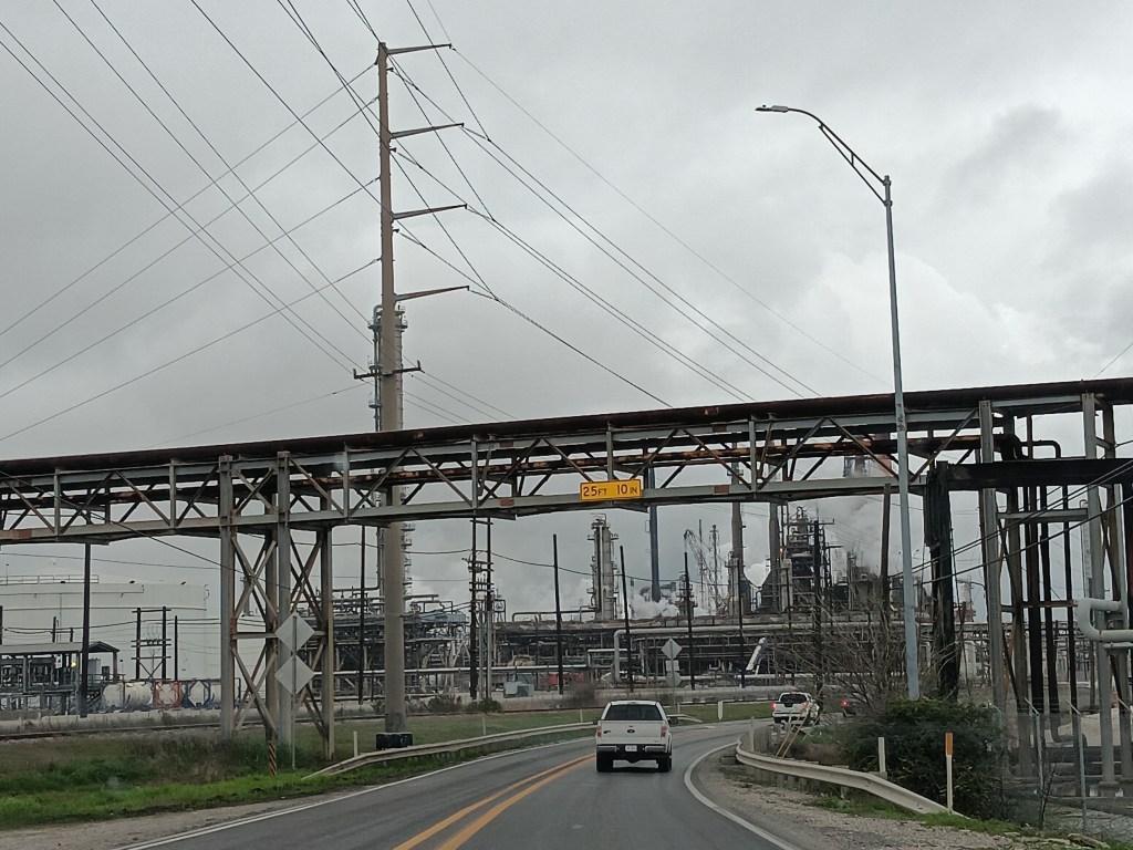
On the way back we detoured off the main road, where massive amounts of construction were going on, having to do with some sort of refinery. Drawn in by the sight of a structure we couldn’t quite work out, we discovered the Sabine Pass Area Artificial Reefs program, where sunken structures were being turned into reefs.
The main road went right through a processing plant.
Whatever this is, it’s becoming a reef.
A day or two later, Big Thicket National Preserve offered the chance for a walk in the woods to a genuine cypress slough, with a paved path and boardwalks that would make pulling Ruthie in her wagon quite easy. And it did, for the first few minutes. Once we were committed to the journey, though, the path turned to off-roading.
The slough reminded us a little bit of Florida.
But we persisted, which was a good thing since it would be the last exercise we’d have for the next few weeks. Unbeknownst to either of us, and after four years of diligently avoiding it, Susan was brewing up a hefty case of Covid. Little did we know her face would really look like this a couple of days from now:
The latest instalment of our exclusive series for The Independent newspaper in the UK is now online, highlighting our travels through Nevada and Southern California, including the Mojave National Preserve, Valley of Fire State Park, and Greater Palm Springs.
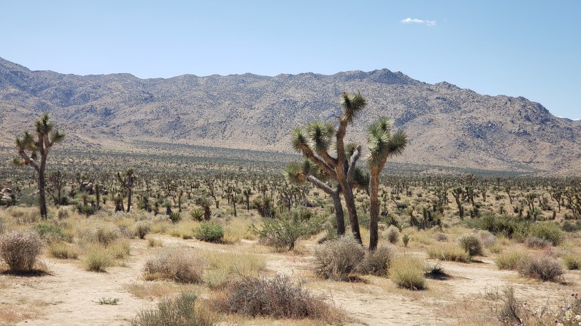
This section of our Year On The road adventure took us deep into desert territory – both the Mojave Desert of much of Nevada and the Sonoran Desert that runs from Mexico up into Arizona, including part of SoCal.
Our view of the Hoover Dam from our travels around Las vegas
There were scenic wonders aplenty, and a chance to see why both one of the Star Trek movies and Arnold Schwarzenegger’s Total Recall were filmed here and, for as bright as it shines, we honestly felt the scenery around Las Vegas actually glittered brighter than the city itself.
We also want to offer our sincere thanks to both Travel Nevada and Greater Palm Springs for their help in ensuring we saw the best of their areas, as there was a LOT to see!
Texas has two Rivieras. One is the conceptual “Riviera” claimed by towns along the Gulf Coast’s Padre and Mustang Islands, and the other is the actual burg of Riviera, our next destination as we started our eastward bounce along the coast toward Florida.
We chose Riviera purely because of its location, a half-way point on the drive from Donna to Corpus Christi. We’d have three days on the inlet to Baffin Bay, get our minds onto “island time,” and maybe take advantage of the campground’s activities.
All activities were cancelled during our stay because Covid, RSV, and flu were going around the campground, which is not what you want to hear, but one of the benefits of this lifestyle is that most socializing takes place outdoors. Most of the campers were seasonal “Winter Texans,” (like Florida’s “snowbirds,” who come from Northern states and spend the winter in a warmer climate), including our neighbors on both sides (Hi Linda and Erik and Linda!), and we enjoyed several happy chats with them, hearing about their travels and telling them about ours.
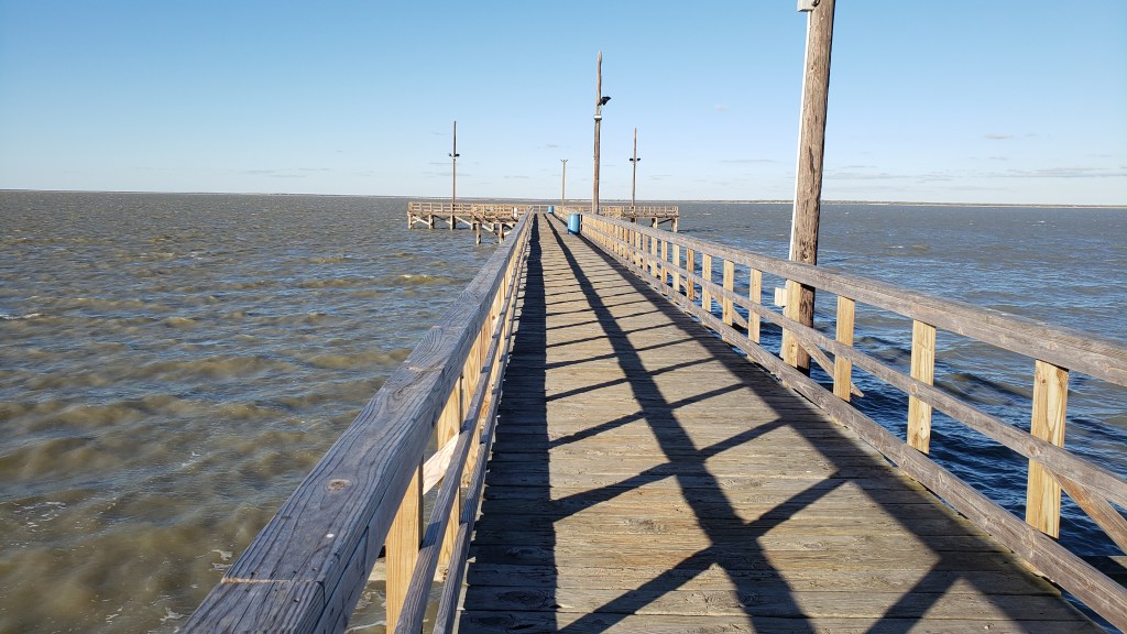
We also took advantage of the good (if chilly) weather and took Ruthie for a walk out the pier. Now, anyone who shares a home with a rescue dog probably has moments when they recognize their pup’s former life is showing up. For Ruthie, there seems to be something about being on a pier over salt water that gives her tremendous joy. She was found along Florida’s Gulf Coast, and our Riviera adventure must have felt like home to her. It was lovely to see her scamper and dance like a puppy!
If you’ve been following along on Facebook (SimonSusanVeness), you already know we had fun with “Caption This” for the following photo, and we had a good laugh about the fantastic captions people came up with.
The real story behind it is, when we arrived at the campground we were told the nearest grocery store was a 40-mile round-trip to Kingman (where we’d Wallydocked the night before we arrived in Donna ((Hi Karin and Darren! Hi Gary and Mary!))), or we could drive eight miles to the local Dollar General, which carried basic foodstuffs. We were happy with soup and a short drive, and I only took the photo to remind us that we actually shopped for comestibles at a Dollar store. Simon’s facial expression, though; priceless!
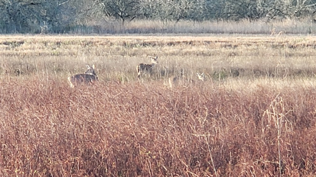
Anyway, our time in Riviera was short, so this blog will be short, too. We strolled the pier just outside the campground, did a little bit of writing, and enjoyed the fabulous view outside our front window, which included sightings of what we were told were Nilgai, the massive, pointy-horned animals that look like big-barreled deer but are really related to antelope.
They were brought to the area by King Ranch as game for the ranch’s hunting expeditions, but, happily, at least some of their descendants are living a free life. We were so thrilled by these unexpected sightings, and when our time in Riveria came to an end, we felt it had been something truly special.
We only had four days on South Padre Island, so we packed in as much as we could. We knew one of our outings would involve the work of someone we consider a five-star jerk, but we didn’t know there was another total git who had a big impact on what would become Texas, and on the country as a whole.
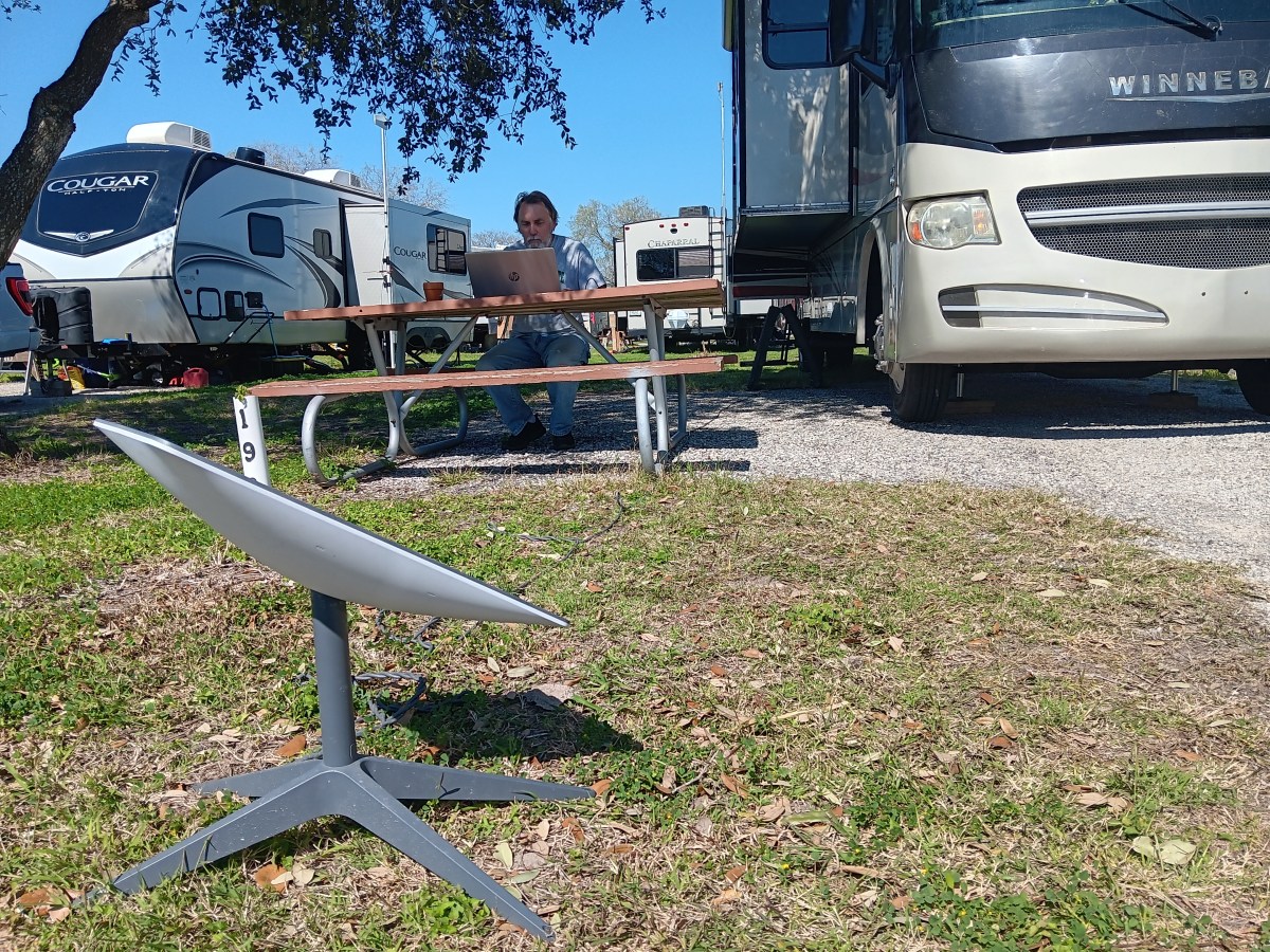
If you’ve been following our blog or follow us on Facebook, you know we’ve mentioned having Starlink as our internet system. For RVers, it’s the only fully reliable connection, and that’s something we are not able to take risks with; we have to have internet powerful enough to deal with large files being transferred, because we’re working as we’re traveling.
Starlink and Simon, both hard at work.
You might also know who owns Starlink. And if you do, you know Elon Musk is a controversial character, to say the very least. Perhaps he’s nice to dogs and babies, but we absolutely cannot stand his attitudes or behaviors. It was a huge moral dilemma when we had to decide how to deal with internet on the road.
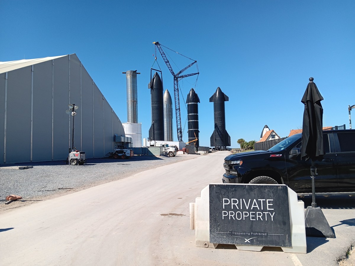
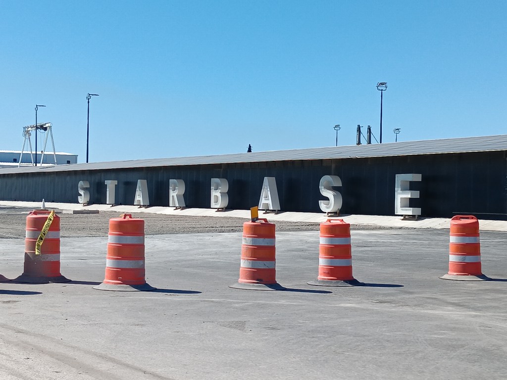
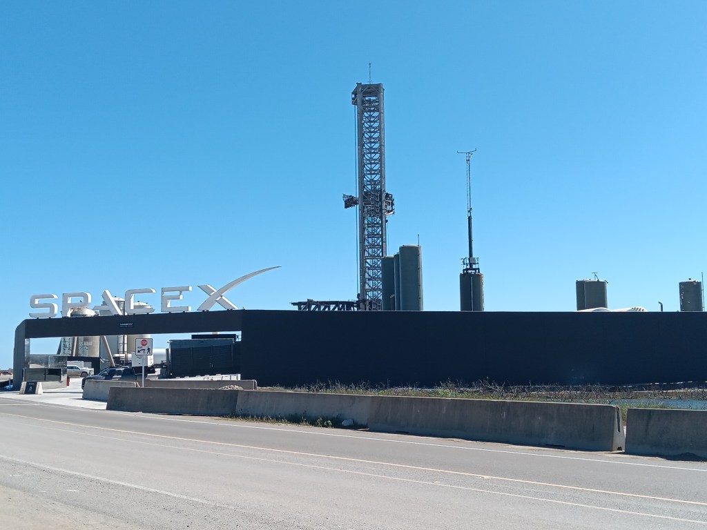
All of that is a long tirade leading up to us saying we made the trip to Starbase, about 40 miles from our campground (by car; maybe 5 if there wasn’t a gigantic ocean inlet in the way), out in the boonies of Boca Chica.
If Elon ever convinces more than one human being to implant a microchip in their brain, he might enclose his Starbase compound and carry out whatever plan he’s working on, but for now you can drive right up to it, and we did. We were impressed by what we saw, in the same way we were impressed by the Reichstag in Berlin – with a mix of admiration for the building and fear of its owner.
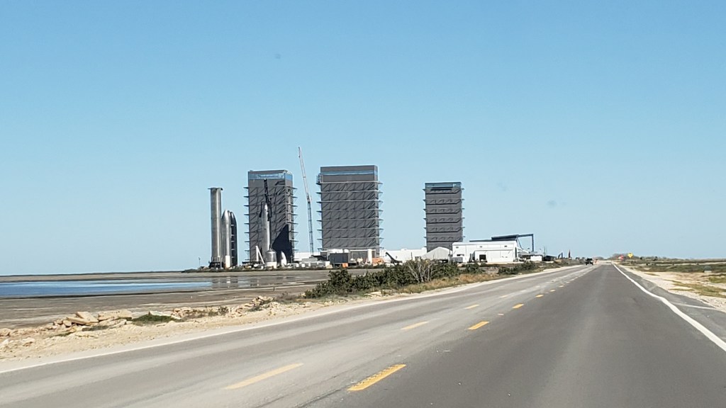
This long road goes straight to the beach, past Starbase and the Starlink compound.
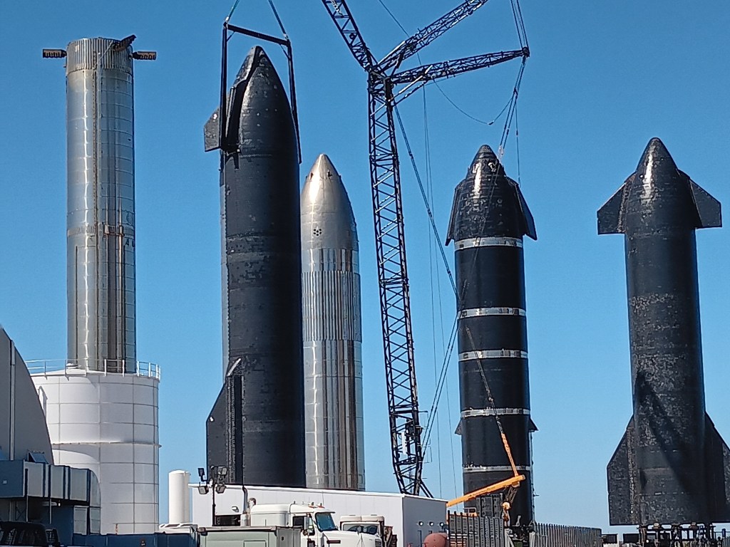
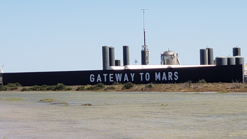
Starbase consists of an area that features rockets and big, mysterious buildings; an area where small, pre-fab homes are stored, presumably for future employees who want to live onsite; the Starlink center; and a launch pad. A massive amount of empty land and the sea surround the compound.
It’s possible these giant…um…rockets…reminded us of their creator in more ways than one.
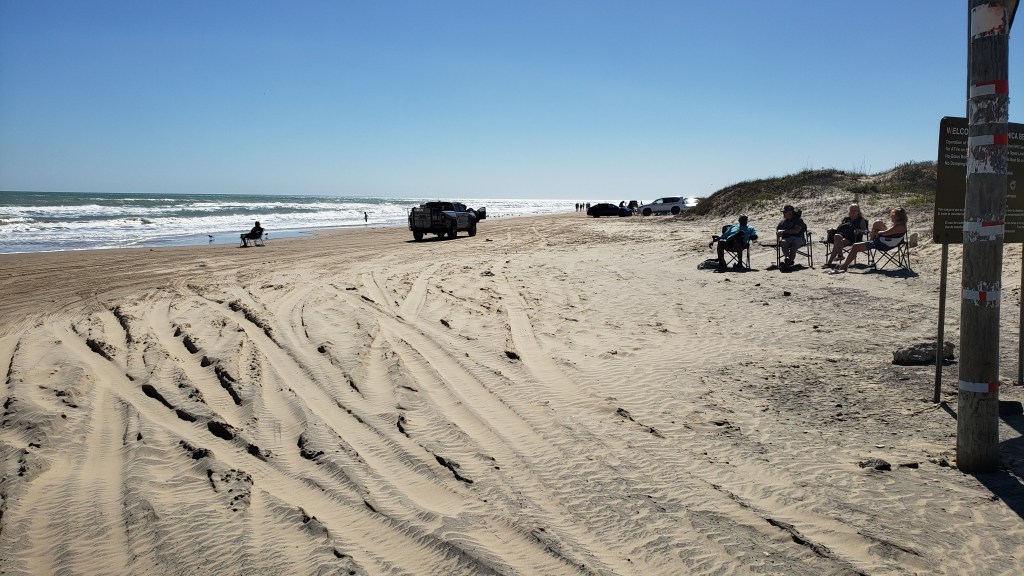
A few hundred feet past the Starlink base is Boca Chica Beach, which, for now, is the reason you can drive right past Elon’s private property. You can also drive on the beach, because of course you can; this is Texas, and it won’t be messed with by paltry safety rules. Admittedly, Florida has a driveable beach where accidents happen every year, but…well…Florida.
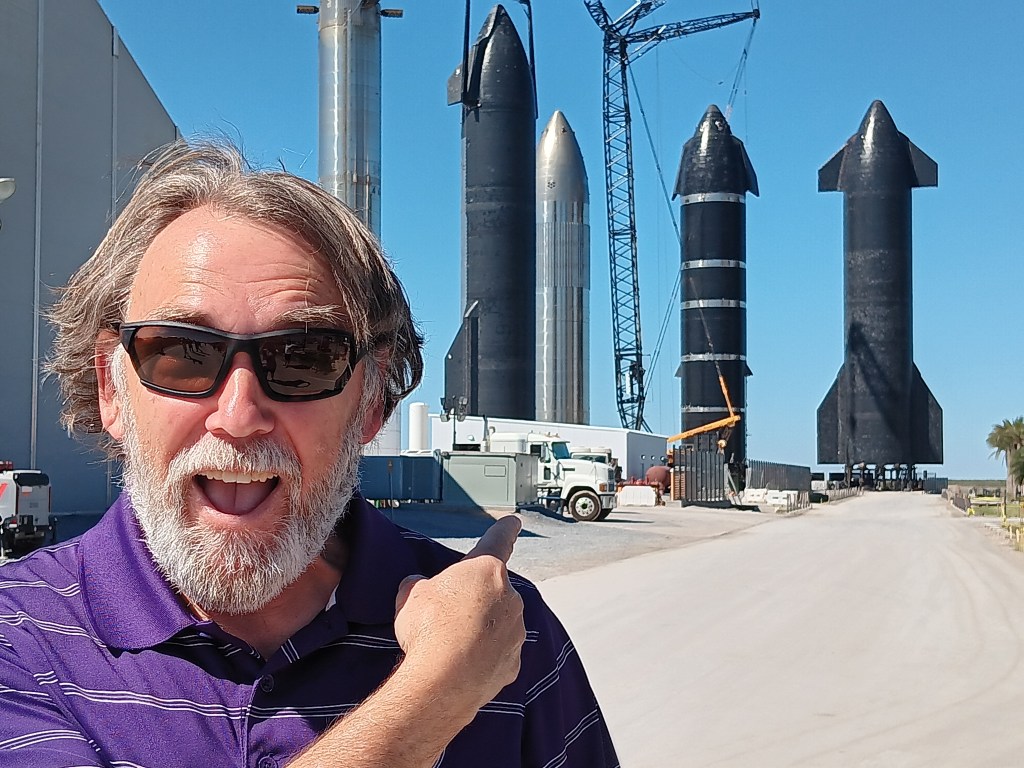
We were actually glad we saw Starbase. There’s no question the place – and the ambition – is impressive. But we’re never going to agree to having microchipped brains or treating people as expendable.
We didn’t expect to be able to get this close to the rockets.
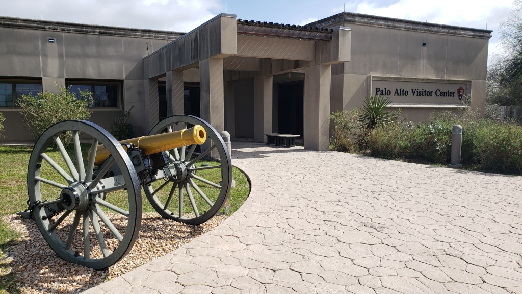
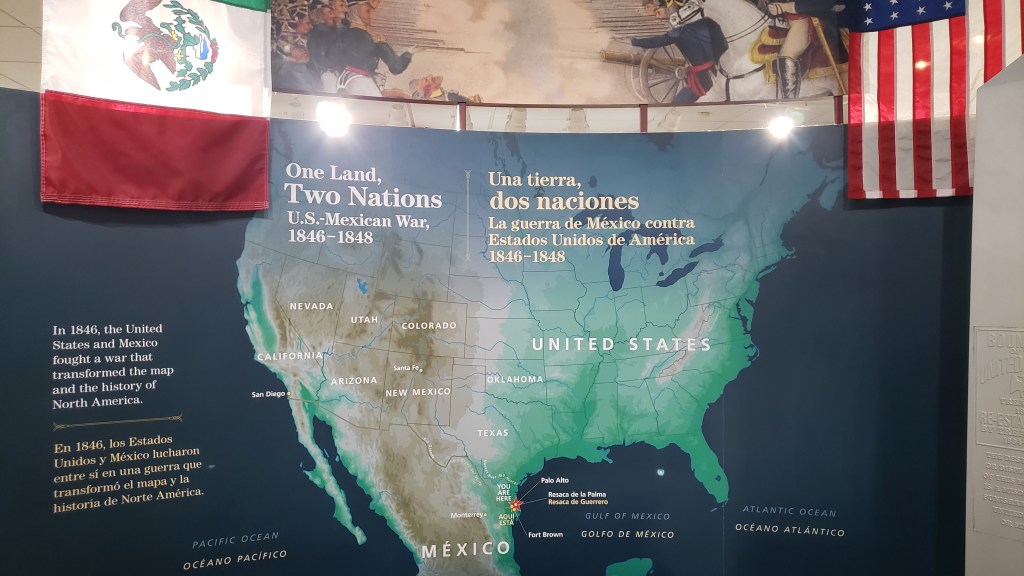
The next day we drove to Brownsville, in part because we were supposed to spend three days camping there and we honestly weren’t sure we wanted to, and in part because we wanted to see Palo Alto, where the first battle of the Mexican War took place when President Polk decided, in 1846, that part of Mexico was now his.
My “unimpressed” face.
I (Susan, obviously) am going to go even more preachy on you than usual, so skip this paragraph if you don’t want to hear it. I won’t be offended, and you’re probably making the right call. But the fact is, I cannot for the life of me understand most wars. Nazi Germany and other wars whose goal was a land grab with a massive side order of genocide is something completely different. That’s a war that needs fighting. Inciting war against people living peacefully just because you want what they have, that’s not how young lives should be lost. Getting along and sharing billions of acres is an option. If you have absolutely no self-control whatsoever and cannot live one more minute without taking someone else’s territory, set up a big speaker and…I dunno…maybe yodel at them without ceasing until they relent. It all ends in negotiation anyway, so skip the murder and get straight to the talking.
Okay, done. Mostly.
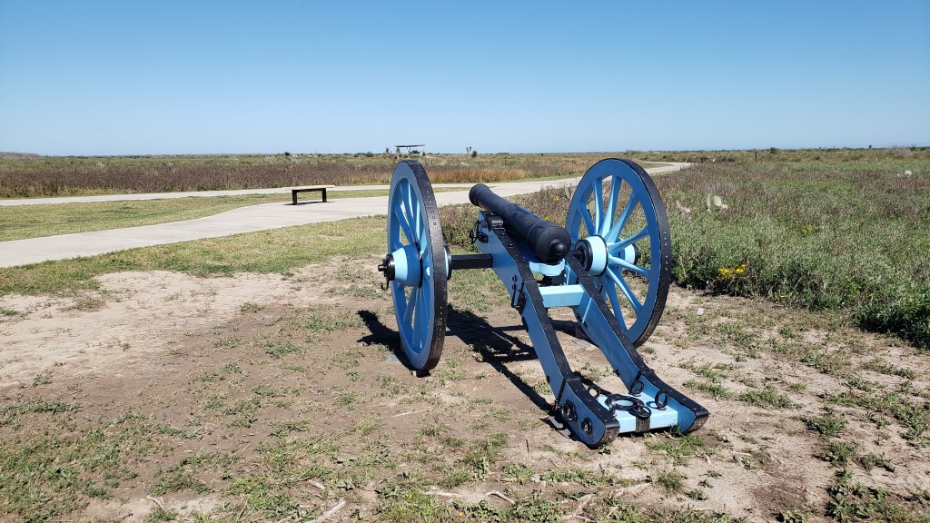
Palo Alto Battlefield National Historical Park features a battlefield marked with U.S. flags and Mexican flags, to show the front lines where the armies faced off as Mexico insisted its territory was its own and the U.S. said, “Nuh-uh. Ours now.” It also has a small interpretive center. We’re here to say it’s one of the best little museums we’ve seen on this trip, and that’s saying something.
Jeager, one of the park rangers, was the right man to answer our question: Didn’t this land come with the Louisiana Purchase? The short answer is, “No.” The long answer is, “Nooooooooooooo.” And the reason it’s “No” is because Mexico’s territory extended up into what is now southern Oregon, while the Brits still held what is now northern Oregon, Idaho, and Washington (state, not D.C.).
Part of what is now Texas was annexed as its own republic, but Polk wanted more. So why not lose a bunch of lives and make the Rio Grande the new U.S./Mexico border? What a jerk.
At the same time as the U.S. was deep in the two-year war for Mexican land, the British decided they weren’t interested in a long fight that would probably end in the loss of their territory below the 49th parallel, so they signed the Oregon Treaty and, at the end of the Mexican War, the continental U.S. enjoyed the boundaries we now know.
General Zachary Taylor, a non-political General who didn’t think the war was justified but ultimately led the successful campaign, became a national hero, and then the 12th President of the United States. Fascinating.
Simon was captivated by how well defined the Palo Alto battlefield was, and by the clarity of the interpretive center’s exhibits, which made it easy to see what had happened there. Susan was drawn in by the human side, and by the way researchers unearthed buttons torn from the soldiers’ uniforms during the violence of the battle, and used them to track the troops’ movements, even down to individual soldiers at times.
For us, the ripples and ramifications we’re encountering on this trip explain so much about what is wonderful and heroic and admirable and outrageously generous about this great country, and they also bring into stark focus the events that stand as lessons about the past and warnings for the future, and the decisions that do not represent our better selves.
Catching up on the first five months of our Ultimate American Road Trip, being serialized in The Independent
Keen readers of our road-trip blog will know we are also serializing the whole trip, month by month, in The Independent newspaper in the UK, and you might like to see the story so far, Months 1 through 5.
It all started back on May 14 with our departure from Orlando and then a month heading north as far as Minnesota…
After arriving in Montana, Part Three of our year-long epic saw us focus on Yellowstone National Park and Glacier National Park for two of the undoubted highlights of the trip…
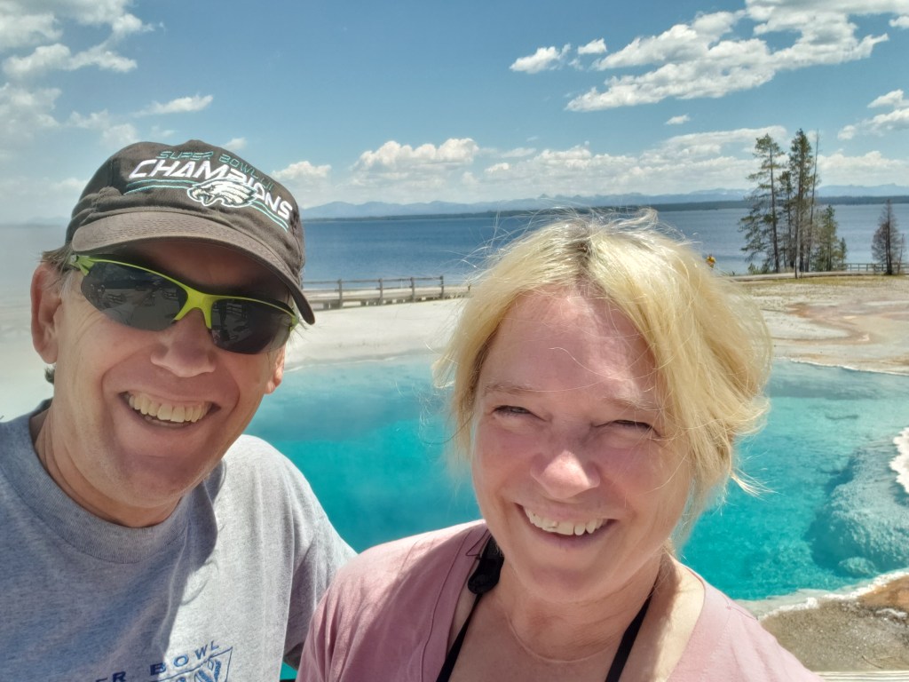
Taking time for the geothermal marvel of West Thumb Geyser Basin in Yellowstone
Some of our adventures begin with “It all started out so well.” This is one of them.
With three hours to kill before we could check in at our new campground in Green River, Wyoming (just 15 miles from the Rock Springs Walmart, whose parking lot we spent the night in after we drove two hours longer than we’d planned to), we popped into the Rock Springs Visitor Center to get some local knowledge about what to do in the area.
Along with the famous Flaming Gorge, we were told to drive out to the White Mountain Petroglyphs, visit the Killpecker Sand Dunes, and take the scenic Wild Horse Loop as great ways to spend time and soak up some natural wonders.
Each time we talk to a Visitor Center person we tell them three things: We have an elderly dog who can’t hike more than a mile round trip; we want to avoid high places with sharp drop-offs; and we’d like to skip any dirt roads, to avoid damage to our little Nippy.
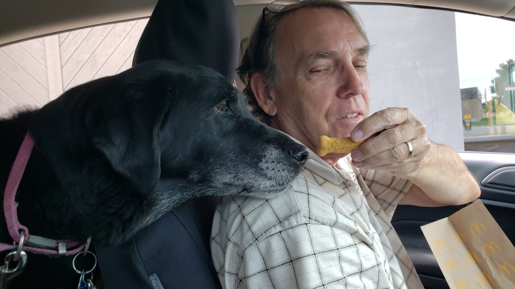
Our Ruthie. In Nippy. With Simon. And a treat.
In this instance, we pointed at Nippy and at our elderly dog, just outside the Visitor Center’s front window, to drive home the point, having been totally ignored by another Visitor Center representative who only told us about long hikes in his area, which were, apparently, his favorite thing to do.
No problem at all, we were assured. We should go to Flaming Gorge, of course (“Well, yes, there are sharp drop-offs, but they only last a few minutes,”), and we should also go out to the White Mountain Petroglyphs, which include what is now called Birthing Rock, a secluded spot where Native American women went to give birth. The highlight of the place was that you could see fingernail marks in the rock, where laboring women tried to cope with their pain.
Okay, odd, but count us in!
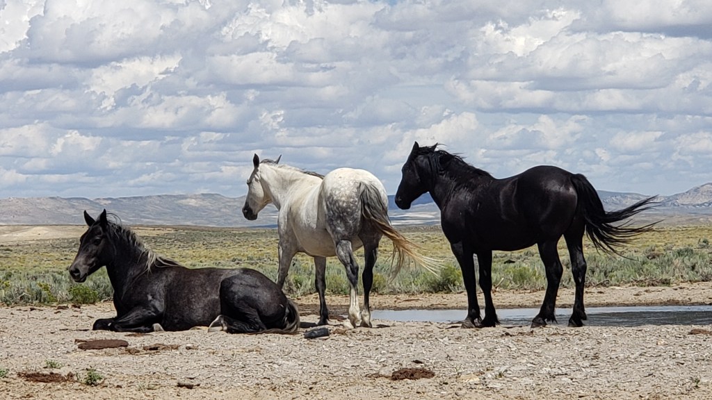
We should also drive the Wild Horse Loop in the evening, and see where thousands of wild horses live, our girl said. The loop would take an hour or two, depending on how often we’d stop. Then, on another day, the Killpecker Sand Dunes are “so much fun,” we should go there and do some dune surfing.
Perfect! We’d do the petroglyphs before checking in at the campground, the Wild Horse Loop the next day, then fit in the unfortunately-named sand dunes and Flaming Gorge, with a day in between to do some work. Plan made!
This isn’t us in Wyoming. It’s us at an Orlando City Soccer game, with our hair covered in beer from the people behind us. But this is how we feel when a plan comes together.
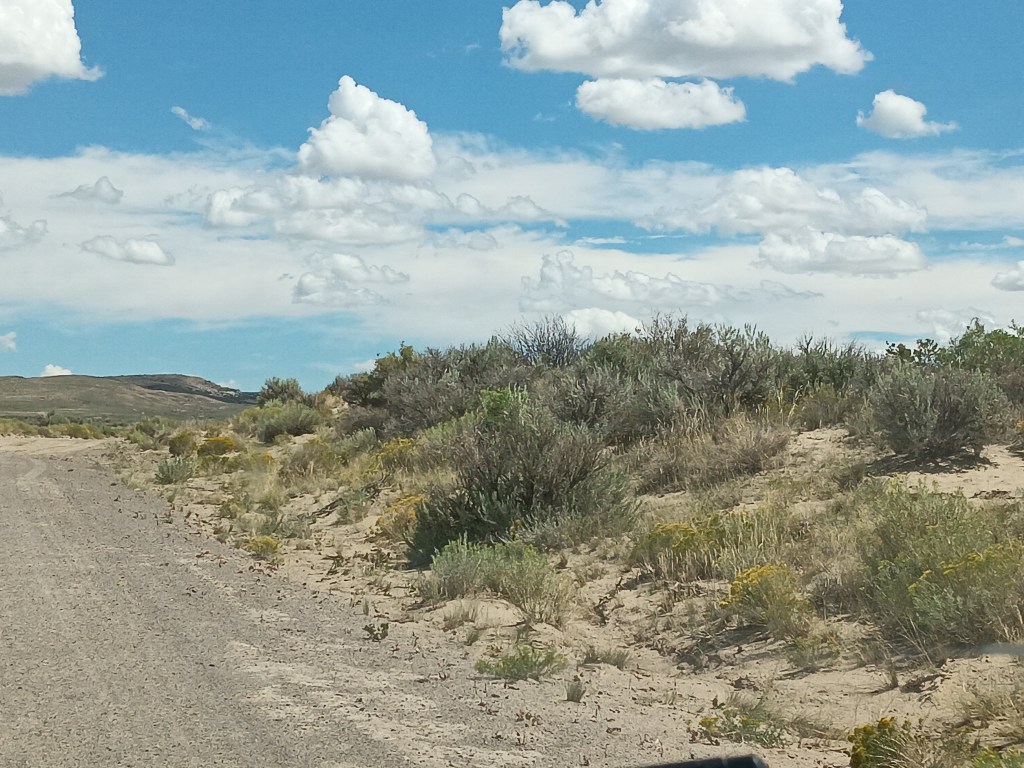
CR-191 heads north out of Rock Springs, and it’s a smooth, paved road into the “Red Desert.” We quickly left the city behind and were passing an increasingly dry, desolate landscape of low, gray-green sagebrush, tufted bunchgrass, some sort of spindly yellow flower, and sand, made even more godforsaken by the harsh summer sun hammering down on us and on the swirling dust-devils.
Foliage we are not familiar with
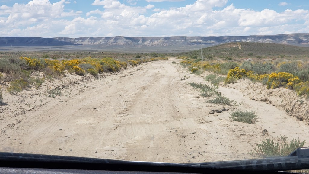
A sign pointed to the turnoff for the road leading to the petroglyphs, and we were mildly dismayed to discover it was, in fact, a gravel road. But it was an “improved gravel road,” meaning, it had recently been watered and graded. Okay. Not too bad. And it was only 17 miles to our destination.
Within minutes, we both agreed if that monstrosity was “improved” we’d hate to see what an unimproved gravel road was like. Unfortunately, after 10 rough, pitted miles, we found out. Some of the cracks created by winter’s run-off in the not-at-all-improved road were so deep we were reminded of the Guernsey Ruts, and extensive holes full of tire-sucking sand threatened to end our journey in the ditch, with a slipped Nippy.
One lone pronghorn watched our progress, and we were certain it was thinking, “What idiots.” Three wild horses turned to observe us briefly, surely wondering if we had a death wish. A small herd of cattle paused mid-chew to give us looks that indicated we were the kind of people who should return to the comforts of the city. Now.
After they looked upon us with scorn, they turned their backs and shunned us altogether.
But we pushed on.
We’d gone more than 17 miles, but there wasn’t a petroglyph or birthing-worthy rock in sight. We’d been traveling parallel to a cliffside for many, many miles, but it was never closer than a mile or so away. We could see quite a way down the “road,” in front of us, but there were no signs indicating our destination was imminent. Where the actual hell were we?
Several miles back, it had begun to dawn on us we had one individual-serving-size bottle of water, no extra gas, no cell phone service, and a dog with very little hind-quarter muscle mass, who could never make it back to the main road. Not only that, but we were totally alone. Some pissed-off rancher could come out and shoot us between the eyes, hide our bodies in the shrubbery, and never spend a moment in prison for the murder of two tourists who didn’t have the sense God gave a goat.
We absolutely are not going to compare ourselves to the brave pioneers who faced immense hardship while founding this great country, but really, sort of, we are.
If the car broke down or we got a flat we could probably make it back to the main road, but there was no way our Ruthie would survive the desert of the damned.
It was time to call it.
So near, yet so far, and with the Grim Reaper’s hot breath on our necks, we turned Nippy around and prayed we’d make it back to pavement.
You’re reading this, so it’s obvious we did. But only just.
It was windy, too.No one can be expected to bear this with grace.
We’ll spare you the next day, when we ventured out for the Killpecker Sand Dunes, which turned out to be much, much further down that same horror of a dirt road. We won’t mention our dismay when we switched gears and decided to do the Wild Horse Loop instead, which (say it with us) was also down an ass-end-of-nowhere road.
This isn’t the Wild Horse Loop. This is the super-easy, get-there-on-a-paved-road Horse Corral we found the next day, where the Bureau of Land Management rounds up wild horses and auctions them for adoption. Wild herds can double every 3-4 years, and, if left in those numbers, most would starve to death.
Later, when we read the multi-page booklet we were given by the Visitor Center, we discovered additional information we hadn’t been told. The fine print for these locations insisted:
“Grab your camera and binoculars, pack plenty of food and water, and make sure to travel in a fueled-up AWD (all wheel drive) vehicle and always let someone know where you will be going and when you will be back.”
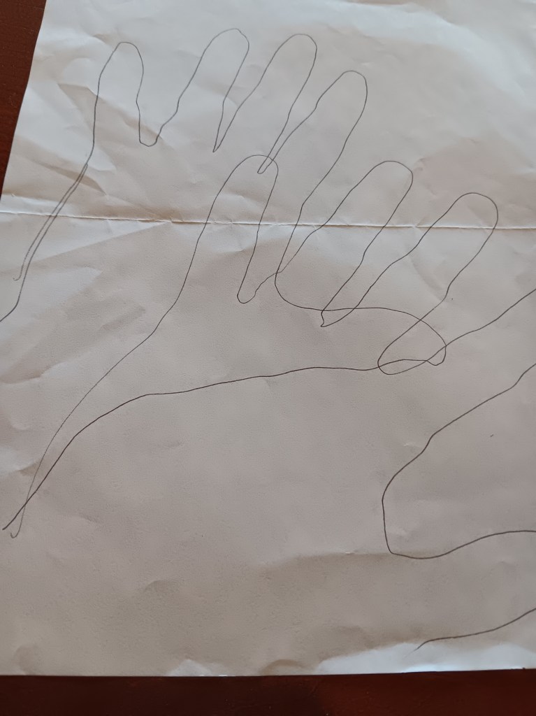
Oh, and by the way, it’s a steep, nearly two-mile round-trip hike to the petroglyphs from the road, through sand and shrub and probably loads and loads of infuriated rattlesnakes.
Since we didn’t get to see the petroglyphs, we made our own.
That is the kind of information you give to people who don’t own trucks or cowboy boots. The kind of people who carry designer purses or wear Ray Ban sunglasses. In short, us. We’re the people who need to be told.
Us in our natural state
But we won’t be the people who need to be told next time, because we learned the lesson and survived to tell the tale. So, in the end, it’s a story of triumph. Right?
While we are charting the almost day-by-day story of our grand year-long RV adventure here on the Veness Travel Media blog, we’re also writing a monthly considered piece for The Independent travel section, featuring the full lowdown on how to do this great American road trip. Part one is now online here: