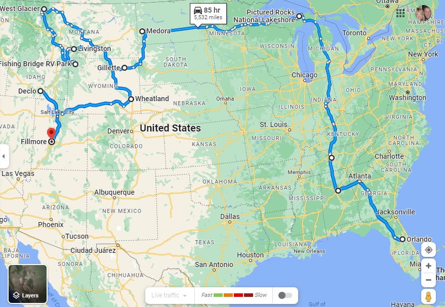
Highlighting our fourth month on the road and the route so far – all 5,929 miles of it
After three months of fairly hectic traveling, our four-month mark shows that we have come the shortest distance for any month of the grand RV trip to date, from Wheatland in Wyoming to Fillmore in Utah (via what looks like a strange detour to Declo in Idaho, but which was the best way to see some of Idaho without putting too many miles on our RV).
Our mileage for Month Four was therefore just 868 miles, compared to 1,318 last month, 1,239 in Month Two and a whirlwind 2,504 in the opening month.
The total distance in Indefatigable (or Fati for short) since we left Orlando is now 5,929 miles.
The slower pace has been deliberate, of course. We realized that we were trying to pack too much in to this crazy 10-wheeled adventure and we have purposely changed both our itinerary and our pace of travel to avoid the mental and physical breakdowns we experienced in the first two months.
The key has been to identify an area that allows us to explore in multiple directions for a week or so, and then use our tow car, Nippy, to do more of the exploration.
To that end, we have actually gone an additional 9,621 miles in Nippy in those four months, almost 3,000 of them in the past month alone. That total includes a spur-of-the-moment trip into Canada from Montana, our overnight excursion to Rocky Mountain State Park in Colorado and an extensive day trip to the Flaming Gorge in Utah, both from Wyoming.
Our total mileage for the trip so far is therefore a whopping 15,550, or 3,887.5 a month!
The next month could see us top that record for Nippy, too, as we plan on basing ourselves in southern Nevada for trips into Southern California. As ever, this is an – ahem – moveable feast, but you can be sure to read all about it here!
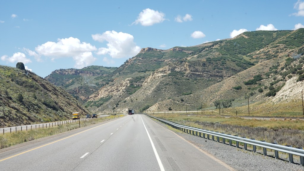
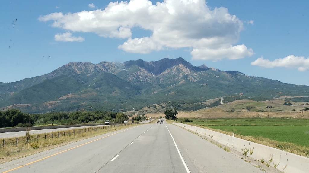
In the last six weeks we have dipped in and out of the Rocky Mountains in each of Montana, Wyoming, and Colorado, but we hadn’t driven through them. Until reaching Utah.
Driving west along I-80, what was initially a dark smudge on the horizon rapidly transformed into a formidable vertical barrier as the Uinta Range loomed into imposing view.
From the relatively flat southwest plain of Wyoming, the Rockies suddenly provide a formidable barrier to the west
The highest peaks of the Uintas reach 13,534ft above sea level, which is only 42nd in terms of the overall peaks in the Rockies, but Colorado has fully 39 of those, and Wyoming two, so Utah actually comes in third of all the states that feature the Rockies. More significantly, it is ninth when it comes to the prominence, or highest vertical rise, at 6,358ft.
Looking up at that 6,000-plus feet of mountain ahead of us was a sobering prospect. We were supposed to drive through there?
Thankfully, the highway into Utah was simpler than it looked and our Fati coped admirably with the winding mountain pass route from Wahsatch to Emory, where we branched northwest on the lower elevation of I-84. Still, surrounded by the massive bulk of peaks reaching almost 10,000 feet put our WPMs (Wows Per Minute) back into high gear.
This is the bulk of Thurston Peak, which reaches 9,705 feet above sea level, with a vertical rise of almost 5,000 feet. Small, it isn’t
Amazingly, I-84 dropped our overall elevation to just below 5,000 feet, meaning Thurston Peak on our immediate left towered almost 5,000 feet above us. It made us feel incredibly small.
We were heading for Layton, Utah, just north of Salt Lake City, where the spectacular Valley View RV Resort awaited us. However, it had to wait a bit longer than expected as our GPS systems (two of them) decided to play silly buggers with us, not for the first time.
Our Garmin wanted us to turn off the highway onto a road that did not exist, while our Samsung phone’s system couldn’t locate us at all. A quick call to the RV resort revealed that we needed to turn off at Antelope Drive, but we then found ourselves in a quiet residential area with our Garmin telling us the road had a six-ton limit. At fully 11 tons, Fati was potentially just a teeny bit over that limit, so we pulled over.
Someone who’s name begins with Simon tends not to handle GPS malfunctions terribly well. It usually includes lots of words beginning with F in a tirade of angry invective. For once, this didn’t reach DEFCON 1 thanks to Susan volunteering to unhitch Nippy and scope out the road ahead, which appeared to drop off the edge of a cliff.
Sure enough, she found the way in, which didn’t involve any cliff-hanging, and, communicating by phone, guided the RV safely to its intended port.
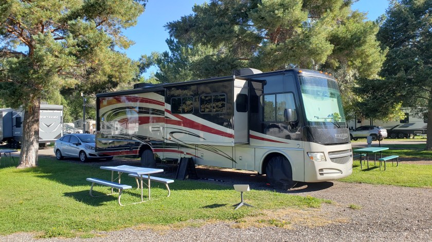
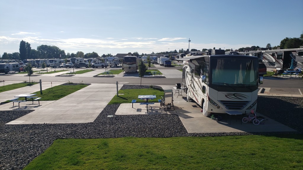
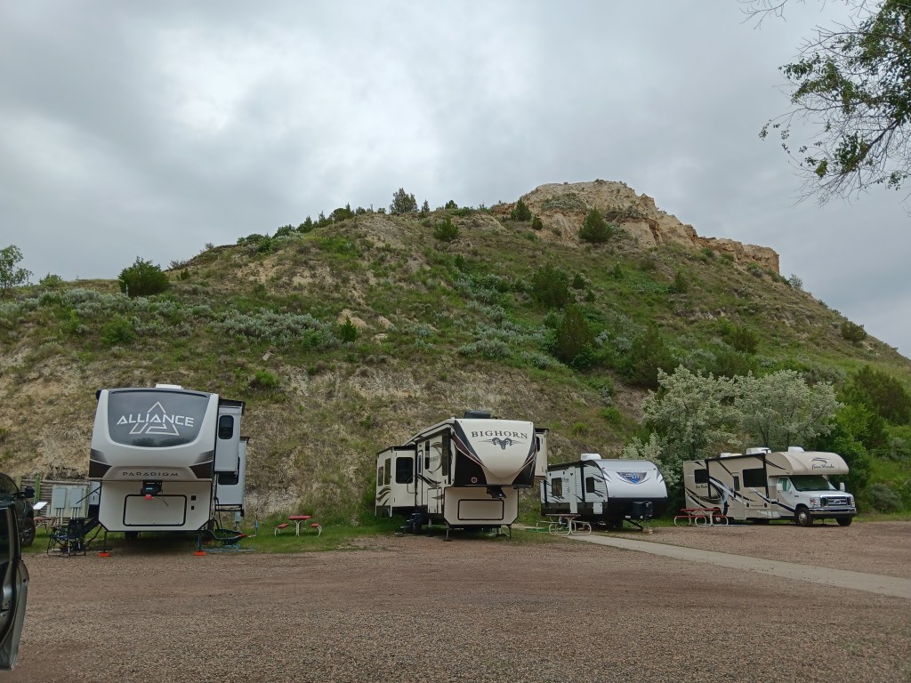
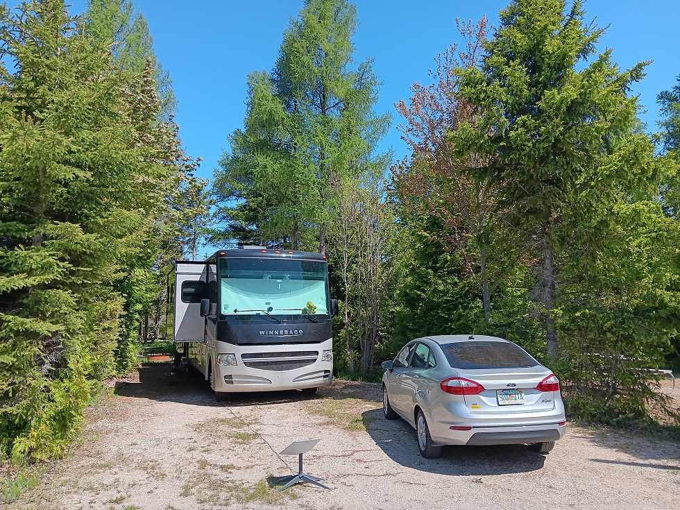
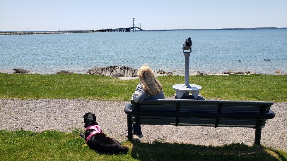
Valley View RV campground is a genuine high-caliber resort, with lots of facilities and a wonderfully modern, clean look
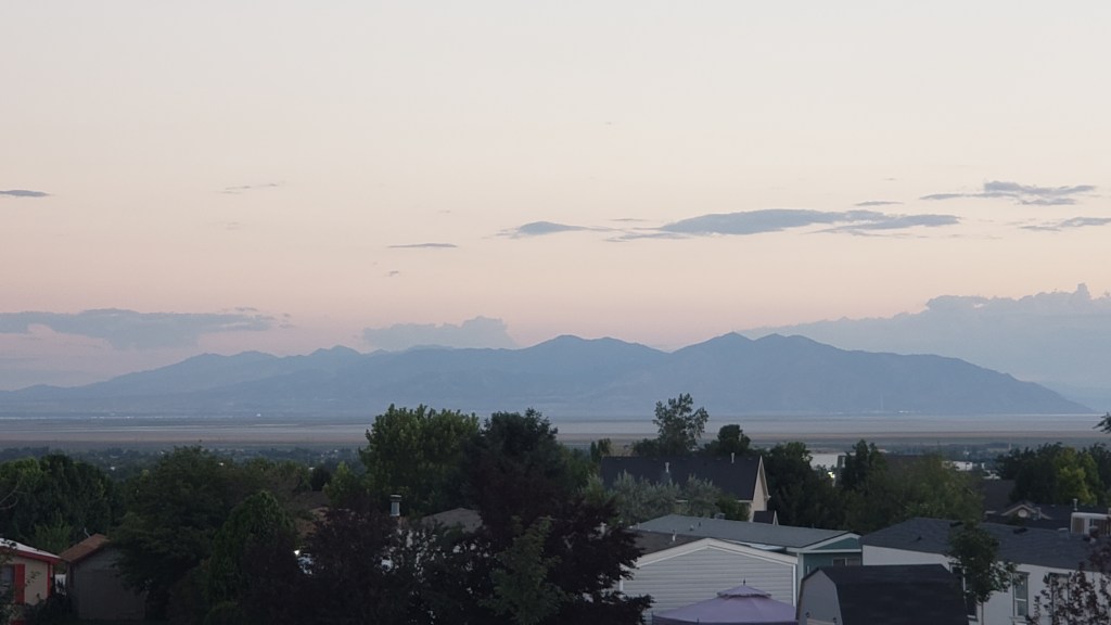
Our new home for the next 8 days is a slick, modern and feature-packed RV resort, with 121 berths for RVs of all types, plus facilities like a swimming pool, clubhouse with fitness center, pickleball courts, and a dog park. Food trucks visit periodically to provide a handy dinner option while the clubhouse also offers complimentary coffee, just like a hotel (much to Simon’s liking). To one side, we have a view of the Uintas; to another it is the Great Salt Lake and Antelope Island.
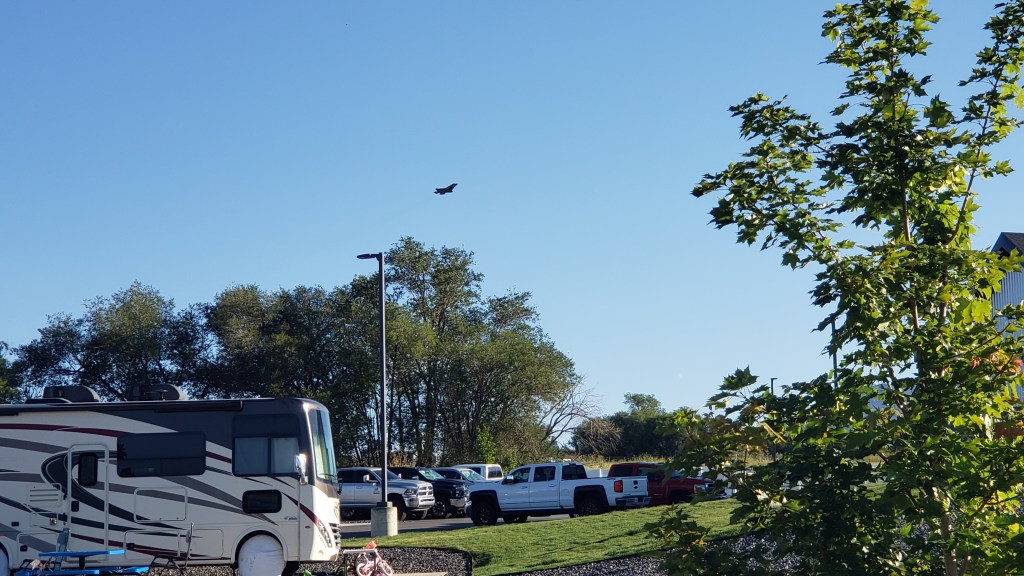
Oh, and we are half a mile from Hill Air Force Base. Who fly F-18s. Every weekday. From 8 a.m. So, there’s that….
Our 8 a.m. alarm call, courtesy of the US Air Force
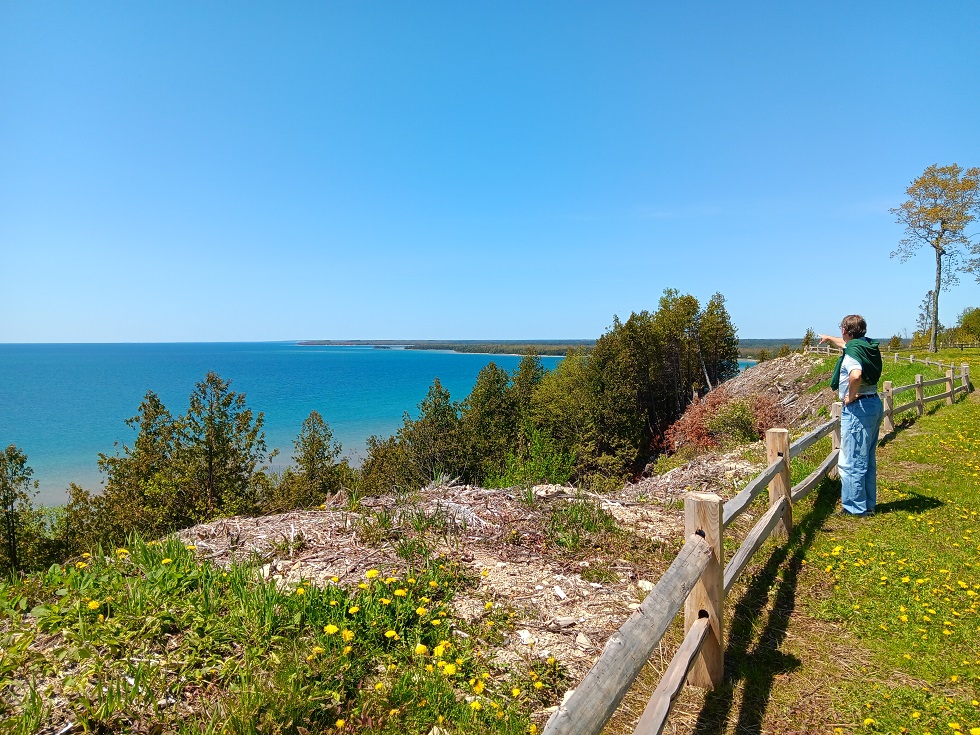
Next, we’re off to see Salt Lake City, more of the Uintas, and Antelope Island. We have a truly excellent base to explore from and the views of the mountains are truly spectacular. This is yet another scenic wonder in what has been a string of them since we hit Upper Michigan back in June, and we are eager for more.
Antelope Island lies to our west, full of intrigue and scenic promise. This is another epic location…and we’ll take you there soon!
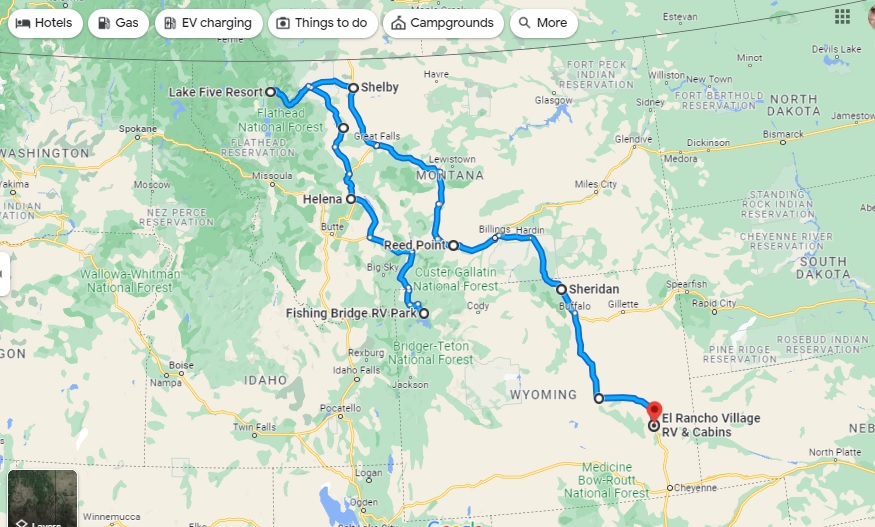
On August 14 we celebrated the third month of our grand ‘A Year On The Road’ RV adventure, with a chance to tot up our mileage and chart the latest course of the scenic route we are forging across the US.
Having ended Month Two at Fishing Bridge RV Park in the heart of Yellowstone National Park, we have basically undergone a bit of an about-face on our original planned route and gone “freelance” for a few weeks. Our third month covered a total of 1,318 miles, giving us a whopping 5,061 for the trip to date.
Month Three – 1,318 miles, starting in Yellowstone and reaching El Rancho Village RV & Cabins in Wheatland, Wyoming, via Glacier National Park in Northwest Montana
As you’ll see from the map, we continued north from Yellowstone to Glacier National Park, but then broke away from the proposed westward trek to Washington and Oregon via a bit of Idaho in favor of seeing more of Montana and Wyoming, two states which we have found utterly enchanting.
We have tried not to cover any of the previous route, apart from a few miles along I-90 in Montana, and have dived much deeper into Wyoming in particular, including side trips to Cheyenne and Laramie – very much the heart of the Old West – in Nippy to avoid putting too many miles on Fati. From here, we’re looking to turn West again, with each of Colorado, Idaho and Utah on our radar – and more of the magnificent Rocky Mountains.
There isn’t really any way you can follow-up the magnificence of Yellowstone, but we were hopeful Glacier National Park would be the next best thing as we headed north back into Montana again.
We were already aware the only entry to the park between 6am and 3pm was by the National Parks Service’s reservation system, which had defeated us for months, but we had a back-up plan – Simon would try for a Red Bus tour on the fabled Going-to-the-Sun Road and Susan wouldn’t. After her nerve-shredding experience in the passenger seat in Nippy going over the 8,878ft Dunraven Pass in Yellowstone, she was more than happy to sit out anything that offered the prospect of mountain-edge driving.
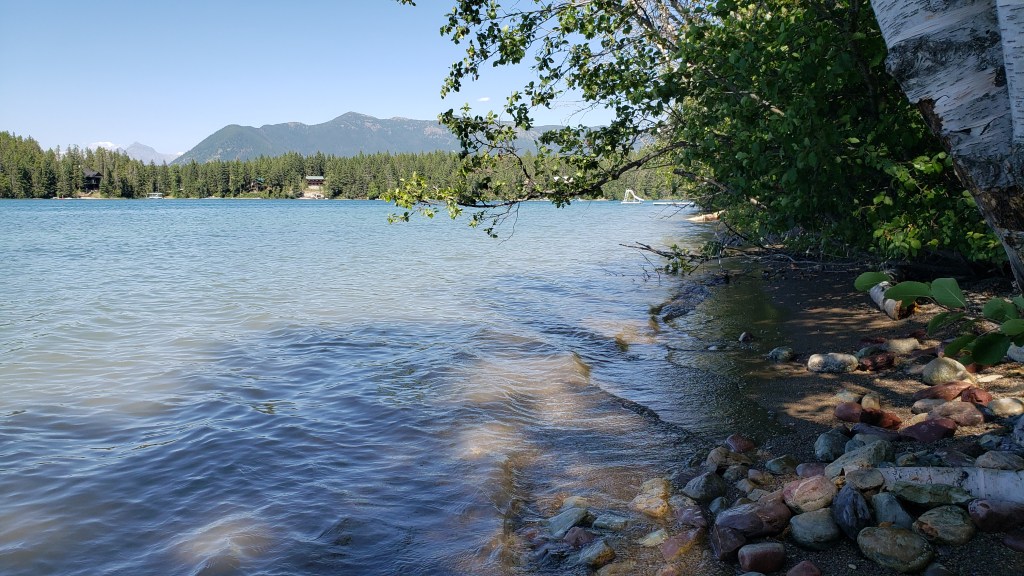
We had snagged a four-night reservation at the Lake Five RV Resort well in advance, knowing how popular Glacier NP is these days, so we were right on the doorstep of the park’s west entrance (and there are only really two ways to see Glacier, from the east or west roads).
The view from the back of our spot at Lake Five RV Resort, with Glacier NP in the distance
The park was beautifully situated and we were able to get set up and then visit Glacier NP’s visitor center, taking the (short) scenic drive along Camas Road, and spending time in the delightful Apgar Visitor Center and Village, which is the heart of the park’s western side.
Just a week out from our arrival, we were able to snag a seat for Simon on the Xanterra Red Bus Tour from Apgar Visitor Center to the Logan Pass – the passage from west to east across the stunning Lewis range of the Rocky Mountains – but we were going to have to wing it for the rest of our four-day stay.
What we hadn’t counted on was the fact that there really isn’t a lot to do and see outside the West entrance to the park. There are no other major scenic drives beyond the park’s boundaries – other than the hilly, winding drive in from the town of Browning, which showcases the southern edge of the Lewis range and which we had already seen in reaching West Glacier.
One of the, ahem, highlights of the West Glacier area
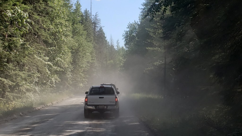
There was also major reconstruction under way of the 10-mile stretch of road along Lake McDonald from the Visitor Center to the lower end of Going-to-the-Sun Road. Not only had the usual paved road been ripped up for replacement, leaving a crude, pitted dirt track in its place, the construction crew also seemed to have abandoned any attempt to keep down the clouds of dust in the afternoon, making it 10 miles of driving torture, especially with a low-slung car like Nippy.
To put it mildly, this was a shocking state of affairs for any park, let alone one of the NPS showcase parks, and to say it was inhibiting was a major understatement. We abandoned the road at the Lake McDonald Lodge, and limped back to the Visitor Center.
The rutted dust bowl of the “road” alongside Lake McDonald with its ongoing reconstruction
This left Simon’s trip on Going-to-the-Sun Road as our lone highlight of the visit. It turned out to be a pretty memorable highlight.
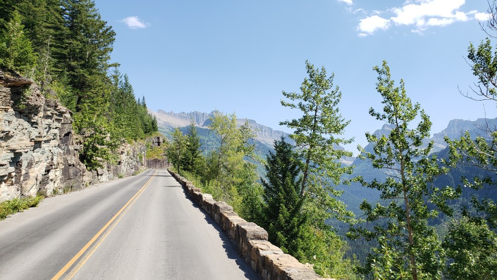
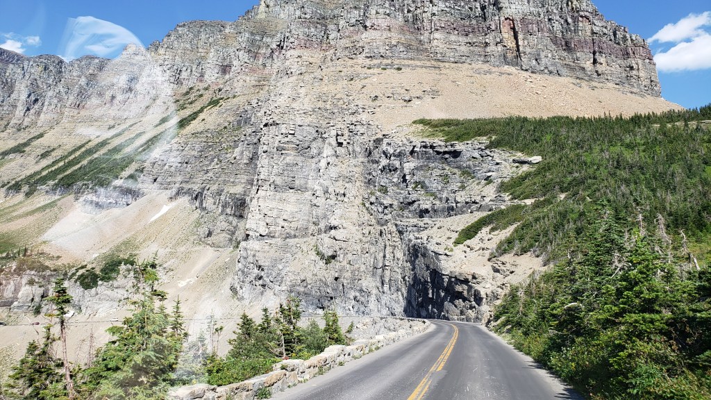
Now, GTTS Road is aptly named, albeit it isn’t quite what you think. It is actually named for the 9,647ft Going-to-the-Sun Mountain, the sacred peak of the Blackfeet Indians, and the rather tortuous translation of their word for it is actually “The-Face-of-Sour-Spirit-Who-Went-Back-to-The-Sun-After-His-Work-Was-Done Mountain.” More aptly, for first-time visitors to the road, it merely feels like you are going to the sun, such is the precarious nature of the precipitous passage up to the 6,646ft mountain pass.
The road dates back to 1932, when it was opened after an 11-year construction process that cost the lives of three workers (how it wasn’t any more is one of the minor miracles of the project). It wasn’t fully paved until 1956, and is one of the hardest routes in America to reopen after each winter, such is the nature of its extreme inaccessibility. Put simply, this road is scratched into the side of a near-vertical mountain wall with all the seeming permanence of an Etch-a-Sketch. How the engineers conceived it, let alone built it, absolutely boggles the mind.
A viable road or an unfeasible creation of an over-worked engineering mind? You decide…
But there it is – the only way to cross Glacier NP, on a winding, sketchy, winter-worn stretch of “road” that wouldn’t earn that designation in any other place on Earth.
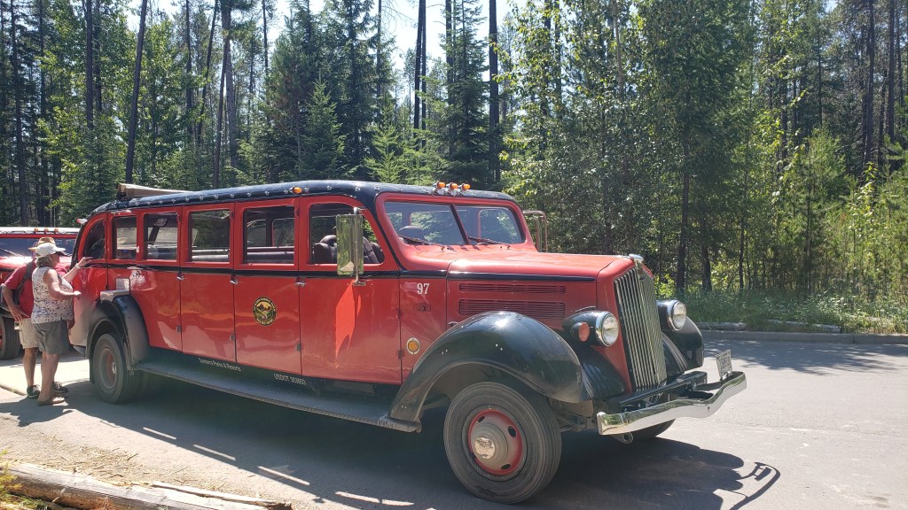
Oh, and the iconic Red Bus vehicles – nicknamed the Rubies of the Rockies – that take you there (and back), are almost 90 years old. Really. OK, so they have been modified with modern engines, transmissions, and braking systems, but the basic vehicle was introduced in 1935 and each has chalked up around 200,000 miles since then.
The maximum length for all private vehicles is 21ft. The Red Buses are 25ft long. Yup. Go figure.
So, the basic equation is:
Rickety Road + Outrageous Drop + 90-Year-Old Over-Long Vehicle – New Engine = A Hair-Raising Experience for All Concerned (especially Susan waiting back at the Visitor Center, praying for my safe return).
(It should be added, however, that each vehicle has a 100 percent safety record throughout all those years and miles, and each driver is a specialist)
One of the original Red Bus fleet, which made its debut in 1935. Glacier National Park had 35 of the original 500 that were made for the NPS, and 33 are still in service
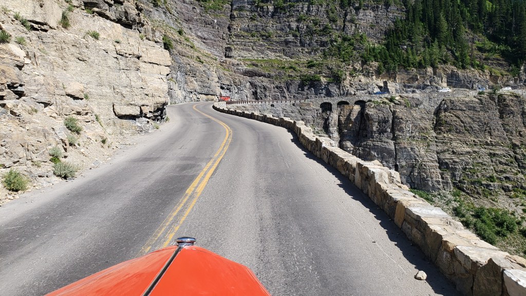
The journey from the Visitor Center to Logan Pass, and back, takes almost 3.5 hours. It reaches a top speed of a daring 45mph, and just 20mph on the seriously scary bits. Two red buses can pass each other on that cliff-edge monstrosity. With about six inches to spare. So, absolutely no worries for the passengers, especially Simon in the front seat next to the driver, with the grandstand view 3,300ft straight down the mountainside.
The first part of the journey is pretty gentle, through impressive cedar forest, alongside Avalanche Creek (nothing inhibiting in that name, either) and past several suitably scenic picnic areas. Then it reaches The Loop.
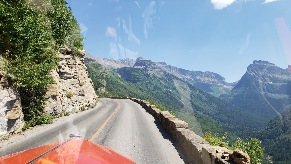
The full magnificence of Going To The Sun Road
This is the most critical feature of the entire Road, the only serious hairpin bend on the whole, implausible 50-mile route. It is the engineering pivot that allows the roadway to cling to its precipitous perch and provide access all the way to Logan Pass, which adds a resounding wide alpine plateau for a sizeable visitor center of its own, plus a variety of hiking trails which vary from gentle to “You’ve Got To Be Joking” (the latter for the Highline Trail, which is barely 4ft wide in parts and equally precarious, especially when you hear that the wildlife has right of way, and can include both bighorn sheep and black bears. Any takers…?).
That’s the Highline Trail, in that frail line30 yards above the road
But – and this is a seriously substantial adverb – none of that even begins to describe the utter, stonking majesty of this drive. The solidity of the buses, the assurance of the drivers, and the ability Simon has to be blissfully ignorant about the likely terminal nature of any vehicular mishaps make this a journey of total superlatives.
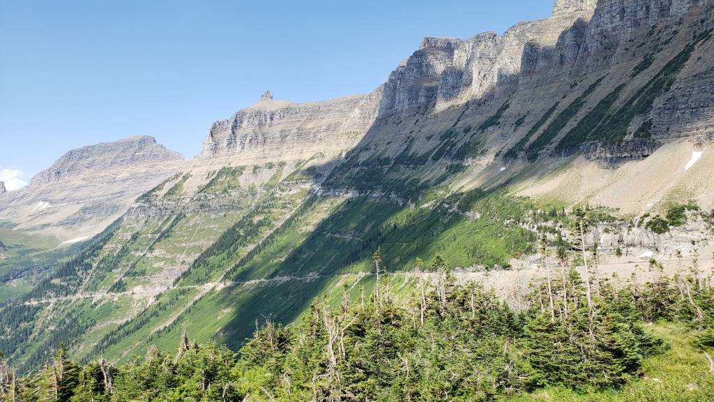
On each side, the mountain ranges seemingly reach up to levels normally reserved for stratospheric aircraft, including the heart-stopping Garden Wall that towers to 9,553ft and is the main conduit for GTTS Road, as well as the demarcation line for the Continental Divide. That’s right, this is where the North American continent is basically split into East and West, albeit that is primarily a geological term and not a regional designation, seeing as Montana is about as Wild West as it gets.
The stunning extent of the Garden Wall – and the Going-to-the-Sun Road crawling along it
The mountains are studded with breathtaking waterfalls at regular intervals, along with various overlooks to allow drivers to get out and confirm that, yes, that really IS a bugger of a long way down, and “Don’t look now Ethel, but the car brakes are over-heating.”
Seriously, driving these buses up there is something approaching an art form, and sometimes you’re not sure whether to gape at the mountain scenery or the driver’s nonchalant style as they narrate the full story of the Road and everything connected with it.
And that’s it. We comfortably made it there and back, our open-top vehicle providing the best possible viewpoint of the entire Glacier NP, along with regular stops when, on the command “Prairie Dogs Up!,” our 18 passengers all stood up through the open lattice-work of the bus to take photos and marvel at the increasingly insane drop on one side.
“Prairie dogs up!”
It was an experience of the utmost refinement and beauty, a combination of Evel Knievel and Bob Ross, with a dash of Errol Flynn thrown in for good measure. It called for extreme belief in the person behind the wheel, and a cavalier disregard for normal road safety. And it was totally, utterly, mind-blowingly brilliant.
While we are charting the almost day-by-day story of our grand year-long RV adventure here on the Veness Travel Media blog, we’re also writing a monthly considered piece for The Independent travel section, featuring the full lowdown on how to do this great American road trip. Part one is now online here:
Want to see how far we’ve come in a month? This is the 31-day update of route – and distance – so far.
We now have a full month of our scheduled 12 officially in the books, and we have so far traveled a whopping 2,504 miles from home. We have crossed nine states, two time zones, and stayed in 14 different campgrounds and Harvest Host venues.
We have slowed down since our initial 7-day warp-speed approach (1,289 miles in that period; 1,215 in the 3 weeks since), and are paying more attention to savoring the sights as we travel. And we’re seeing some pretty stunning sights.
The route so far – 2,504 miles in 31 days, taking us from tropical Florida to the wide open spaces, and amazing scenery, of the Midwest and Northern Plains.
We are now in uncharted territory – for us – and ready for more adventures in the Dakotas, Montana and Wyoming. This is a hugely exciting part of the journey, with the areas rightly renowned for the wide open spaces of this huge country.
Having just arrived on the edge of The Badlands of North Dakota, the landscape is truly outlandish and full of intrigue. We’re here for the best part of a week, and will have a LOT more to report in due course.
The backdrop to our current spot in Medora, North Dakota, the Red Trail Campground, surrounded by the rugged scenery of The Badlands, and the gateway to Theodore Roosevelt National Park
For those keen on geography and geology, the term “Badlands” is a specific geologic feature of sedimentary rock erosion, and it creates some captivating and bizarre landscapes. We hope to see a lot of it in the next few days, as well as wildlife that should include bison, pronghorn antelope, bighorn sheep, deer, feral horses, and – Simon’s favorite – the prairie dog.
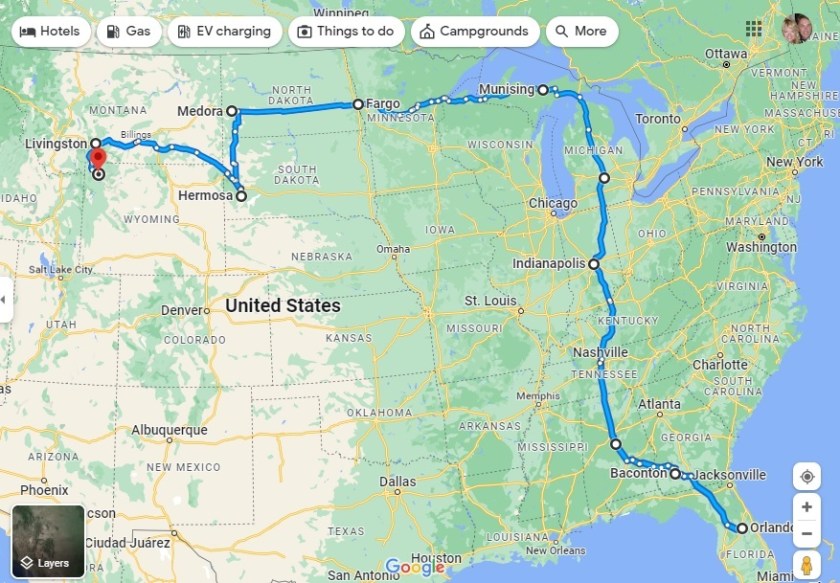
After our indecently hasty first-week charge through the center of the USA, our pace has (deliberately) slowed in weeks two and three. Instead of 1,289 miles in 7 days, we covered “just” 691 in 14 days; i.e. half the distance in twice the time. That’s still probably more than most dedicated RVers will travel in that time, but a better realization of what RV travel is all about.
We gave ourselves a day in Gaylord, three days in northern Michigan at Mackinaw City, seven in the Upper Peninsula in Munising for the superb Pictured Rocks National Lakeshore, one day in Crystal Falls, and then another seven as we crossed over into Minnesota at Duluth and pitched camp in Saginaw, just to the north-west.
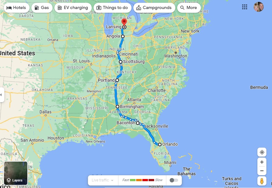
The map of our route from Lansing, Michigan, to Saginaw, Minnesota, 14 days of excellent RV travel
That’s where we are right now, prior to our next major move – west through Minnesota and into the “undiscovered country” of North Dakota, Fargo, Bismarck and all. This will be entirely new territory for both of us, and we can’t wait to discover new adventures…
PS: The map shows it would take 11hr 33min (by car, non-stop) to cover the route that took us 2 weeks!
The first week of our grand “Year On The Road” adventure – and a LOT of miles!
Considering how far we’ve come in the initial phase of our great American road trip by RV, we thought it was worth highlighting our route, and how much ground we covered.
In reality, the first week of our ‘Year On The Road’ was effectively the “shakedown cruise,” the testing ground for our ability to actually drive this remarkable vehicle (that’s Indefatigable, or Fati for short, plus our tow vehicle or ‘toad’, Nippy).
Our initial route, through Georgia, Alabama, Tennessee, Kentucky and Indiana, before arriving in Michigan
In all we covered 1,289 miles through the first seven days, traveling from our home base in Orlando to Lansing, Michigan. That’s a LOT of miles for an RV in such a short time, and we had some challenges along the way but, in general terms, Fati handled it with aplomb.
Our first target was to reach Michigan, to set up the second phase of our route, which will take us into the Northwest of the country, via Minnesota and the Dakotas. Realistically, we achieved our main target and have got the hang of the driving and setting up camp at each location.
Normally, regular RVers wouldn’t travel and set up camp every day, but we wanted to see if we could manage a tough schedule before moving on to Phase 2. We certainly have a few issues to deal with (including the lack of hot water!), and we’ve had to consult various RV authorities, including the excellent MyRVResource.com, but we’re happy that we’ve grasped some of the essential principles of RV travel, and we’re ready for more adventures in the weeks and months ahead!
Michigan is cold. It’s cold for about five months of the year, it’s cold at night and in the morning for longer than that, and it gets cold snaps in May, like it has for the last three days. Michigan is also one of the most beautiful states you’ll ever visit.
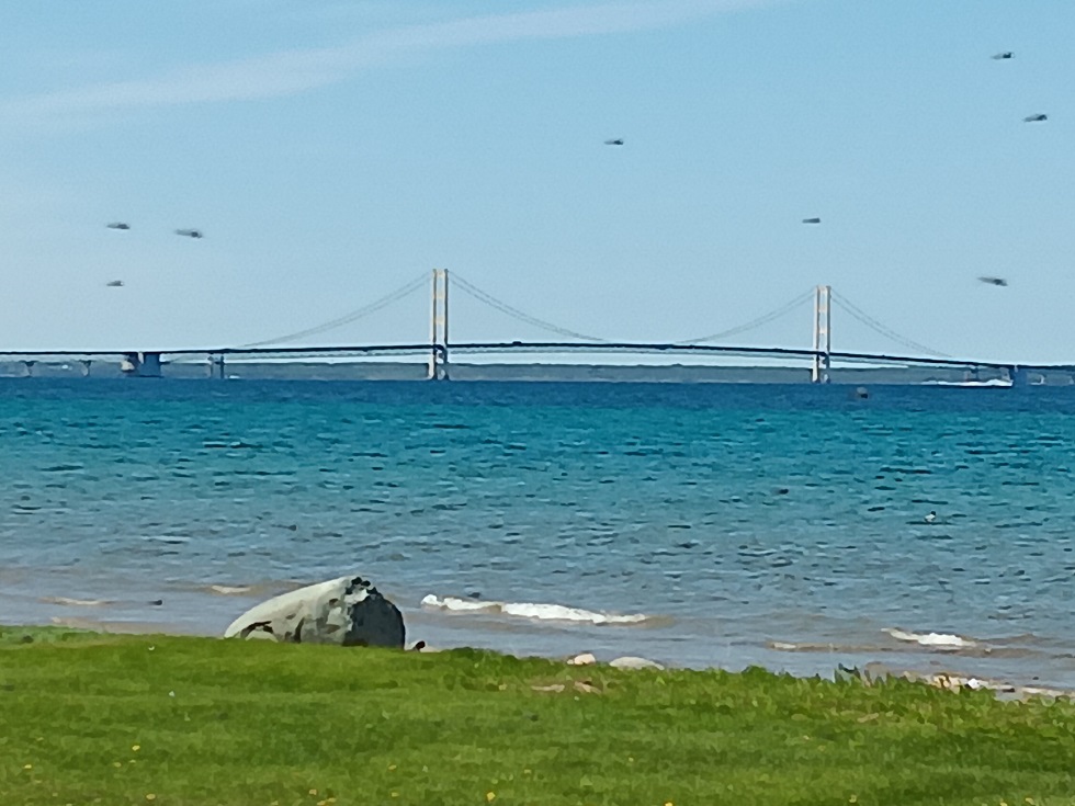
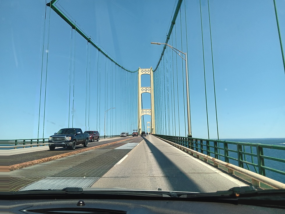
Mackinaw Bridge, the “Mighty Mac”
“Pure Michigan” is one of the slogans for this nature-lover’s paradise, where four distinct seasons allow for everything from river tubing – affectionately called “rump bumping” – to skiing, snow shoeing, ice fishing, and snowmobiling. The state is crisscrossed by hiking trails through landscapes as varied as pine forests, sand dunes, and urban centers.
And it’s those heady, scented pine forests that take Susan straight back to her childhood (Michigan is her home state) and feel exotic to Simon, who marvels in the natural diversity of this massive country. When we hit the pine tree-lined stretches of Highway 127 and Interstate 75, the REAL adventure we’ve embarked upon began.
Michigan has fabulous rest stops all the way up to the Bridge, this one with a hike to a scenic overlook.
Yes, we’ve had some setbacks and hurdles along the way, and we’ve booked a mobile RV repair service for a week from now (showers and shampoos with boiled water are our new friend!). With help on the way, eventually, we spent yesterday and today exploring Mackinaw City at the upper tip of the “Mitten” (referring to Michigan’s hand shape) and St. Ignace, just across the mighty Mackinaw Bridge.
We had planned to “boondock” for a day or two, finding parking places without any hookups, according to our whim, but a serious cold snap with threats of temperatures that could reach freezing forced us into a campground with 50amp power so we could run our heater and keep the plumbing from freezing.
With that in mind, we found the beautiful Mackinaw Mill Creek Campground and a cozy spot with pine trees on three sides, just a short stroll from Lake Michigan.
Our home for two nights.
The downside was, it’s midge season. Those pesky, swarming, non-biting, gawd-awful bugs that absolutely invade every breath of air, especially along the shoreline. That cold snap and its gusty wind became our bug-busting friends, keeping these demons of the breezes to a low roar.
Those things that look like helicopters are midges. They’re tiny, but they’re hellish in swarms!
Mackinaw City is touristy, but in a charming, midwestern way. Lots of little gift shops, fudge shops, and, in the past, mom-and-pop places serving up the area’s iconic pasties (pastry-enclosed individual meat and potato pies the miner’s took with them into the mines for meals). But we’d have to go into St. Ignace to find those delicious treats – a must-do on Susan’s long must-do list – as only one pasty shop remains in Mackinaw City, and it was closed.
Let’s go in THERE!Okay, then let’s go in THERE!!
We spent yesterday watching the ferries go back and forth to Mackinaw Island (a place we know well, and decided not to visit this trip), taking a stroll along the main drag, and walking along a rocky beach with a view of the bridge.
This is actually looking back at the lower peninsula from St. Ignace, but it’s better than our rocky beach pics.
Today we crossed the bridge in our car, Nippy, with Susan doing a serious butt-clench the whole way, thinking about the comment our friend made (Hi, Janet!) about how the bridge was recently hit by a crane.
The butt-clench gets tighter when you have to drive over those grates.
Once safely on land again, we headed to Lehto’s Pasties to pick up lunch (beef, potato, and rutabaga ((swede in the UK)) for purist Susan, chicken and vegetables for sacrilegious Simon), then headed to the waterside for a view of Mackinaw Island and the ferries. A&W Root Beer and Michigan’s own Vernor’s Ginger Ale were our drinks of choice, and it was a truly picture-perfect experience. Just what we’d been hoping for.
After lunch we poodled around, looking for roadside stops where we could walk down to the water. At every turn, we found more and more gorgeous vistas. If not for the winters, we could move here.
Beauty, everywhere.
The toilet seal was still leaking when we got back to Fati, and there’s no hot water unless we boil it, but we do love this life when we’re out exploring, and Michigan’s natural and human-made wonders lifted our spirits immensely.
Next…Pictured Rocks National Lakeshore in Michigan’s Upper Peninsula!