Missions And Moral Dilemmas


Tucson is only 70 miles from the U.S. border with Mexico, and the history in this area is rich with native peoples, changing land ownership with “New Spain,” and the missionaries who came to Arizona with “saving souls” for God in mind.

And therein lies a moral dilemma.

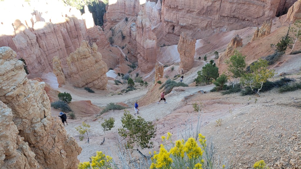
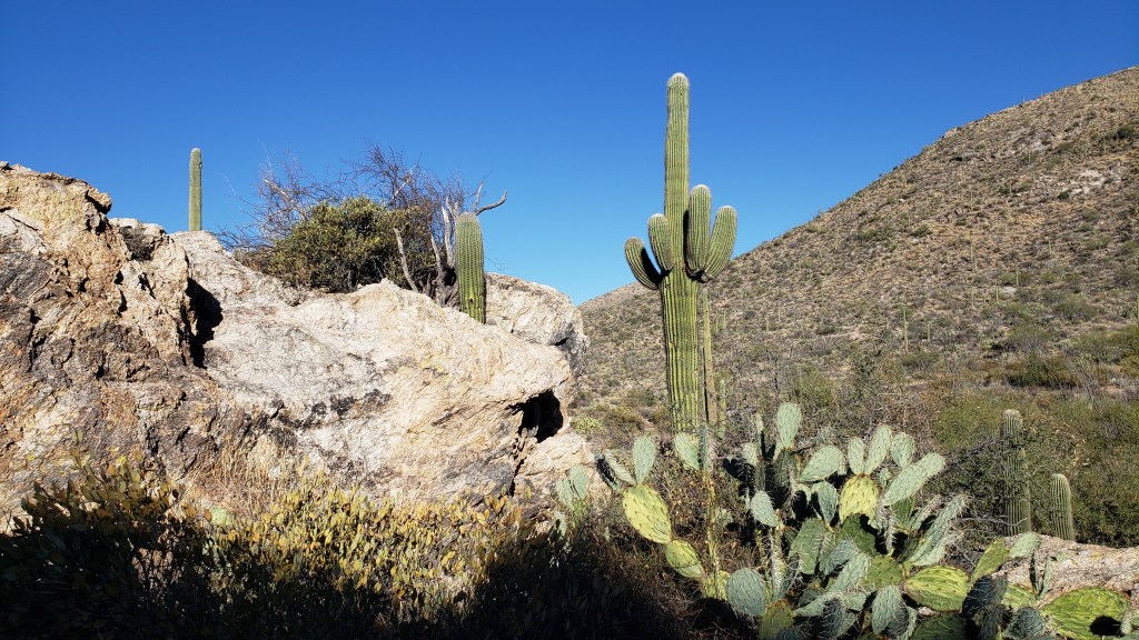
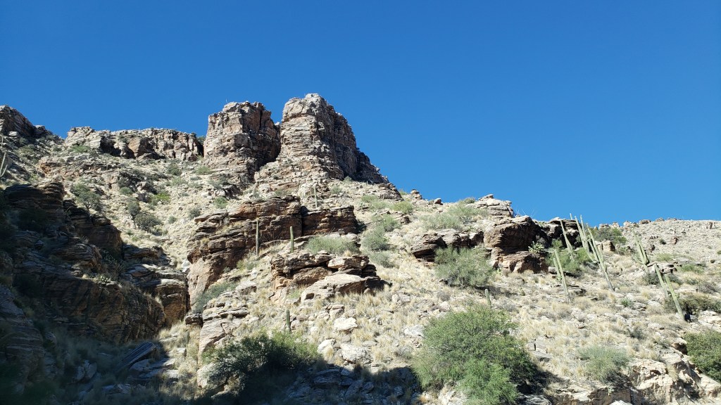
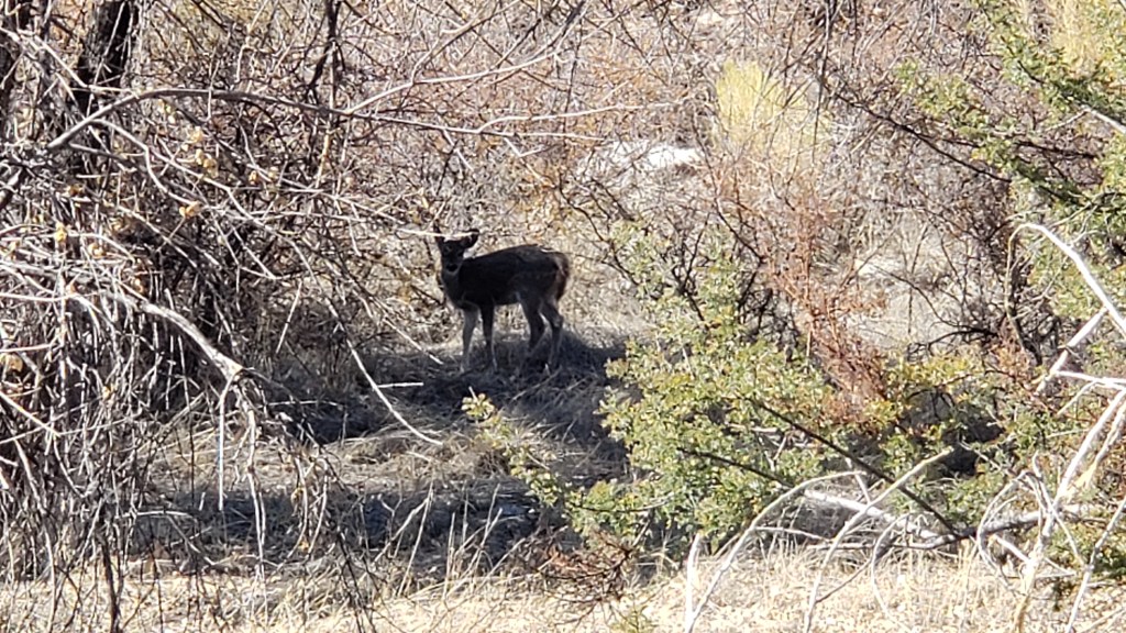
We had soaked up Tucson’s natural side with a visit to Saguaro National Park East and a trip up Mount Lemmon the day before, where the views and an unexpected wildlife sighting were thrilling starts to our touring.

Saguaro National Park is split into two locations; East and West. East isn’t overly blessed with saguaro cactuses due to a killing freeze in 1962.

Simon: “I don’t think I can get the mountains in.”
Susan: “How about if I do this?”

It’s a wild and rugged land, with more than just saguaro cactuses. O’odham tribes used the gangly ocotillo cactus on the right for building.


This shows the road going up Mount Lemmon. There were probably more saguaro cactuses on the mountain than there are in Saguaro N.P. East.


We saw two baby mule deer hiding in the underbrush as we were driving back down Mount Lemmon. Only one can be seen in this photo.

After a quiet day “at home,” the next day, we then headed south toward what was once New Spain territory (along with Puerto Rico, Cuba, Florida, what is now the southern U.S., the Philipinnes, and Central America as far south as Costa Rica), then Mexico, but now part of southern Arizona.

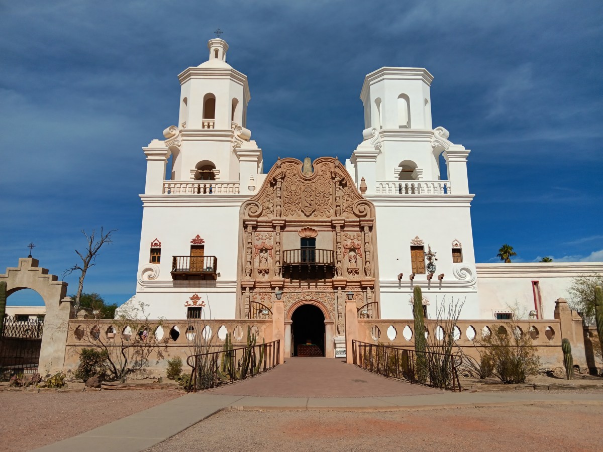
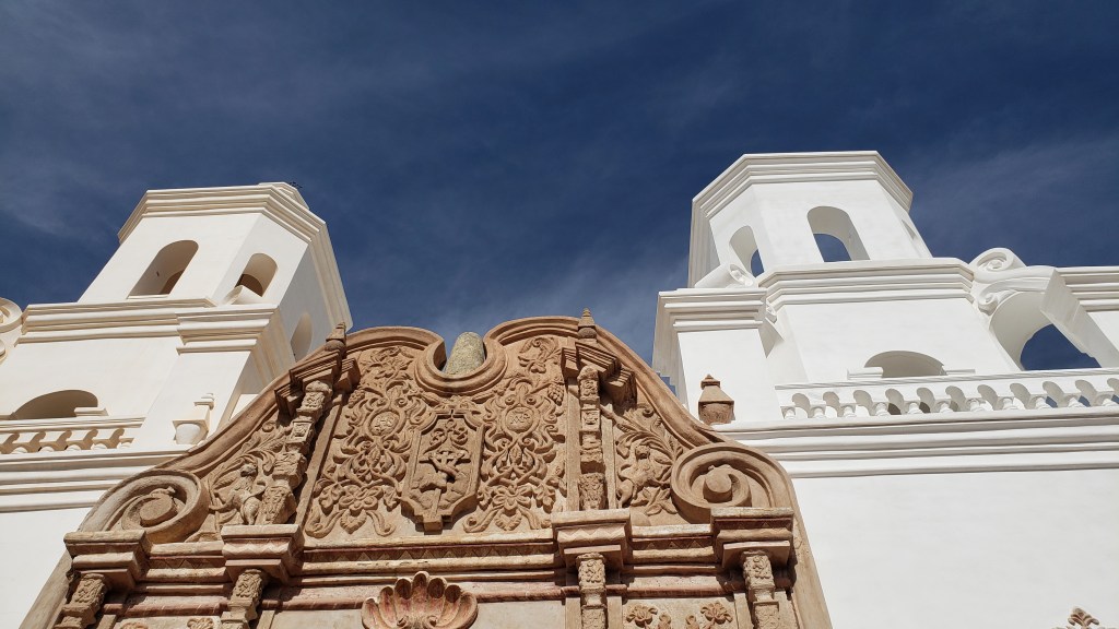
Spain was big on evangelizing, and many missionaries were sent to its dependency, with San Xavier del Bac Mission (completed in 1797) being one of the churches that sprang up to bring the natives to Jesus. I’m not going to go all preachy, though I surely could. Instead, let the Mission’s plaques do the talking:

Jesuit Padre Eusebio Francisco Kino “served two majesties – the Church and the Crown. For the Church, the Mission saved souls and spread the Christian faith. For the Crown, they served as training grounds for native people to learn their assigned role as subjects of the King and citizens of a growing New Spain.”

“A mission was much more than a church; it was an entire community designed to teach European ways of life to people living on lands claimed by Spain.”


So much to unpack about that, isn’t there, when compared to the history of those “people living on lands claimed by Spain,” who had successfully thrived in the area for thousands of years. When I asked the docent at San Xavier what the Tohono O’odham tribe’s spiritual culture was like before the arrival of the missionaries, he said, “They were used to converting.”

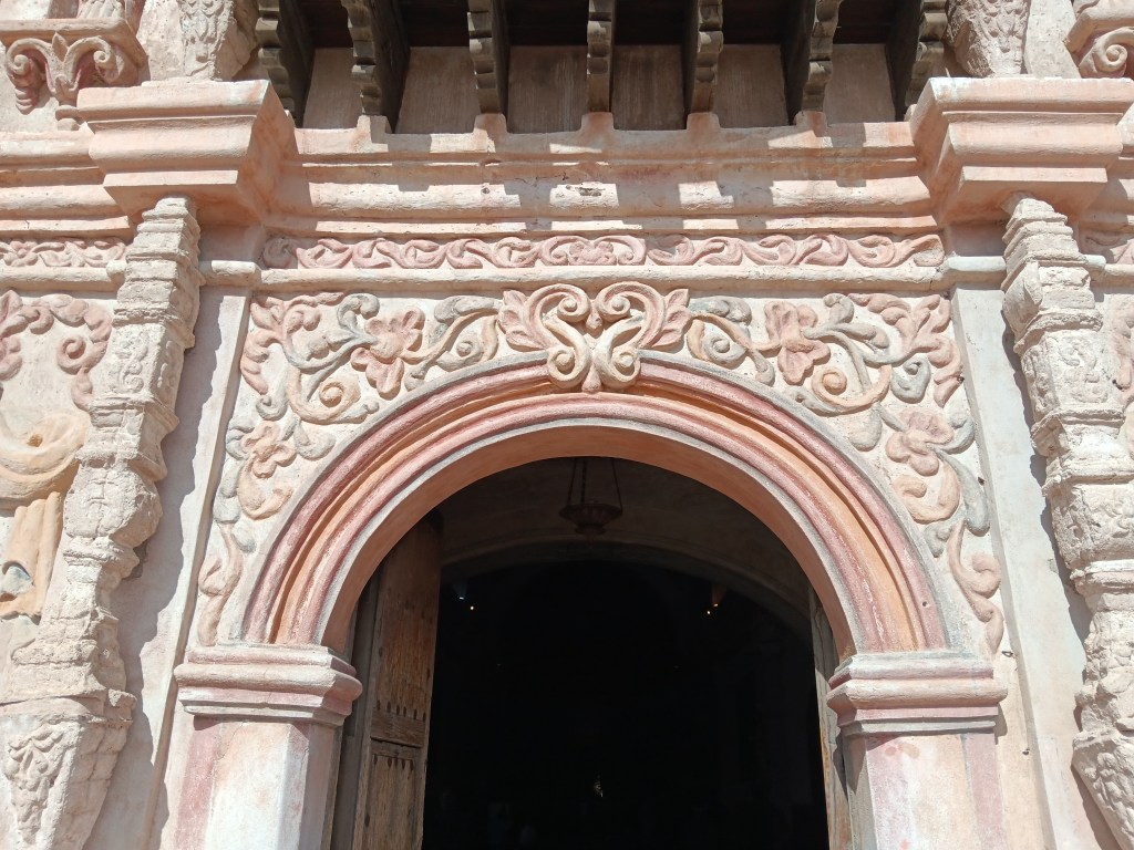
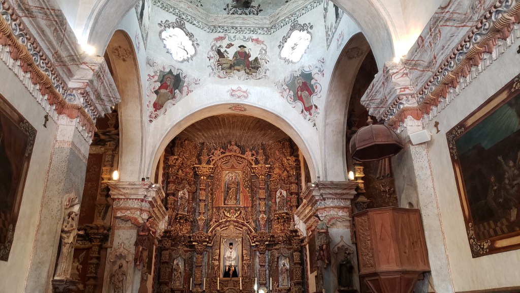
We set all of that aside and entered each of two churches with the idea that we were experiencing historical places. Let’s take a stroll through San Xavier del Bac first.

The Mission’s property ends at the wall in front of it. The surrounding 71,095 acres are the San Xavier Indian Reservation, home to approximately 1,200 Tohono O’odham people.

The tower on the right doesn’t have a dome because (say it with me) they ran out of money.

The rainbow is an important image to the O’odham, signifying unity, among other things, so it was used in the entry’s archway.


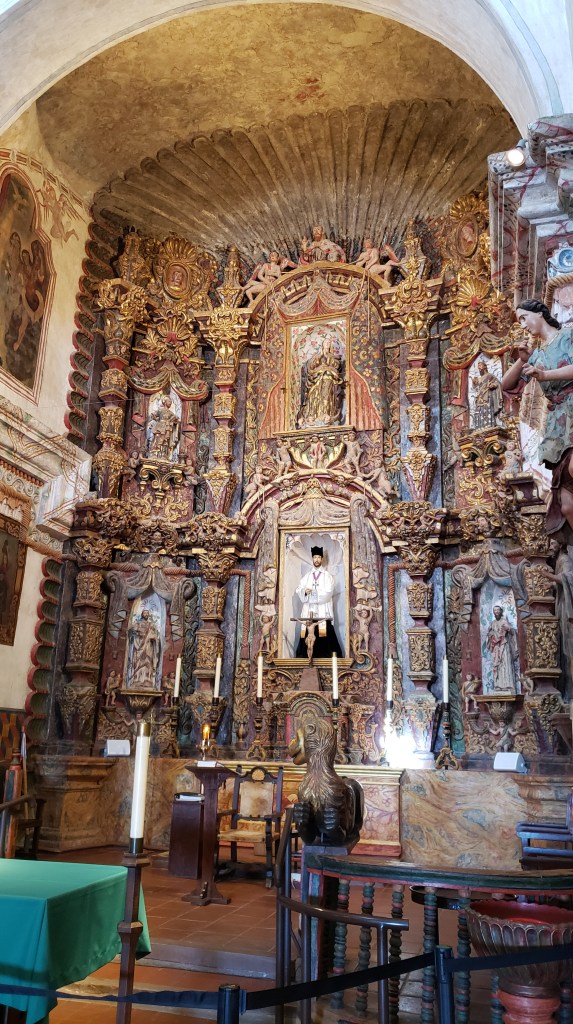
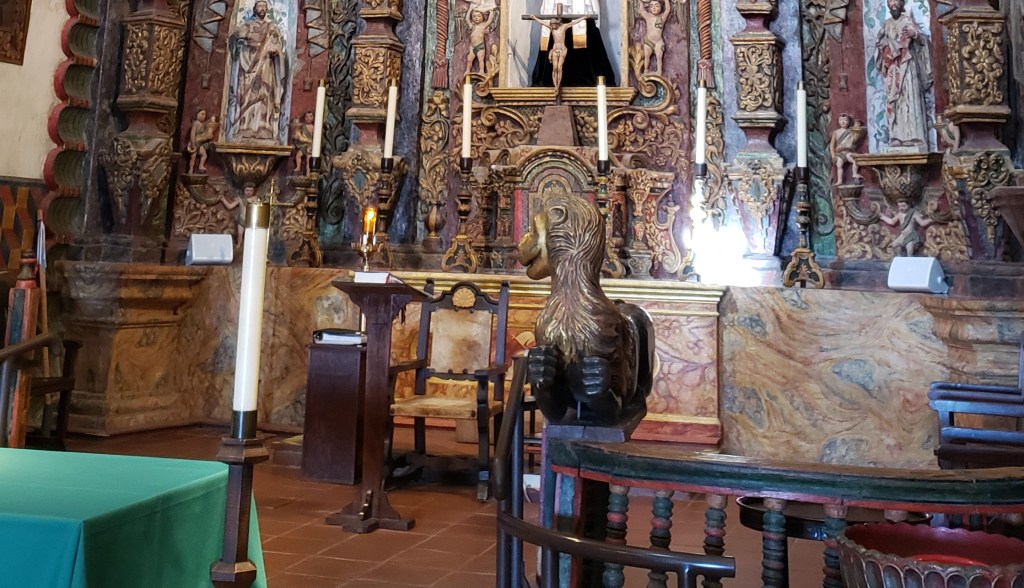
It’s impossible not to notice the two animals flanking the altar. They look like weird cousins of those flying monkeys in The Wizard of Oz, but they’re really lions. Why so wonky-looking? Because the artists who created them had never seen lions, and only had a verbal description of a lion to work from.

According to the docent, the original lions were stolen. These were funded by a woman who sits on the board of directors. She hired Mexican craftsmen to carve the wooden statues, then she let the wood cure for a year, applied gold leaf, and, six years later, these beasts took their place on the altar. That woman? Former U.S. Representative Gabby Gifford’s mother.

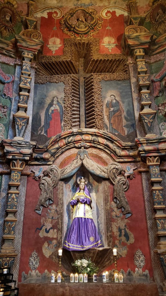
The church honors Mary, mother of Jesus. Here, her dress includes an important O’odham concept through two embroidered “Man in the Maze” images, one on her gold vestment and one on her skirt.

Those round, gold images represent the Man in the Maze.

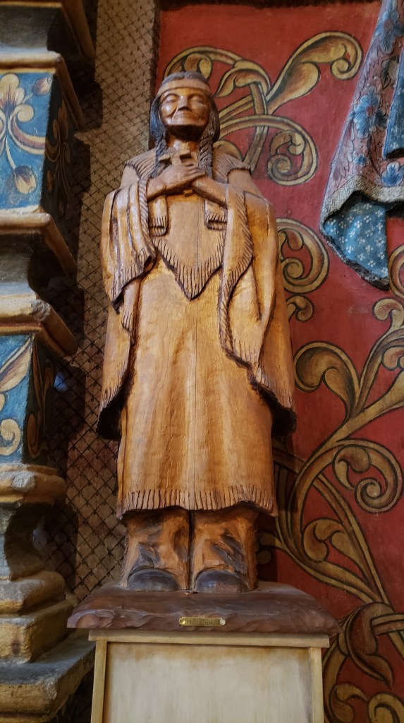
Made of wood and without embellishment, this statue honors Kateri Tekakwitha, the only Native American to have been recognized as a Catholic Saint.


It’s a beautiful church filled with contrasts, arguably rife with cultural appropriation, and it has the devotion of those who worship here. It reminded us of a mission church we visited in Arizona many years ago, on a Reservation that was home to the poorest of the poor. When we commented on the immense wealth that could have fed the community and its children for decades, one of the parishioners said, “Yes, there is a great deal of wealth here, but we find solace and relief from our difficult lives in this place of such beauty.”

Who are we to say that’s wrong? Perspective matters.

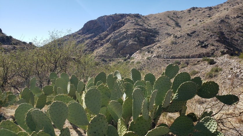
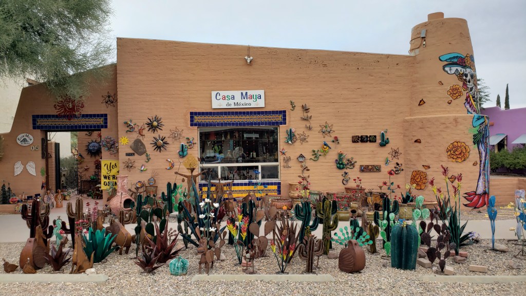
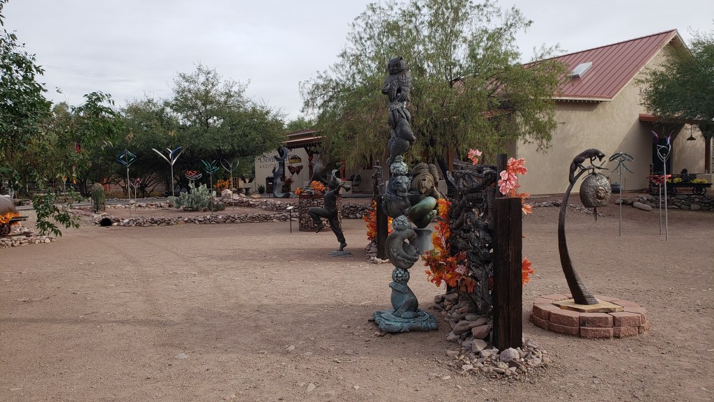
Tubac – a little “village” of shops, restaurants, galleries, and a museum – was next along I-10, and we had a little wander and some lunch there. We try not to bring any more weight onboard Fati, so we admired the artists’ creativity, then headed south again.


Simon had the breakfast burrito crammed full of…well…everything.

Susan had the pulled pork, and Ruthie ate the bun.

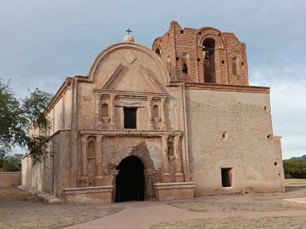
Tumacácori National Historic Park features one of the areas other missions, the oldest in Arizona. Nearly 200 people lived here at one time, and the grounds included orchards, fields, gardens, homes, a “convento” (shared workspace and governmental center, not a nunnery), and a cemetery, as well as the church.

The mission church is on the left, and a later adobe ruin is on the right.

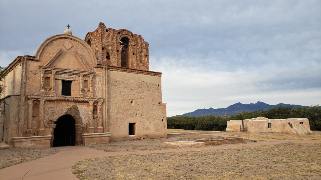
The bell tower on the upper right-hand side of the building isn’t a ruin. It was never finished, as the parish ran out of money before they could complete it.

The church façade originally boasted bright colors – blue, red, yellow, and orange – in the Spanish style, but you can’t really see the colors today.

Tumacácori makes no bones about what Spain’s mission was: “All aspects of daily life were subject to transformation – food, language, clothing, agriculture, and religion.” There is a term for that sort of “transformation” of entire groups of people, and as much as we enjoyed immersing in the history as we walked around, it was hard not to think about the O’odham’s lives before and after “transformation.”

The interior is in pretty rough shape, but it does show the layers involved in creating the building.

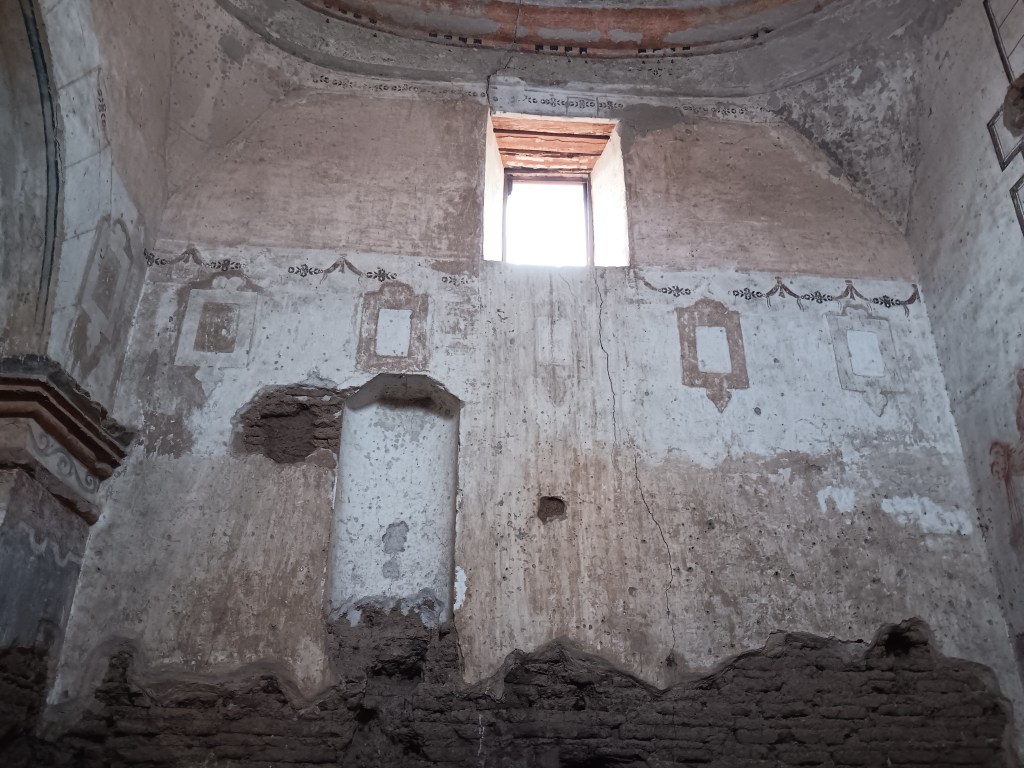
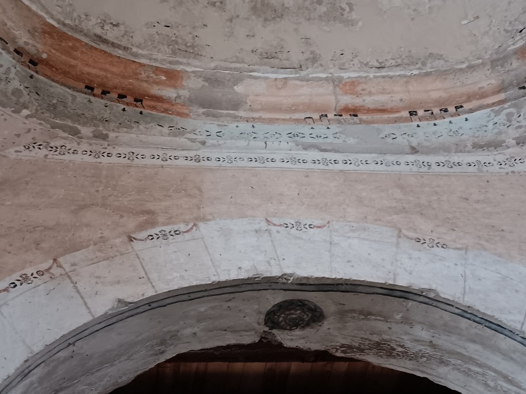
The Sanctuary was also painted and stenciled in bright designs, some of which can still be seen, albeit in faded form.

The squares were “frames” for religious imagery.


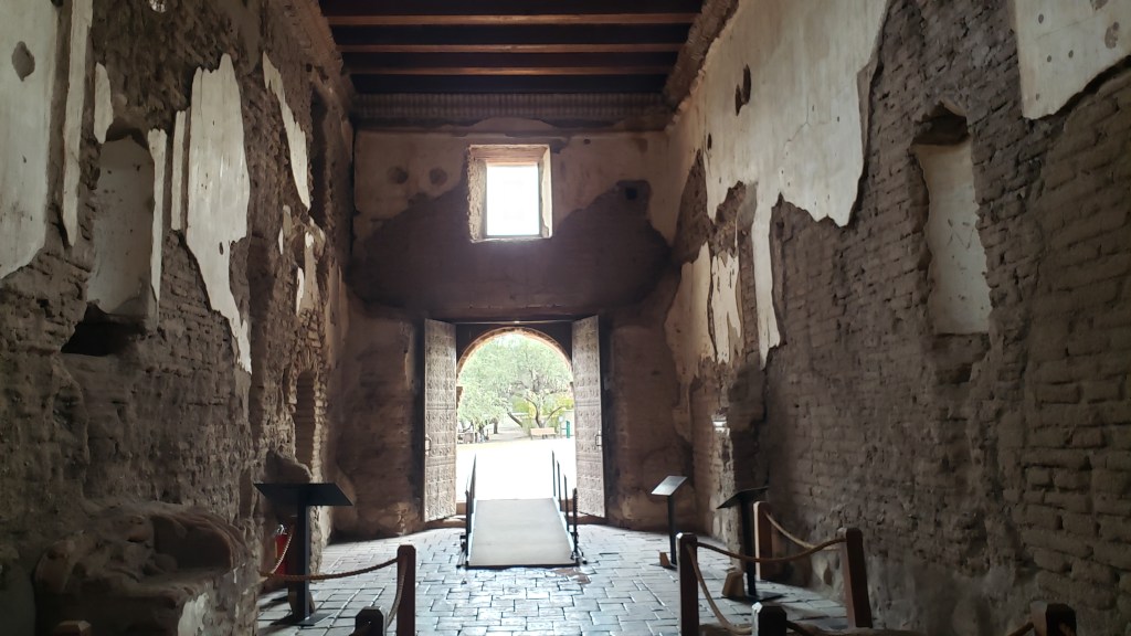
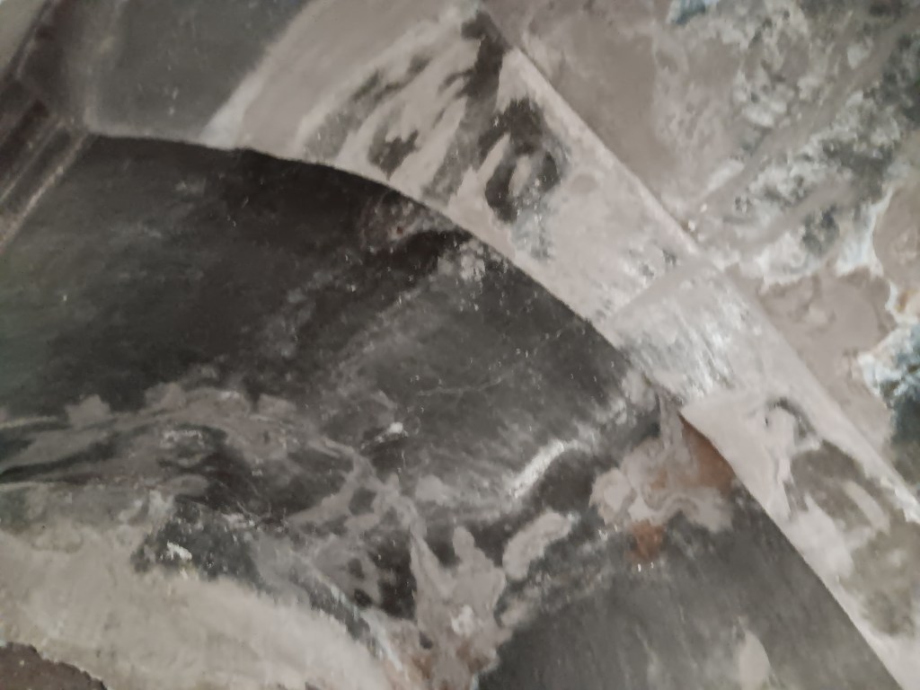
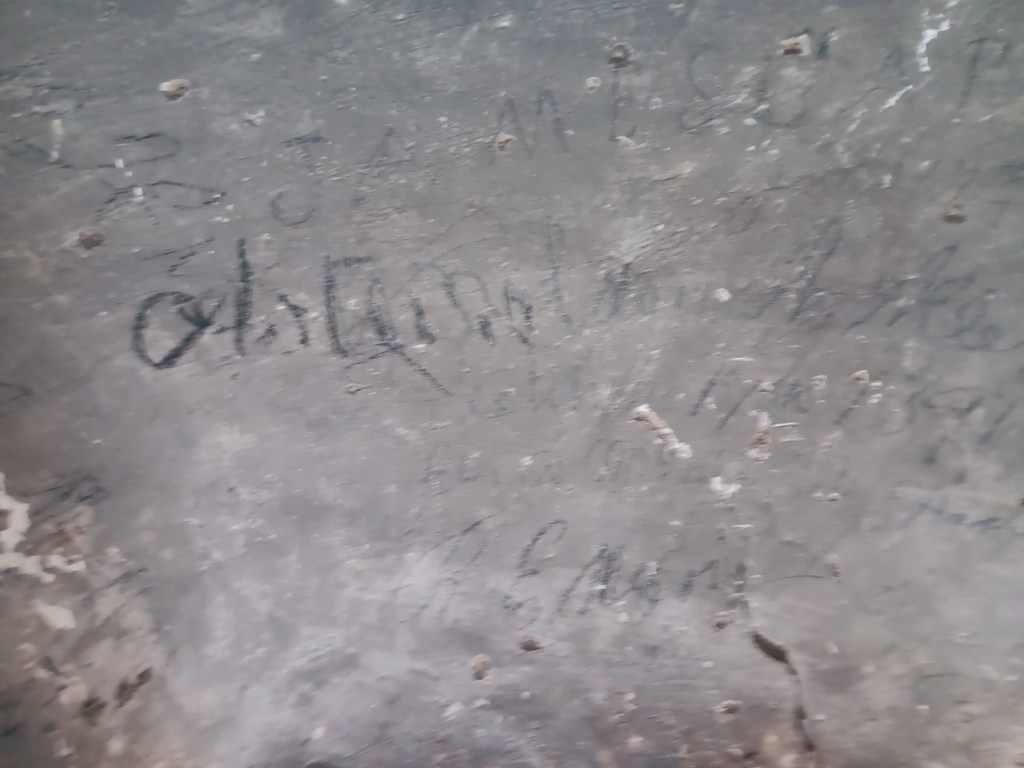
After Tumacácori was abandoned in 1848, the Sacristy became a refuge for cowboys, soldiers, Mexicans, and gold-rush era fortune hunters during inclement weather. Soot from their fires can still be seen on the ceiling, and their names are still on the walls around the door.

Lousy photo, but the black is soot from cooking fires.

Lousy photo, but these are some of the signatures.

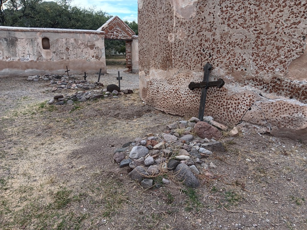
The cemetery bears silent witness to the devastation Apache raids and several epidemics wrought on the community. Most of the human beings originally buried here were children under the age of five.


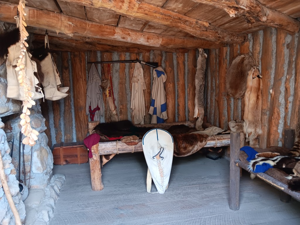
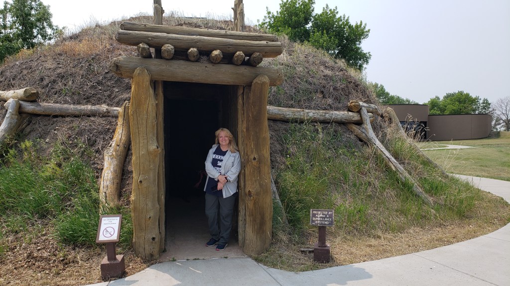
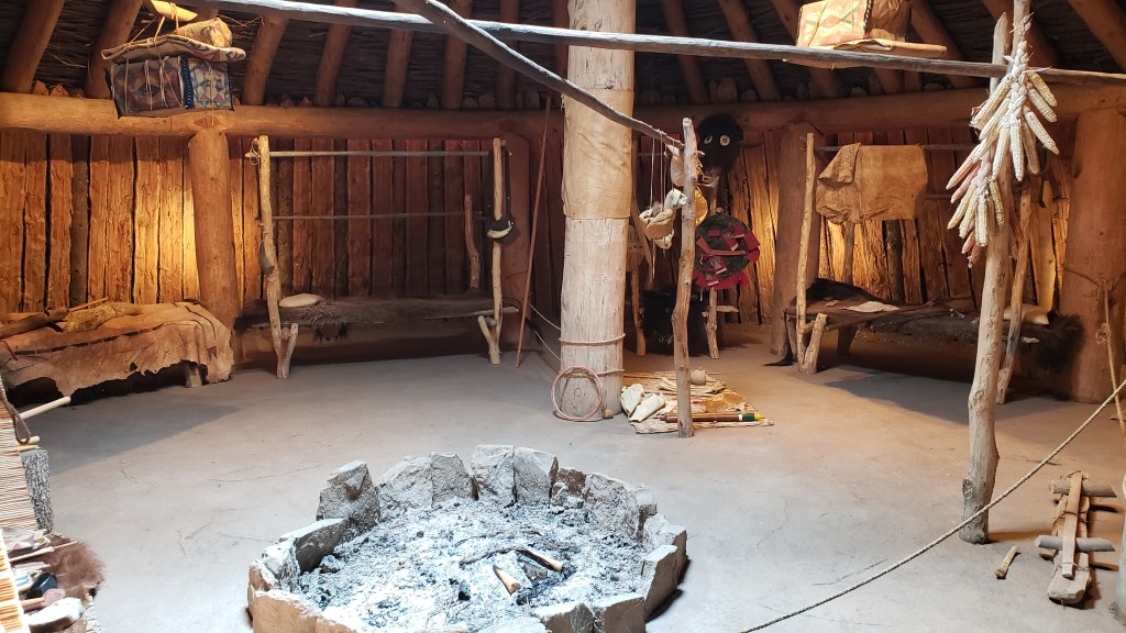
The ki – the O’odham word for house – provided shelter, while the outdoor wa:ato (brush enclosure) was the place for gathering together and for cooking. The O’odham still sometimes build homes from mesquite branches, ocotillo sticks, the ribs of saguaro cactus, and mud.


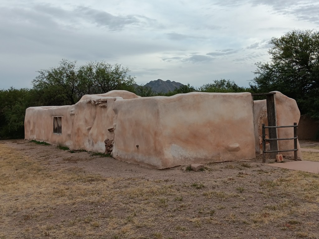
The convento was originally much, much larger. Built of adobe, most of the long, low expanse of it has slowly “melted” away.  Now, only a small section (once a storeroom) is still standing.


The mission was abandoned for a year after an O’odham uprising against the Spanish and an intrusive neighboring tribe. Jesuit priests returned in 1753, were expelled in 1767, and were replaced by Franciscans who continued evangelizing until 1822.

The places we visit become a part of us, and, as small pieces of historical information are assembled into a greater picture, we find ourselves contemplating the story that greater picture tells.

Wonky Hoodoos And A Magical Flute


Throughout our journey, we’ve had to modify our plans around Ruthie, and we’ve done so happily, since one of our goals was to give her the best of what time she has left. Another one of our goals was to see as many National Parks as possible, and in Southern Utah those two desires collided.

“I’ll go wherever you take me!”

From our base in Cedar City, we were 77 miles from Bryce Canyon National Park, and just 20 miles from Zion National Park, two places that were high on our list of must-do experiences. They were places Susan’s parents had really enjoyed and, because of that, they had an emotional pull, too.

Grand Staircase Escalante National Monument and Capital Reef National Park were also on our radar, but after much discussion we came to the conclusion we couldn’t do everything or we’d end up frazzled and exhausted…again. So Bryce and Zion were “it.”


But not so fast.

Before we visit a place (usually months or, in some cases, years) we do our research. When it came to Zion, however, we’d dropped the ball. In some places, rules changed with the pandemic and, from March to November, Zion can only be visited via shuttles. No-dog shuttles.

The single exception was Zion’s Kolob Canyons on the north end of the park, and with that, the plan fell into place.


Bryce Canyon contains the largest collection of hoodoos in the world, and while we’d seen a LOT of canyons over the past weeks, this one promised something different. Even before we reached the park, we passed through the ridiculously gorgeous Red Canyon on Scenic Byway 12, which almost would have been enough on its own.


Not as small as Needles Eye, but still rather exciting.

From the Badlands in North Dakota to Utah’s magnificent landscapes, we’ve repeatedly said, “How did that happen?” The short answer is, wind, water, and time. The longer answer in Bryce is, its distinctive formations began as flat rock on an ancient sea bed, uplift of land that created plateaus, which then weathered into “walls” with vertical gaps between them, then into “windows” (big holes in the rock, like we saw in Arches), and finally into the oddly-shaped, sticky-uppy hoodoos we see today.

Each of the park’s overlooks offered a different perspective:

Natural Bridge (elevation 8,627 feet) is an example of the “window” phase of the plateau’s erosion.

Obligatory selfie.

Hoodoos taking on their distinctive shape.

The park’s crownlng glory, Bryce Amphitheater.
Click on photo for video

A pathway leads to the floor of the Amphitheater, but with temperatures at the summit in the 90sF, neither of us were prepared to endure the heat in the canyon.


We were put to shame when we caught sight of a bride and her groom hiking back up, with a photographer in tow. Anyone who has ever worn a wedding gown knows what a feat this was for the bride.


Everyone at the overlook clapped and wished them well as they rejoined their wedding party.

Kolob Canyons in Zion National Park was even more straightforward. An easy drive, entry with our America the Beautiful pass, and we were in. But only for three miles, as the scenic-drive road in the park was damaged due to a weather-related rock slide.

Ruthie really appreciated the cooler wind blowing through the canyon.

These 2000-feet-high canyon walls were pretty much all we could see, having walked a short stretch of the road beyond the barriers that were put up to prevent car travel.

It was a very limited way to appreciate Zion, but sometimes that’s how it goes, and with all the rock walls we’d seen in Utah, life was still worth living.

The next day we pointed Nippy north for a trip to Parowan Gap, a wind-and-water-created hole through a mountain that was used by Native Americans who left their stories etched into the deep crimson walls. And it was these petroglyphs that drew us to the area.


Other than three kids on motorbikes racing down the road, the gap was absolutely still and silent. We clambered around enjoying the petroglyphs, wondering at their meaning, and, in that stillness, it was easy to imagine nomadic tribes pausing to rest, play, soak up the beauty, and go about their daily lives.


The petroglyph roughly in the center of the photo is now called the Zipper Glyph, for obvious reasons. Its meaning isn’t known, but it’s thought to be a marker of travel days, first one way then another, from the summer solstice (the circle at the bottom). It may have been used as a means of tracking where game would be throughout the seasons.

As we stood admiring a particularly large set of petroglyphs, the most haunting, soul-stirring sounds of an ancient flute melody gently caressed the breeze, and for a moment we could imagine it was an echo of the people who used the area for a thousand years.

Turn your volume up, listen closely, and you can hear the flute.
Click on photo for video

Instead, it was Michael. Michael comes to the gap now and then to play his hand-carved flute, because, he says, he likes the acoustics.

The spirits of those who once passed through here like Michael’s playing, and he has had several encounters with them, he told us. It was easy to believe. Even Simon, who holds no particular belief in such things, agreed there was something special –and spiritual – happening in the gap.

This cave entry leads to a place where the tribes’ shamans meditated during their time here.

I’m tempted to stop this blog here, and just bask in the memory of such an extraordinary experience. We did have a rather startling return trip that included an unexpected climb up a mountain range to a ski resort town called Brian Head (elevation 10K+) and a journey through Cedar Breaks National Monument…


…but let’s just let the memory of the flute music sooth us into a happy stupor, and call it a day.

Fargo: It’s So Much More Than A Wood Chipper

Fargo wood chipper
Nobody should be smiling when encountering a sight like this

Simon loves the dark comedy movie, Fargo, with its relentlessly evil villains, the dogged heroine Marge, and that chipper no one who has ever seen the movie can forget. The Chipper prop now lives at the Fargo-Moorehead Visitor Center, and it was the reason we put Fargo on our Grand Adventure route.

We stayed at a Harvest Host in Minnesota the night before, celebrating Simon’s birthday in high style with cheese and bikkies (crackers for us U.S. folks) and a beer, since we had no access to electricity and didn’t want to use up our batteries (generators aren’t usually allowed at Harvest Hosts), plus we’d had a celebratory lunch and were too full for much more.

Birthday beer
Birthday beer out there on the edge of the prairie (okay, right ON the prairie)

The host location was a farm with horses, goats, chickens, cats with newborn kittens, and a gangly, year-old dog named Pooh Bear.

Harvest Host baby goat
It’s so soft!

We got to hold a three-day-old baby goat, meet the newborn kittens, and Simon, always ready to try his hand at something new, milked a mama goat.


We then spent the evening sitting on the front porch chatting with the owners, and felt it was exactly the kind of experience we were hoping to have during this journey.

The next morning we made the short trip into North Dakota, where we had another Harvest Host stay, this time at a winery, and while the sweet wines weren’t to our taste (neither was the eyelid tick), the food was good and we met another RVing couple who had come in from Oregon, which passed a happy couple of hours before heading back to the rig for the night, with a strong wind whipping through the prairie grasses as a small storm rolled past, which we loved.

Harvest Host 4e winery
Moody sky, but we only had a little bit of rain as the storm went past

Bismarck was our next destination, with a detour off the highway into Jamestown to see the World’s Largest Buffalo.

Largest buffalo in the world
Imagine the droppings….

The roadside attraction included a touristy town with stagecoach rides, and it made for a nice diversion on our way to Bismarck.


We woke up early and headed back to Fargo for a photo op with the infamous Chipper. If you don’t know the movie Fargo, it’s the means through which the hapless main character gets turned into the human equivalent of ground beef, thanks to a crazy man with a passion for gruesome murders [Note: Leg in Chipper = hint].

simon with wood chipper
Non-gory recreation of a very gory scene

The Coen brothers (Fargo’s producers and directors) signed the Chipper, but there was no way to get a photo of their signatures without glare, so here they are, just as obscure and unfathomable as the movie the brothers created.

wood chipper signatures
Appropriately scrawled across the “exit”” end of the chipper, where whatever you shove into it blows out. Across the snow. All bloody.

Our next campground (with full hookups!) was Hillcrest Acres in Bismarck, a small, pretty place appropriately located on a hill, a forerunner to the scenery we’d see as we drove around the area for the next few days.

Hillcrest acres campground
Fati getting comfortable

Countless times, we wondered how those hills (variously called “buttes,” “hills,” “points,” and “ridges”) formed, why most were grassy but some were bare, and why glacial movement made North Dakota so undulating, but Michigan so flat. Wind and water played their part, but we’d like to talk with a geologist to find out more. That’s one of the beauties of travel; it inspires curiosity.

north dakota butte
These odd outcroppings are everywhere

Our first full day took us to Washburn, where we discovered the restored Fort Mandan, in an area the Lewis and Clark expedition spent the winter of 1804. The fort had various tiny rooms, such as quarters for soldiers, interpreters, and the captain, plus a smokehouse, blacksmith, and storage room.

Fort Mandan

Fort mandan interpreter room

fort mandan room

fort mandan room details

Ruthie was absolutely captivated by the Sargent of the Guard’s quarters and didn’t want to leave. We don’t know why, but she was very clear about wanting to stay.

ruthie fort mandan
We tried not to read too much into it, but “past lives” certainly came to mind

She was less captivated by the statue remembering Seaman, the faithful Newfoundland dog who traveled with the expedition, but she dutifully sat for a quick picture.

seaman statue

A short stroll beyond the statue rewarded us with our first up-close view of the Missouri River, whose waters were low and many big sandbars could be seen. We would cross over the Missouri several times in the following days.

missouri river

Just a short drive away from the fort was the Knife River Indian Villages National Historic Site (using their cultural terminology, not the terminology we might have chosen), with a recreation of a Native American earthlodge that marks the area many tribes used as a trading center.

A buffalo hide acts as the doorway into the lodge, and inside the temperature is about 10 degrees cooler. A deep, smokey smell permeates, which gave us a small sense of what living inside it would have been like. Ruthie lost her mind in there, loving all the new sniffs.


The visitor center here was superb, giving an excellent overview of two tribes and their lifestyles. Although the day was cool and we could safely leave Ruthie in the car for a short time, we had to turn down the host’s offer to watch a movie, as our Floridian sensibilities made us uncomfortable leaving her for very long. But the exhibits were terrific, and we felt we learned more about the people who once lived there.

We drove further west for Lake Sakakawea (pronounced here as Sah-KAH-kuh-WEE-uh, not Sack-a-juh-WAY-uh), a huge lake set below stark cliffsides, which must be ideal for boating on summer weekends. The history of the lake is, predictably, one of eminent domain, force, and the subsequent throwing-of-a-bone in naming it after a famous figure who (it is my opinion) probably had as little say in her destiny as the land that now holds the lake named for her did.

lake sakakawea
A small slice of Lake Sakakawea

This is the site of two-mile-long Garrison Dam, a three-part set of structures built by the U.S. Corp of Engineering in 1953, that includes a pump station…

garrison dam pump house

…the dam itself…

garrison dam

…and a spillway that helps route water back into the Missouri when levels get too high. Neither of us are geeky in that way, but it was truly fascinating, and we spent a fair bit of time pointing and saying, “I wonder what that’s for….”

garrison dam spillway

North Dakota’s oldest state park, Fort Abraham Lincoln State Park ($7 to enter), was our next stop, with three re-created blockhouses overlooking the Missouri River. On breezy summer days, the many narrow lookout windows must have afforded an excellent breeze. In winter, it must have been cold enough to freeze the brass whatsits off a monkey.

Fort Abraham Lincoln blockhouse
One of the three blockhouses

fort abraham lincoln window
There are several of these narrow windows all around the blockhouse, some with fabulous views

On-A-Slant Indian Village was within the park’s boundaries, too, and the earthlodges here were beautifully displayed, along with panels that described life in the Mandan tribe village from 1575-1781.

On-A-Slant Village

We were captivated by the idea that boys in the Mandan culture learned to shoot with accuracy by playing a game that involved throwing a hoop into the river and shooting an arrow into its moving center. According to an exhibit we saw, it was their belief that the dead buffalo they found floating in the river with each spring thaw were a result of these games. All of the children would have been treated to funny stories that told important tales.

Old Man Coyote and the Wild Potota legend

On the way out of the park, Simon made a quick right turn when he saw a sign for Custer’s House. We couldn’t take Ruthie in it, so we agreed Simon would check out the house while Ruthie and I waited in the car with the air conditioner on.

Custer's house
Spot the docent? No, you don’t, and neither did Susan

Twenty minutes later he was still standing on the house’s porch, so the following phone call ensued:

Susan: Hey. What’s going on?
Simon: Oh. Yes. It’s nice to hear from you. Uh-huh. I’ll let you know when I’m there.
Susan: What the hell are you talking about? I can see you standing on the porch, so I’ll certainly see you when you get back.
Simon: Okay, thanks! All the best. Bye for now.

When he got back to the car, he detailed the conversation a docent sitting on the porch (whom I couldn’t see) had at him. Not with him, at him. Simon asked what rank Custer was during the war, and 20 minutes later he knew everything from Custer’s blood type to his favorite dessert and whether he preferred tighty-whities or boxer-briefs. (Okay, not really, but the docent talked for a full 20 minutes, and Simon had to pretend I was someone important so as to break off the dissertation gently and with respect).

For those who cannot bear not knowing, it turns out Custer was a Lieutenant Colonel during the battle at Little Bighorn, but was a General during the Civil War and was allowed to keep that designation as an honorary title when that bloody war ended.

We finished the day at Standing Rock, an important stop along the Native American Scenic Byway. Our goal was to visit Sitting Bull’s burial site, which we found after many wrong turns, having blown past it on the way into town. Most people probably do that, too. There is only a small sign on the side of the road that indicates where this great man’s resting place is (or rather, was; he’s since been moved at the request of his grandchildren).

Sitting Bull burial site

The grand brochure we were given at the Fargo visitor center did not prepare us for what we found at Standing Rock. Perhaps we missed the highlights, though we’re not quite sure how we could have. Instead – and we’re assuming a LOT, all of which may be wrong – we found a town completely void of energy, as if a total lack of opportunity and a heaping helping of injustice held the place and its people in a state of downcast limbo. We’ll end our sweeping assumptions there, and, with heavy hearts filled with compassion, put our energy into hoping all good things come to the people who, by choice or by historical force, make it their home.