The latest instalment of our excusive series for The Independent featuring our “Year On The Road” RV adventure is now online, highlighting Month 5 as we reached Idaho and Utah, and the incredible scenery of places like Craters of the Moon National Monument and Bryce Canyon State Park.
If there’s a massive crack in the earth, Simon wants to explore it. Southern Idaho seemed to be riddled with them, from the modest Box Canyon to the gargantuan gorge in Twin Falls, a rift so long and deep it had become a world-renowned location for the extreme sport of Base Jumping.
We had a long day in store as we left Fati at the campground and drove west, with Box Canyon State Park, Thousand Springs State Park, and Bruneau Dunes (the tallest single-structure sand dune in North America) as our goals.
Box Canyon State Park proved to be more of an overlook than an actual park, what with being surrounded by cow farms and having nothing but a porta-potty at the dirt parking lot, though if we’d had the inclination we could have hiked from the top of the canyon to the clear, bright-aqua waters of the river below. But you already know that’s not something we could (or would) do with a senior dog in tow.
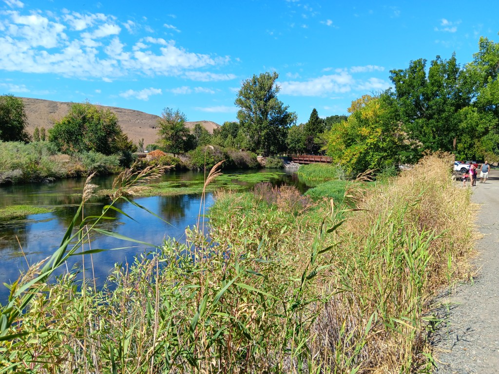
Thousand Springs also found us wandering aimlessly. The road down to the springs was steep and winding, and either a thrill or unpleasant, depending on which one of us you ask. But as so many locations we’d visited in Idaho had done, this one closed on Labor Day, which was the day before our visit.
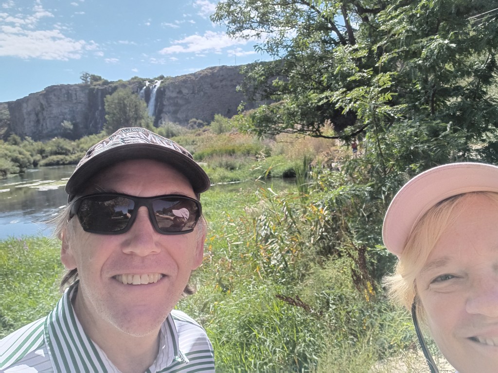
We enjoyed the falls, just to say we’d done something, then headed to the day’s headliner attraction.
Along with Craters of the Moon, one of our original must-see locations in Idaho was Bruneau Dunes State Park, where our plan was to rent a couple of sand sleds, climb to the top of the dunes, and freewheel our way back down, with me sitting on a board with Ruthie on my lap and Simon taking the plunge wakeboard-style.
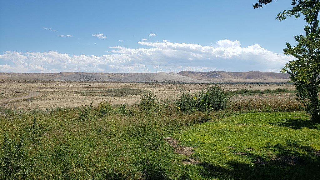
The dry, gravely landscape and fascinating trees reminded us of our trip to Botswana, where Simon went to school for a few years.
It was a ridiculous idea. Sure, the sand would probably prevent any broken bones when we came crashing down, but one of us was bound to get injured, and Ruthie would never tolerate the walk up, or the slide back down. We were saved from ourselves when the early afternoon temperature edged up to 90F, ten degrees hotter than it had to be for the Visitor Center to suspend all sled rentals.
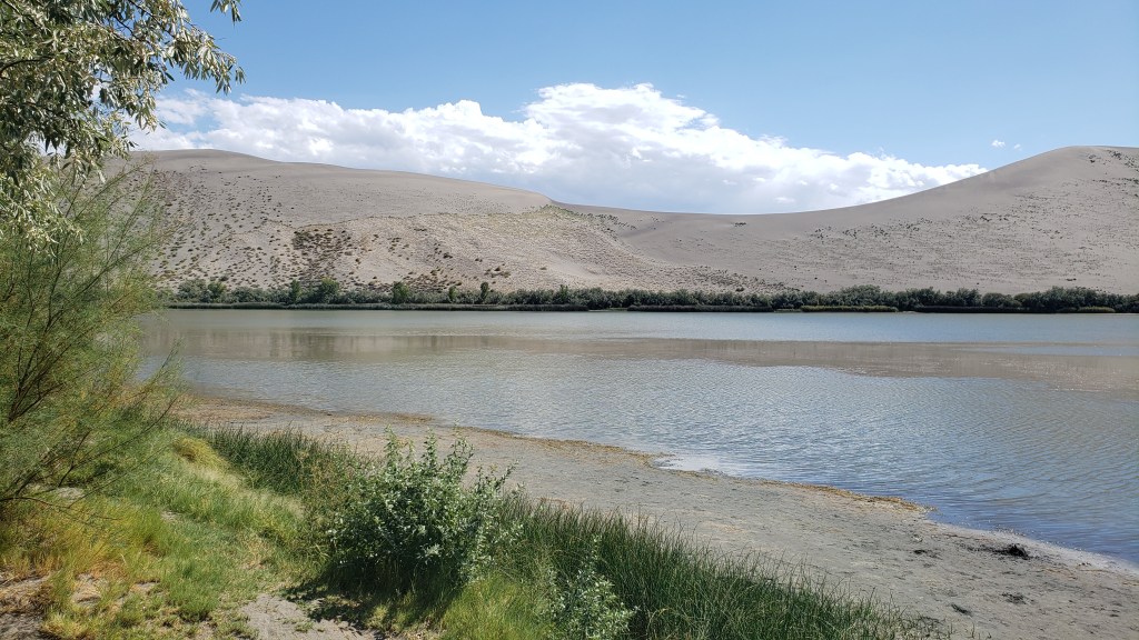
The trip wasn’t a waste, though. We had a nice picnic in the shade of a pavilion by the river, then sweated our whatsits off with a climb up the smallest dune.
Oh, look! Another lunch whose components have nothing to do with one another!
Ruthie doesn’t like it when we’re not all huddled together in a group, and we knew she’d want to follow whoever went up the dune first. So we put her booties on to save her paws from the blistering sand, and told her to climb as high as she wanted to, and no higher.
Click on photo for video
Click on photo for video
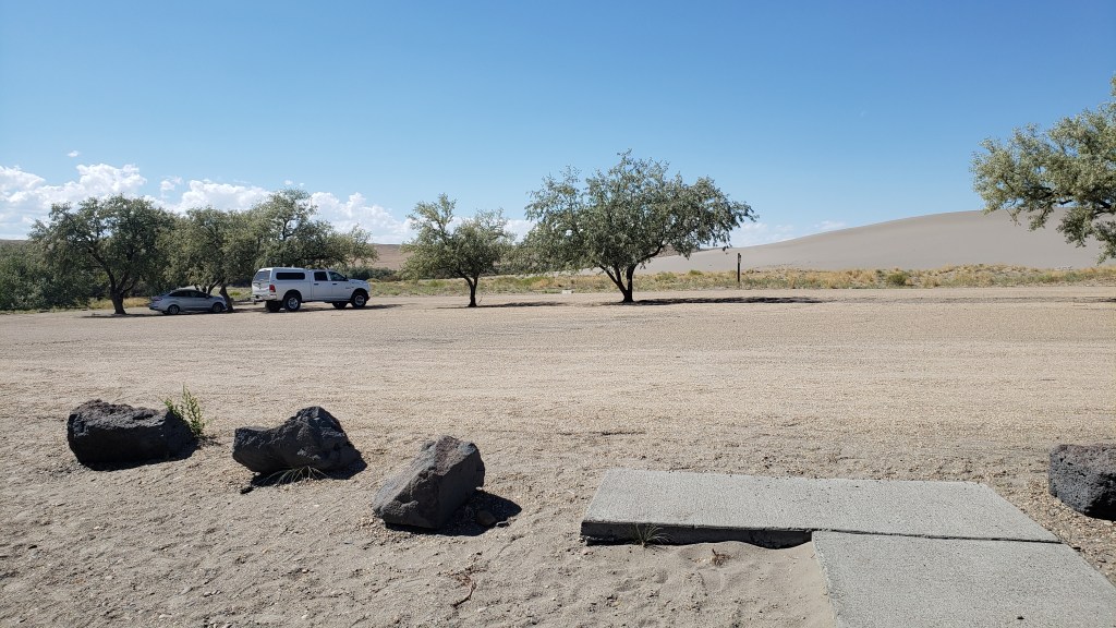
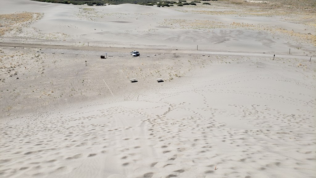
View of Nippy from the top of the dune.
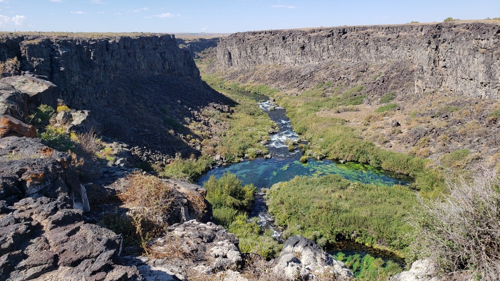
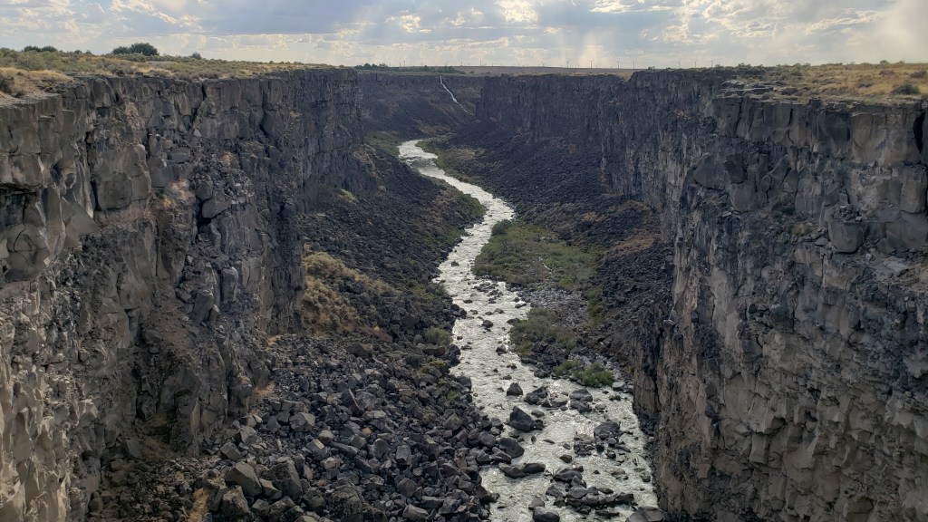
We weren’t exactly batting a thousand in terms of WPM (Wows Per Minute), though we definitely enjoyed what we’d been able to do, so Simon decided a quick detour to Malad State Park was in order, for one more chance to stand on the precipice of a deep crevasse and lean out over it as far as possible.
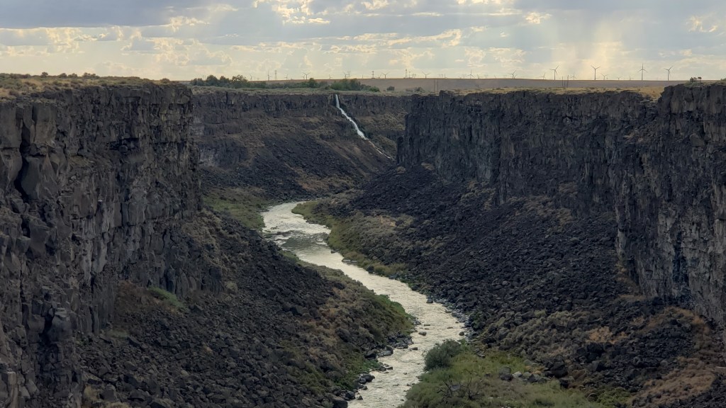
Here you get some small idea of the length of this gorge, with the tiny white line at the back being a waterfall.
Zoomed in a bit more, you can see the waterfall a little more clearly. We’re constantly amazed at what rivers can do to solid rock, given time.
Happily, there was a long, metal bridge spanning the gaping fissure, which gave him an excellent view of the river below. Ruthie joined him, and her bravery was rewarded with a little butt scritch.
But it was our next day’s trip out to Twin Falls that cranked the thrill factor up to eleven. We knew we wanted to see the famous Perrine Memorial Bridge, and we hoped with all our hearts there would be a base jumper or two.
The bridge spans the Snake River, a waterway made famous by the Lewis and Clark Expedition as they journeyed west in an effort to discover what, exactly, the country had gained through the Louisiana Purchase, and where, exactly, that land purchase ended.
That isn’t why it’s famous now, though, at least not with extreme thrill seekers. Today, it has a well-earned reputation as hallowed ground, being the only place in North American where it’s legal to base jump, year-round.
Our hopes of seeing someone jump were met twenty-fold. All day long there are jumpers taking the dive into Snake River Canyon, either as singles or in tandem, some of them longstanding pros, some entering into it for the first time. Some dove in head-first, others did somersaults, but however they left that ledge, it was massively impressive to spectators lining the stone wall along the edge of the gorge.
Click on photo for video
You can feel the anxiety in this person before jumping. Click on photo for video
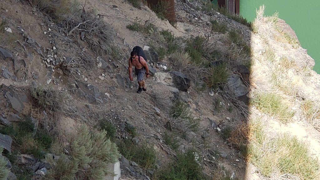
We made it a point to speak with a few jumpers, and hit absolute gold when we met Sam.
Former military paratrooper Sam never said anything about being Tom Cruise’s stunt double, but if he’s not, I’ll eat a pound of liver and onions from a filthy truck stop deli (no I won’t; I’d never do that). He looks like Tom’s twin, he speaks as if he’s dealt with media all his adult life, and he’s possibly the best advertisement for fitness and extreme sports you will ever find.
We chatted for about half an hour, then watched him walk out to the middle of the bridge, climb over the railing, stand on the narrow ledge, and swan-dive into the gorge. His parachute opened, and he soared effortlessly to the target point on the side of the river.
It was an astounding feat, but even more incredible was that jumpers then have to repack their parachutes and climb the rocky cliff out of the canyon. Sam scaled the cliff as we looked on, and gave us a final comment as we waved goodbye. “That’s the hard part,” he said.
This is Sam. Sam just jumped. Sam is now hiking up a 5,500-foot gorge. Strive to be like Sam in all your endeavors.
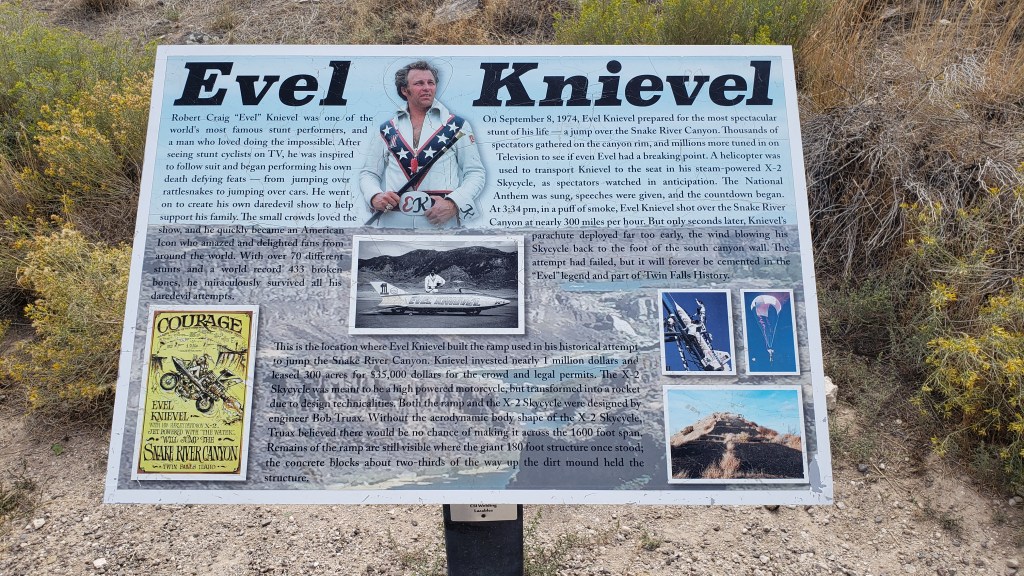
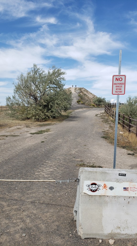
We could have watched all day, but it was getting a bit too hot for Ruthie, so we cranked up Nippy’s A/C and drove to the nearby Evel Knievel Jump Site. Those of us with birth years starting with the number 1 probably all remember the crazy daredevil whose unrealistic motorcycle stunts led to 433 broken bones over the course of his 15-year career as a performer.
You probably can’t see this photo large enough to read the panel, but somehow we only took a few photos of the site, so this will have to do.
The dirt ramp he used for a jump over the Snake River Canyon in his X-2 Skycycle steam-powered rocket is still there. He didn’t make it from one side to the other, of course, and, as we stood at the top of the jump, we were pretty sure he never really intended to make it.
That hill in the background is the ramp.
He blamed it on his parachute opening right after take-off. We blamed it on the fact that no one with an ounce of knowledge about physics could ever think that ramp was going to be enough to launch him one-quarter mile across the canyon. But never mind; it was an epic stunt, and we were delighted to discover our visit was exactly 49 years, to the day, since that fateful jump which, although he survived it, proved to be his last.
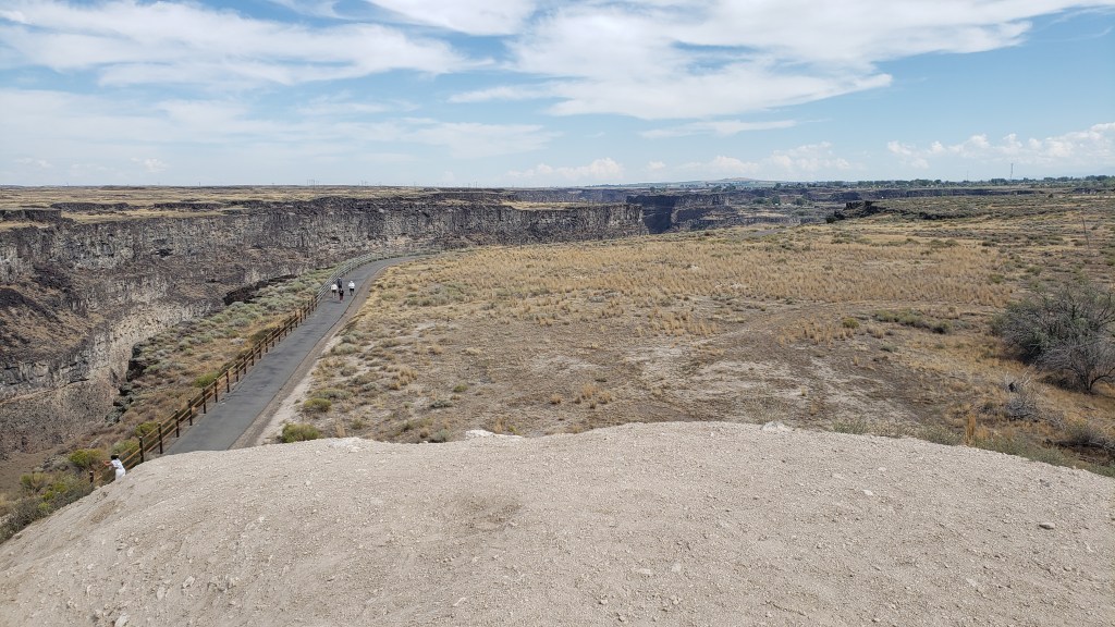
View from the top of the ramp, looking over the right side. The gorge is that dark part, with a walking path to its right.
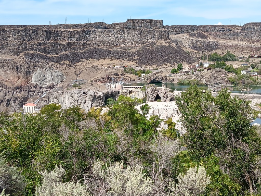
Shoshone Falls was our final stop of the day. Dubbed the “Niagara of the West,” the 212-foot-tall, 900-foot-wide, horseshoe-shaped falls are the largest natural falls in North American (yes, bigger than Niagara). They caught the attention of travelers along the Oregon Trail, and are still a tourist attraction today.
How it started. Photo from Wikipedia
How it’s going. The falls should be flowing over those two white rocky areas immediately below the long, horizontal white building in the center of the photo.
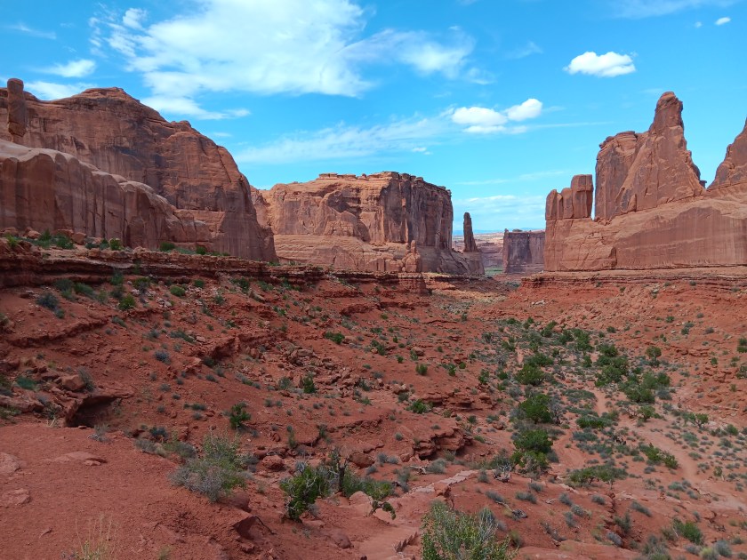
Unfortunately, due to a dry summer, the water level was too low for the falls to flow, so we skipped the drive down into the park, looked at the bare rock from above, and rewarded our day with a cold beer, shrimp tacos, and a hearty salad on our way back to the campground, before leaving Idaho and returning to Utah for its grand National Parks the next day.
Technically, Idaho wasn’t a new state for us. We’d flown in to Idaho Falls several years ago, and made the 108-mile drive to Yellowstone in Wyoming. But, clearly, we were new to Idaho, as evidenced by the Sheriff in Richfield who caught sight of our Florida license plate and “escorted” us out of town.
Our suspicious nature wasn’t helped by Susan taking random photos of weird road signs while the Sheriff was behind us, or Simon making an extremely abrupt turn onto a lonely back road, having nearly missed our GPS’s warning that the turn was coming up. Richfield’s Finest responded by following us all the way to his county’s border to see us off.
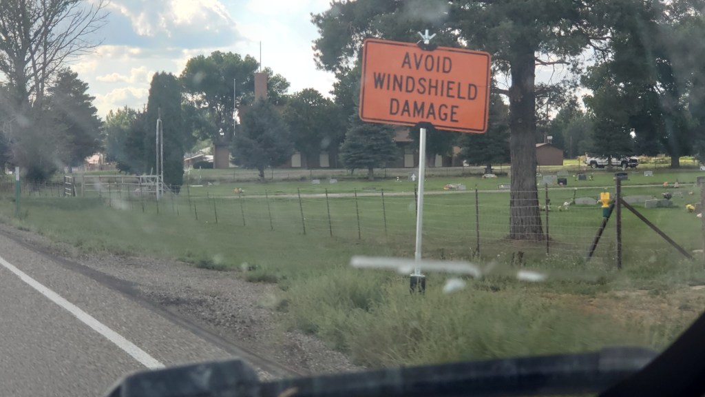
We don’t have a photo of the Sheriff, because we’re not crazy, but we did wonder about this sign. HOW do we avoid windshield damage, and damage from what? Pedestrians? Squirrels? What? Isn’t this something every driver wants to avoid from the moment they purchase their car?
The several-mile drama unfolded after our visit to Craters of the Moon National Monument and Preserve, the reason we were in Idaho in the first place. If you’ve been following along, you know we made a change to our original itinerary, and because of that our time in Idaho was in doubt. But both of us were eager to see the otherworldly park, so we booked a week in the area after our time near Salt Lake City, which opened up the opportunity to also see City of Rocks National Reserve, Shoshone Falls, and massive piles of the vegetable for which the state is famous.
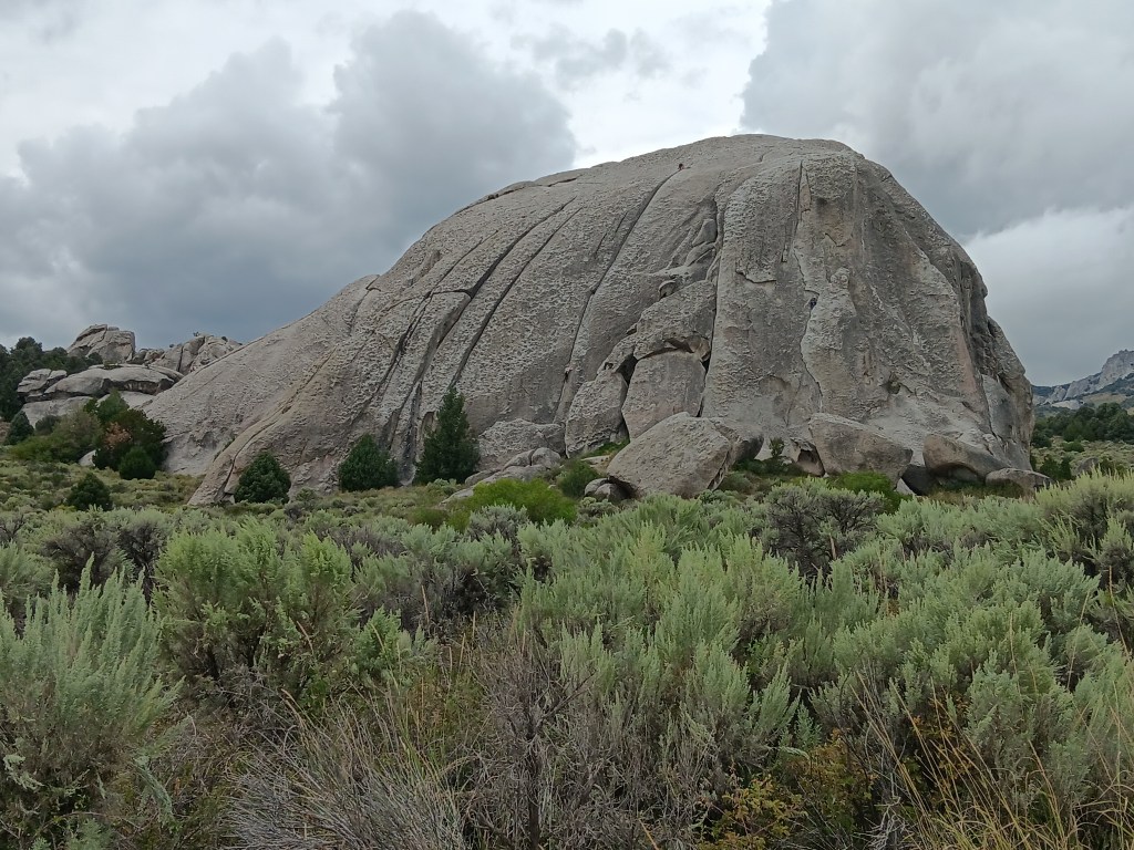
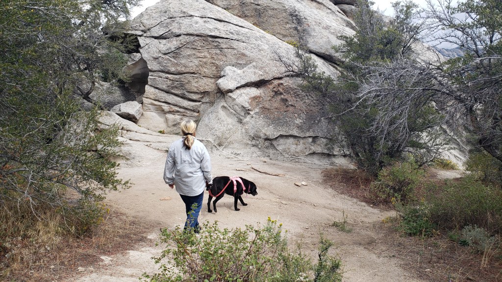
City of Rocks is a world-class playground for rock climbers, but its history includes emigrants passing through on the California Trail from 1843-1882 and, prior to that, use by native peoples. Its oldest rocks date back 2.5 billion years.
Really old rocks.
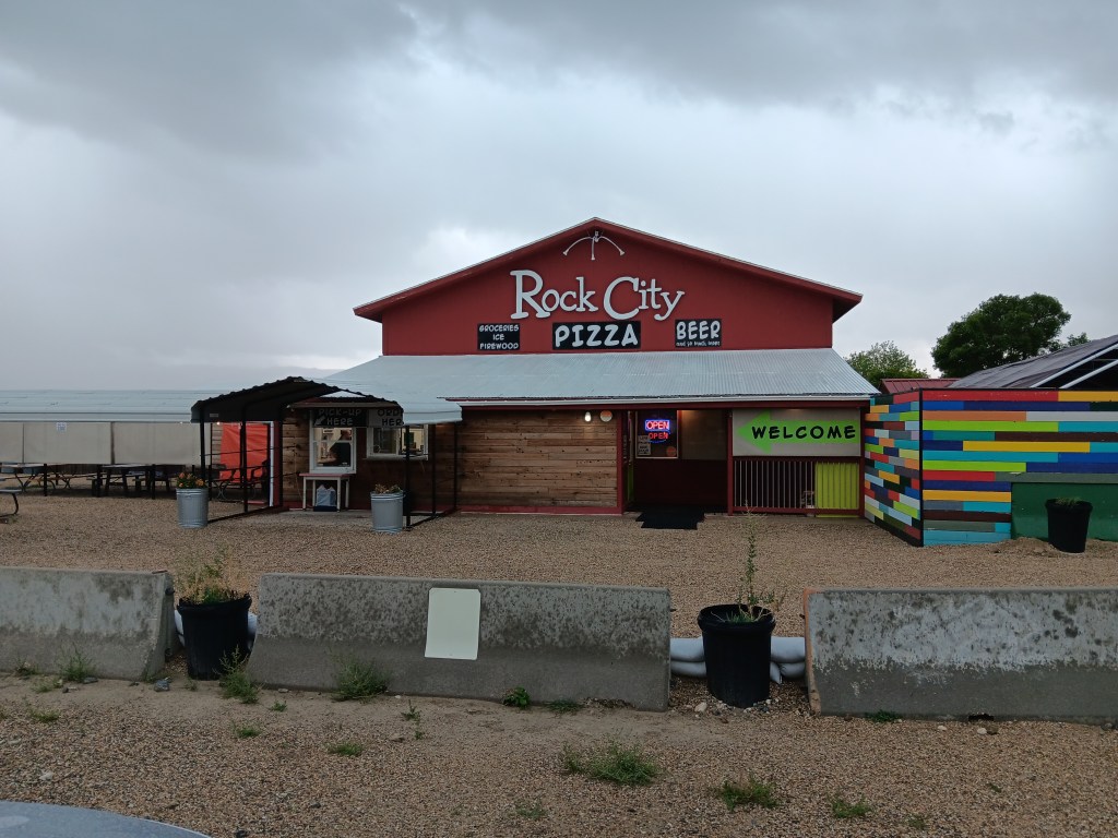
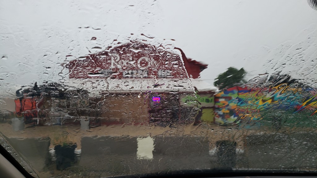
We were there for the scenery, though we didn’t know what to expect. A stop at the Visitor Center resulted in two useful suggestions from ranger Robb: Don’t take little Nippy on the rough road beyond the Bath Rock formation, and stop at Rock City for the best pizza you’ll ever eat and the only craft beers for a hundred miles.
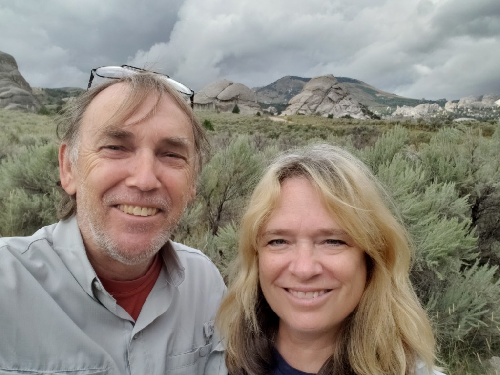
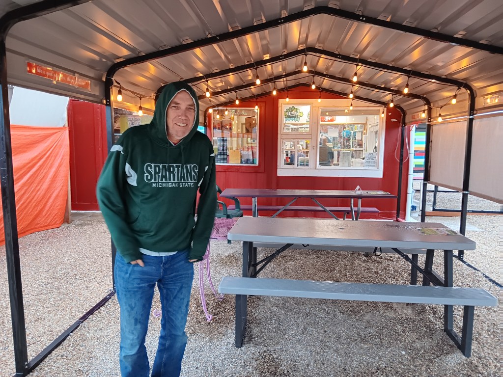
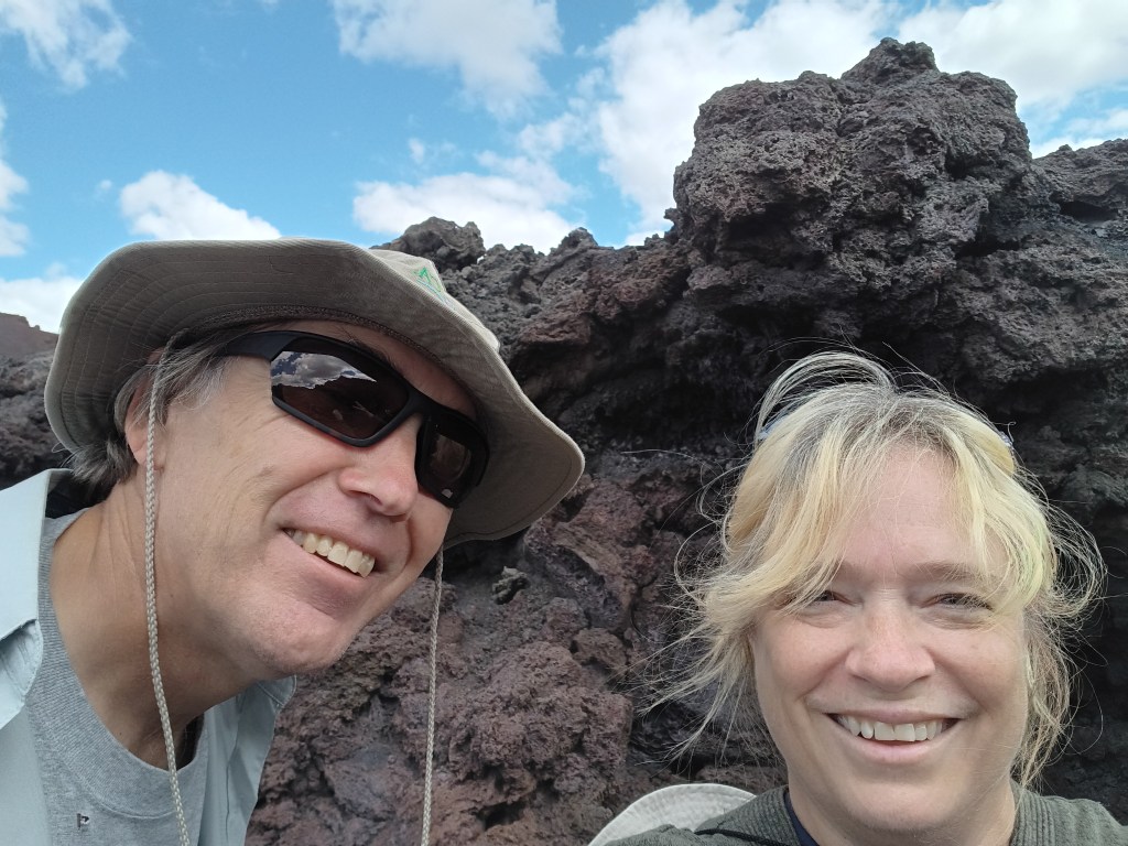
Obligatory selfie!
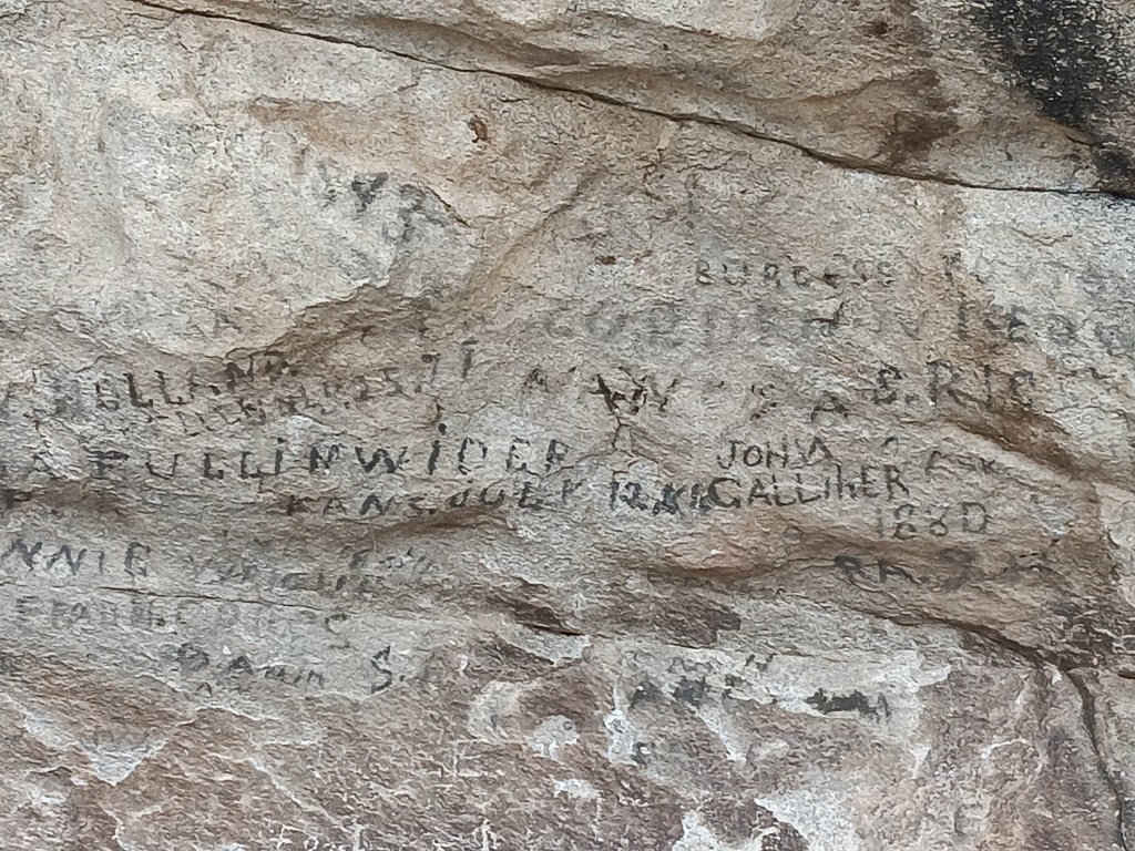
The park is entirely dog-friendly, with a handful of dramatic geological features, starting with Camp Rock (a.k.a. Register Rock). There, we found signatures and dates from emigrants who passed by, pausing to leave their names and sometimes a short message, written in axle grease.
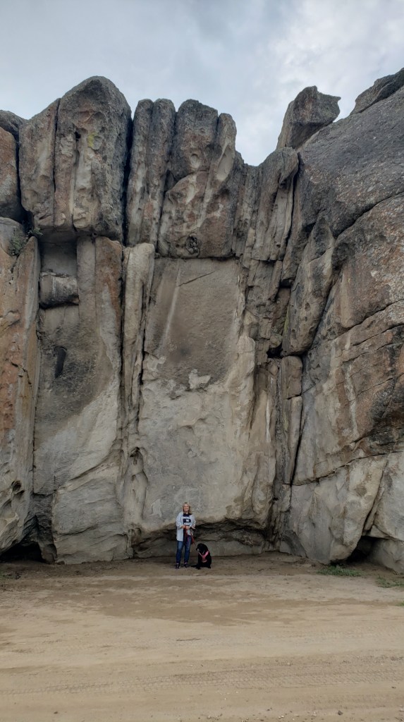
The rocks here are not small; this one was the smallest.
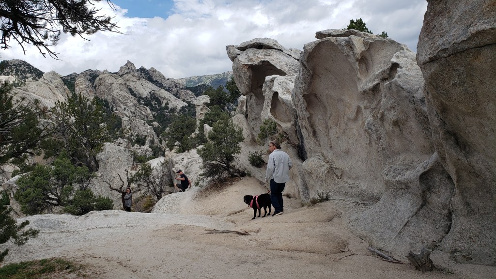
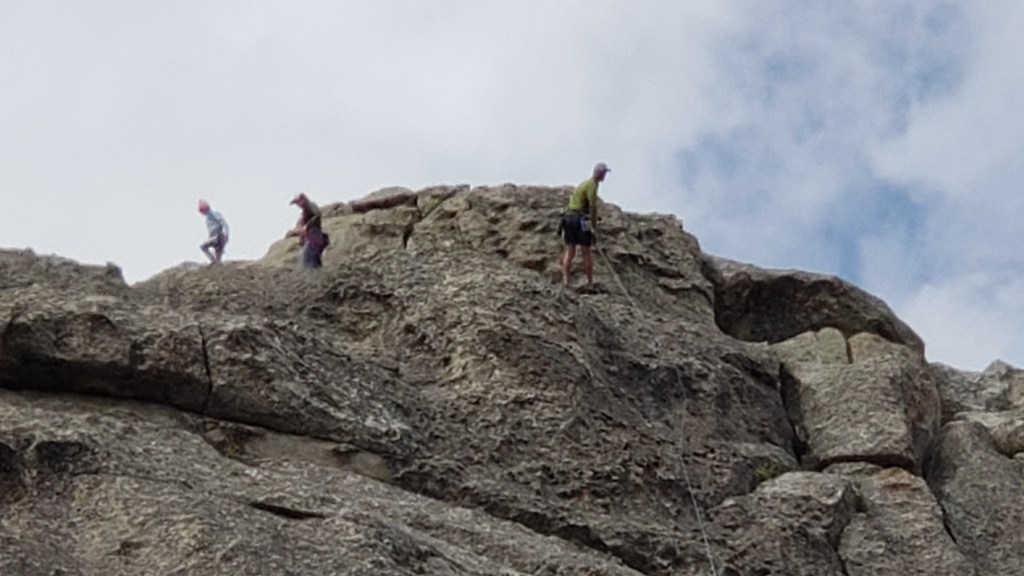
Next along the byway was Elephant Rock, and we were told it was a great place to see climbers. Sure enough, there were several making their way up (and down) the rock face.
The “trunk” of the elephant is on the left, but you can’t see it in this photo.
Look carefully and you’ll see a climber just above the horizontal boulder on the ground (the third one to the left of the boulder in the foreground), and another climber near the top of the fissure the lower climber is scaling.
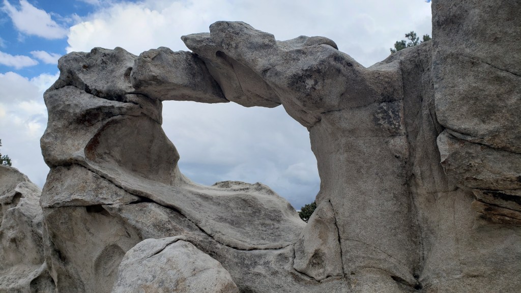
The trail to Window Arch, just beyond Elephant Rock, was only 250-feet long, but included some of the most dramatic views.
As with most photos, you can’t get the scale of this place.
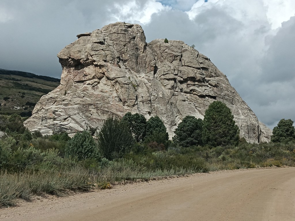
We ended at Bath Rock, a spiritual place, Robb at the Visitor Center told us, where his grandmother used to take him and his sister when their parents were traveling, and she’d “bathe” in the positive energy to remove the negative energy she was covered in. Energy which, his sister told him, was all his fault.
Bath Rock. Bathe in its healing powers!
Bath Rock was active with climbers, but a storm was brewing in the distance, so we enjoyed their activities for a while, took a little stroll along the trail, then headed out of the park for an al fresco pizza lunch.
People who are braver than us.
The storm had other plans. It hammered down rain, sending bolts of lightning perilously close to the gravel we were standing on, directly under a metal roof.
It was really cold, too.
We high-tailed it to the car, watching water pool alarmingly around the store and its picnic area, which added credibility to the Flash Flood warning we’d heard the store employees mention while we waited for our pie to bake.
Our view.
City of Rocks made a terrific afternoon out, in spite of the rain, and we were even more excited for our trip to Craters of the Moon two days later.
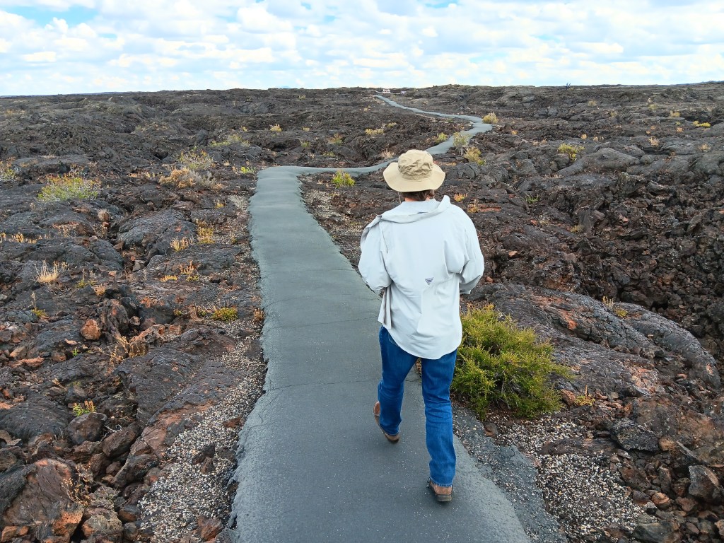
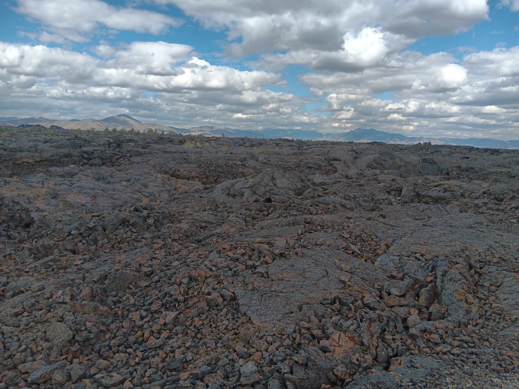
Our $20 America the Beautiful Senior Pass got us into the park for free (we’ll just add here that we’ve literally saved hundreds of dollars using this wonderful National Parks pass), and we marveled at the seemingly endless lava fields and features that were formed when molten lava oozed through cracks in the earth compliments of the 50-mile fissure known as the Great Rift.
Who are these people, and why are they always laughing?
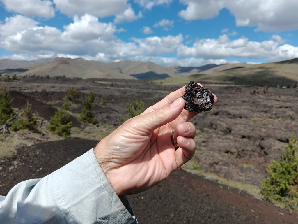
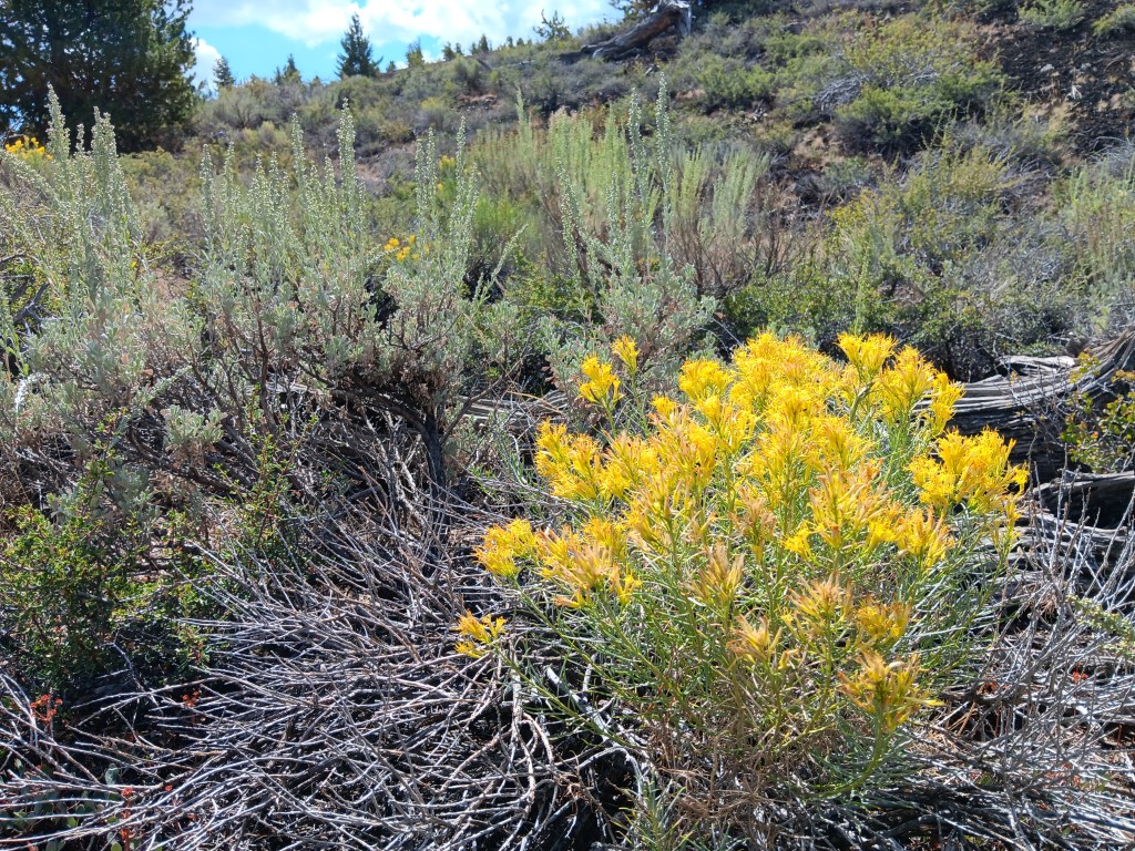
Our first stop along the seven-mile scenic loop was a hike up the powdery Devil’s Orchard cinder cone, a gentle start to our visit, punctuated by a surprising variety of flora.
The volcanic rock here was feather-light.
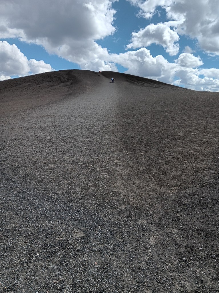
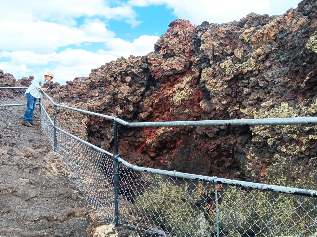
Inferno Cone was much higher, with a well-worn, crunchy path to the top of not one, but three rises with magnificent views over the valleys and to the mountain ranges beyond.
You can just make out the people climbing the hill.
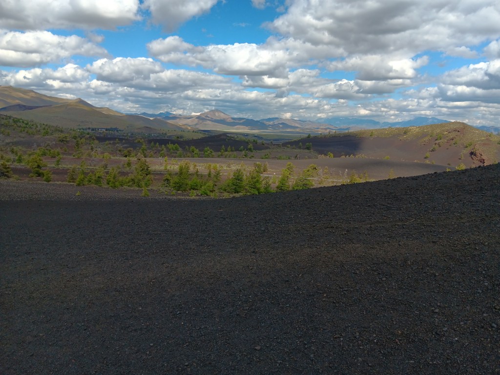
The view from one of the rises. It’s way, way down.
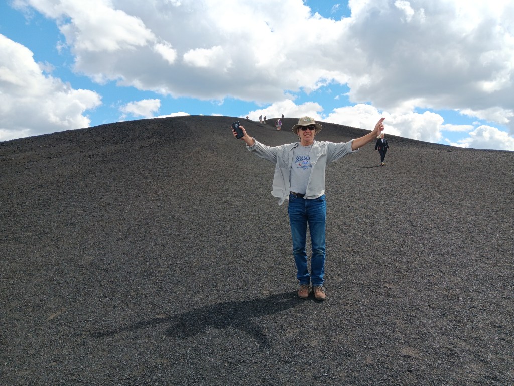
Guess who made it up to the third rise? Him!
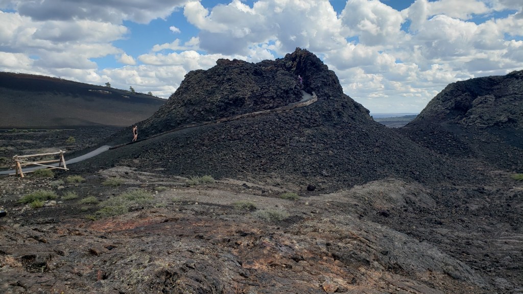
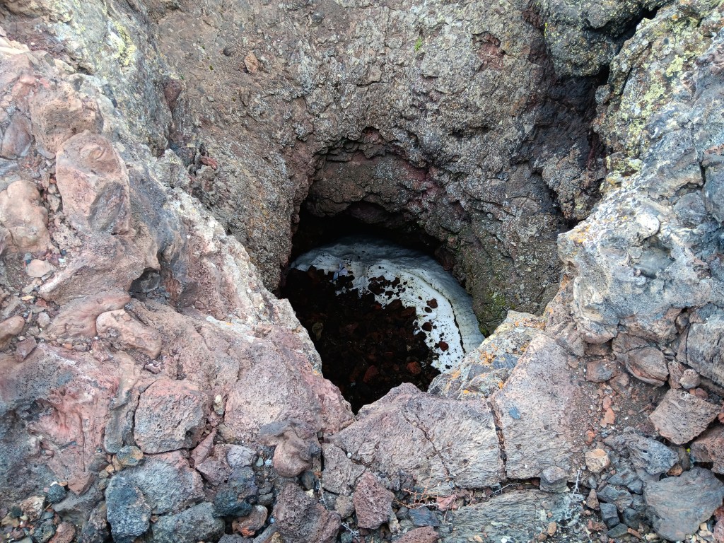
It felt fabulous to be out walking, and we were loving the interactive nature of the features. A second short hike of just a few hundred feet saw us looking into two Spatter Cones, the first of which still had ice at the bottom.
You can see the pathway leading up to the part of this splatter cone where you can look down into it.
That white stuff is ice. The second splatter cone had three or four hats in it.
We took all the side roads off the main loop, and had several WPM (Wows Per Minute) passing miles and miles of lava fields and curious “cinder gardens.”
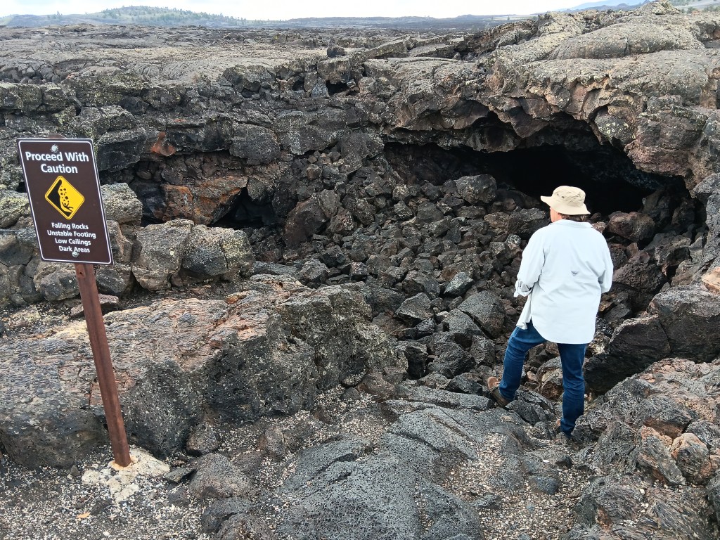
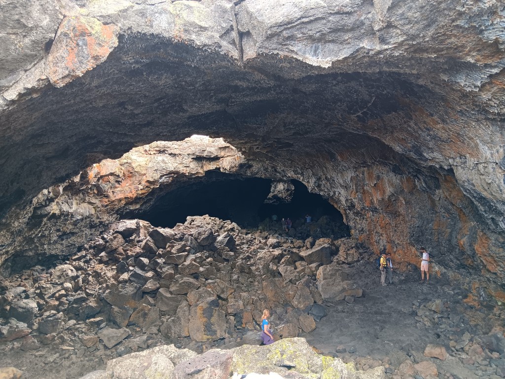
But our absolute favorite WPM was the Caves Area, where visitors could descend into some of the caves that formed when lava tubes collapsed.
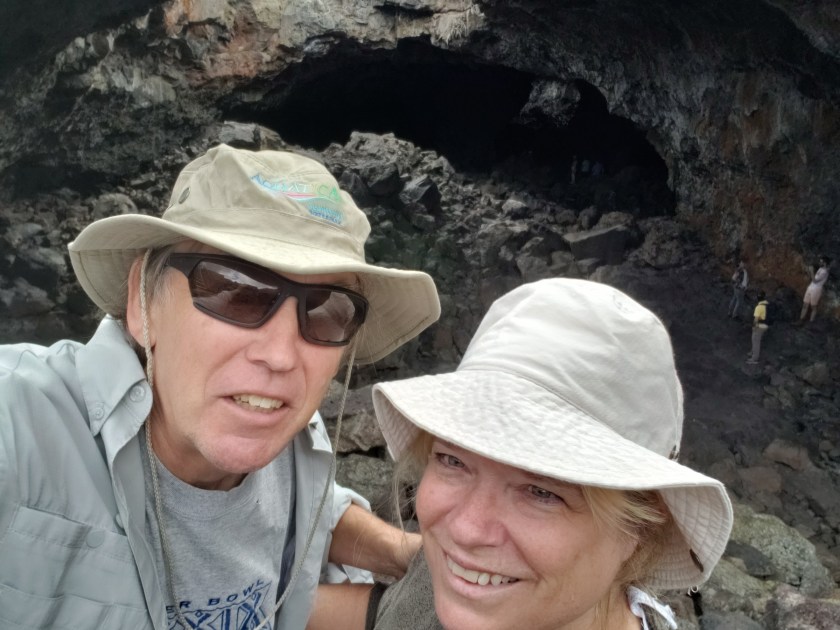
Precarious perch for a selfie inside the cave!
Sheriff of Richfield being the slightly humorous (if also slightly unnerving) exception, it had been a fantastic, unforgettable day. Our return trip to Village of Trees RV Park had one more surprise in store.
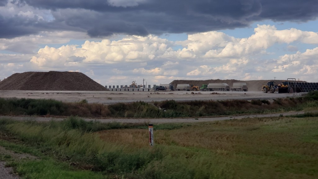
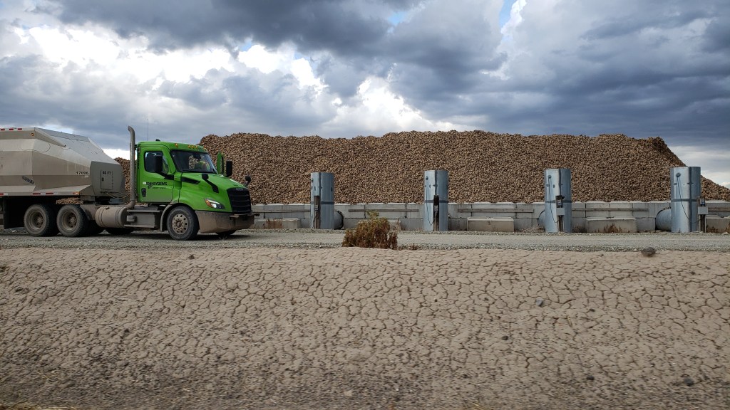
We’d been unreasonably excited by all the trucks we’d seen carrying Idaho potatoes from one place to another, but we didn’t expect the absolute thrill of two massive mounds of potatoes getting ready for transit. We shouted and pointed and laughed out loud at the piles and our incredible luck!
Those piles aren’t wood or sand or dirt. They’re potatoes!YAY!
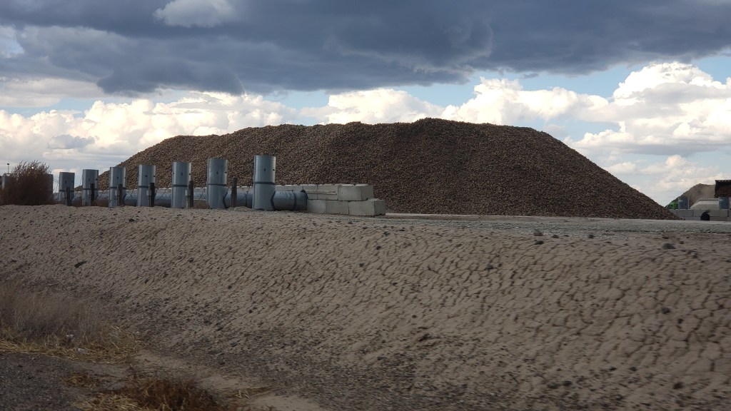
One more potato photo.
Okay, last one, I promise!
We know that’s sad and maybe even worrisome, but we’re proud of our little quirks, and of our ability to find joy in the small stuff.