The latest instalment of our exclusive series for The Independent newspaper in the UK is now online, highlighting our travels through Nevada and Southern California, including the Mojave National Preserve, Valley of Fire State Park, and Greater Palm Springs.
This section of our Year On The road adventure took us deep into desert territory – both the Mojave Desert of much of Nevada and the Sonoran Desert that runs from Mexico up into Arizona, including part of SoCal.
Our view of the Hoover Dam from our travels around Las vegas
There were scenic wonders aplenty, and a chance to see why both one of the Star Trek movies and Arnold Schwarzenegger’s Total Recall were filmed here and, for as bright as it shines, we honestly felt the scenery around Las Vegas actually glittered brighter than the city itself.
We also want to offer our sincere thanks to both Travel Nevada and Greater Palm Springs for their help in ensuring we saw the best of their areas, as there was a LOT to see!
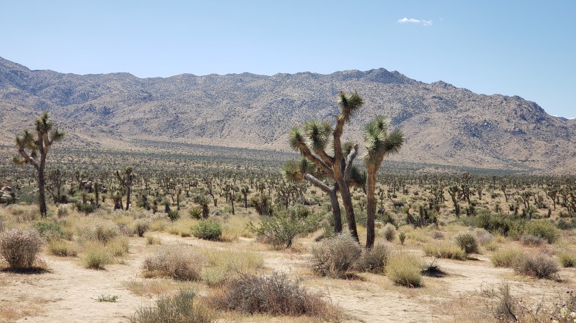
Signs pleading “Do Not Die Today” served as a grim introduction to Joshua Tree National Park, but, like most visitors, we made a mental note to avoid death and joyfully headed into the desert where succulents beseeching God and the un-huggable “Teddybear” cactus both live.
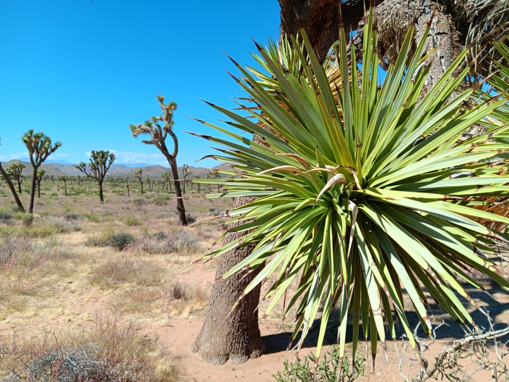
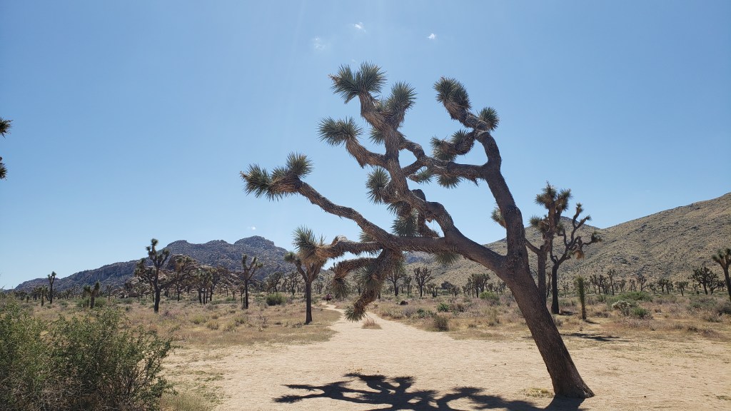
Joshua Tree National Park’s star attractions – named by 19th-century Mormon settlers who decided they looked like the Old Testament’s tribal leader, Joshua, with his arms raised toward his Heavenly Father – aren’t trees. They’re a type of Agave, the genus responsible for tequila, which, when imbibed in quantity, can also make you see God.
Other agave.
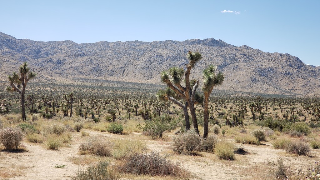
Joshua Tree National Park contains the greatest number of its namesake specimens in the world, and their importance to the ecosystem has earned them well-deserved protection by law. Visitors are allowed to walk the sandy trails between the plants, and a quick touch of their spiky appendages is all the incentive needed to leave them alone.
Having driven in via the West Entrance (located on the north side of the park), we had at least two hours of good scenic driving, with plenty of stops to enjoy each elevations’ unique topography.
Every time I turned around he was poking his finger on a plant.
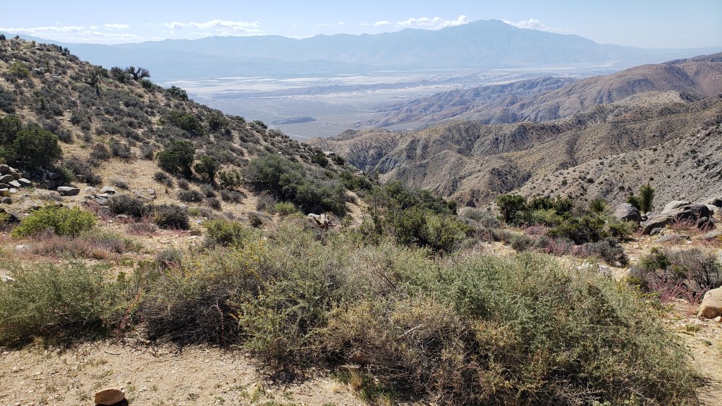
Among the highlights were an unexpected view of Palm Springs (our next destination) from the 5,185-foot-high Keys View overlooking the Coachella Valley, and the shocking realization we were also looking at the infamous 750-mile-long San Andreas Fault Line, an unsettling uprising where the Pacific and North American tectonic plates collide, with dramatic results (earthquakes).
The long, thin, dark mound stretching across the valley just below the furthest mountain range is the San Andreas Fault Line. Who knew?
Also visible from Keys View are the Salton Sea, which we’d visit the next day, Signal Mountains on the U.S./Mexico border, and Mount San Jacinto, rising 10,831 feet above the valley.
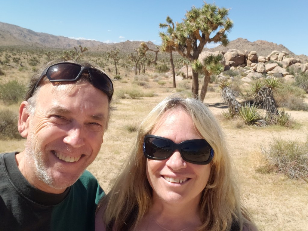
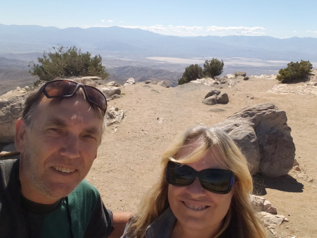
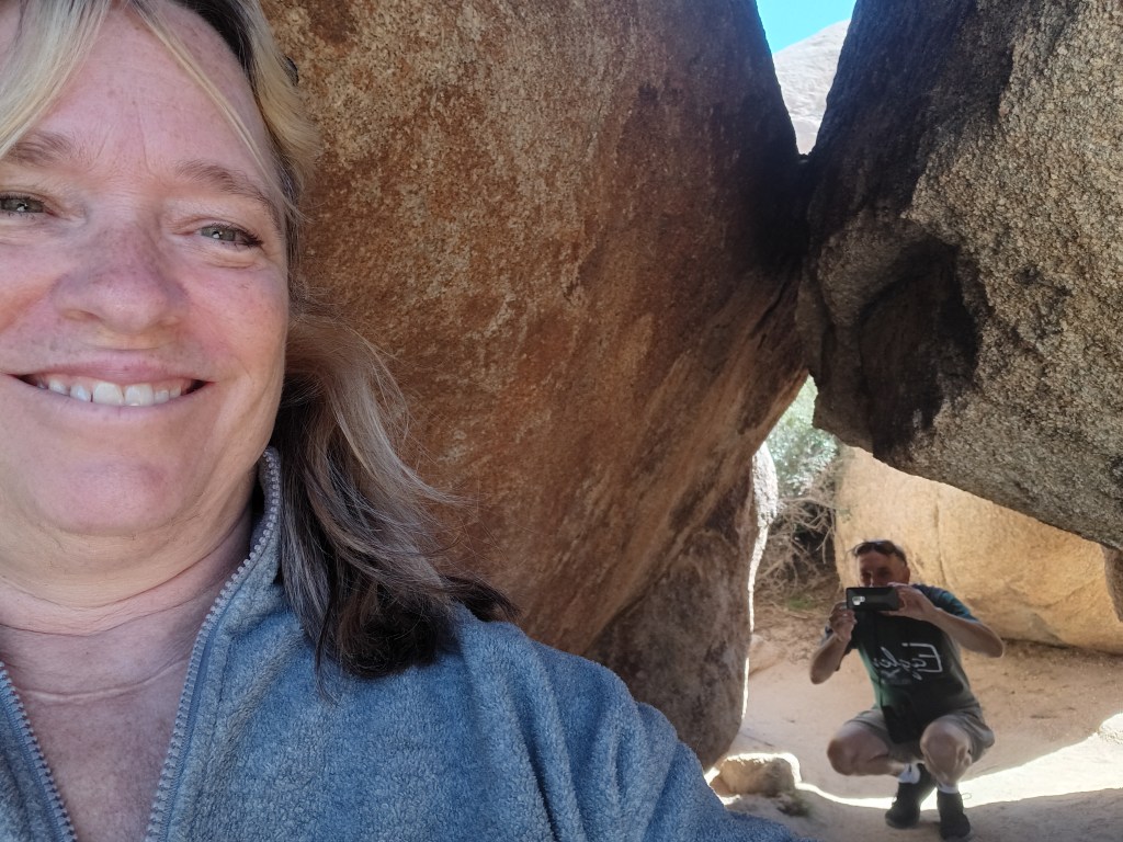
Obligatory Selfie.
Returning to a lower elevation, we paid a visit to Hall of Horrors and its freaky rock mounds before taking a detour south to Cholla Cactus Garden.
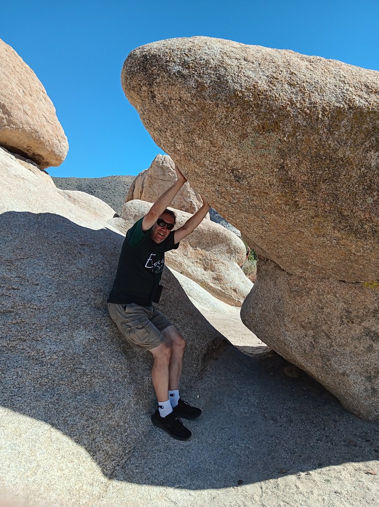
How artsy are we!
Some shots look so real in your mind, but maybe not quite as real when you take them,
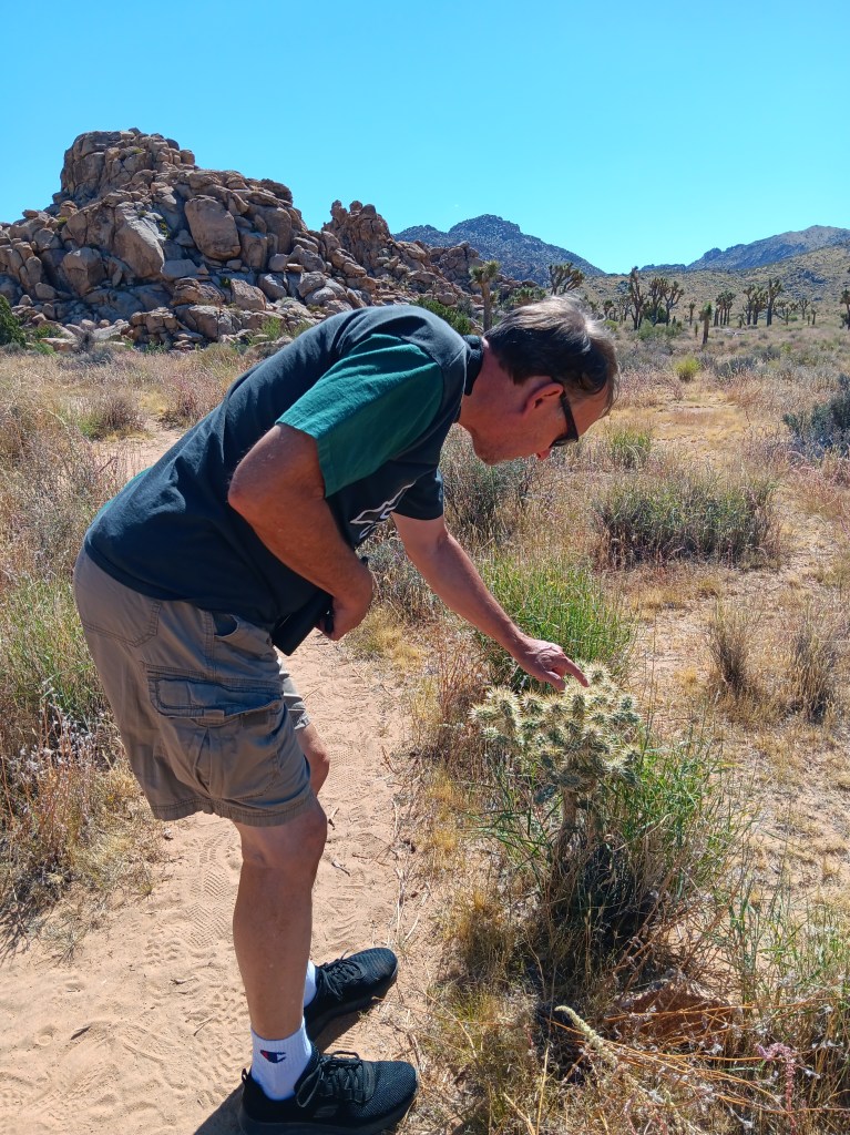
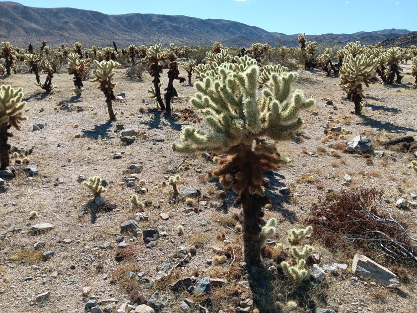
As much as we enjoyed the delightfully wonky Joshua Trees, we were even more taken by the ten-acre grove of Teddybear Cholla cactuses that only grow between 600 and 3,300 feet above sea level. Their name is misleading. This isn’t the sort of thing you’d want your toddler to snuggle down with for a good night’s sleep.
They look so cute and fuzzy, don’t they? They’re not.
Adorable as they are, they also have a super-power that allows their needles to readily attach to anything that brushes by them, and not in a good way. Simon was tempted to give them a poke, but, somehow, he resisted. We have special tweezers in the car for just such emergencies (tick tweezers for dogs, really, but they’ll pull needles, too), but thankfully we didn’t have to use them.
We returned to Joshua Tree after our visit to Palm Springs, but in the interest of efficiency I’m going to include that visit here and cover Palm Springs separately. We ate a lot of real food while experiencing the tucked-away haven for celebrities, wealthy second-homers, and the hard-working people who keep the whole place going, and that deserves its own blog.
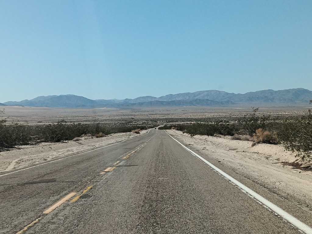
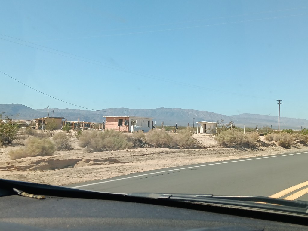
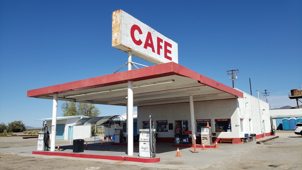
On our way through California from Nevada we took the northern route to Joshua Tree, traveling along roads that were not only desolate, they also featured tiny towns that were mostly abandoned, and a single gas station/café that we thought would have a restroom for bursting bladders, but didn’t.
This, but for three hours.
There may have been about 50 buildings here, but only a handful were occupied.
Need a bathroom with a flushable toilet? Too bad. Not doin’ it here!
Not wanting a repeat of that crushing emptiness and full bladders, and also wanting to see the southern side of Joshua Tree National Park, we opted for Highway 10 east, blissfully unaware of what the northern leg of the journey along connecting Highway 177 would bring.
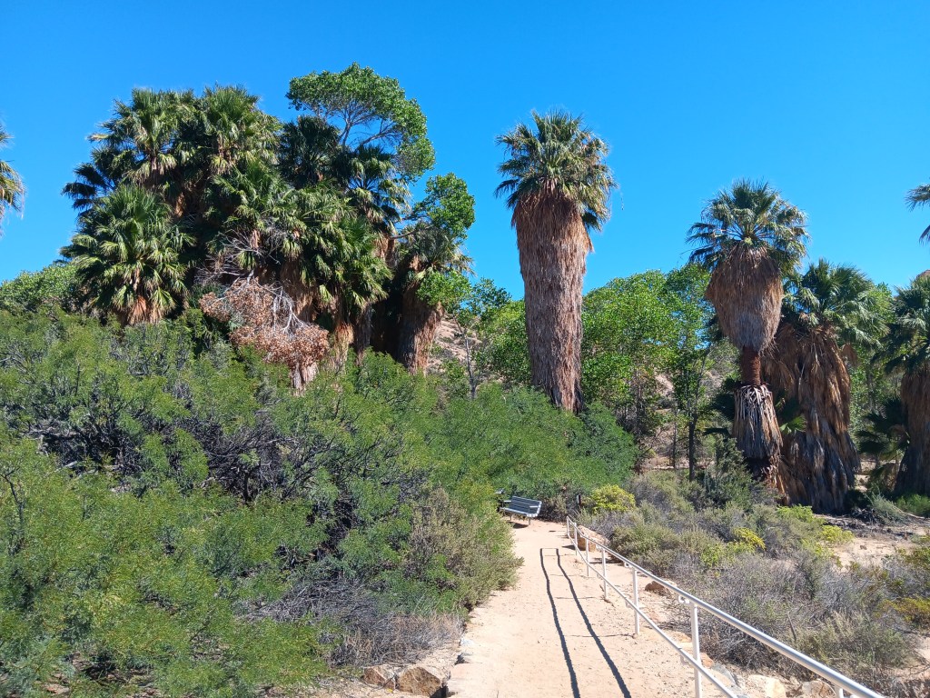
We only needed a moderate detour into the park for Cottonwood Spring, a literal oasis in the desert. Instead of the shimmering mirage that promised a palm tree-line water hole to movie and cartoon characters who didn’t pay attention to the Do Not Die Today signs and pack enough water and their own shade, this oasis did exist, and provided cooling cover, though all of its water had dried up.
A real live oasis. I’m not even sure I knew these existed.
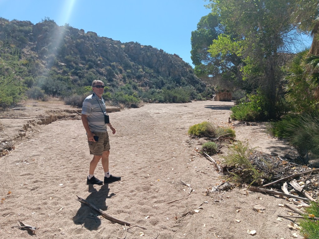
Tiny Simon.
With so much dense foliage around, and this being a desert, we did wonder what might be lurking in the underbrush or clinging to tree branches, but we set that aside and had a nice little wander, admiring the dry wash that ran through it while also bearing all the Flash Flood Danger signs in mind.
As pretty as the oasis was, it must be even more spectacular when this wash is flowing.
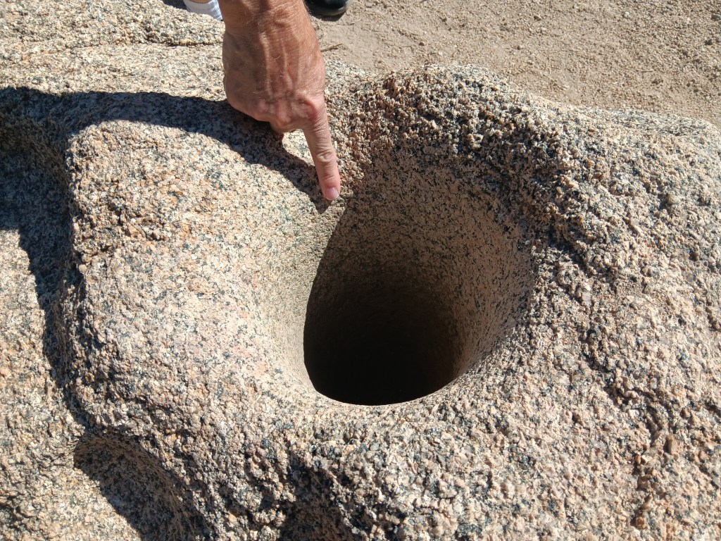
Fascinating signs along the oasis’ pathway described how the Cahuilla Indians who lived here used desert plants for food and medicine, and evidence of their daily lives remains, through mortar holes ground into granite rocks. The holes are so deep we could put our hands into them, nearly up to the elbow. Imagine how long it would take to form a hole that deep when grinding seeds for food.
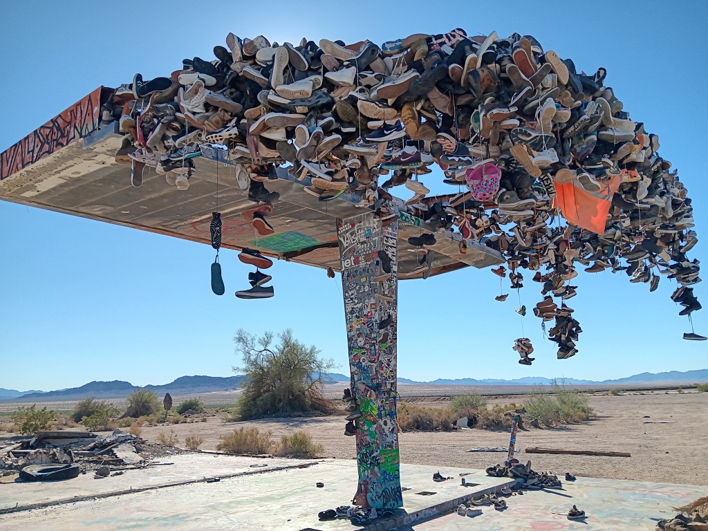
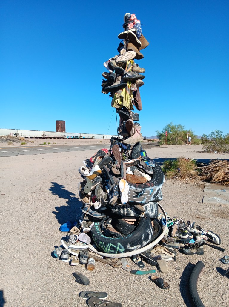
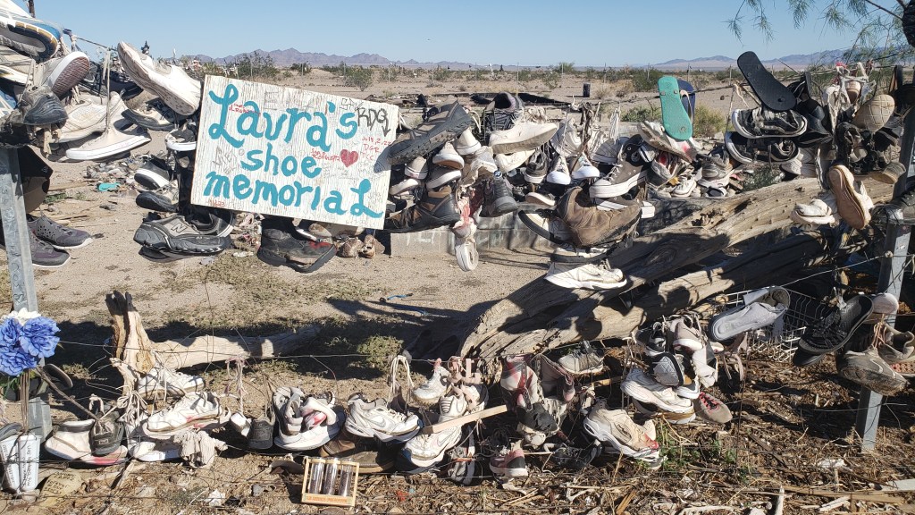
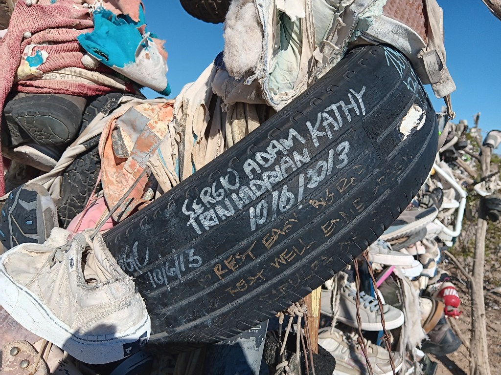
On the return journey back to Laughlin, we had the same mind-numbing emptiness along Highway 177 as we’d had on Highway 62 on our way out, with two major exceptions. Out in the middle of absolutely nowhere were two roadside curiosities. Hundreds of shoes, most tied together in pairs by their laces, some just singles, and some nothing more than the sole of a shoe, were thrown over a metal structure and a fence, or strewn across the ground as if blown down by the wind or left by a careless owner.
There’s no way you can drive by something like this without stopping.
Fledgling shoe tree.
One side of the big shoe fence.
Other travelers had stopped, too, and we all wondered what it could mean. The trash and broken glass scattered around the place suggested a festival of some sort had taken place, but signs and signed objects indicated grief. Many shoes were signed with, presumably, their owner’s name, but other objects included comments such as “Rest easy,” or “R.I.P., Forever in our hearts” or the grief-ridden, “I love you, my boy, my son.”
It began to dawn on us that these could be memorials to young people who had passed during their school years, or shortly after, and the shoes were a way to show respect for their memory.
There were no schools nearby, and no town, nor even any buildings. Was the road a hazard? Did local teens dare each other to take on the desert the way only those who feel they have lots of time and are somewhat invincible could do? What happened here?
When we returned to our dear Fati we looked it up, and it turns out these shoe memorials are mainly just due to people passing by who throw their footwear over the metal “tree” or fence, presumably to combat the utter boredom of driving along that vacuous road. No one perished along the highway, though some deaths were remembered there.
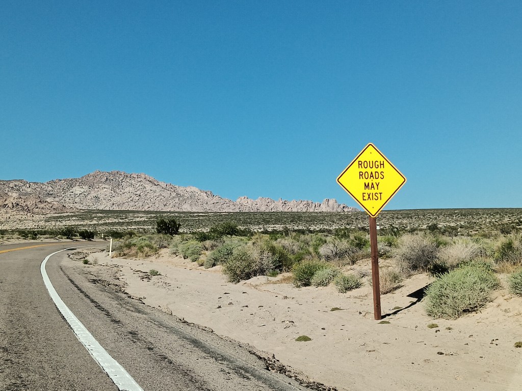
We could see how people might die in Mojave, however, if they’re ill-informed or careless. At the same time, the desert held a quiet beauty for us; a beauty that was subtle and odd and blistering. We left thankful that we did not die that day in that fierce and wonderful place.
At the start of our journey, we had five California national parks on our itinerary. Once we were within striking distance of The Golden State after modifying our route, only two of those parks remained viable.
Yosemite, Sequoia, Death Valley, Mojave Desert, and Joshua Tree were high on our list of parks we were most excited to see, but from our base in Laughlin, Nevada, the logistics – and Hurricane Hilary – came into play.
We had spent the last several weeks working on a plan that would allow us to make two overnight trips into California in Nippy, first to Yosemite and Sequoia, then to Joshua Tree and Palm Springs, along with a day trip to Death Valley and a day trip to Mojave Desert.
We won’t put you through the mental gymnastics we performed, but will only say it just wasn’t feasible. With various road closures, Sequoia and Yosemite were too far for a single overnight, and Death Valley was closed completely due to damage from Hurricane Hilary.
This isn’t a national park. It’s our lunch in the Mojave Desert. We are (and by “We are,” I mean “Susan is”) posting it only to prove we do sometimes eat real food whose ingredients go together. I’m also posting it because I don’t have any other photos that would be appropriate, and I’m tired of posting photos of rocks.
When our year on the road ends, it doesn’t mean we’ll never travel again, we decided, and we would put Oregon, Washington, and California on the menu for a later date, to enjoy them fully and at leisure. Problem solved.
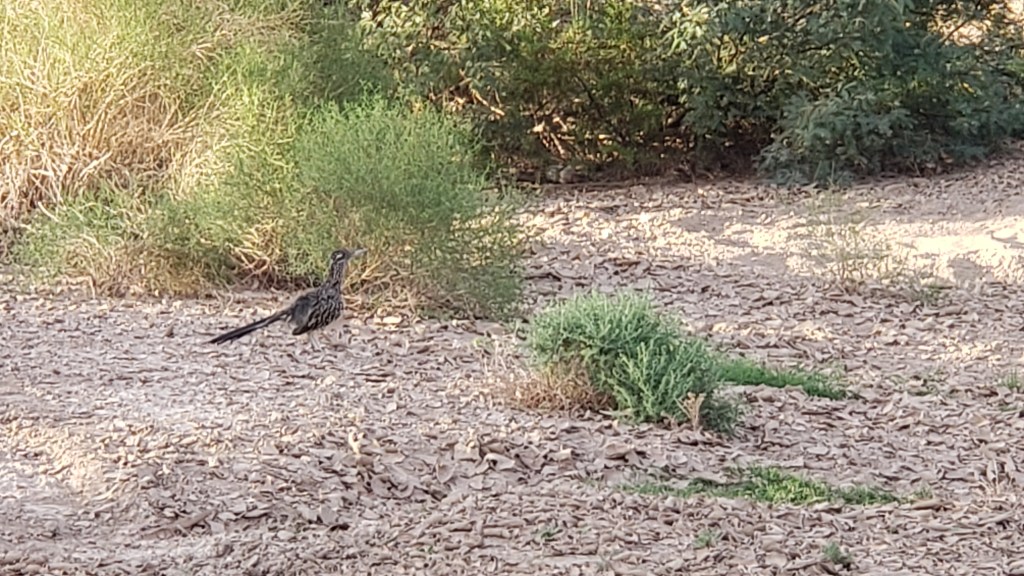
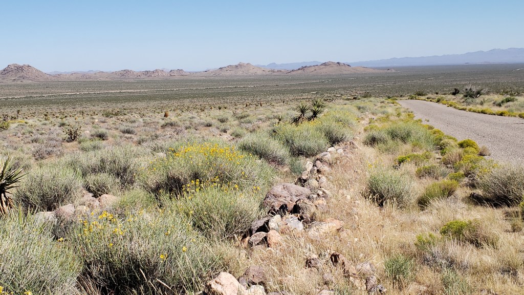
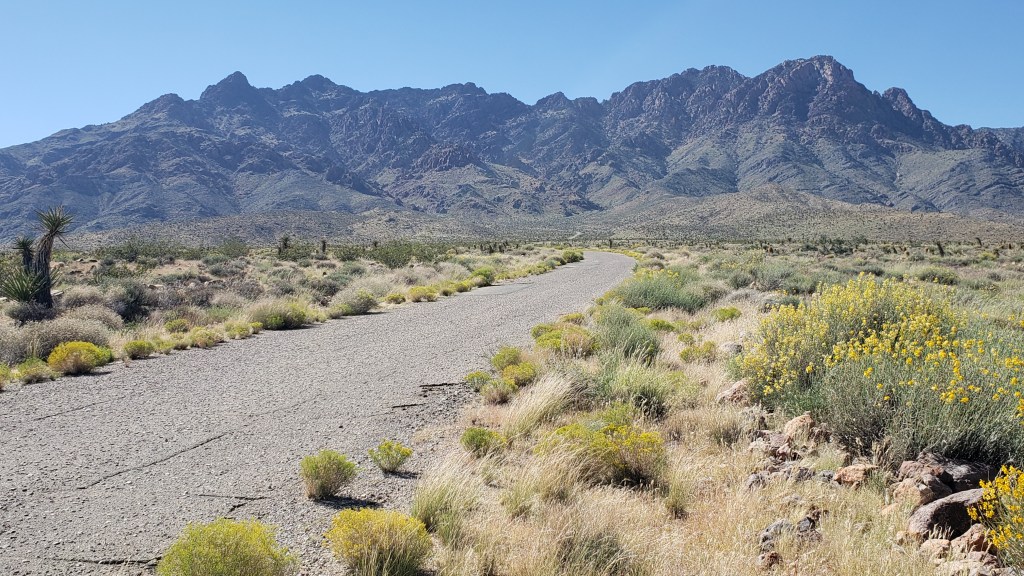
Mojave Desert National Preserve was only 51 miles from Laughlin, barely time to get Nippy’s engine warmed up. Neither of us had any real idea of what to expect, but we did hope we’d come across another roadrunner, a bird Simon was eager to see. We’d spotted one at Davis Dam in Laughlin but, as everyone knows, one roadrunner sighting isn’t enough.
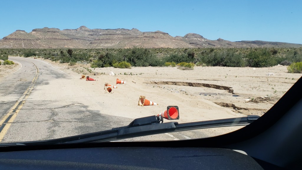
There was still evidence of water damage from Hurricane Hilary when we entered Mojave Desert National Preserve at Hole-in-the-Wall, named for the rocky hillsides that look like Swiss cheese.
Messy, but passable.
Swiss-cheesy rocks
There were also no-go areas that were under construction or prohibitive due to a fire, and many roads were only accessible to four-wheel-drive vehicles, so our options were limited. But our goal had really been to see the desert, and we’d certainly get a flavor of it with the driving we could do.
This goes on for 1.6 million acres, and spills out to a whole lot more of southern California.
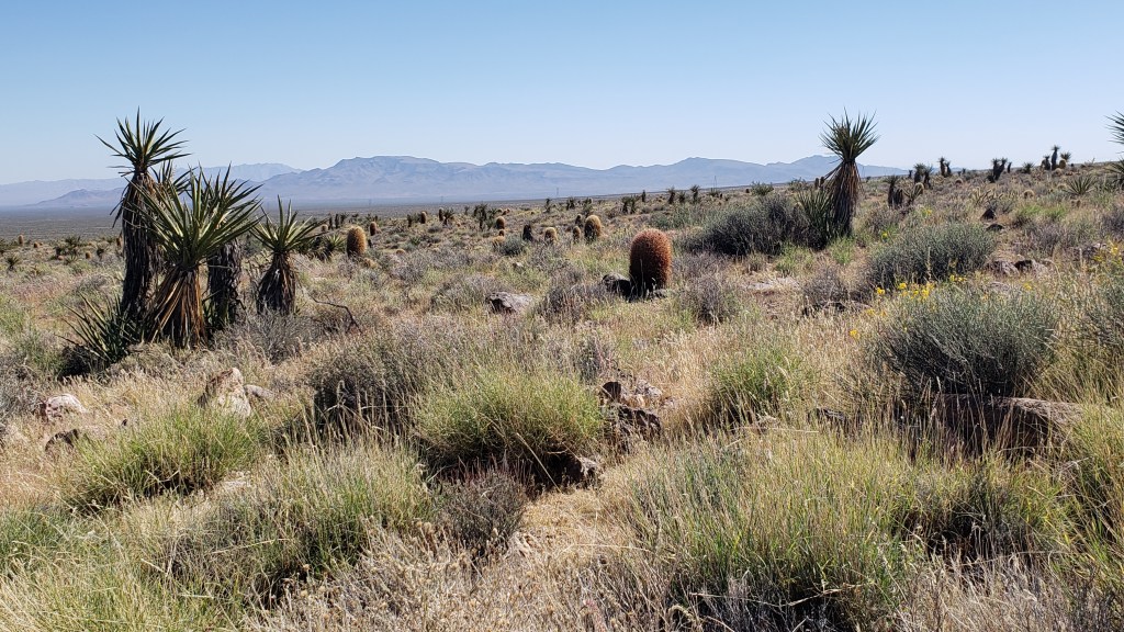
We thought the desert would be nearly all sand, but it was surprisingly vibrant.
Those brown cactus kept fooling us into thinking there was a large mammal grazing in the distance. They sort of look like baby Wookie penguins up close.
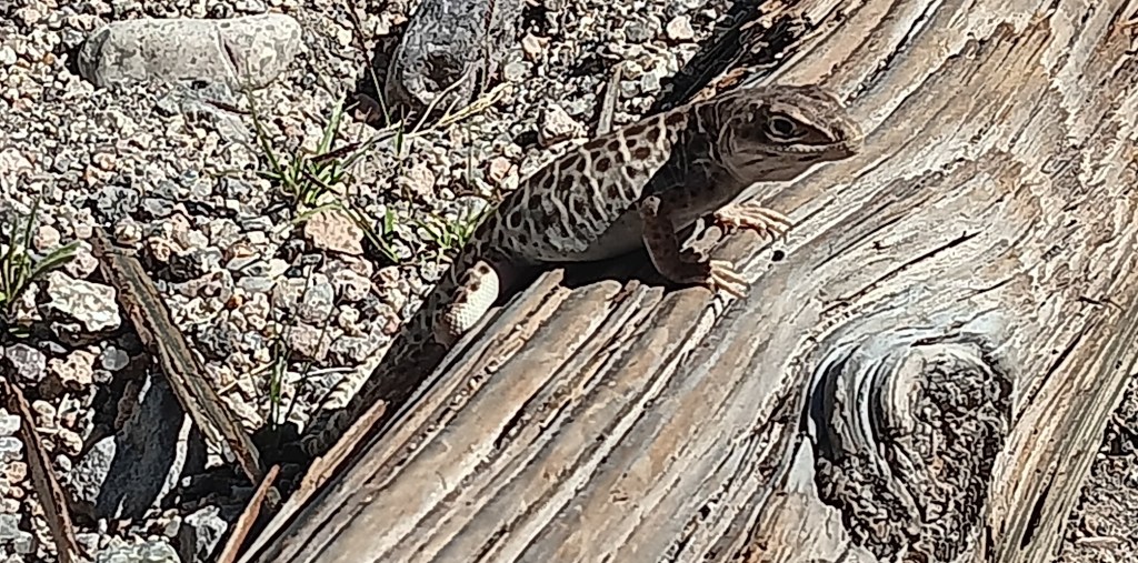
This little fellow greeted us at the Visitor Center, and wasn’t at all shy about posing for the camera.
We didn’t see any roadrunners, but we did have a wonderful wildlife sighting, which capped off the trip perfectly. The Desert Tortoise is a threatened species, so it felt quite special to see one, especially at such close proximity.
Click on photo to view video
One of the most popular reasons for visiting Mojave Desert is the Rings Loop, a hike which includes an ascent through the tight Banshee Canyon using metal rings embedded into each side of the narrow rockway, but Ruthie couldn’t do that because she doesn’t have opposable thumbs.
Rings Loop Photo credit U.S. National Park Service
The Lava Tubes are another major draw, but due to damage they are now accessible only by four-wheel-drive, so the man at the Visitor Center suggested a side trip to Kelso Dunes, further west along Highway 40. The loss was softened a bit by having been in the lava tubes at Craters of the Moon while we were in Idaho.
We forgot to take the obligatory selfie at Mojave Desert, so here’s one from Craters of the Moon.
The dunes are massive. Much more extensive than Bruneau Dunes, but also much harder to access. There are plenty of warnings not to enter any road that’s not paved if you aren’t in a 4WD, so again, that particular road was off limits to us.
Roads often start out looking all benign, but can quickly devolve into bone-jarring terrain.
The day had still been worthwhile, and we were glad to have made the trip. To make up for any small frustrations, we had a rockin’ surprise in store when we returned home to Fati.
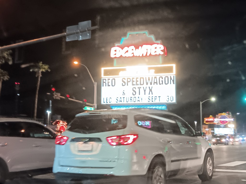
One of the casinos in Laughlin had been advertising a concert featuring REO Speedwagon and Styx (for those born after the turn of the century, these were popular rock bands from the ancient days of the 1980s). What we hadn’t realized was, it would be an outdoor concert just up the road from our campground, and we’d be able to hear every single note from our living room.
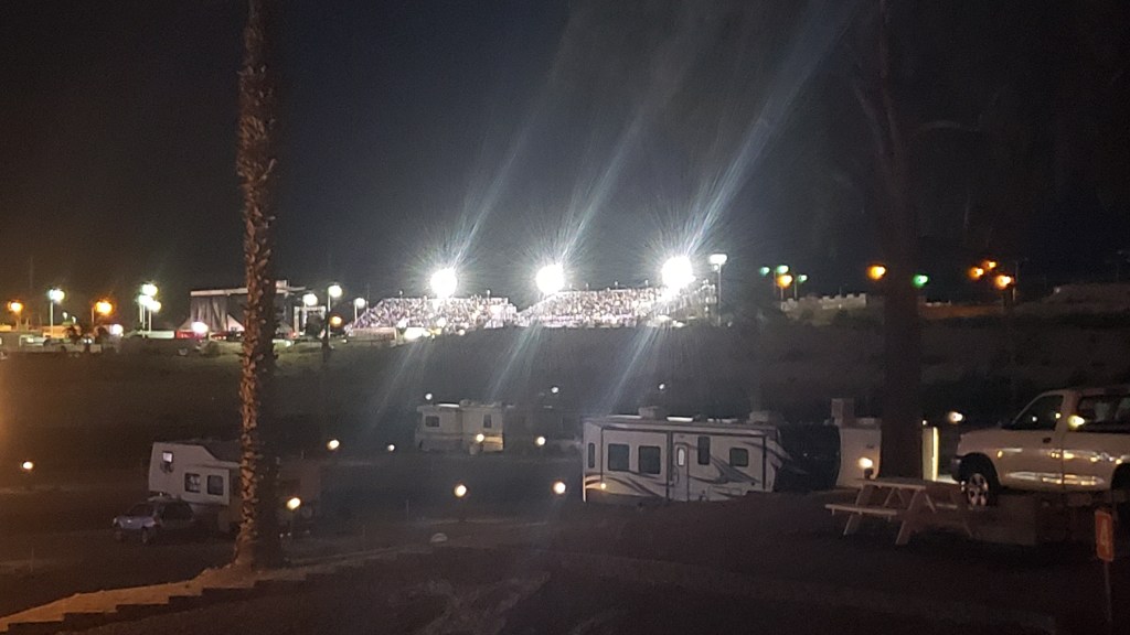
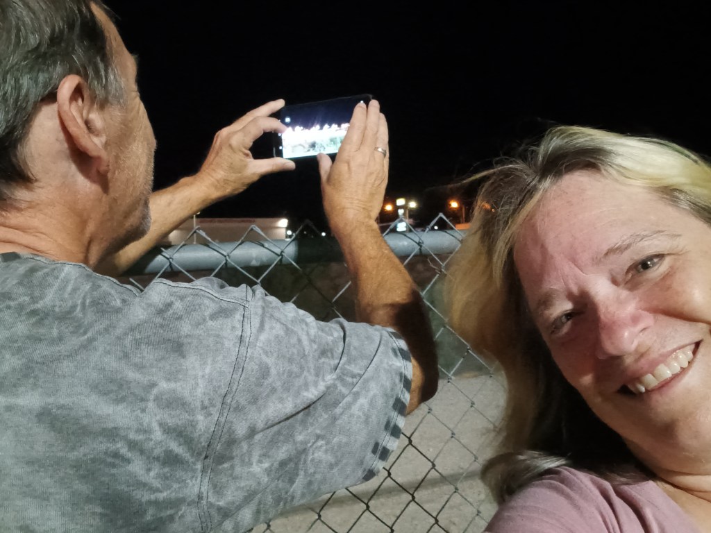
It occurred to us we might have an even better view if we drove over, parked nearby, and walked up to the venue, but the police were out in full force at barricades to the road the stadium was on, so that was a big “No.”
We sat in a parking lot just across the street, but it quickly dawned on us the wind was blowing in a direction that favored us returning to Fati, where we could hear each song clearly, have our own clean bathroom, and enjoy a beer for less than $15 a pop. Rock on, Team Veness!