Part 3 of our exclusive series for The Independent Travel is now online, highlighting the glories of both Yellowstone National Park and Glacier National Park, including the Bison of Yellowstone and the astounding Going-to-the-Sun Road in Glacier:


Part 3 of our exclusive series for The Independent Travel is now online, highlighting the glories of both Yellowstone National Park and Glacier National Park, including the Bison of Yellowstone and the astounding Going-to-the-Sun Road in Glacier:
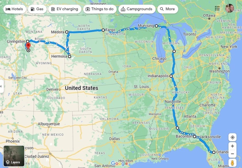
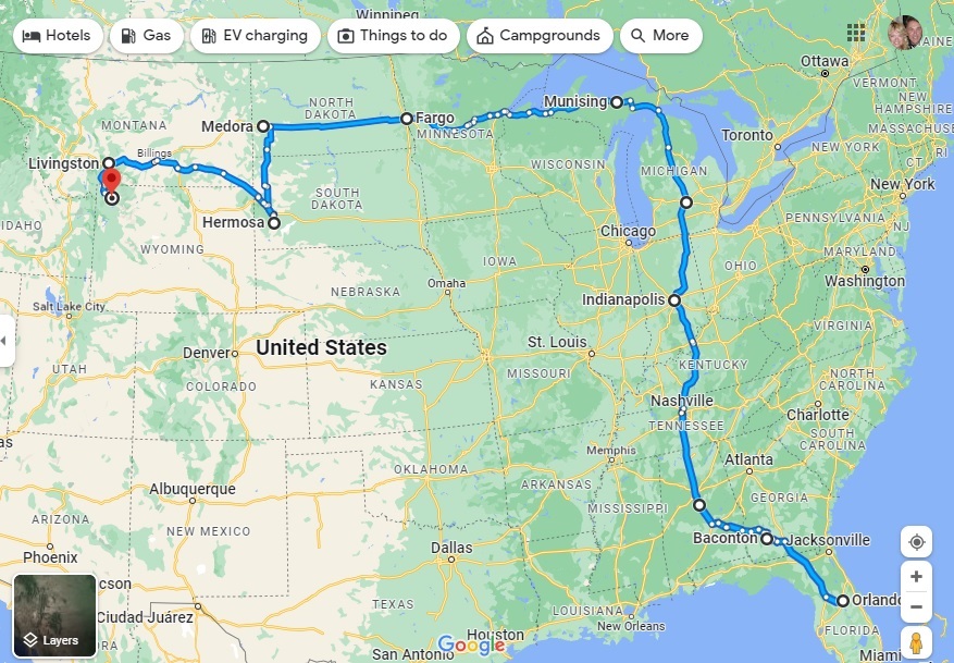
Highlighting our fourth month on the road and the route so far – all 5,929 miles of it
After three months of fairly hectic traveling, our four-month mark shows that we have come the shortest distance for any month of the grand RV trip to date, from Wheatland in Wyoming to Fillmore in Utah (via what looks like a strange detour to Declo in Idaho, but which was the best way to see some of Idaho without putting too many miles on our RV).
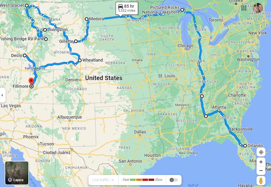
Our mileage for Month Four was therefore just 868 miles, compared to 1,318 last month, 1,239 in Month Two and a whirlwind 2,504 in the opening month.
The total distance in Indefatigable (or Fati for short) since we left Orlando is now 5,929 miles.
The slower pace has been deliberate, of course. We realized that we were trying to pack too much in to this crazy 10-wheeled adventure and we have purposely changed both our itinerary and our pace of travel to avoid the mental and physical breakdowns we experienced in the first two months.
The key has been to identify an area that allows us to explore in multiple directions for a week or so, and then use our tow car, Nippy, to do more of the exploration.
To that end, we have actually gone an additional 9,621 miles in Nippy in those four months, almost 3,000 of them in the past month alone. That total includes a spur-of-the-moment trip into Canada from Montana, our overnight excursion to Rocky Mountain State Park in Colorado and an extensive day trip to the Flaming Gorge in Utah, both from Wyoming.
Our total mileage for the trip so far is therefore a whopping 15,550, or 3,887.5 a month!
The next month could see us top that record for Nippy, too, as we plan on basing ourselves in southern Nevada for trips into Southern California. As ever, this is an – ahem – moveable feast, but you can be sure to read all about it here!
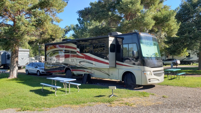
We’re used to living and working together 24/7, but being in a tiny space all the time isn’t the same as being in a house with several rooms. So how do we live, work, and organize a space that compresses down to a single aisle with just a bedroom, bathroom, and living area? Here’s how.
Admittedly, our 36-foot Class A motorhome is massive compared to some rigs (the smallest one we’ve seen being literally just a mattress on the inside and a tiny covered shelf with a sink on the outside), but it’s not all that big compared to the really big rigs.

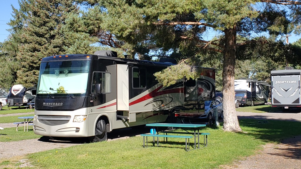
Naturally, with space at such a premium, we have to be incredibly organized. Our living area breaks down to the “basement,” the cab, the galley, the bathroom/shower, and the bedroom. Everything has a place, and everything has to be in its place or we’d have total chaos. Let’s take a tour, starting with the basement.

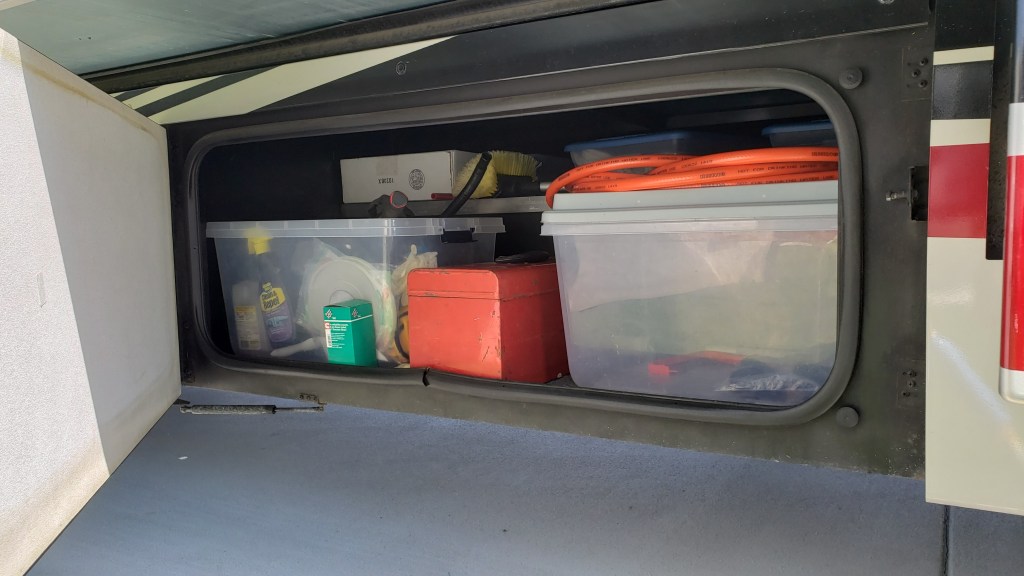
Along with opposing slide-outs that make our galley/living room seem like a ballroom, one of the features of our Winnebago Sightseer that really attracted us to it was the storage space under the rig. As we’ve traveled, each “bay” became organized according to a specific use.
First, we have a bay filled with the stuff we use in a campground. Ruthie’s ramp and tie-outs (plus anything of hers we store) goes in it, along with our outdoor mat, shoe mat, chairs, folding tables, tire covers, and miscellaneous stuff. A small bay to the right of this one has two boxes with mechanical stuff that helps power our electricity.
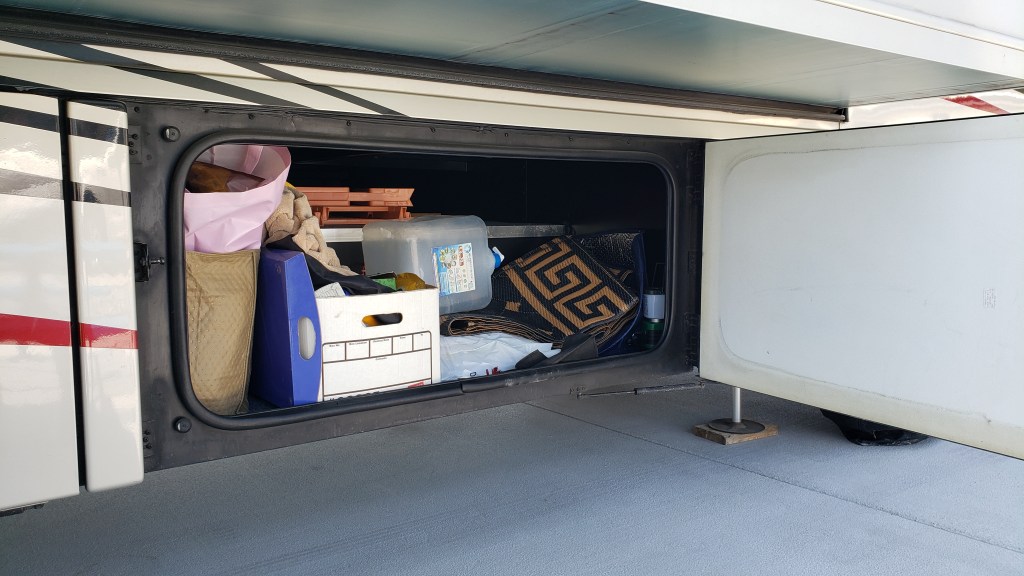
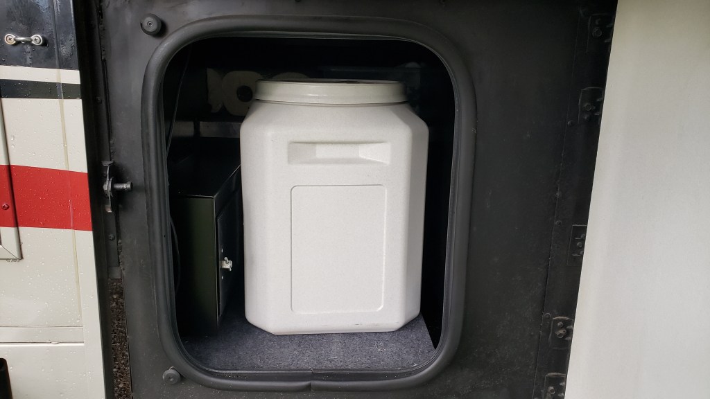
The second bay holds Ruthie’s big food container, a small shelf, and some mechanics for the rig. We fill a smaller container from this one, which we keep inside the rig so we don’t have to open the big one twice a day.
Next is a small bay with our inverter, some extra rolls of paper towel (which we use a LOT, including to wipe the dishes before we wash them so the least amount of fat or food goes into our gray tank and causes smells), and the router for our Starlink internet system.

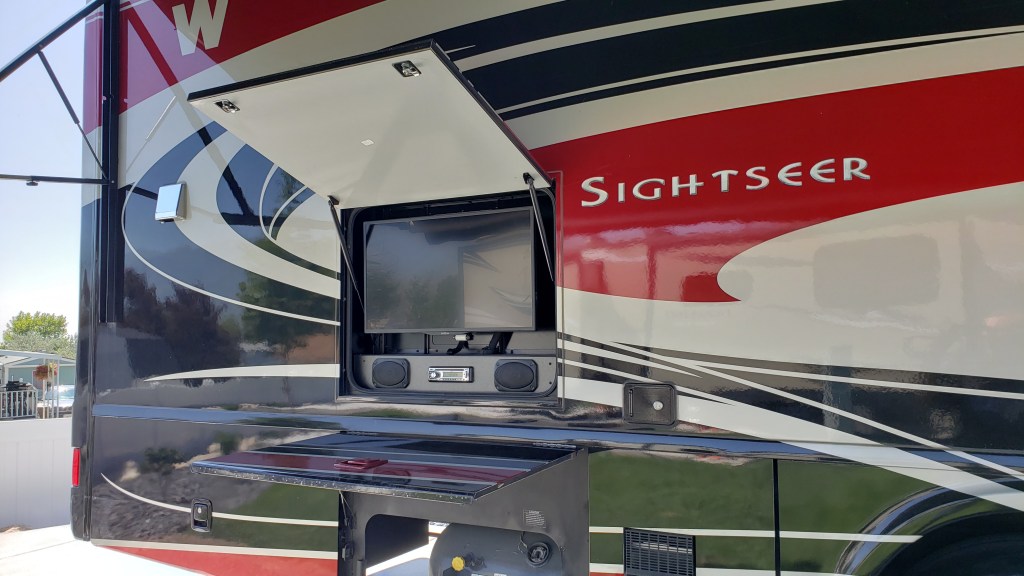
The propane tank has its own bay. Above the propane tank and end bay is our outdoor entertainment system (TV and radio). We’ve used it exactly twice so far, since we’re generally out touring or inside working.
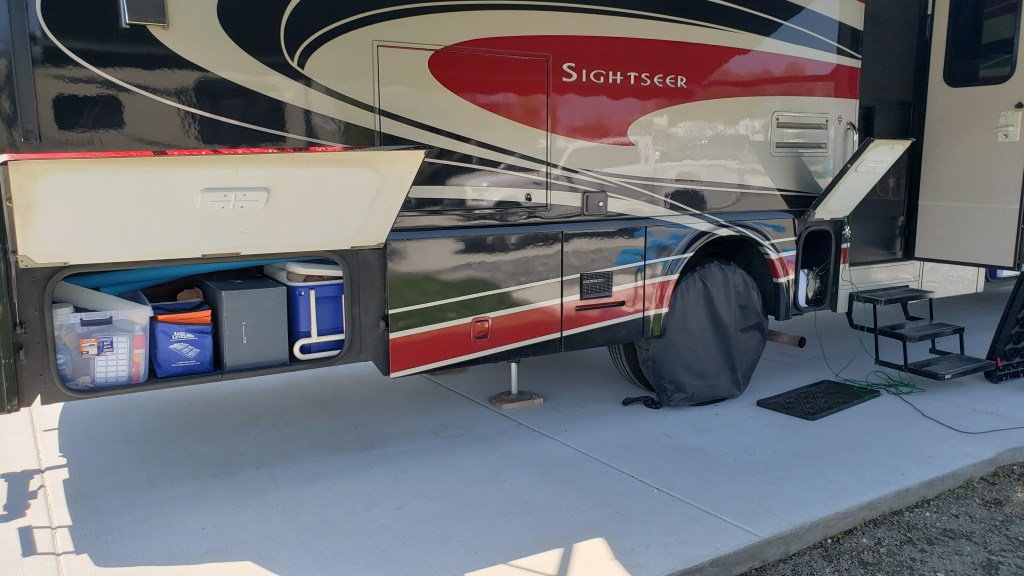
And finally, the rear bay on this side has our emergency stuff (cones and LED flares in case of a breakdown, plus a foam fire retardant), jack pads, pool noodles that go on the slide-out edges to save our noggins when the inevitable bumps happen, the box we store Starlink in, and “extras” of things like toilet paper, tissue, soap, and such.
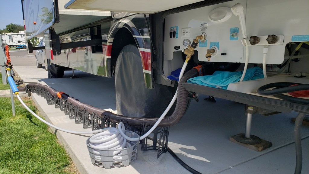
On the other side of the rig we have a bay with our fresh water hose, plus extras items such as shampoo, first aid stuff, laundry detergent and other necessities that need replacing fairly often, plus our broom and Swiffer.

Then comes the icky bay, which holds cleaning and maintenance supplies, a tool box, our sewer hose, and the black tank flushing hose.
The “wet bay” is where all our electric/water/sewer hookups are located, and the place where the black tank and gray tank dump from. We also have an “outdoor shower,” (really just a hose with a shower head) which we have yet to use. A good place for washing muddy boots and stinky dogs, probably.
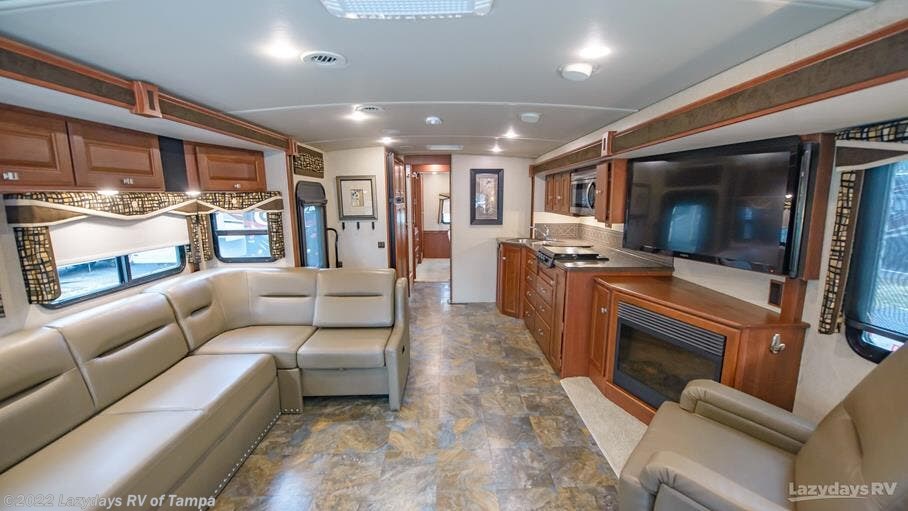
Heading inside, the door leads to the galley. This is our main living space and our kitchen.
Dishes, pots and pans, dish cloths and towels, silverware, and cooking utensils live in the drawers, while non-perishable foods live in the cupboards. The small Instant Pot, Air Fryer, and electric kettle live on the counter, with non-slip pads under them so they don’t slide when we’re in transit.
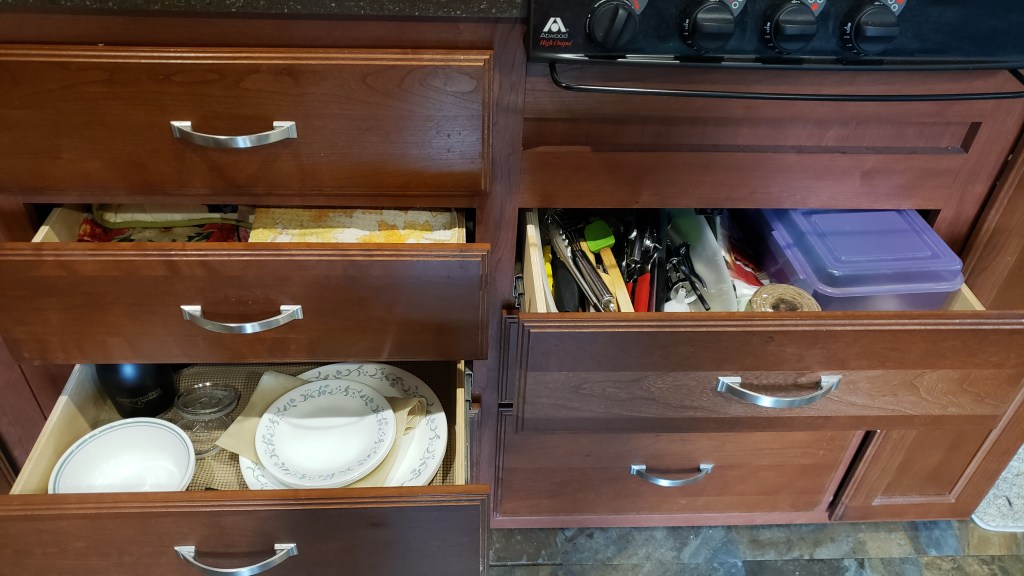

There is a big space (relatively speaking) under the sink that holds cleaning supplies, a baking sheet, a dish-drying pad and rack, garbage can liners, our UV water filtration system, and the ever-important bottle of gin. Cutting boards hang next to it.

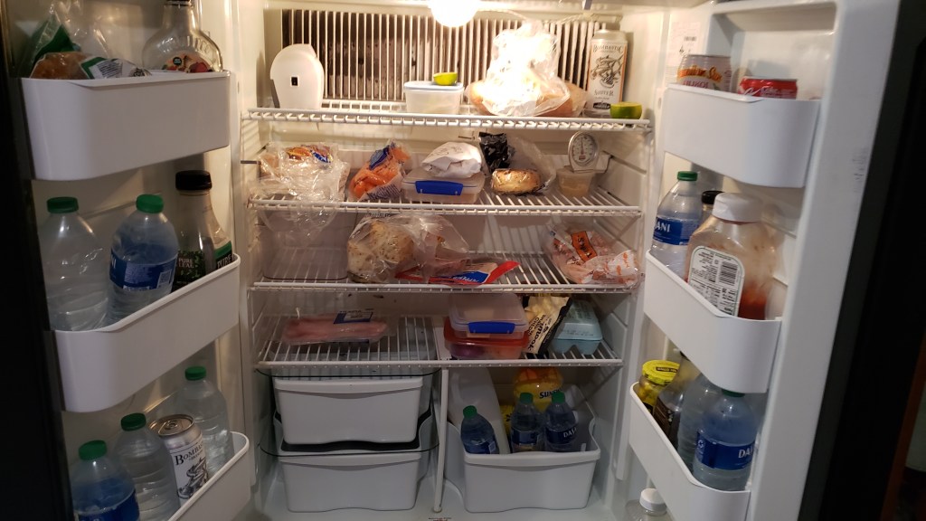
Across the aisle from the sink is the refrigerator and freezer, with our carbon monoxide detector below it.
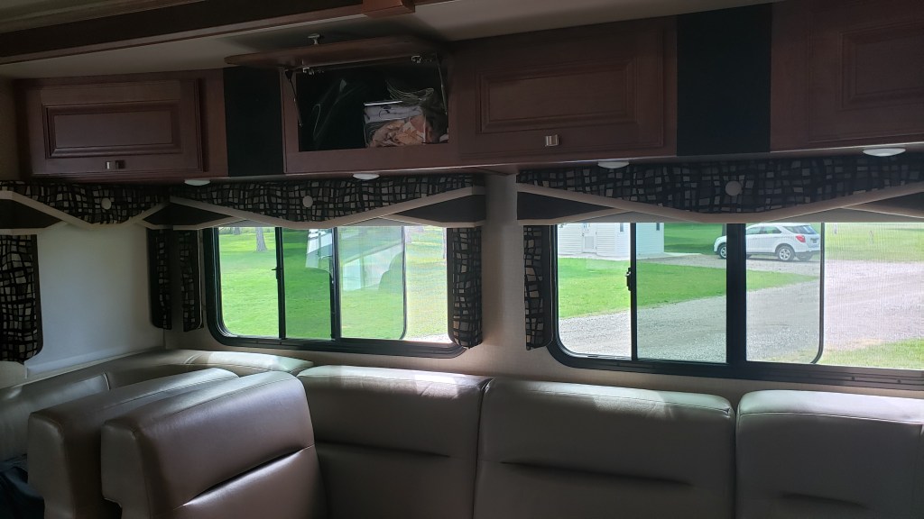
To the right of the kitchen is the living space. Our U-shaped couch (which folds down to make a queen-sized bed) and a drop-leaf table serve as our dining area and our work space. The table has storage in it, which we use for the little fan we bought to help keep the air moving on hot afternoons when the A/C could use a little help.

Above the sofa is storage space for games we play when we’re dry camping (no water, electric, or sewer hookups) and don’t have TV reception; table cloths, placemats, and paper plates for dry camping; Ruthie’s medications; and RV books, plus miscellaneous small tools and other items, such as markers and face masks.
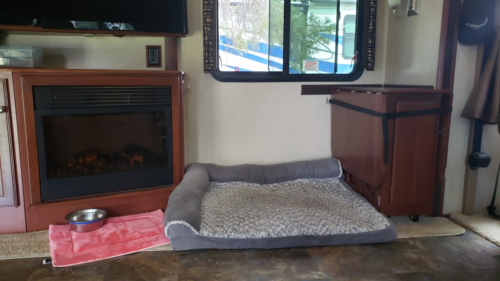
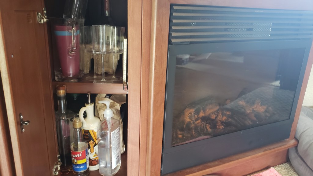
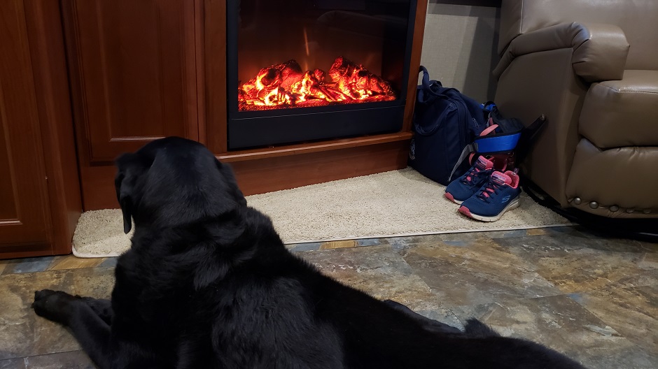
A fireplace under the TV warms this space beautifully on cool mornings and evenings. We’ve used it far more than we thought we might. The cupboard to the left of the fireplace is our “bar,” with wine, wine glasses, whatever Simon is drinking at any given time, and some miscellaneous stuff. It sounds more exciting than it is.
Ruthie’s bed is here, too, in a space that had a reclining chair (which we removed before we left home) and the table folds down and stores next to her while we’re in motion.
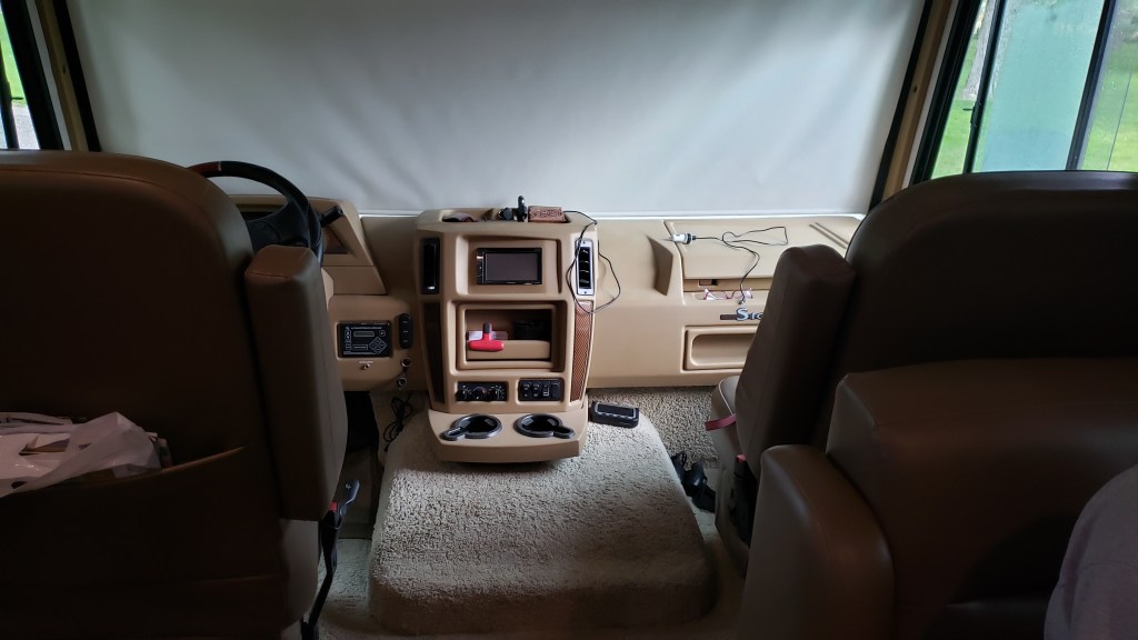
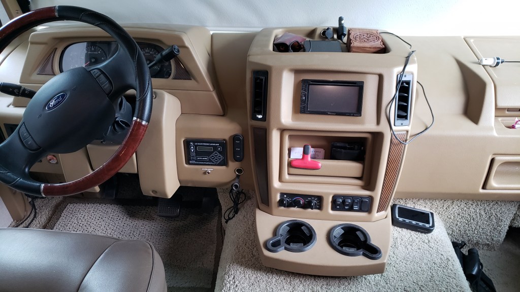
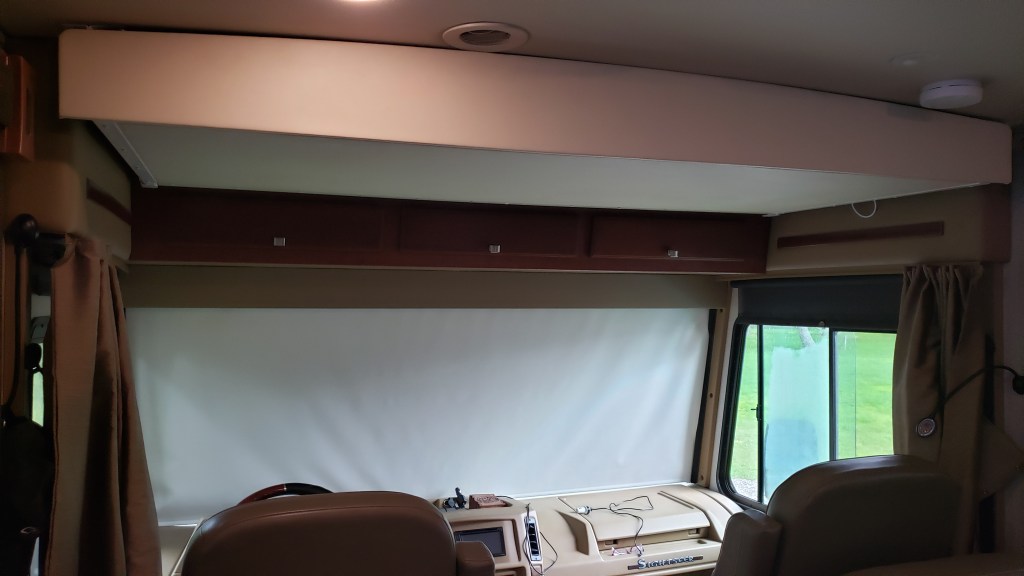
The cab is where all our technology and maps live, including an RV GPS, Tire Pressure Monitoring System, DVD player, and things like a high-beam flashlight and our high-visibility vests for roadside emergencies.
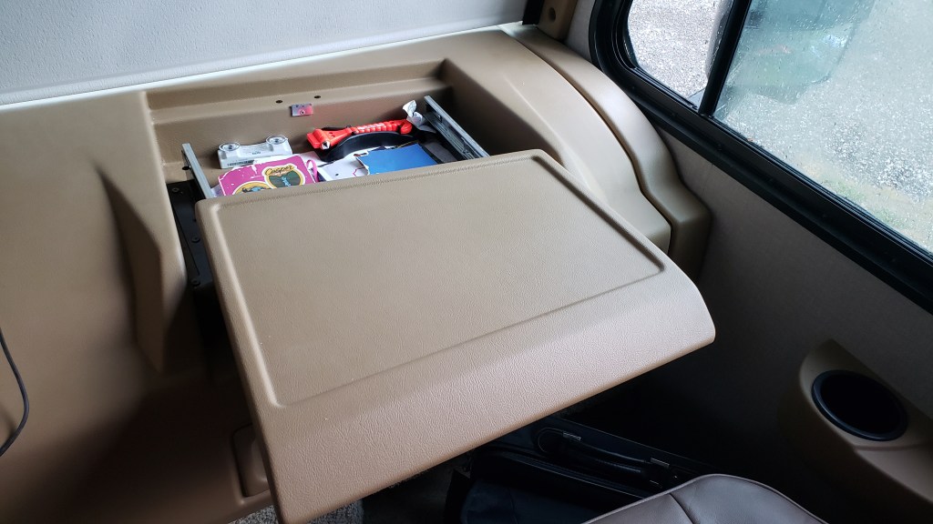
The passenger side of the cab has a space where we keep vital info such as campground membership forms, Ruthie’s vaccination records, and other things campground hosts might want to see, plus a book in which we record each campground location and details, and a book in which we record milage each time we move, the time of day we left the campground, and other boring details.
Above the cab is our “guest room,” which is really just a pull-down bed. Before we left home, we removed the thin mattress and now use that area for winter clothes and heavy bedding storage.
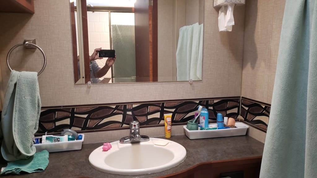
To the left of the galley is our bathroom. The shower is on the left-hand side of the aisle (and it doubles as a drying area on laundry day, when we don’t want to take the time to dry things in the washer/dryer, or heat up the bedroom with dryer mode) and on the right-hand side, behind a door, is the toilet, sink, cupboard, and drawers.

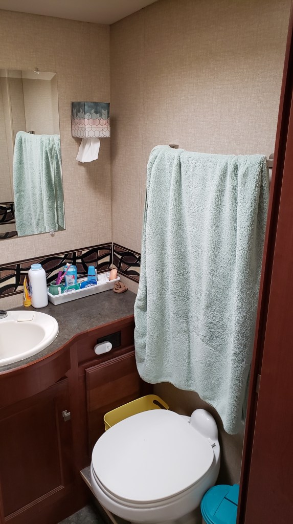
Long, thin containers hold our toothbrushes, toothpaste, and other daily necessities. Each of our containers lives on the countertop while we’re in camp, then they go into the cupboard above and to the left of the sink when we’re in transit. Three drawers hold things like hairbrushes, powder, first-aid stuff, and the like. Toilet paper, Happy Camper black tank treatment, and cleaning supplies live under the sink.
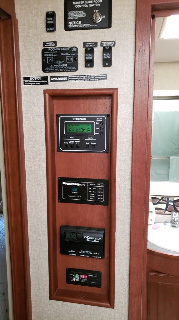
To the left of the bathroom is our “command center,” with monitors for our tanks, buttons to turn our generator and hot water heater on and off, a monitor that shows what power source we’re using (campground “shore” power, generator, or house batteries) and a monitor that shows the health of our house batteries. At the top are buttons that bring the slides in and out.
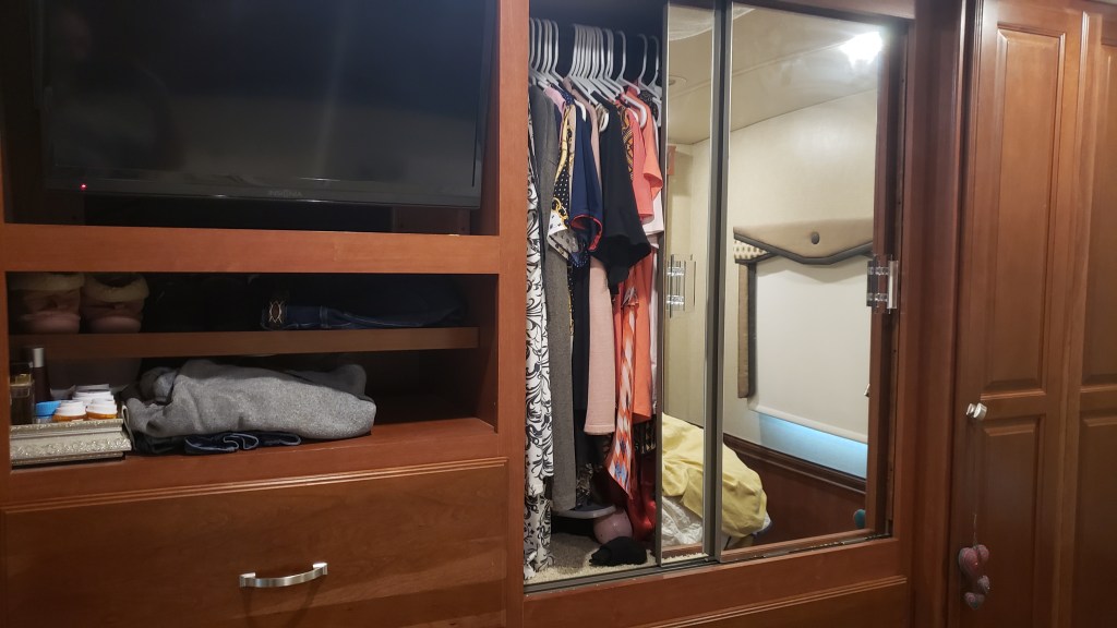
Next comes the bedroom. Our King bed is on a motorized base, so it “folds up” (to a degree) when we’re in transit and the slide-out is in, and folds down when we’re at a campground.

We each have drawers and half of the closet space for clothes, shoes, etc. There is an A/C in the ceiling here, too (a second A/C is in the living space).
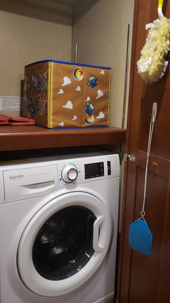
The far corner is where our combo washer/dryer lives, along with a duster, laundry soap and fabric softener, a short step-stool, and the like. We don’t make the most of this cupboard, but we probably should.
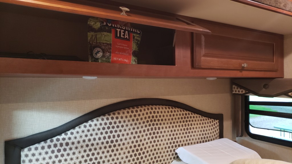
Above the bed is more storage, but at the moment it only has things like extra towels and sheets, and a massive bag of tea bags given to us by dear friends in the U.K.
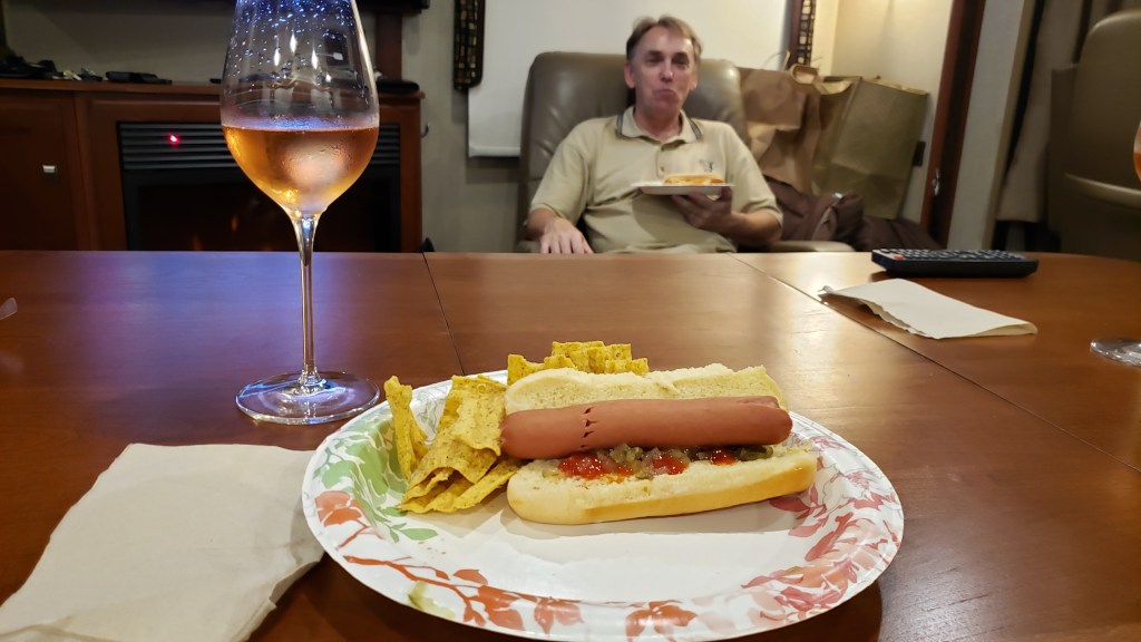
So that’s our house on wheels! And it really does feel homey when we’re settled in for the evening, watching some TV, having a drink, and eating whatever gets thrown together and called a meal.
We were very conservative when we loaded the RV, and the weigh station we stopped at in Florida showed we were 2,000 pounds under our maximum allowable weight. We like to keep it that way, for better gas milage and easier mountain driving.
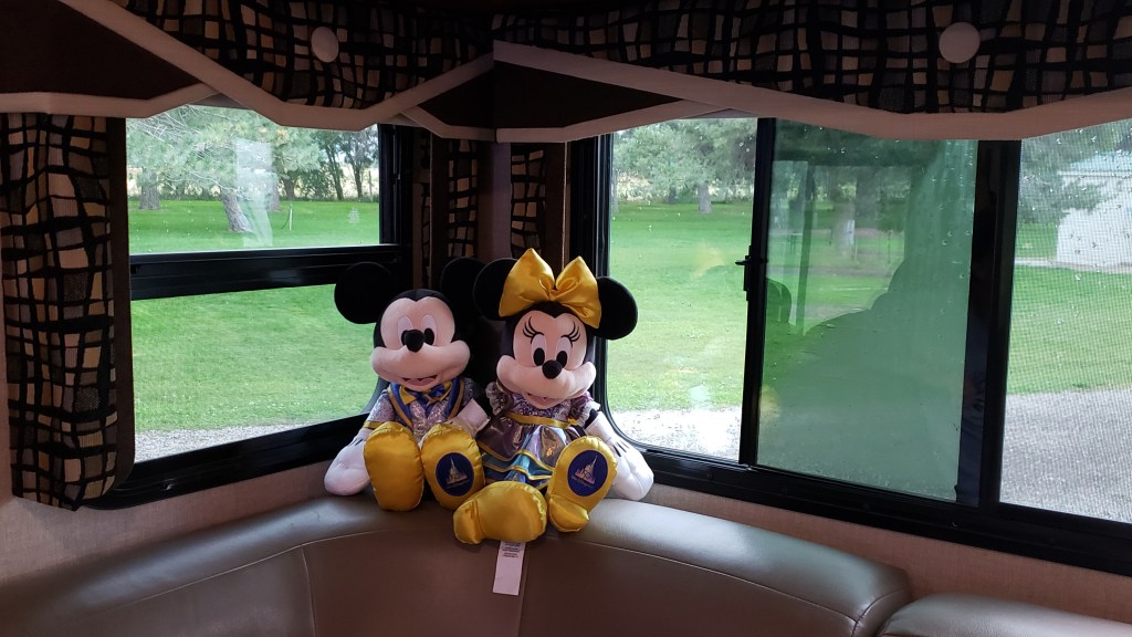
Oh…and Mickey and Minnie sit on one corner of the sofa, to remind us of home.
On August 14 we celebrated the third month of our grand ‘A Year On The Road’ RV adventure, with a chance to tot up our mileage and chart the latest course of the scenic route we are forging across the US.
Having ended Month Two at Fishing Bridge RV Park in the heart of Yellowstone National Park, we have basically undergone a bit of an about-face on our original planned route and gone “freelance” for a few weeks. Our third month covered a total of 1,318 miles, giving us a whopping 5,061 for the trip to date.
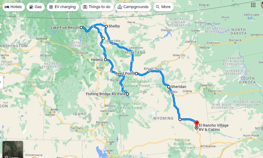
As you’ll see from the map, we continued north from Yellowstone to Glacier National Park, but then broke away from the proposed westward trek to Washington and Oregon via a bit of Idaho in favor of seeing more of Montana and Wyoming, two states which we have found utterly enchanting.
We have tried not to cover any of the previous route, apart from a few miles along I-90 in Montana, and have dived much deeper into Wyoming in particular, including side trips to Cheyenne and Laramie – very much the heart of the Old West – in Nippy to avoid putting too many miles on Fati. From here, we’re looking to turn West again, with each of Colorado, Idaho and Utah on our radar – and more of the magnificent Rocky Mountains.
There isn’t really any way you can follow-up the magnificence of Yellowstone, but we were hopeful Glacier National Park would be the next best thing as we headed north back into Montana again.
We were already aware the only entry to the park between 6am and 3pm was by the National Parks Service’s reservation system, which had defeated us for months, but we had a back-up plan – Simon would try for a Red Bus tour on the fabled Going-to-the-Sun Road and Susan wouldn’t. After her nerve-shredding experience in the passenger seat in Nippy going over the 8,878ft Dunraven Pass in Yellowstone, she was more than happy to sit out anything that offered the prospect of mountain-edge driving.
We had snagged a four-night reservation at the Lake Five RV Resort well in advance, knowing how popular Glacier NP is these days, so we were right on the doorstep of the park’s west entrance (and there are only really two ways to see Glacier, from the east or west roads).
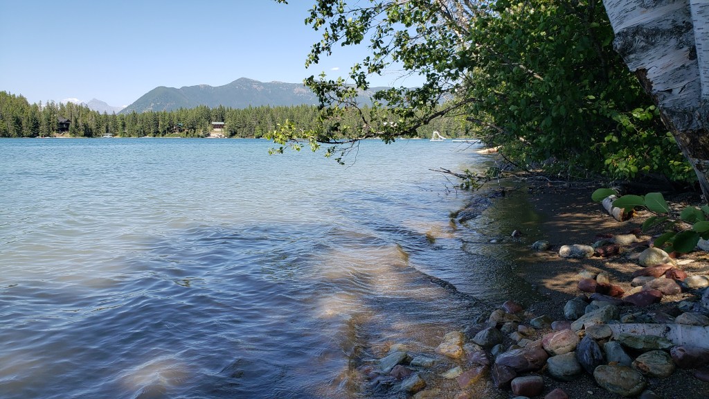
The park was beautifully situated and we were able to get set up and then visit Glacier NP’s visitor center, taking the (short) scenic drive along Camas Road, and spending time in the delightful Apgar Visitor Center and Village, which is the heart of the park’s western side.
Just a week out from our arrival, we were able to snag a seat for Simon on the Xanterra Red Bus Tour from Apgar Visitor Center to the Logan Pass – the passage from west to east across the stunning Lewis range of the Rocky Mountains – but we were going to have to wing it for the rest of our four-day stay.
What we hadn’t counted on was the fact that there really isn’t a lot to do and see outside the West entrance to the park. There are no other major scenic drives beyond the park’s boundaries – other than the hilly, winding drive in from the town of Browning, which showcases the southern edge of the Lewis range and which we had already seen in reaching West Glacier.
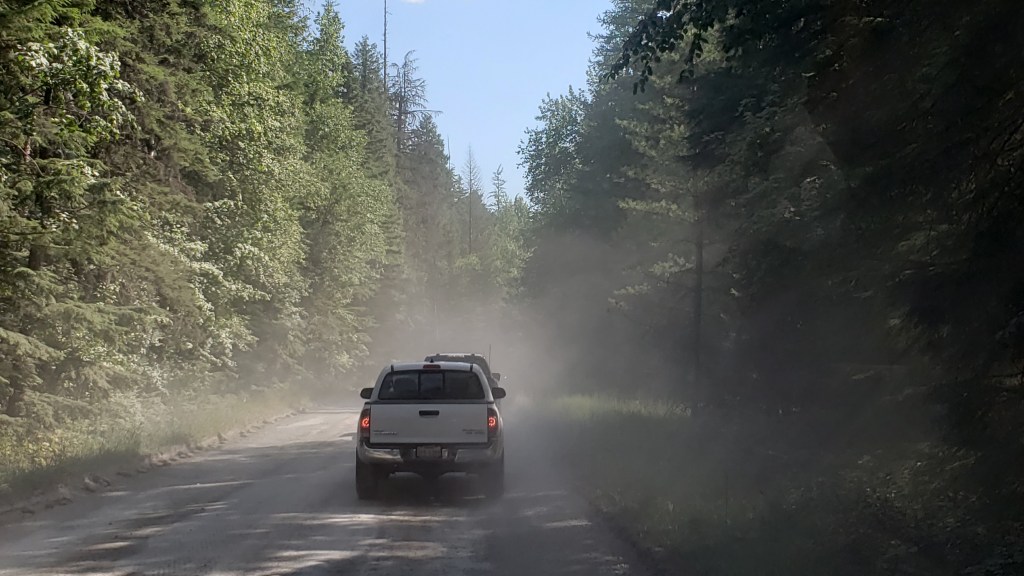
There was also major reconstruction under way of the 10-mile stretch of road along Lake McDonald from the Visitor Center to the lower end of Going-to-the-Sun Road. Not only had the usual paved road been ripped up for replacement, leaving a crude, pitted dirt track in its place, the construction crew also seemed to have abandoned any attempt to keep down the clouds of dust in the afternoon, making it 10 miles of driving torture, especially with a low-slung car like Nippy.
To put it mildly, this was a shocking state of affairs for any park, let alone one of the NPS showcase parks, and to say it was inhibiting was a major understatement. We abandoned the road at the Lake McDonald Lodge, and limped back to the Visitor Center.
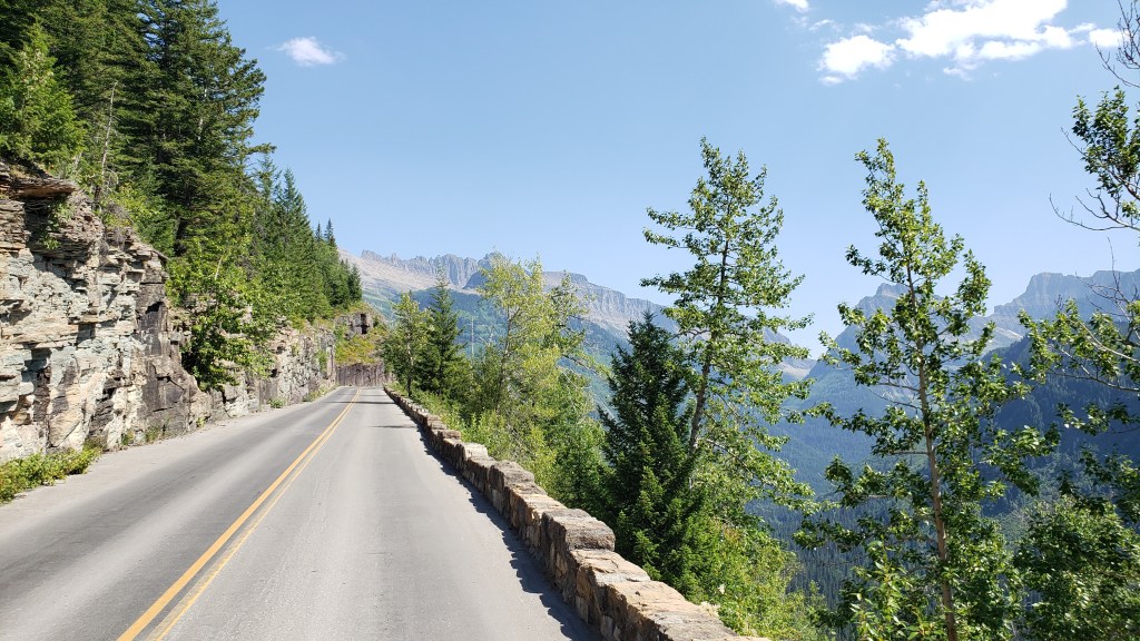
This left Simon’s trip on Going-to-the-Sun Road as our lone highlight of the visit. It turned out to be a pretty memorable highlight.
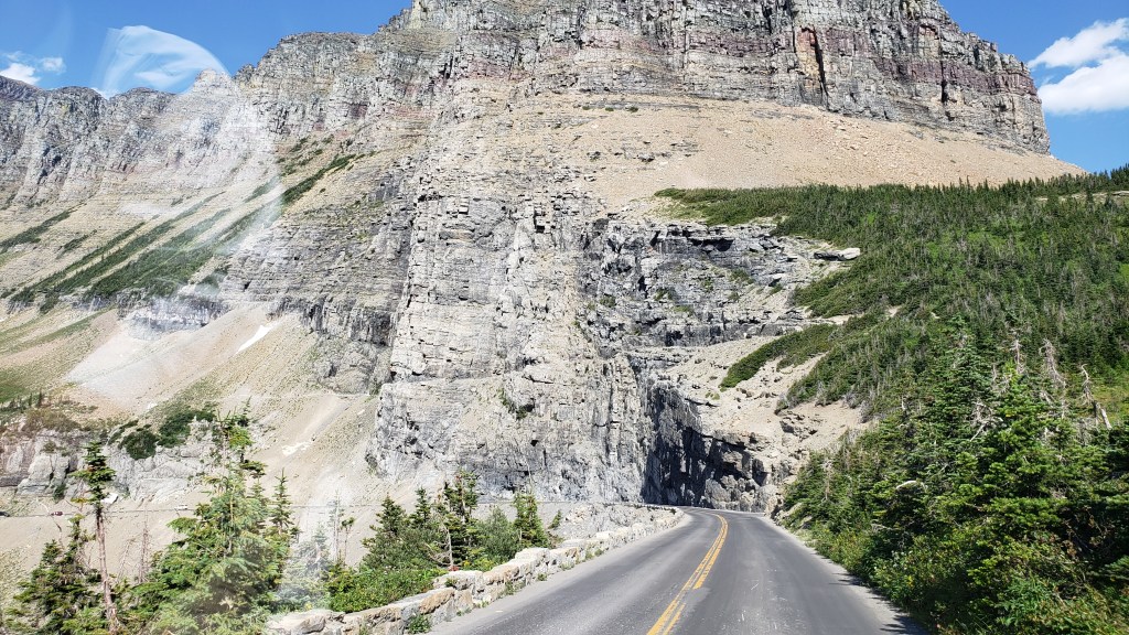
Now, GTTS Road is aptly named, albeit it isn’t quite what you think. It is actually named for the 9,647ft Going-to-the-Sun Mountain, the sacred peak of the Blackfeet Indians, and the rather tortuous translation of their word for it is actually “The-Face-of-Sour-Spirit-Who-Went-Back-to-The-Sun-After-His-Work-Was-Done Mountain.” More aptly, for first-time visitors to the road, it merely feels like you are going to the sun, such is the precarious nature of the precipitous passage up to the 6,646ft mountain pass.
The road dates back to 1932, when it was opened after an 11-year construction process that cost the lives of three workers (how it wasn’t any more is one of the minor miracles of the project). It wasn’t fully paved until 1956, and is one of the hardest routes in America to reopen after each winter, such is the nature of its extreme inaccessibility. Put simply, this road is scratched into the side of a near-vertical mountain wall with all the seeming permanence of an Etch-a-Sketch. How the engineers conceived it, let alone built it, absolutely boggles the mind.
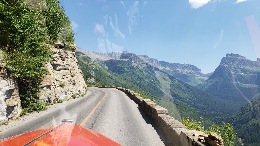
But there it is – the only way to cross Glacier NP, on a winding, sketchy, winter-worn stretch of “road” that wouldn’t earn that designation in any other place on Earth.
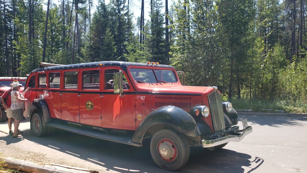
Oh, and the iconic Red Bus vehicles – nicknamed the Rubies of the Rockies – that take you there (and back), are almost 90 years old. Really. OK, so they have been modified with modern engines, transmissions, and braking systems, but the basic vehicle was introduced in 1935 and each has chalked up around 200,000 miles since then.
The maximum length for all private vehicles is 21ft. The Red Buses are 25ft long. Yup. Go figure.
So, the basic equation is:
Rickety Road + Outrageous Drop + 90-Year-Old Over-Long Vehicle – New Engine = A Hair-Raising Experience for All Concerned (especially Susan waiting back at the Visitor Center, praying for my safe return).
(It should be added, however, that each vehicle has a 100 percent safety record throughout all those years and miles, and each driver is a specialist)
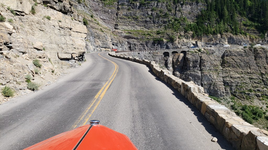
The journey from the Visitor Center to Logan Pass, and back, takes almost 3.5 hours. It reaches a top speed of a daring 45mph, and just 20mph on the seriously scary bits. Two red buses can pass each other on that cliff-edge monstrosity. With about six inches to spare. So, absolutely no worries for the passengers, especially Simon in the front seat next to the driver, with the grandstand view 3,300ft straight down the mountainside.
The first part of the journey is pretty gentle, through impressive cedar forest, alongside Avalanche Creek (nothing inhibiting in that name, either) and past several suitably scenic picnic areas. Then it reaches The Loop.
This is the most critical feature of the entire Road, the only serious hairpin bend on the whole, implausible 50-mile route. It is the engineering pivot that allows the roadway to cling to its precipitous perch and provide access all the way to Logan Pass, which adds a resounding wide alpine plateau for a sizeable visitor center of its own, plus a variety of hiking trails which vary from gentle to “You’ve Got To Be Joking” (the latter for the Highline Trail, which is barely 4ft wide in parts and equally precarious, especially when you hear that the wildlife has right of way, and can include both bighorn sheep and black bears. Any takers…?).
But – and this is a seriously substantial adverb – none of that even begins to describe the utter, stonking majesty of this drive. The solidity of the buses, the assurance of the drivers, and the ability Simon has to be blissfully ignorant about the likely terminal nature of any vehicular mishaps make this a journey of total superlatives.
On each side, the mountain ranges seemingly reach up to levels normally reserved for stratospheric aircraft, including the heart-stopping Garden Wall that towers to 9,553ft and is the main conduit for GTTS Road, as well as the demarcation line for the Continental Divide. That’s right, this is where the North American continent is basically split into East and West, albeit that is primarily a geological term and not a regional designation, seeing as Montana is about as Wild West as it gets.
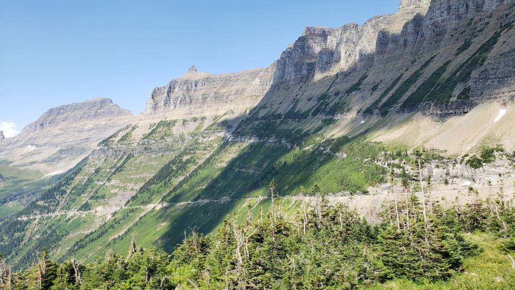
The mountains are studded with breathtaking waterfalls at regular intervals, along with various overlooks to allow drivers to get out and confirm that, yes, that really IS a bugger of a long way down, and “Don’t look now Ethel, but the car brakes are over-heating.”
Seriously, driving these buses up there is something approaching an art form, and sometimes you’re not sure whether to gape at the mountain scenery or the driver’s nonchalant style as they narrate the full story of the Road and everything connected with it.
And that’s it. We comfortably made it there and back, our open-top vehicle providing the best possible viewpoint of the entire Glacier NP, along with regular stops when, on the command “Prairie Dogs Up!,” our 18 passengers all stood up through the open lattice-work of the bus to take photos and marvel at the increasingly insane drop on one side.

It was an experience of the utmost refinement and beauty, a combination of Evel Knievel and Bob Ross, with a dash of Errol Flynn thrown in for good measure. It called for extreme belief in the person behind the wheel, and a cavalier disregard for normal road safety. And it was totally, utterly, mind-blowingly brilliant.
And I’d do it again in a heartbeat.
Our second month is in the books, and we are now 3,743 miles into the grand year’s adventure. The arrival of July 14 sees us having reached the magnificent Yellowstone National Park in the Northwest corner of Wyoming (albeit, a small part of it is in Southwest Montana). The driving has been astounding, the views panoramic, and the wildlife absolutely everywhere.
From Orlando to Yellowstone – a 3,743-mile adventure (s0 far!)
In truth, we HAVE slowed down in the second month. The first month chalked up a whopping 2,504 miles, meaning we’ve traveled just 1,239 miles in the second stanza of four weeks. In truth, we’ve gone much further than that with our localized sight-seeing in Nippy once we reach a new destination, but the official distance is measured by Fati’s odometer, and she says 3,743!
In the meantime, we’re considering our next move. In theory it is Glacier National Park in Northwest Montana, and then through Idaho to Washington and Oregon. But we have discovered something wonderfully captivating about Montana and Wyoming, hence we may well explore further here…

Want to see how far we’ve come in a month? This is the 31-day update of route – and distance – so far.
We now have a full month of our scheduled 12 officially in the books, and we have so far traveled a whopping 2,504 miles from home. We have crossed nine states, two time zones, and stayed in 14 different campgrounds and Harvest Host venues.
We have slowed down since our initial 7-day warp-speed approach (1,289 miles in that period; 1,215 in the 3 weeks since), and are paying more attention to savoring the sights as we travel. And we’re seeing some pretty stunning sights.

We are now in uncharted territory – for us – and ready for more adventures in the Dakotas, Montana and Wyoming. This is a hugely exciting part of the journey, with the areas rightly renowned for the wide open spaces of this huge country.
Having just arrived on the edge of The Badlands of North Dakota, the landscape is truly outlandish and full of intrigue. We’re here for the best part of a week, and will have a LOT more to report in due course.
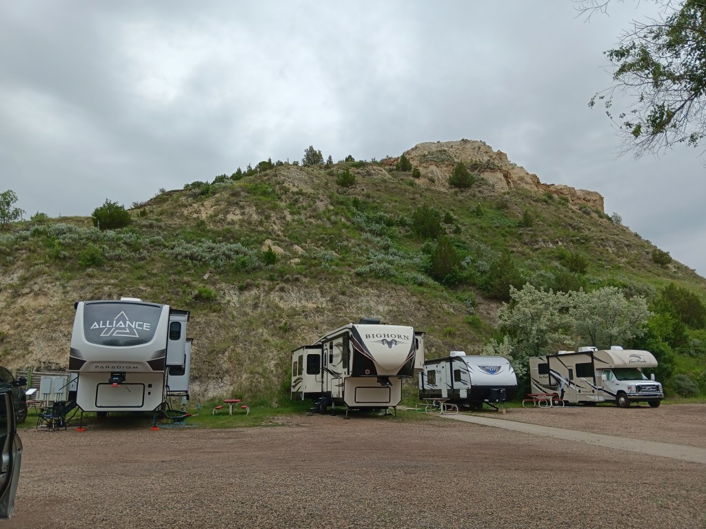
For those keen on geography and geology, the term “Badlands” is a specific geologic feature of sedimentary rock erosion, and it creates some captivating and bizarre landscapes. We hope to see a lot of it in the next few days, as well as wildlife that should include bison, pronghorn antelope, bighorn sheep, deer, feral horses, and – Simon’s favorite – the prairie dog.
The first week of our grand “Year On The Road” adventure – and a LOT of miles!
Considering how far we’ve come in the initial phase of our great American road trip by RV, we thought it was worth highlighting our route, and how much ground we covered.
In reality, the first week of our ‘Year On The Road’ was effectively the “shakedown cruise,” the testing ground for our ability to actually drive this remarkable vehicle (that’s Indefatigable, or Fati for short, plus our tow vehicle or ‘toad’, Nippy).
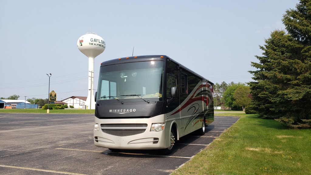
In all we covered 1,289 miles through the first seven days, traveling from our home base in Orlando to Lansing, Michigan. That’s a LOT of miles for an RV in such a short time, and we had some challenges along the way but, in general terms, Fati handled it with aplomb.
Our first target was to reach Michigan, to set up the second phase of our route, which will take us into the Northwest of the country, via Minnesota and the Dakotas. Realistically, we achieved our main target and have got the hang of the driving and setting up camp at each location.
Normally, regular RVers wouldn’t travel and set up camp every day, but we wanted to see if we could manage a tough schedule before moving on to Phase 2. We certainly have a few issues to deal with (including the lack of hot water!), and we’ve had to consult various RV authorities, including the excellent MyRVResource.com, but we’re happy that we’ve grasped some of the essential principles of RV travel, and we’re ready for more adventures in the weeks and months ahead!