Wonky Hoodoos And A Magical Flute


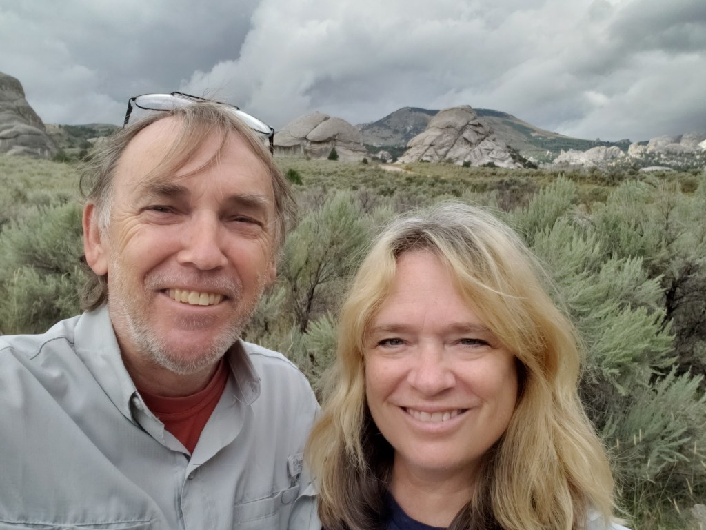
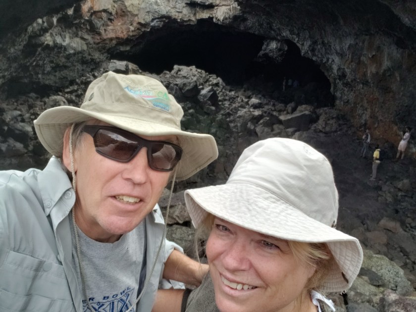
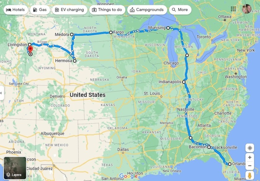
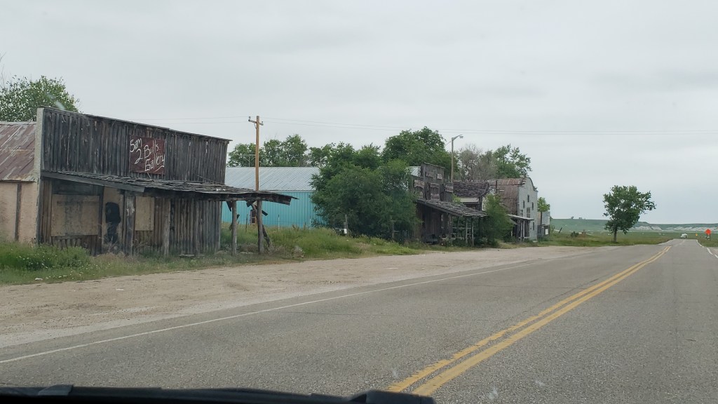
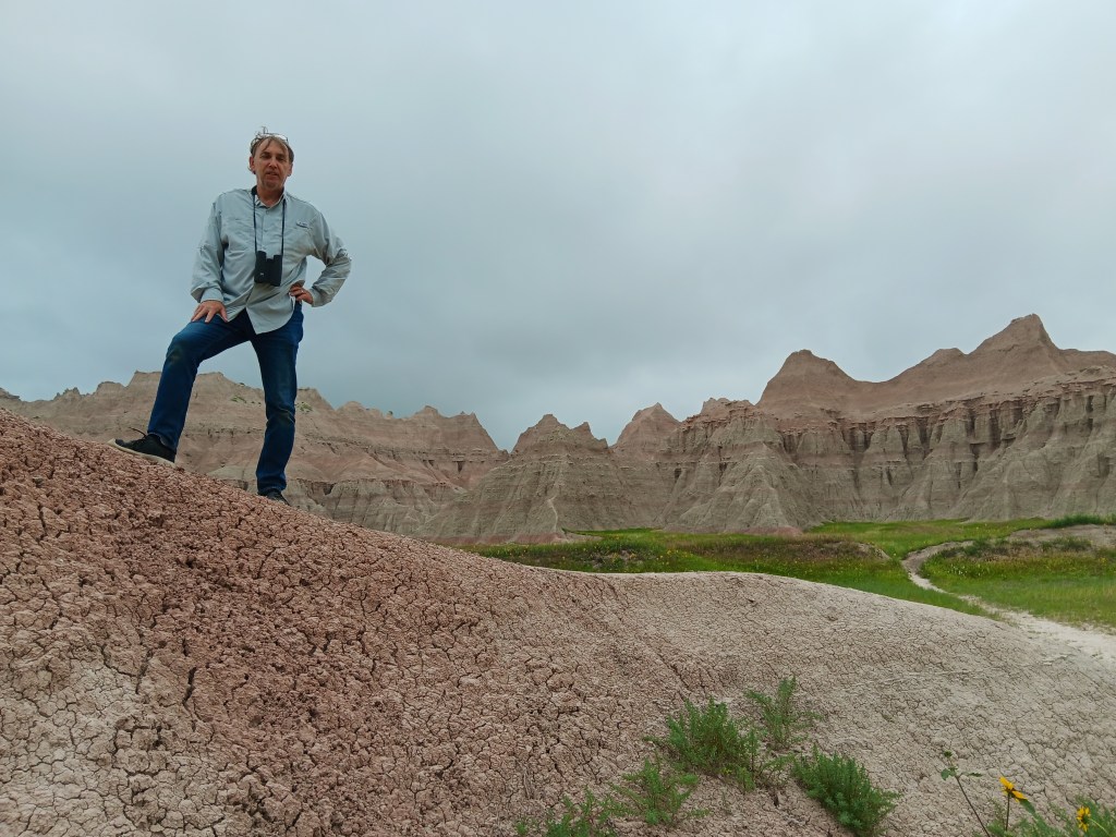
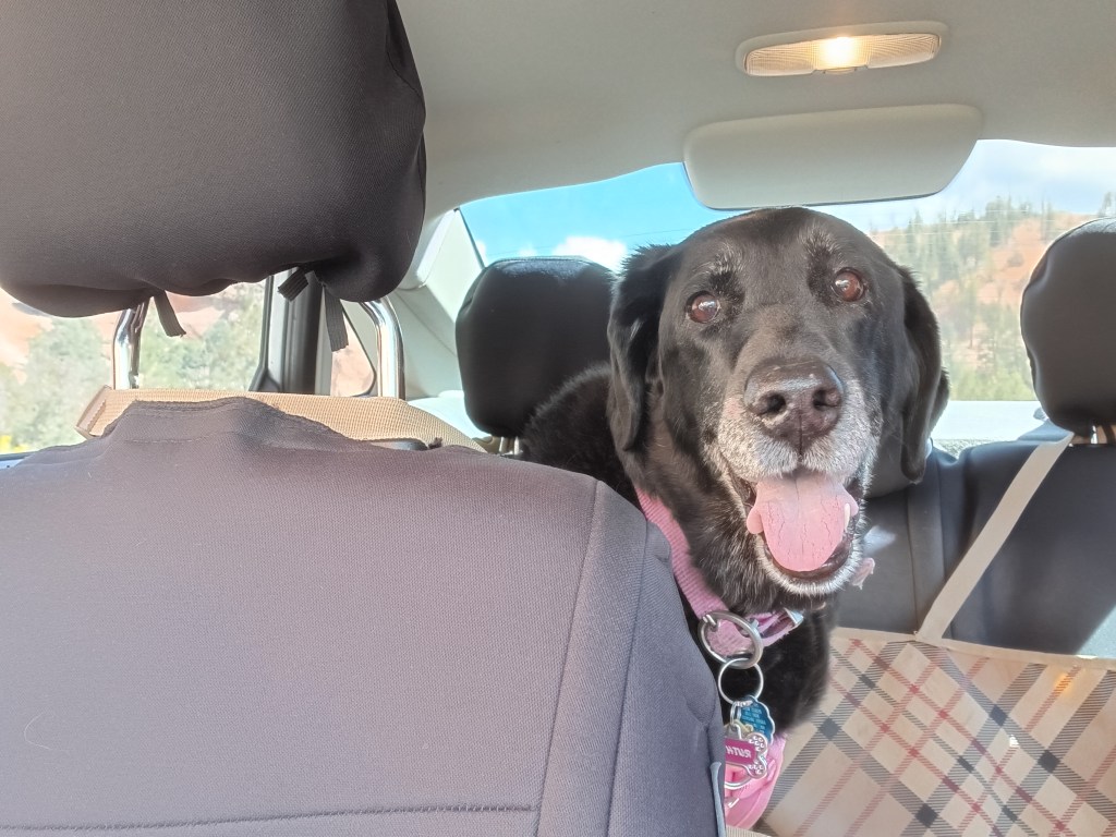
Throughout our journey, we’ve had to modify our plans around Ruthie, and we’ve done so happily, since one of our goals was to give her the best of what time she has left. Another one of our goals was to see as many National Parks as possible, and in Southern Utah those two desires collided.

“I’ll go wherever you take me!”

From our base in Cedar City, we were 77 miles from Bryce Canyon National Park, and just 20 miles from Zion National Park, two places that were high on our list of must-do experiences. They were places Susan’s parents had really enjoyed and, because of that, they had an emotional pull, too.

Grand Staircase Escalante National Monument and Capital Reef National Park were also on our radar, but after much discussion we came to the conclusion we couldn’t do everything or we’d end up frazzled and exhausted…again. So Bryce and Zion were “it.”


But not so fast.

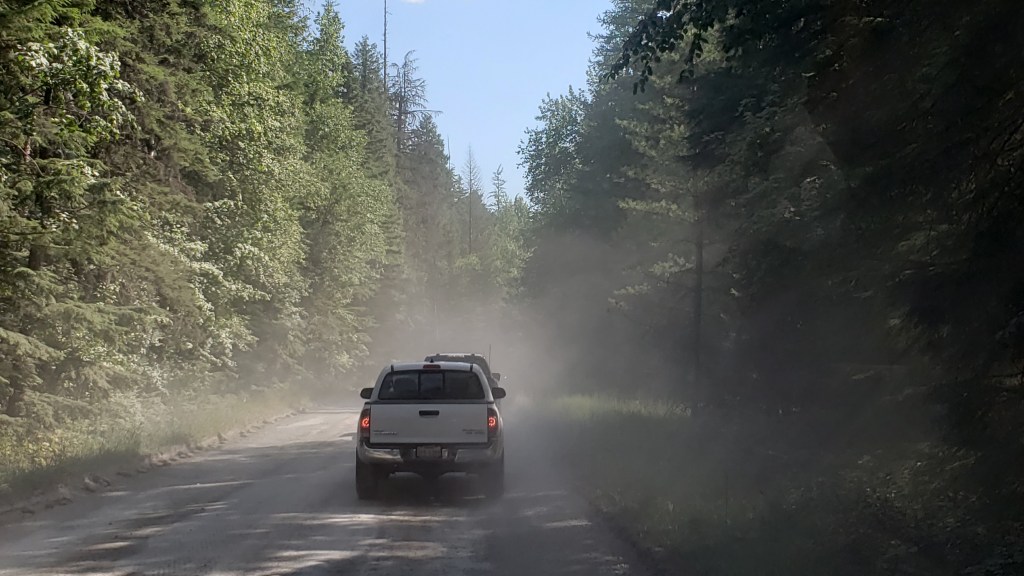
Before we visit a place (usually months or, in some cases, years) we do our research. When it came to Zion, however, we’d dropped the ball. In some places, rules changed with the pandemic and, from March to November, Zion can only be visited via shuttles. No-dog shuttles.

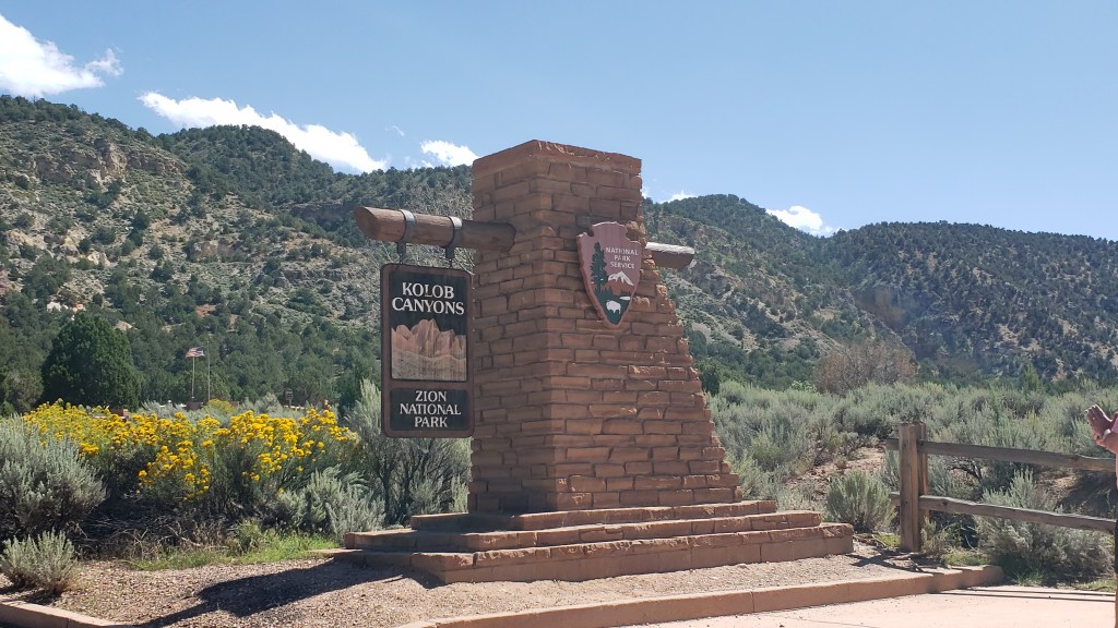
The single exception was Zion’s Kolob Canyons on the north end of the park, and with that, the plan fell into place.


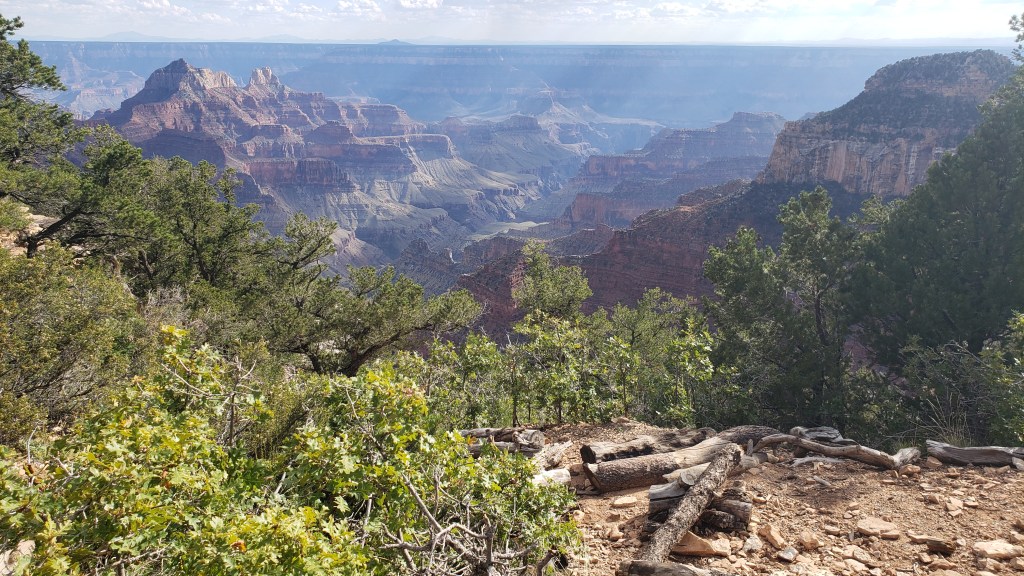
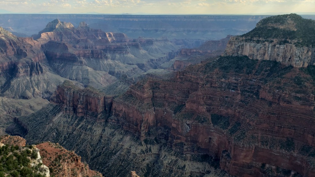
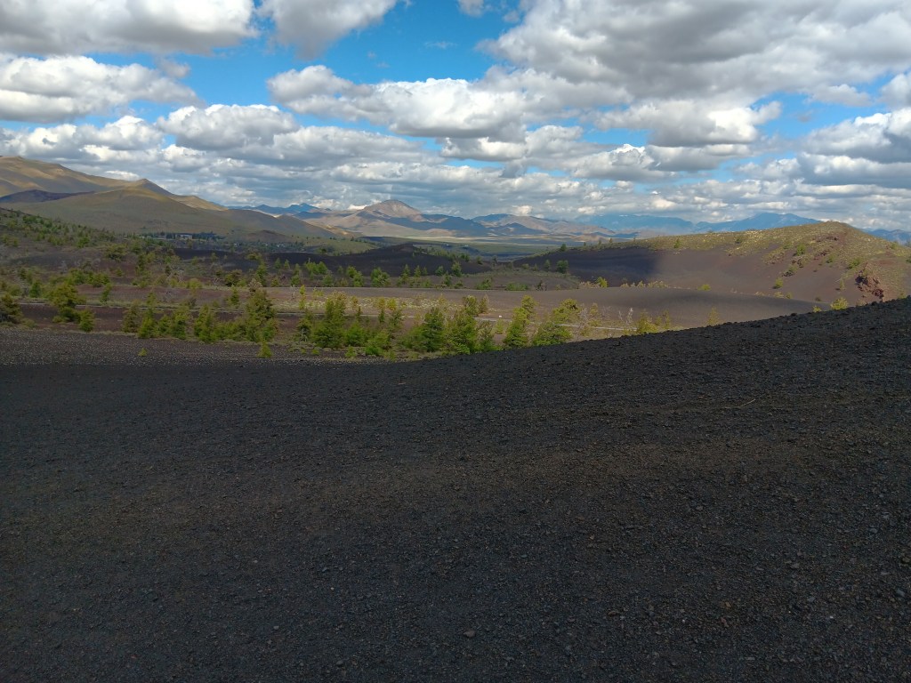
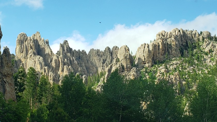
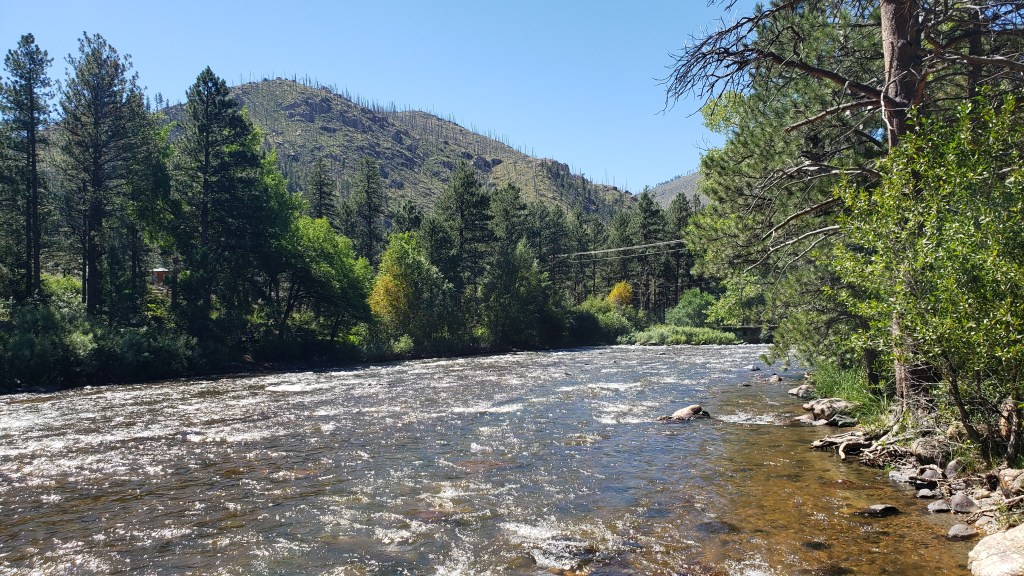
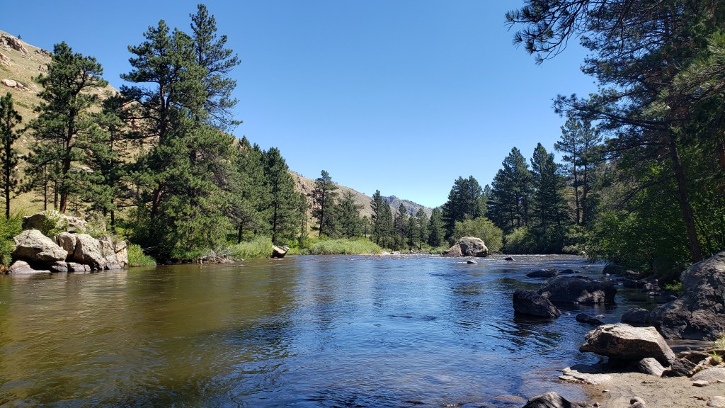
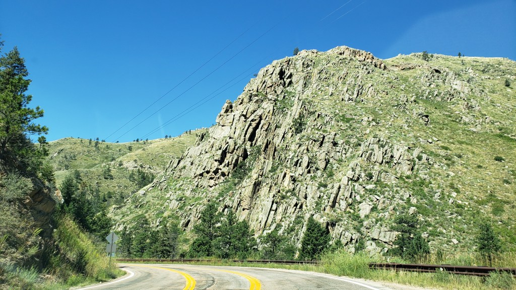
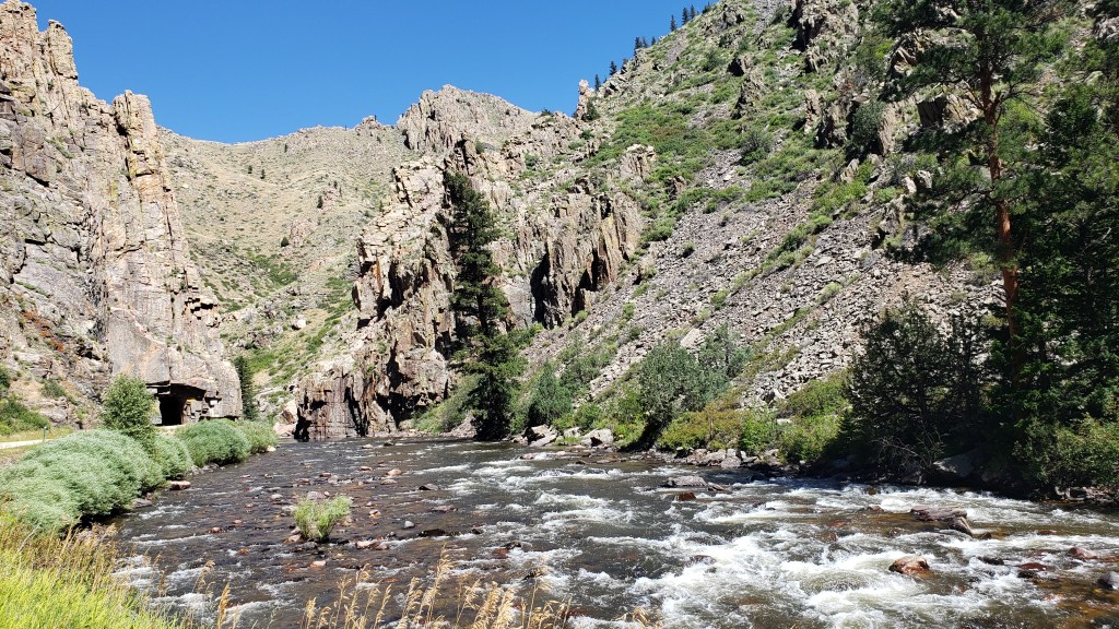
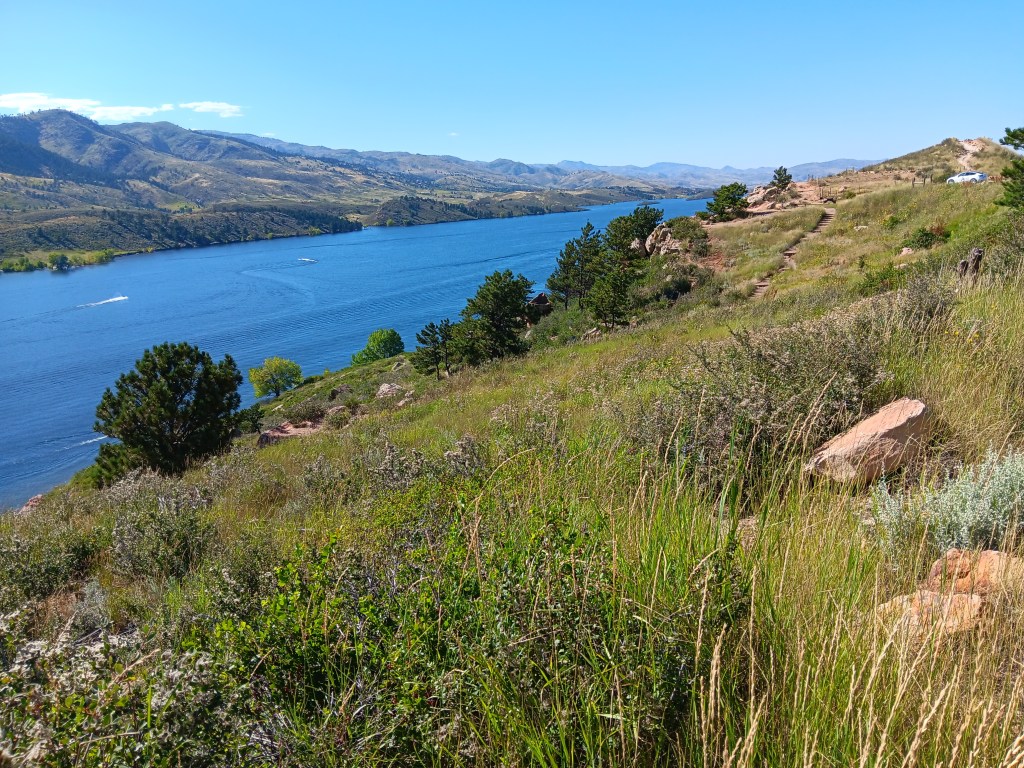
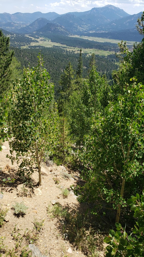
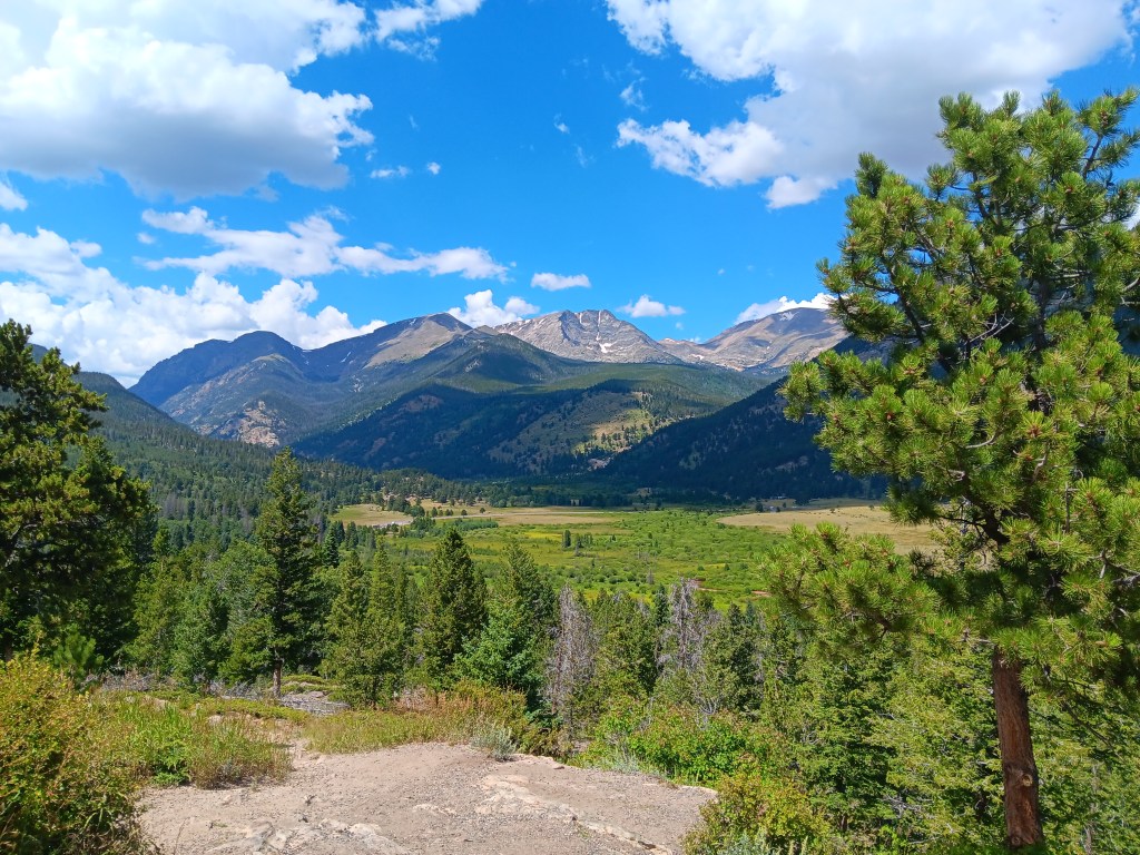
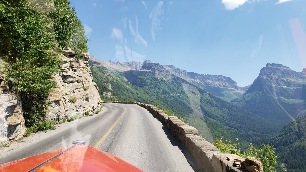
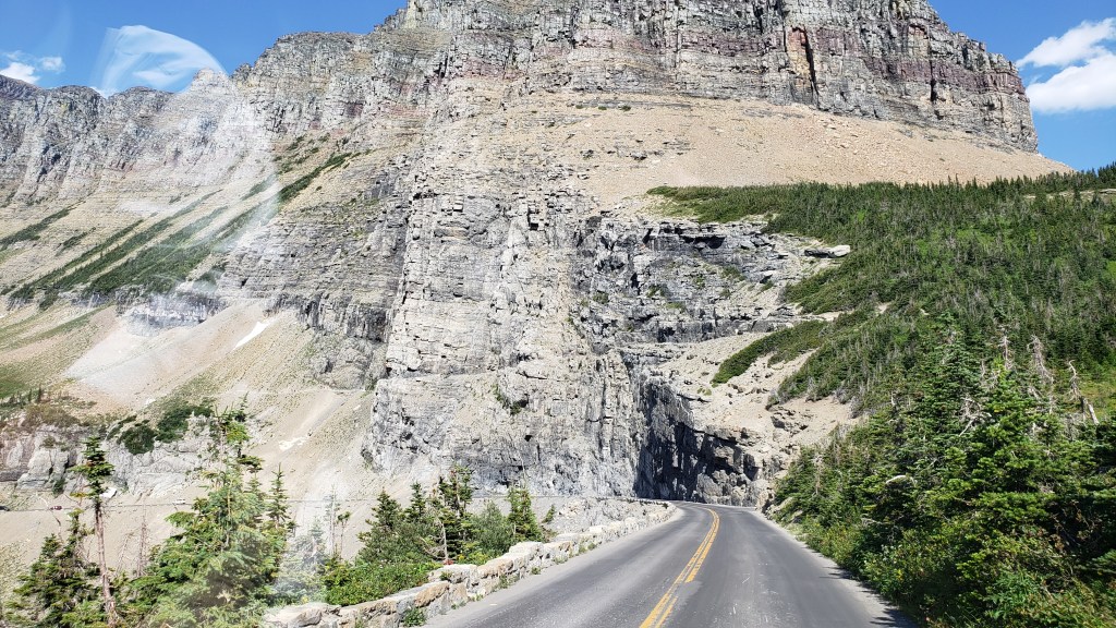
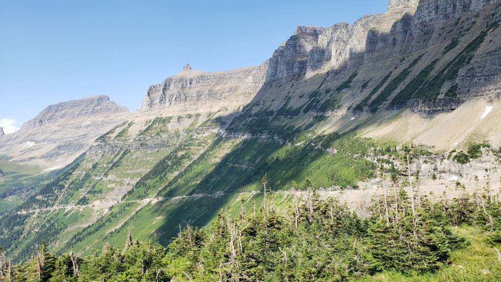
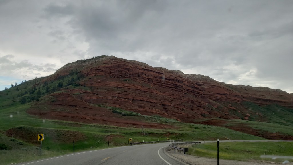
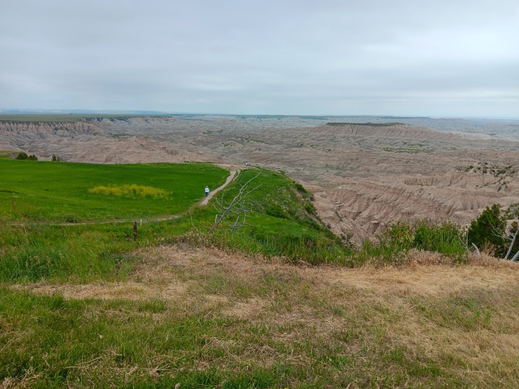
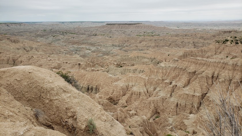
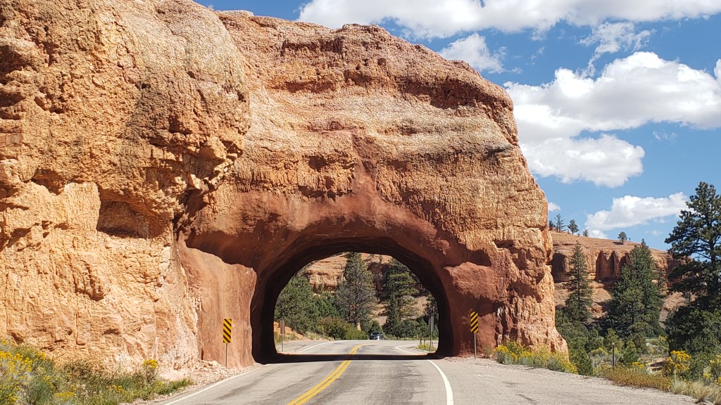
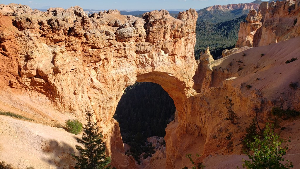
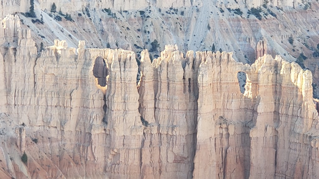
Bryce Canyon contains the largest collection of hoodoos in the world, and while we’d seen a LOT of canyons over the past weeks, this one promised something different. Even before we reached the park, we passed through the ridiculously gorgeous Red Canyon on Scenic Byway 12, which almost would have been enough on its own.


Not as small as Needles Eye, but still rather exciting.

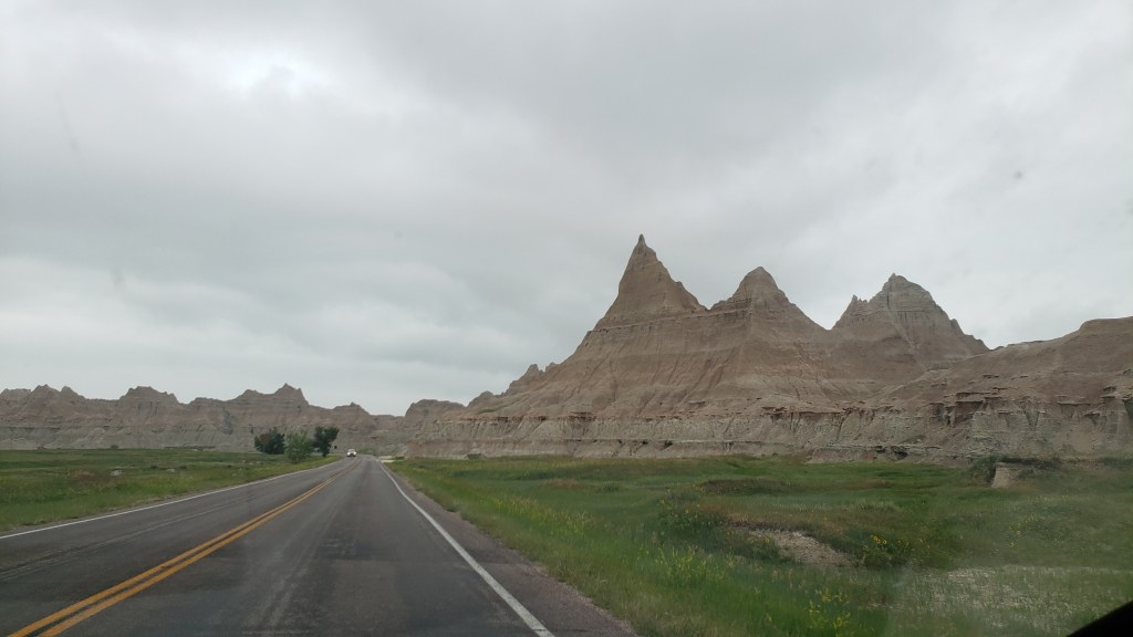
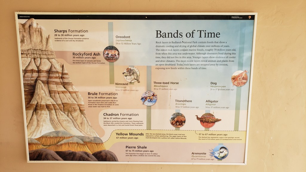
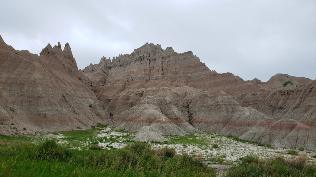
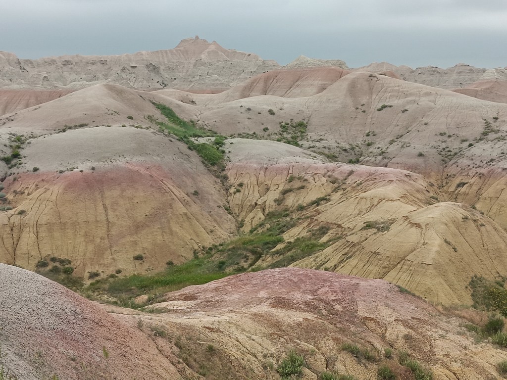
From the Badlands in North Dakota to Utah’s magnificent landscapes, we’ve repeatedly said, “How did that happen?” The short answer is, wind, water, and time. The longer answer in Bryce is, its distinctive formations began as flat rock on an ancient sea bed, uplift of land that created plateaus, which then weathered into “walls” with vertical gaps between them, then into “windows” (big holes in the rock, like we saw in Arches), and finally into the oddly-shaped, sticky-uppy hoodoos we see today.

Each of the park’s overlooks offered a different perspective:

Natural Bridge (elevation 8,627 feet) is an example of the “window” phase of the plateau’s erosion.

Obligatory selfie.

Hoodoos taking on their distinctive shape.

The park’s crownlng glory, Bryce Amphitheater.
Click on photo for video

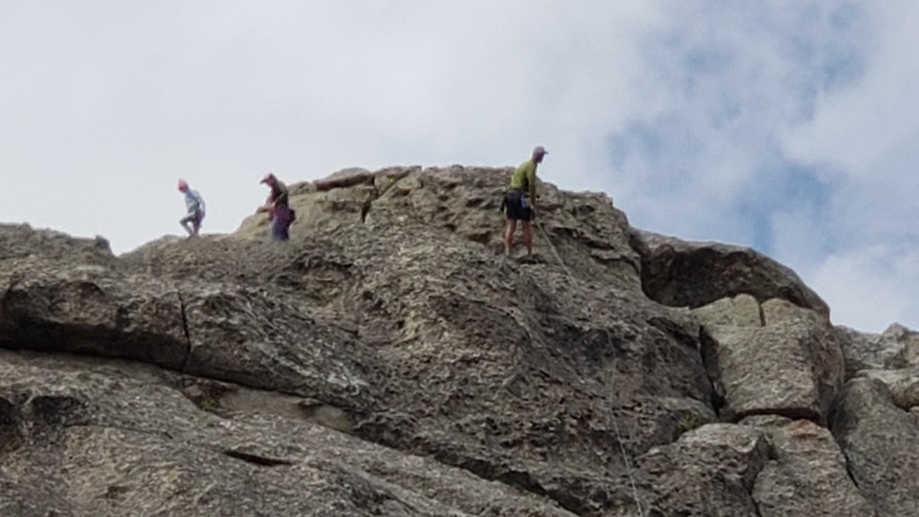
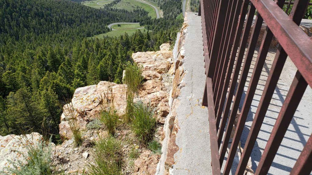
A pathway leads to the floor of the Amphitheater, but with temperatures at the summit in the 90sF, neither of us were prepared to endure the heat in the canyon.


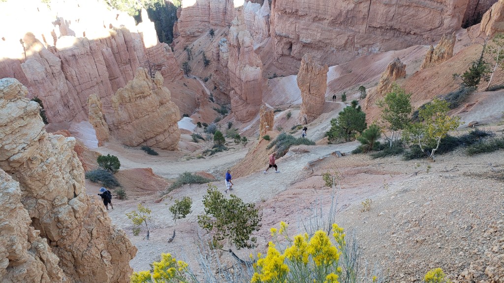
We were put to shame when we caught sight of a bride and her groom hiking back up, with a photographer in tow. Anyone who has ever worn a wedding gown knows what a feat this was for the bride.


Everyone at the overlook clapped and wished them well as they rejoined their wedding party.

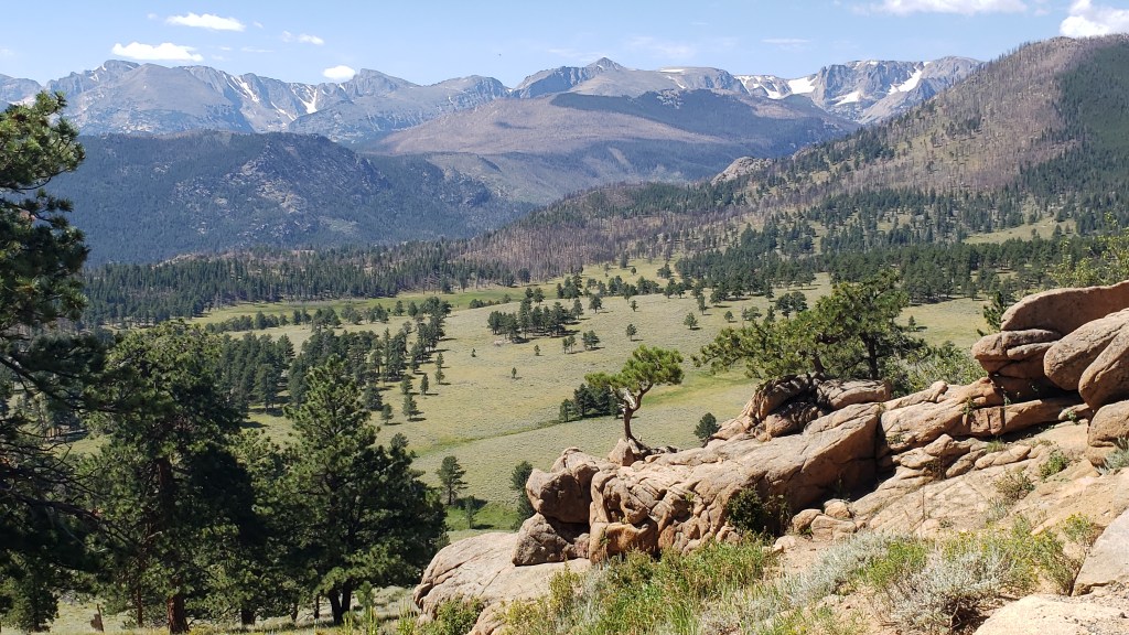
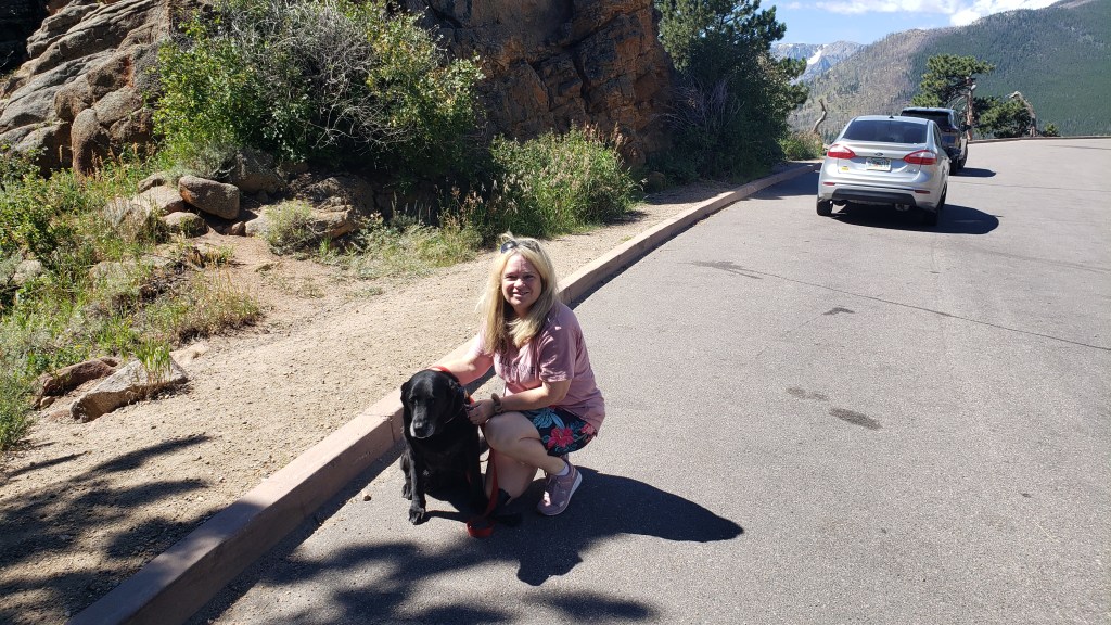
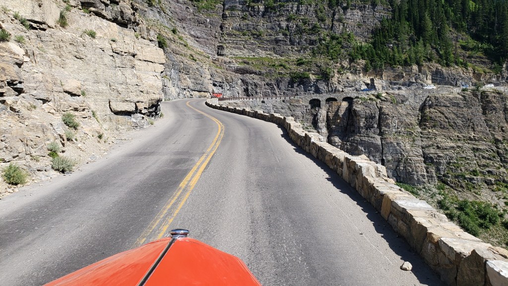
Kolob Canyons in Zion National Park was even more straightforward. An easy drive, entry with our America the Beautiful pass, and we were in. But only for three miles, as the scenic-drive road in the park was damaged due to a weather-related rock slide.

Ruthie really appreciated the cooler wind blowing through the canyon.

These 2000-feet-high canyon walls were pretty much all we could see, having walked a short stretch of the road beyond the barriers that were put up to prevent car travel.

It was a very limited way to appreciate Zion, but sometimes that’s how it goes, and with all the rock walls we’d seen in Utah, life was still worth living.

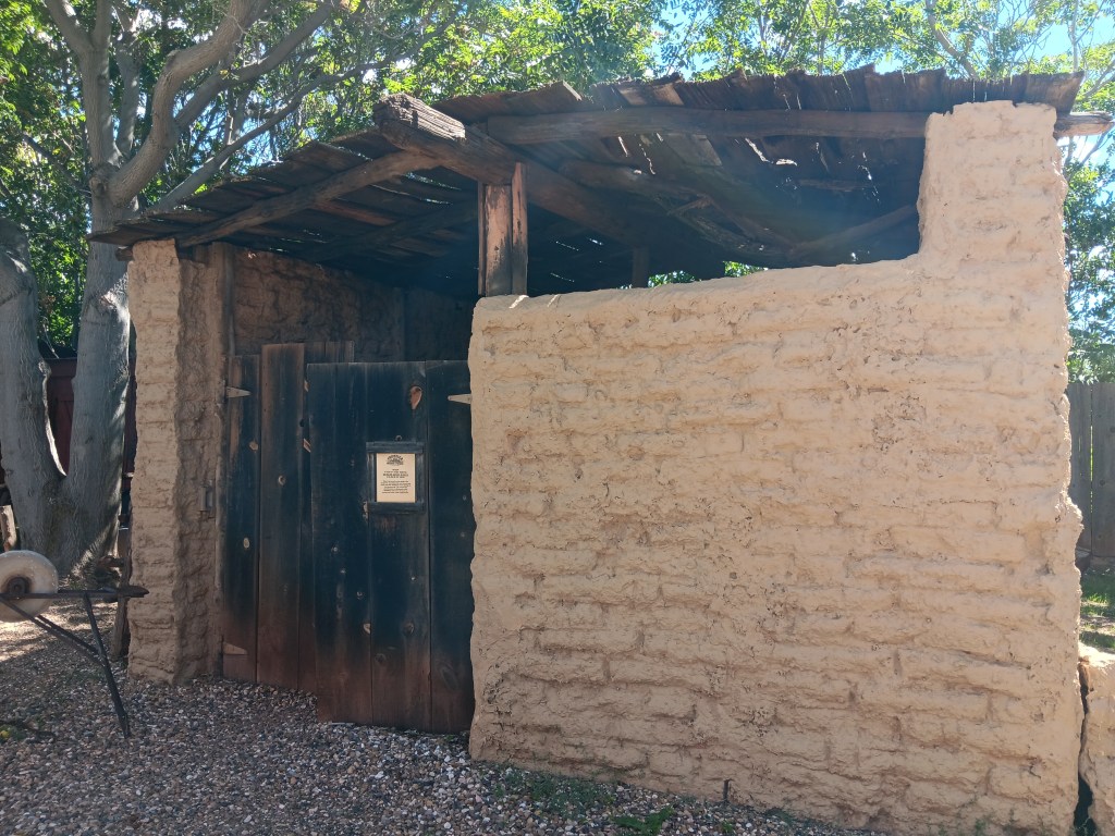
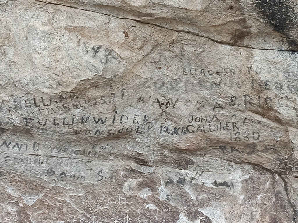
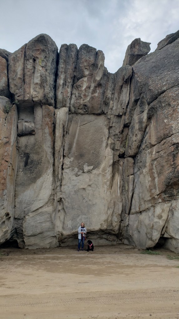
The next day we pointed Nippy north for a trip to Parowan Gap, a wind-and-water-created hole through a mountain that was used by Native Americans who left their stories etched into the deep crimson walls. And it was these petroglyphs that drew us to the area.


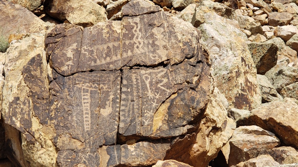
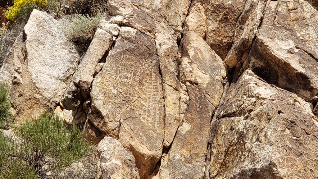
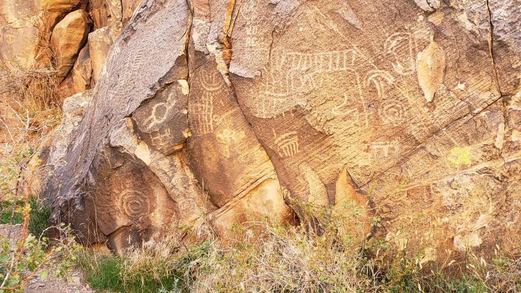
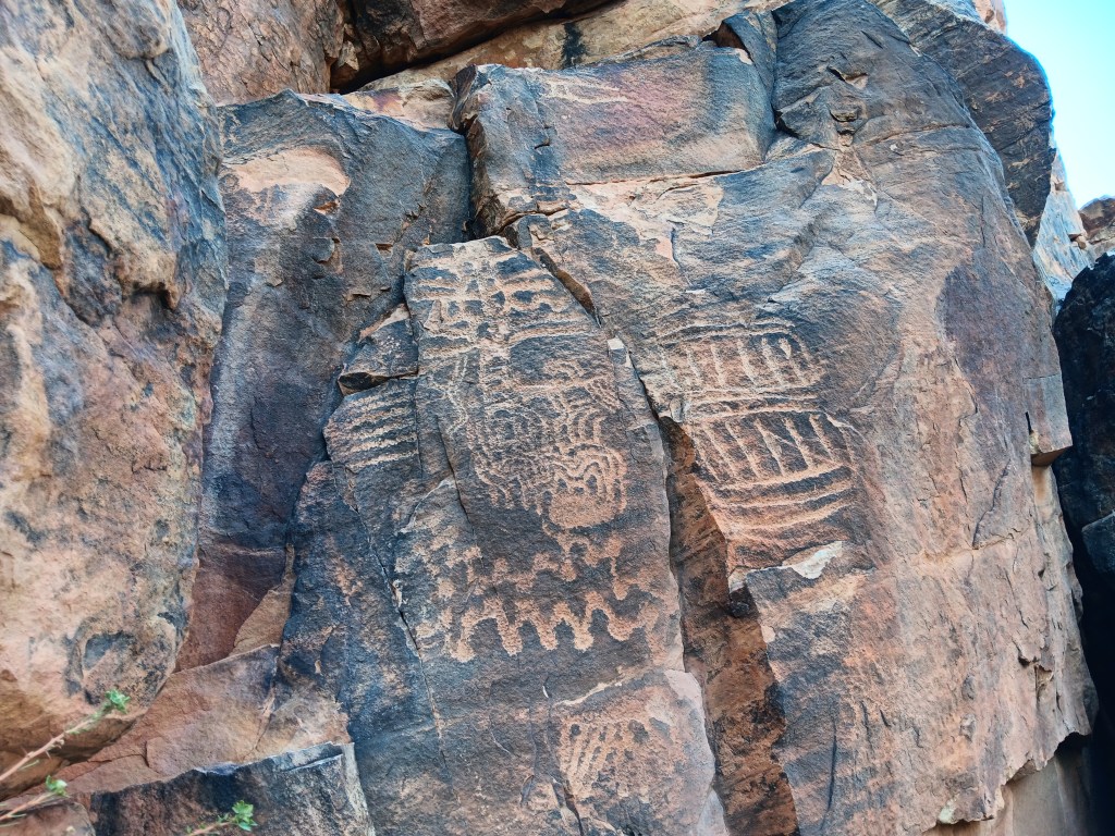
Other than three kids on motorbikes racing down the road, the gap was absolutely still and silent. We clambered around enjoying the petroglyphs, wondering at their meaning, and, in that stillness, it was easy to imagine nomadic tribes pausing to rest, play, soak up the beauty, and go about their daily lives.


The petroglyph roughly in the center of the photo is now called the Zipper Glyph, for obvious reasons. Its meaning isn’t known, but it’s thought to be a marker of travel days, first one way then another, from the summer solstice (the circle at the bottom). It may have been used as a means of tracking where game would be throughout the seasons.

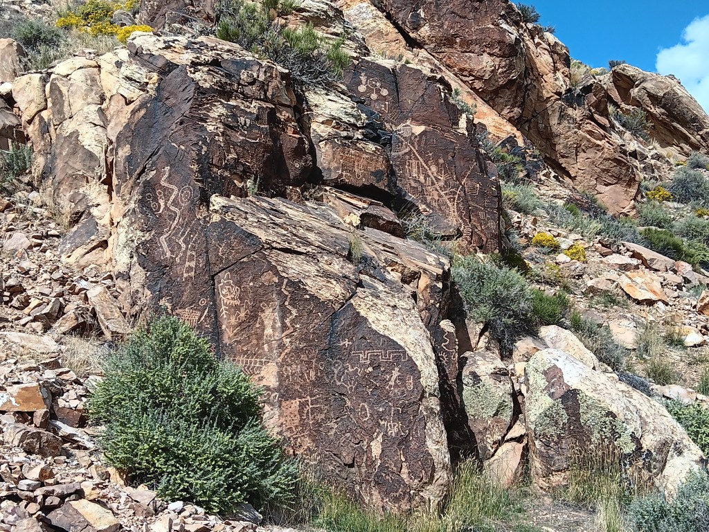
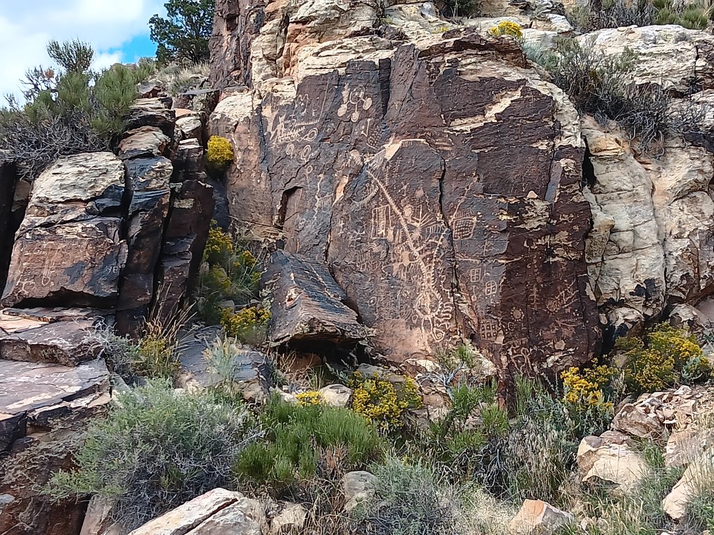
As we stood admiring a particularly large set of petroglyphs, the most haunting, soul-stirring sounds of an ancient flute melody gently caressed the breeze, and for a moment we could imagine it was an echo of the people who used the area for a thousand years.

Turn your volume up, listen closely, and you can hear the flute.
Click on photo for video

Instead, it was Michael. Michael comes to the gap now and then to play his hand-carved flute, because, he says, he likes the acoustics.

The spirits of those who once passed through here like Michael’s playing, and he has had several encounters with them, he told us. It was easy to believe. Even Simon, who holds no particular belief in such things, agreed there was something special –and spiritual – happening in the gap.

This cave entry leads to a place where the tribes’ shamans meditated during their time here.

I’m tempted to stop this blog here, and just bask in the memory of such an extraordinary experience. We did have a rather startling return trip that included an unexpected climb up a mountain range to a ski resort town called Brian Head (elevation 10K+) and a journey through Cedar Breaks National Monument…


…but let’s just let the memory of the flute music sooth us into a happy stupor, and call it a day.

The Grandest Canyon Of Them All


Simon had been to the Grand Canyon, but Susan had not. The South Rim was on our schedule, but with the change in our itinerary in Month Two, we now had the option to fit in the North Rim as well. Could we make it happen from 156 miles away? You know we could!


Donkey’s years ago (“a long time ago” for our U.S. readers), Simon visited the South Rim during his first trip to the States. We had heard the North Rim was pretty special, and much less crowded. While it would be a very long day, we agreed to make the trip, reckless vagabonds that we are!

Our dear friend Richard recommended a stop at Little Hollywood Land in Kanab on the way to the North Rim, for its Western movie props. Simon was all in; he absolutely loves that sort of thing.

Little Hollywood is as kitschy as it comes. Homespun, quirky, it’s a curiosity for those who don’t know the old Westerns well, and if the AARP-aged man visiting with his son and pointing out all the little details is anything to go by, it’s a delight for those who do.


Some of the movie location props we saw were:

The backdrop for Kenny Loggins Live from the Grand Canyon concert in 1991


The barn and homestead sets used in the Clint Eastwood movie, Outlaw Josey Wales

The barn

Inside the homestead

Simon, pointing at the cross-shaped window that featured in the movie’s final, dramatic gun battle.

And many more, along with a smattering of atmosphere props


The drive to the Grand Canyon felt like it took forever once we left Kanab. This is pretty much what we saw the whole way:


But once we arrived, the WPM (Wows Per Minute) cranked right up. We took the advice of previous visitors and made the drive from the entry straight to the end of the scenic road, then drove back and stopped at the overlooks, which were now on the right-hand side of the road, saving us from having to cross traffic to get to them.


It was the right decision. There was some pretty dicey roadway those last four miles, with big drop-offs and no guard rails, so it was better to get that over with quickly so that Susan could enjoy the rest of the visit.


Again, it’s impossible to get the scale. You’ll see people part-way into this video, which helps give some perspective.

Click on photo for video

The “mood” of the canyon changes, depending on how the light hits it, and this has always been something that intrigues me (Susan). Some might say I relate to “moody,” but that’s a discussion for another time.


Simon scampered around the park like a squirrel on a mission, taking all the narrow pathways and leaning out over all the railings, and as part of his exploration he discovered a room inside the lodge where guests staying at North Rim check in for their accommodation.


The room had huge windows overlooking the canyon, and while it was right on the edge of a drop-off, like most overlooks are, he took me by the hand when I returned from getting Ruthie settled in the car with some water, and said, “Come see this.” I’m SO grateful for that loving gesture, which gave me a view with a sense of safety.

This is an incredibly proud moment. Tears may have happened.

On the way out of the park we were treated to a wildlife sighting, which capped off the day just right.

Mule deer doing mule deer stuff

We had two more major National Park experiences coming up, and one unexpected mini canyon. While it was nowhere near as grand as the Grand Canyon, the emotional impact of little Parowan Gap would prove immense.

Walking On The Craters Of The Moon


Technically, Idaho wasn’t a new state for us. We’d flown in to Idaho Falls several years ago, and made the 108-mile drive to Yellowstone in Wyoming. But, clearly, we were new to Idaho, as evidenced by the Sheriff in Richfield who caught sight of our Florida license plate and “escorted” us out of town.

Our suspicious nature wasn’t helped by Susan taking random photos of weird road signs while the Sheriff was behind us, or Simon making an extremely abrupt turn onto a lonely back road, having nearly missed our GPS’s warning that the turn was coming up. Richfield’s Finest responded by following us all the way to his county’s border to see us off.

We don’t have a photo of the Sheriff, because we’re not crazy, but we did wonder about this sign. HOW do we avoid windshield damage, and damage from what? Pedestrians? Squirrels? What? Isn’t this something every driver wants to avoid from the moment they purchase their car?

The several-mile drama unfolded after our visit to Craters of the Moon National Monument and Preserve, the reason we were in Idaho in the first place. If you’ve been following along, you know we made a change to our original itinerary, and because of that our time in Idaho was in doubt. But both of us were eager to see the otherworldly park, so we booked a week in the area after our time near Salt Lake City, which opened up the opportunity to also see City of Rocks National Reserve, Shoshone Falls, and massive piles of the vegetable for which the state is famous.

City of Rocks is a world-class playground for rock climbers, but its history includes emigrants passing through on the California Trail from 1843-1882 and, prior to that, use by native peoples. Its oldest rocks date back 2.5 billion years.

Really old rocks.

We were there for the scenery, though we didn’t know what to expect. A stop at the Visitor Center resulted in two useful suggestions from ranger Robb: Don’t take little Nippy on the rough road beyond the Bath Rock formation, and stop at Rock City for the best pizza you’ll ever eat and the only craft beers for a hundred miles.

Obligatory selfie!

The park is entirely dog-friendly, with a handful of dramatic geological features, starting with Camp Rock (a.k.a. Register Rock). There, we found signatures and dates from emigrants who passed by, pausing to leave their names and sometimes a short message, written in axle grease.


The rocks here are not small; this one was the smallest.

Next along the byway was Elephant Rock, and we were told it was a great place to see climbers. Sure enough, there were several making their way up (and down) the rock face.

The “trunk” of the elephant is on the left, but you can’t see it in this photo.

Look carefully and you’ll see a climber just above the horizontal boulder on the ground (the third one to the left of the boulder in the foreground), and another climber near the top of the fissure the lower climber is scaling.

The trail to Window Arch, just beyond Elephant Rock, was only 250-feet long, but included some of the most dramatic views.


As with most photos, you can’t get the scale of this place.


We ended at Bath Rock, a spiritual place, Robb at the Visitor Center told us, where his grandmother used to take him and his sister when their parents were traveling, and she’d “bathe” in the positive energy to remove the negative energy she was covered in. Energy which, his sister told him, was all his fault.

Bath Rock. Bathe in its healing powers!


Bath Rock was active with climbers, but a storm was brewing in the distance, so we enjoyed their activities for a while, took a little stroll along the trail, then headed out of the park for an al fresco pizza lunch.

People who are braver than us.

The storm had other plans. It hammered down rain, sending bolts of lightning perilously close to the gravel we were standing on, directly under a metal roof.


It was really cold, too.

We high-tailed it to the car, watching water pool alarmingly around the store and its picnic area, which added credibility to the Flash Flood warning we’d heard the store employees mention while we waited for our pie to bake.

Our view.

City of Rocks made a terrific afternoon out, in spite of the rain, and we were even more excited for our trip to Craters of the Moon two days later.

Our $20 America the Beautiful Senior Pass got us into the park for free (we’ll just add here that we’ve literally saved hundreds of dollars using this wonderful National Parks pass), and we marveled at the seemingly endless lava fields and features that were formed when molten lava oozed through cracks in the earth compliments of the 50-mile fissure known as the Great Rift.

Who are these people, and why are they always laughing?

Our first stop along the seven-mile scenic loop was a hike up the powdery Devil’s Orchard cinder cone, a gentle start to our visit, punctuated by a surprising variety of flora.

The volcanic rock here was feather-light.


Inferno Cone was much higher, with a well-worn, crunchy path to the top of not one, but three rises with magnificent views over the valleys and to the mountain ranges beyond.

You can just make out the people climbing the hill.


The view from one of the rises. It’s way, way down.

Guess who made it up to the third rise? Him!

It felt fabulous to be out walking, and we were loving the interactive nature of the features. A second short hike of just a few hundred feet saw us looking into two Spatter Cones, the first of which still had ice at the bottom.

You can see the pathway leading up to the part of this splatter cone where you can look down into it.

That white stuff is ice. The second splatter cone had three or four hats in it.


We took all the side roads off the main loop, and had several WPM (Wows Per Minute) passing miles and miles of lava fields and curious “cinder gardens.”


But our absolute favorite WPM was the Caves Area, where visitors could descend into some of the caves that formed when lava tubes collapsed.


Precarious perch for a selfie inside the cave!

Sheriff of Richfield being the slightly humorous (if also slightly unnerving) exception, it had been a fantastic, unforgettable day. Our return trip to Village of Trees RV Park had one more surprise in store.

We’d been unreasonably excited by all the trucks we’d seen carrying Idaho potatoes from one place to another, but we didn’t expect the absolute thrill of two massive mounds of potatoes getting ready for transit. We shouted and pointed and laughed out loud at the piles and our incredible luck!

Those piles aren’t wood or sand or dirt. They’re potatoes! YAY!

One more potato photo.

Okay, last one, I promise!

We know that’s sad and maybe even worrisome, but we’re proud of our little quirks, and of our ability to find joy in the small stuff.

It may have been windy.

A Year On The Road in The Indy (Pt 2)

The second installment of our exclusive RV travel series for The Independent Travel has just been published, highlighting the second month of our ‘Year on the Road’ from Minnesota to Montana, and including the wildlife-rich Theodore Roosevelt National Park, eye-popping Badlands National Park, and extensive Custer State Park. Check it out on this link:

https://www.independent.co.uk/travel/north-america/usa/american-road-trip-usa-minnesota-montana-rv-b2398864.html

Custer State Park in South Dakota

An Unexpected Detour Into Colorful Colorado


Colorado wasn’t on our original itinerary. We just couldn’t fit it in before winter hit, but with the changes we made – skipping Oregon and Washington – we took advantage of the extra time we have, and our proximity to the Rocky Mountain state.


With Fati tucked up at the campground in Wheatland, WY, we headed south into Colorado, having booked a hotel room in Loveland for one night. If we could get a timed entry reservation, we’d visit Rocky Mountain National Park on our second day.

But it was a big “If.” From experience, we knew timed entries go quickly, so we were ready to sniper the 5 p.m. online reservation release and hope for the best.

We had perfect weather for our first adventure, which saw us leaving I-25 at Wellington, Colorado, aiming for Cache la Poudre Canyon (oddly pronounced “cache la pooh-der,” and named for French-Canadian trappers who hid their gunpowder there during a blizzard in the early 1800s).


The landscape started gently, but quickly morphed into high, craggy spires lifted vertically by whatever natural forces were at work back when dinosaurs roamed the land, and a mighty Poudre River now wends its way along the bottom of the canyon it carved out.


We all have our “things” that unnerve us slightly, and Simon paused for just a moment when we stopped along the river and saw this sign. We were astonished by how many houses were built in the canyon, and often wondered how they would survive a flash flood.


Similar to the Galatin River on our way to Yellowstone, Poudre River is heavily used for fishing and white water rafting. We love seeing rivers as-is, but it’s even more thrilling each time a raft filled with happy (but dogless) adventurers comes bounding down the gentle (and not so gentle) rapids.


We know you’re probably growing tired of scenery photos, but this beautiful country astounds us at nearly every turn, so here’s a video of the canyon’s prettiest turn.

Click on photo for video

Lunch that day was at the Mishawaka, partly because it’s a long-time institution in these parts, and also because it’s the only restaurant (and a hot-spot music venue) for about a hundred miles. It’s busy…like, REALLY busy…but after driving as far as we could, we backtracked, scored a table on the patio overhanging the river, and life was good.

Surrounded by mountains, with the river behind it

Susan, happy as a clam who didn’t have to cook

Ruthie, happy as a Labrador who has just been given four french fries

Simon, happy as a well-fed boy who’s finally had a real meal. We split an order of fish & chips, but scarfed it down so fast we forgot to take a photo. Still, it’s not hard to imagine what fish & chips looks like.

We made our way out of the canyon after lunch, marveling at how different the view is, depending on which way you’re going.


The day was still young enough for us to detour to Horsetooth Reservoir before heading to our hotel for long, hot showers and a good night’s sleep. The reservoir was created to divert water from the Poudre River to ensure a steady, accessible supply, and now it’s used for all sorts of recreational activities.


At exactly 5 p.m., Susan was on nps.gov, for the release of coveted timed-entry reservations for Rocky Mountain National Park. Forty seconds later we had confirmation for entry between 9 a.m. and 11 a.m. and were good to go!

The face I make when it’s all going right! PS: Those spots are freckles, not dirt, though with this lifestyle they could easily be dirt.

Simon’s word for the day even, before we reached the park, was “Stupendous,” but it barely scratches the surface of what this place is all about. We couldn’t do any of its fabulous hikes (Ruthie just isn’t able, and dogs aren’t allowed on the trails anyway), but Oh! What glorious vistas!


The ranger we spoke to at the Beaver Meadows Visitor Center just outside the park’s entry told us we must do the Trail Ridge Road (“No, we don’t have any big drop-offs here, we have ‘rolling drop offs,’ which means they’re just long slopes next to the road,”), then visit the hidden gem of Sheep Lake Valley.

We agreed we’d go as far as Beaver Pond, part-way up the mountain, then see if it was still comfortable. During our ascent, the term “rolling drop-off” revealed its true meaning: You won’t die immediately upon impact after falling off the cliff, you’ll just bounce your way down to the valley and die a long, slow, horrible death.

Okay, so it’s not a “sheer” drop-off, but damn, son…the only thing “rolling” about it is you and your car if you’re not careful

Happier times, just before we hit those “rolling drop-offs.”

Still, Beaver Pond was located before the big switchbacks, so it would all be fine. Right?

We blew past Bever Pond without realizing it, and were well into the switchbacks when Susan said, “Get me the hell down from here.” Loving husband that he is, Simon pulled into the next big turnout, just on the uphill side of the hideously named Many Parks Curve Overlook (elevation 12,183 feet). He pulled right up to the edge of the parking area, got out, and said, “I’ll just get a couple of photos and be right back.”

Click on the photo for video

As always, Simon had to go right out to the edge of the cliff while Ruthie and I stayed in the car watching him lean way, way over the guardrail. The following conversation took place:

Ruthie: Where’s he going?

Susan: Twelve thousand feet straight down, if he’s not careful.

Ruthie: Who will feed me?

Susan: Me. I always feed you. You know that.

Ruthie: Who will pick up after me when I’m a Good Girl in the garden?

Susan: Now we have a problem.

He was back ten long minutes later, and we were on the descent to Sheep Lake Valley (elevation 8,524), named for the Bighorn Sheep that are prevalent there, so much so that, during summer months, rangers have to be stationed along the road to act as crossing guards.

That green patch is the valley, still quite a way down


We hadn’t seen Bighorn Sheep since Custer National Park in South Dakota, so we were hopeful of finding another herd or two.

It was not to be. But something even better was waiting for us when we reached the valley. A bull moose was browsing in a pond just off the road, giving us the thrill of a wildlife sighting we had not yet had.

That dark thing with antlers to the left of the reeds is our moose. It isn’t wise to get too close.

Enjoying swamp salad for lunch

We shared our binoculars with another couple, who hadn’t seen a moose during their travels, either. There are few things better than having someone say you made their day by doing something so simple.

What a wonderful finale to a day of WPM (Simon’s new term, meaning “Wows per minute”). But we had two more Wows to enjoy when we stopped at Estes Park for dinner. First was the horror-movie Wow of passing the Stanley Hotel, architectural star of the movie, The Shining.

Even driving past it felt a little bit creepy

The second was the Wild Game Sampler at Molly B’s restaurant, an enormous platter of smoked buffalo, jalapeno elk, apricot boar, and smoked caribou sausages, with cheese, crackers, and mixed-berry jam, meant to be a sharing appetizer, but the right size for a full entrée, if you’re Simon.

He had no idea which meat was which, but he enjoyed it all

Susan had a vegetable sandwich.

Too big to eat, so it became “deconstructed”

Ruthie had to settle for water, and refused to look at us.

This isn’t at Molly B’s, but it’s exactly what she always does when there’s food around and she hasn’t had any. PS: She did get a spoonful of ice cream.

So much fresh air cleared most of the caffeine out of Simon’s bloodstream, so we stopped at the most adorable coffee shop we’ve ever seen. It was a drive through, or a walk-up, or whatever you wanted it to be, and we both ordered a Cherry Garcia coffee and chatted for quite some time with the shop’s owner, who offered to take our photo when we told her we’re travel writers. Isn’t life grand when you slow down and appreciate the quirky?


It was a three-hour drive back to Fati, and several times during the return trip we mentioned how happy we were to have checked Moose off our Bingo card, in a place so stupendous we struggle to find the words.

A Year On The Road – The First Three Months

On August 14 we celebrated the third month of our grand ‘A Year On The Road’ RV adventure, with a chance to tot up our mileage and chart the latest course of the scenic route we are forging across the US.

Having ended Month Two at Fishing Bridge RV Park in the heart of Yellowstone National Park, we have basically undergone a bit of an about-face on our original planned route and gone “freelance” for a few weeks. Our third month covered a total of 1,318 miles, giving us a whopping 5,061 for the trip to date.

Month Three – 1,318 miles, starting in Yellowstone and reaching El Rancho Village RV & Cabins in Wheatland, Wyoming, via Glacier National Park in Northwest Montana

As you’ll see from the map, we continued north from Yellowstone to Glacier National Park, but then broke away from the proposed westward trek to Washington and Oregon via a bit of Idaho in favor of seeing more of Montana and Wyoming, two states which we have found utterly enchanting.

We have tried not to cover any of the previous route, apart from a few miles along I-90 in Montana, and have dived much deeper into Wyoming in particular, including side trips to Cheyenne and Laramie – very much the heart of the Old West – in Nippy to avoid putting too many miles on Fati. From here, we’re looking to turn West again, with each of Colorado, Idaho and Utah on our radar – and more of the magnificent Rocky Mountains.

The first two months – and 3,743 miles

The Glory Of Going-To-The -Sun Road

There isn’t really any way you can follow-up the magnificence of Yellowstone, but we were hopeful Glacier National Park would be the next best thing as we headed north back into Montana again.

We were already aware the only entry to the park between 6am and 3pm was by the National Parks Service’s reservation system, which had defeated us for months, but we had a back-up plan – Simon would try for a Red Bus tour on the fabled Going-to-the-Sun Road and Susan wouldn’t. After her nerve-shredding experience in the passenger seat in Nippy going over the 8,878ft Dunraven Pass in Yellowstone, she was more than happy to sit out anything that offered the prospect of mountain-edge driving.

We had snagged a four-night reservation at the Lake Five RV Resort well in advance, knowing how popular Glacier NP is these days, so we were right on the doorstep of the park’s west entrance (and there are only really two ways to see Glacier, from the east or west roads).

The view from the back of our spot at Lake Five RV Resort, with Glacier NP in the distance

The park was beautifully situated and we were able to get set up and then visit Glacier NP’s visitor center, taking the (short) scenic drive along Camas Road, and spending time in the delightful Apgar Visitor Center and Village, which is the heart of the park’s western side.

Just a week out from our arrival, we were able to snag a seat for Simon on the Xanterra Red Bus Tour from Apgar Visitor Center to the Logan Pass – the passage from west to east across the stunning Lewis range of the Rocky Mountains – but we were going to have to wing it for the rest of our four-day stay.

What we hadn’t counted on was the fact that there really isn’t a lot to do and see outside the West entrance to the park. There are no other major scenic drives beyond the park’s boundaries – other than the hilly, winding drive in from the town of Browning, which showcases the southern edge of the Lewis range and which we had already seen in reaching West Glacier.

One of the, ahem, highlights of the West Glacier area

There was also major reconstruction under way of the 10-mile stretch of road along Lake McDonald from the Visitor Center to the lower end of Going-to-the-Sun Road. Not only had the usual paved road been ripped up for replacement, leaving a crude, pitted dirt track in its place, the construction crew also seemed to have abandoned any attempt to keep down the clouds of dust in the afternoon, making it 10 miles of driving torture, especially with a low-slung car like Nippy.

To put it mildly, this was a shocking state of affairs for any park, let alone one of the NPS showcase parks, and to say it was inhibiting was a major understatement. We abandoned the road at the Lake McDonald Lodge, and limped back to the Visitor Center.

The rutted dust bowl of the “road” alongside Lake McDonald with its ongoing reconstruction

This left Simon’s trip on Going-to-the-Sun Road as our lone highlight of the visit. It turned out to be a pretty memorable highlight.

Now, GTTS Road is aptly named, albeit it isn’t quite what you think. It is actually named for the 9,647ft Going-to-the-Sun Mountain, the sacred peak of the Blackfeet Indians, and the rather tortuous translation of their word for it is actually “The-Face-of-Sour-Spirit-Who-Went-Back-to-The-Sun-After-His-Work-Was-Done Mountain.” More aptly, for first-time visitors to the road, it merely feels like you are going to the sun, such is the precarious nature of the precipitous passage up to the 6,646ft mountain pass.

The road dates back to 1932, when it was opened after an 11-year construction process that cost the lives of three workers (how it wasn’t any more is one of the minor miracles of the project). It wasn’t fully paved until 1956, and is one of the hardest routes in America to reopen after each winter, such is the nature of its extreme inaccessibility. Put simply, this road is scratched into the side of a near-vertical mountain wall with all the seeming permanence of an Etch-a-Sketch. How the engineers conceived it, let alone built it, absolutely boggles the mind.

A viable road or an unfeasible creation of an over-worked engineering mind? You decide…

But there it is – the only way to cross Glacier NP, on a winding, sketchy, winter-worn stretch of “road” that wouldn’t earn that designation in any other place on Earth.

Oh, and the iconic Red Bus vehicles – nicknamed the Rubies of the Rockies – that take you there (and back), are almost 90 years old. Really. OK, so they have been modified with modern engines, transmissions, and braking systems, but the basic vehicle was introduced in 1935 and each has chalked up around 200,000 miles since then.

The maximum length for all private vehicles is 21ft. The Red Buses are 25ft long. Yup. Go figure.

So, the basic equation is:

Rickety Road + Outrageous Drop + 90-Year-Old Over-Long Vehicle – New Engine = A Hair-Raising Experience for All Concerned (especially Susan waiting back at the Visitor Center, praying for my safe return).

(It should be added, however, that each vehicle has a 100 percent safety record throughout all those years and miles, and each driver is a specialist)

One of the original Red Bus fleet, which made its debut in 1935. Glacier National Park had 35 of the original 500 that were made for the NPS, and 33 are still in service

The journey from the Visitor Center to Logan Pass, and back, takes almost 3.5 hours. It reaches a top speed of a daring 45mph, and just 20mph on the seriously scary bits. Two red buses can pass each other on that cliff-edge monstrosity. With about six inches to spare. So, absolutely no worries for the passengers, especially Simon in the front seat next to the driver, with the grandstand view 3,300ft straight down the mountainside.

The first part of the journey is pretty gentle, through impressive cedar forest, alongside Avalanche Creek (nothing inhibiting in that name, either) and past several suitably scenic picnic areas. Then it reaches The Loop.

The full magnificence of Going To The Sun Road

This is the most critical feature of the entire Road, the only serious hairpin bend on the whole, implausible 50-mile route. It is the engineering pivot that allows the roadway to cling to its precipitous perch and provide access all the way to Logan Pass, which adds a resounding wide alpine plateau for a sizeable visitor center of its own, plus a variety of hiking trails which vary from gentle to “You’ve Got To Be Joking” (the latter for the Highline Trail, which is barely 4ft wide in parts and equally precarious, especially when you hear that the wildlife has right of way, and can include both bighorn sheep and black bears. Any takers…?).

That’s the Highline Trail, in that frail line30 yards above the road

But – and this is a seriously substantial adverb – none of that even begins to describe the utter, stonking majesty of this drive. The solidity of the buses, the assurance of the drivers, and the ability Simon has to be blissfully ignorant about the likely terminal nature of any vehicular mishaps make this a journey of total superlatives.

On each side, the mountain ranges seemingly reach up to levels normally reserved for stratospheric aircraft, including the heart-stopping Garden Wall that towers to 9,553ft and is the main conduit for GTTS Road, as well as the demarcation line for the Continental Divide. That’s right, this is where the North American continent is basically split into East and West, albeit that is primarily a geological term and not a regional designation, seeing as Montana is about as Wild West as it gets.

The stunning extent of the Garden Wall – and the Going-to-the-Sun Road crawling along it

The mountains are studded with breathtaking waterfalls at regular intervals, along with various overlooks to allow drivers to get out and confirm that, yes, that really IS a bugger of a long way down, and “Don’t look now Ethel, but the car brakes are over-heating.”

Seriously, driving these buses up there is something approaching an art form, and sometimes you’re not sure whether to gape at the mountain scenery or the driver’s nonchalant style as they narrate the full story of the Road and everything connected with it.

And that’s it. We comfortably made it there and back, our open-top vehicle providing the best possible viewpoint of the entire Glacier NP, along with regular stops when, on the command “Prairie Dogs Up!,” our 18 passengers all stood up through the open lattice-work of the bus to take photos and marvel at the increasingly insane drop on one side.

“Prairie dogs up!”

It was an experience of the utmost refinement and beauty, a combination of Evel Knievel and Bob Ross, with a dash of Errol Flynn thrown in for good measure. It called for extreme belief in the person behind the wheel, and a cavalier disregard for normal road safety. And it was totally, utterly, mind-blowingly brilliant.

And I’d do it again in a heartbeat.

Making Choices In Montana

This was the easiest decision we had to make. And yes, that’s a long line ahead of Simon. A locals’ favorite!

Sometimes you have to make hard choices. While there are times when you have to take a leap of faith, our decisions over the next few days would be based on both local knowledge and hard-earned first-hand reconnaissance.

Billings, Montana was supposed to be our next stop, but since we were running a day late we pushed on to Columbus, which we planned to use as a base from which to see the Pryor Mountain wild horses, Devil’s Canyon Overlook, Cody, Beartooth Pass, and Chief Joseph Scenic Byway.

We ruled out Pryor Mountain, a 204 mile round-trip in Nippy that sounded long but oh-so-scenic from the comfort of our house when we were making plans, but sounded truly awful when reality hit, then ruled out Beartooth Pass when it became obvious the sharp drop-offs, cliffside driving without barriers, and the sheer terror of it all were going to do Susan’s head in. Instead, we opted for the still-very-high-up Chief Joseph Scenic Byway, which gave us plenty of spectacular views without the threat of death.

A quick stop in Absarokee’s little downtown market for a bite of take-away lunch (two pizza sticks for Simon, one chicken strip for Susan, and a pot of potato salad to split) gave us the fuel needed to start ascending the mountain to Red Lodge, Montana, which bills itself as “The Gateway to Yellowstone Park.”

Feasting in the car . Rainstorms make everything taste better!

And it is a gateway…if you’re willing to brave the Beartooth Highway, a 69-mile twisting, turning, sharp-drop-off road that tops out at 10,947 feet (that’s 3,337 meters for our UK friends).

The trip to Red Lodge offered yet more rolling landscape dotted with green hills that led to sharp, craggy rock, and while the weather over the Beartooth mountains threatened a bit of rain, we only had a few spotty showers.


We stopped at the Visitor Center, which included a one-room cabin once owned by Liver Eating Johnston. There were people then and are people now who can live and thrive in a dirt-floor cabin, but we aren’t among them.


Photo taken through a glass door. Ignore the reflection on the right.

The Visitor Center host suggested we take a drive to Wild Bill Lake for a one-mile hike, then head up the Chief Joseph Scenic Byway, an alternative to the Beartooth Highway. The hike was a terrific suggestion, and we thoroughly enjoyed our walk, as did Ruthie, who got lots of love and attention from kids fishing along the lake.


Now, we’d been assured the Chief Joesph was tame, but over the course of the next week or so we’d learn that “tame” in Montana and Wyoming is not the same as “tame” in Michigan, Florida, or the UK. We would also learn that “rolling hills” mean something entirely different, too (steep grades both up and down, in quick succession).


None of that mattered as we wound up the mountainside, stopping at markers for the likes of Bear Creek Hill and Dead Indian Pass (elevation 8,000 feet). Naturally, Simon had to find the most precarious place on the whole mountain to lean out and peek over the edge, while Susan very sensibly waited in the car.

See that little strip of pavement way, way down, in the middle of the photo? That’s the road.

A marker at the summit tells the story of 600 members of the Nez Perce tribe, led by Lean Elk and Chief Joseph, who used the pass to escape the U.S. Army in 1877. At this point in their retreat, they were forced to leave an injured warrior, who was subsequently killed by U.S. scouts.


The byway eventually hooks up with the Beartooth Highway, so we retraced our route for the return trip and veered off at WY-120 heading to Cody, just 18 miles away.

Cody was busy, as we’d expected, and, inexplicably, with thoughts of a big, juicy Wyoming steak on our minds, we ended up at a German restaurant eating a kid’s portion of schnitzel and some sort of noodle dish with eggs and cheese. They were out of nearly all of their interesting beers, so we ended up with brews neither of us can remember. Life is funny sometimes.


What is this noodle, egg, and cheese food? We don’t know.

Can you really go wrong with half a schnitzel?

Fati took us to Livingston the next day, which served the dual purpose of getting us closer to Yellowstone National Park while also giving us the opportunity to decide on our best route to the West Yellowstone entrance through real-life experience. We could take Highway 191 from Bozeman, or, as had been suggested by the campground host, take the longer route down the 287 through Ennis. Our trusty Mountain Directory West showed 191 as the better route, but was local knowledge the real story?

The next morning we took advantage of the opportunity to do some sightseeing south of the city, heading to Chico Hot Springs. It was probably just an excuse to get so close to the Gardiner entry into Yellowstone that we couldn’t pass it up and would have to pop in for a look.

Cute little bar in Chico Hot Springs, but, of course, NO DOGS ALLOWED.

We’d been to Yellowstone before, and remembered the road from Gardiner into the park as being steep but nothing to bat an eye at in a car. In fact, it had been the only place we’d seen mountain goats the last time we were there, and we hoped to repeat that experience. What we hadn’t realized was, the road has been rebuilt in a new location since the flooding last year that washed out several roads in Yellowstone. Now it has such steep grades and such tight turns, even some of the park rangers would later tell us they preferred not to use it. We have no photos of this part of the journey, since Simon was gripping the steering wheel and Susan was white-knuckling Nippy’s armrests.

We were blissfully unaware of what lay ahead as we played around taking photos in front of the famous Arch, and when we did make the arduous climb up to Mammoth Hot Springs – punctuated by a few straggler elk – we were hugely relieved to reach the top, and not at all eager to make the trip back down.


It may have been a bit windy.

Why? Why do you people do this to me?

Still, there was no other choice, so down we went when we’d finished our nice little drive to view Mammoth’s glimmering travertine formations.

This isn’t travertine. This is elk.

This is elk and travertine.

This is us and travertine but no elk.

The next day, the 191 wound us through a valley in Gallatin National Forest and along the Gallatin River in Nippy, giving us the lay of the land. Simon was just slightly apprehensive about the drive when we’d have to make it with Fati, because of its sharp curves and very few passing lanes long enough for us to pull over and let other vehicles go by. Big benefit? No major grades. And what a road it turned out to be!

Every curve offered a view more superb than the next, and often we had river rafting tours and people out fly fishing alongside us.


We stopped for a peaceful picnic lunch along the riverside, where four fishermen were grilling whatever it was they’d caught. The scent of pine trees made it an idyllic setting, and we spent a fair bit of time enjoying the serenity.

Our picnic lunch didn’t include fresh-caught fish, but it did include a hiking boot used to hold down one side of our Christmas tablecloth.

We then returned to Livingston via Highway 287, and were hugely surprised to see one of the mountainsides along the road had come down due to a 7.5 magnitude earthquake, leaving a massive scar and an even bigger pile of rubble.


Lucky for us, this all happened in 1959, and whoever takes care of these sorts of catastrophes had created a charming visitor center for Earthquake Lake on top of the rubble, and on top of 14 people whose bodies were never recovered.

Dead trees still stand in the lake, and the hosts at the visitor center told us the concussion from the landslide was heard all the way into Yellowstone.


The visitor center monitors tremors, and we were told the seismograph is so sensitive it often records the footfalls of elk walking in the vicinity. The employees feel tremors several times a day, but they seemed happy with their jobs and their location, so nothing major appears to be on the horizon.


It was reassuring to hear, since we’d soon be spending a few days exploring Yellowstone.

In the end, we were glad we drove both highways to help our decision-making, and it turned out local knowledge didn’t stand up to the test. Highway 287 was gorgeous, but had so many long, steep grades that poor Simon was tuckered out by the time we returned to Fati that night.


Our decision had been made. Next stop, Fishing Bridge Campground in Yellowstone!

A Year on the Road – The First Two Months

Our second month is in the books, and we are now 3,743 miles into the grand year’s adventure. The arrival of July 14 sees us having reached the magnificent Yellowstone National Park in the Northwest corner of Wyoming (albeit, a small part of it is in Southwest Montana). The driving has been astounding, the views panoramic, and the wildlife absolutely everywhere.

From Orlando to Yellowstone – a 3,743-mile adventure (s0 far!)

In truth, we HAVE slowed down in the second month. The first month chalked up a whopping 2,504 miles, meaning we’ve traveled just 1,239 miles in the second stanza of four weeks. In truth, we’ve gone much further than that with our localized sight-seeing in Nippy once we reach a new destination, but the official distance is measured by Fati’s odometer, and she says 3,743!

In the meantime, we’re considering our next move. In theory it is Glacier National Park in Northwest Montana, and then through Idaho to Washington and Oregon. But we have discovered something wonderfully captivating about Montana and Wyoming, hence we may well explore further here…

South Dakota’s Badlands And The Results Of Effective Billboard Marketing

Badlands National Park selfie
South Dakota’s windy Badlands

We entered the new-to-us state of South Dakota on June 19, eager to see more of the Dakotas after a fantastic stay in the northernmost state in the Midwest. We’ve got a week in Hermosa, then 3 full days in Sturgis, to see Custer State Park, Crazy Horse, the town of Custer, Deadwood, Badlands National Park, Needles Highway, and Six Grandfathers, now known as Mount Rushmore.

To break up the long trip from Medora to Hermosa, we had an overnight stop at Harvest Host location, Belle Valley Ancient Grains in Newell, SD, which felt incredibly rural but was just minutes off the highway heading south.

Belle Valley Ancient Grains

We learned about the ancient grains owner Brian is farming, and came away with whole Spelt and White Sonora Wheat that we’ll make into grain bowls and hot cereal.

Belle Valley Ancient Grains grain machine
The 1950s machine Brian uses to separate the grain from the waste, before putting it through high-tech machines that finish the job.

Belle Valley Ancient Grains sunset
It’s hard to beat a stunning sunset over pastoral land

Then it was on to Hermosa, with a butt-clenching 11 miles through construction cones on a highway with a speed limit of 75mph. You can imagine the number of cars that passed us after the construction zone ended. We’ve decided their honking and single-finger salutes are congratulatory celebrations of how well we navigated a tight lane with harrowing twists and turns, and we felt very special indeed.

But enough of that, and on to the touring. We settled in at Heartland RV Park, enjoyed a pizza and live music at the campground’s event center, and had a relatively quiet night (rain is loud when you’re in a metal can), then made our way to Badlands National Park the next morning.


It was quite cloudy and windy all day, but that didn’t deter us.  We were on a mission to see something other than the rolling hills we’ve been driving over, and even before we reached the park, the landscaped changed. Immediately off the highway, the hillsides on either side of us opened to two massive valleys, with structures completely different to the ones we saw in Theodore Roosevelt.

Badlands National Park valley
For scale, that teeny tiny white dot you can barely see at the end of the dirt pathway on the far edge of the plateau is Simon, and a lady who had just come from the Black Hills is in the foreground.

Badlands National Park valley up close

We made a quick stop at the Visitor Center, where they told us we could find gas in the appealingly-named town of Scenic if we needed any, but when we found it, it had obviously been a dead town for years. Decades maybe. The gas station had a price of $5.55 per gallon, so we’re guessing the place drew its last breath back when Jimmy Carter was President. Luckily, Nippy is very sippy, so we didn’t need to fill up until evening.

Scenic South Dakota
Is Scenic scenic? You decide!

Scenic South Dakota 2

Once we reached the first outcroppings, it was obvious we were in an entirely new landscape. The peaks were sharper at the top and more angular as they descended, with a softer, more “melted” look when we got up close.

Badlands National Park peaks

Badlands National Park Bands of Time
We were given a guide that showed what each later represented, moving from the oldest layers at the bottom to the youngest at the top.

Badlands National Park range

The badlands here were created by runoff that washed into an inland sea as Colorado’s Rocky Mountains rose into existence. We could see the layers when we took a short hike into a wide canyon, and the ground we were walking on was primarily the finest silt imaginable. Just like walking on talcum powder.

Badlands National Park simon and ruthie
The white pathway feels exactly like talcum powder

Other areas in the same canyon were like petrified mud, hard enough to create hills you could stand on but also dry and cracked on some surfaces.

Badlands National Park simon mud mound
This ancient sediment is described as “popcorn” rock

Badlands National Park flower
Even on that barren surface, the most delicate flowers have taken hold.

Another surprise were the “yellow mounds” (called paleosols) that were left when the inland sea drained away and chemicals from its plants left staining of yellow, red, purple, and gray. Against the cloudy sky, they’re less striking, but when sunlight hits them they positively shine.

Badlands National Park yellow mounds
Some yellow mounds we saw were only yellow, while most were multi-colored. We missed the sunlight photos, but you can imagine.

We could post a few hundred photos from the park, but we’ll spare you that and instead share a few from the absolutely bizarre town of Wall, our exit point from the park as we headed north to Hermosa.

Normally, commercials on TV and billboards along highways have zero impact on us. But Wall Drug Store is too smart for that, and the sheer number of billboards they’ve installed made it inevitable Simon would have to see what all the fuss was about.

Wall South Dakota
Our introduction to Wall

Like Buc-ee’s, if you’ve been there, you know. Wall Drug Store is just…massive. Like, a full city block massive.

Wall Drug Store facade
Not all of these storefronts are Wall Drug Store, but most of them are

Want a billion shot glasses, T-shirts, cups, mugs, magnets, and every other form of tourist crap you can imagine, all wrapped up in interactive stuff that includes a jackalope the kiddies can sit on, a gorilla animatronic playing a piano, and an insane trio-plus-one of mechanical cowboys singing in a wild-west setting of howling coyotes and an upset bear? Wall Drug Store has all of it and much, much more.

wall drug store interior

wall drug store mechanical band
This is a terrible photo, but there was no way to avoid the glare. Still, it softens the full horror.

wall drug store jackalope

wall drug store gorilla
Why?

We didn’t buy anything. We didn’t even try the “free water” the store so proudly advertises on the front façade. But we’ll remember Wall Drugs with the same fondness we remember that wacky gas station with a beaver as its mascot.

wall drug store front

Tomorrow (subject of our next blog) would see us making the first of many trips into Custer State Park, and we’ll just say that at $20 for a seven-day pass, we absolutely got our money’s worth.

Custer National Park male pronghorn
Hello, handsome!