Willcox, Arizona offered a chance to catch our breath, keep our touring low-key, and end our time in the state on a relaxed note. We expected to spend most of our time “at home,” with a few afternoon jaunts before dinner and a movie each night in Fati. And while that was partially true, we all know what they say about the best-laid plans.
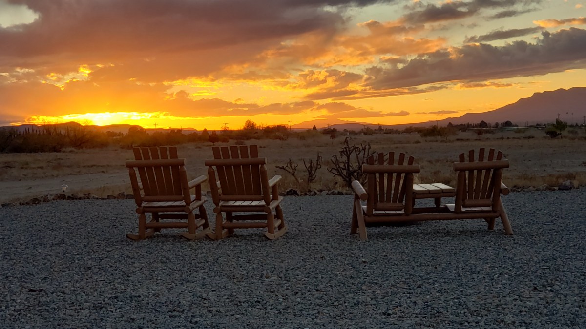
We started our five-day stay at the fabulous Willcox-Cochise AZ, KOA Holiday campground with dinner from the onsite Roadrunner Kafé, where the pizza we ordered was delivered right to our door, hot and delicious. We’d been excited to have a patio with a real table and chairs, an outdoor grill (oh, happy day!), and a fire pit. The unexpectedly cold weather had other ideas, but if we return to this area, we’ll make sure we do it when it’s sunny and pleasant so we can make full use of those fabulous amenities.
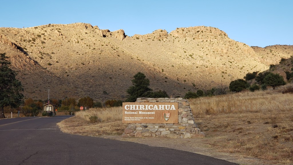
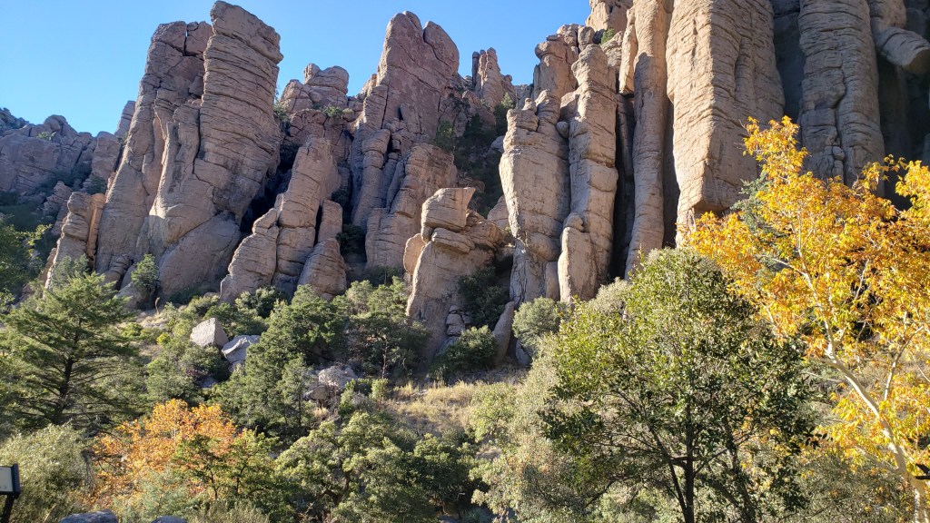
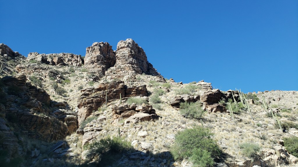
We didn’t really have plans for touring the area, but we did want to visit the “sky islands” of Chiricahua National Monument, where enormous rock formations tower high above Bonita Canyon. Apache – who at one time did not use that pejorative term (from the Spanish interpretation of the Zuni word meaning “enemy”) in reference to themselves, but instead use the name “Nde,” meaning “the people” – lived here while it was still a part of Mexico, prior to settlement by emigrant families from Canada, Ireland, and Sweden.
Looking down into the canyon from the top of the mountain, we wondered if this is what Bryce Canyon may have looked like at one point.
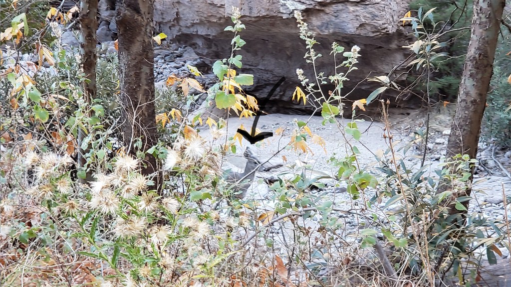
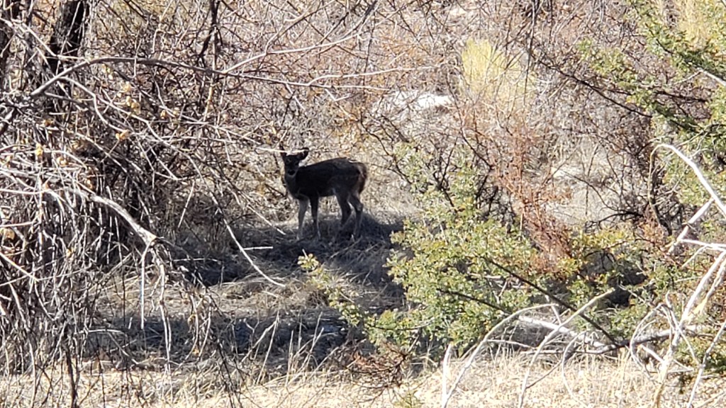
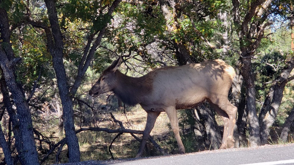
A band of coatimundi had been spotted that morning, so we should watch for them, said the woman at the Visitor Center. Black bear, rattlesnakes, whitetail deer, mountain lions, and other large mammals live here, too, but the only wildlife we saw was a lone deer.
Lone deer here.
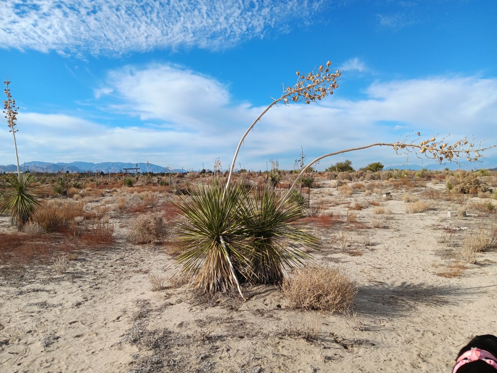
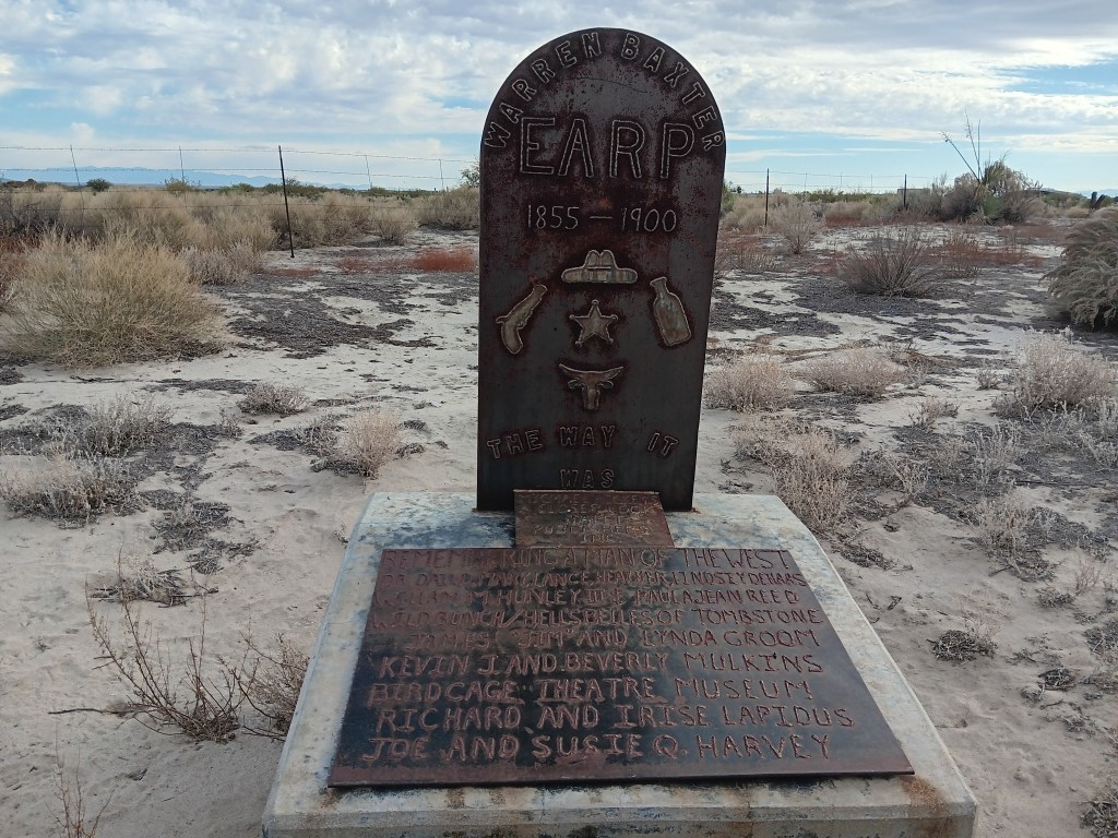
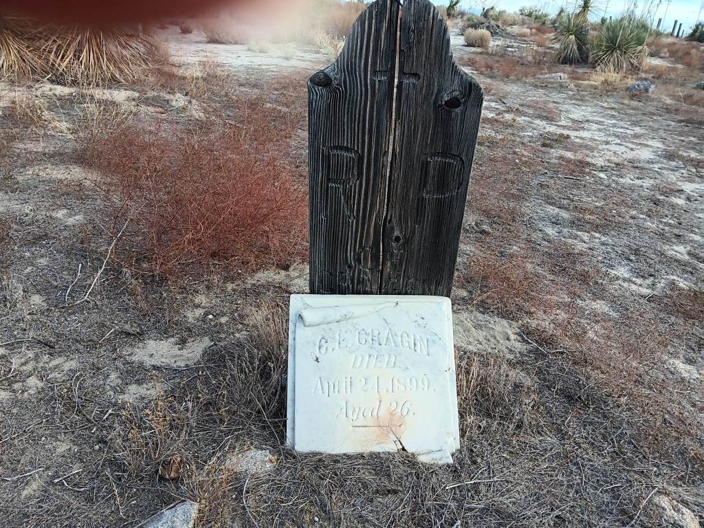
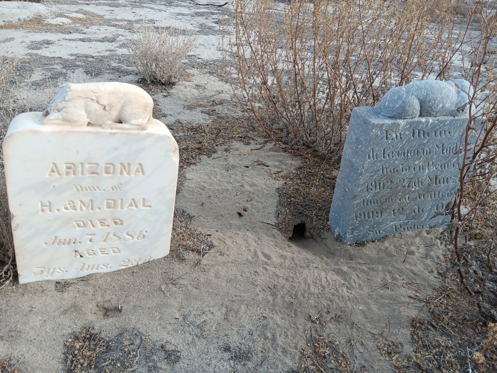
Driving around Willcox the next day, we braved a rough road that led to a derelict cemetery just outside town, where Warren Earp was buried.
The desert is definitely taking back the cemetery grounds.
Warren was the youngest of the Earp brothers and, having avoided the shootout at the O.K. Corral in Tombstone, he jumped right in to help his brother Wyatt and their buddy Doc Holliday take revenge for the later killing of his brother Morgan before fleeing Arizona, only to land in Willcox years later, get stupid drunk, and take a bullet through the heart compliments of a patron of the saloon where Earp was over-imbibing. The shooter was acquitted on grounds of self-defense.
The nearly-forgotten cemetery told the story of Willcox’s early days, when people died too young; some far too young.
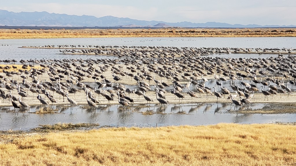
Also just outside town is the Willcox Playa Wildlife Area where, we’d heard, we might spot Sandhill Cranes arriving at their winter migration grounds. Understatement of the decade. There were thousands and thousands, with more arriving every minute. We spent two evenings at the wildlife area watching them flying in over the mountains in great, long lines.
One small section of birds!
Even Ruthie was captivated.
Many of you have probably seen Simon’s videos of their arrival. If not, here are a couple of videos from our YouTube channel.
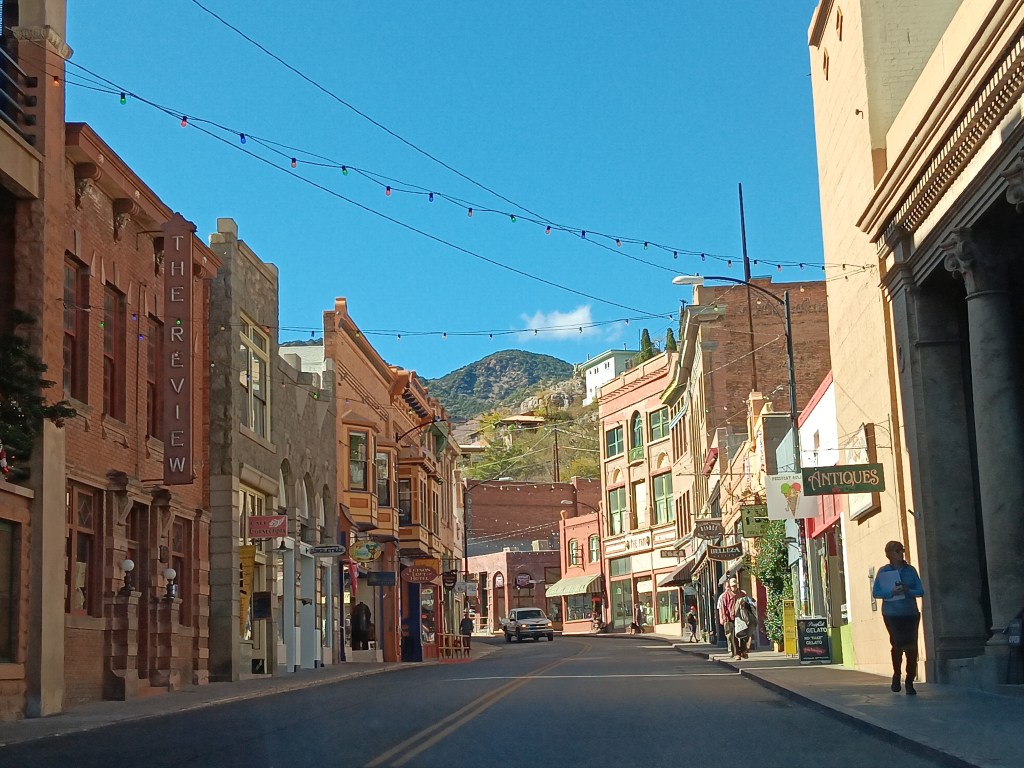
Then, because we can’t help ourselves when there is touring to be done, we paid a visit to Bisbee, on the border with Mexico, the day before leaving Willcox.
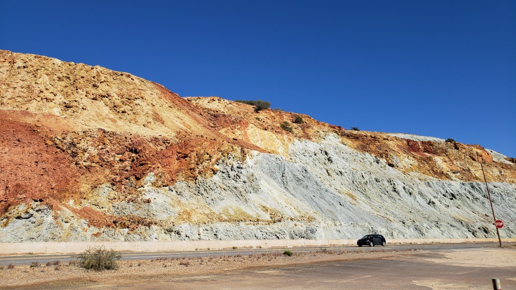
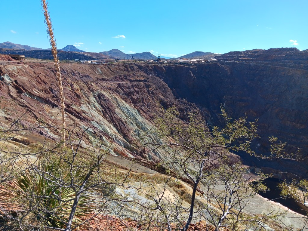
Bisbee was a mining town, and Simon spent a long time looking at the open mine while Susan mainly waited in the car.
That’s a small lake at the bottom, which gives you an idea of how huge the pit is.
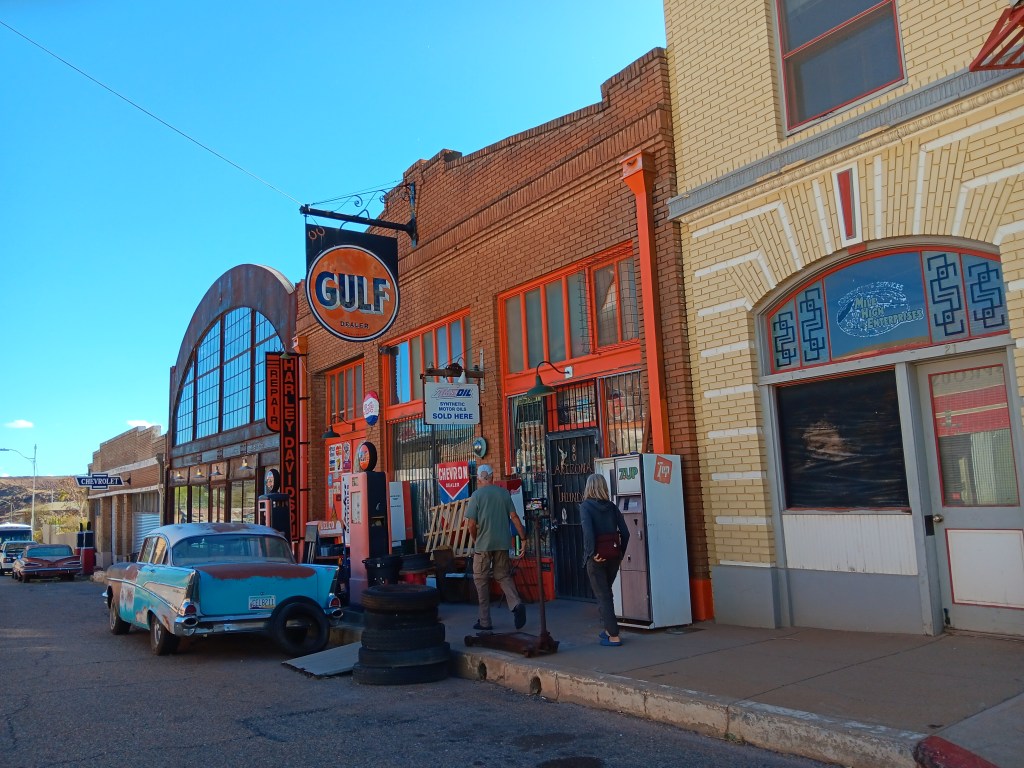
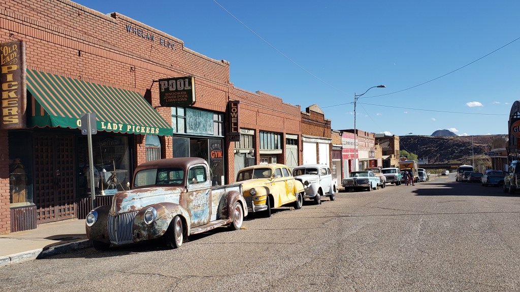
The semi-abandoned but totally adorable Lowell was just a couple of blocks away. It’s a tiny throwback to a kinder, gentler time, from the storefronts down to the old-timey cars parked along the curbs.
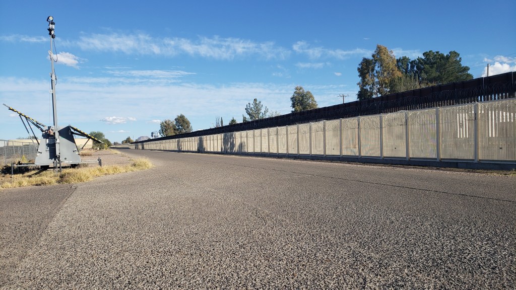
It was here that we also got our first look at the border wall between the U.S. and Mexico, just a few miles south of Bisbee, in Douglas.
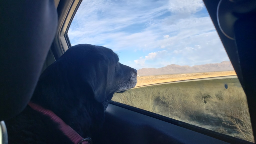
On the way back to Willcox we stopped at Whitewater Draw, where some of the Sandhill Cranes spend the day before flying over the mountain range to Willcox. Here, we watched them take off and make that journey.
The marshy area is chock-full of Sandhill Cranes.
Ruthie seemed content to watch the birds prepare for their nightly migration.
We were ready to move on when morning came. We’d spent 49 days in Arizona – the most in any state so far – and we headed toward New Mexico feeling we’d learned so much about this part of the southwest, which had surprised and delighted us so often.
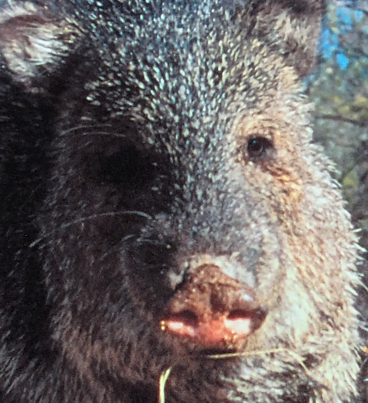
We’ve been in Tucson for exactly one week. We’ve gone out every day – morning, evening, all day long – and every time we’re out we scan the desert’s scrub, the washes, and the roadsides for javelina. Today, we’ve finally accepted the fact that these fat, smelly animals are a lie, and do not exist. At all.
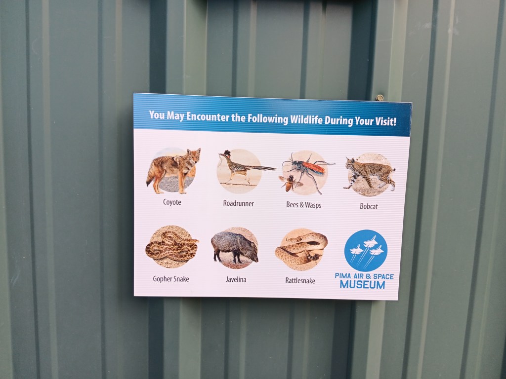
“They’re everywhere!” people assured us. “They get into my trash bins,” one man said. Signs at Pima Air and Space Museum warned us we might encounter some. But we didn’t. Why? Because they don’t exist.
You “may,” but you won’t.
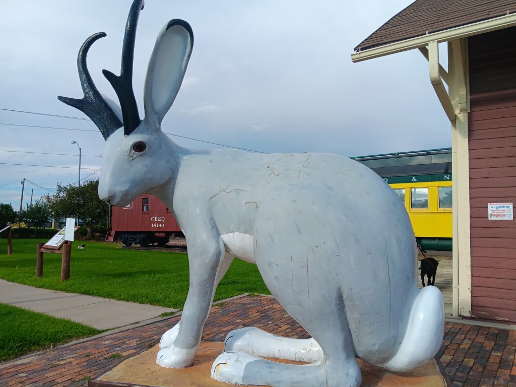
Like the illusive jackalope, they’re a myth perpetrated on gullible tourists. You, like us, probably saw jackalope in backwoods diners, their antlered bunny heads hanging on the wall like some rare and desirable trophy. And you, like us, probably believed –oh, innocent you! – they could, maybe, be real.
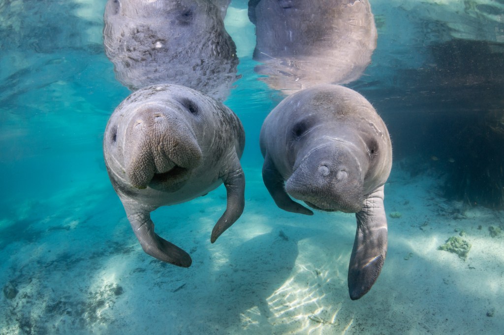
There was a time when sailors making years-long voyages believed they were seeing mermaids, and told their loved ones back home about these sirens of the sea. What embarrassment they must have felt when those who took to the water for short excursions only found manatees.
We share that shame, having rejoiced at seeing herds of javelina that simply fell under the category of wishful thinking. Each time, they’ve turned out to be brown, barrel-shaped cactuses.
Not javelina.
And, like manatees and mermaids, that’s probably exactly how the not-trueness of javelinas got started. They’re both brown and prickly, and you don’t want to get too close to them when you’re out hiking in the desert.
We didn’t want to draw the only logical conclusion (javelina = lie) so Simon suggested we make double use of a visit to Seguaro National Park West, which we hadn’t seen yet, and enjoy the park as evening drew close, then stay on until dusk; prime javelina hours.
We made a point of asking for expert advice when we reached the park’s Visitor Center, four minutes before it closed. Where, for the love of gawd, should we go to see the illusive herbivore that looks like a pig but isn’t?
Perfect javelina territory. No javelinas.
“Just go right out to the overlook here,” our good man told us, pointing at a second-story platform connected to the center. “They travel up and down the wash just beyond it in the evening.”
Plenty of room for a stampede.
Yay! Finally – FINALLY! – our dream of achieving this precious sighting would come true!
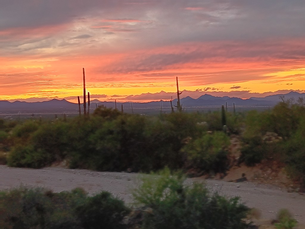
Binoculars and cameras at the ready, we marveled at the sunset that lit up the sky like fire in the direction of California and Mexico, while scanning the wash for activity.
An hour later it was so dark we couldn’t have seen a javelina even if it really did exist. The lie was revealed.
Sure, we saw a “dead” one along the highway on our way to San Xavier del Bac Mission, but it was probably just a stuffed toy thrown out the car window by some careless child. We no longer believed.
We have one more week in Tucson, but frankly, our hearts are hardened. There is only so much pain and disappointment we can take.
Tucson is only 70 miles from the U.S. border with Mexico, and the history in this area is rich with native peoples, changing land ownership with “New Spain,” and the missionaries who came to Arizona with “saving souls” for God in mind.
And therein lies a moral dilemma.
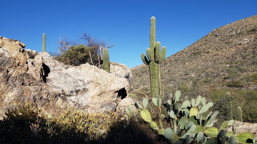
We had soaked up Tucson’s natural side with a visit to Saguaro National Park East and a trip up Mount Lemmon the day before, where the views and an unexpected wildlife sighting were thrilling starts to our touring.
Saguaro National Park is split into two locations; East and West. East isn’t overly blessed with saguaro cactuses due to a killing freeze in 1962.
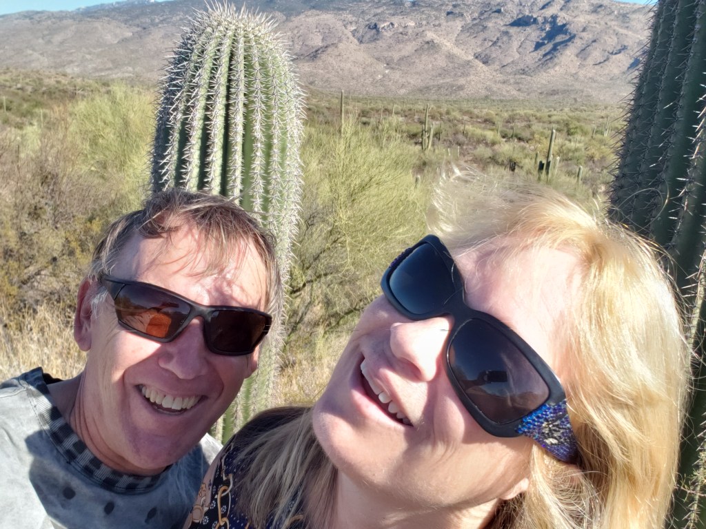
Simon: “I don’t think I can get the mountains in.” Susan: “How about if I do this?”
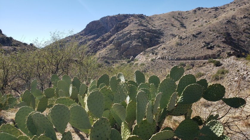
It’s a wild and rugged land, with more than just saguaro cactuses. O’odham tribes used the gangly ocotillo cactus on the right for building.
This shows the road going up Mount Lemmon. There were probably more saguaro cactuses on the mountain than there are in Saguaro N.P. East.
We saw two baby mule deer hiding in the underbrush as we were driving back down Mount Lemmon. Only one can be seen in this photo.
After a quiet day “at home,” the next day, we then headed south toward what was once New Spain territory (along with Puerto Rico, Cuba, Florida, what is now the southern U.S., the Philipinnes, and Central America as far south as Costa Rica), then Mexico, but now part of southern Arizona.
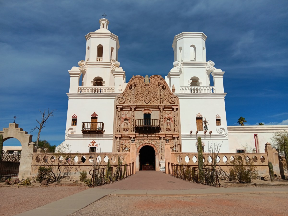
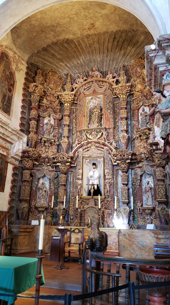
Spain was big on evangelizing, and many missionaries were sent to its dependency, with San Xavier del Bac Mission (completed in 1797) being one of the churches that sprang up to bring the natives to Jesus. I’m not going to go all preachy, though I surely could. Instead, let the Mission’s plaques do the talking: Jesuit Padre Eusebio Francisco Kino “served two majesties – the Church and the Crown. For the Church, the Mission saved souls and spread the Christian faith. For the Crown, they served as training grounds for native people to learn their assigned role as subjects of the King and citizens of a growing New Spain.”
“A mission was much more than a church; it was an entire community designed to teach European ways of life to people living on lands claimed by Spain.”
So much to unpack about that, isn’t there, when compared to the history of those “people living on lands claimed by Spain,” who had successfully thrived in the area for thousands of years. When I asked the docent at San Xavier what the Tohono O’odham tribe’s spiritual culture was like before the arrival of the missionaries, he said, “They were used to converting.”
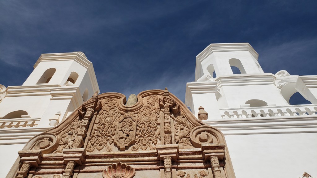
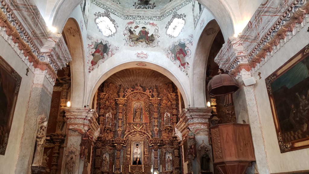
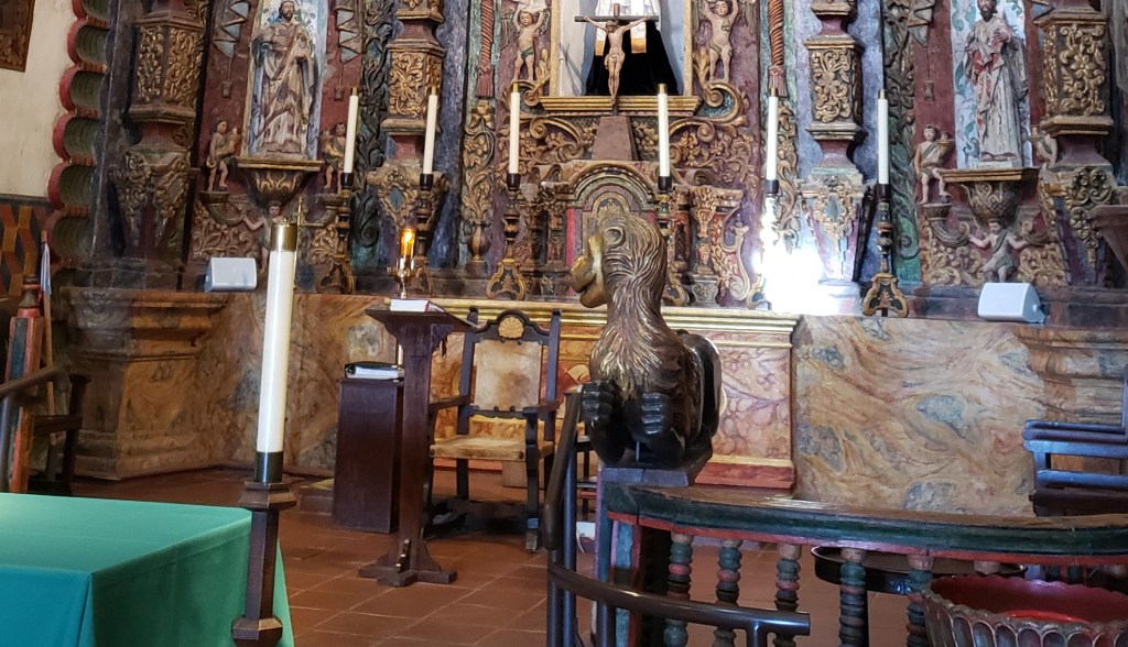
We set all of that aside and entered each of two churches with the idea that we were experiencing historical places. Let’s take a stroll through San Xavier del Bac first.
The tower on the right doesn’t have a dome because (say it with me) they ran out of money.
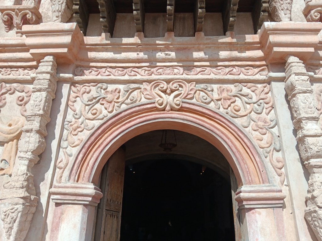
The rainbow is an important image to the O’odham, signifying unity, among other things, so it was used in the entry’s archway.
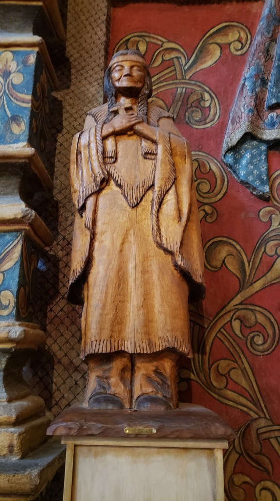
It’s impossible not to notice the two animals flanking the altar. They look like weird cousins of those flying monkeys in The Wizard of Oz, but they’re really lions. Why so wonky-looking? Because the artists who created them had never seen lions, and only had a verbal description of a lion to work from.
According to the docent, the original lions were stolen. These were funded by a woman who sits on the board of directors. She hired Mexican craftsmen to carve the wooden statues, then she let the wood cure for a year, applied gold leaf, and, six years later, these beasts took their place on the altar. That woman? Former U.S. Representative Gabby Gifford’s mother.
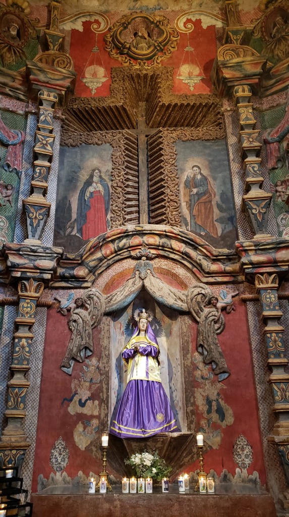
The church honors Mary, mother of Jesus. Here, her dress includes an important O’odham concept through two embroidered “Man in the Maze” images, one on her gold vestment and one on her skirt.
Those round, gold images represent the Man in the Maze.
Made of wood and without embellishment, this statue honors Kateri Tekakwitha, the only Native American to have been recognized as a Catholic Saint.
It’s a beautiful church filled with contrasts, arguably rife with cultural appropriation, and it has the devotion of those who worship here. It reminded us of a mission church we visited in Arizona many years ago, on a Reservation that was home to the poorest of the poor. When we commented on the immense wealth that could have fed the community and its children for decades, one of the parishioners said, “Yes, there is a great deal of wealth here, but we find solace and relief from our difficult lives in this place of such beauty.”
Who are we to say that’s wrong? Perspective matters.
Tubac – a little “village” of shops, restaurants, galleries, and a museum – was next along I-10, and we had a little wander and some lunch there. We try not to bring any more weight onboard Fati, so we admired the artists’ creativity, then headed south again.
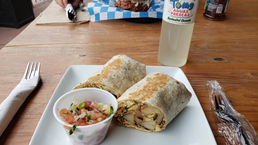
Simon had the breakfast burrito crammed full of…well…everything.
Susan had the pulled pork, and Ruthie ate the bun.
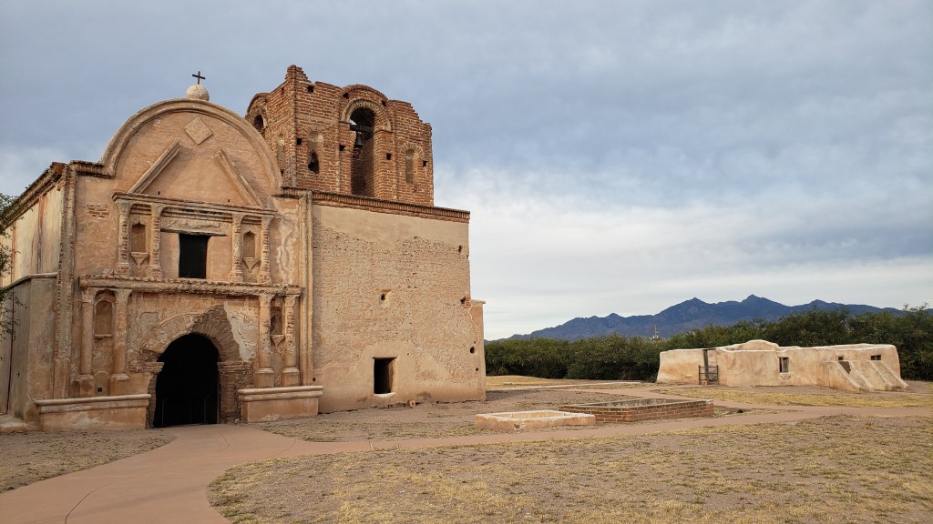
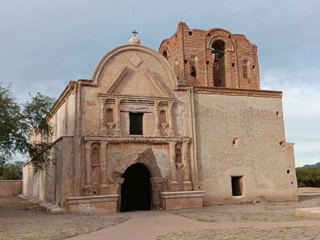
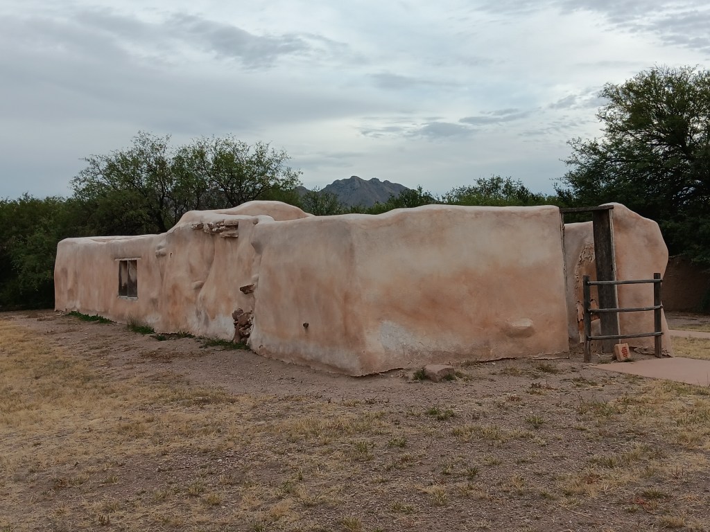
Tumacácori National Historic Park features one of the areas other missions, the oldest in Arizona. Nearly 200 people lived here at one time, and the grounds included orchards, fields, gardens, homes, a “convento” (shared workspace and governmental center, not a nunnery), and a cemetery, as well as the church.
The mission church is on the left, and a later adobe ruin is on the right.
The bell tower on the upper right-hand side of the building isn’t a ruin. It was never finished, as the parish ran out of money before they could complete it.
The church façade originally boasted bright colors – blue, red, yellow, and orange – in the Spanish style, but you can’t really see the colors today.
Tumacácori makes no bones about what Spain’s mission was: “All aspects of daily life were subject to transformation – food, language, clothing, agriculture, and religion.” There is a term for that sort of “transformation” of entire groups of people, and as much as we enjoyed immersing in the history as we walked around, it was hard not to think about the O’odham’s lives before and after “transformation.”
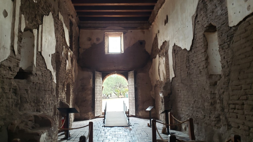
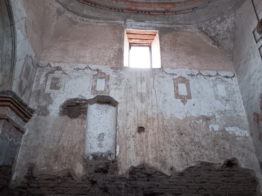
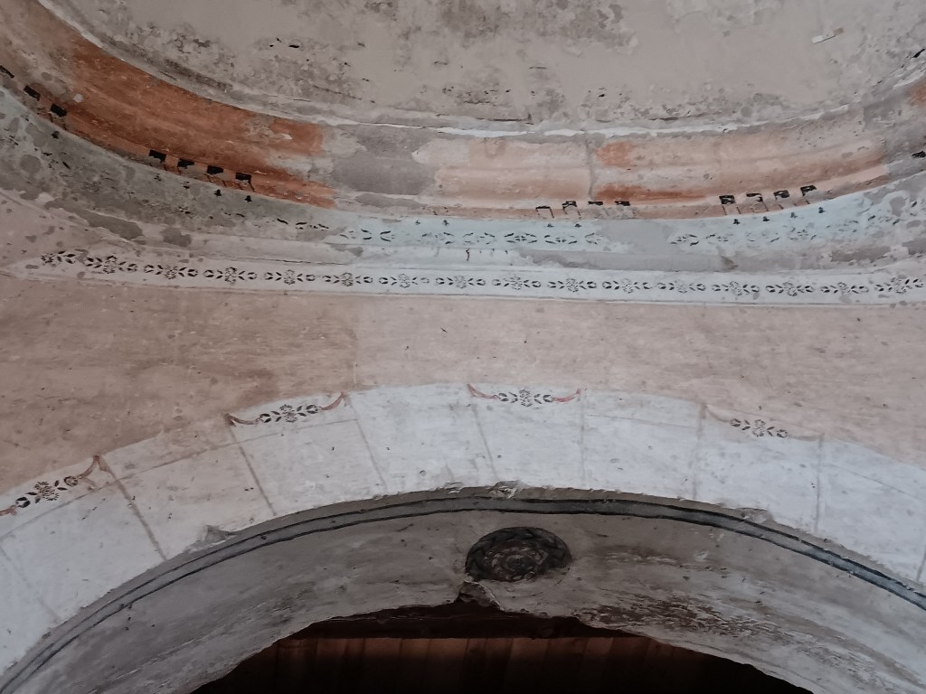
The interior is in pretty rough shape, but it does show the layers involved in creating the building.
The Sanctuary was also painted and stenciled in bright designs, some of which can still be seen, albeit in faded form.
The squares were “frames” for religious imagery.
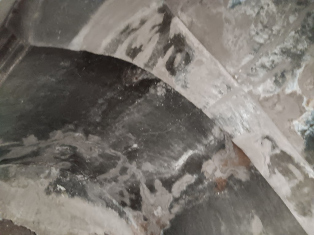
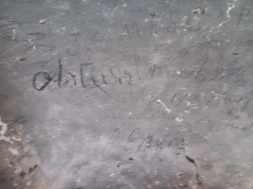
After Tumacácori was abandoned in 1848, the Sacristy became a refuge for cowboys, soldiers, Mexicans, and gold-rush era fortune hunters during inclement weather. Soot from their fires can still be seen on the ceiling, and their names are still on the walls around the door.
Lousy photo, but the black is soot from cooking fires.
Lousy photo, but these are some of the signatures.
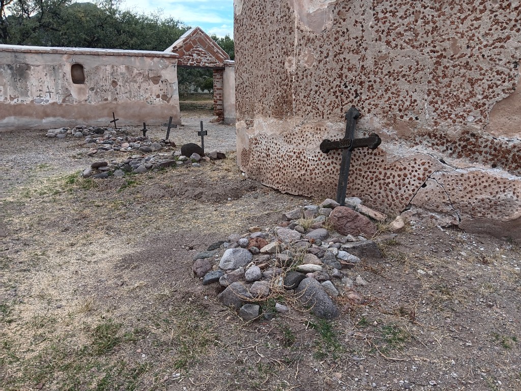
The cemetery bears silent witness to the devastation Apache raids and several epidemics wrought on the community. Most of the human beings originally buried here were children under the age of five.
The ki – the O’odham word for house – provided shelter, while the outdoor wa:ato (brush enclosure) was the place for gathering together and for cooking. The O’odham still sometimes build homes from mesquite branches, ocotillo sticks, the ribs of saguaro cactus, and mud.
The convento was originally much, much larger. Built of adobe, most of the long, low expanse of it has slowly “melted” away. Now, only a small section (once a storeroom) is still standing.
The mission was abandoned for a year after an O’odham uprising against the Spanish and an intrusive neighboring tribe. Jesuit priests returned in 1753, were expelled in 1767, and were replaced by Franciscans who continued evangelizing until 1822.
The places we visit become a part of us, and, as small pieces of historical information are assembled into a greater picture, we find ourselves contemplating the story that greater picture tells.
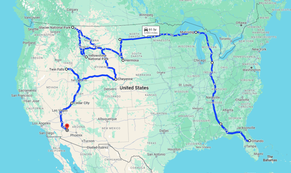
May 14, 2023 seems like a long time ago. In fact, it is just 7,053 miles ago. That’s the 6-month distance we have covered in our “A Year On The Road” RV adventure since leaving home in Florida.
From that original departure point to November 14, we have traveled through 18 states and totaled a mind-boggling 22,319 miles when you add in the mileage we have covered in our little Ford Fiesta, Nippy, as well as that 7,053 in RV Indefatigable (or Fati for short).
This isn’t quite 6 months, as Google won’t allow additional destinations after Lake Havasu in Arizona, but it should show the most recent part of the trip, to current spot Tucson (see below)
The last month has added 545 miles to Fati’s total but also 1,927 to Nippy’s. That means Nippy has now piled up a whopping 15,266 miles to date, so she is proving a real workhorse.
Of course, we should have gone even further afield, as we scrapped plans to head out to Washington and Oregon after reaching Glacier National Park in Montana, but we think that is still a pretty respectable total.
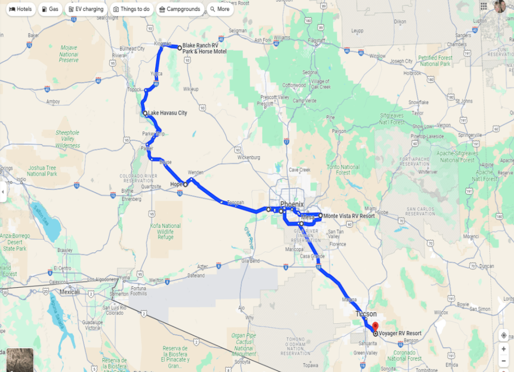
Below are two maps showing just the last month of our travels, from Kingman in Arizona to Tucson, via sparkling Lake Havasu City, Hope, Goodyear and Mesa (with 3 weeks in the greater Phoenix area in all):
From Kingman in northern Arizona, we traveled down the extreme west part of the state before reaching Interstate 10 and heading east to Mesa and then Tucson, with a week in between in Goodyear
And this shows the more detailed version, highlighting an overnight stop in tiny Hope and the (rather confusing) route through and around Phoenix before reaching the chic Voyager RV resort in east Tucson
Continuing our exclusive series for The Independent, here is the fourth instalment of our Great American Road Trip, charting the scenic splendors of Montana and Wyoming, and the history that underpins them.
Month 4 of our year-on-the road RV adventure took us from Glacier National Park in northwest Montana to the Wyoming-Idah0 border via a wealth of small towns, vibrant wildlife, epic countryside and historic counterpoints. You can read it on this link to the Indy’s Travel section.
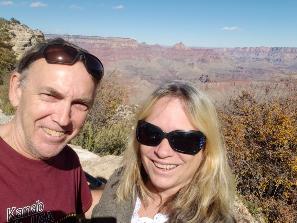
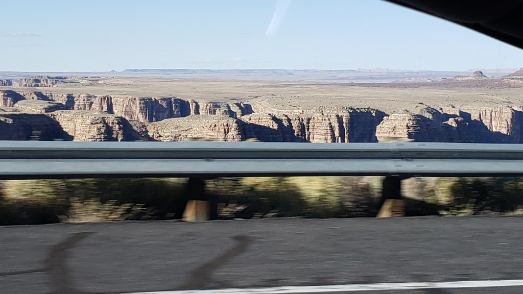
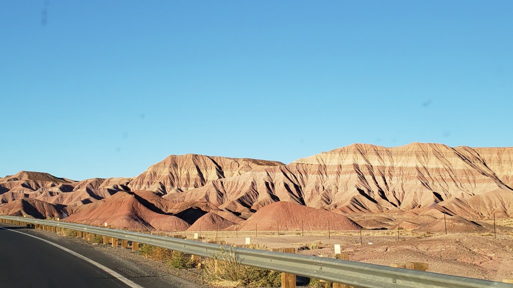
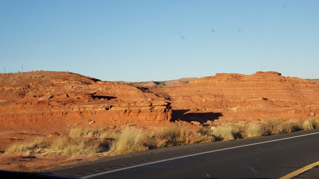
Grand Canyon’s South Rim made a convenient detour as we traveled north from Kingman to Monument Valley, and the view there was completely different to the North Rim. While North Rim is rustic and less visited, South Rim is iconic for a reason. Wider, more colorful, and much more approachable.
Simon had been to the South Rim before, but my first view of it was shocking, in a good way. It struck me as a grand amphitheater with a story to tell in each of its folds and crevices, and its sloping sides are so enormous no binoculars are necessary to see them, though we used ours anyway and were treated to intricate views of the canyon’s smaller details.
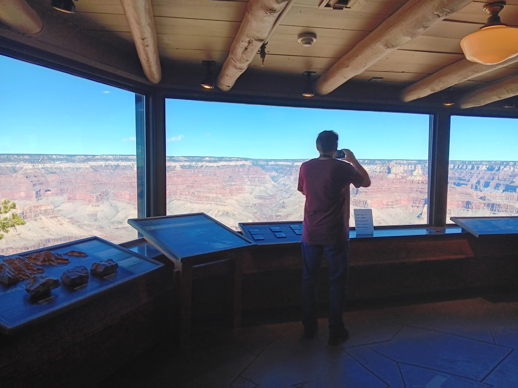
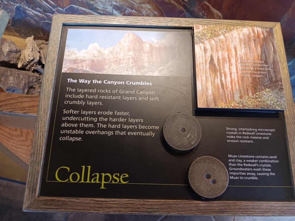
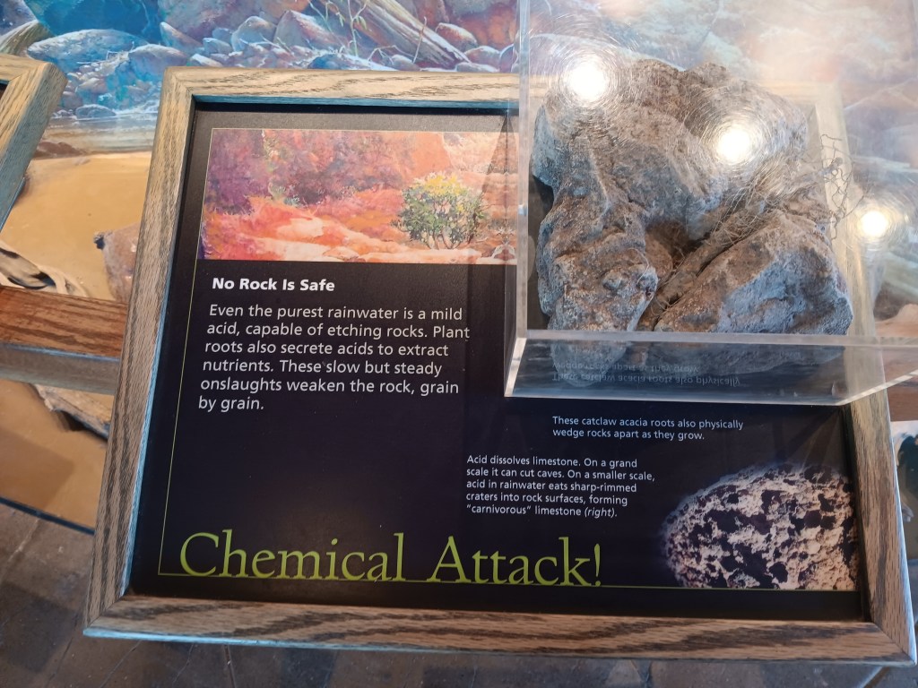
There was a little interpretive center not far from where we parked, with a panoramic view through its windows. Sitting right on the edge of the canyon, it offered an exceptional sight line right down to the bottom.
Among the displays were two panels that hit smack at the heart of what bothers those of us with a fear of heights. We’re thinkin’ it, Grand Canyon, we’re thinkin’ it!
Fear 1
Fear 2
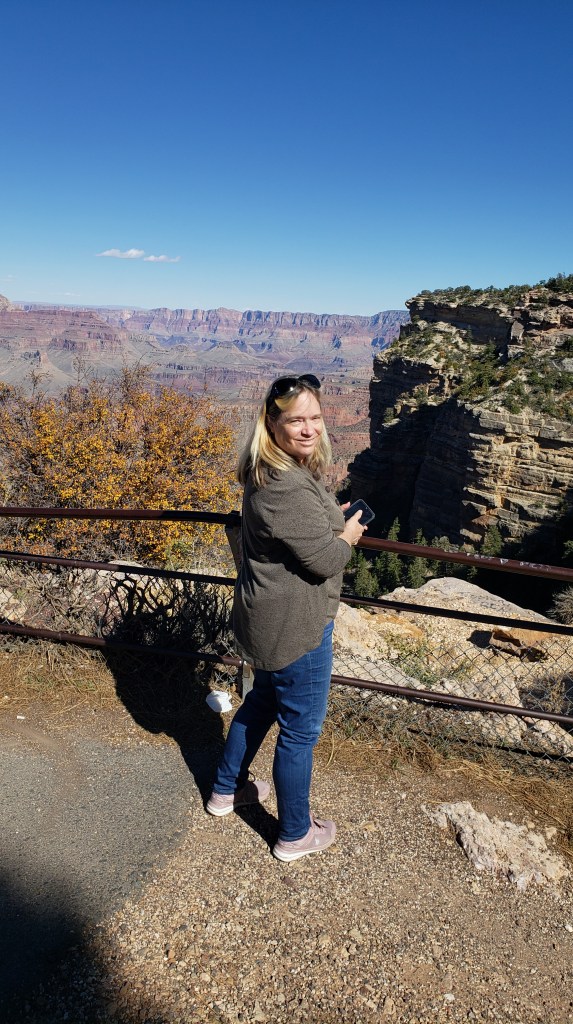
South Rim has three main areas that look into the widest part of the canyon, and we checked each of them out.
When we had our fill of the main overlooks, we continued along the spectacular East Rim drive, where several more turnouts provided views over the canyon’s less-visited eastern arm.
Obligatory Selfie.
If you read our blog about Monument Valley, you know we had begun using a “points” system when it comes to things that challenge us as we travel, but we do them anyway. Simon cashed in some of his points to avoid driving the valley’s rough road, and I cashed in some of my points by asking to skip an overlook accessed via a steep, narrow road along the East Rim.
This is what a thousand points looks like.
Standing on this wall earned me a billion points, but I can’t post the photo of that moment because you can see my mouth and it’s really obvious what word is coming out of it. Look at these happy people instead.
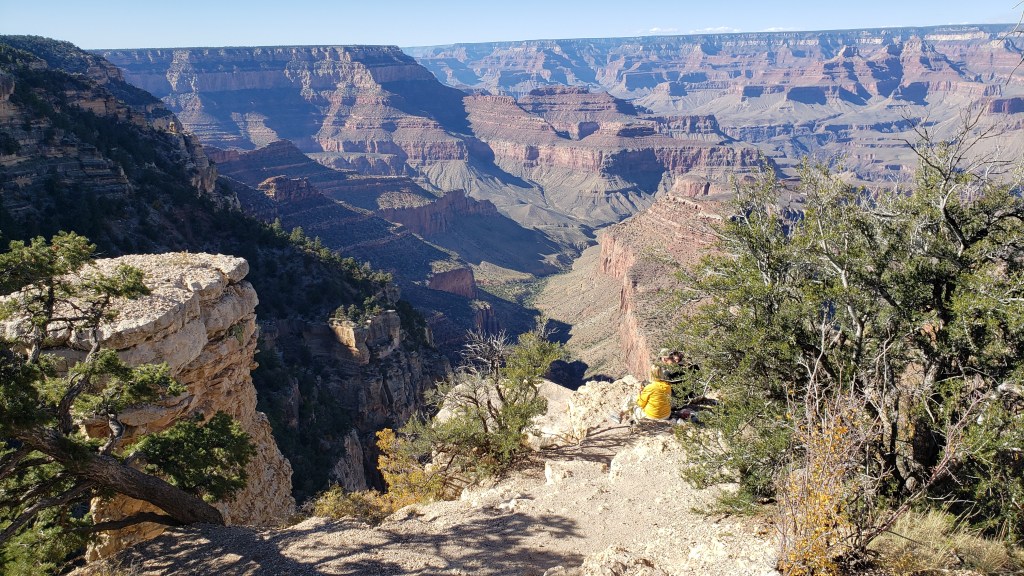
The rest of East Rim was spectacular, and it was also a convenient shortcut toward the road to Monument Valley, so the decision to head that way rather than backtrack to I-40 was a double win.
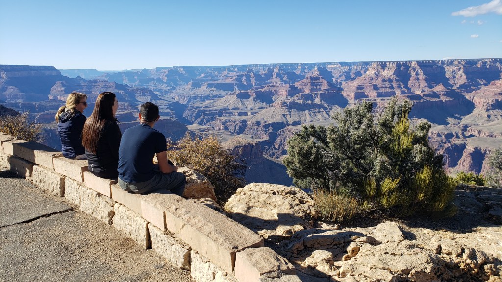
We saw quite a few people just hanging out on rocks near the edge of the canyon.
The main area only allows tiny glimpses of the Colorado River, but it’s much more visible from the East Rim.
Skipping the steep road also led to our first wildlife sighting in a long time when we came upon five or six elk grazing along the East Rim road, which made for a happy sign-off to our visit.
We didn’t get a photo of the many people who were foraging for something in the forested area, but it looked like they were picking up small pine cones. During one of our turnout stops, my guess was confirmed; they were harvesting pine nuts from the mini pine cones. How cool is that?
As we continued north after leaving the park, we came across one of the furthest reaches of the canyon, near where the Colorado River and the Little Colorado River meet. A huge fissure runs along the highway, and we stopped to have a look at a big parking area set up just for that purpose.
Etc? What the living hell could “etc” be?!
That night we stayed in Navajo Land Hotel in Tuba City, having driven into dusk through scenery lit by the fading sun. The name is an odd side-step meant to honor Hopi Chief Tuva, but the Mormons who were guided through the land by Tuva apparently had trouble pronouncing the letter “v” (but did they, really?) and simply replaced it with “b.” We’ll leave our comments at that, and instead revel in the glorious hillsides.
We were glad to have seen both sides of the Grand Canyon, with their distinct personalities that earn the National Park its place as one of the United States’ most iconic destinations.
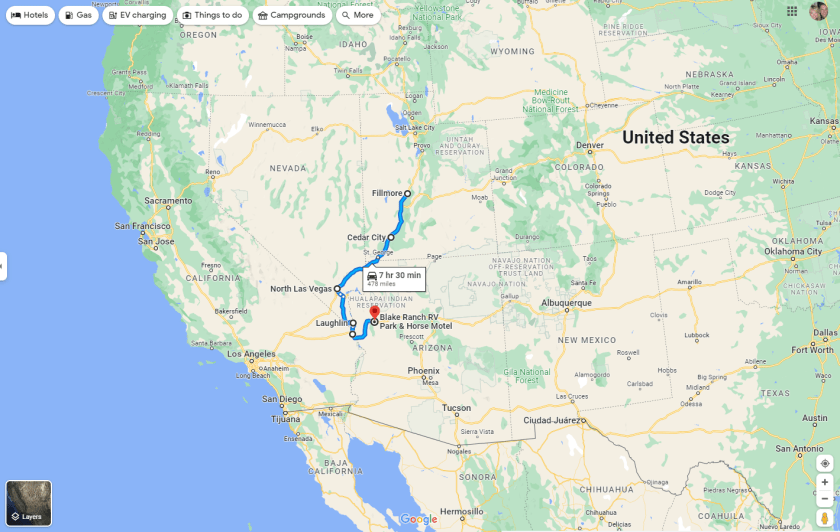
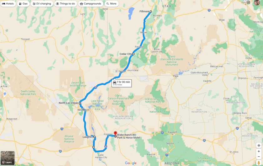
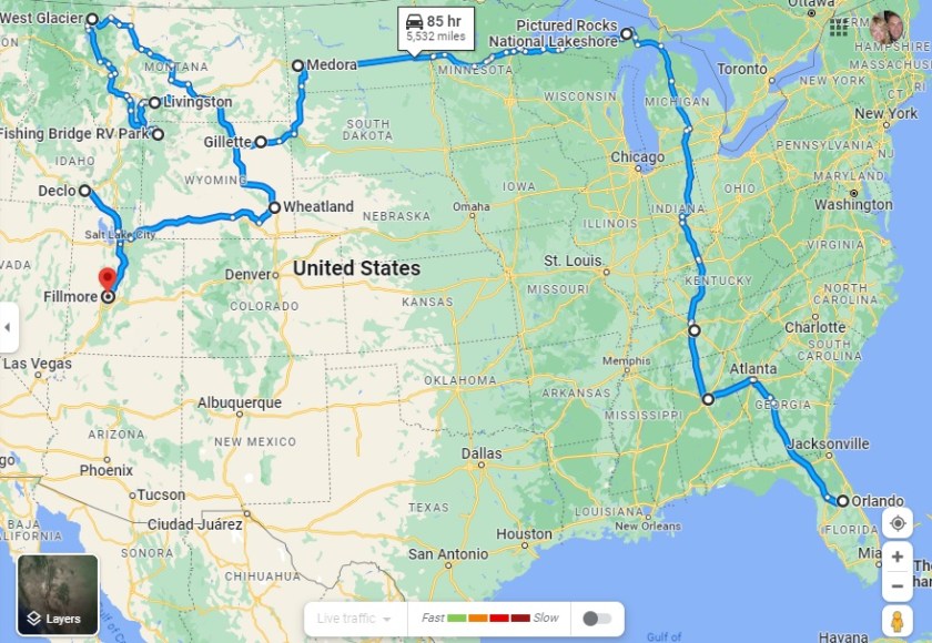
Having just hit the 5-month mark on our grand RV adventure, it is especially illuminating to see that we had by FAR our lowest month for mileage in Fati, with just 474 miles covered from Fillmore in Utah to Kingman here in Arizona.
Month 5 – picking up in Fillmore, Utah, and traveling to Kingman, Arizona
Showing more detail of our Month 5 route from Utah, through Nevada, to Arizona
The main reason for such a low total for the full month (as opposed to the 868 miles in Month 4 and the mind-boggling 2,504 we travelled in the first month!) was because we spent two full weeks in one location (Laughlin, Nevada) , and used our tow car, Nippy, for our more extensive travelling once we were settled.
We haven’t been sluggards, though. Our mileage in Nippy was a whopping 3,718 for this month, which included trips from Cedar City to the Grand Canyon (North Rim) and Palm Springs from Laughlin, as well as our just-completed 779-mile 3-day round-trip from Kingman to the Grand Canyon (South Rim), Monument Valley and Flagstaff.
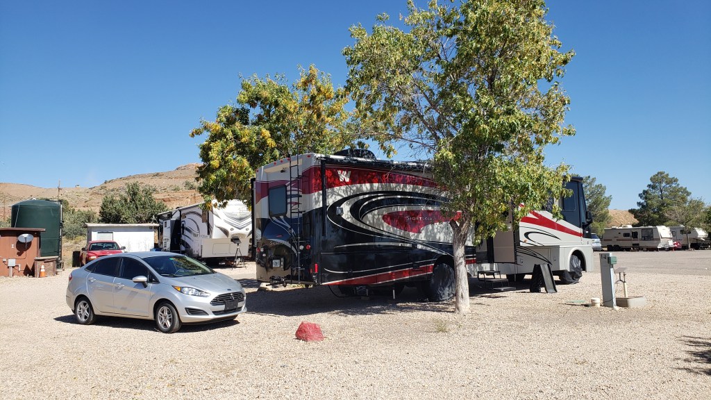
Fati and Nippy in our current campground, the Blake Ranch RV Resort in Kingman, AZ
Highlights of the last month include Las Vegas, the Mojave Desert, both North and South visitor centers of the Grand Canyon, the Colorado River, Monument Valley, and the city of Flagstaff, which really caught our attention, in addition to a fascinating section of Route 66.
When all added up, we have travelled 6,403 miles from home in Florida in Fati, and another 13,339 sight-seeing in Nippy from our various RV campgrounds.
The first 4 months – from home in Florida to Fillmore, Utah, a total of 5,929 miles
That’s a total of 19,742 miles in and around the US since we left home. And we’re still hungry for more! We do still have another 7 months to explore this half (or two-thirds) of the country, though, and the next month will include more iconic stop-overs, notably Lake Havasu and London Bridge, the RV Mecca of Quartzite, Phoenix, Sedona and Tucson. Stay tuned…
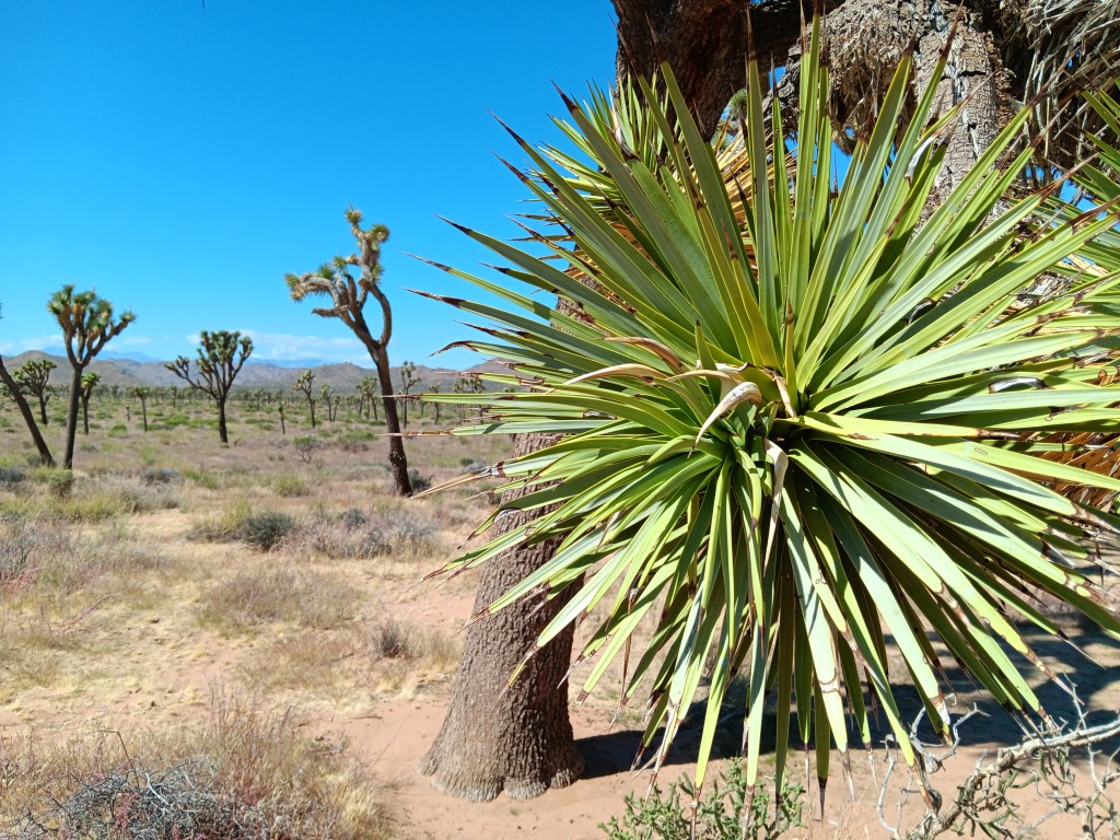
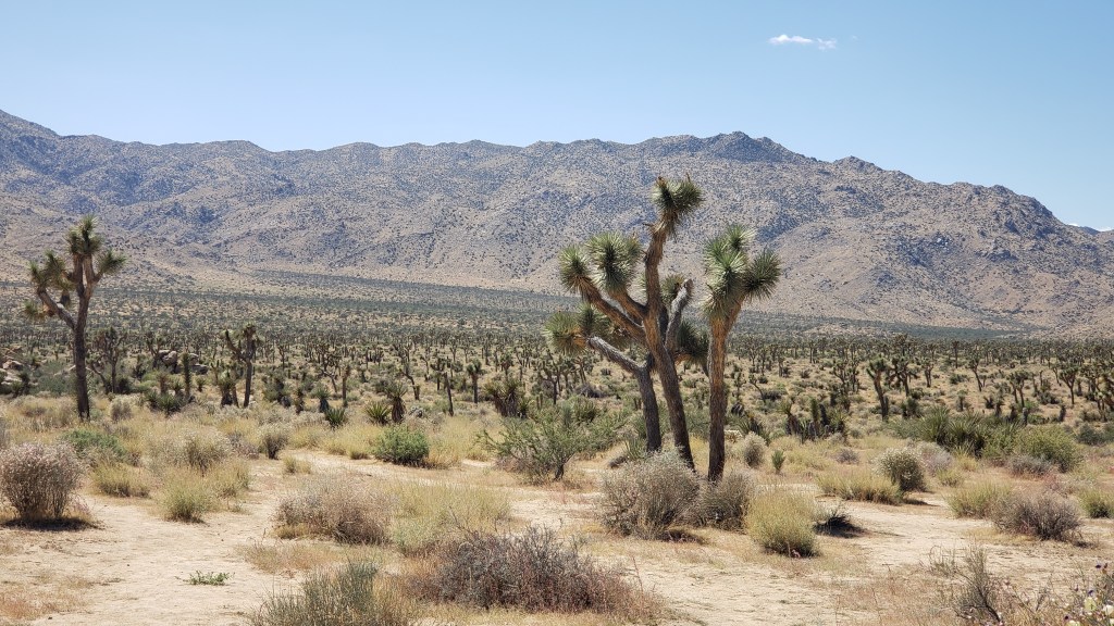
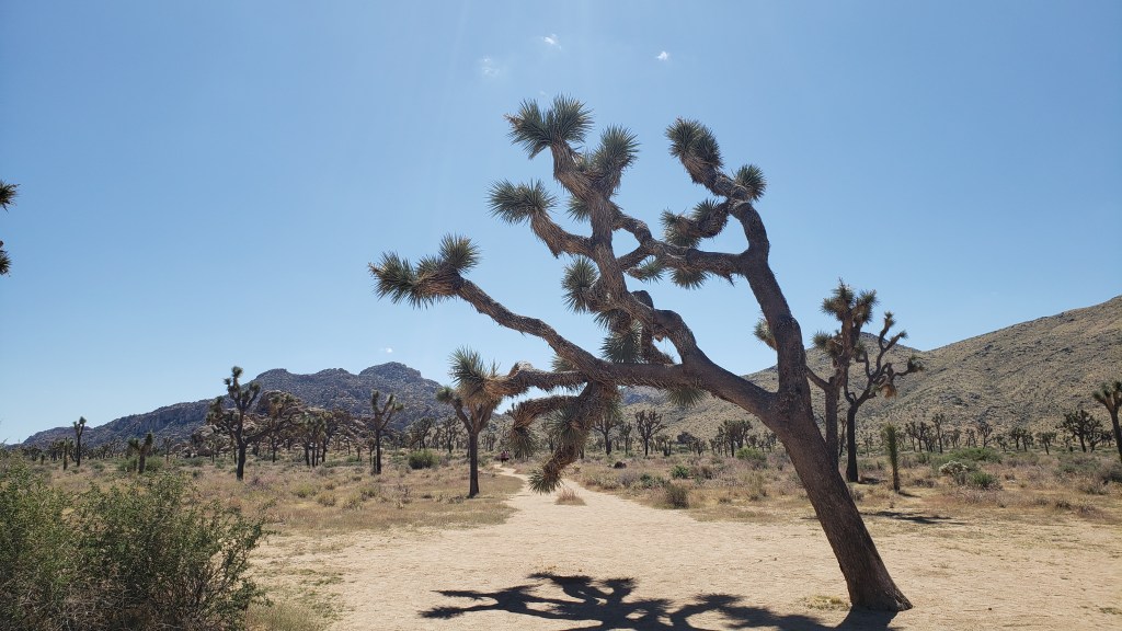
Signs pleading “Do Not Die Today” served as a grim introduction to Joshua Tree National Park, but, like most visitors, we made a mental note to avoid death and joyfully headed into the desert where succulents beseeching God and the un-huggable “Teddybear” cactus both live.
Joshua Tree National Park’s star attractions – named by 19th-century Mormon settlers who decided they looked like the Old Testament’s tribal leader, Joshua, with his arms raised toward his Heavenly Father – aren’t trees. They’re a type of Agave, the genus responsible for tequila, which, when imbibed in quantity, can also make you see God.
Other agave.
Joshua Tree National Park contains the greatest number of its namesake specimens in the world, and their importance to the ecosystem has earned them well-deserved protection by law. Visitors are allowed to walk the sandy trails between the plants, and a quick touch of their spiky appendages is all the incentive needed to leave them alone.
Having driven in via the West Entrance (located on the north side of the park), we had at least two hours of good scenic driving, with plenty of stops to enjoy each elevations’ unique topography.
Every time I turned around he was poking his finger on a plant.
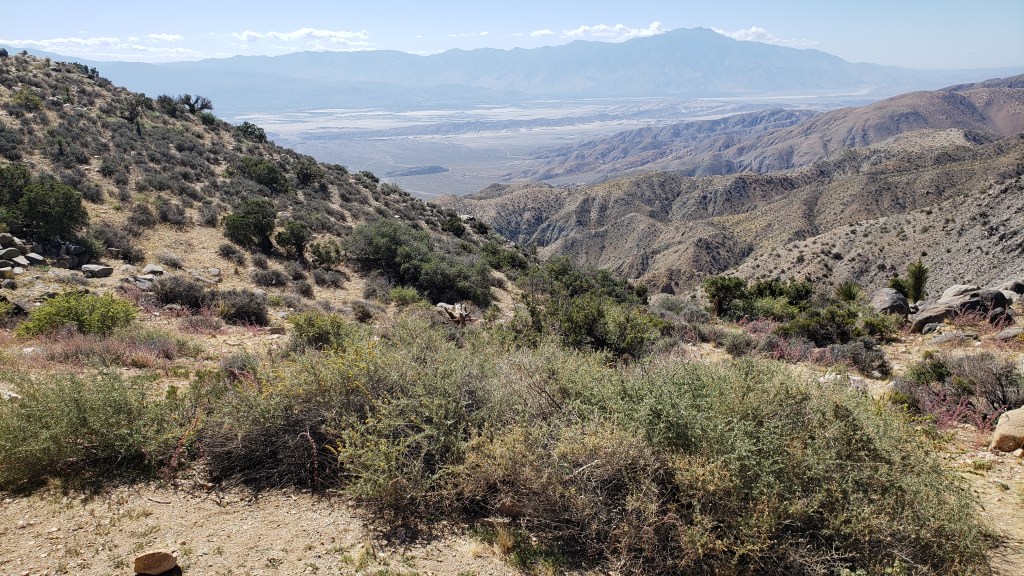
Among the highlights were an unexpected view of Palm Springs (our next destination) from the 5,185-foot-high Keys View overlooking the Coachella Valley, and the shocking realization we were also looking at the infamous 750-mile-long San Andreas Fault Line, an unsettling uprising where the Pacific and North American tectonic plates collide, with dramatic results (earthquakes).
The long, thin, dark mound stretching across the valley just below the furthest mountain range is the San Andreas Fault Line. Who knew?
Also visible from Keys View are the Salton Sea, which we’d visit the next day, Signal Mountains on the U.S./Mexico border, and Mount San Jacinto, rising 10,831 feet above the valley.
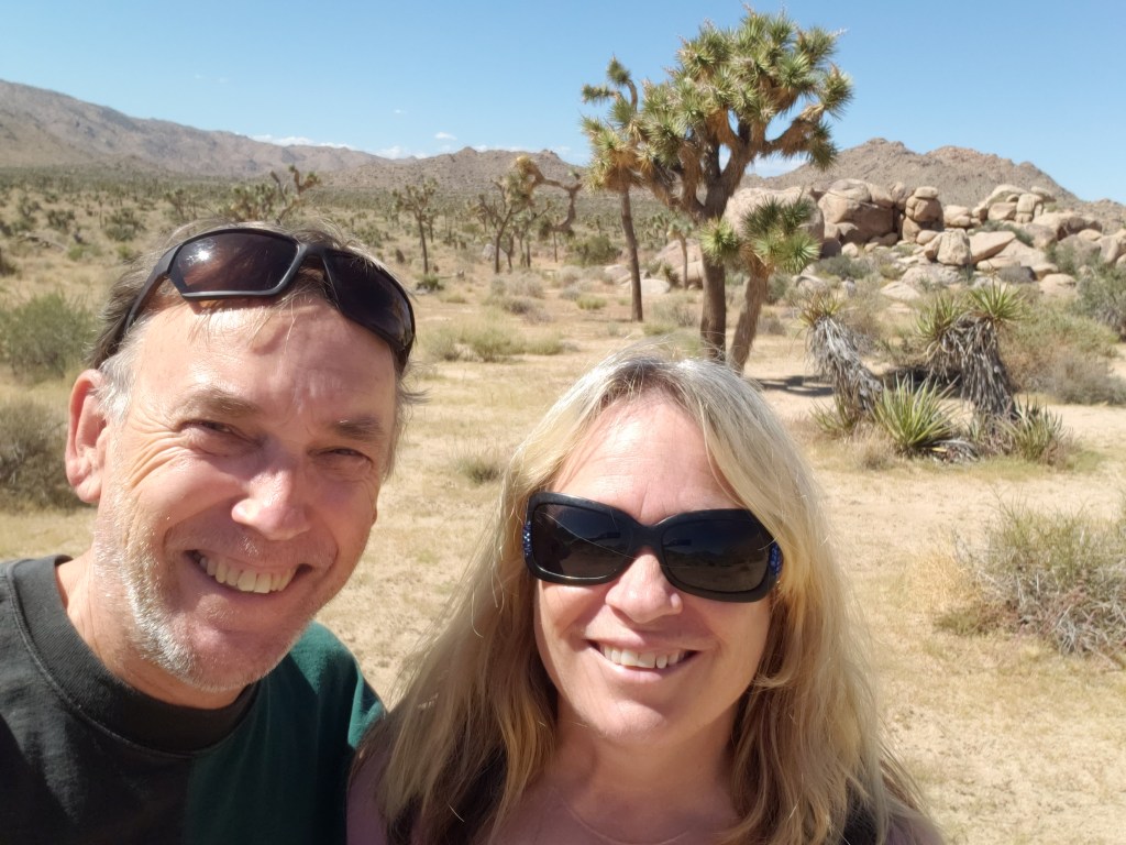
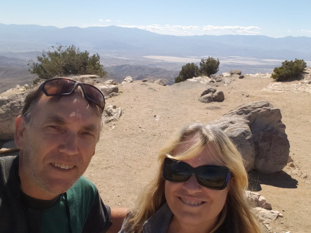
Obligatory Selfie.
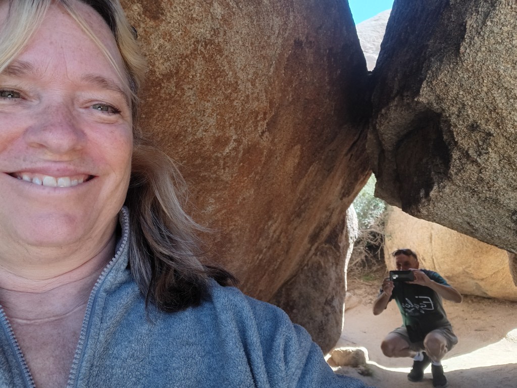
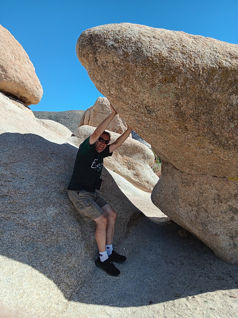
Returning to a lower elevation, we paid a visit to Hall of Horrors and its freaky rock mounds before taking a detour south to Cholla Cactus Garden.
How artsy are we!
Some shots look so real in your mind, but maybe not quite as real when you take them,
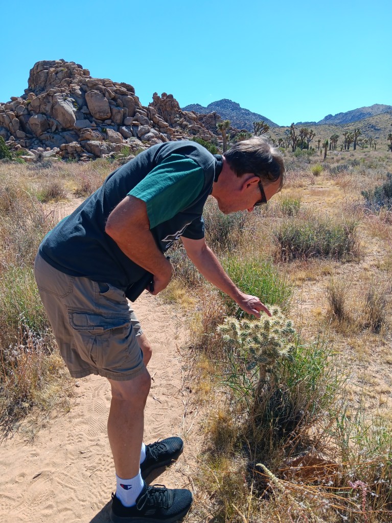
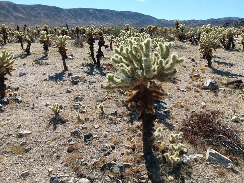
As much as we enjoyed the delightfully wonky Joshua Trees, we were even more taken by the ten-acre grove of Teddybear Cholla cactuses that only grow between 600 and 3,300 feet above sea level. Their name is misleading. This isn’t the sort of thing you’d want your toddler to snuggle down with for a good night’s sleep.
They look so cute and fuzzy, don’t they? They’re not.
Adorable as they are, they also have a super-power that allows their needles to readily attach to anything that brushes by them, and not in a good way. Simon was tempted to give them a poke, but, somehow, he resisted. We have special tweezers in the car for just such emergencies (tick tweezers for dogs, really, but they’ll pull needles, too), but thankfully we didn’t have to use them.
We returned to Joshua Tree after our visit to Palm Springs, but in the interest of efficiency I’m going to include that visit here and cover Palm Springs separately. We ate a lot of real food while experiencing the tucked-away haven for celebrities, wealthy second-homers, and the hard-working people who keep the whole place going, and that deserves its own blog.
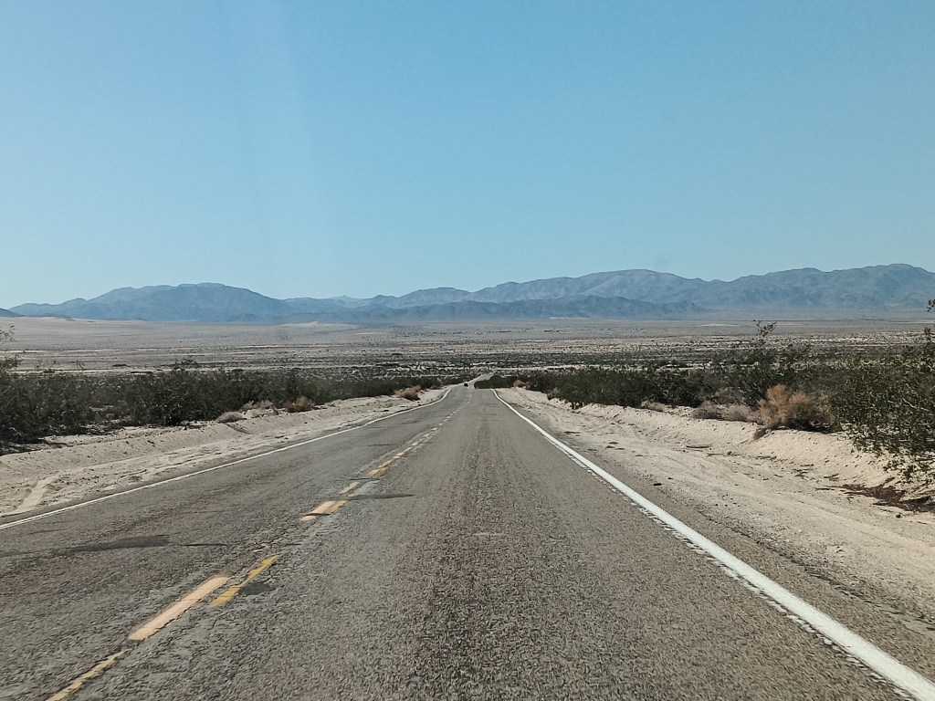
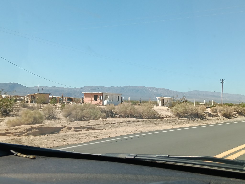
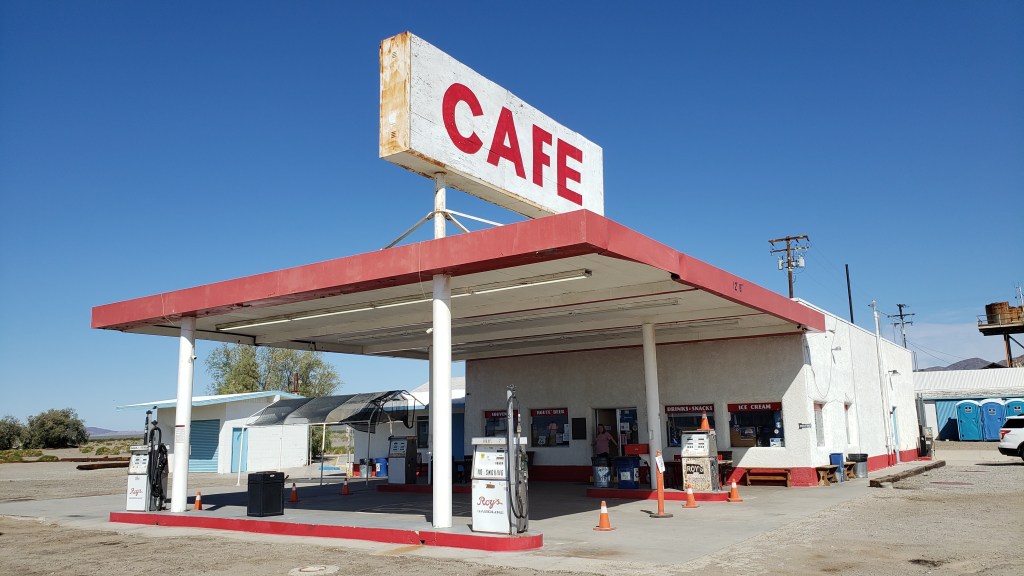
On our way through California from Nevada we took the northern route to Joshua Tree, traveling along roads that were not only desolate, they also featured tiny towns that were mostly abandoned, and a single gas station/café that we thought would have a restroom for bursting bladders, but didn’t.
This, but for three hours.
There may have been about 50 buildings here, but only a handful were occupied.
Need a bathroom with a flushable toilet? Too bad. Not doin’ it here!
Not wanting a repeat of that crushing emptiness and full bladders, and also wanting to see the southern side of Joshua Tree National Park, we opted for Highway 10 east, blissfully unaware of what the northern leg of the journey along connecting Highway 177 would bring.
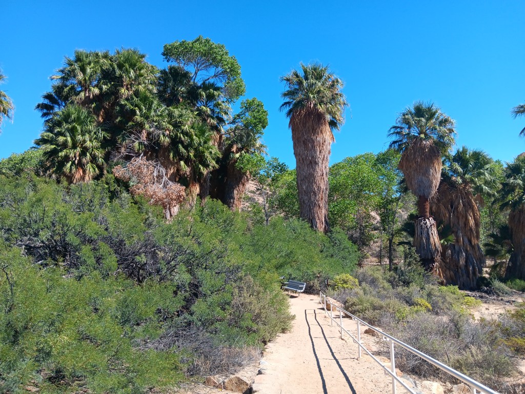
We only needed a moderate detour into the park for Cottonwood Spring, a literal oasis in the desert. Instead of the shimmering mirage that promised a palm tree-line water hole to movie and cartoon characters who didn’t pay attention to the Do Not Die Today signs and pack enough water and their own shade, this oasis did exist, and provided cooling cover, though all of its water had dried up.
A real live oasis. I’m not even sure I knew these existed.
Tiny Simon.
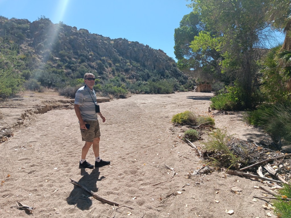
With so much dense foliage around, and this being a desert, we did wonder what might be lurking in the underbrush or clinging to tree branches, but we set that aside and had a nice little wander, admiring the dry wash that ran through it while also bearing all the Flash Flood Danger signs in mind.
As pretty as the oasis was, it must be even more spectacular when this wash is flowing.
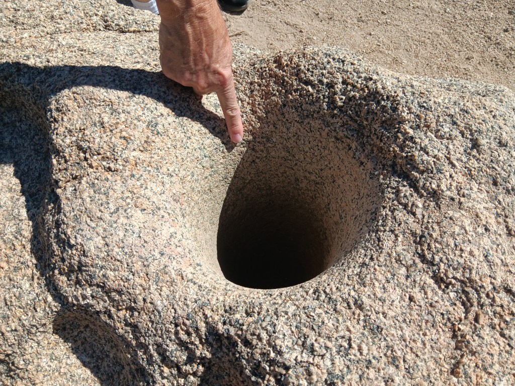
Fascinating signs along the oasis’ pathway described how the Cahuilla Indians who lived here used desert plants for food and medicine, and evidence of their daily lives remains, through mortar holes ground into granite rocks. The holes are so deep we could put our hands into them, nearly up to the elbow. Imagine how long it would take to form a hole that deep when grinding seeds for food.
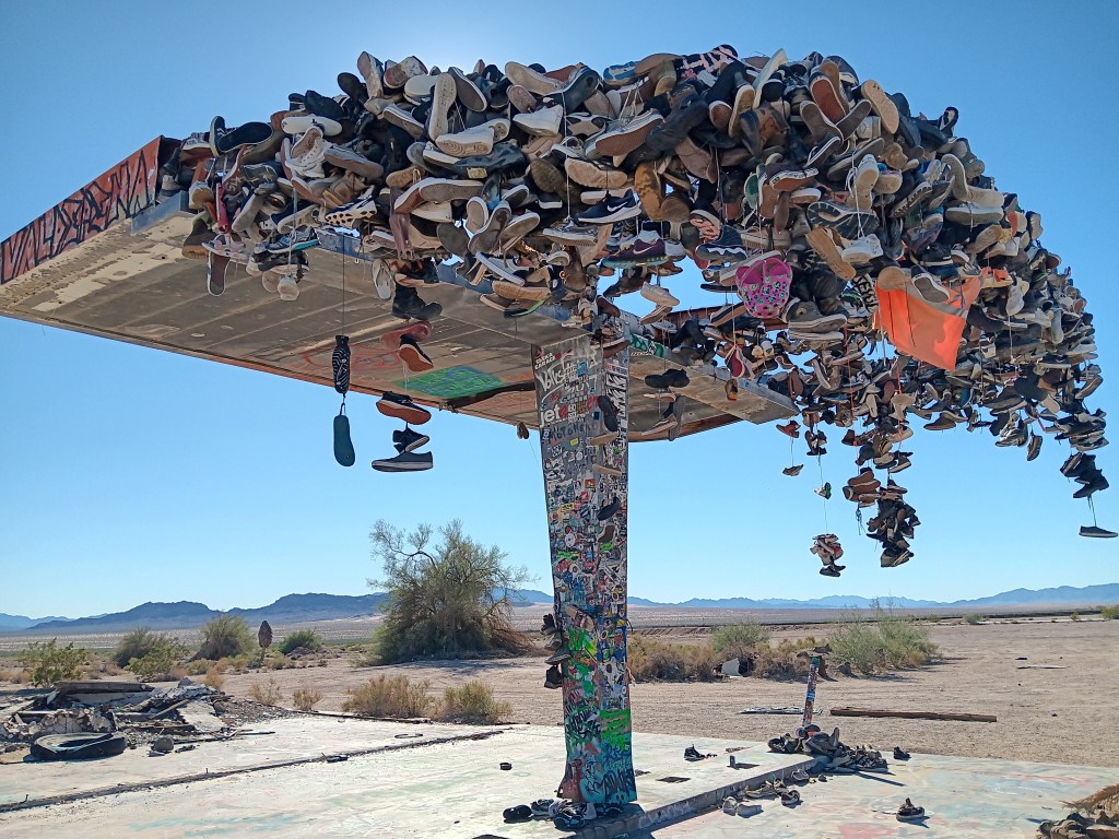
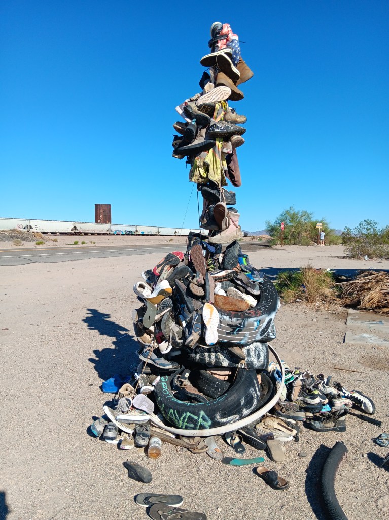
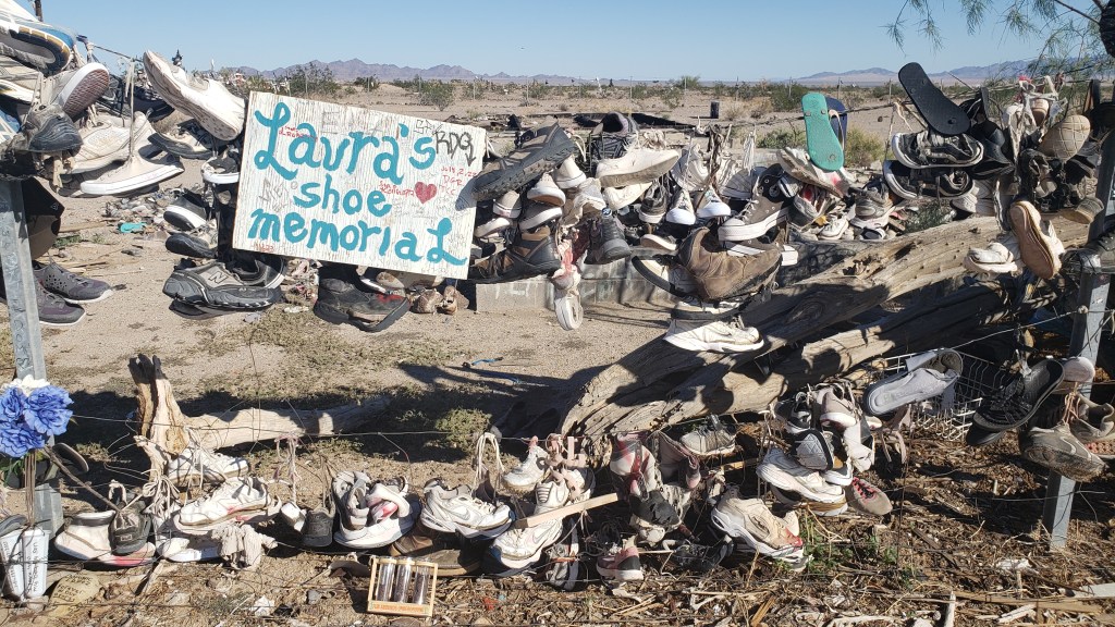
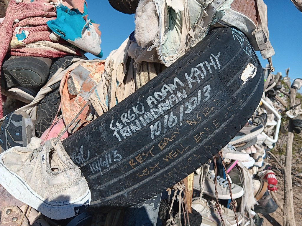
On the return journey back to Laughlin, we had the same mind-numbing emptiness along Highway 177 as we’d had on Highway 62 on our way out, with two major exceptions. Out in the middle of absolutely nowhere were two roadside curiosities. Hundreds of shoes, most tied together in pairs by their laces, some just singles, and some nothing more than the sole of a shoe, were thrown over a metal structure and a fence, or strewn across the ground as if blown down by the wind or left by a careless owner.
There’s no way you can drive by something like this without stopping.
Fledgling shoe tree.
One side of the big shoe fence.
Other travelers had stopped, too, and we all wondered what it could mean. The trash and broken glass scattered around the place suggested a festival of some sort had taken place, but signs and signed objects indicated grief. Many shoes were signed with, presumably, their owner’s name, but other objects included comments such as “Rest easy,” or “R.I.P., Forever in our hearts” or the grief-ridden, “I love you, my boy, my son.”
It began to dawn on us that these could be memorials to young people who had passed during their school years, or shortly after, and the shoes were a way to show respect for their memory.
There were no schools nearby, and no town, nor even any buildings. Was the road a hazard? Did local teens dare each other to take on the desert the way only those who feel they have lots of time and are somewhat invincible could do? What happened here?
When we returned to our dear Fati we looked it up, and it turns out these shoe memorials are mainly just due to people passing by who throw their footwear over the metal “tree” or fence, presumably to combat the utter boredom of driving along that vacuous road. No one perished along the highway, though some deaths were remembered there.
We could see how people might die in Mojave, however, if they’re ill-informed or careless. At the same time, the desert held a quiet beauty for us; a beauty that was subtle and odd and blistering. We left thankful that we did not die that day in that fierce and wonderful place.
At the start of our journey, we had five California national parks on our itinerary. Once we were within striking distance of The Golden State after modifying our route, only two of those parks remained viable.
Yosemite, Sequoia, Death Valley, Mojave Desert, and Joshua Tree were high on our list of parks we were most excited to see, but from our base in Laughlin, Nevada, the logistics – and Hurricane Hilary – came into play.
We had spent the last several weeks working on a plan that would allow us to make two overnight trips into California in Nippy, first to Yosemite and Sequoia, then to Joshua Tree and Palm Springs, along with a day trip to Death Valley and a day trip to Mojave Desert.
We won’t put you through the mental gymnastics we performed, but will only say it just wasn’t feasible. With various road closures, Sequoia and Yosemite were too far for a single overnight, and Death Valley was closed completely due to damage from Hurricane Hilary.
This isn’t a national park. It’s our lunch in the Mojave Desert. We are (and by “We are,” I mean “Susan is”) posting it only to prove we do sometimes eat real food whose ingredients go together. I’m also posting it because I don’t have any other photos that would be appropriate, and I’m tired of posting photos of rocks.
When our year on the road ends, it doesn’t mean we’ll never travel again, we decided, and we would put Oregon, Washington, and California on the menu for a later date, to enjoy them fully and at leisure. Problem solved.
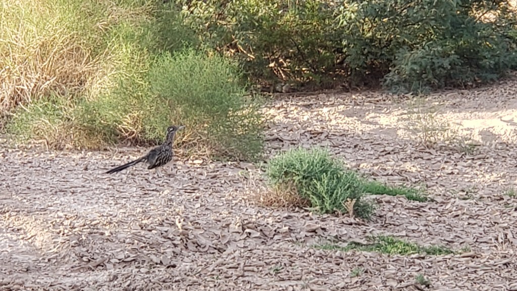
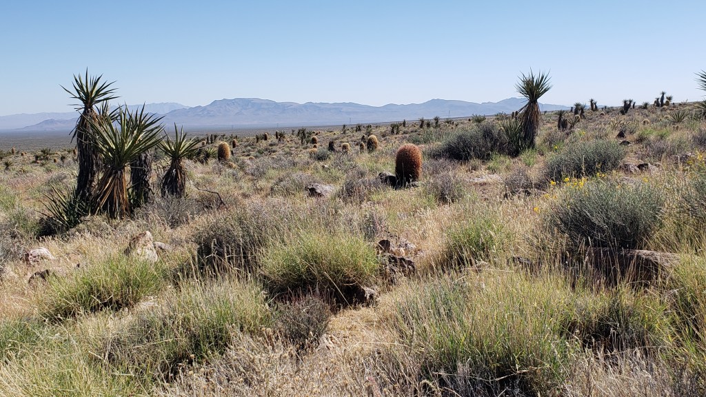
Mojave Desert National Preserve was only 51 miles from Laughlin, barely time to get Nippy’s engine warmed up. Neither of us had any real idea of what to expect, but we did hope we’d come across another roadrunner, a bird Simon was eager to see. We’d spotted one at Davis Dam in Laughlin but, as everyone knows, one roadrunner sighting isn’t enough.
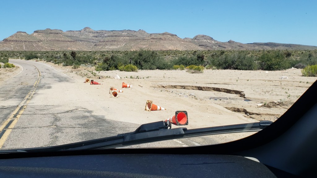
There was still evidence of water damage from Hurricane Hilary when we entered Mojave Desert National Preserve at Hole-in-the-Wall, named for the rocky hillsides that look like Swiss cheese.
Messy, but passable.
Swiss-cheesy rocks
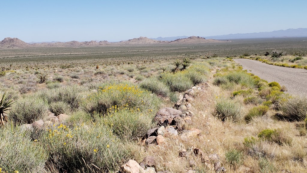
There were also no-go areas that were under construction or prohibitive due to a fire, and many roads were only accessible to four-wheel-drive vehicles, so our options were limited. But our goal had really been to see the desert, and we’d certainly get a flavor of it with the driving we could do.
This goes on for 1.6 million acres, and spills out to a whole lot more of southern California.
We thought the desert would be nearly all sand, but it was surprisingly vibrant.
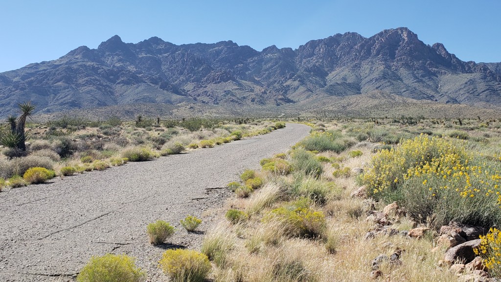
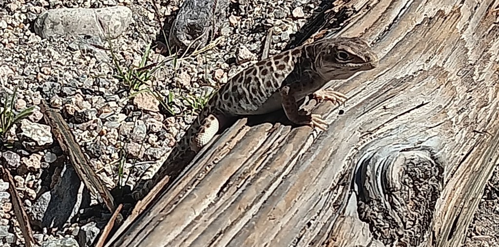
Those brown cactus kept fooling us into thinking there was a large mammal grazing in the distance. They sort of look like baby Wookie penguins up close.
This little fellow greeted us at the Visitor Center, and wasn’t at all shy about posing for the camera.
We didn’t see any roadrunners, but we did have a wonderful wildlife sighting, which capped off the trip perfectly. The Desert Tortoise is a threatened species, so it felt quite special to see one, especially at such close proximity.
Click on photo to view video
One of the most popular reasons for visiting Mojave Desert is the Rings Loop, a hike which includes an ascent through the tight Banshee Canyon using metal rings embedded into each side of the narrow rockway, but Ruthie couldn’t do that because she doesn’t have opposable thumbs.
Rings Loop Photo credit U.S. National Park Service
The Lava Tubes are another major draw, but due to damage they are now accessible only by four-wheel-drive, so the man at the Visitor Center suggested a side trip to Kelso Dunes, further west along Highway 40. The loss was softened a bit by having been in the lava tubes at Craters of the Moon while we were in Idaho.
We forgot to take the obligatory selfie at Mojave Desert, so here’s one from Craters of the Moon.
The dunes are massive. Much more extensive than Bruneau Dunes, but also much harder to access. There are plenty of warnings not to enter any road that’s not paved if you aren’t in a 4WD, so again, that particular road was off limits to us.
Roads often start out looking all benign, but can quickly devolve into bone-jarring terrain.
The day had still been worthwhile, and we were glad to have made the trip. To make up for any small frustrations, we had a rockin’ surprise in store when we returned home to Fati.
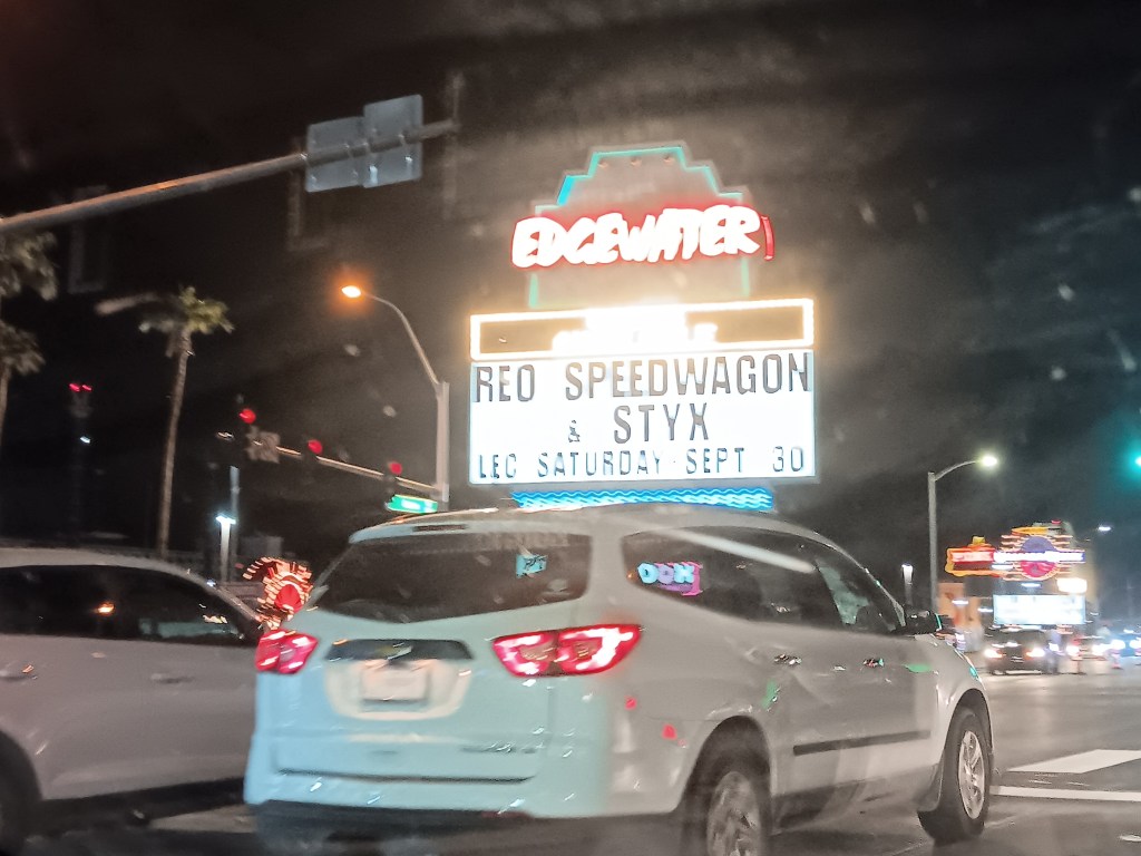
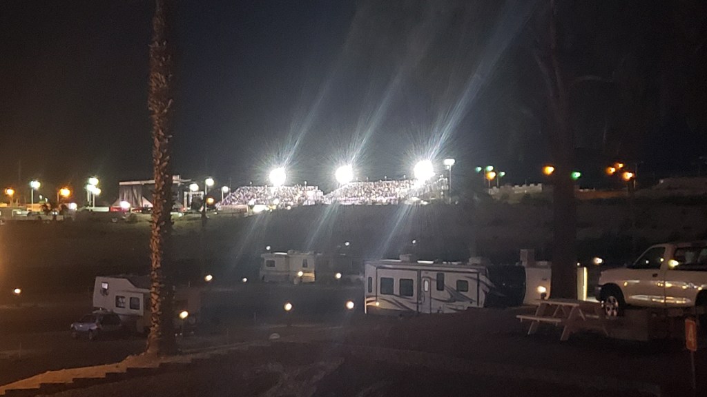
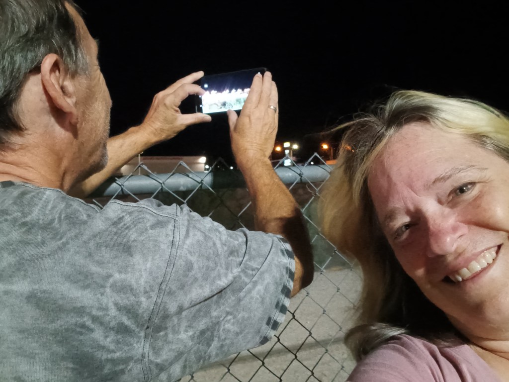
One of the casinos in Laughlin had been advertising a concert featuring REO Speedwagon and Styx (for those born after the turn of the century, these were popular rock bands from the ancient days of the 1980s). What we hadn’t realized was, it would be an outdoor concert just up the road from our campground, and we’d be able to hear every single note from our living room.
It occurred to us we might have an even better view if we drove over, parked nearby, and walked up to the venue, but the police were out in full force at barricades to the road the stadium was on, so that was a big “No.”
We sat in a parking lot just across the street, but it quickly dawned on us the wind was blowing in a direction that favored us returning to Fati, where we could hear each song clearly, have our own clean bathroom, and enjoy a beer for less than $15 a pop. Rock on, Team Veness!