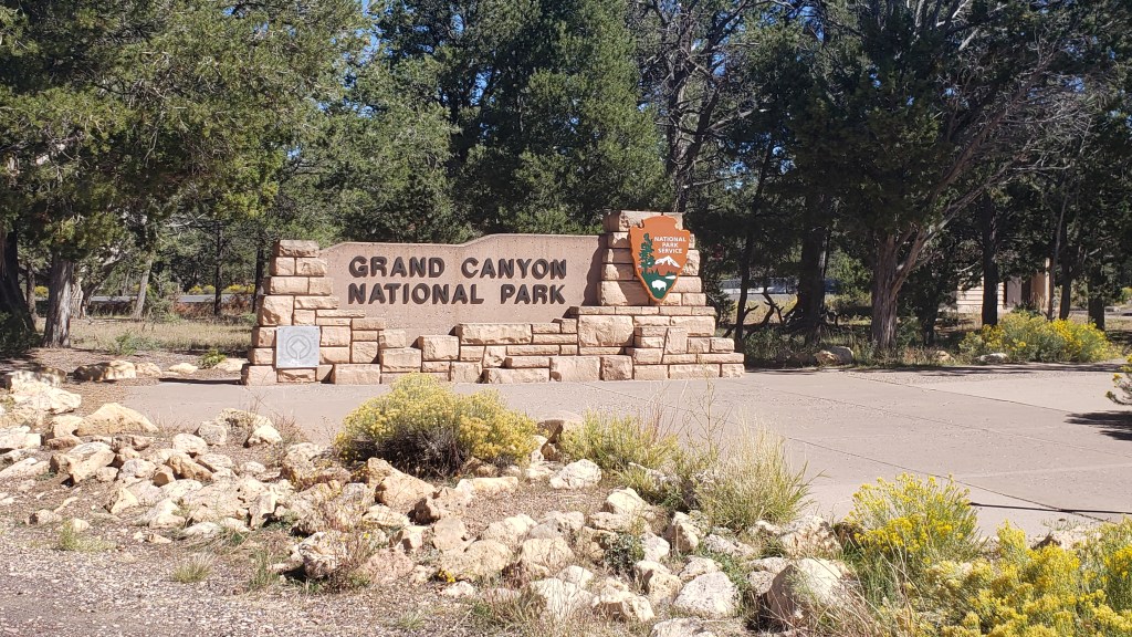
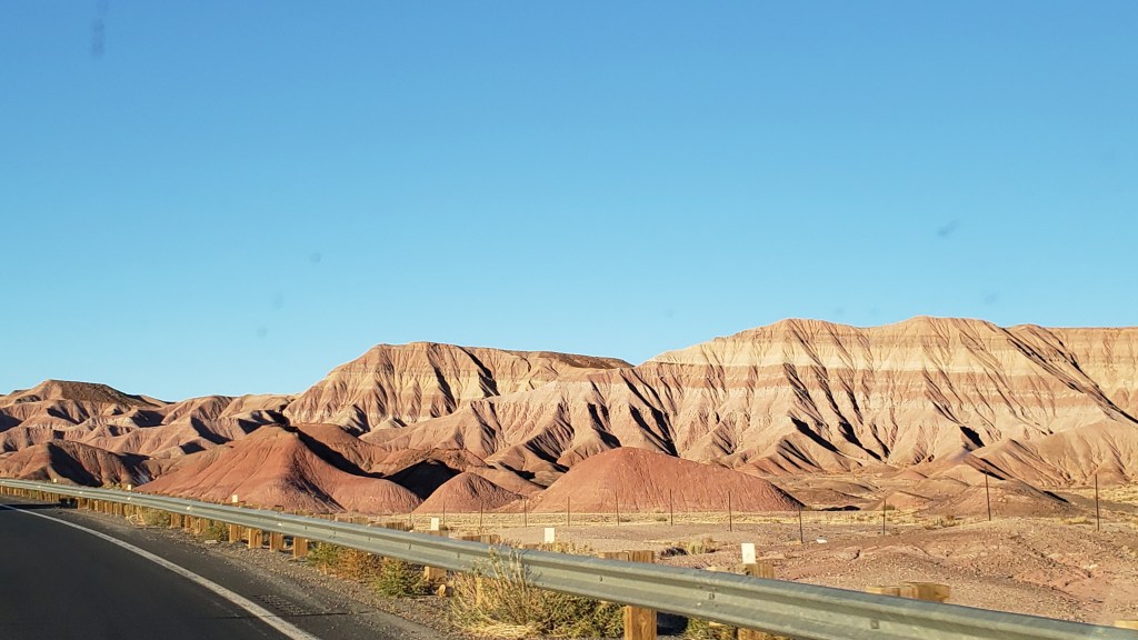
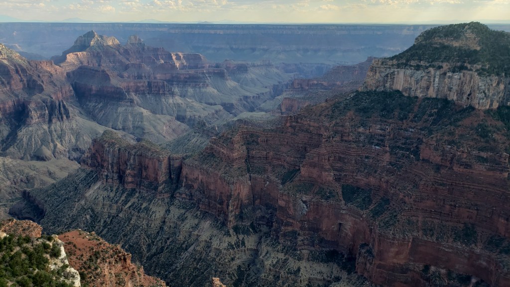
Grand Canyon’s South Rim made a convenient detour as we traveled north from Kingman to Monument Valley, and the view there was completely different to the North Rim. While North Rim is rustic and less visited, South Rim is iconic for a reason. Wider, more colorful, and much more approachable.
Simon had been to the South Rim before, but my first view of it was shocking, in a good way. It struck me as a grand amphitheater with a story to tell in each of its folds and crevices, and its sloping sides are so enormous no binoculars are necessary to see them, though we used ours anyway and were treated to intricate views of the canyon’s smaller details.
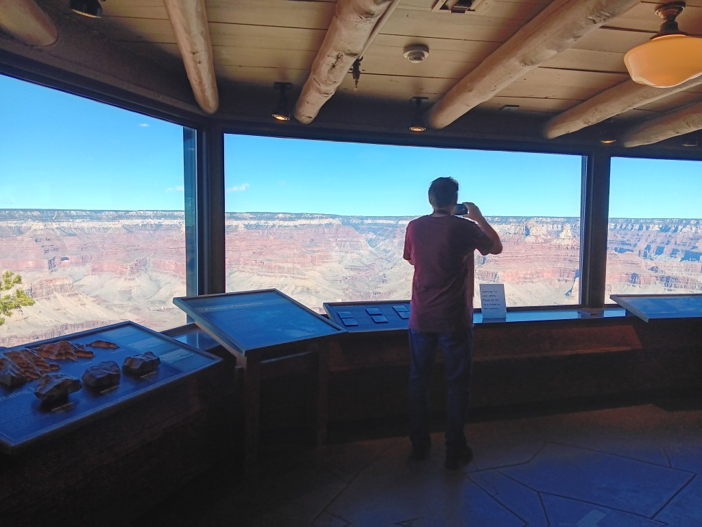
There was a little interpretive center not far from where we parked, with a panoramic view through its windows. Sitting right on the edge of the canyon, it offered an exceptional sight line right down to the bottom.
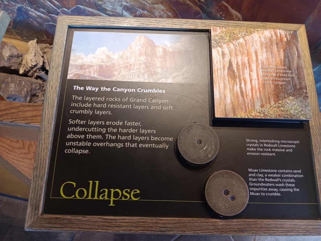
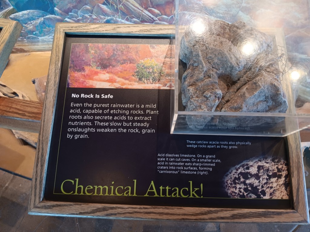
Among the displays were two panels that hit smack at the heart of what bothers those of us with a fear of heights. We’re thinkin’ it, Grand Canyon, we’re thinkin’ it!
Fear 1
Fear 2
South Rim has three main areas that look into the widest part of the canyon, and we checked each of them out.
When we had our fill of the main overlooks, we continued along the spectacular East Rim drive, where several more turnouts provided views over the canyon’s less-visited eastern arm.
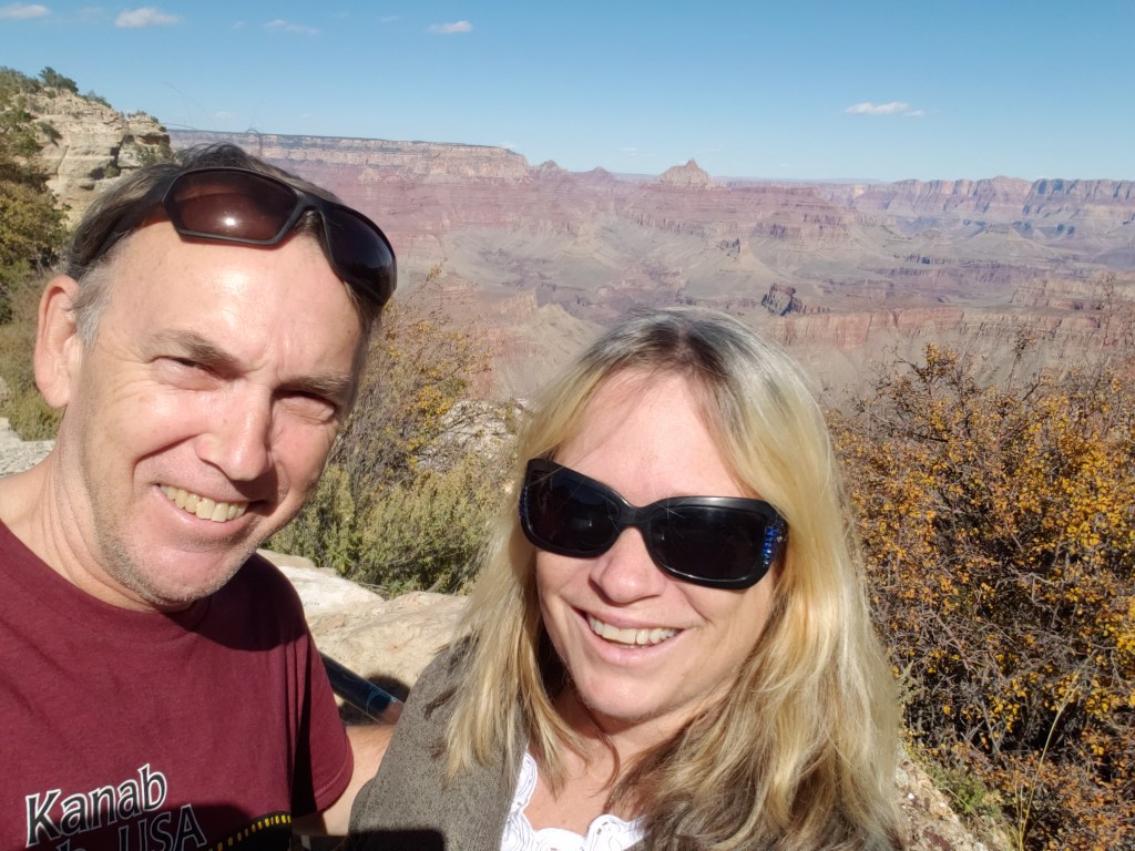
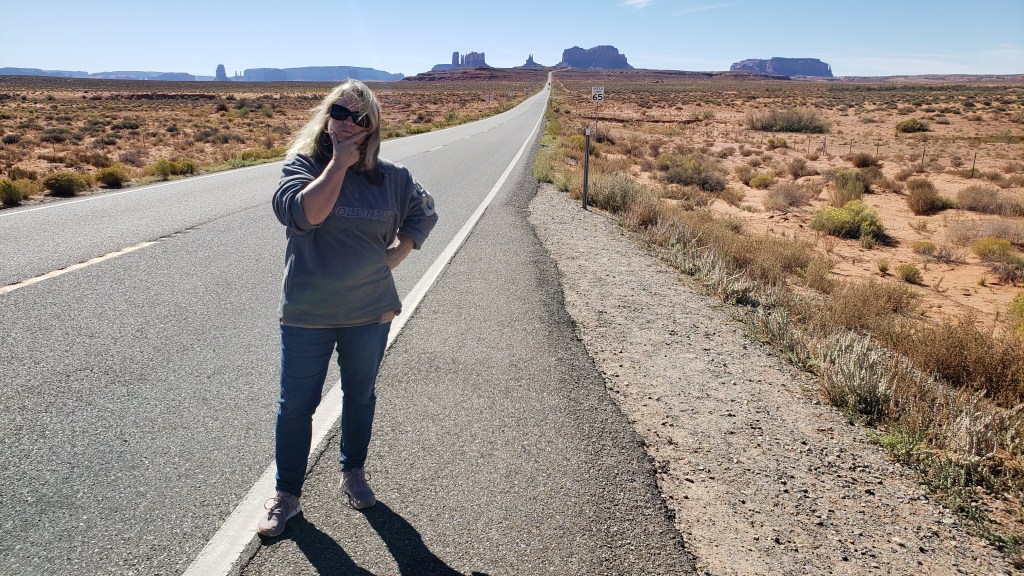
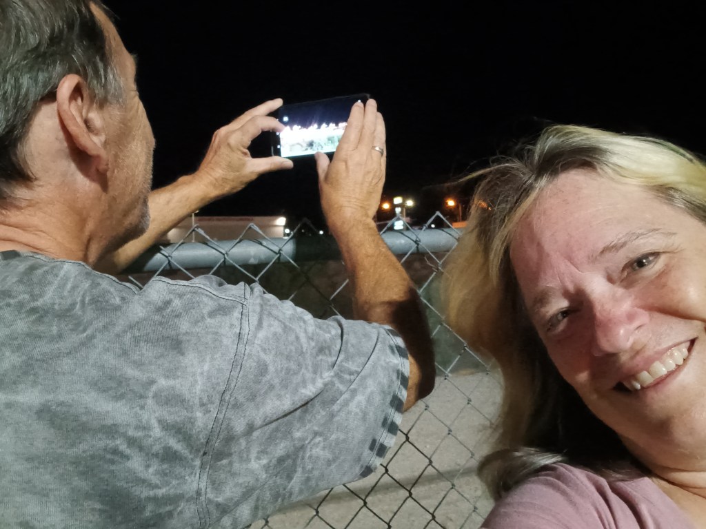
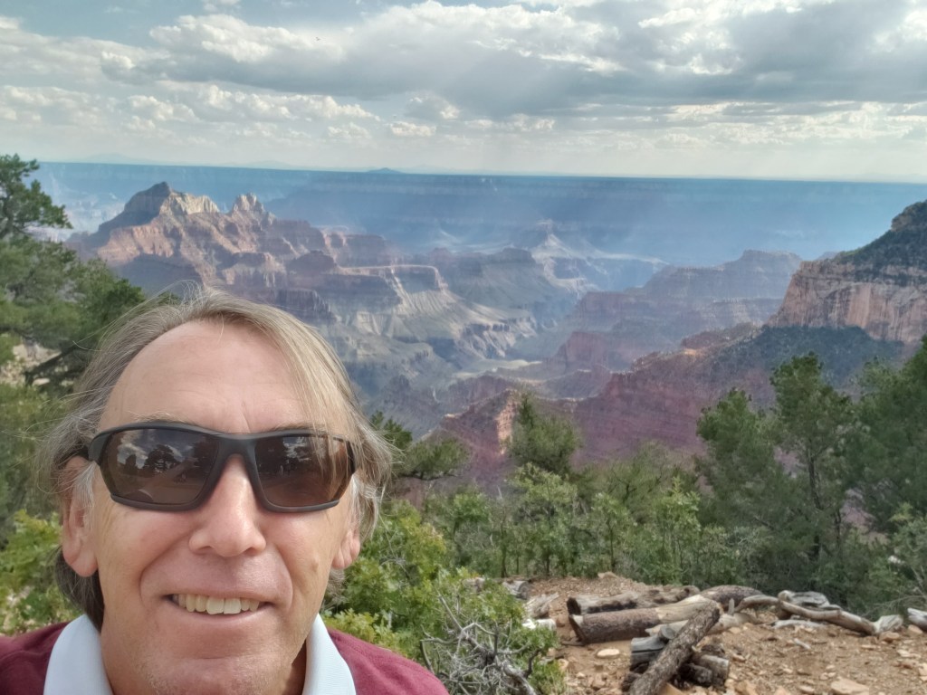
Obligatory Selfie.
If you read our blog about Monument Valley, you know we had begun using a “points” system when it comes to things that challenge us as we travel, but we do them anyway. Simon cashed in some of his points to avoid driving the valley’s rough road, and I cashed in some of my points by asking to skip an overlook accessed via a steep, narrow road along the East Rim.
This is what a thousand points looks like.
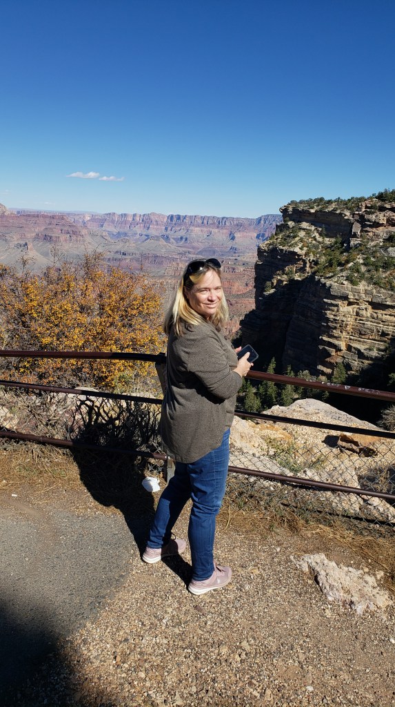
Standing on this wall earned me a billion points, but I can’t post the photo of that moment because you can see my mouth and it’s really obvious what word is coming out of it. Look at these happy people instead.
The rest of East Rim was spectacular, and it was also a convenient shortcut toward the road to Monument Valley, so the decision to head that way rather than backtrack to I-40 was a double win.
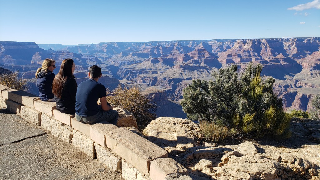
We saw quite a few people just hanging out on rocks near the edge of the canyon.
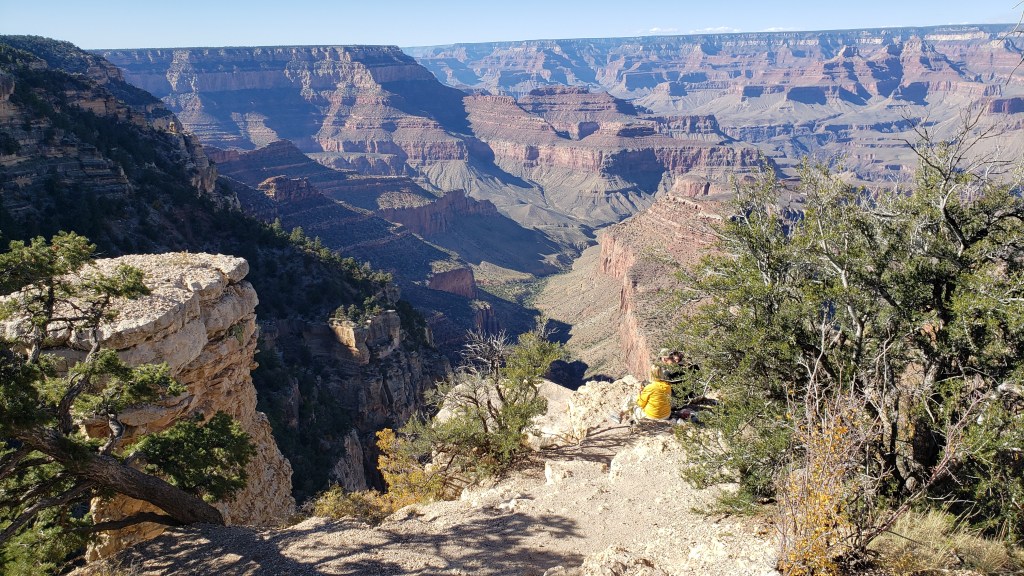
The main area only allows tiny glimpses of the Colorado River, but it’s much more visible from the East Rim.
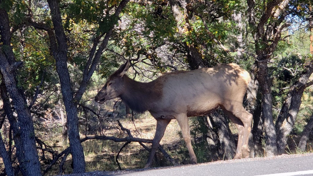
Skipping the steep road also led to our first wildlife sighting in a long time when we came upon five or six elk grazing along the East Rim road, which made for a happy sign-off to our visit.
We didn’t get a photo of the many people who were foraging for something in the forested area, but it looked like they were picking up small pine cones. During one of our turnout stops, my guess was confirmed; they were harvesting pine nuts from the mini pine cones. How cool is that?
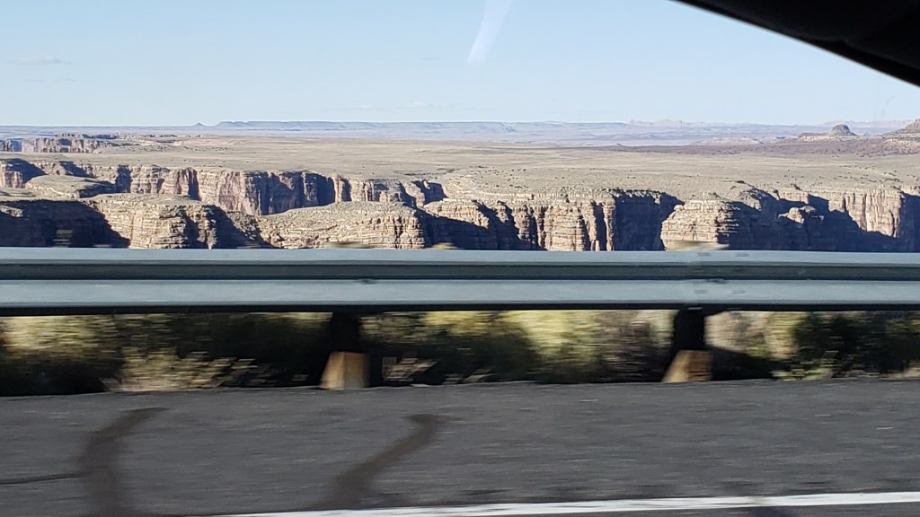
As we continued north after leaving the park, we came across one of the furthest reaches of the canyon, near where the Colorado River and the Little Colorado River meet. A huge fissure runs along the highway, and we stopped to have a look at a big parking area set up just for that purpose.
Etc? What the living hell could “etc” be?!
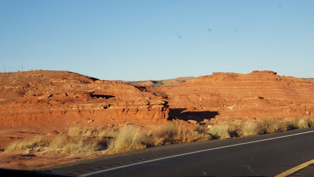
That night we stayed in Navajo Land Hotel in Tuba City, having driven into dusk through scenery lit by the fading sun. The name is an odd side-step meant to honor Hopi Chief Tuva, but the Mormons who were guided through the land by Tuva apparently had trouble pronouncing the letter “v” (but did they, really?) and simply replaced it with “b.” We’ll leave our comments at that, and instead revel in the glorious hillsides.
We were glad to have seen both sides of the Grand Canyon, with their distinct personalities that earn the National Park its place as one of the United States’ most iconic destinations.
Simon is a huge fan of old cowboy movies and Sergio Leone’s “spaghetti Westerns.” So much so that we decided to leave Fati for two days and make the 790-mile round trip from Kingman, Arizona to the Navajo Nation to see Monument Valley’s iconic red-rock formations.
Leone only shot scenes for one movie in Monument Valley – Once Upon A Time In The West – as a tribute to filmmaker John Ford, who helped make the area famous through his classic Westerns. Nearly 30 movies feature scenes shot in the red-earth valley, including Thelma and Louise, 2001: A Space Odyssey, National Lampoon’s Vacation, and Back to the Future III, but none captured the magnificence of the place the way the Westerns did.
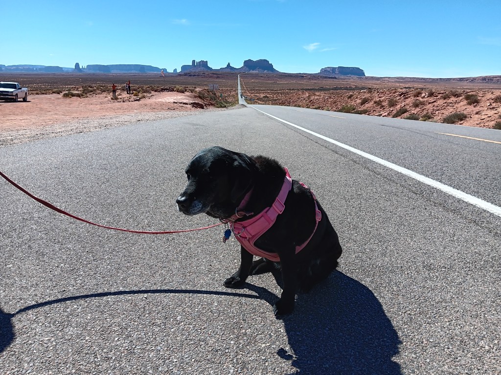
The back side of Monument Valley.
In reality, we paid a visit to Grand Canyon’s South Rim on the way to Monument Valley, but we’ll share that with you in our next blog.
While researching our trip to Arizona’s north-eastern corner, we read several times that the scenic loop through what is properly called Monument Valley Navajo Tribal Park is a rugged dirt road, and only recommended for those with a high-clearance vehicle. One of us (whose name begins with the letter Simon) could not accept that as fact, and a few websites also insisted small cars were fine. Both of us agreed we’d check it out and decide for ourselves.
When we reached Monument Valley’s toll booth, Simon asked the question. The woman in the booth took one look at Nippy and said, “The road is really rough. I wouldn’t try it in that.”
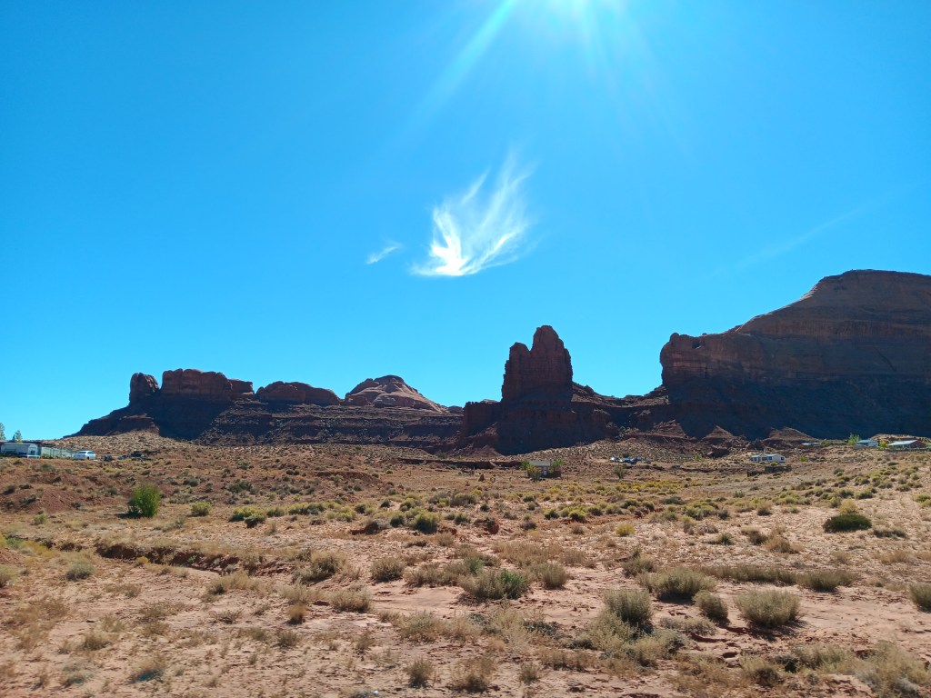
Most of the terrain looked like this.
We had begun using a “points” system when it comes to things that challenge us as we travel but we do them anyway. To be fair, we give each other anywhere from a thousand up to a billion points for any given challenge, so it’s a bit of a skewed system, and it was here that Simon cashed in some of his points. The decision was made.
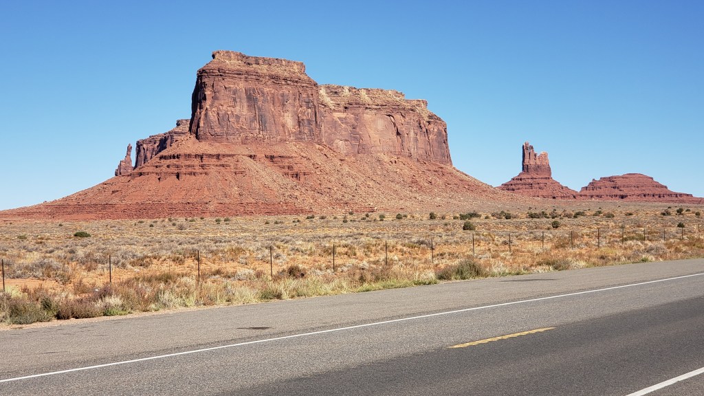
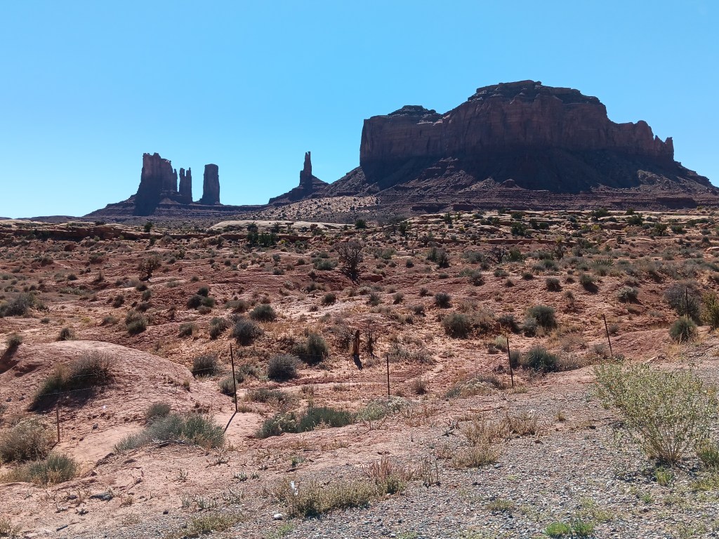
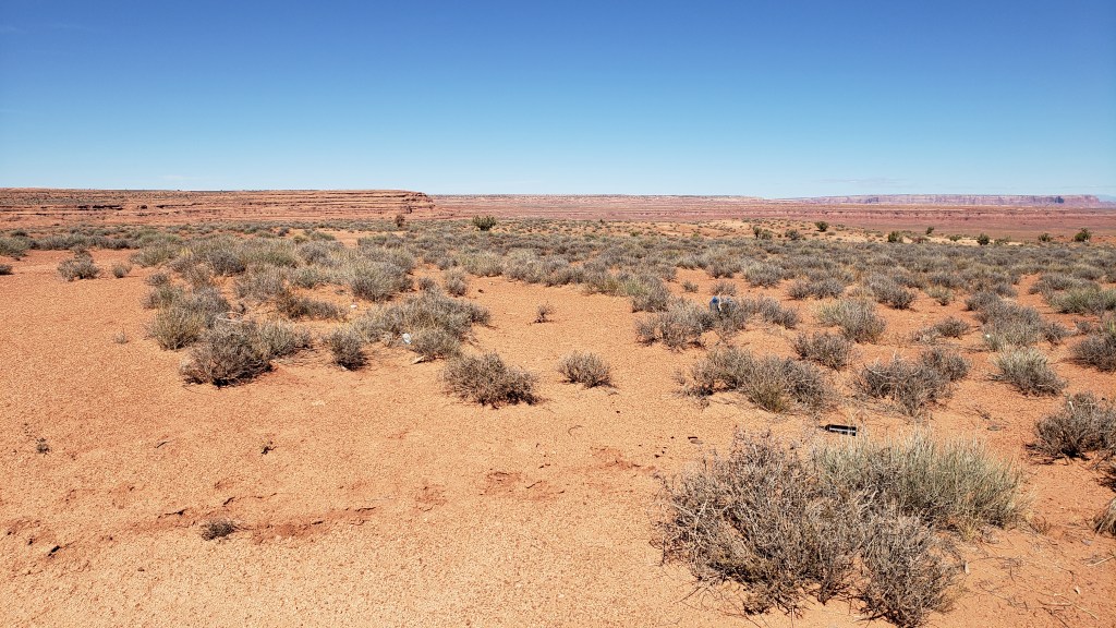
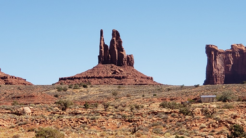
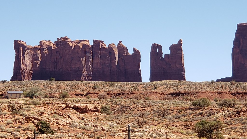
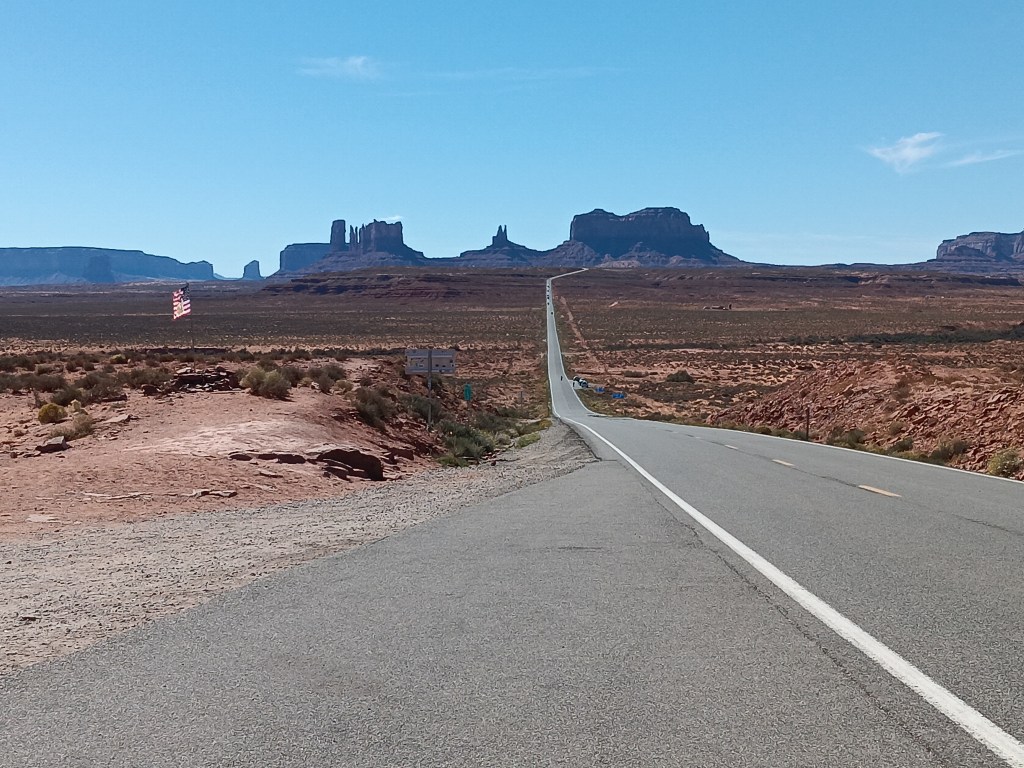
But not to worry; we’d noticed two things as we were driving toward the park. One was that you can see all of the valley’s rock formations from Route 163, which parallels the park, and the other was that Route 163 is entirely paved.
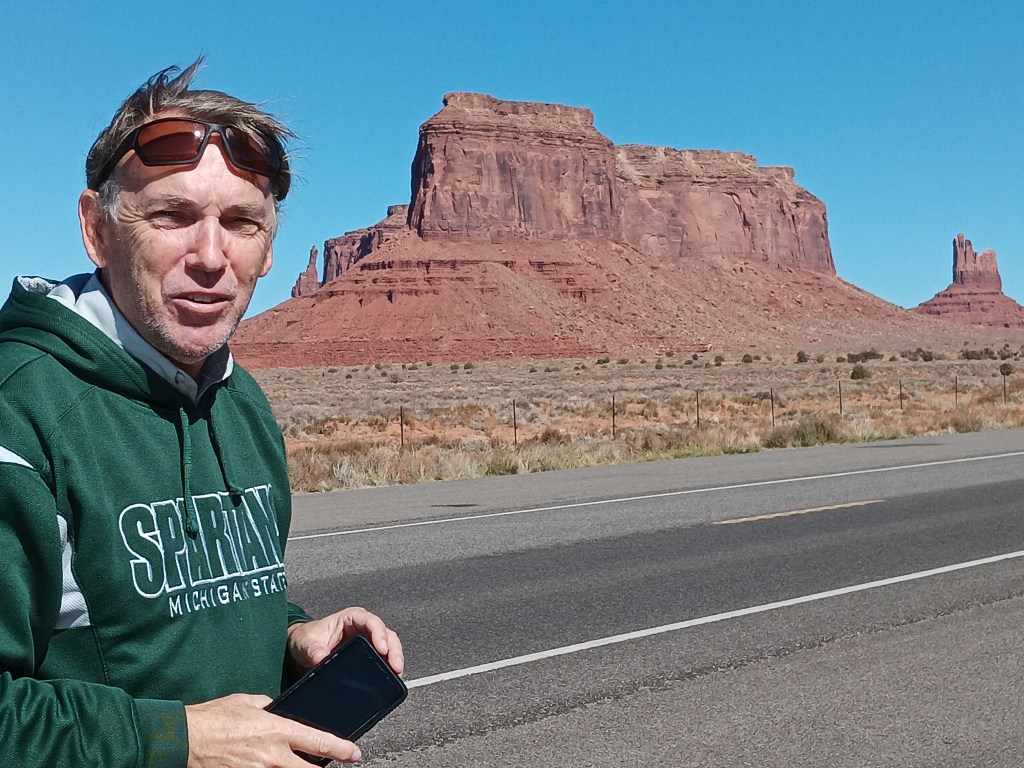
Each formation can be viewed up close from inside the park, but we were perfectly happy with our grand overview, and we stopped at every turnout, marveling at the magnificence.
The movie Forrest Gump, starring Tom Hanks, was also partly shot on location in the Navajo Nation, and Route 163 was the setting in which Forrest stops running during his three-years crisscrossing the U.S.
The road looks abandoned in this photo, but really it’s quite busy.
Today, the road draws visitors who want to recreate that memorable scene. It does involve standing stock-still in the middle of a relatively busy road, but that doesn’t deter fans, some of whom have been injured or killed in the process. We chose to stand along the side of the road rather than in it, because it would take a long time for Emergency Services to reach us if we got run over by a truck.
What a wonderful afternoon it had been! For Simon, it was the fulfilment of a movie fascination dating back to his childhood, when he watched John Ford’s The Searchers, and again in Once Upon A Time In The West.
“It opened up a magnificent real-life panorama that far surpassed the two-dimensional qualities of the cinema screen, in a landscape that was both breathtaking and awe-inspiring,” he gushed as we drove to Williams for an overnight to break up the long drive back to Fati.
Happy husband!
We have thoroughly enjoyed our time in Arizona so far, but there was something quite special about Monument Valley that gave me (Susan) a deeper understanding of why my parents, especially my beloved mother, loved the Southwest so much. And in that moment of acknowledgement as we were leaving the Navajo Nation, I looked to my right and saw the only cloud in the sky, which, to me, looked ethereal and angelic.
It was one of those moments people who have lost a loved one recognize, and I smiled, silently thanking my Mom for showing up.
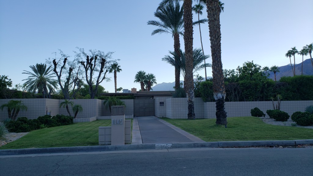
Simon wanted to see Palm Springs because “it has a reputation as an iconic destination, like Rodeo Drive, Beverly Hills, and Manhattan, and it’s right in the middle of the desert.” Plus, it has a golf course that was featured in Walt Disney World’s former Soarin’ attraction at Epcot.
Susan had been before, in what feels like another lifetime. At that time, the experience was all about wealth and what it could buy. Staying in a home in swanky Rancho Las Palmas in Rancho Mirage, enjoying the finest dining, and having a BMW to drive around in. Would the city tucked into a valley with the San Jacinto Mountains as its backdrop live up to that glittering yesteryear now that self-indulgence was no longer on the menu?
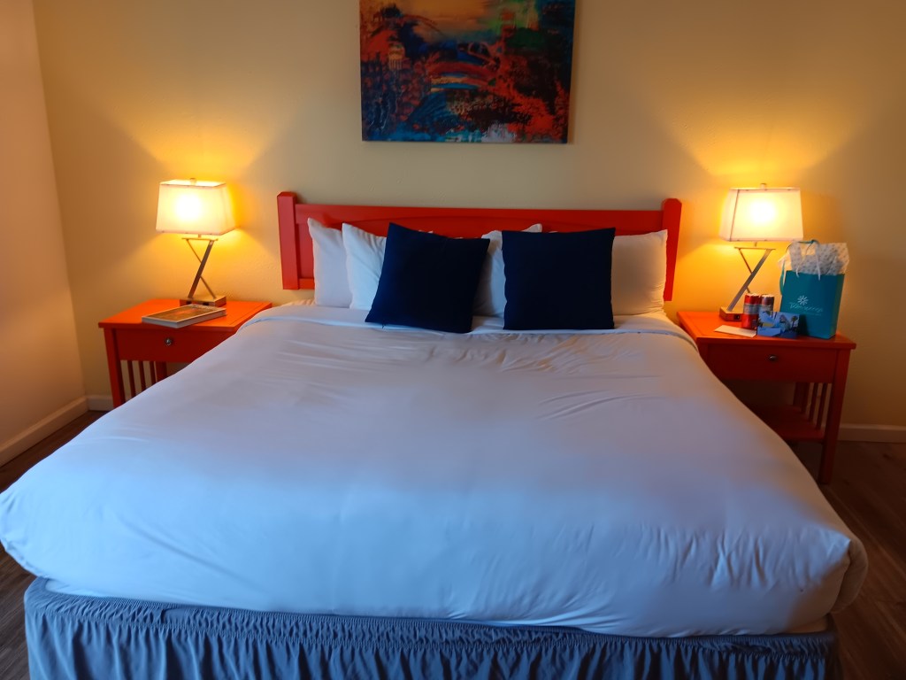
Just 36 miles from the town of Joshua Tree, Palm Springs and our two-night stay at the pet-friendly Inn at Palm Springs was an easy drive. The Inn is a comfy boutique hotel on Palm Canyon Drive, the main artery that connects the north side of town with pretty much everything.
We totally switched off, professionally, during this trip, and didn’t get a photo of the outside of the hotel. Frankly, we didn’t get a photo of a lot of things, which is probably a good sign even if it’s not very helpful for a blog.
But let’s get straight to the food. Real food. Food that makes sense, wasn’t prepared in an Instant Pot or an air fryer, and had so much flavor we almost wept with happiness and appreciation.
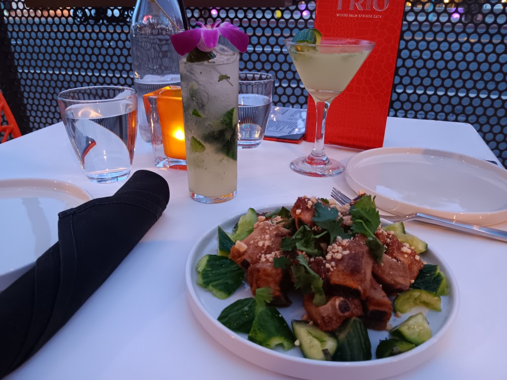
Having spent the day in Joshua Tree National Park, we freshened up before heading to Trio for dinner. Their outdoor seating was perfect for bringing Ruthie along, with the added benefit of being right on Palm Canyon Drive so we could enjoy the evening ambiance.
Our kind of outdoor dining!
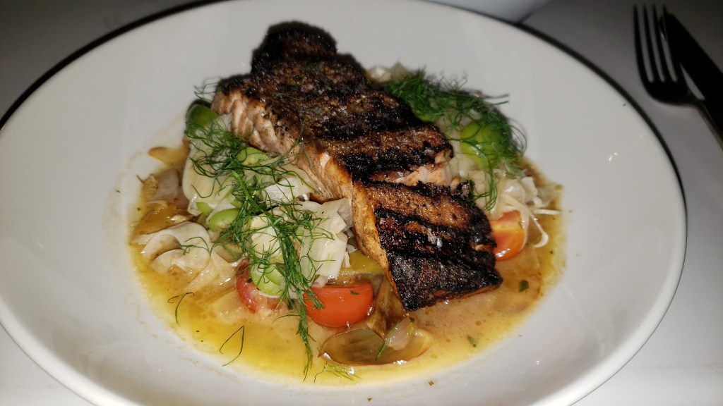
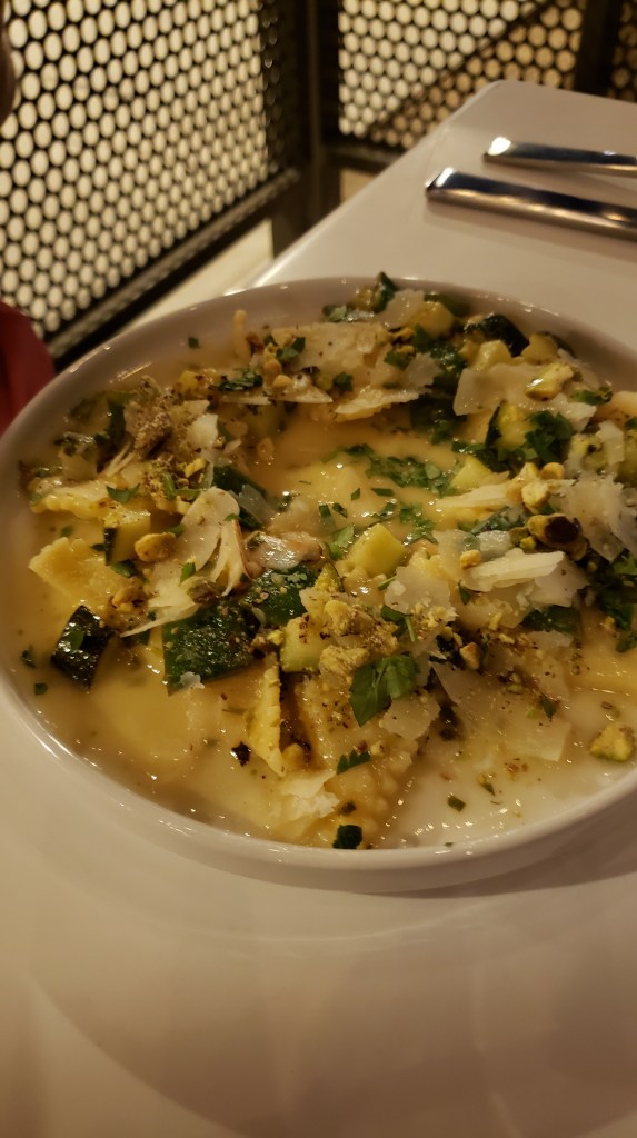
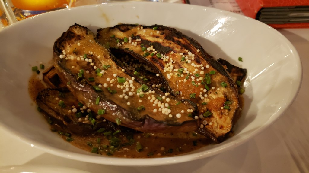
We started with a perky Cucumber Gin Fizz for Susan and vodka-based Triotini for Simon, then moved on to the Sticky Pork Riblets appetizer, light-as-air Triangoli pasta with summery veggies and parmesan cheese for Susan, succulent Scottish Salmon for Simon, and the earthy deliciousness of Japanese Eggplant with White Miso Sauce to share. (Apologies for the dark photos; it was dim, which is romantic, and we didn’t want to disturb other diners with camera flash.)
Sticky rib appetizer and luxurious cocktails. Like real adults would have!
How luscious is this?
It is a rare day when Susan orders pasta, but this light, lemony version was a worthwhile exception.
We could have made a meal of the Japanese Eggplant on its own. Delicious!
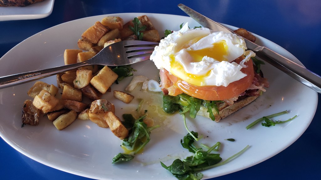
After a good night’s sleep, we refilled our half-empty stomachs with breakfast at Grand Central Palm Springs, which came highly recommended. Common sense won out over greediness, and we split a Morning BLT (bacon, tomato, baby arugula, poached eggs, and avocado dressing, served open-faced on sourdough, with house potatoes) and a Chocolate Hazelnut croissant, with tea and coffee.
Half of the large Morning BLT.
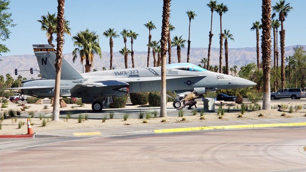
Our visit wasn’t just about eating (although we did a lot of eating!), so after breakfast we poodled over to the Palm Springs Air Museum, one of the city’s major non-golfing/non-eating/non-shopping attractions.
Simon loves this kind of place; Susan thought she’d be bored stiff. But, like the GE Aviation Learning Center in Evandale, Ohio, where jet engines are the stars of the show, something unforgettable happened.
This isn’t the unforgettable thing. Ruthie just loves statues. She thinks this one is trying to hand her a treat.
In Evandale, it was the cute little PR girl who said to Susan, “You’re bored, aren’t you? Well, I’m going to tell you, in just four words, something that will help you remember how every single engine works, and you’ll never forget it. Ready? Suck, squeeze, bang, blow. That’s how engines work.”*
A representation of my reaction. I never did forget how engines work.
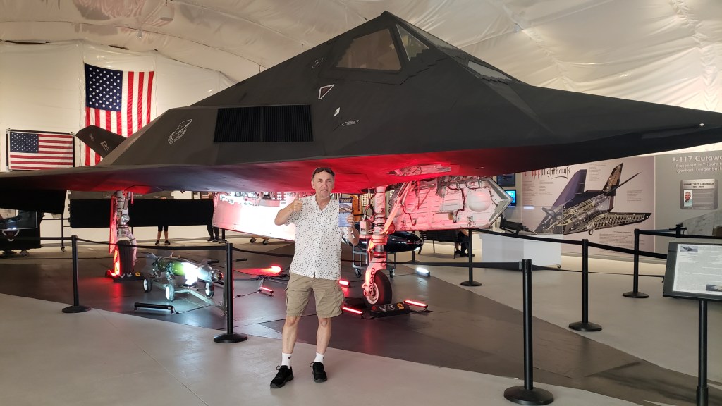
The Air Museum wasn’t nearly as X-rated, but it was no less astonishing. They have an actual Stealth Bomber on display, and while aircraft and war are not Susan’s thing at all, being in its presence was hugely impressive. Discovering how something that big can be “hidden” from radar was truly fascinating.
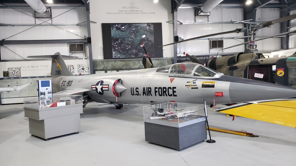
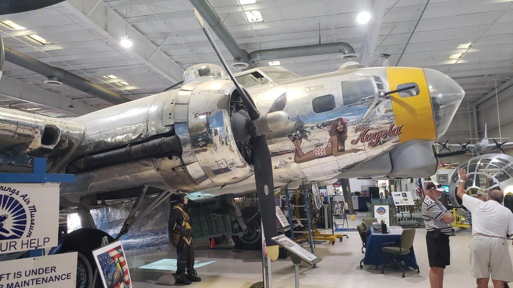
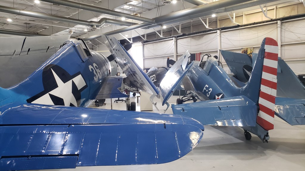
Talking to the docents as we walked through each hanger, arranged by the wars each planes served in, made the whole experience come alive. Many of the docents are veterans, and we spent far more time at the museum than we thought we would because they were so eloquent in sharing their stories, both triumphant and heartrending.
There was even a fabulous tribute to Walt Disney and the Disney Company’s role in WWII. It’s far more extensive than this one photo.
All that patriotic fervor was thirsty work, so we made a stop at Shields Date Garden for sustenance. From the moment Palm Springs became a possibility for our trip, Susan had insisted Simon had to try a Date Shake. He needed no second urging, and was rewarded with a 21-ounce cup of culinary delight that starts with a subtle mocha flavor, although there is no mocha in it, then evolves into a deep, rich date flavor, with just a pleasing hint of grit from the dates’ rough skin.
Simon’s first Date Shake. Click on photo for video
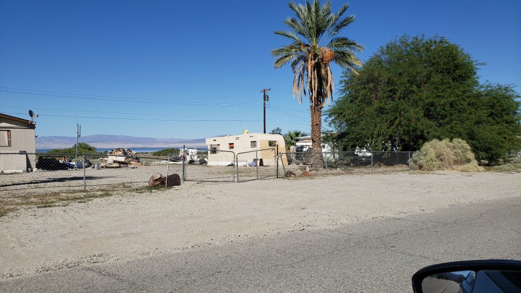
The day was hot, so a visit to the cool breezes of the Salton Sea were in order as we brought our internal temperature down with our Date Shakes. It was a 120-mile journey, round trip, but we had no real plans and it’s an iconic part of the desert experience.
Susan remembered it as a place that absolutely reeked of dead fish, but that was 40 years ago. Things change, and by this time all the inland sea’s fish were probably long gone.
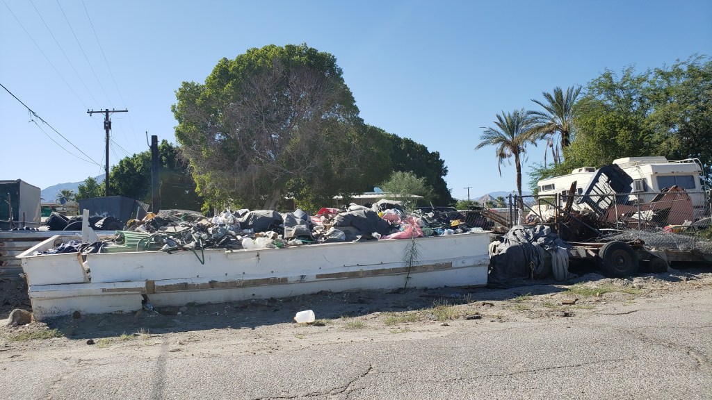
That part was true. If there were any fish left, we never saw them. What we did see was desolation, and a lot of Border Patrol cars. Once upon a time, the landlocked salty sea was an oasis that drew tourists from far and wide. Now, it’s a dying lake riddled with heavy metals, agricultural toxins, pesticides, and no cooling breezes. The small communities around it are dying, too.
This was as close as we could get.
Salton Sea City wasn’t looking its best.
Those who remain here deserve to have basic services. We wondered what had happened.
Like Utah’s Great Salt Lake, Salton Sea is drying up. It’s a sobering reminder of what’s happening with the climate, and a warning bell that rings loudly when you’re standing shoreside.
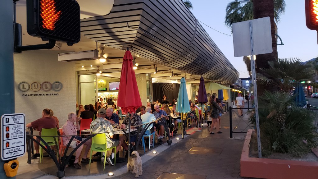
Dinner outdoors at LuLu California Bistro that evening helped restore our mood. Simon ordered a Santa Fe Panini (the California version of a Cuban Sandwich) and Susan had the lettuce wrap appetizer, with a beer each to adjust our attitudes quickly.
If there’s one thing that isn’t in short supply, it’s great food.
On the way back to our hotel, we were on the lookout for Bob Hope’s house, high on a hill overlooking the city, which made a huge impression on Susan during her first visit, for it’s astounding roofline architecture that curves gracefully downward, practically covering the 24,000-square-foot residence within. (Click HERE for an insightful story—with interior photos! – about this building, describing its restoration and why its famous architect felt the original project was an “ugly, tough job.”)
We also detoured into an area called The Movie Colony, where many famous people live or lived, including Frank Sinatra, Leonardo DeCaprio, Marilyn Monroe, Cary Grant, the Kardashians, and a list of other celebrities as long as your arm.
The houses are all low-rise and tucked away behind walls, fences, and/or high bushes. This was once Frank Sinatra’s house.
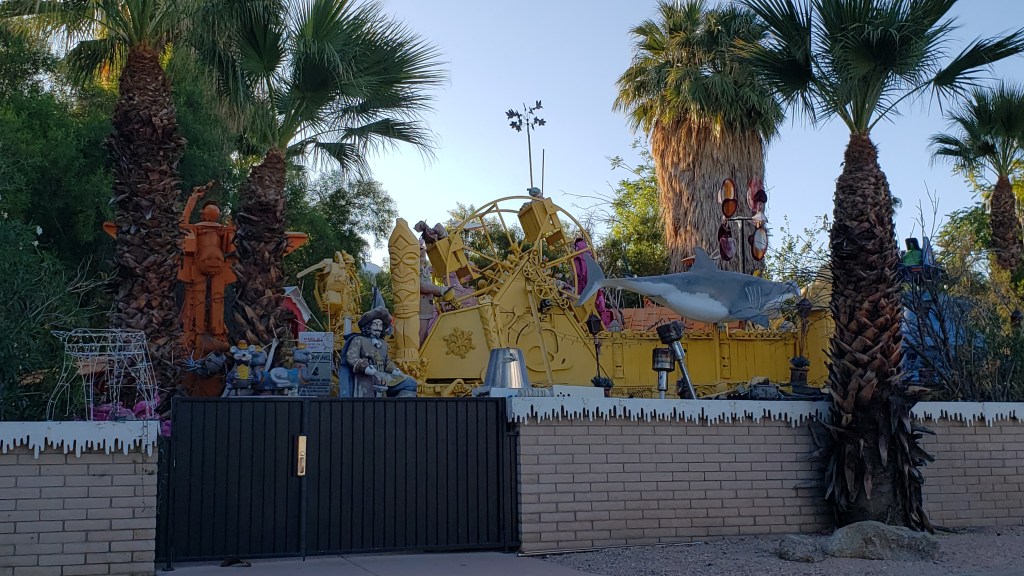
This is the home of an artist, and the entire yard is full of metal sculptures he’s made.
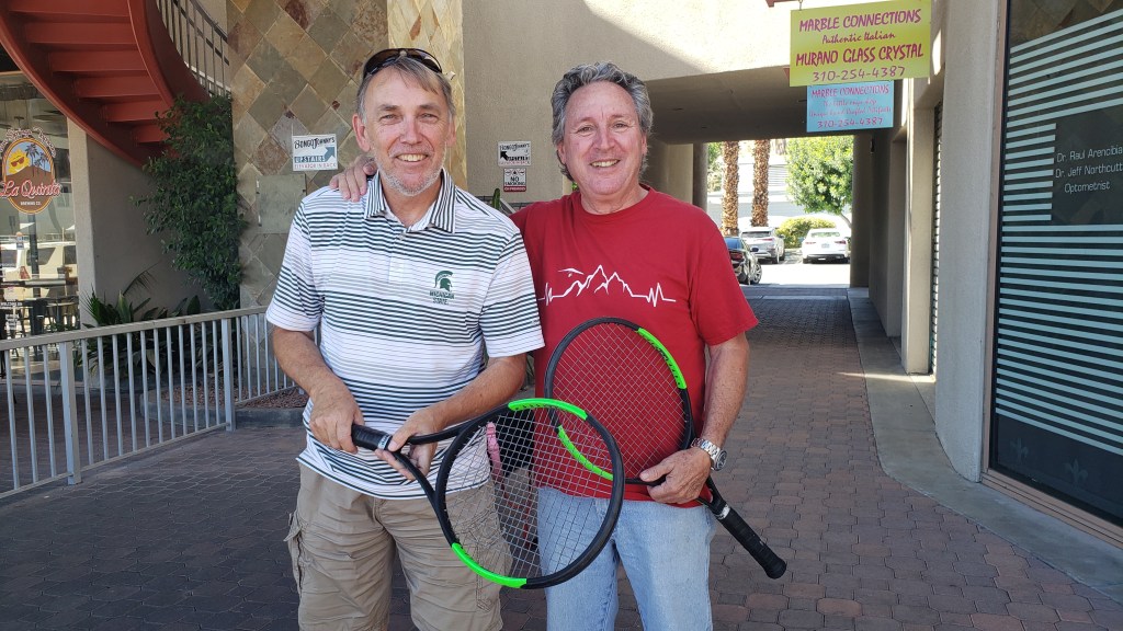
But it was the next day’s adventure that would prove to be the ultimate highlight of a trip that had many highlights. Simon had arranged to meet up with his childhood tennis buddy, Juan Carlos, during their time living in Botswana in the 1970s. They hadn’t seen each other in 48 years, but Simon still has a photo of the two of them, taken after the 1974 Botswana Boys Singles Final, which Juan Carlos won in three sets.
And what a reunion it was. Juan Carlos was accompanied by his lovely lady, Adrianna, and over the course of two hours, lively conversation closed the gap on those 48 years. Upon parting, the two recreated Simon’s photo from long ago, and we were left with the promise of a place to stay should we find ourselves in San Diego, while they have a room waiting for them if they visit Orlando.
Did our detour into Palm Springs live up to that opulent, cash-fueled visit all those years ago? It exceeded it by far, because this time it was all about the joy of being together, the simplicity of a full belly, and the bond of friendship that lasts a lifetime. Priceless.
*For those who also wish to never forget how engines work, they Suck fuel and air in, they Squeeze it down tight, it creates a big Bang as it burns, and finally it will Blow exhaust out. You’re welcome!
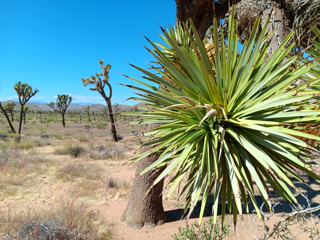
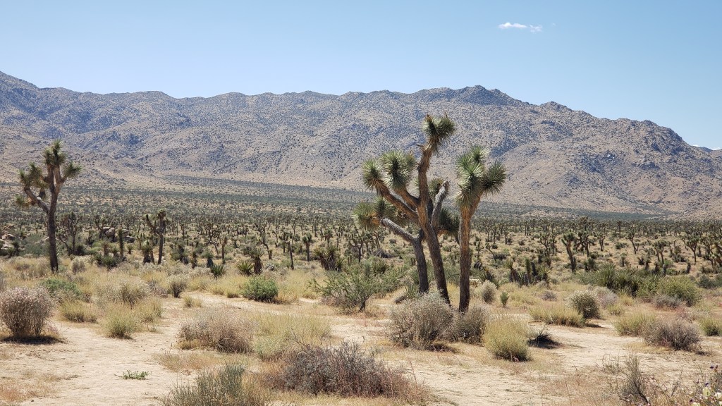
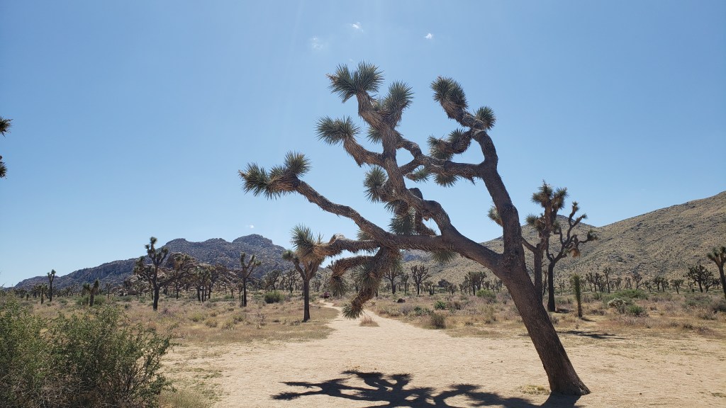
Signs pleading “Do Not Die Today” served as a grim introduction to Joshua Tree National Park, but, like most visitors, we made a mental note to avoid death and joyfully headed into the desert where succulents beseeching God and the un-huggable “Teddybear” cactus both live.
Joshua Tree National Park’s star attractions – named by 19th-century Mormon settlers who decided they looked like the Old Testament’s tribal leader, Joshua, with his arms raised toward his Heavenly Father – aren’t trees. They’re a type of Agave, the genus responsible for tequila, which, when imbibed in quantity, can also make you see God.
Other agave.
Joshua Tree National Park contains the greatest number of its namesake specimens in the world, and their importance to the ecosystem has earned them well-deserved protection by law. Visitors are allowed to walk the sandy trails between the plants, and a quick touch of their spiky appendages is all the incentive needed to leave them alone.
Having driven in via the West Entrance (located on the north side of the park), we had at least two hours of good scenic driving, with plenty of stops to enjoy each elevations’ unique topography.
Every time I turned around he was poking his finger on a plant.
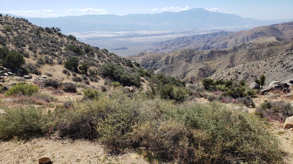
Among the highlights were an unexpected view of Palm Springs (our next destination) from the 5,185-foot-high Keys View overlooking the Coachella Valley, and the shocking realization we were also looking at the infamous 750-mile-long San Andreas Fault Line, an unsettling uprising where the Pacific and North American tectonic plates collide, with dramatic results (earthquakes).
The long, thin, dark mound stretching across the valley just below the furthest mountain range is the San Andreas Fault Line. Who knew?
Also visible from Keys View are the Salton Sea, which we’d visit the next day, Signal Mountains on the U.S./Mexico border, and Mount San Jacinto, rising 10,831 feet above the valley.
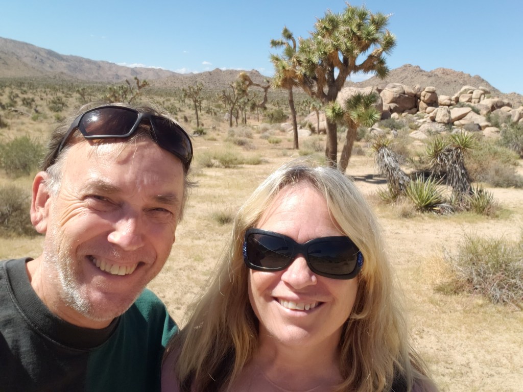
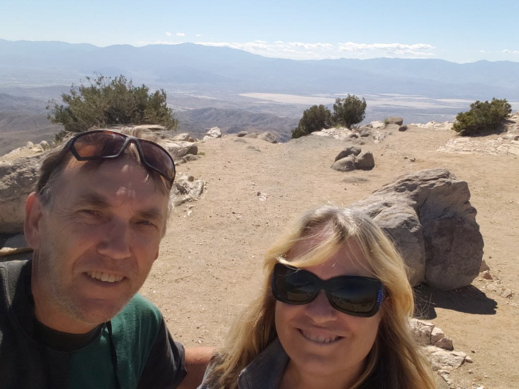
Obligatory Selfie.
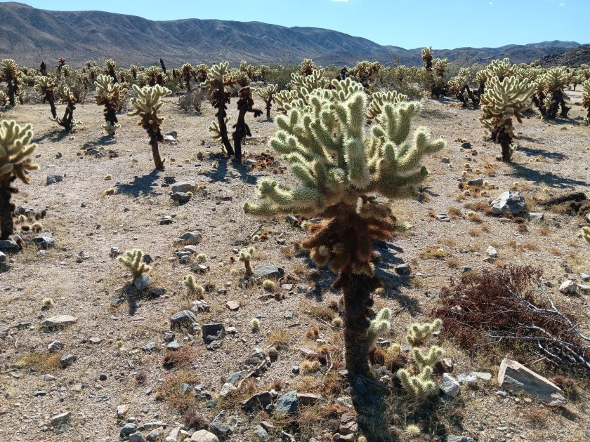
Returning to a lower elevation, we paid a visit to Hall of Horrors and its freaky rock mounds before taking a detour south to Cholla Cactus Garden.
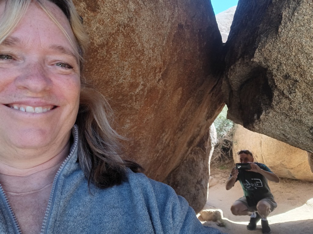
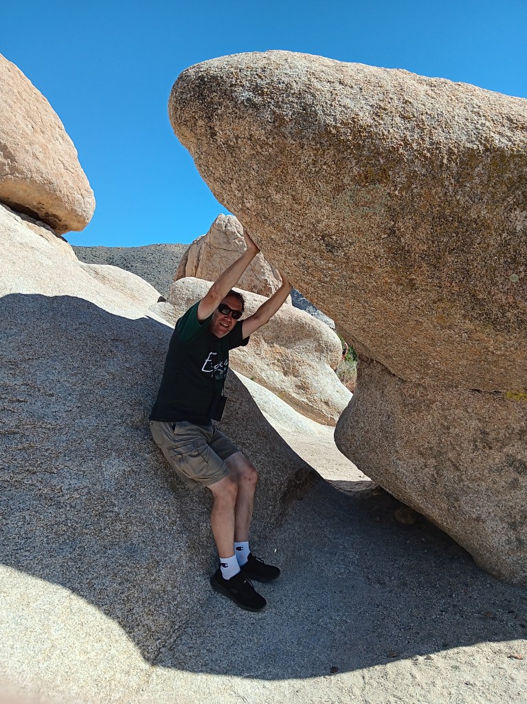
How artsy are we!
Some shots look so real in your mind, but maybe not quite as real when you take them,
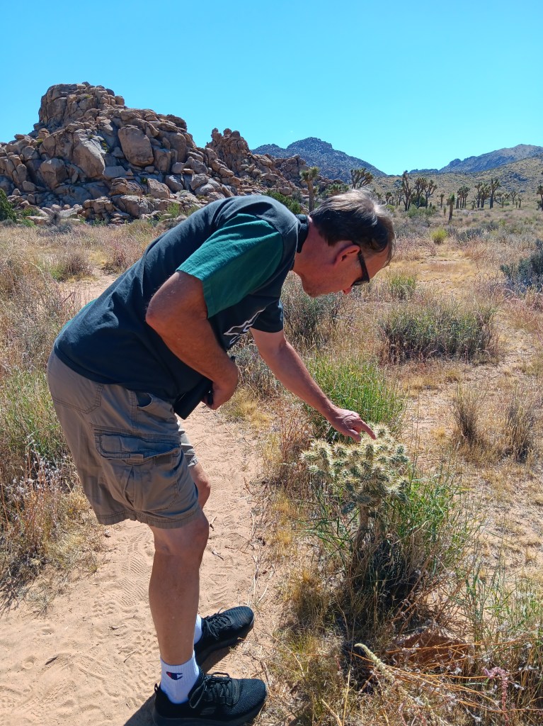
As much as we enjoyed the delightfully wonky Joshua Trees, we were even more taken by the ten-acre grove of Teddybear Cholla cactuses that only grow between 600 and 3,300 feet above sea level. Their name is misleading. This isn’t the sort of thing you’d want your toddler to snuggle down with for a good night’s sleep.
They look so cute and fuzzy, don’t they? They’re not.
Adorable as they are, they also have a super-power that allows their needles to readily attach to anything that brushes by them, and not in a good way. Simon was tempted to give them a poke, but, somehow, he resisted. We have special tweezers in the car for just such emergencies (tick tweezers for dogs, really, but they’ll pull needles, too), but thankfully we didn’t have to use them.
We returned to Joshua Tree after our visit to Palm Springs, but in the interest of efficiency I’m going to include that visit here and cover Palm Springs separately. We ate a lot of real food while experiencing the tucked-away haven for celebrities, wealthy second-homers, and the hard-working people who keep the whole place going, and that deserves its own blog.
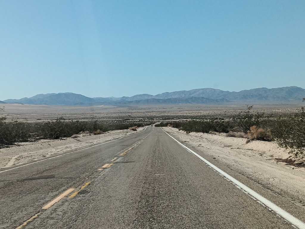
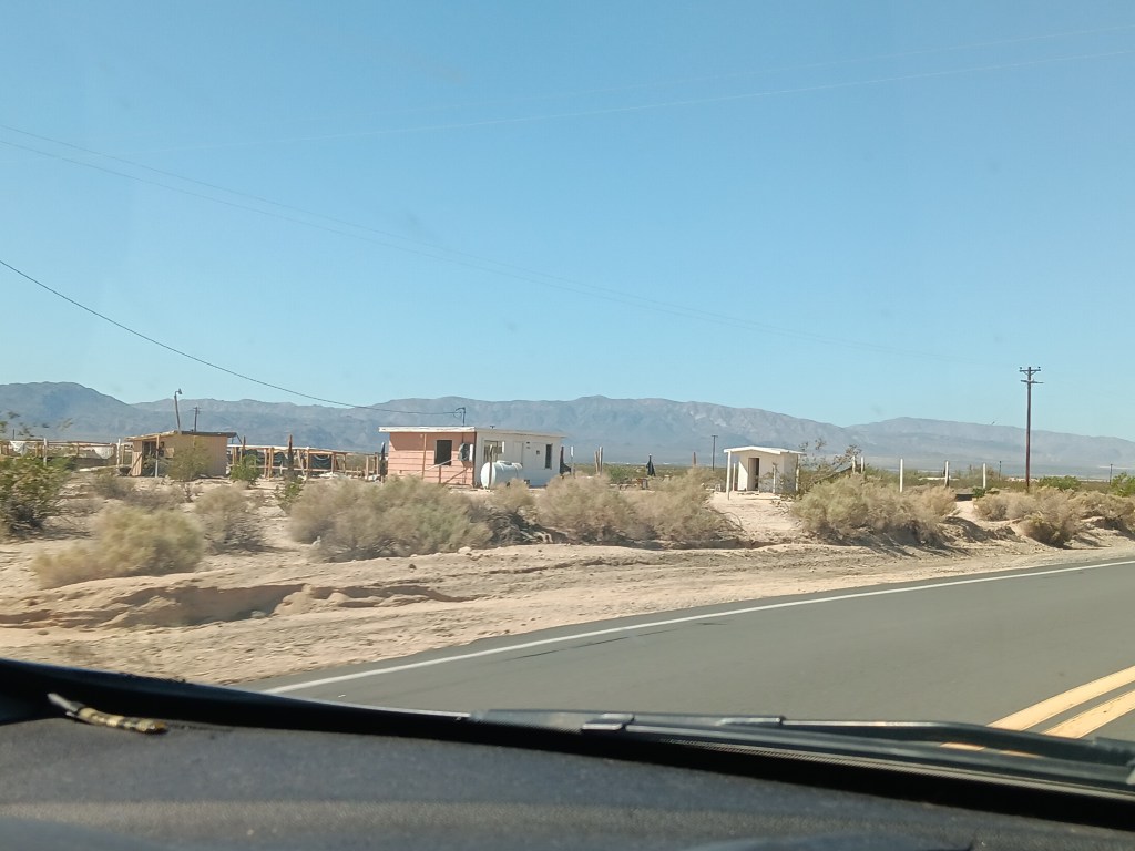
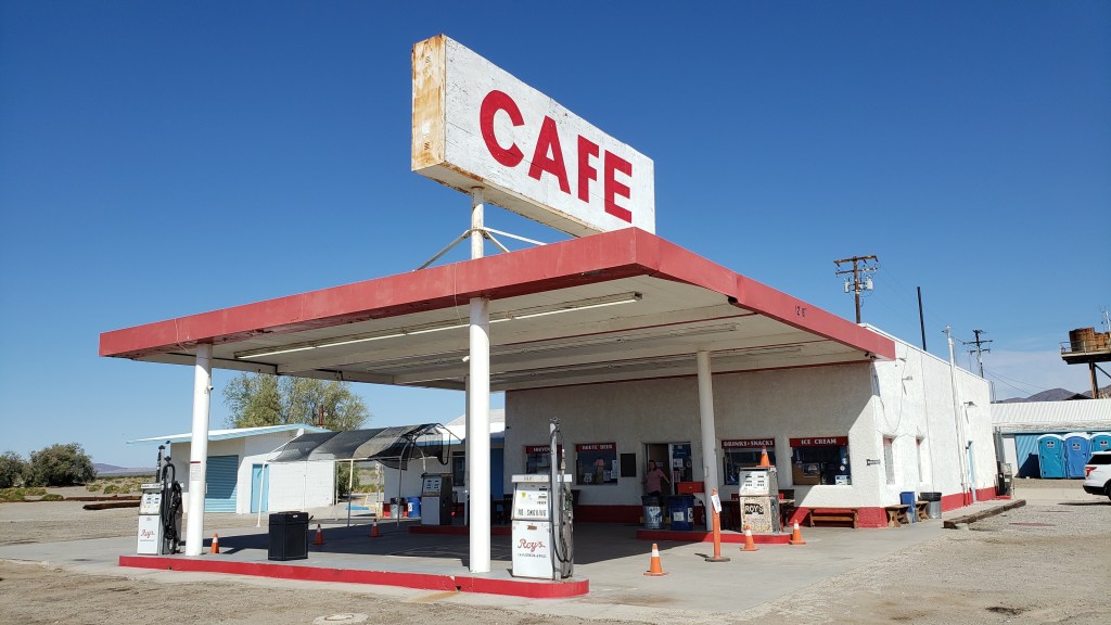
On our way through California from Nevada we took the northern route to Joshua Tree, traveling along roads that were not only desolate, they also featured tiny towns that were mostly abandoned, and a single gas station/café that we thought would have a restroom for bursting bladders, but didn’t.
This, but for three hours.
There may have been about 50 buildings here, but only a handful were occupied.
Need a bathroom with a flushable toilet? Too bad. Not doin’ it here!
Not wanting a repeat of that crushing emptiness and full bladders, and also wanting to see the southern side of Joshua Tree National Park, we opted for Highway 10 east, blissfully unaware of what the northern leg of the journey along connecting Highway 177 would bring.
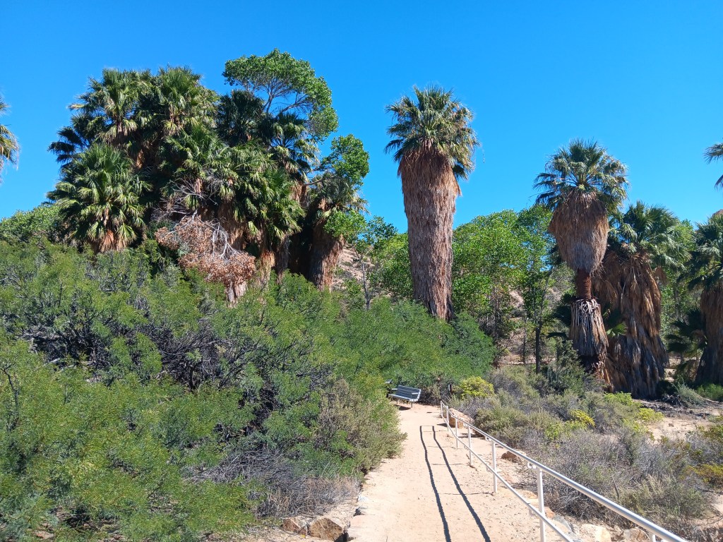
We only needed a moderate detour into the park for Cottonwood Spring, a literal oasis in the desert. Instead of the shimmering mirage that promised a palm tree-line water hole to movie and cartoon characters who didn’t pay attention to the Do Not Die Today signs and pack enough water and their own shade, this oasis did exist, and provided cooling cover, though all of its water had dried up.
A real live oasis. I’m not even sure I knew these existed.
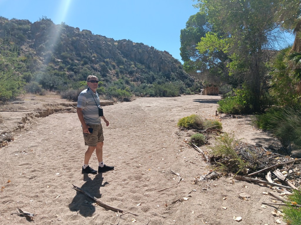
Tiny Simon.
With so much dense foliage around, and this being a desert, we did wonder what might be lurking in the underbrush or clinging to tree branches, but we set that aside and had a nice little wander, admiring the dry wash that ran through it while also bearing all the Flash Flood Danger signs in mind.
As pretty as the oasis was, it must be even more spectacular when this wash is flowing.
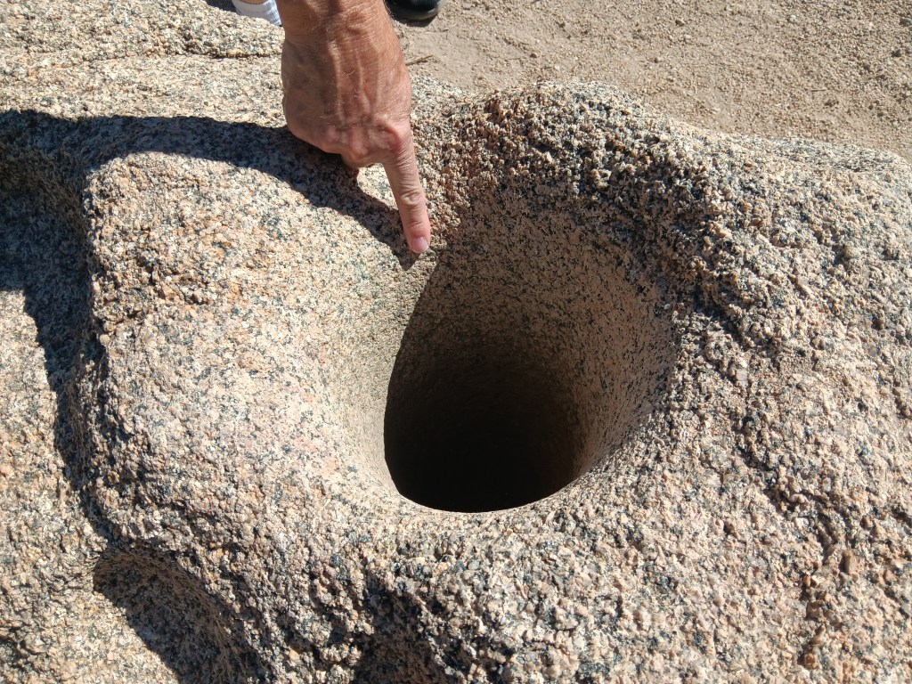
Fascinating signs along the oasis’ pathway described how the Cahuilla Indians who lived here used desert plants for food and medicine, and evidence of their daily lives remains, through mortar holes ground into granite rocks. The holes are so deep we could put our hands into them, nearly up to the elbow. Imagine how long it would take to form a hole that deep when grinding seeds for food.
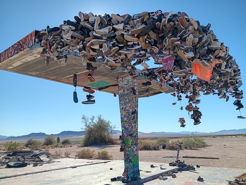
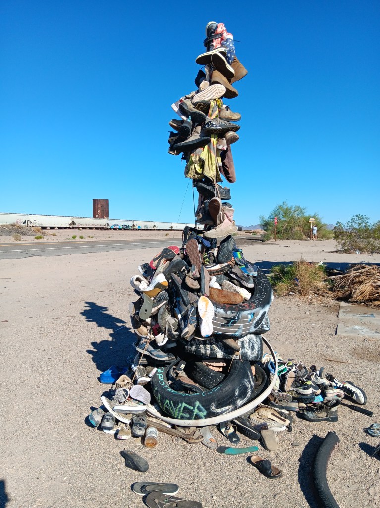
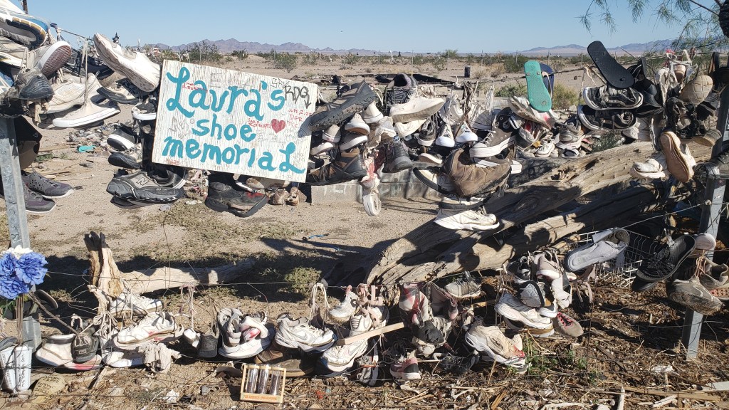
On the return journey back to Laughlin, we had the same mind-numbing emptiness along Highway 177 as we’d had on Highway 62 on our way out, with two major exceptions. Out in the middle of absolutely nowhere were two roadside curiosities. Hundreds of shoes, most tied together in pairs by their laces, some just singles, and some nothing more than the sole of a shoe, were thrown over a metal structure and a fence, or strewn across the ground as if blown down by the wind or left by a careless owner.
There’s no way you can drive by something like this without stopping.
Fledgling shoe tree.
One side of the big shoe fence.
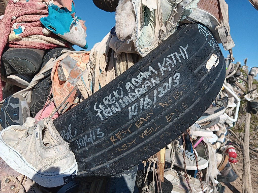
Other travelers had stopped, too, and we all wondered what it could mean. The trash and broken glass scattered around the place suggested a festival of some sort had taken place, but signs and signed objects indicated grief. Many shoes were signed with, presumably, their owner’s name, but other objects included comments such as “Rest easy,” or “R.I.P., Forever in our hearts” or the grief-ridden, “I love you, my boy, my son.”
It began to dawn on us that these could be memorials to young people who had passed during their school years, or shortly after, and the shoes were a way to show respect for their memory.
There were no schools nearby, and no town, nor even any buildings. Was the road a hazard? Did local teens dare each other to take on the desert the way only those who feel they have lots of time and are somewhat invincible could do? What happened here?
When we returned to our dear Fati we looked it up, and it turns out these shoe memorials are mainly just due to people passing by who throw their footwear over the metal “tree” or fence, presumably to combat the utter boredom of driving along that vacuous road. No one perished along the highway, though some deaths were remembered there.
We could see how people might die in Mojave, however, if they’re ill-informed or careless. At the same time, the desert held a quiet beauty for us; a beauty that was subtle and odd and blistering. We left thankful that we did not die that day in that fierce and wonderful place.
At the start of our journey, we had five California national parks on our itinerary. Once we were within striking distance of The Golden State after modifying our route, only two of those parks remained viable.
Yosemite, Sequoia, Death Valley, Mojave Desert, and Joshua Tree were high on our list of parks we were most excited to see, but from our base in Laughlin, Nevada, the logistics – and Hurricane Hilary – came into play.
We had spent the last several weeks working on a plan that would allow us to make two overnight trips into California in Nippy, first to Yosemite and Sequoia, then to Joshua Tree and Palm Springs, along with a day trip to Death Valley and a day trip to Mojave Desert.
We won’t put you through the mental gymnastics we performed, but will only say it just wasn’t feasible. With various road closures, Sequoia and Yosemite were too far for a single overnight, and Death Valley was closed completely due to damage from Hurricane Hilary.
This isn’t a national park. It’s our lunch in the Mojave Desert. We are (and by “We are,” I mean “Susan is”) posting it only to prove we do sometimes eat real food whose ingredients go together. I’m also posting it because I don’t have any other photos that would be appropriate, and I’m tired of posting photos of rocks.
When our year on the road ends, it doesn’t mean we’ll never travel again, we decided, and we would put Oregon, Washington, and California on the menu for a later date, to enjoy them fully and at leisure. Problem solved.
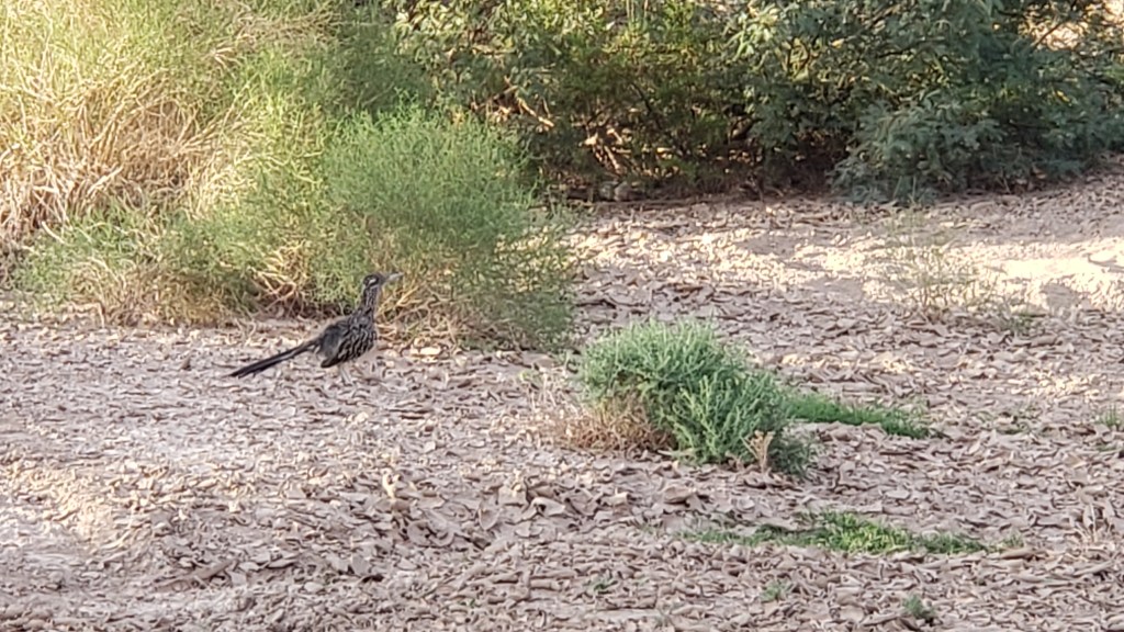
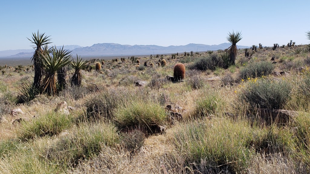
Mojave Desert National Preserve was only 51 miles from Laughlin, barely time to get Nippy’s engine warmed up. Neither of us had any real idea of what to expect, but we did hope we’d come across another roadrunner, a bird Simon was eager to see. We’d spotted one at Davis Dam in Laughlin but, as everyone knows, one roadrunner sighting isn’t enough.
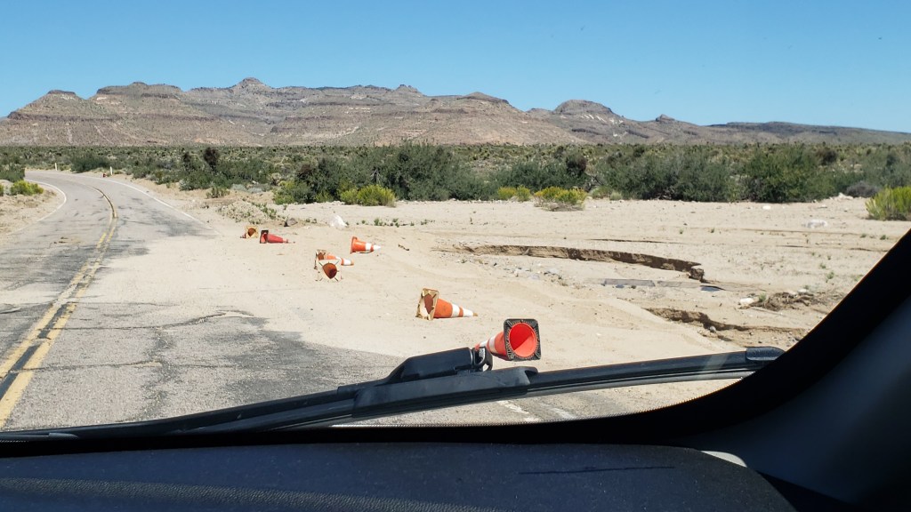
There was still evidence of water damage from Hurricane Hilary when we entered Mojave Desert National Preserve at Hole-in-the-Wall, named for the rocky hillsides that look like Swiss cheese.
Messy, but passable.
Swiss-cheesy rocks
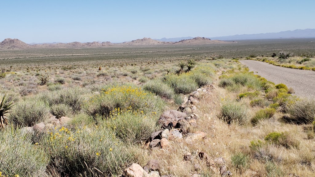
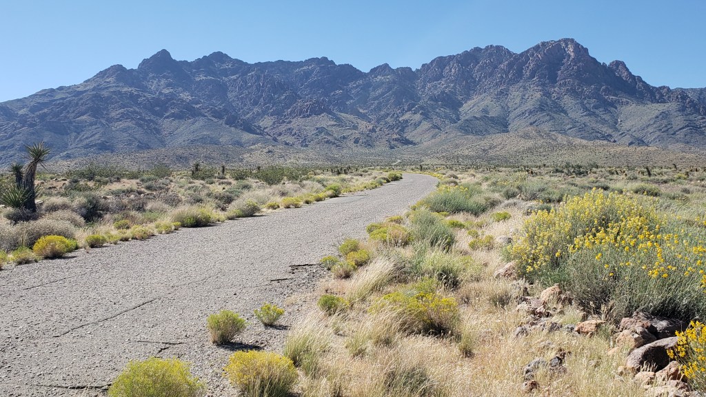
There were also no-go areas that were under construction or prohibitive due to a fire, and many roads were only accessible to four-wheel-drive vehicles, so our options were limited. But our goal had really been to see the desert, and we’d certainly get a flavor of it with the driving we could do.
This goes on for 1.6 million acres, and spills out to a whole lot more of southern California.
We thought the desert would be nearly all sand, but it was surprisingly vibrant.
Those brown cactus kept fooling us into thinking there was a large mammal grazing in the distance. They sort of look like baby Wookie penguins up close.
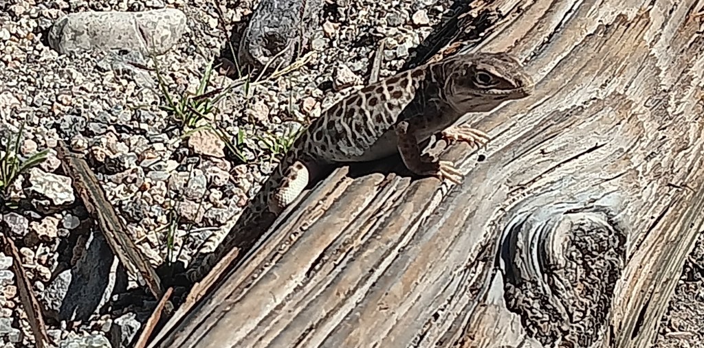
This little fellow greeted us at the Visitor Center, and wasn’t at all shy about posing for the camera.
We didn’t see any roadrunners, but we did have a wonderful wildlife sighting, which capped off the trip perfectly. The Desert Tortoise is a threatened species, so it felt quite special to see one, especially at such close proximity.
Click on photo to view video
One of the most popular reasons for visiting Mojave Desert is the Rings Loop, a hike which includes an ascent through the tight Banshee Canyon using metal rings embedded into each side of the narrow rockway, but Ruthie couldn’t do that because she doesn’t have opposable thumbs.
Rings Loop Photo credit U.S. National Park Service
The Lava Tubes are another major draw, but due to damage they are now accessible only by four-wheel-drive, so the man at the Visitor Center suggested a side trip to Kelso Dunes, further west along Highway 40. The loss was softened a bit by having been in the lava tubes at Craters of the Moon while we were in Idaho.
We forgot to take the obligatory selfie at Mojave Desert, so here’s one from Craters of the Moon.
The dunes are massive. Much more extensive than Bruneau Dunes, but also much harder to access. There are plenty of warnings not to enter any road that’s not paved if you aren’t in a 4WD, so again, that particular road was off limits to us.
Roads often start out looking all benign, but can quickly devolve into bone-jarring terrain.
The day had still been worthwhile, and we were glad to have made the trip. To make up for any small frustrations, we had a rockin’ surprise in store when we returned home to Fati.
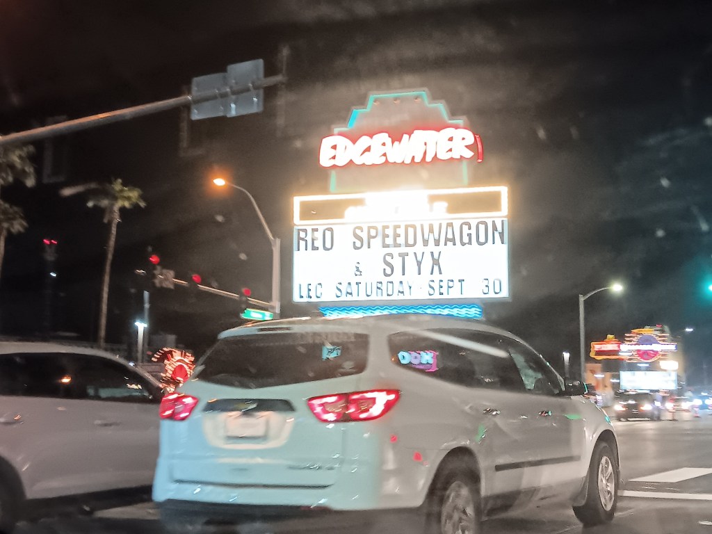
One of the casinos in Laughlin had been advertising a concert featuring REO Speedwagon and Styx (for those born after the turn of the century, these were popular rock bands from the ancient days of the 1980s). What we hadn’t realized was, it would be an outdoor concert just up the road from our campground, and we’d be able to hear every single note from our living room.
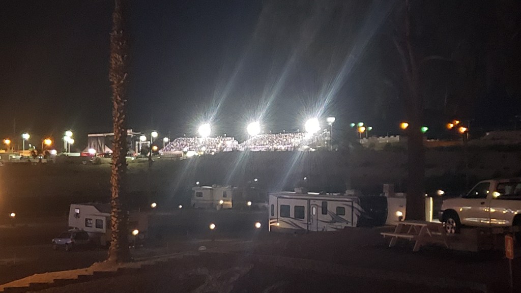
It occurred to us we might have an even better view if we drove over, parked nearby, and walked up to the venue, but the police were out in full force at barricades to the road the stadium was on, so that was a big “No.”
We sat in a parking lot just across the street, but it quickly dawned on us the wind was blowing in a direction that favored us returning to Fati, where we could hear each song clearly, have our own clean bathroom, and enjoy a beer for less than $15 a pop. Rock on, Team Veness!
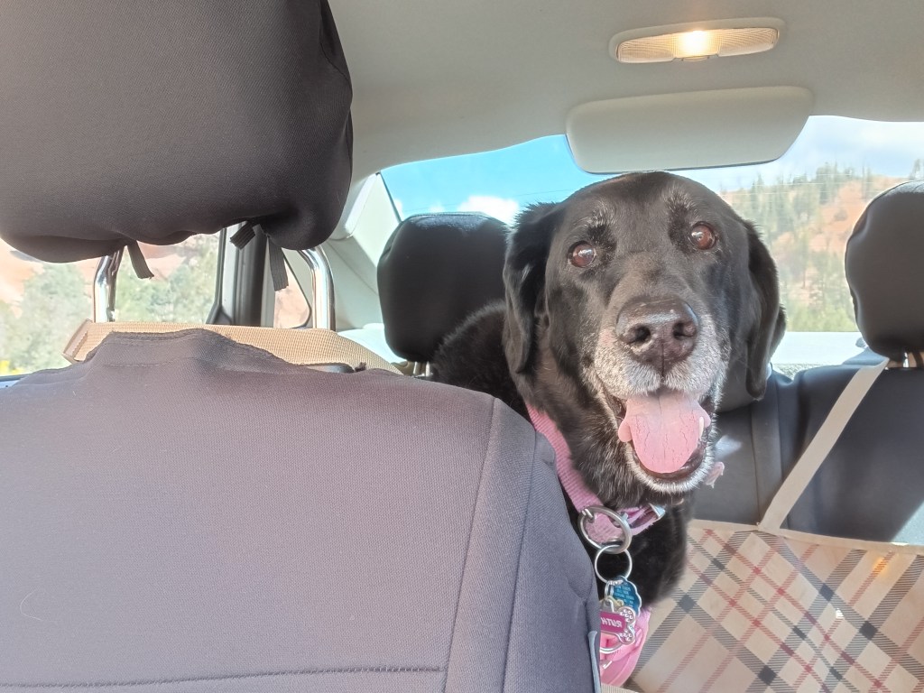
Throughout our journey, we’ve had to modify our plans around Ruthie, and we’ve done so happily, since one of our goals was to give her the best of what time she has left. Another one of our goals was to see as many National Parks as possible, and in Southern Utah those two desires collided.
“I’ll go wherever you take me!”
From our base in Cedar City, we were 77 miles from Bryce Canyon National Park, and just 20 miles from Zion National Park, two places that were high on our list of must-do experiences. They were places Susan’s parents had really enjoyed and, because of that, they had an emotional pull, too.
Grand Staircase Escalante National Monument and Capital Reef National Park were also on our radar, but after much discussion we came to the conclusion we couldn’t do everything or we’d end up frazzled and exhausted…again. So Bryce and Zion were “it.”
But not so fast.
Before we visit a place (usually months or, in some cases, years) we do our research. When it came to Zion, however, we’d dropped the ball. In some places, rules changed with the pandemic and, from March to November, Zion can only be visited via shuttles. No-dog shuttles.
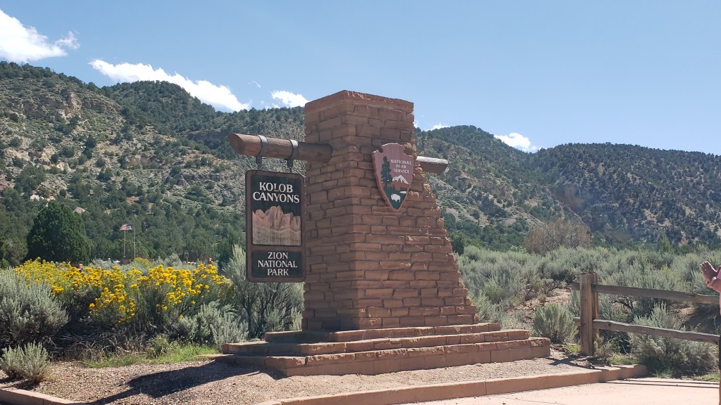
The single exception was Zion’s Kolob Canyons on the north end of the park, and with that, the plan fell into place.
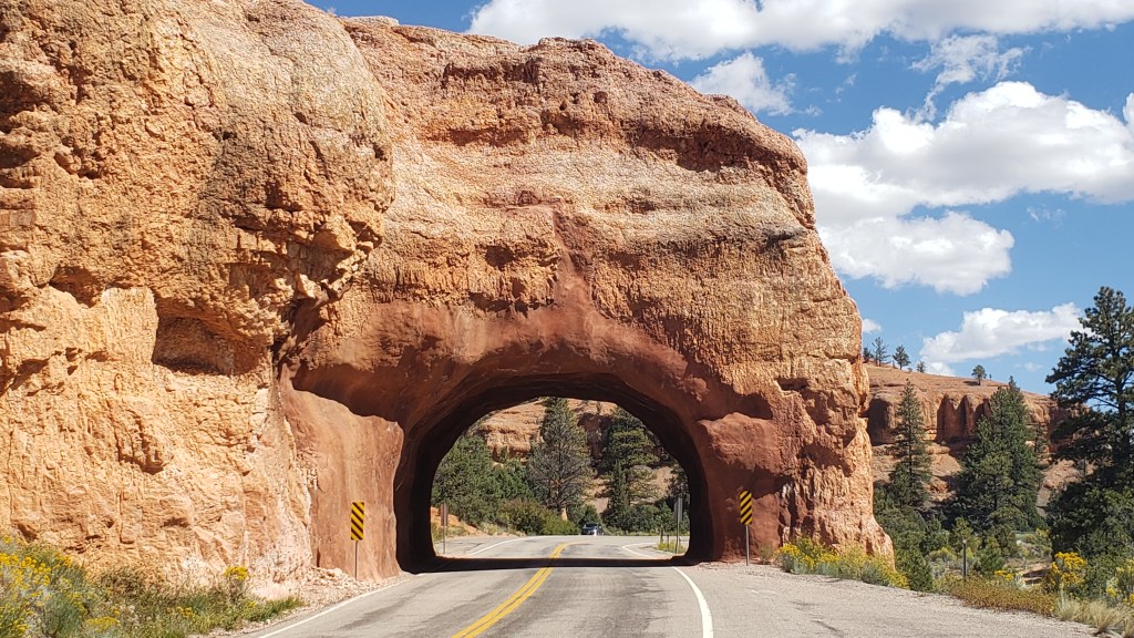
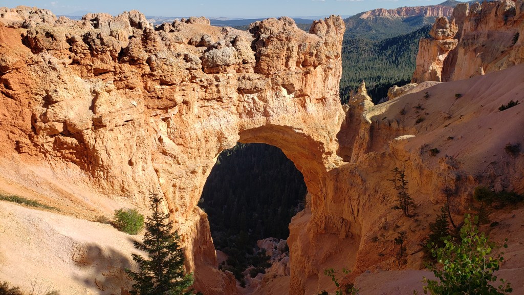
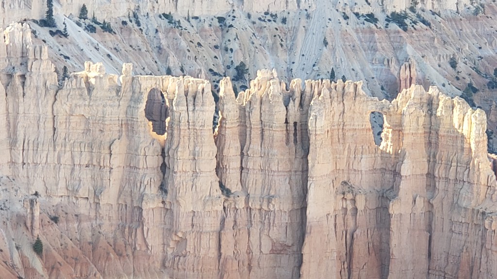
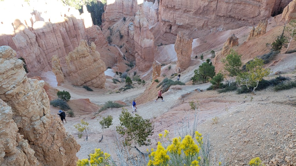
Bryce Canyon contains the largest collection of hoodoos in the world, and while we’d seen a LOT of canyons over the past weeks, this one promised something different. Even before we reached the park, we passed through the ridiculously gorgeous Red Canyon on Scenic Byway 12, which almost would have been enough on its own.
Not as small as Needles Eye, but still rather exciting.
From the Badlands in North Dakota to Utah’s magnificent landscapes, we’ve repeatedly said, “How did that happen?” The short answer is, wind, water, and time. The longer answer in Bryce is, its distinctive formations began as flat rock on an ancient sea bed, uplift of land that created plateaus, which then weathered into “walls” with vertical gaps between them, then into “windows” (big holes in the rock, like we saw in Arches), and finally into the oddly-shaped, sticky-uppy hoodoos we see today.
Each of the park’s overlooks offered a different perspective:
Natural Bridge (elevation 8,627 feet) is an example of the “window” phase of the plateau’s erosion.
Obligatory selfie.
Hoodoos taking on their distinctive shape.
The park’s crownlng glory, Bryce Amphitheater. Click on photo for video
A pathway leads to the floor of the Amphitheater, but with temperatures at the summit in the 90sF, neither of us were prepared to endure the heat in the canyon.
We were put to shame when we caught sight of a bride and her groom hiking back up, with a photographer in tow. Anyone who has ever worn a wedding gown knows what a feat this was for the bride.
Everyone at the overlook clapped and wished them well as they rejoined their wedding party.
Kolob Canyons in Zion National Park was even more straightforward. An easy drive, entry with our America the Beautiful pass, and we were in. But only for three miles, as the scenic-drive road in the park was damaged due to a weather-related rock slide.
Ruthie really appreciated the cooler wind blowing through the canyon.
These 2000-feet-high canyon walls were pretty much all we could see, having walked a short stretch of the road beyond the barriers that were put up to prevent car travel.
It was a very limited way to appreciate Zion, but sometimes that’s how it goes, and with all the rock walls we’d seen in Utah, life was still worth living.
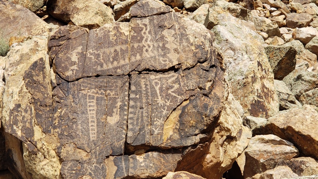
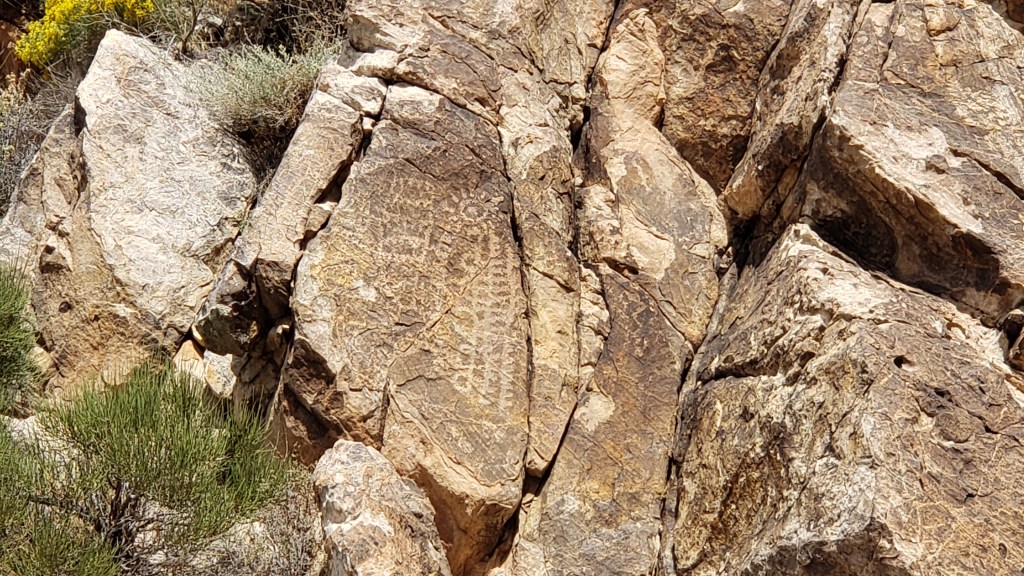
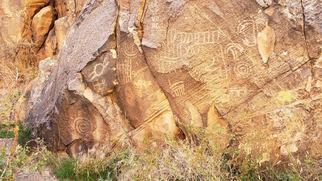
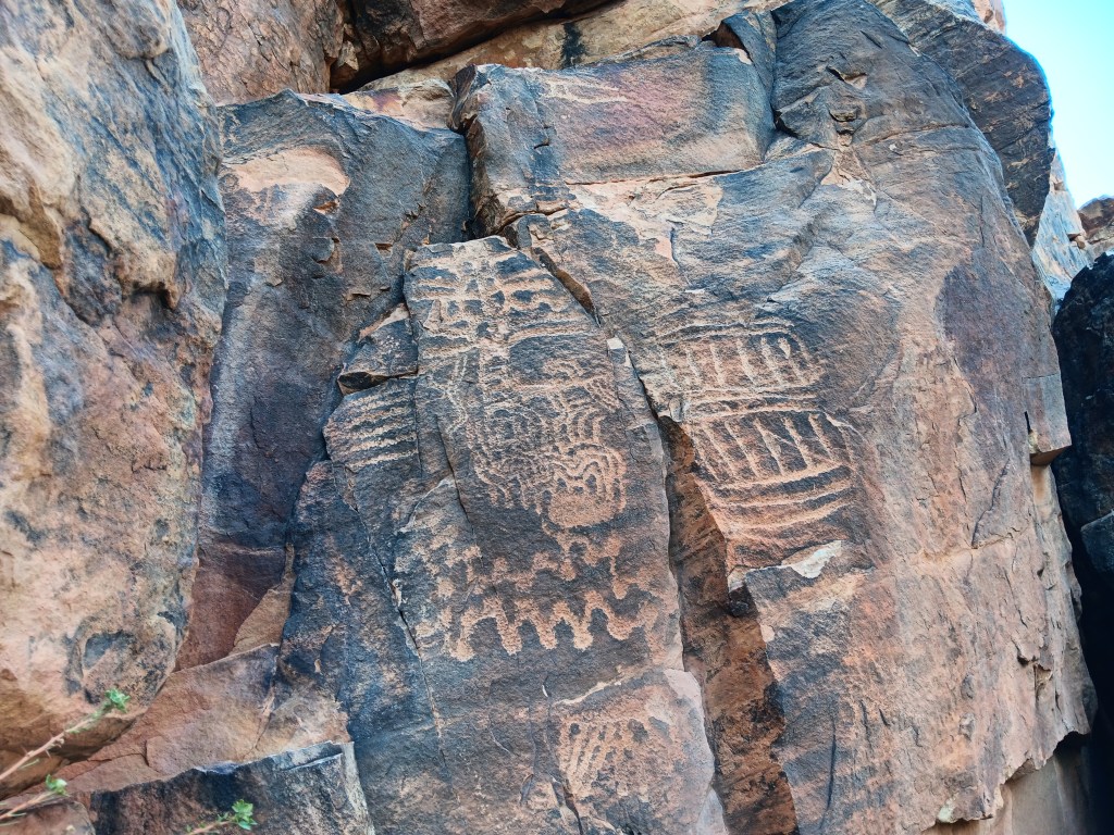
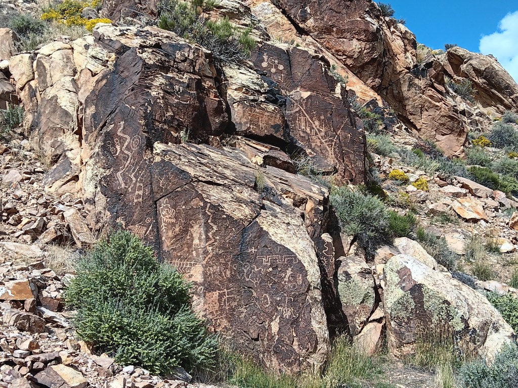
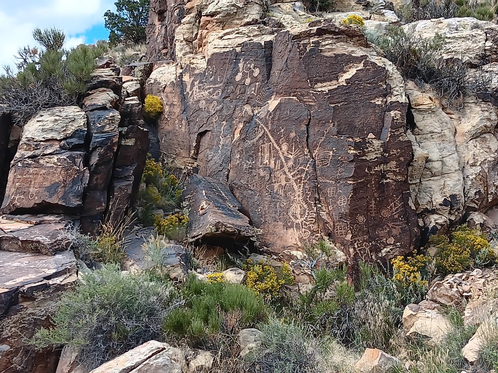
The next day we pointed Nippy north for a trip to Parowan Gap, a wind-and-water-created hole through a mountain that was used by Native Americans who left their stories etched into the deep crimson walls. And it was these petroglyphs that drew us to the area.
Other than three kids on motorbikes racing down the road, the gap was absolutely still and silent. We clambered around enjoying the petroglyphs, wondering at their meaning, and, in that stillness, it was easy to imagine nomadic tribes pausing to rest, play, soak up the beauty, and go about their daily lives.
The petroglyph roughly in the center of the photo is now called the Zipper Glyph, for obvious reasons. Its meaning isn’t known, but it’s thought to be a marker of travel days, first one way then another, from the summer solstice (the circle at the bottom). It may have been used as a means of tracking where game would be throughout the seasons.
As we stood admiring a particularly large set of petroglyphs, the most haunting, soul-stirring sounds of an ancient flute melody gently caressed the breeze, and for a moment we could imagine it was an echo of the people who used the area for a thousand years.
Turn your volume up, listen closely, and you can hear the flute. Click on photo for video
Instead, it was Michael. Michael comes to the gap now and then to play his hand-carved flute, because, he says, he likes the acoustics.
The spirits of those who once passed through here like Michael’s playing, and he has had several encounters with them, he told us. It was easy to believe. Even Simon, who holds no particular belief in such things, agreed there was something special –and spiritual – happening in the gap.
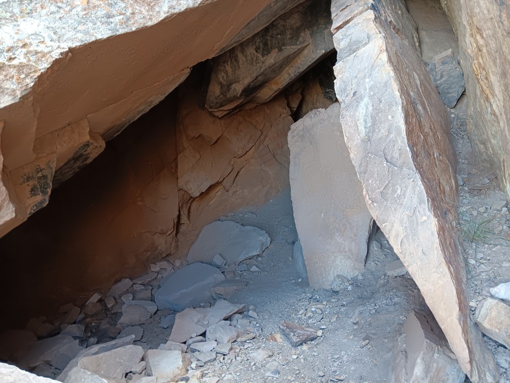
This cave entry leads to a place where the tribes’ shamans meditated during their time here.
I’m tempted to stop this blog here, and just bask in the memory of such an extraordinary experience. We did have a rather startling return trip that included an unexpected climb up a mountain range to a ski resort town called Brian Head (elevation 10K+) and a journey through Cedar Breaks National Monument…
…but let’s just let the memory of the flute music sooth us into a happy stupor, and call it a day.
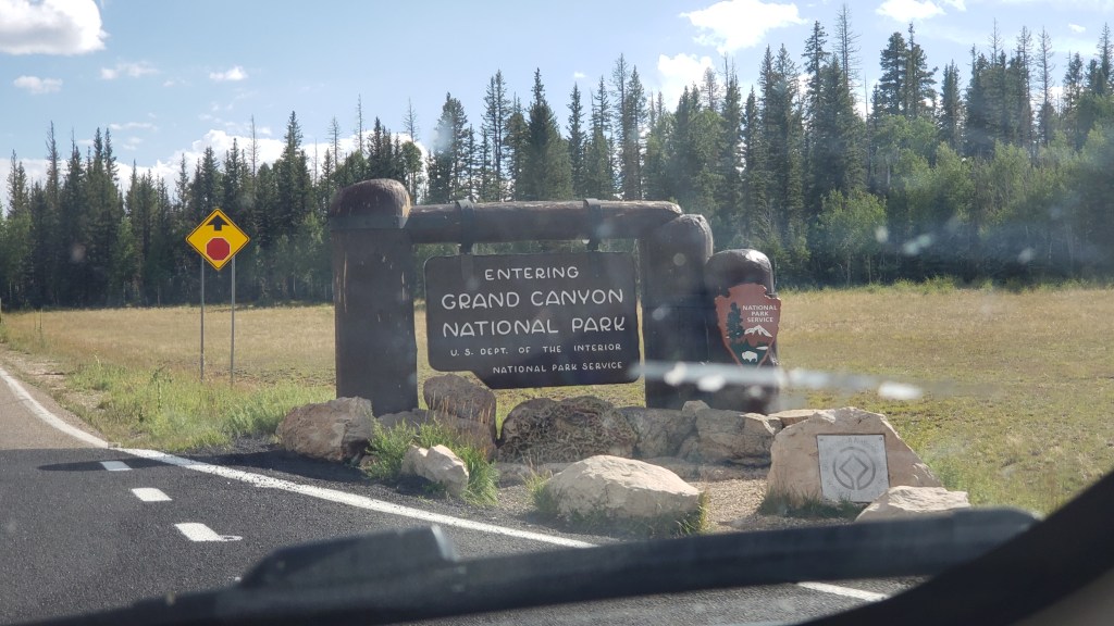
Simon had been to the Grand Canyon, but Susan had not. The South Rim was on our schedule, but with the change in our itinerary in Month Two, we now had the option to fit in the North Rim as well. Could we make it happen from 156 miles away? You know we could!
Donkey’s years ago (“a long time ago” for our U.S. readers), Simon visited the South Rim during his first trip to the States. We had heard the North Rim was pretty special, and much less crowded. While it would be a very long day, we agreed to make the trip, reckless vagabonds that we are!
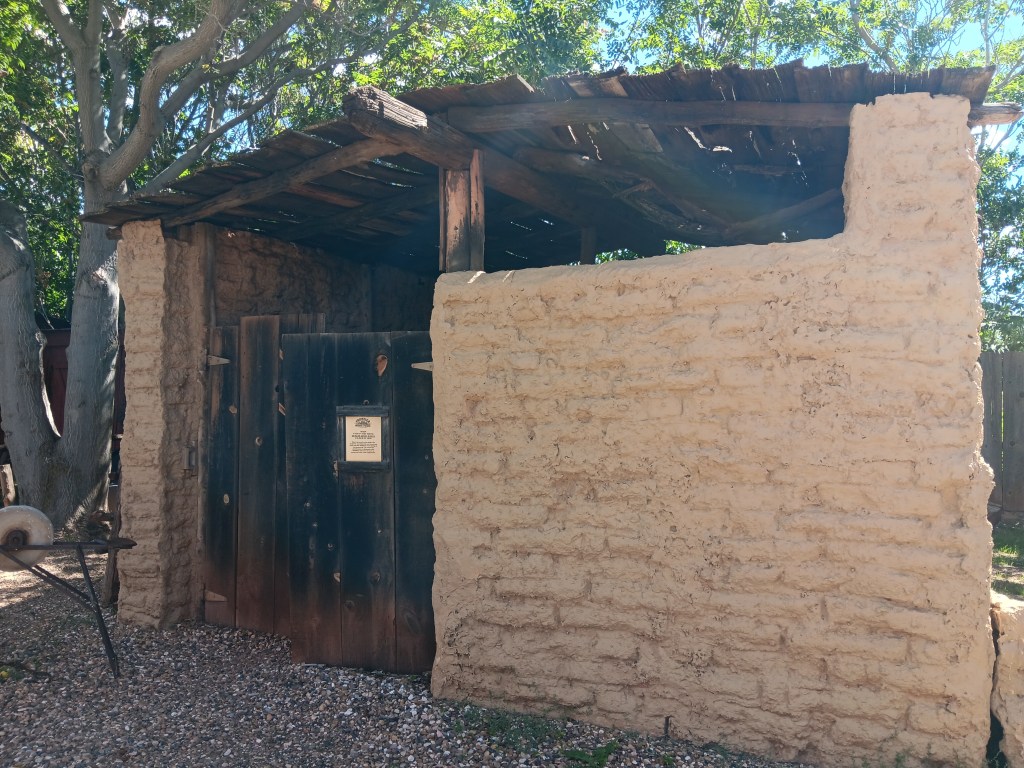
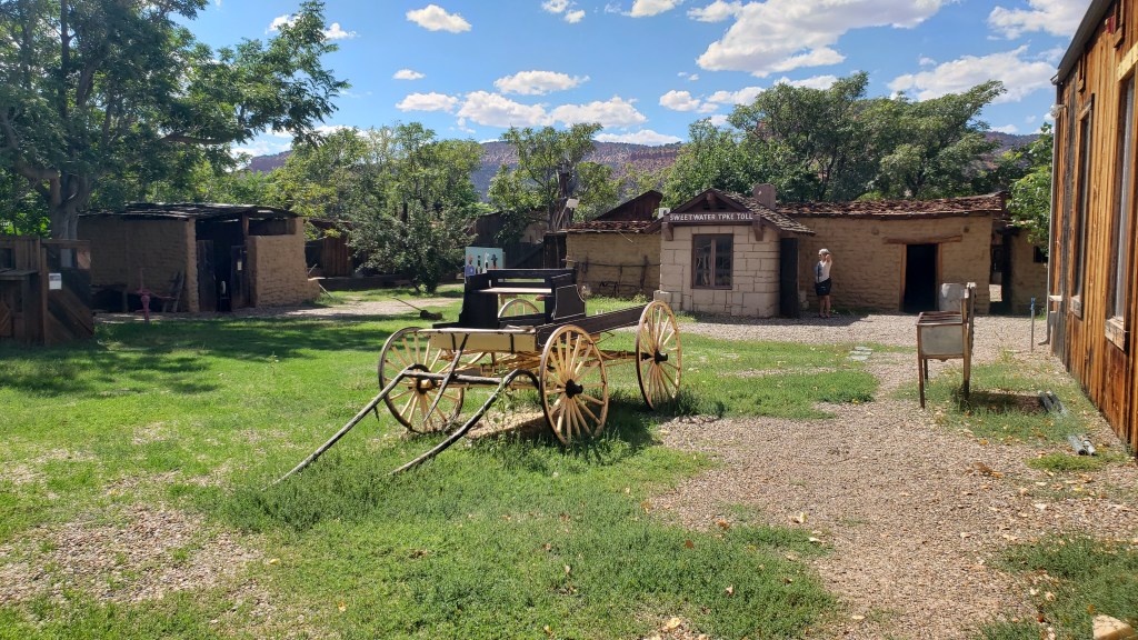
Our dear friend Richard recommended a stop at Little Hollywood Land in Kanab on the way to the North Rim, for its Western movie props. Simon was all in; he absolutely loves that sort of thing.
Little Hollywood is as kitschy as it comes. Homespun, quirky, it’s a curiosity for those who don’t know the old Westerns well, and if the AARP-aged man visiting with his son and pointing out all the little details is anything to go by, it’s a delight for those who do.
Some of the movie location props we saw were:
The backdrop for Kenny Loggins Live from the Grand Canyon concert in 1991
The barn and homestead sets used in the Clint Eastwood movie, Outlaw Josey Wales
The barn
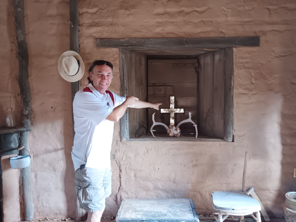
Inside the homestead
Simon, pointing at the cross-shaped window that featured in the movie’s final, dramatic gun battle.
And many more, along with a smattering of atmosphere props
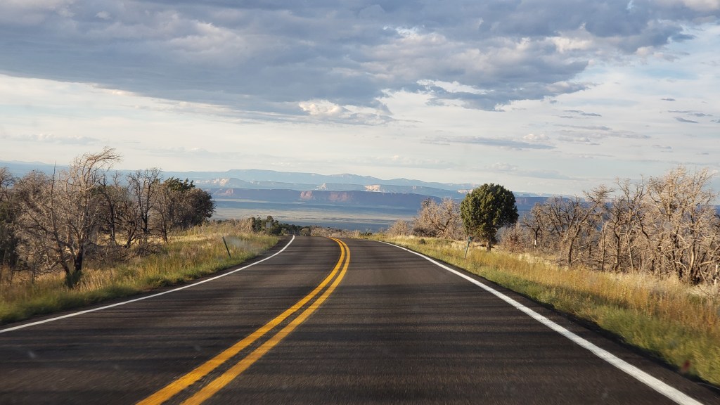
The drive to the Grand Canyon felt like it took forever once we left Kanab. This is pretty much what we saw the whole way:
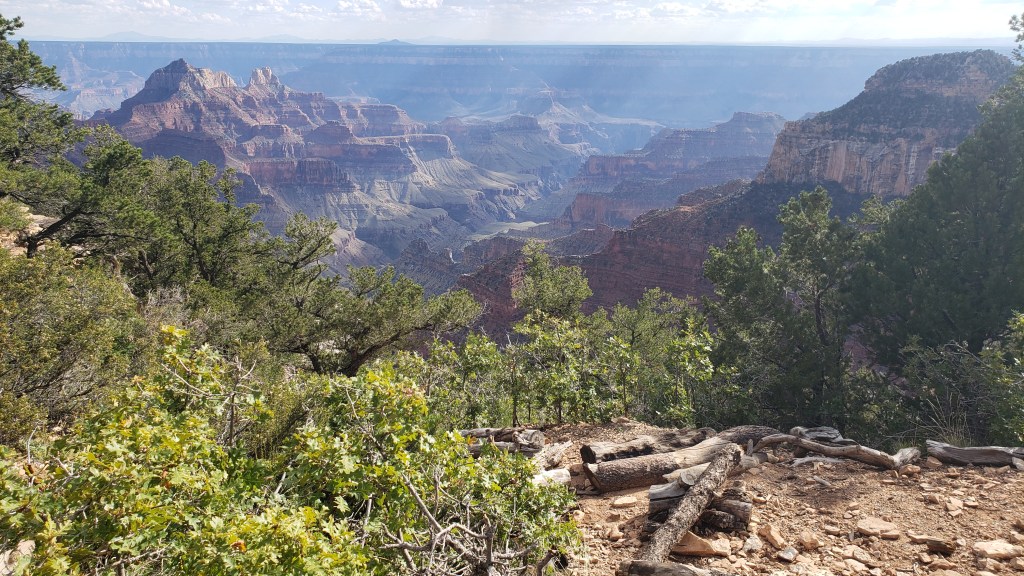
But once we arrived, the WPM (Wows Per Minute) cranked right up. We took the advice of previous visitors and made the drive from the entry straight to the end of the scenic road, then drove back and stopped at the overlooks, which were now on the right-hand side of the road, saving us from having to cross traffic to get to them.
It was the right decision. There was some pretty dicey roadway those last four miles, with big drop-offs and no guard rails, so it was better to get that over with quickly so that Susan could enjoy the rest of the visit.
Again, it’s impossible to get the scale. You’ll see people part-way into this video, which helps give some perspective.
Click on photo for video
The “mood” of the canyon changes, depending on how the light hits it, and this has always been something that intrigues me (Susan). Some might say I relate to “moody,” but that’s a discussion for another time.
Simon scampered around the park like a squirrel on a mission, taking all the narrow pathways and leaning out over all the railings, and as part of his exploration he discovered a room inside the lodge where guests staying at North Rim check in for their accommodation.
The room had huge windows overlooking the canyon, and while it was right on the edge of a drop-off, like most overlooks are, he took me by the hand when I returned from getting Ruthie settled in the car with some water, and said, “Come see this.” I’m SO grateful for that loving gesture, which gave me a view with a sense of safety.
This is an incredibly proud moment. Tears may have happened.
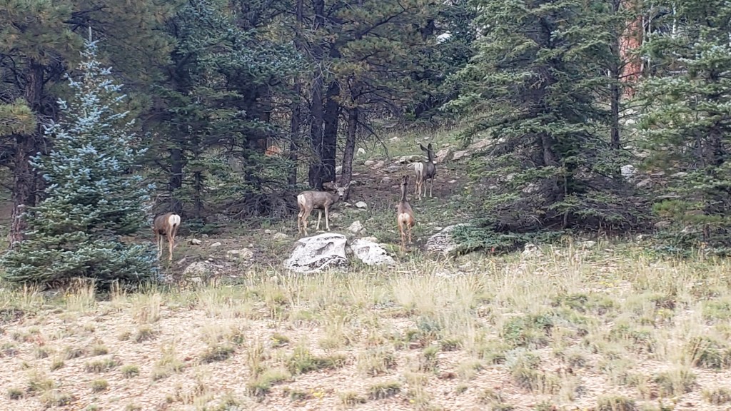
On the way out of the park we were treated to a wildlife sighting, which capped off the day just right.
Mule deer doing mule deer stuff
We had two more major National Park experiences coming up, and one unexpected mini canyon. While it was nowhere near as grand as the Grand Canyon, the emotional impact of little Parowan Gap would prove immense.
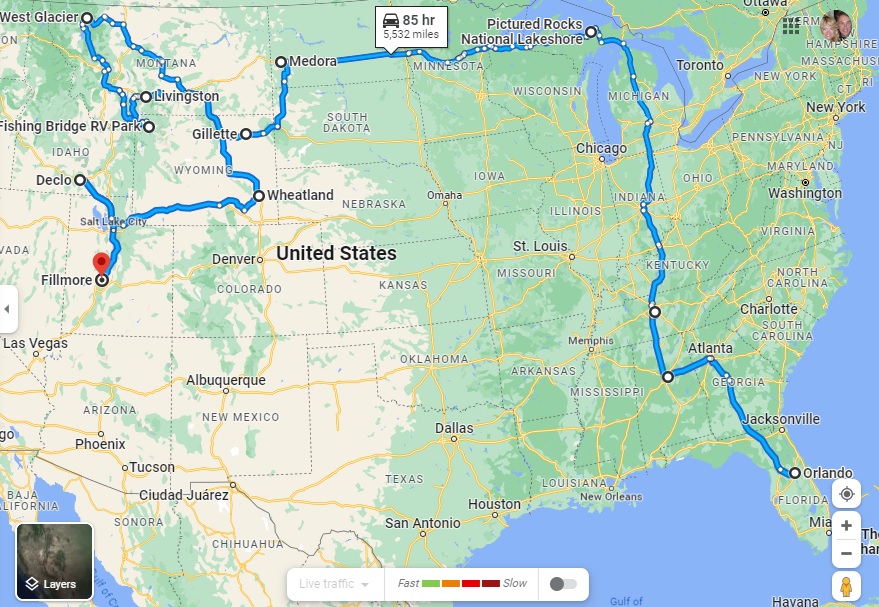
Highlighting our fourth month on the road and the route so far – all 5,929 miles of it
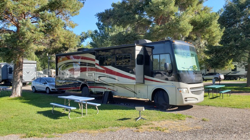
After three months of fairly hectic traveling, our four-month mark shows that we have come the shortest distance for any month of the grand RV trip to date, from Wheatland in Wyoming to Fillmore in Utah (via what looks like a strange detour to Declo in Idaho, but which was the best way to see some of Idaho without putting too many miles on our RV).
Our mileage for Month Four was therefore just 868 miles, compared to 1,318 last month, 1,239 in Month Two and a whirlwind 2,504 in the opening month.
The total distance in Indefatigable (or Fati for short) since we left Orlando is now 5,929 miles.
The slower pace has been deliberate, of course. We realized that we were trying to pack too much in to this crazy 10-wheeled adventure and we have purposely changed both our itinerary and our pace of travel to avoid the mental and physical breakdowns we experienced in the first two months.
The key has been to identify an area that allows us to explore in multiple directions for a week or so, and then use our tow car, Nippy, to do more of the exploration.
To that end, we have actually gone an additional 9,621 miles in Nippy in those four months, almost 3,000 of them in the past month alone. That total includes a spur-of-the-moment trip into Canada from Montana, our overnight excursion to Rocky Mountain State Park in Colorado and an extensive day trip to the Flaming Gorge in Utah, both from Wyoming.
Our total mileage for the trip so far is therefore a whopping 15,550, or 3,887.5 a month!
The next month could see us top that record for Nippy, too, as we plan on basing ourselves in southern Nevada for trips into Southern California. As ever, this is an – ahem – moveable feast, but you can be sure to read all about it here!
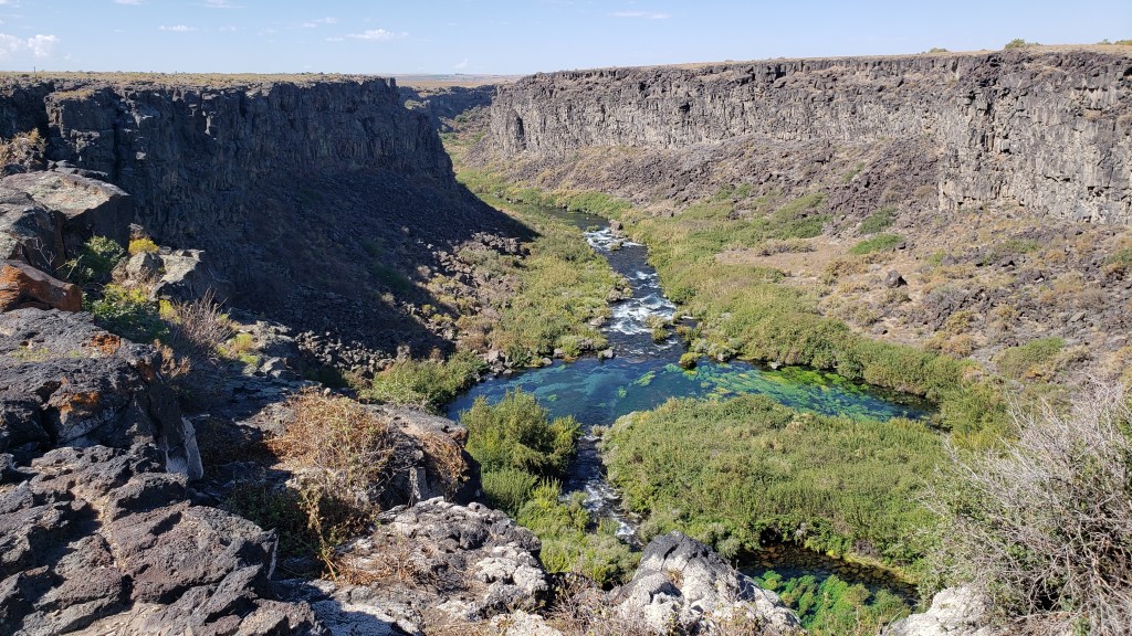
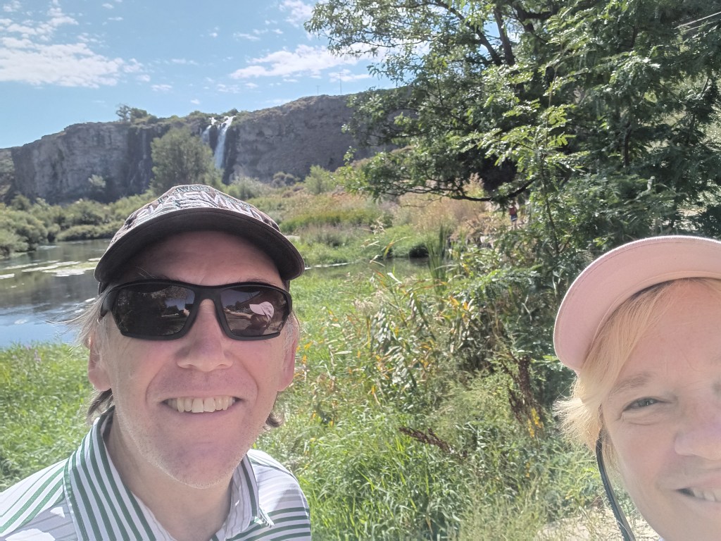
If there’s a massive crack in the earth, Simon wants to explore it. Southern Idaho seemed to be riddled with them, from the modest Box Canyon to the gargantuan gorge in Twin Falls, a rift so long and deep it had become a world-renowned location for the extreme sport of Base Jumping.
We had a long day in store as we left Fati at the campground and drove west, with Box Canyon State Park, Thousand Springs State Park, and Bruneau Dunes (the tallest single-structure sand dune in North America) as our goals.
Box Canyon State Park proved to be more of an overlook than an actual park, what with being surrounded by cow farms and having nothing but a porta-potty at the dirt parking lot, though if we’d had the inclination we could have hiked from the top of the canyon to the clear, bright-aqua waters of the river below. But you already know that’s not something we could (or would) do with a senior dog in tow.
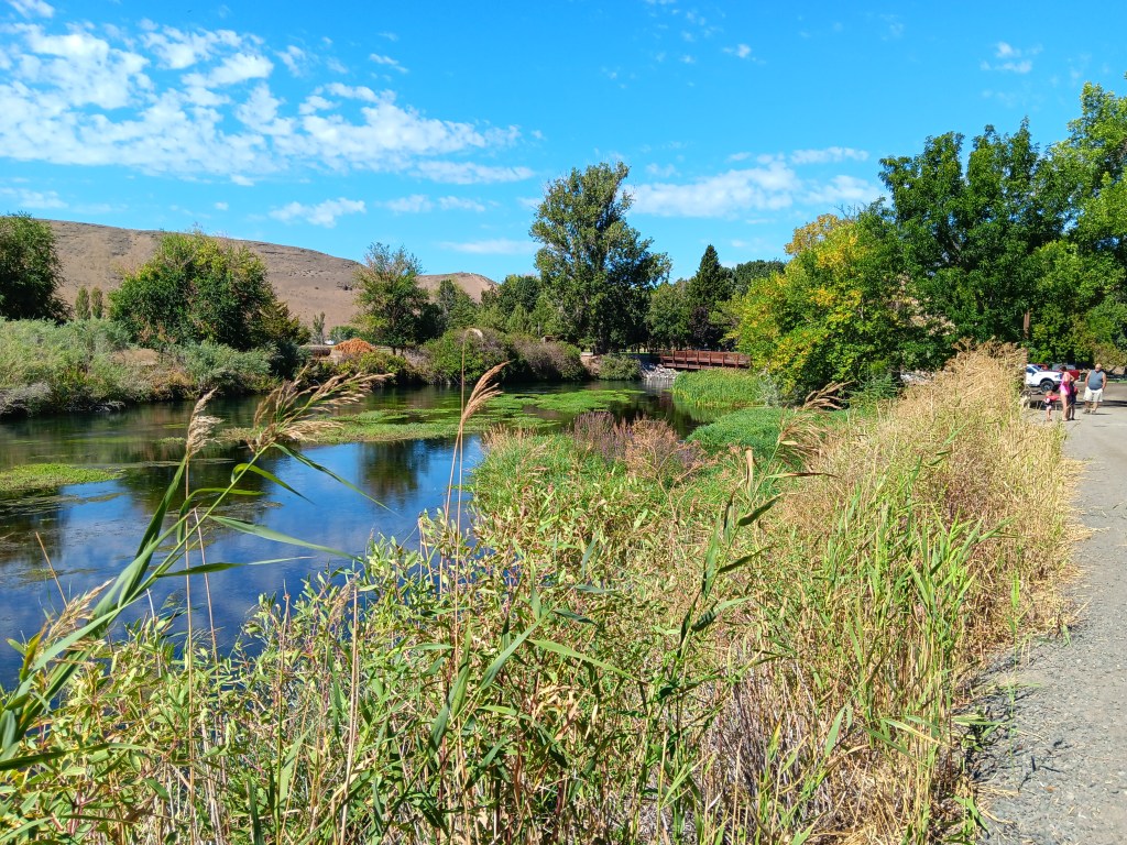
Thousand Springs also found us wandering aimlessly. The road down to the springs was steep and winding, and either a thrill or unpleasant, depending on which one of us you ask. But as so many locations we’d visited in Idaho had done, this one closed on Labor Day, which was the day before our visit.
We enjoyed the falls, just to say we’d done something, then headed to the day’s headliner attraction.
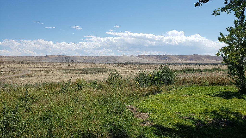
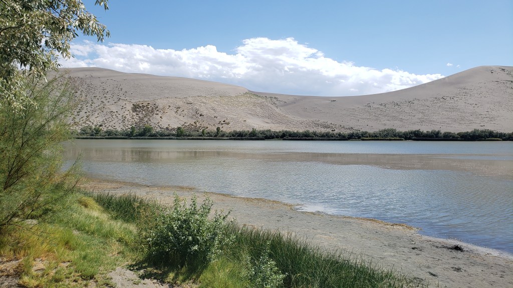
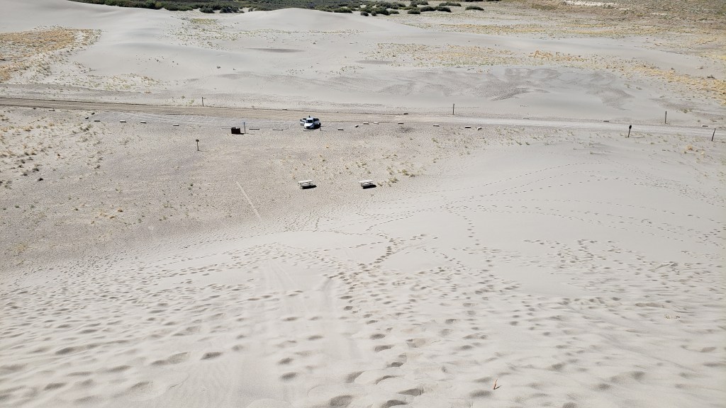
Along with Craters of the Moon, one of our original must-see locations in Idaho was Bruneau Dunes State Park, where our plan was to rent a couple of sand sleds, climb to the top of the dunes, and freewheel our way back down, with me sitting on a board with Ruthie on my lap and Simon taking the plunge wakeboard-style.
The dry, gravely landscape and fascinating trees reminded us of our trip to Botswana, where Simon went to school for a few years.
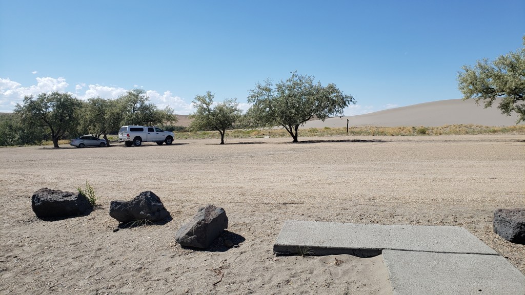
It was a ridiculous idea. Sure, the sand would probably prevent any broken bones when we came crashing down, but one of us was bound to get injured, and Ruthie would never tolerate the walk up, or the slide back down. We were saved from ourselves when the early afternoon temperature edged up to 90F, ten degrees hotter than it had to be for the Visitor Center to suspend all sled rentals.
The trip wasn’t a waste, though. We had a nice picnic in the shade of a pavilion by the river, then sweated our whatsits off with a climb up the smallest dune.
Oh, look! Another lunch whose components have nothing to do with one another!
Ruthie doesn’t like it when we’re not all huddled together in a group, and we knew she’d want to follow whoever went up the dune first. So we put her booties on to save her paws from the blistering sand, and told her to climb as high as she wanted to, and no higher.
Click on photo for video
Click on photo for video
View of Nippy from the top of the dune.
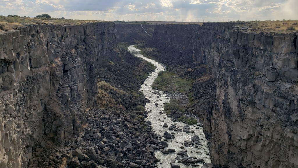
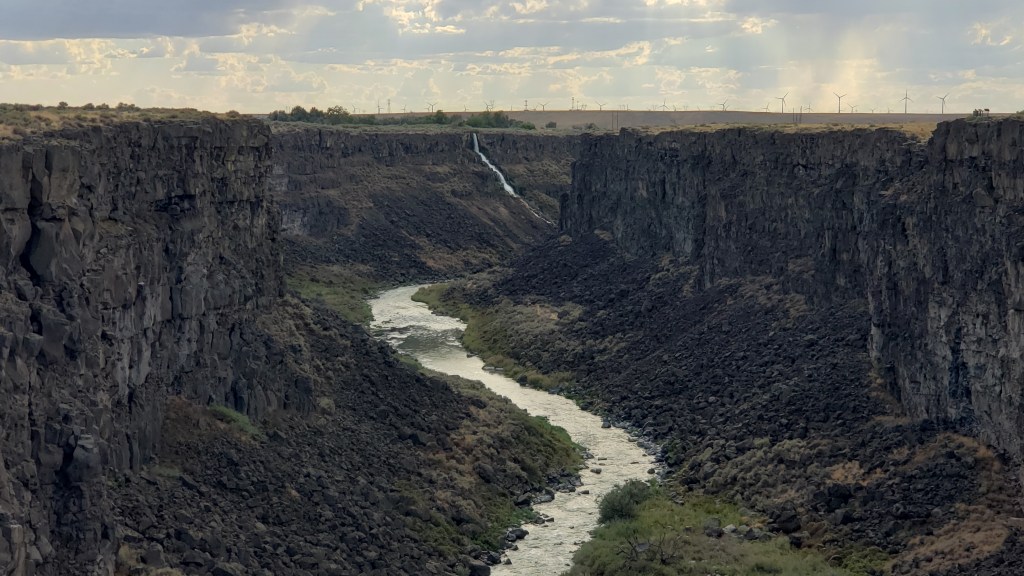
We weren’t exactly batting a thousand in terms of WPM (Wows Per Minute), though we definitely enjoyed what we’d been able to do, so Simon decided a quick detour to Malad State Park was in order, for one more chance to stand on the precipice of a deep crevasse and lean out over it as far as possible.
Here you get some small idea of the length of this gorge, with the tiny white line at the back being a waterfall.
Zoomed in a bit more, you can see the waterfall a little more clearly. We’re constantly amazed at what rivers can do to solid rock, given time.
Happily, there was a long, metal bridge spanning the gaping fissure, which gave him an excellent view of the river below. Ruthie joined him, and her bravery was rewarded with a little butt scritch.
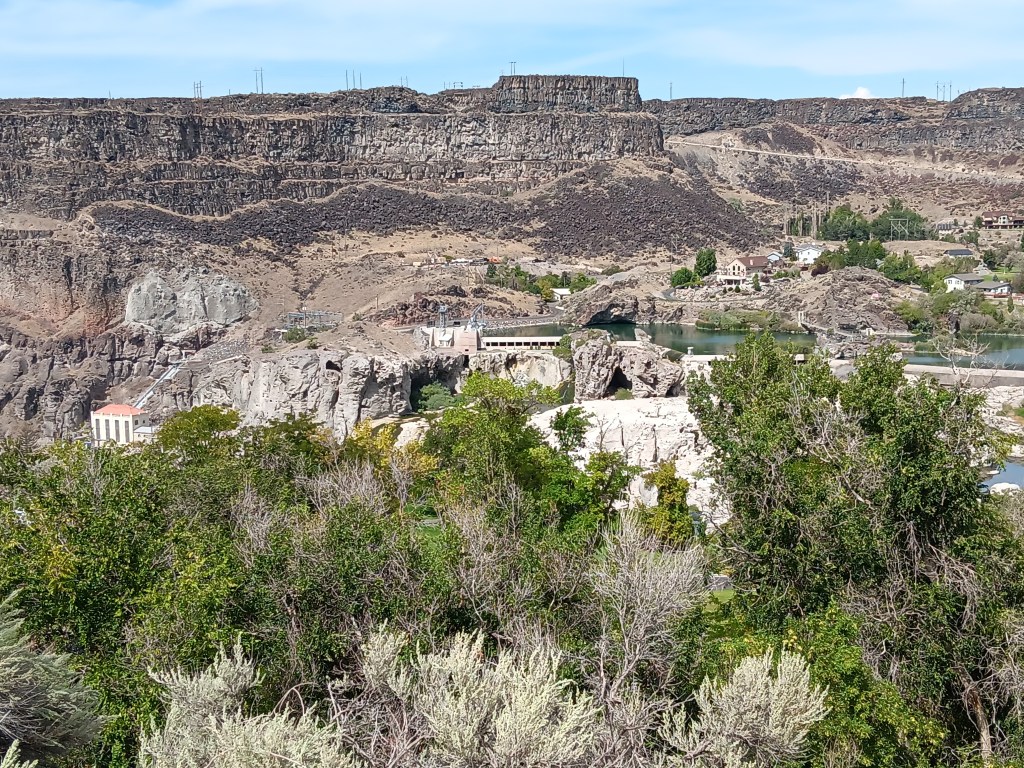
But it was our next day’s trip out to Twin Falls that cranked the thrill factor up to eleven. We knew we wanted to see the famous Perrine Memorial Bridge, and we hoped with all our hearts there would be a base jumper or two.
The bridge spans the Snake River, a waterway made famous by the Lewis and Clark Expedition as they journeyed west in an effort to discover what, exactly, the country had gained through the Louisiana Purchase, and where, exactly, that land purchase ended.
That isn’t why it’s famous now, though, at least not with extreme thrill seekers. Today, it has a well-earned reputation as hallowed ground, being the only place in North American where it’s legal to base jump, year-round.
Our hopes of seeing someone jump were met twenty-fold. All day long there are jumpers taking the dive into Snake River Canyon, either as singles or in tandem, some of them longstanding pros, some entering into it for the first time. Some dove in head-first, others did somersaults, but however they left that ledge, it was massively impressive to spectators lining the stone wall along the edge of the gorge.
Click on photo for video
You can feel the anxiety in this person before jumping. Click on photo for video
We made it a point to speak with a few jumpers, and hit absolute gold when we met Sam.
Former military paratrooper Sam never said anything about being Tom Cruise’s stunt double, but if he’s not, I’ll eat a pound of liver and onions from a filthy truck stop deli (no I won’t; I’d never do that). He looks like Tom’s twin, he speaks as if he’s dealt with media all his adult life, and he’s possibly the best advertisement for fitness and extreme sports you will ever find.
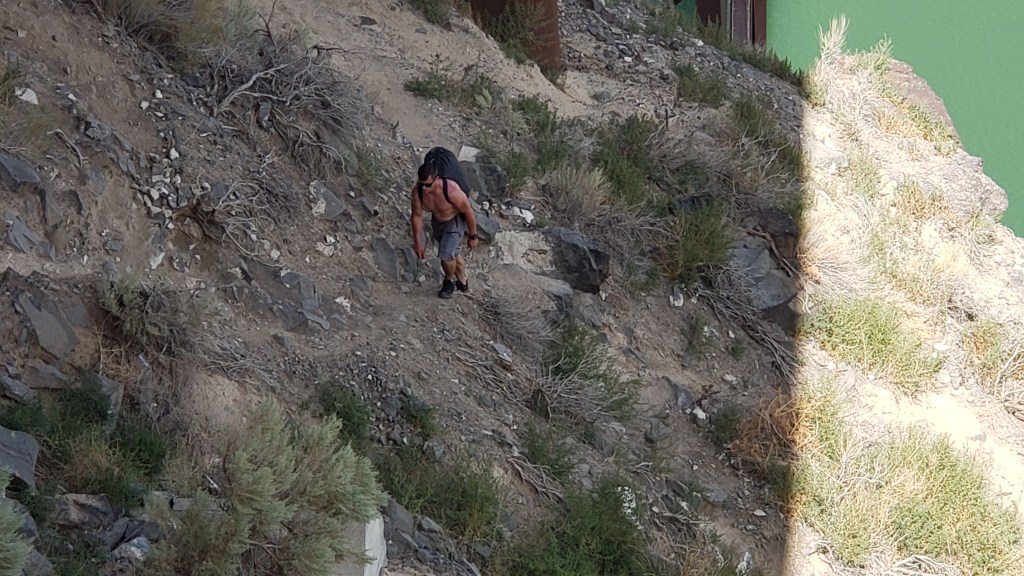
We chatted for about half an hour, then watched him walk out to the middle of the bridge, climb over the railing, stand on the narrow ledge, and swan-dive into the gorge. His parachute opened, and he soared effortlessly to the target point on the side of the river.
It was an astounding feat, but even more incredible was that jumpers then have to repack their parachutes and climb the rocky cliff out of the canyon. Sam scaled the cliff as we looked on, and gave us a final comment as we waved goodbye. “That’s the hard part,” he said.
This is Sam. Sam just jumped. Sam is now hiking up a 5,500-foot gorge. Strive to be like Sam in all your endeavors.
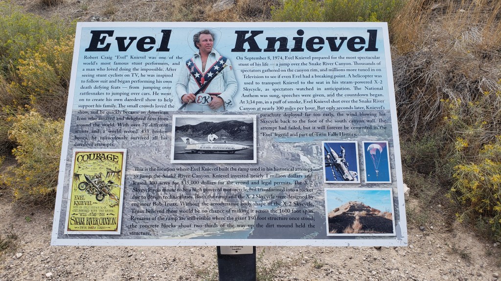
We could have watched all day, but it was getting a bit too hot for Ruthie, so we cranked up Nippy’s A/C and drove to the nearby Evel Knievel Jump Site. Those of us with birth years starting with the number 1 probably all remember the crazy daredevil whose unrealistic motorcycle stunts led to 433 broken bones over the course of his 15-year career as a performer.
You probably can’t see this photo large enough to read the panel, but somehow we only took a few photos of the site, so this will have to do.
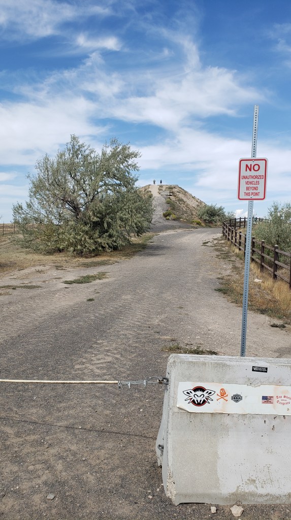
The dirt ramp he used for a jump over the Snake River Canyon in his X-2 Skycycle steam-powered rocket is still there. He didn’t make it from one side to the other, of course, and, as we stood at the top of the jump, we were pretty sure he never really intended to make it.
That hill in the background is the ramp.
He blamed it on his parachute opening right after take-off. We blamed it on the fact that no one with an ounce of knowledge about physics could ever think that ramp was going to be enough to launch him one-quarter mile across the canyon. But never mind; it was an epic stunt, and we were delighted to discover our visit was exactly 49 years, to the day, since that fateful jump which, although he survived it, proved to be his last.
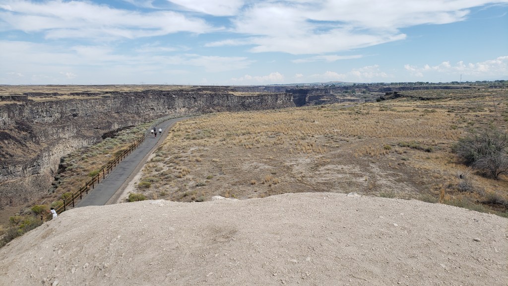
View from the top of the ramp, looking over the right side. The gorge is that dark part, with a walking path to its right.
Shoshone Falls was our final stop of the day. Dubbed the “Niagara of the West,” the 212-foot-tall, 900-foot-wide, horseshoe-shaped falls are the largest natural falls in North American (yes, bigger than Niagara). They caught the attention of travelers along the Oregon Trail, and are still a tourist attraction today.
How it started. Photo from Wikipedia
How it’s going. The falls should be flowing over those two white rocky areas immediately below the long, horizontal white building in the center of the photo.
Unfortunately, due to a dry summer, the water level was too low for the falls to flow, so we skipped the drive down into the park, looked at the bare rock from above, and rewarded our day with a cold beer, shrimp tacos, and a hearty salad on our way back to the campground, before leaving Idaho and returning to Utah for its grand National Parks the next day.