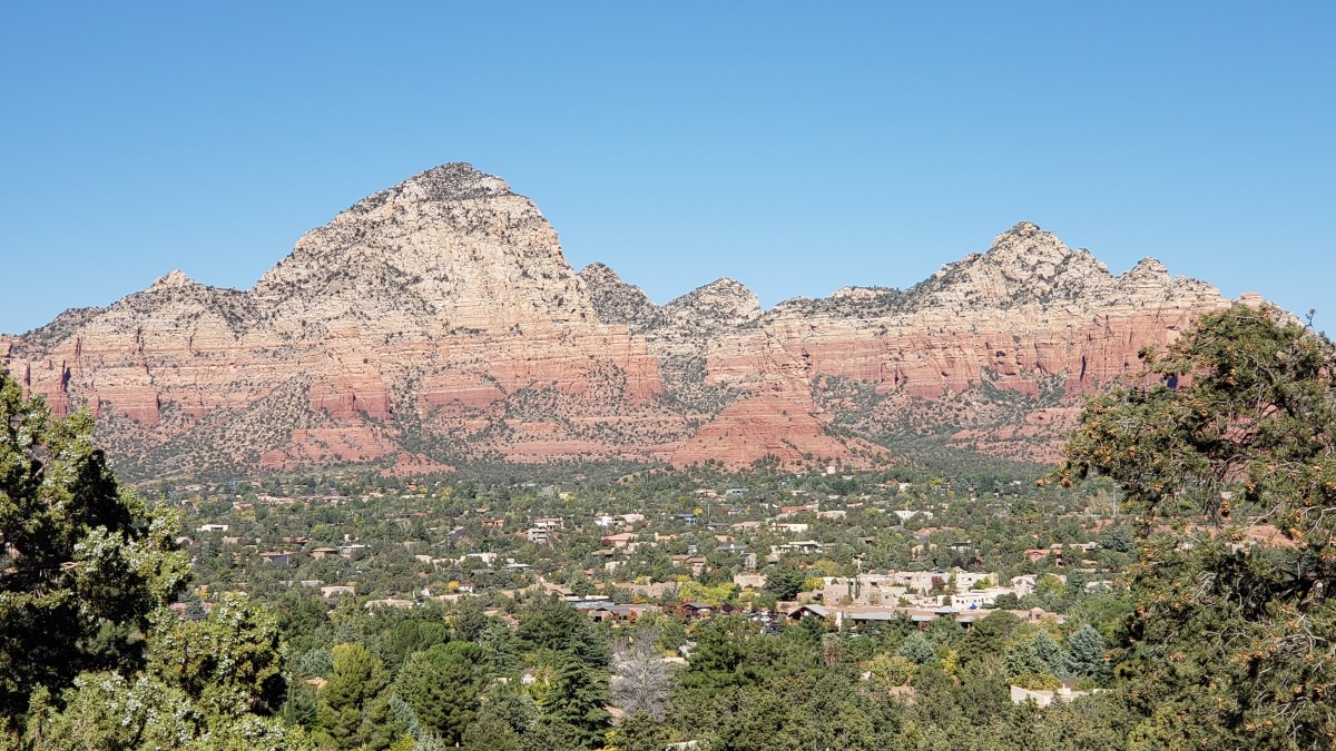
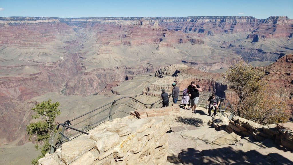
Here’s another look at our recently-completed RV adventure across the US from our exclusive series for The Independent, highlighting the section of the journey across southern Arizona and into New Mexico, with amazing sights that included Sedona, Tucson, Tombstone and the stunning migratory sandhill cranes of the Willcox Playa Wildlife Area:
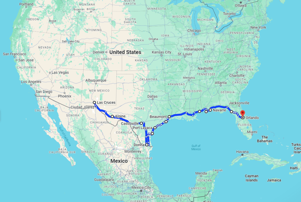
Back in Orlando again, it’s time to tot up the final mileage and trace our entire route (in 2 maps) around the US. We reached West Glacier, Montana, at our furthest distance from Orlando at almost 2,700 miles away, albeit we reached there via a distinctly circuitous route that involved fully 12 states!
The first 7 months saw us take in by far the biggest ‘chunk’ of our year-long route, including side-trips into Colorado and Southern California by car, as well as parts of Northern Arizonaand New Mexico
The “return journey” from there was also far from a straight line, taking in another 10 states before completing what was essentially a giant circle of the Midwest, the North, South West and Southern states. For much of the last 5 months we were close to the Gulf of Mexico before coming back into Florida via Pensacola and the Panhandle area, where we were definitely able to relax a bit (albeit keeping more than one eye on staying out of the way of some seriously stormy weather).
The final five months took us from the heart of New Mexico down to the far south-western corner of Texas, then right around the Gulf of Mexico via Galveston, New Orleans, Biloxi and Gulf Shores
So, with no further ado and a bit of a fanfare – “Ta RA!!!!!” – our final mileage comes to, wait for it…35,186 miles since we left home on May 14, 2023. In our RV, Fati, we traveled a total distance of 9,846 miles, while in our trusty little Ford Fiesta, Nippy, we added a whopping additional 25,840.
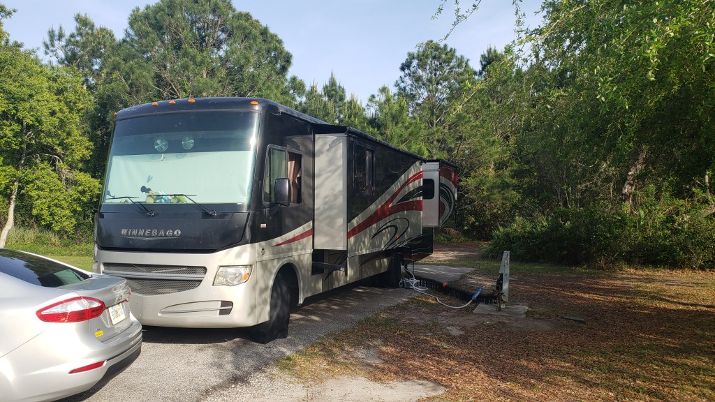
Somehow, we’re all still in one piece, albeit Fati has been in for several repairs and 2 full services, while Nippy is heading for a fourth service today and has needed new tires, windshield wipers and two air filters (!). Needless to say, we are immensely proud of our Ford-engined Winnebago RV, as well as our little Fiesta, and they both now deserve a good rest.
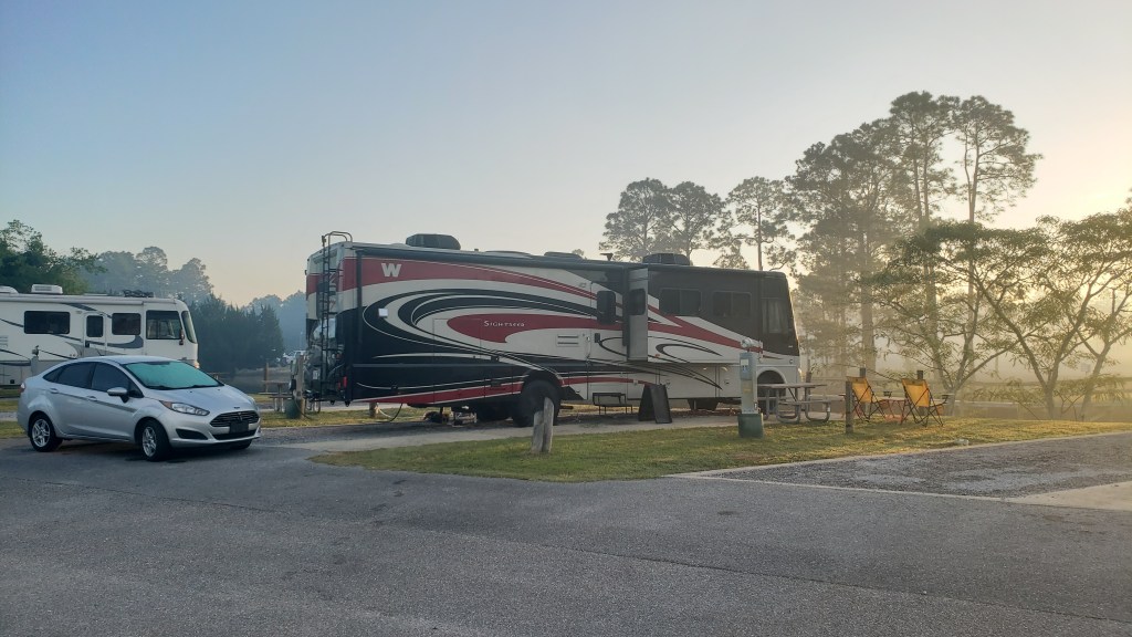
Finally back in Florida, we spent a quiet week in a beautiful little RV campground in Milton in the Panhandle before turning south for the last leg of the year-long trip
Will we have more travels to report anytime soon? The debate is now on at Chez Veness! We DO have a fair bit of work to catch up on first, but there is already talk of an East Coast RV tour, as well as a possible trip out West to the areas we missed this time, namely Washington, Oregon and Northern California, as well as more of Colorado.
So, stay tuned for further travel bulletins, and, if you have liked and enjoyed our blogs, please leave us a comment and be sure to check out our YouTube channel for a series of snapshot videos of the trip on this link: https://www.youtube.com/channel/UCP5dY0TcznDGkOY8BQUkpQg
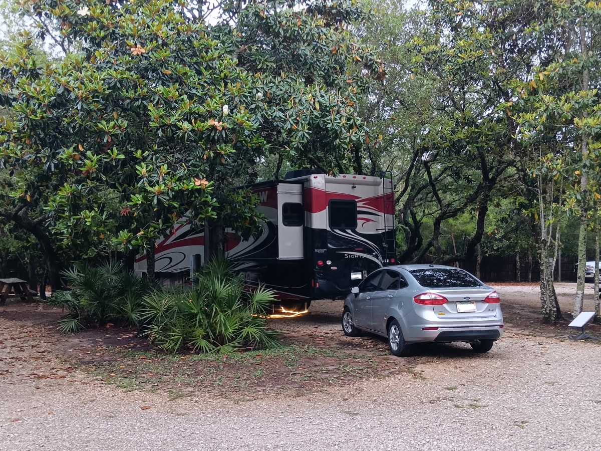
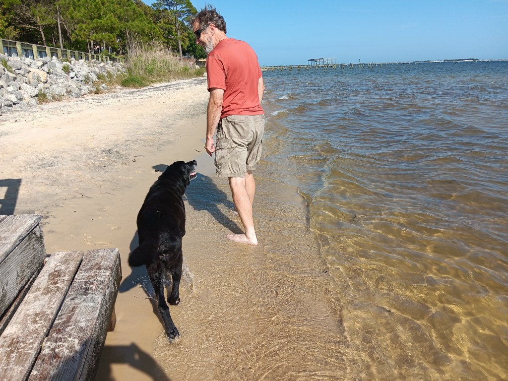
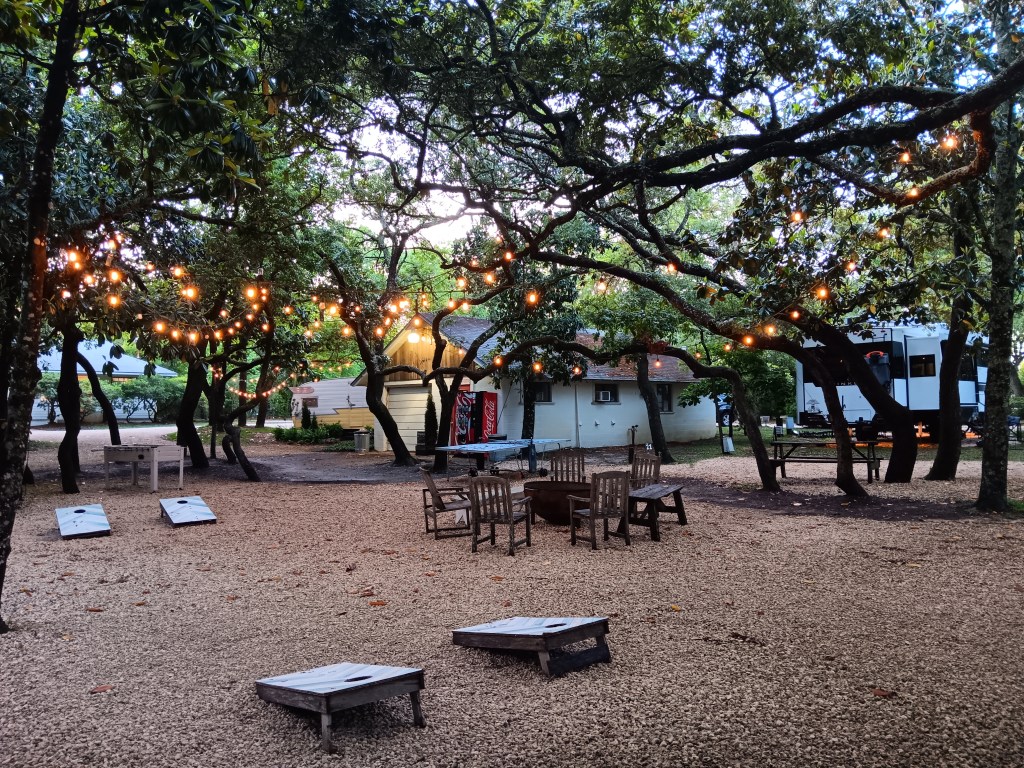
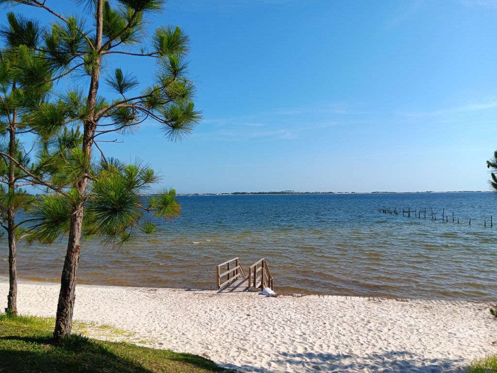
When is a campground only 29 miles away from your previous location but a million miles away from harsh reality? When it’s The Hideaway Retreat in Navarre, Florida, an oasis of magnolia trees, white sand beach, and the blue, blue, blue of the ocean.
Okay, so maybe it’s on the Santa Rosa Sound, not the ocean, but the effect is the same. A self-proclaimed “shabby chic” retreat that offers rare shade in the Sunshine State, the Hideaway scared us at first for its close-together trees, then proved to be far more straightforward than we imagined, and a gem of a place we’ll return to if we ever get the chance.
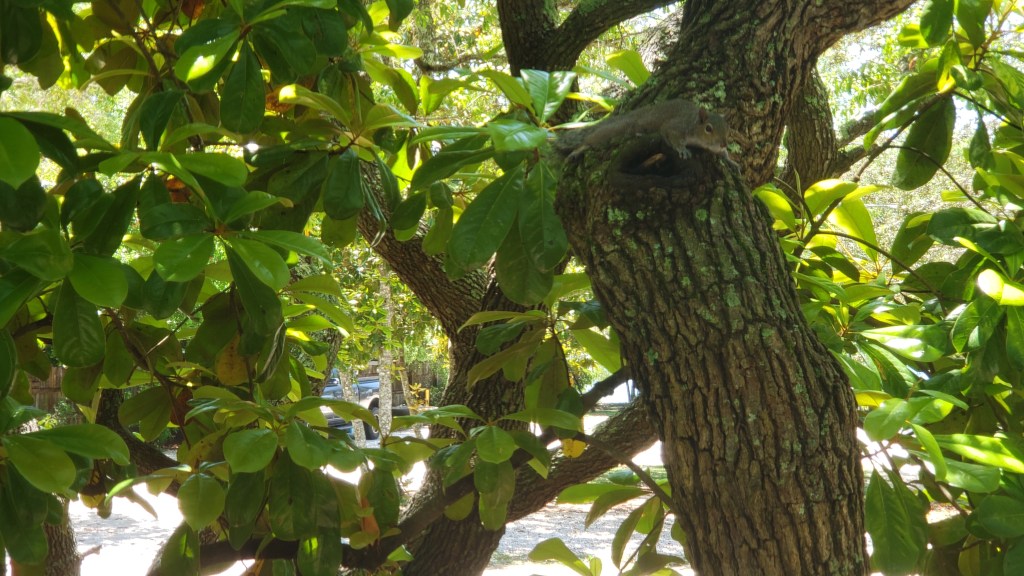
When you live in an RV, every noise matters. We know all of our noises, from the occasional hum of the fridge as it tries to freeze everything solid to the gentle click of the light switches and the metal “pop” as the slides or the jacks settle in during cold weather. But the muffled thumping we kept hearing eluded us. What the hell was it?
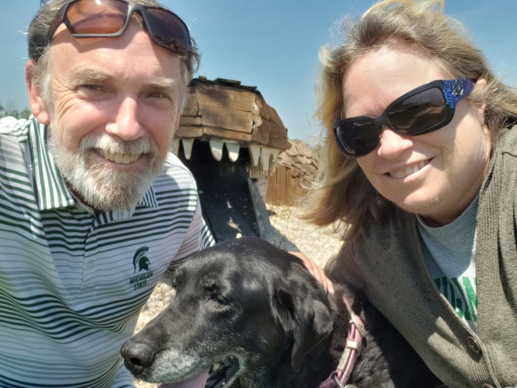
This isn’t the source of the thumping noise. It’s a squirrel (clinging to the sawed-off part of the trunk) that swore at us for a full five minutes because we were parked so close to its tree. We eventually came to an agreement, and he/she moved on.
It drove us to distraction until we asked one of the staff and they told us it was testing that takes place at the Hurlburt Air Force Base Special Operations Command’s training grounds, just across the Sound. They’re blowing things up, but don’t worry; after a while you won’t hear it anymore. Which was (partly) true. It was simply one of those background noises that makes RVers (okay, us) wonder if something on their rig is eager to meet a mobile mechanic and will cost many, many hard-earned dollars.
The strip of land at the far side of the Sound is the training grounds. It looks far in the photo, but it’s not, really.
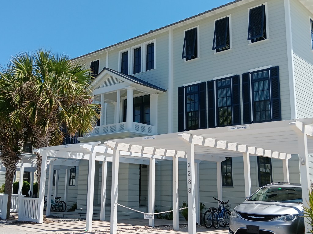
That problem solved, Simon had never seen the movie The Truman Show, but was aware Seaside, Florida, not far away, was the setting for the fictional town of Seahaven, so we had a drive along the coast the next day with that town as our goal. When we arrived, we couldn’t escape the feeling that it was very much like the formerly-Disney-owned town of Celebration, which some say looks like a Normal Rockwell painting and others say is more along the lines of The Stepford Wives.
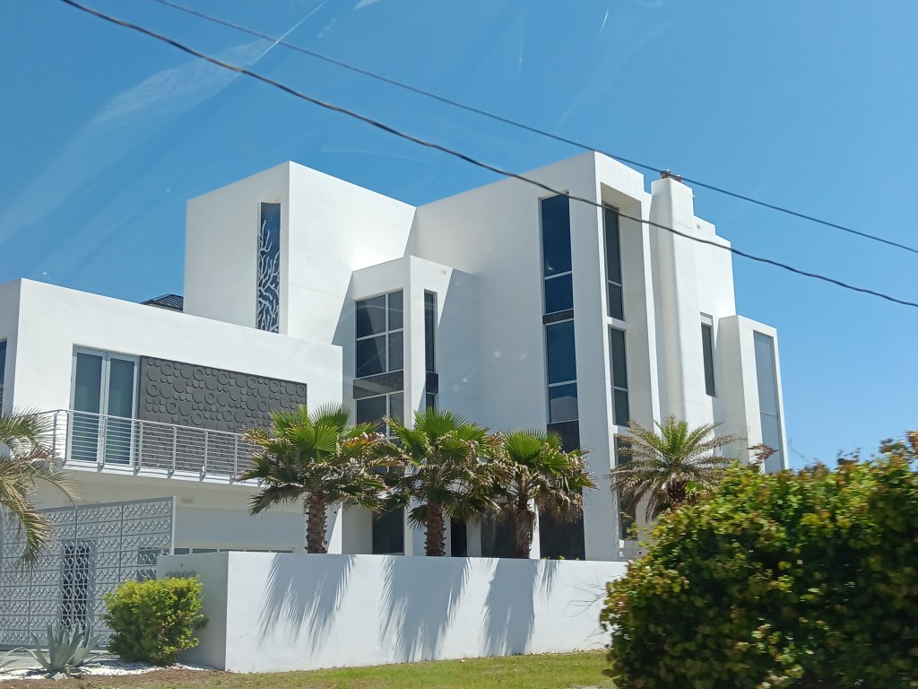
Row after row of condos and single-family homes, and nearly all of them were painted white.
This is a single family home. And it isn’t even the biggest along the shoreline in this area.
Unfair movie comparisons aside, Seaside clearly has money. It also has a lot of community amenities, including an intriguing area featuring permanent kiosks and food trucks that would have been perfect for lunch.
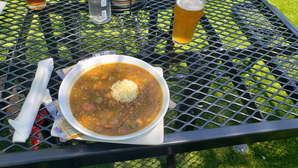
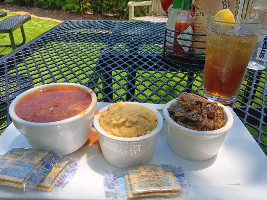
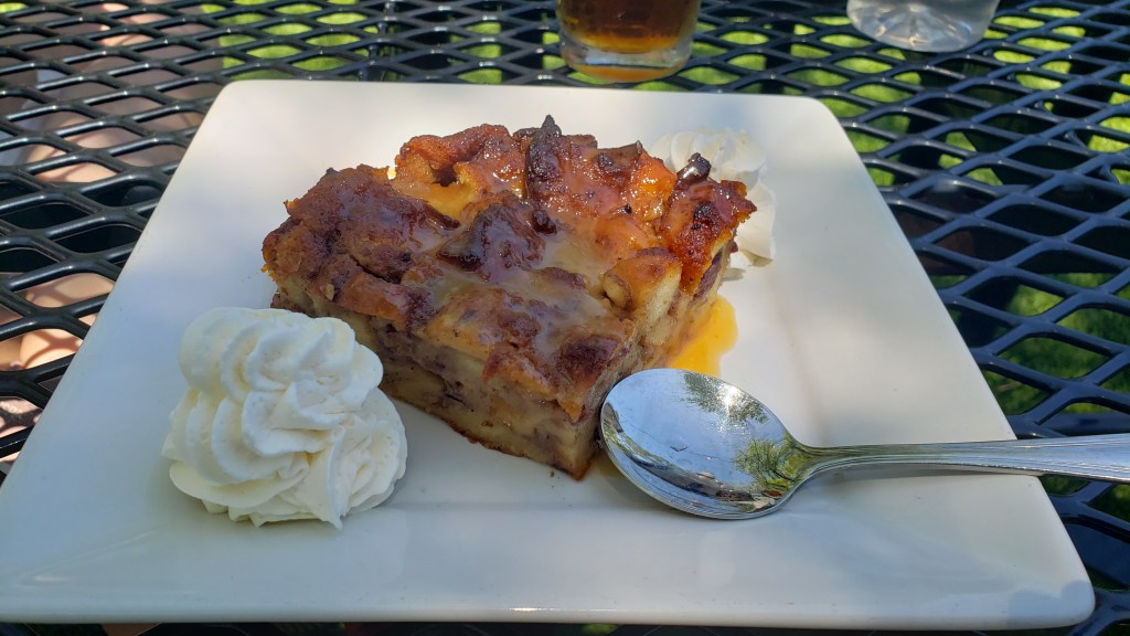
But we’d already eaten, having stopped at Beach Camp Brewpub, not realizing Seaside was so close. Still, Simon had a huge bowl of gumbo and a beer, Susan went for a cup of Brunswick Stew and iced tea, and we split sides of cheese grits and collard greens, all of which were delicious. Simon being Simon, Sticky Toffee Bread Pudding rounded off a fine meal.
Thick and rich and scarfable!
Trio of deliciousness!
Yes, yes, yes! But more caramel sauce, please.
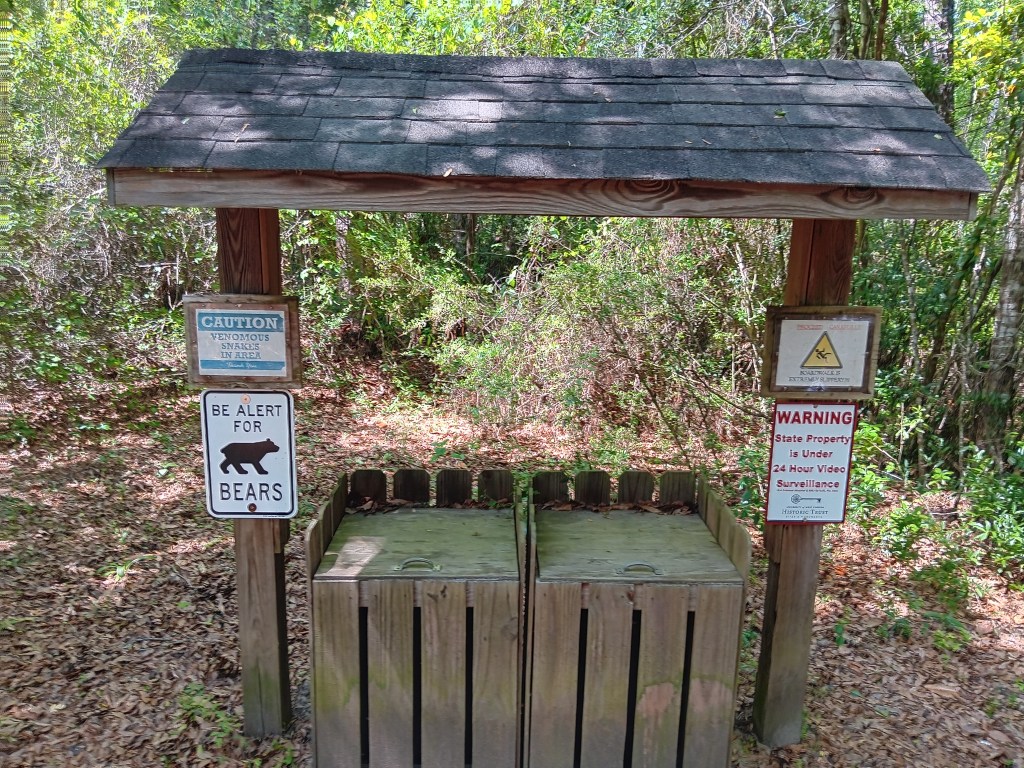
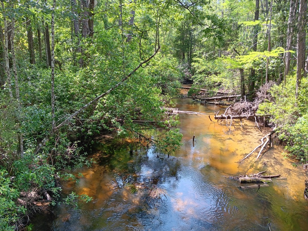
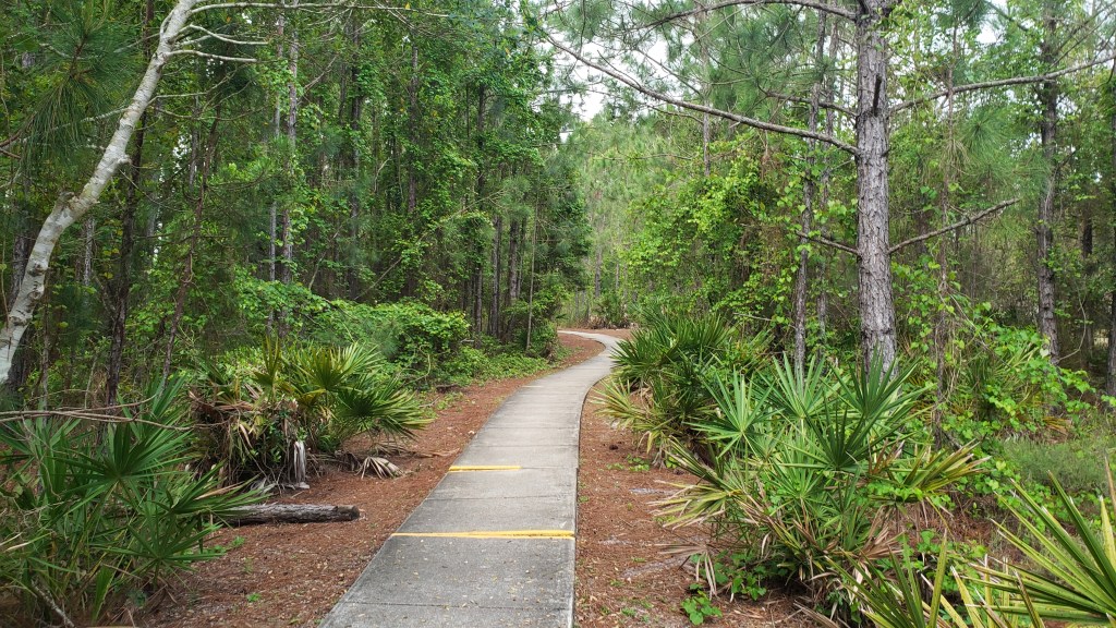
The next day we had hiking and a boat tour on our radar, for a bit of exercise and the chance to get out on the water. Arcadia Mill has a three-quarter-mile-long, dog-friendly boardwalk through what was once antebellum Florida’s first water-powered industrial complex. Very little remains of that logging endeavor, other than a few ruins of retaining walls, but it’s a gorgeous walk through the forest, with peaceful streams running languidly across our path. True balm for the soul.
Venomous snakes, bears, slippery boardwalks, and 24-hour surveillance. This should be fun!
Why do we love views like this one so much? Perfection!
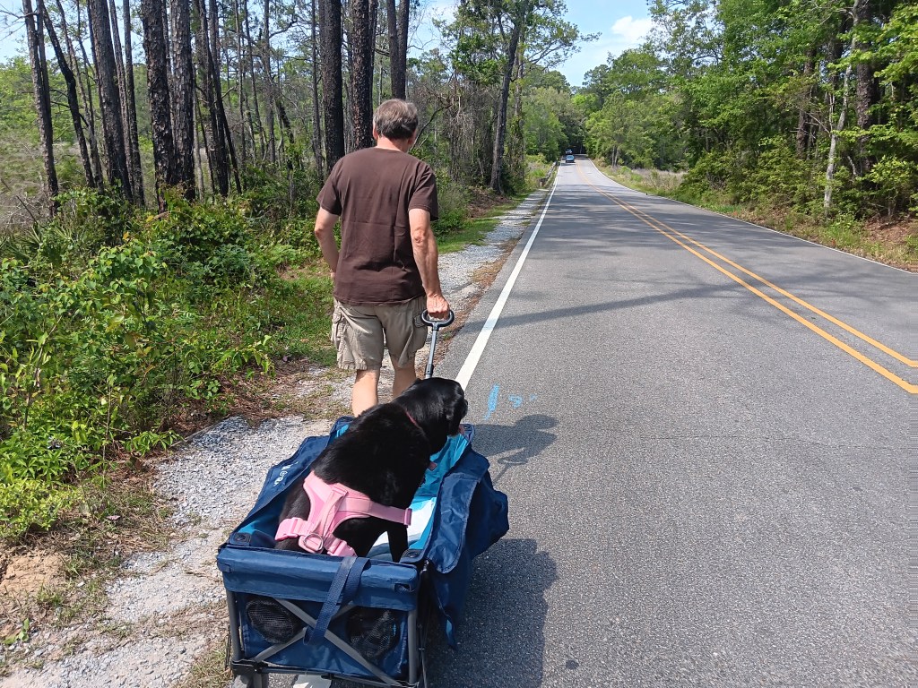
We started the adventure with a little picnic of sandwiches, carrots, and fruit, then did the full loop, with Ruthie making the trek in her wagon.
After consulting her vet about the more advanced laryngeal paralysis our pup is experiencing, walks are now out of the question for her, but she seems to appreciate getting around comfortably when the path isn’t too bumpy.
Who’s a beautiful girl? YOU ARE!
The boat tour? Well, that didn’t really work out. Simon wanted to “drop by” and find out more about it, but when we arrived it was someone’s house. No one came out when we pulled into the driveway. It all got very awkward, with shades of our horrible coffee debacle in Leiter, Wyoming, so we backed out and agreed we’d better call first.
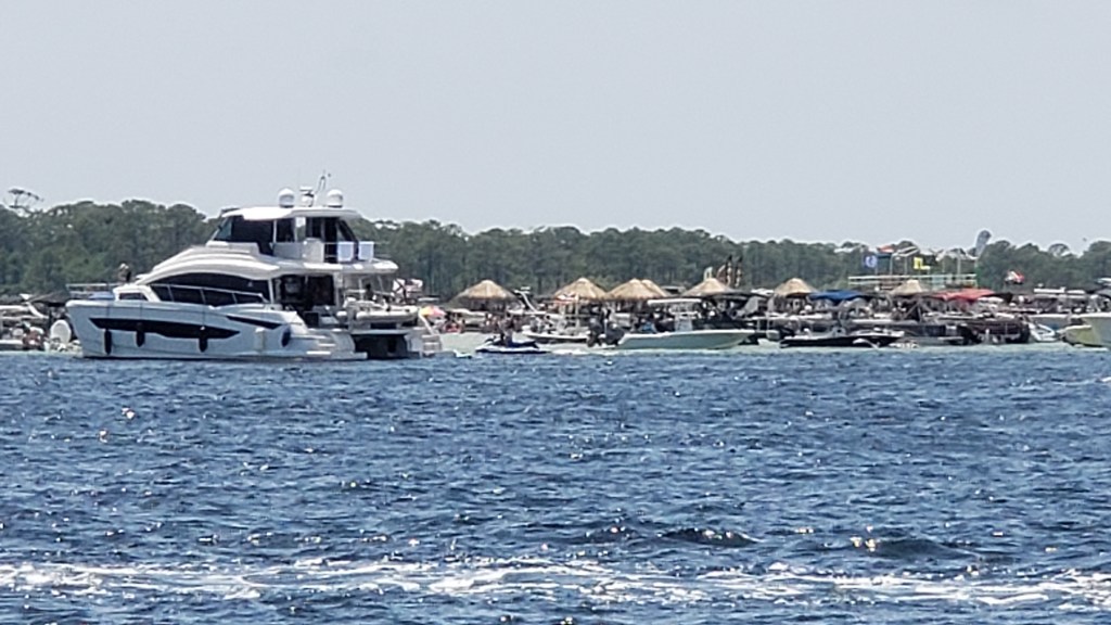
While we couldn’t go boating (renting is cost-prohibitive here), we did take time to head down to the Destin marina for a view of the famous Crab Island. It was once a real “island” in the North Channel, but much of it washed away, and now it’s a massive sand bar with four-foot-deep water, making it an ideal spot for boaters who want to chill out or party.
A tiny, tiny portion of the “island.”
We could see it well from the marina, but had an even better view as we crossed over the William T. Marler Bridge (Highway 98). It was jam-packed on that sunny Friday afternoon, with weather in the high 80s, and we imagine it’s shoulder-to-shoulder and boat-to-boat in high summer.
Those with a keen eye will have noticed the floating tiki huts. During busy times, mobile food and drink boats (not you, alcohol) putter out to the island and offer their wares. This little shaved ice and ice cream boat was just coming back to the mainland for refills.
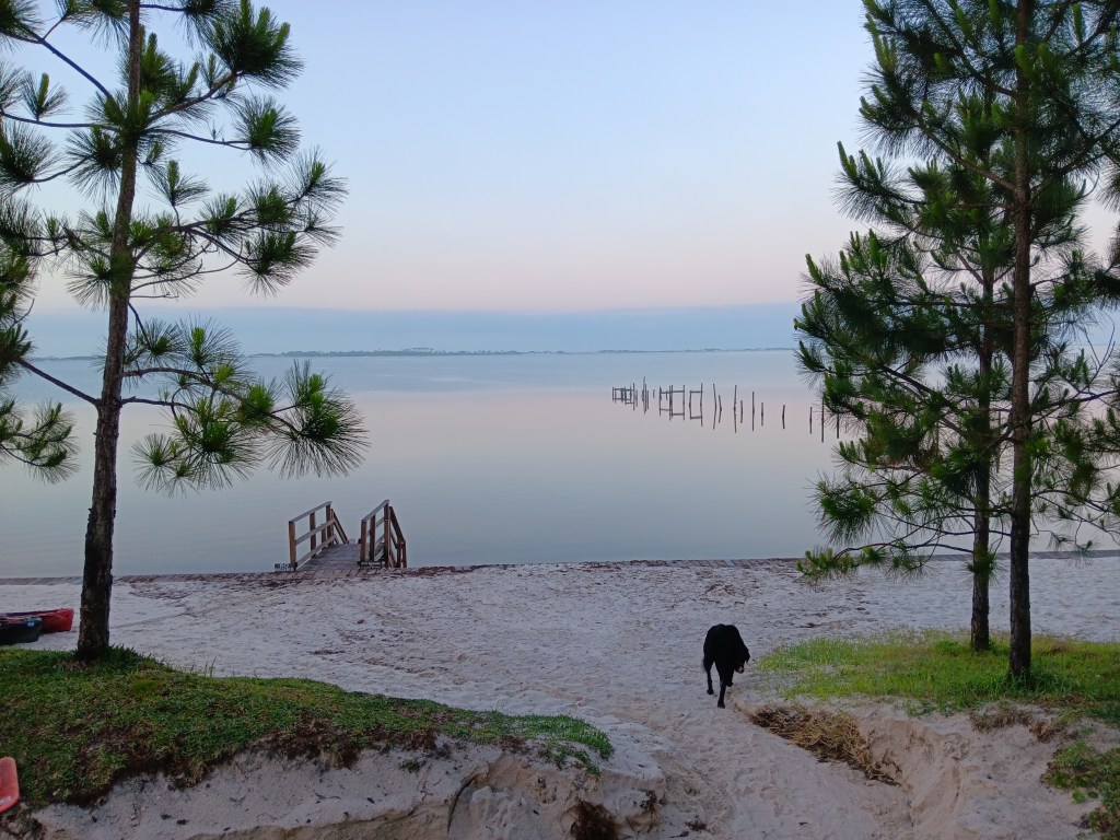
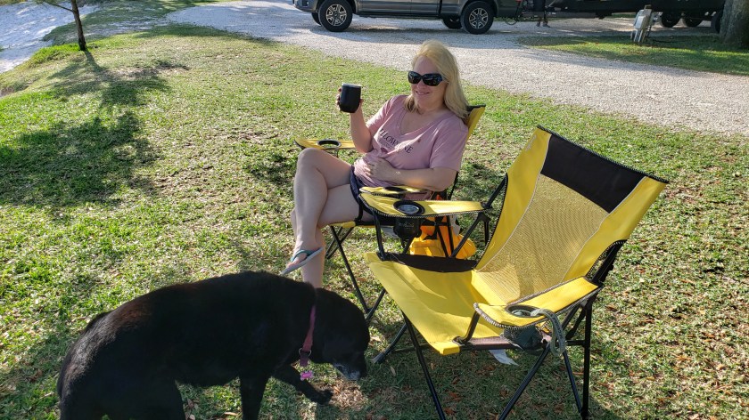
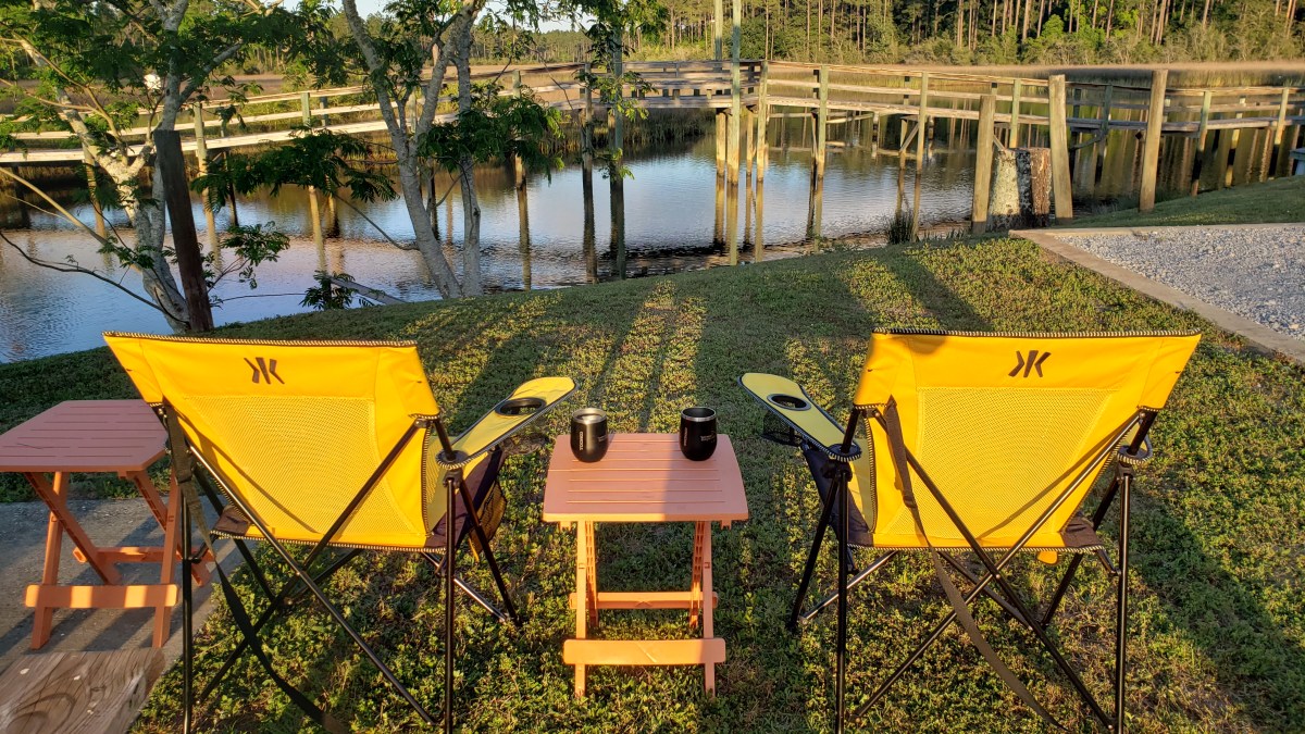
But possibly the best thing we did in Navarre was hang out near the beach at our campground, eating ice cream, having a drink, and watching through our binoculars as boats went by. Only a few times during this trip have we just kicked back and acted like real campers. We could get used to it.
Regular blog readers will know our grand year-long RV adventure is being serialized in the UK’s Independent newspaper, and the latest instalment is now online.
It covers the northern part of our Arizona travels, and you can find it on this link:
Simon: Let’s go to Milton as our first week in Florida. There’s nothing nearby to tempt us away from the campground, and we can push through the work we need to get done so we can enjoy our final stops. Susan: Perfect. If I can count on that, I’ll fill up the fridge and plan for all our meals at home. Simon: You can count on it. Also Simon (first full day at campground): Let’s do a loop around East Bay and down to the coast today and visit Pensacola tomorrow! YAY! GO, GO, GO!!!
The man just can’t. But our thoughts are starting to focus on our return home and the major decisions we’ll be facing once we’re back, so we agreed to two days exploring, and the rest of the time in the rig getting a jump on preparations for summer’s onslaught.
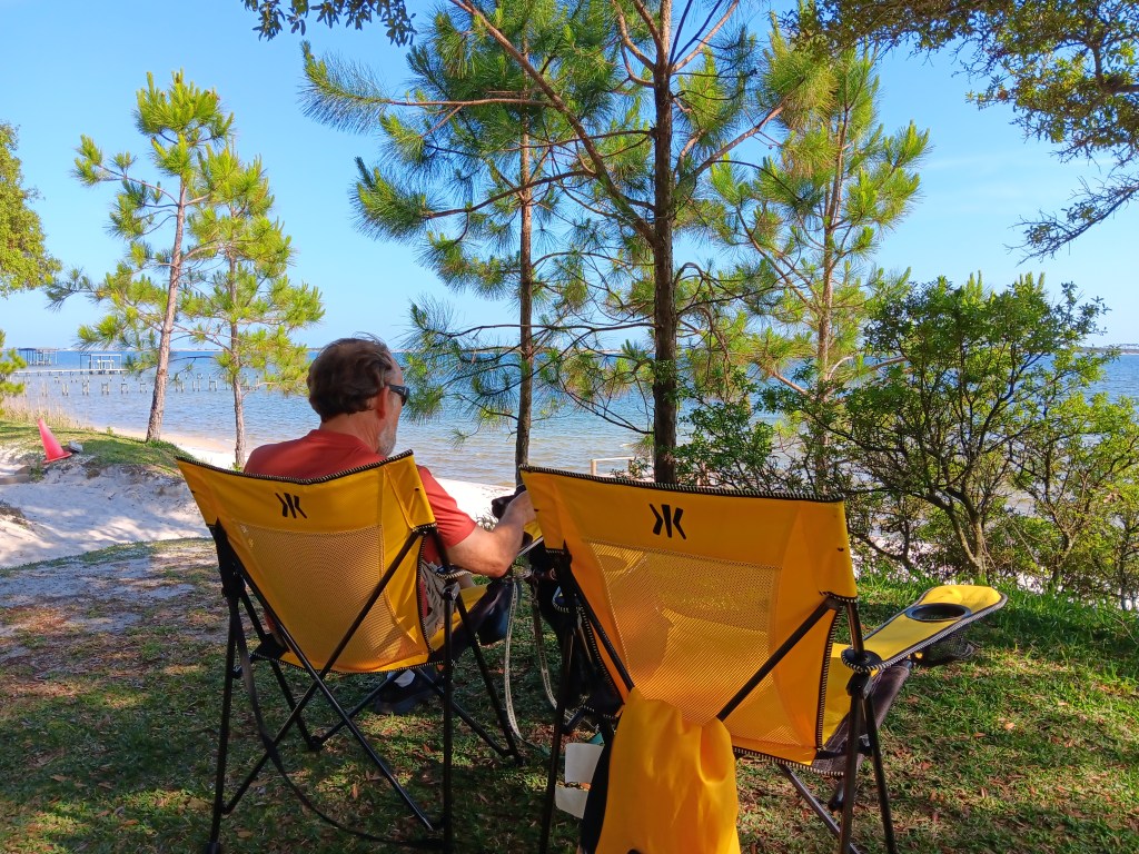
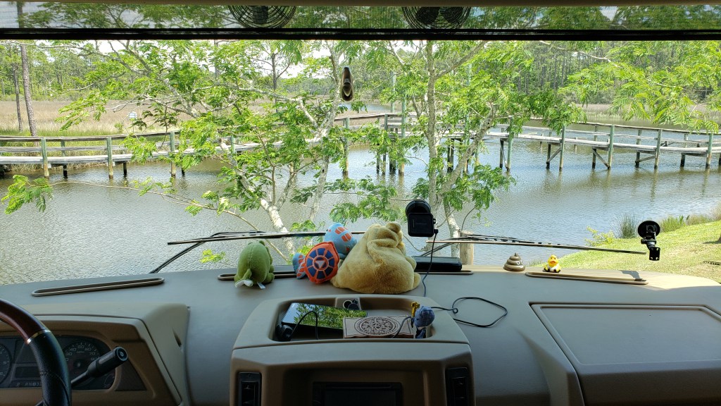
With a view like this, why leave?
If you have other things to do, here’s the short version: We pretty much did nothing, other than two short excursions. For the longer version, read on.
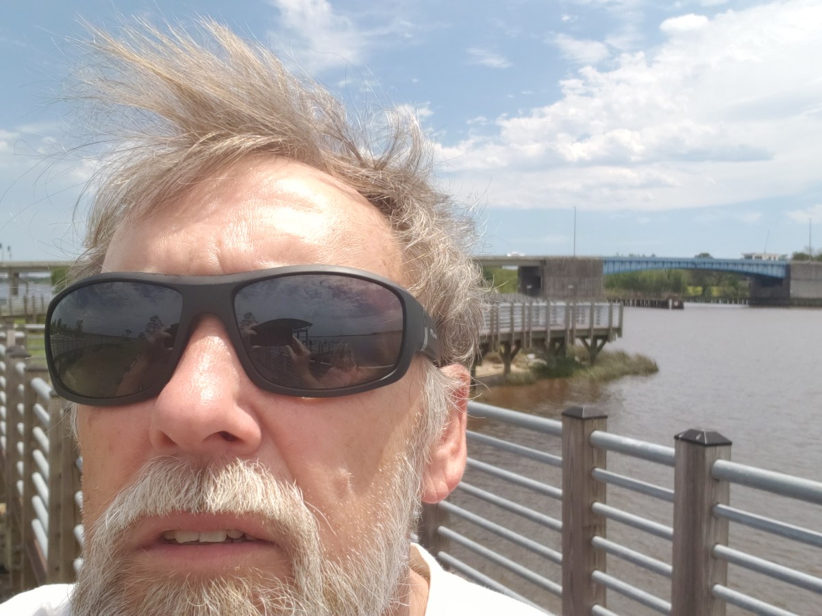
Resting scowl-face!
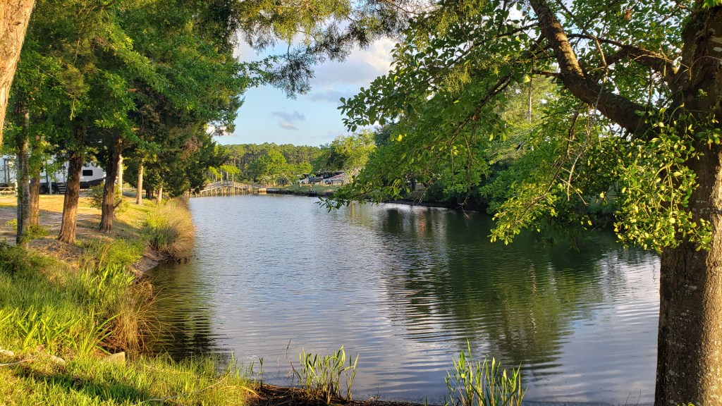
When we checked in at Avalon Landing RV Park, we were offered an upgrade to a water site for $30 ($4.28 a night), and while we weren’t quite sure we wanted the extra fee, we agreed, and it was a decision that really paid off. Birds swooping and diving, mullet jumping, people fishing from the bridge; absolute viewing perfection from inside the rig while we worked, and from outside with our pre-dinner drinks.
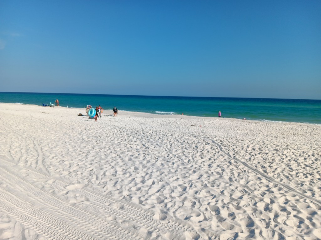
We spent the first day “at home” getting laundry, shopping, and a little bit of work done, then set out for a loop around the bay the next day. When we reached the Gulf, we both had a little catch in our breath, seeing the wonderfully familiar blue of the water. Florida, in our opinion, has the most beautiful ocean water in the country (well, around the country, really), with its deep blues and bright blues that are even more radiant against the Panhandle’s superb white-sand beaches.
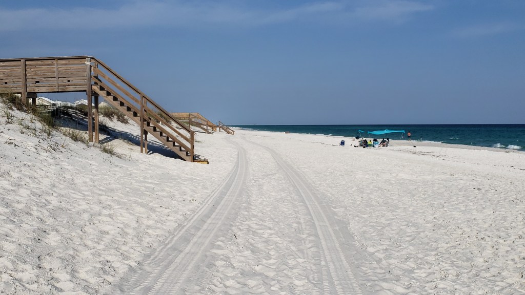
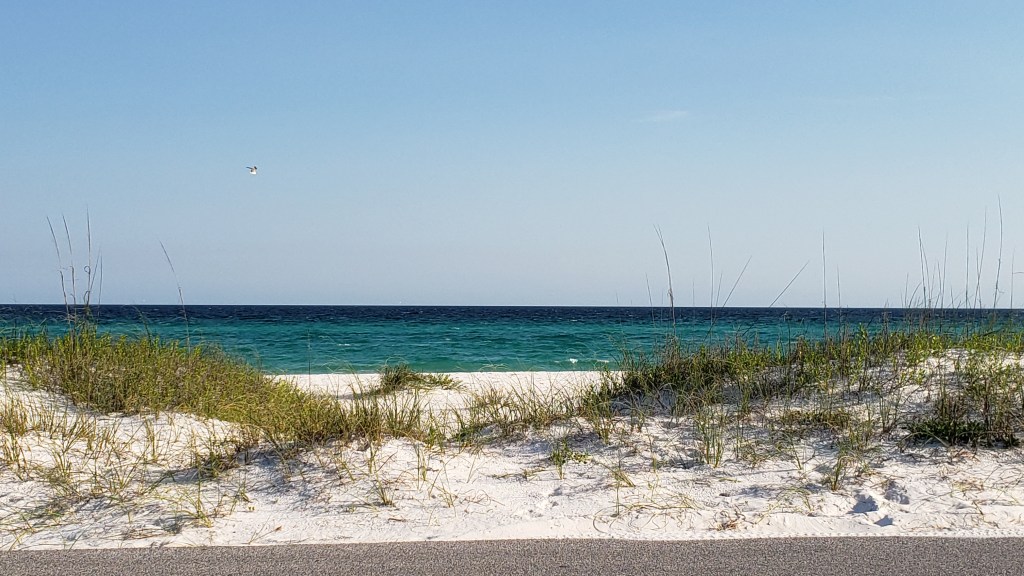
The next day we drove south, then turned west along the single road through Gulf Islands National Seashore, which we had first encountered ‘way back in Mississippi. Little dune-ettes – tiny by Lake Michigan standards – stretched the full length, with the occasional peek at the sea on one side, and the East Bay on the other. A gentle day, yes, but we felt the full impact of being so close to the end of our adventure.
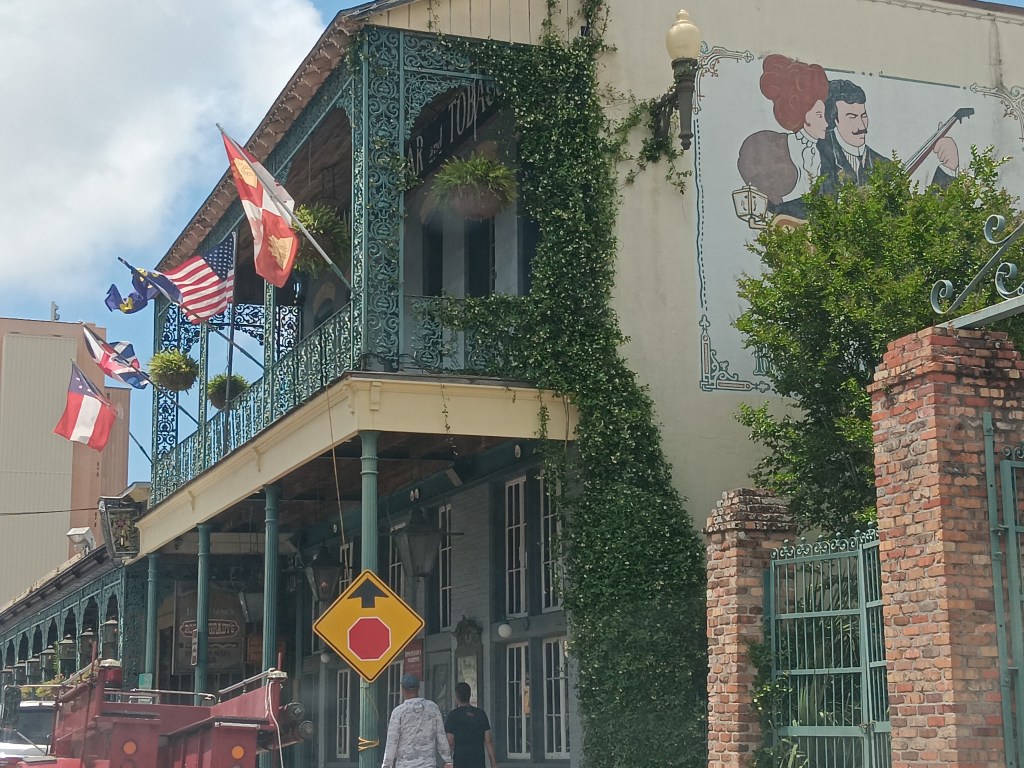
Next up was Pensacola, with its pretty downtown balconies reminiscent of New Orleans, and an up-close (-ish) view of Captain America, an off-shore support vessel that helps install and decommission things like drilling rigs and wind farms. The ship was just paying a visit, and its home port is Pascagoula, Mississippi.
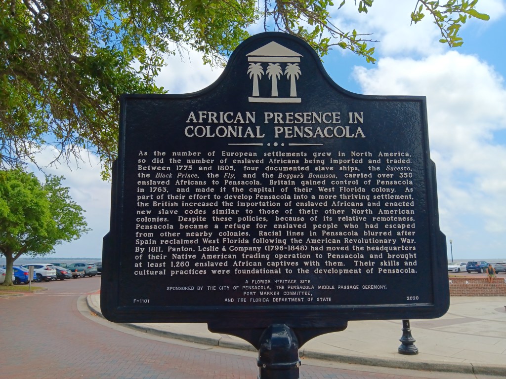
A historical marker at Palafox Pier, where the ship is anchored, recalls a darker time. Pensacola’s history of importing enslaved Africans is long, dating back to the mid-1500s. First the Spanish, then the English, shipped human “cargo” to the area, presumably landing at or near what is now the pier. It also recalls the people who escaped enslavement and hid out in Pensacola’s relative remoteness. Their ancestors, the sign indicates, helped shape the character of the city.
Why is this marker important? Because it (and others like it, specifically in St. Augustine, Florida) counters the history we were taught in school, that slavery began in Virginia in the mid-1600s. St. Augustine saw its first slaves in the early 1500s. These markers are so easy to overlook, but we’ve been surprised at how much they’ve inspired us to learn more about things we didn’t know, or thought we knew.
The rest of our time was spent working, putting “decisions” in motion, and enjoying our gorgeous view. We’ll have one more beach destination, two more short moves, and then a very special finale to what has been a mind-expanding trip.
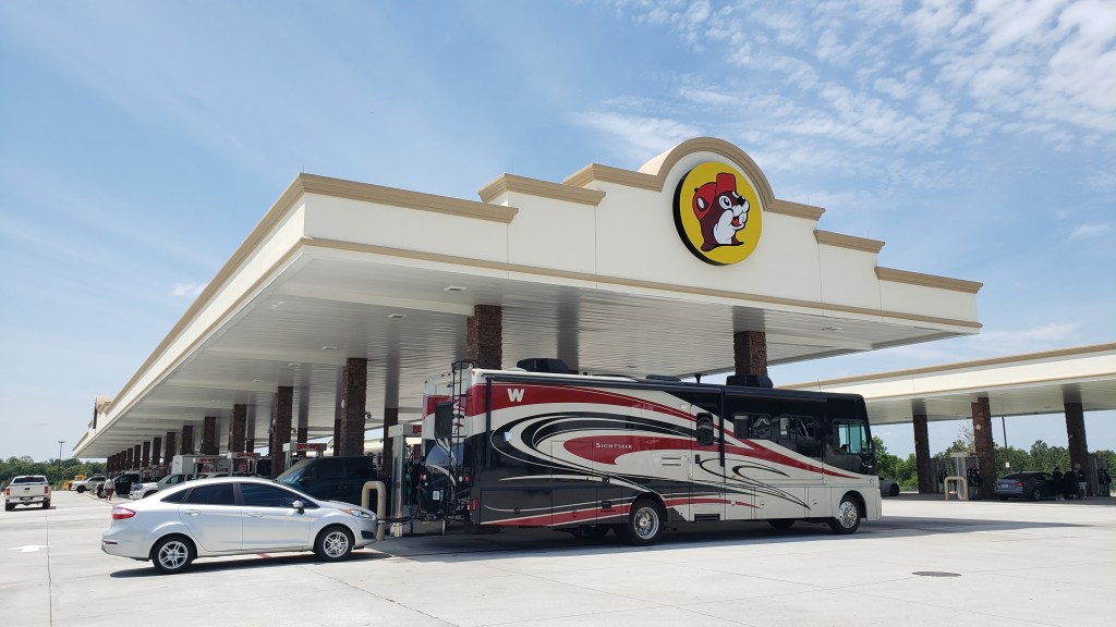
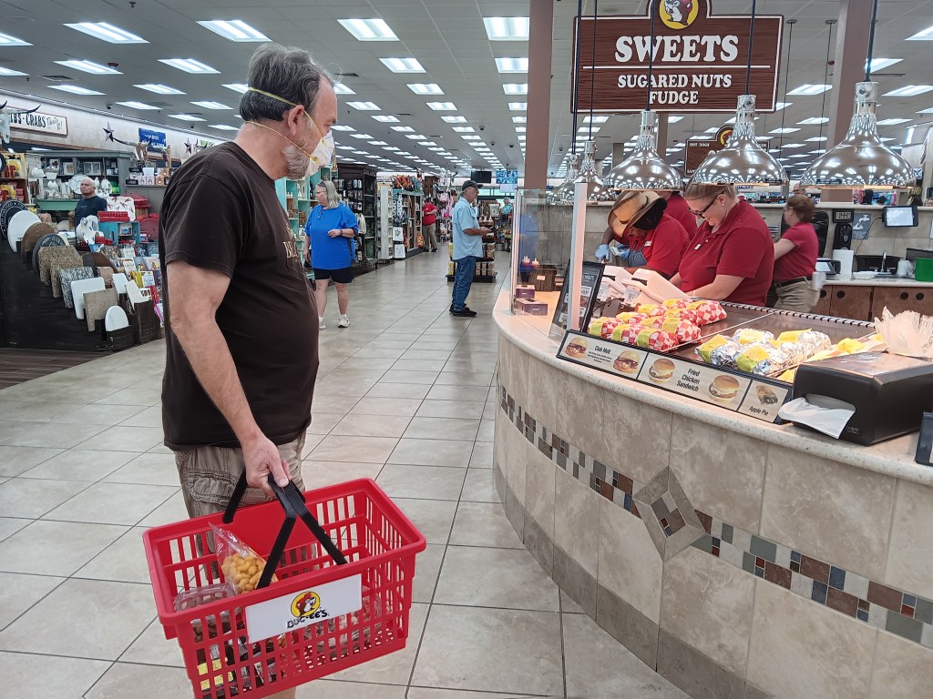
How do you burn through five hours when you’ve only got a 90-minute drive between campgrounds, you have to leave the first one at 11 a.m., you can’t check in at the second one until 4 p.m., and you have no idea where to find a place big enough to park a 36-foot rig and its tow car? You stop at a massive Buc-Ee’s, that’s how!
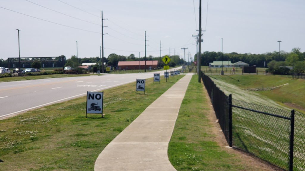
We were pretty tired of Buc-Ee’s sandwiches, but salad is always a good choice, so we gassed up Fati, grabbed two Cobb Salads, sat in the parking lot for a very long time (with a couple dozen other RVers), and on the way out we took a photo of Buc-Ee’s “No (trucks)” signs we’d seen when we stopped on our way to Tallahassee ahead of the storm. At that time, there were about 20 signs crammed into a long row just outside the parking lot, which read like, “No, no, no, no, no, no, no, no, no, no, no, no, no, no, no……” and made us laugh. Some of them got knocked down in the wind, so the joke wasn’t quite as funny anymore.
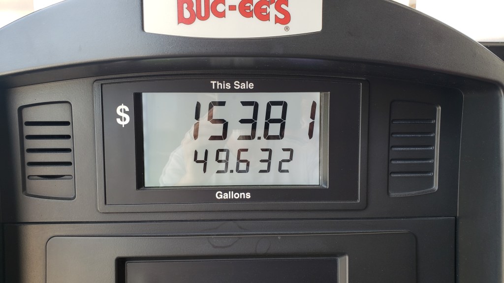
This was not for our salads and tea. It’s for 3/4 of a tank of gas.
Imagine 20 of these, just a foot or two apart. Is it just us, or is that funny?
Over the course of the week, we took several drives along the Gulf and its bays, taking in the magnificent (expensive) homes between Point Clear and Daphne, and Fairhope’s lovely little downtown. One of the stoppers for us is the hurricane risk. And that’s a big stopper, right up there with snow. And dust storms.
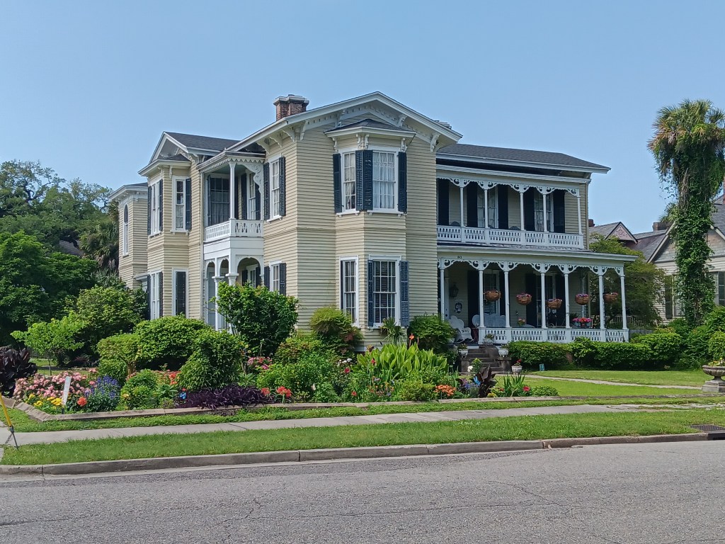
Our campground was south of Mobile, but we took a drive to the city and were surprised, once again, by the giant houses, many of which were just a street or two away from very modest homes. There is a lot to like about Mobile. Pretty parks, lots of history, and an interesting downtown with lots of personality. If Savannah and New Orleans had a baby, it would be Mobile.
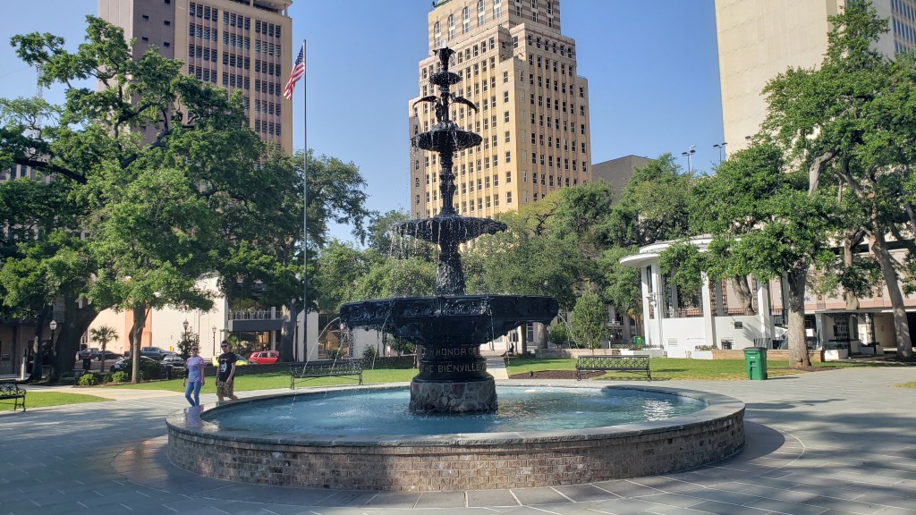
We felt pretty special when we came upon a park that had just that very day re-started its fountain after a long refurbishment. A couple of representatives were walking around asking people how they liked it, so we assured them it was a mighty fine fountain indeed.
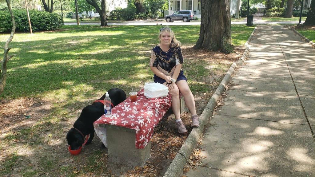
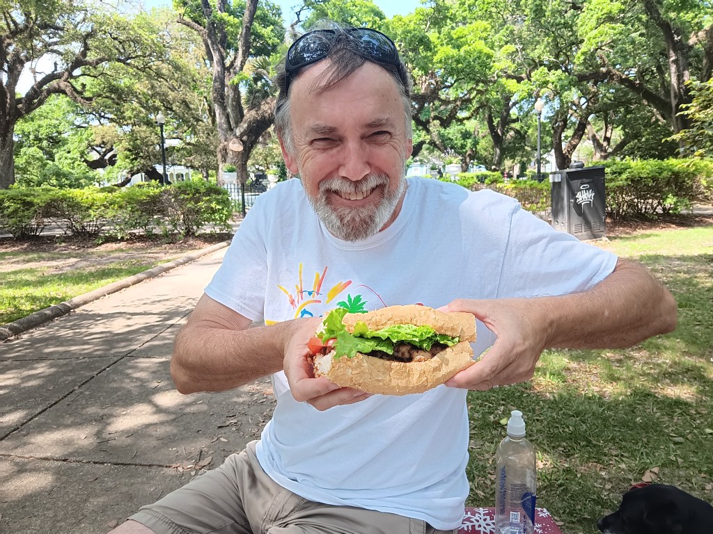
We grabbed lunch from an Irish pub that had come highly recommended, and laid our tablecloth down on a grubby bench (the only seating in an otherwise beautiful park) for a picnic. Here is my “social media” face from our al fresco lunch.
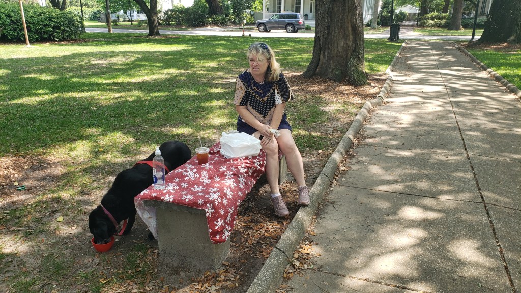
This is how I really felt about that bench.
This is Simon eating a Shrimp Po’Boy that’s as big as his head (yes, he ate it all).
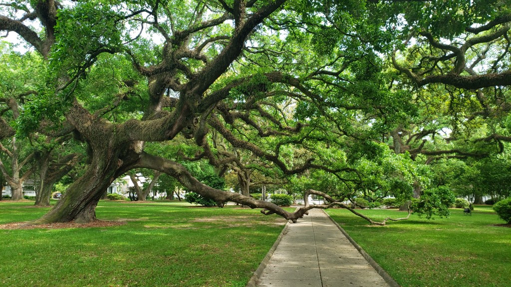
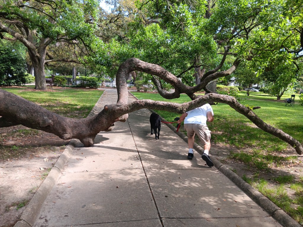
And this is a Live Oak in the park that waves its hands in the air like it just don’t care, but is also so old it has to balance itself a bit by holding on to the sidewalk.
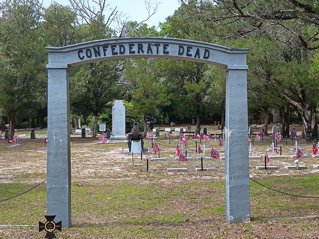
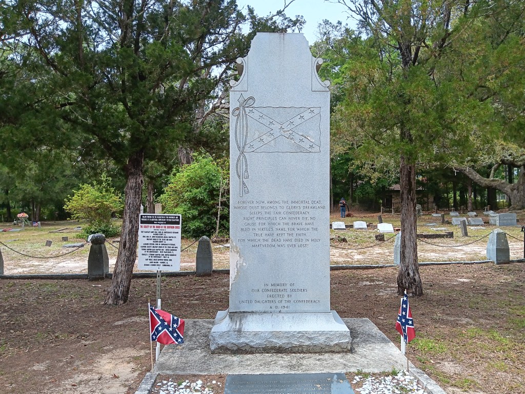
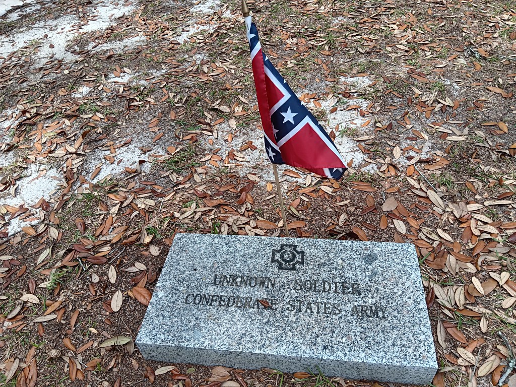
At the risk of sounding like we’re on some cemetery kick lately, we did visit the Confederate Rest Cemetery for its historical value. It is unquestionably right and fitting to remember your glorious dead (each one of them some mother’s son), and to keep their sacrifice in mind, and the cemetery certainly does that.
We did stare in mild disbelief as we read the monument put up by the United Daughters of the Confederacy, which reads:
Forever now, among the immortal dead, whose dust belongs to glory’s dreamland, sleeps the fair Confederacy. Right principles can never die. No cause for which the brave have bled in virtue’s name, for which the true have kept the faith, for which the dead have died in holy martyrdom, was ever lost.
Ummm….so much to unpack about that, isn’t there, starting with exactly what those “right principles” were all about.
On the back, it reads:
Furled in our conquered banner, but its folds, rich in immortal memories, bore no stain save the blood of her matchless heroes.
The monument went up in 1941. 1941! We have big feelings about that, but will leave you to your conclusions.
We’d been passing billboards for Lambert’s Cafe – and the actual restaurant itself – a few times, and decided to drop by to see what all the “throwed rolls” fuss was about. And yes, indeed, they do throw hot rolls at diners. Want one? Just put your hand up when the roll guy (or gal) comes by, and he (or she, or they) will whip one at you. Brilliant!
Hot rolls! Who wants hot rolls!
The area’s best attraction, however, was our campground. Gulf State Park is ginormous. Its hugeness is part of its charm, though, because it offers the largest amount of space between sites that we have seen on this trip. And, like Biloxi Bay, it feels like traditional camping, with pine trees, 28 miles of well-used walking and biking trails, and campfires around us each night. We could get used to this!
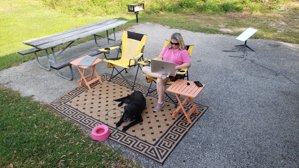
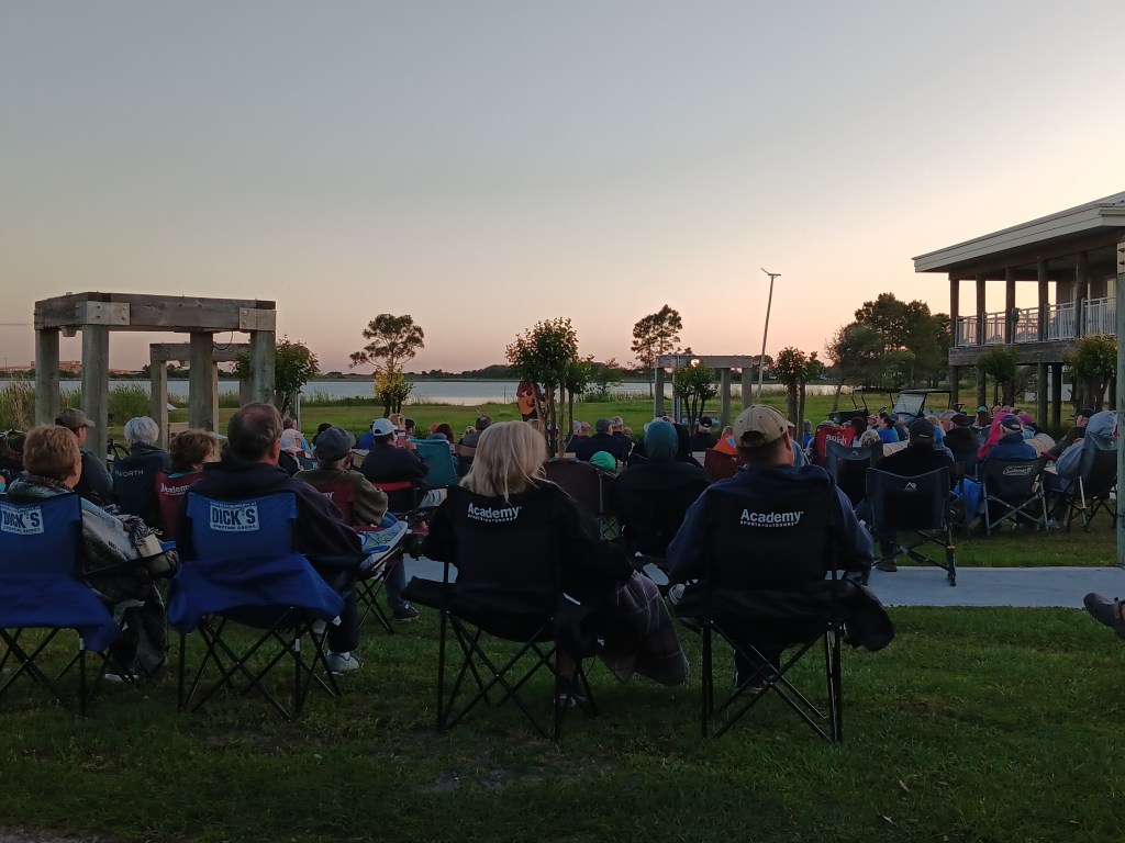
There are also a lot of activities, making it feel resort-like rather than just a campground. Simon loves live music, and one of the events was a free outdoor concert, so we packed up our chairs, poured a couple of G&Ts into our travel mugs, loaded up Ruthie, and spent a thoroughly enjoyable hour listening to a musician who plays Gordon Lightfoot music, having been a good friend of that artist. He also told us the real stories behind each of Lightfoot’s songs, many of them quite heart-wrenching. There may also have been tears when he sang Wreck of the Edmund Fitzgerald, a tragedy that happened in Susan’s home state of Michigan.
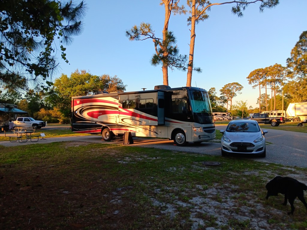
We had to move sites part-way through our visit, but the 50 yards it took to get to the second site was child’s play. Yes, we had to pack up the rig as we normally would (with a few exceptions, like not putting away our stuff in the bathroom, and bringing Starlink into the kitchen area rather than boxing it up), but we had a corner lot, which meant even more privacy, and also a view of the main road through the campground, which allowed for exceptional rig-watching.
Our second site. Look at all that room!
Now that we’re in the final month of our Grand Adventure, we’re doing a lot of rig-watching. We’re ready to stop for a while, but not ready to stop forever, so we’re eying smaller rigs we could be comfortable in for a few months at a time. We’re not sure we’re ready to trade in Fati yet, though. Decisions, decisions!
There are times when getting from Point A to Point B is a functional undertaking, and the Interstate gets you there quickly. Then there are times when the scenery is so appealing, the slow roll along a small road is worth the effort. Our trip from Waveland to Biloxi was one such drive, and we ended up taking the road less traveled three times during our stay, twice with great pleasure and once as a torturous, screaming nightmare.
Highway 90, our old friend from previous drives, gave us a non-stop view of the Gulf of Mexico as we made our way to Biloxi in Fati, and, for a change, we planned ahead and had sandwiches ready for a beachside lunch.
With our windows open and a glorious sea-salt breeze blowing through the rig, we soaked up the bliss even as we ruled the Gulf coast out as a place we could live. One thing we’d hoped to discover during our Year on the Road was a place we could be happy settling down when we’re ready to leave Florida. We’d come so close a few times, but hadn’t yet found just the right fit.
Biloxi Bay RV Resort and Marina was certainly the right fit for the next week, situated right on the bay, with mature pine trees that give it the feel of a genuine “camping” experience. There’s something about pine trees that makes a campground feel…I dunno…cozy, I guess.
Our first day trip took us out to Davis Bayou for a hike along the trails, and while the man at the Visitor Center recommended two trails we could take Ruthie on, they proved to be hard going and didn’t lead to a big pay-off at the end (like a lake, or some other scenic “Wow!”).
Our little girl’s harness used to fit her. Now she’s shrinking.
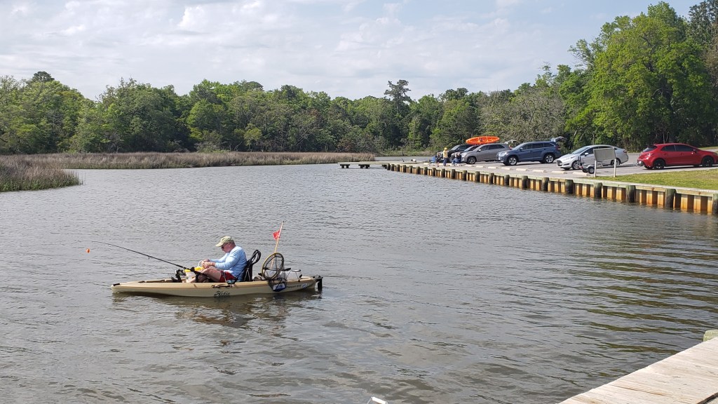
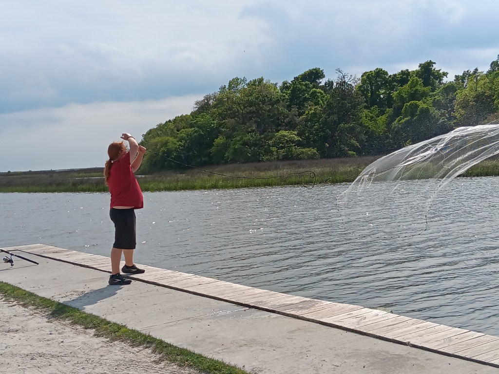
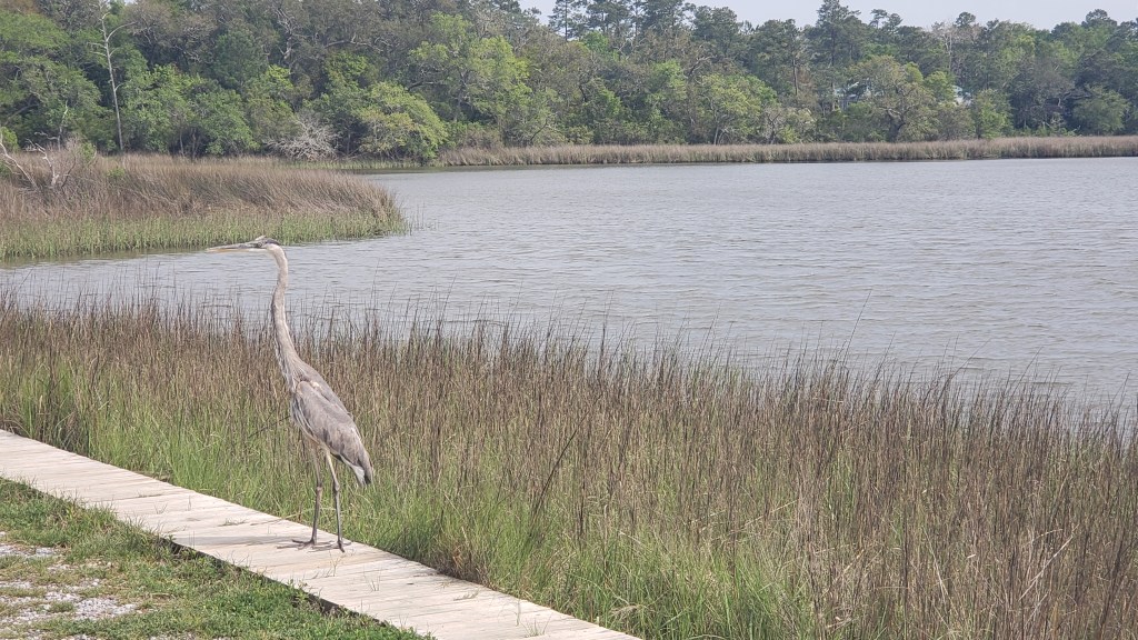
As we were heading out of the park in Nippy after our walk, we detoured down a small road just beyond the Visitor Center and found a big inlet with kayakers and boats and guys fishing with rods and with nets, and a Blue Heron named Reggie. Score!
We chatted with the fishermen about their catches, how long they’d been fishing the inlet (forever), and any dining we shouldn’t miss while we were in the area. One of them mentioned TatoNuts, and the exchange between him and his cousin went like this:
Him: TatoNuts has the best donuts. They’re like no other donuts.
Cousin: That’s because they’re made with potatoes.
Him: No, they’re not.
Cousin: Yes, they are. That’s why they’re TatoNuts. It’s the “tato” part of TatoNuts.
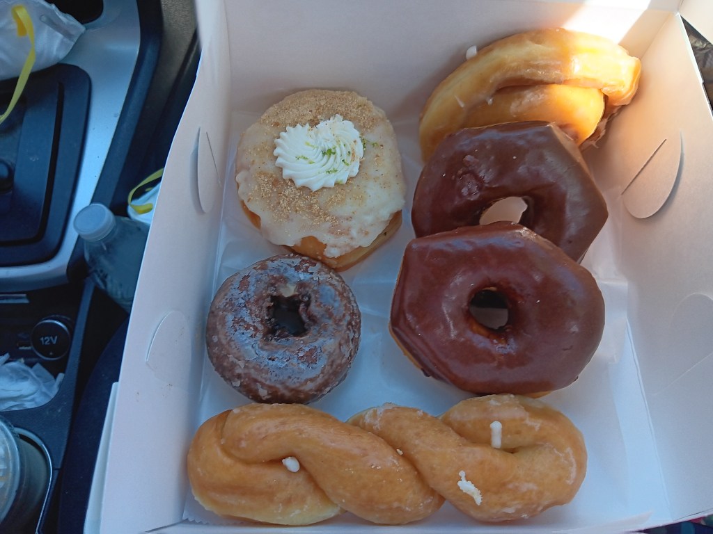
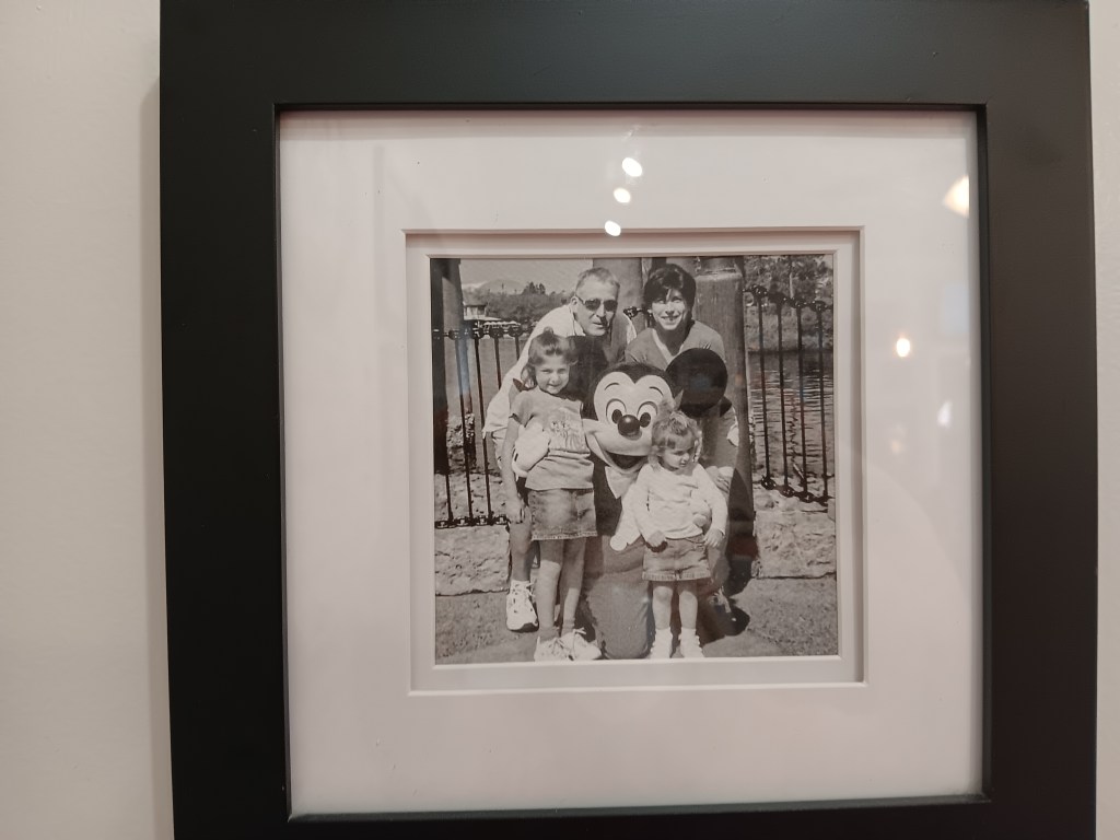
So, of course, we got some. The line to get in was out the door, and while only a few of their donuts were made with ‘tatoes, we couldn’t taste the ‘tato in the nuts we bought, but still agreed they were yummy, made even better by the fact the owners seem to be Disney fans, if the photos on the wall were anything to go by.
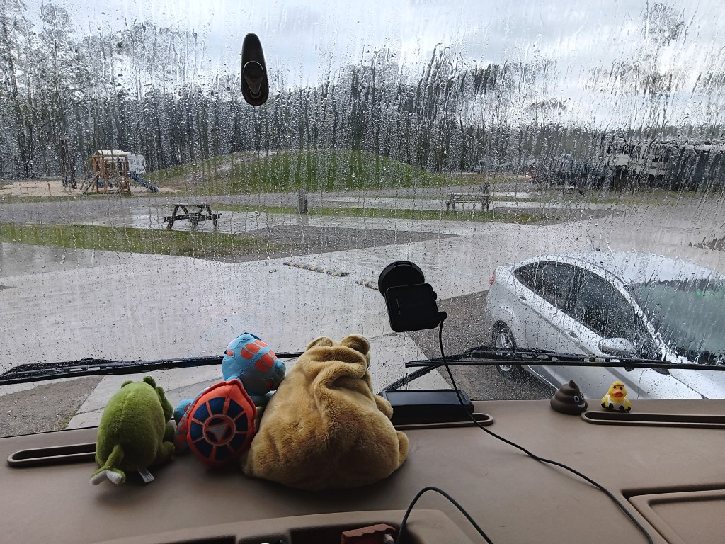
We spent the next day at home, eager to see the event the whole country was talking about. We were forecast to have an 89% solar eclipse view, with just 3% cloud cover. What we got was a zero percent view with 100% cloud cover and pouring-down rain.
But it didn’t dampen our spirits. We turned on the TV and watched the coverage from all over the country, and were thrilled each time a massive cheer went up from those who did get a great view. We take our joy where we can find it!
But the weather wasn’t done with us yet. A massive, dangerous storm was rolling our way, with a forecast of tornadoes, golf-ball sized hail, and wind gusts up to 40 miles per hour or more. We’ve ridden out big storms before, but with the threat of flooding and tornadoes, we made a snap decision to get out of harm’s way, which was 300 miles and two states east, in Tallahassee, Florida.
The extent of the storm’s reach meant we couldn’t get out of the way quickly enough in Fati. We’ve already described on our Facebook page the awfulness of leaving her – our home and our friend – so I won’t go over it again. We spent two nights in a hotel, got sandwiches and salads at Buc-Ee’s twice, and the reunion with Fati was sweet when we returned and found her totally undamaged.
After five visits to Buc Ee’s, what hasn’t he tried yet?
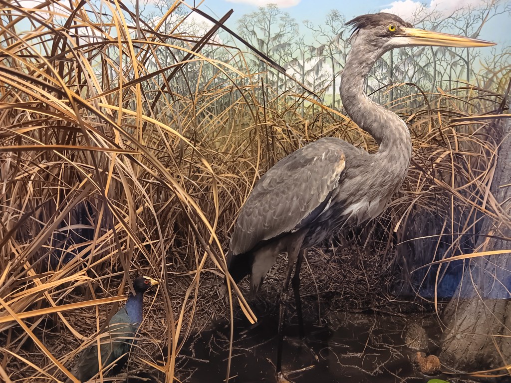
The next day dawned bright, so we visited Mississippi State Sandhill Crane Wildlife Preserve and did a one-mile hike. We didn’t see any Sandhill Cranes, but we have them in our yard in Orlando, so it wasn’t a loss. We did see tiny Spring flowers starting to bloom, and were reminded of the start of this big adventure, when those same flowers were our roadside companions.
The visitor center had a few bird displays, so we didn’t strike out completely.
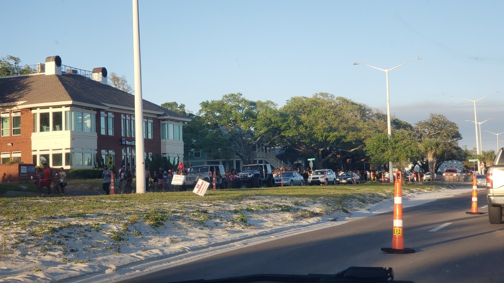
As we drove back along Highway 90 toward Biloxi, the eastbound lane was funneled down to one lane with traffic cones, and every turn-off for several miles was blocked by police cars and barriers. Police and sheriffs from neighboring towns drove up and down the cordoned-off lanes. No one was getting off that road, and traffic was slowed to a crawl or less. What in the living hell was going on?
Our hour-long conversation progressed along the lines of A) This looks like they’re trying to find someone. Human trafficking, maybe? Or drug dealers? B) Is there a terrible accident ahead? Can’t be that, since the traffic cones and barriers were set up well in advance, and there are miles of it. C) Is this…an event? Why all the firetrucks and ambulances and police? Maybe a protest? What day is this? It is an anniversary of some terrible thing? D) It’s got to be a protest of some kind. Every single person we’ve seen for miles has been Black, and roughly the same age. What the hell has Biloxi done to them?
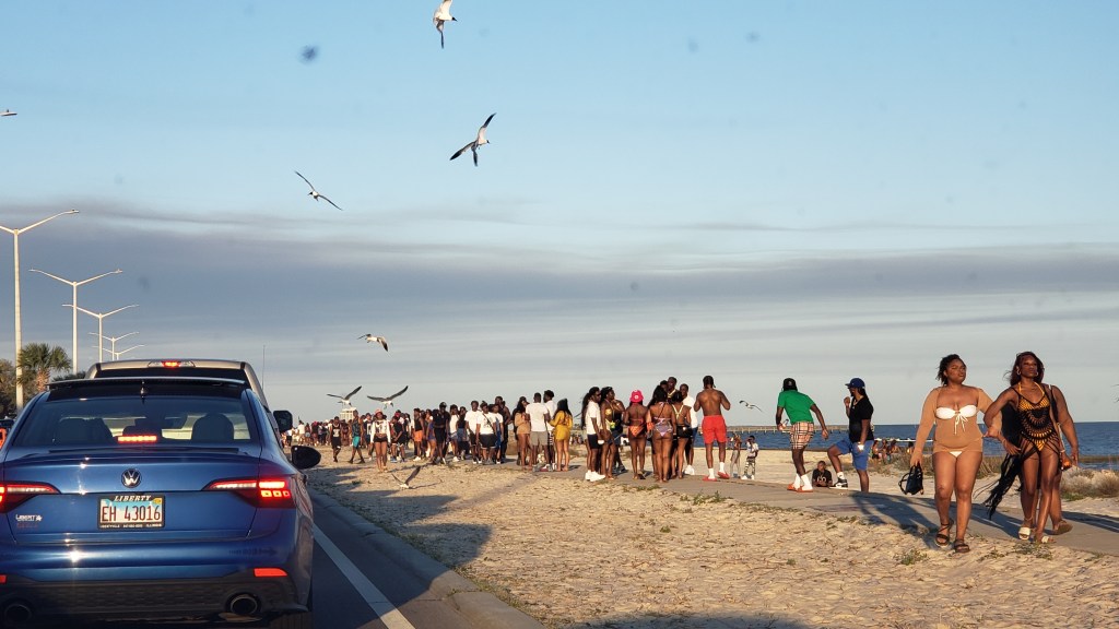
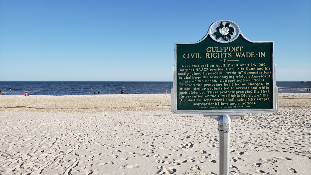
It was none of that. When we returned to Fati and looked it up on the news, we discovered it was Black Spring Break. Black Spring Break (a.k.a. Black Beach) draws Black college students from all over Mississippi to the Gulfport/Biloxi area, for the chance to have a fabulous few days of fun while also remembering the state’s dark days of segregation, and subsequent desegregation of Harrison County’s beaches spurred by the 1959-1963 “wade-ins” that took place right where Black Spring Break unfolded in front of us.
Why the massive amount of law enforcement and emergency medical services? In 2023, a shooter injured five people during the event, including a police officer. This year was not going to see a repeat of that violence. What we saw was thousands of college kids enjoying a gorgeous day at the beach. And while the roadblocks slowed us down immensely, we were thrilled to have seen it once we knew what it was, and what it meant.
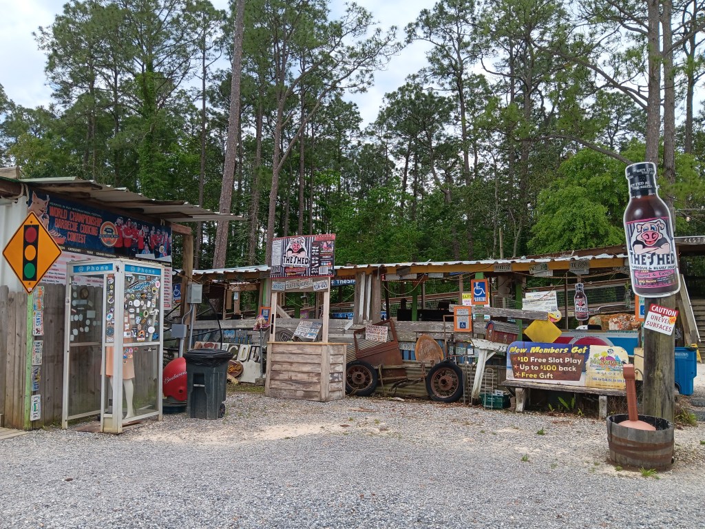
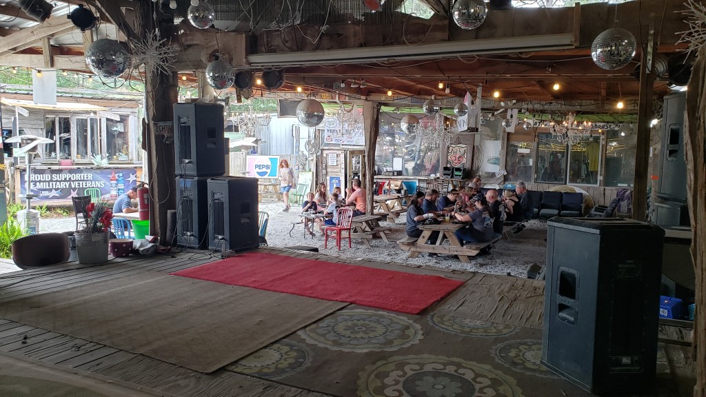
During the rest of our stay in Biloxi, we poodled around with no particular plan, other than paying a visit to the local institution where everyone goes for barbeque, even though it’s freaky and jam-packed and it looks like it hasn’t had a good clean since Hector was a pup. Longer, even. Like, maybe, never.
Oh my lord gawd sweet baby Jesus!
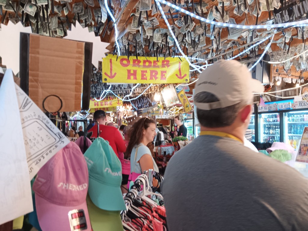
The Shed is the sort of place Susan doesn’t even want to drive past. The kind of place where the likelihood of food poisoning appears to be high. But travel makes people brave, so in we went.
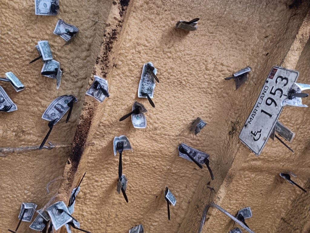
We were the only ones wearing masks (of course we were!), so we got suspicious looks, but who were these people to judge us? They stuck dollar bills to the ceiling with plastic forks, and most of the floor inside is just gravel, so nuh-uh! They don’t get to judge!
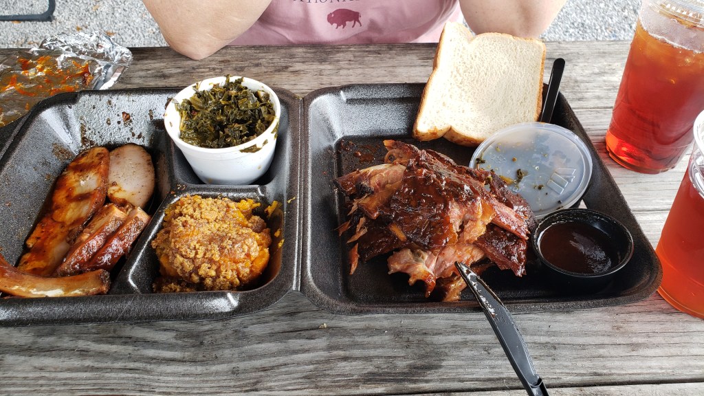
We split half of a Combo Platter of smoked turkey, bbq ribs, sweet potato casserole, and collard greens (with the odd but apparently obligatory slices of thick white bread on the side), and saved the rest for later. Every single bit was fantastic. Fall-off-the-bone ribs, moist and meaty turkey, the kind of sweet potato deliciousness you wish you could recreate at home, and collard greens that make your eyes roll back in your head and your mouth make “yummy” sounds.
It was all going so well until an employee brought out the bread pudding Simon forgot to grab at the pick-up window, and when we said how scrummy it all was, she said, “I wouldn’t know. I’ve never eaten here.”
It’s not what you want to hear when you’re sitting at a restaurant that appears not to put the slightest emphasis on hygiene, but since the number of days it takes to suffer from food poisoning has already passed as I type this, I’m just going to say she’s really missing out.
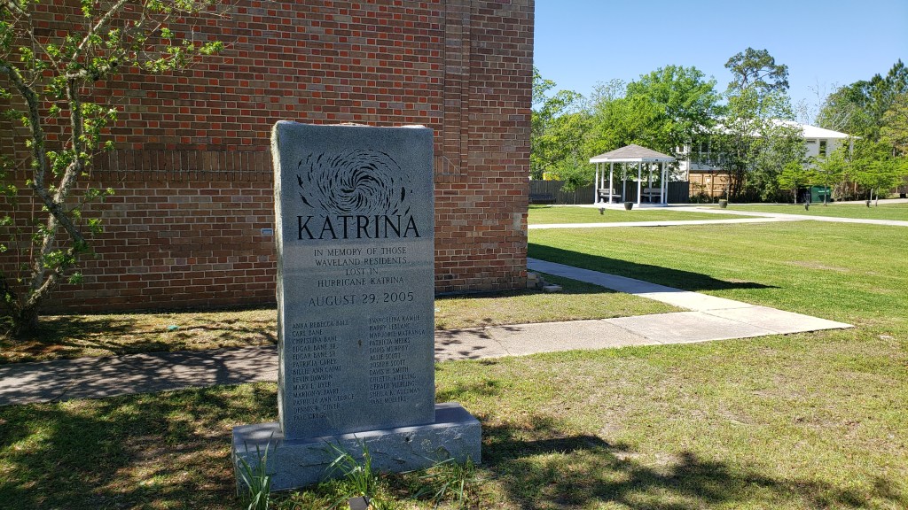
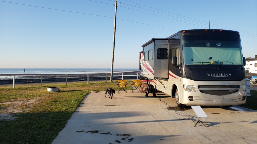
The name Waveland, Mississippi should have rung a loud and distinct bell for us, but as we pulled into our campsite at pretty Buccaneer State Park, with the Gulf of Mexico as our view, we were none the wiser. Over the next few days we’d discover reminders of the great trauma Waveland suffered at the hands of Hurricane Katrina were everywhere, primarily through how the tiny town fought its way back to recovery.
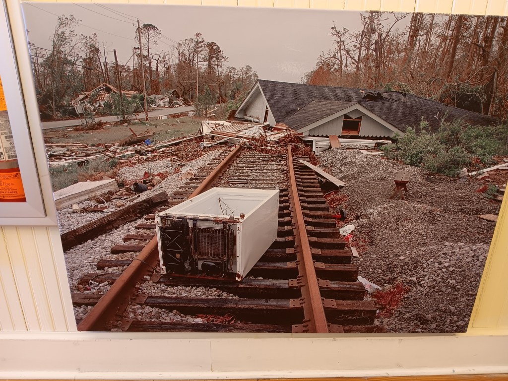
This photo is from the Ground Zero Museum, and it was taken right after Katrina hit.
When Katrina passed and its 30-foot storm surge subsided, next to nothing was left of this once-peaceful seaside community. Homes? Gone. Businesses? Flattened. The railroad tracks running through Waveland? Bent and useless metal. It was one of the worst-hit places along the coast. New Orleans got the press, but Waveland also suffered immensely. Twenty-five of her residents lost their lives, including four in just one family.
Memorial to the twenty-five residents.
Our first stop after settling in was the Ground Zero Museum, which remembers that terrible time through photos, artefacts, and a short movie featuring survivor testimony.
Also from the Ground Zero Museum.
The railroad tracks a mile or more inland acted as a mini levee, and some of the homes on the north side of it survived. Everything south of the tracks was washed away.
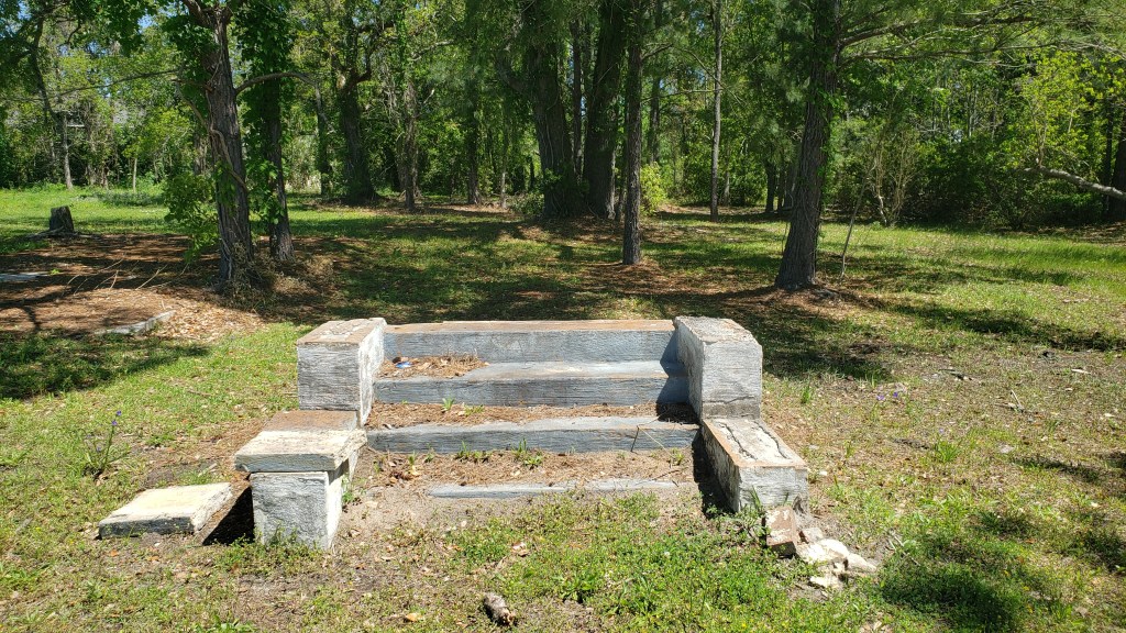
Many plots that obviously once had homes on them still sit vacant.
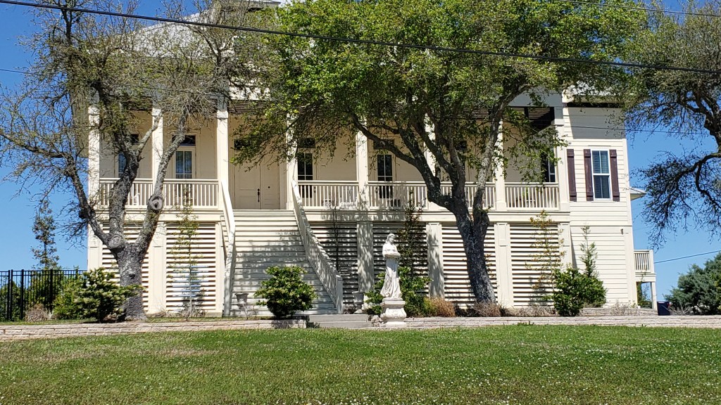
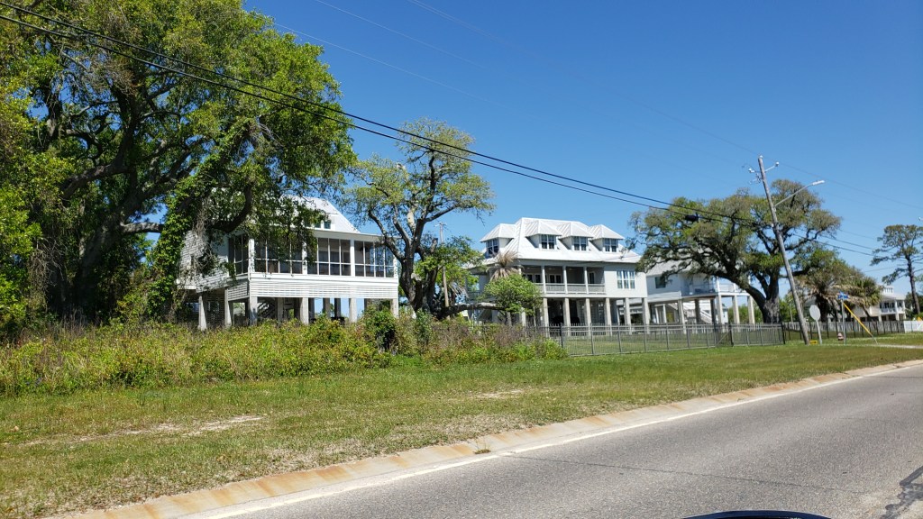
But we found the town’s recovery even more interesting. A long line of huge, expensive homes has gone up along the waterfront (with a road between them and the Gulf), which speaks either to the indomitable human spirit or reckless optimism, and we’re not in a position to make the call on which one it is.
Next-door neighbor, Bay St. Louis, recovered relatively quickly. Settled by the French in 1699 under the name Shieldsborough, Bay St. Louis was held by the Spanish, then the British, and only received its current name in 1875. At one time it was earmarked to be Mississippi’s capital city, but Natchez won, only to lose their title to Washington, which lost the honor to Jackson.
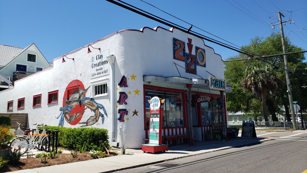
It is now a somewhat touristy area, with shops and restaurants and a fun self-guided tour that takes you past 24 historic sites and buildings, some of which survived Katrina.
Built in 1929, this artist’s co-op was once a grocery store. It’s said to be haunted.
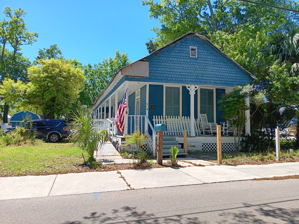
Alice Moseley, who became a famous folk artist at the age of 60, lived here.
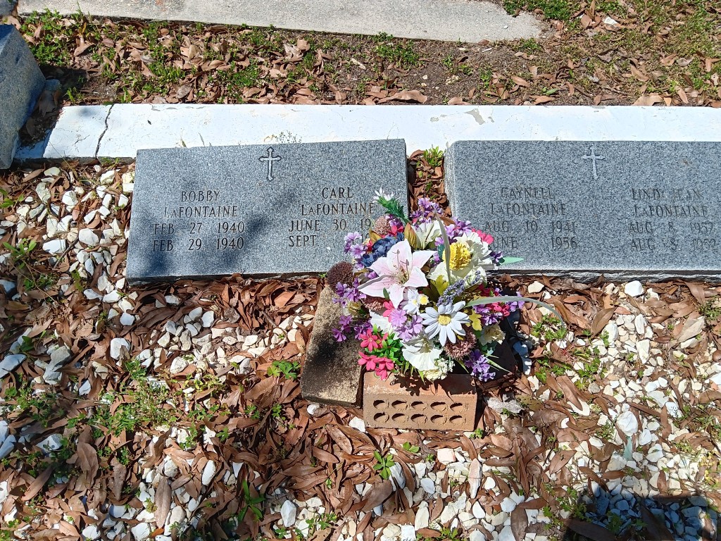
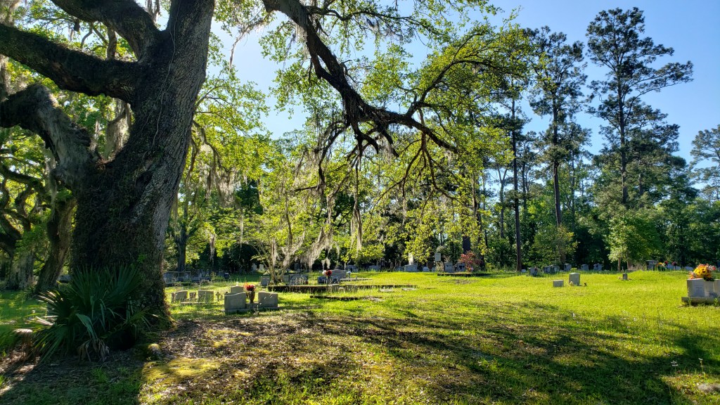
Cedar Rest Cemetery is also on the tour. Here, we found one of the most heartbreaking plots we’ve ever seen. A couple’s four children passed, one on the day of her birth, one on his third day of life, one in his third month, and one in his fifteenth year. Unbearable.
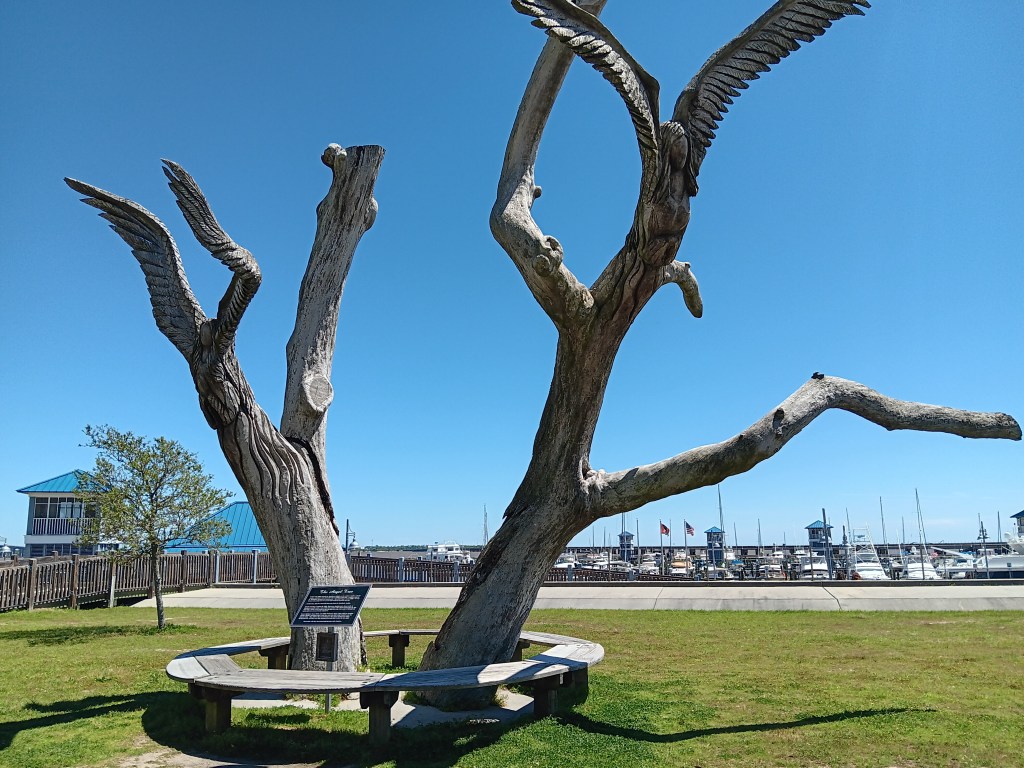
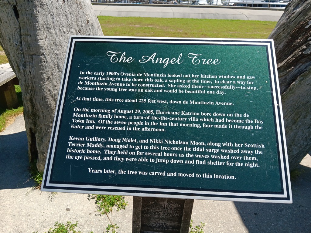
Also located here is the Angel Tree. We’ll let its marker tell you the story.
Look carefully and you’ll see two angels carved into the branches. Their wings are obvious, but their faces less so.
We took a drive out to Kiln on the suggestion there was an interesting historical downtown to explore, but if there was an actual downtown at all, we never found it. And we tried!
We did find a lovely road lined with Live Oak trees, and a marker for Logtown, founded in 1848 as a community supporting one of the United States’ largest lumber mills. Of course, its 250 citizens still living there in 1961 were “removed” so that the John G. Stennis Space Center could take over the land for NASA’s Apollo Moon Mission Program. *Sigh*
All that remains near the marker is a small cemetery.
We only had four days in Waveland, but we were so glad we added it to our itinerary. Hearing the waves from the Gulf at night, seeing the locals out fishing, and enjoying the laid-back vibe, especially at sunrise and sunset, revived us after our time in the Big Easy. But we weren’t finished with the beach just yet.
As keen-eyed blog readers will know, we have just hit the 11 month mark in our grand “A Year On The Road” RV trek across the US. After Louisiana, we arrived in coastal Mississippi, our 23rd state in this epic voyage.
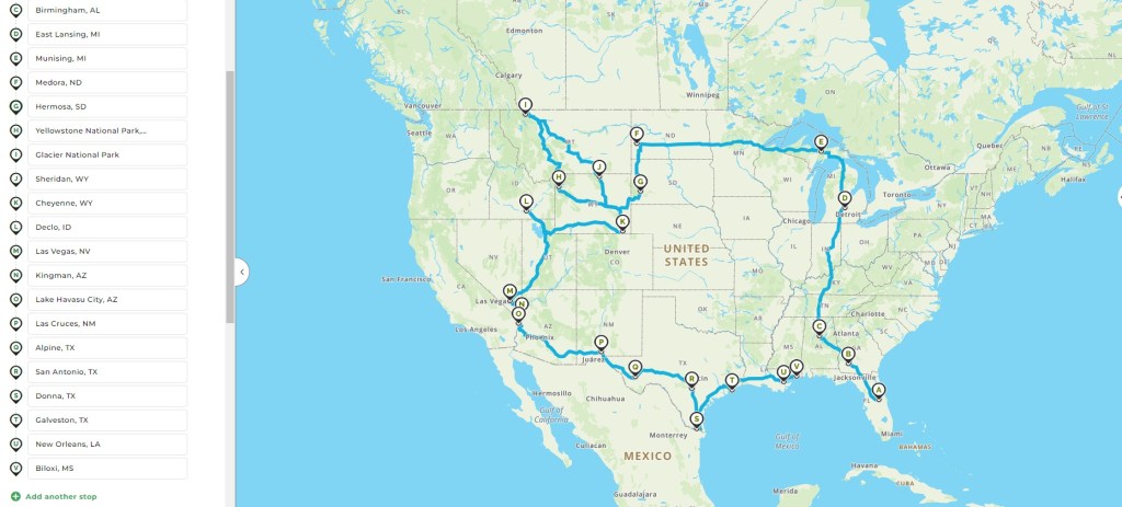
The story so far – 11 months on the road (NB: The pin-points are not our only stopping points – there are more than 60 of those so far!)
Since our last monthly update, we have covered another 181 miles – a totally sedate travel distance at this stage of our journey (especially when we covered more than 2,200 in the first month!).
In the last month we have moved from Baton Rouge, Louisiana, to Biloxi, Mississippi, and our traveling has been a lot more focused on the areas close by, rather than trying to cover vast distances quickly. Even including the last two months, we have only gone a total of 672 miles in our trusty Winnebago, Indefatigable (or Fati for short).
The last two full months of our journey, from Port Aransas in Texas all the way along the Gulf Coast to Biloxi via Louisiana
Mind you, we have still covered some territory in our trusty tow car, Nippy, putting an additional 2,534 miles on our little Ford Fiesta (and 3,991 in the past two months), which shows that we’ve completely changed the balance of our touring – going shorter distances in Fati but doing more exploration in Nippy.
Now, with just a month left of our travels (but still more than 550 miles from home), it definitely feels like the end of our grand adventure is firmly in sight, which is very hard to contemplate after such a prolonged – and intense – period of traveling.
In total, we have come 9,225 miles in Fati since leaving home, and another 24,604 in Nippy, for a grand total of 33,829 around this amazing country. Eat your heart out, Hardest Geezer!
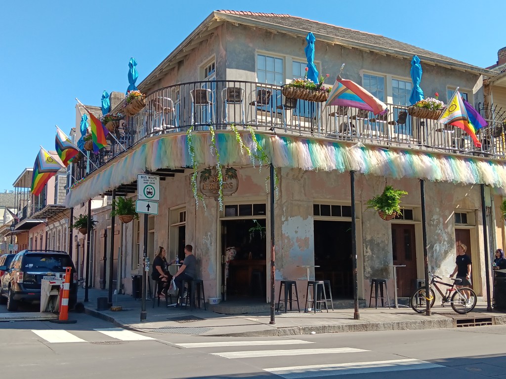
New Orleans wasn’t a new city for us. We’d been there before, but anyone who has visited the Big Easy knows it’s never the same and it’s always the same and you can’t be certain of what you’ll get. The French Quarter is a perfect example – dynamic and predictable at the same time. We love it and we hate it, so, naturally, we made it our first day’s destination.
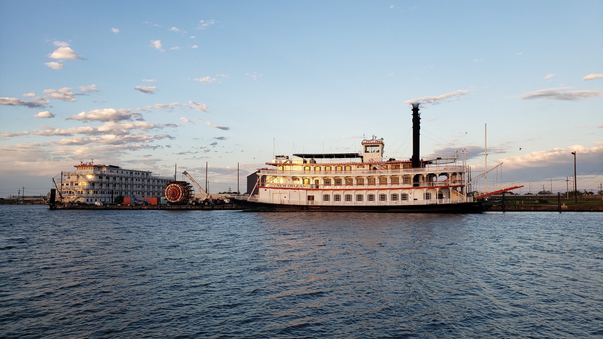
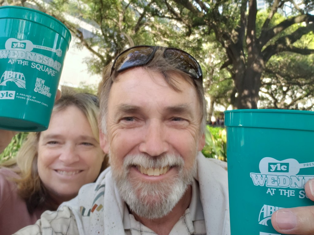
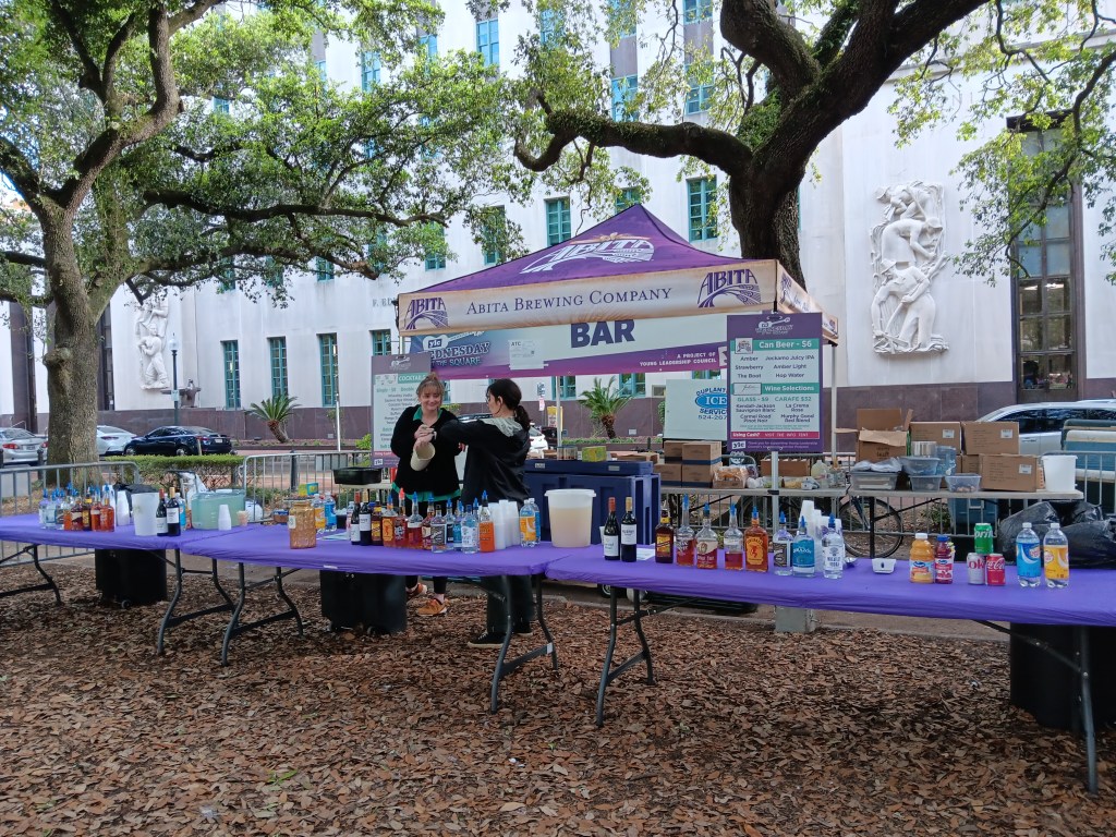
As luck would have it, we arrived mid-week, so after we settled in at waterside New Orleans RV Resort and Marina we went into the city for Lafayette Square’s big Wednesday Concert Series. Locals make good use of the concerts, and it was easy to see why. Plenty of food and booze, good Jazz, and the concert was free.
We bugged out after Trumpet Mafia finished their set, and we headed over to the French Quarter to get our fix of iconic New Orleans and massive, inebriated crowds. To be fair, most people were probably at least somewhat sober, but the area’s open-carry alcohol policy is always in full swing, leading to happy pedestrians rambling in the streets and traffic nearly at gridlock.
Bourbon Street, not yet at full capacity.
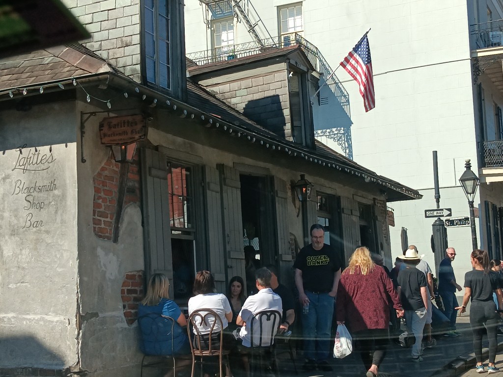
Lafitte’s dates back to the early 1770s and is said to be the oldest bar in the United States
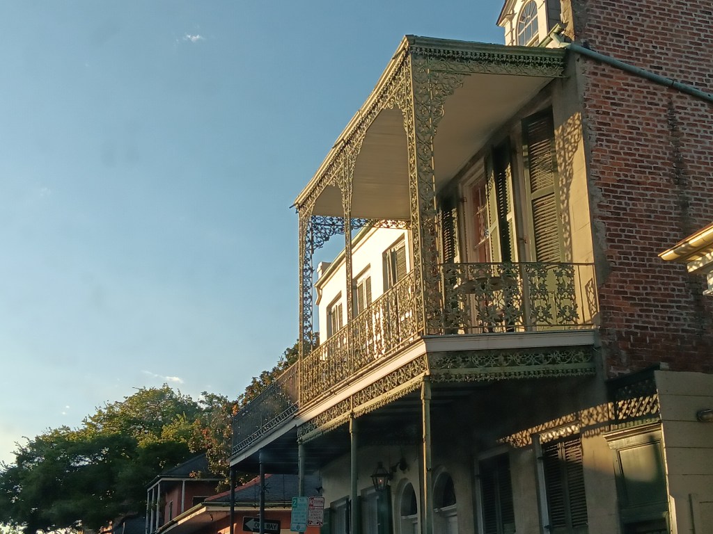
The upside to driving Nippy through the masses was the chance to thoroughly enjoy the architectural details that make New Orleans such a great city. So much of it is just beautiful. It’s one of those locations that, once you’ve seen it you never forget it.
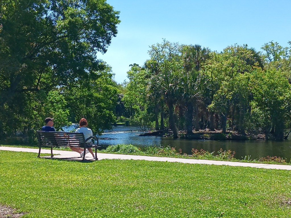
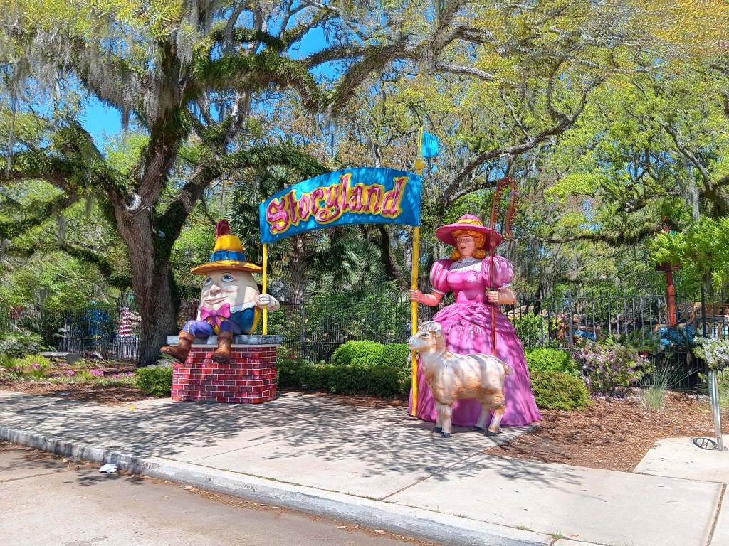
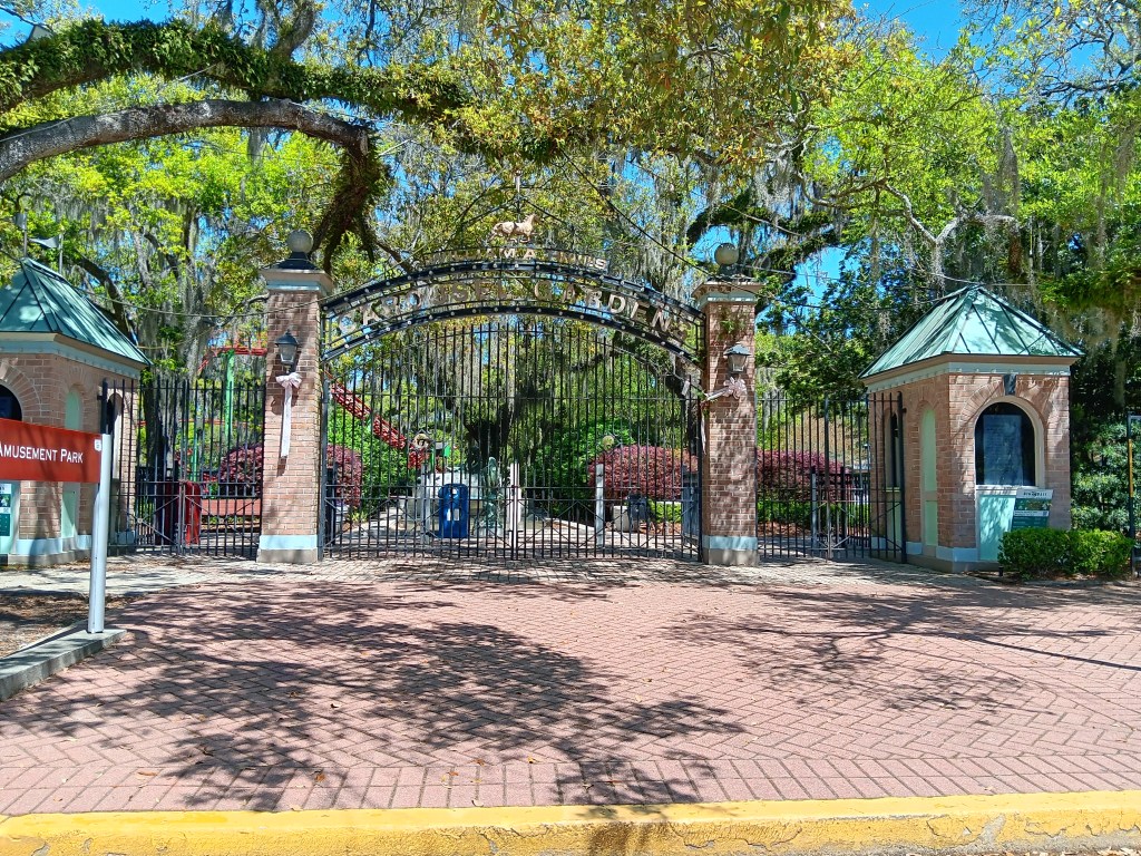
We drove through City Park the next day, primarily for the big dog park, which we discovered was only open to those with a membership. The park itself, however, blew us away with how much it offered, and we could only imagine how fantastic it would be to live nearby. Anything you could ever want from a community amenity could be found there. Storyland for young children, a mini amusement park for older kids, botanical gardens, Putt-Putt golf, all manner of enjoyment on land and on water, and, we noted, an outlet of New Orleans’ famous Café Du Monde.
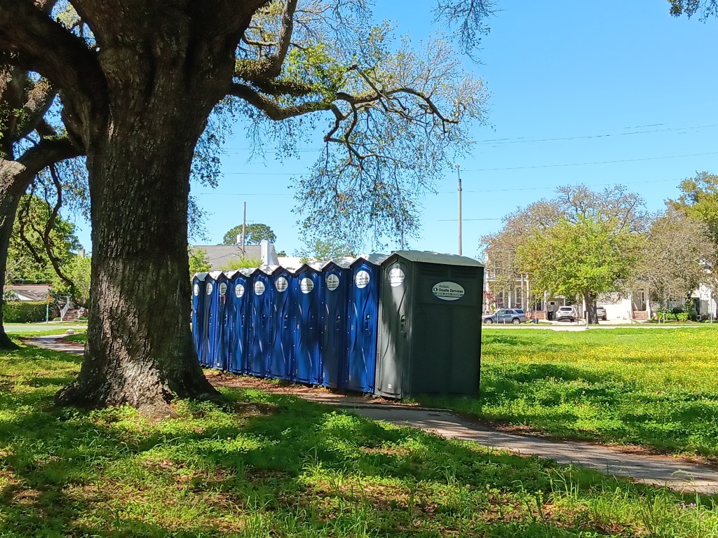
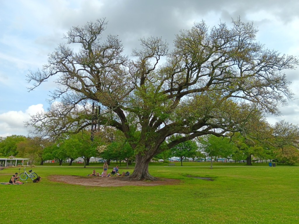
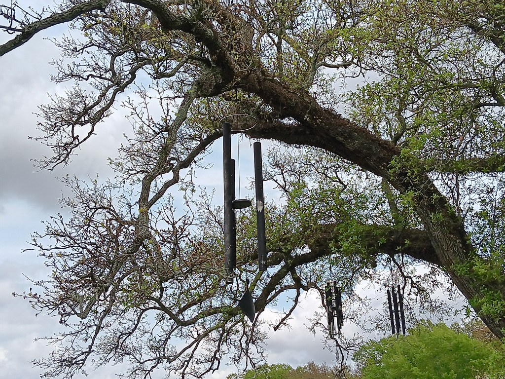
We didn’t stop, other than making a sprint for the porta-potties after all our morning coffee and tea, but we would return here later in the week for a good stroll, and during that time we discovered the enchanting Singing Tree, adorned with lots of wind chimes that created a gentle, pleasing sound with each breeze.
Sweet, blessed relief! But not for us. They were all zip-tied shut.
Here’s a sneak peek at the Singing Tree, which we didn’t see until our next visit.
It has some gigantic clangers.
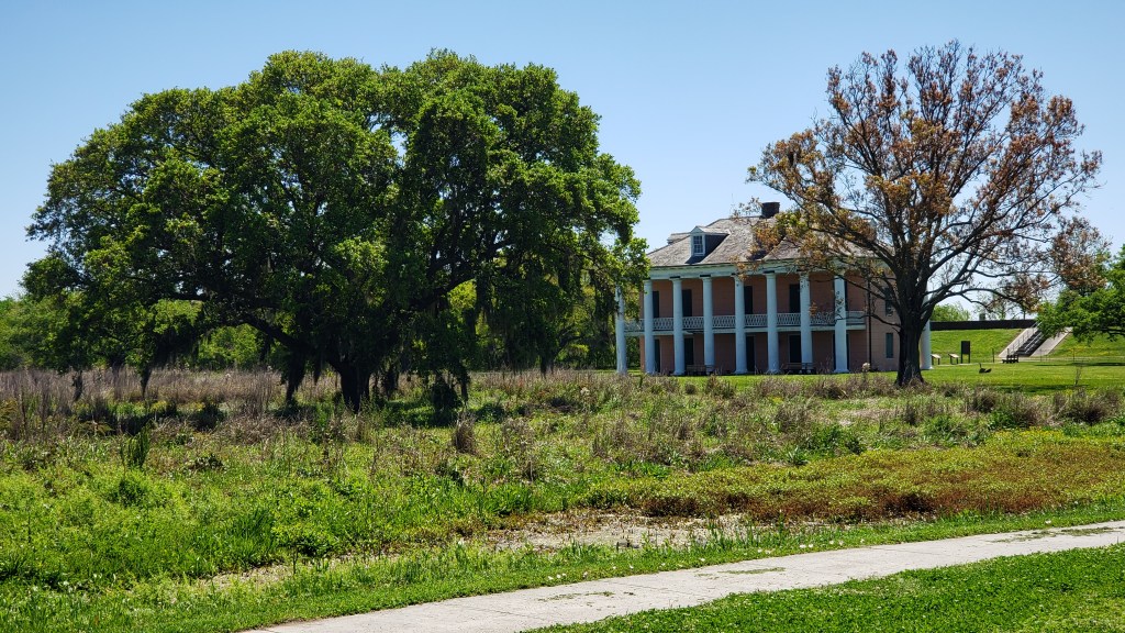
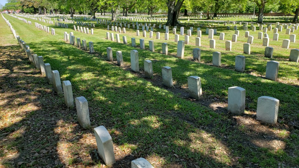
We headed out of the park to San Bernardo Byway, making a stop at Chalmette National Historic Park and Battlefield site of 1815 Battle of New Orleans, between American and British forces. Chalmette Cemetery is right next to the battlefield, with 14,000 graves of soldiers from the War of 1812 through Vietnam. Freeman Cemetery is here, too, with the graves of slaves.
But the coolest thing about the battlefield was, it was inherited by a freed Black man, Jean Pierre Fazende, after the Civil War, who partitioned it off and sold plots to former slaves, creating Fazendeville. The not-cool part is, the National Park Service essentially took back the land in 1966, some say to “honor the sesquicentennial,” other say it was done to break up the community for voting and school segregation reasons. Either way, the thriving village was destroyed, and those who had homes there ended up in New Orleans’ Lower 9th Ward, which later suffered the most damage from the levee failure after Hurricane Katrina.
This plantation home was built on the former battlefield in the 1830s
The Byway also passed through St. Bernard, where 81% of the buildings (20,229 houses) were damaged on Aug 29, 2005, due to Hurricane Katrina. Then Issac hit –twice—in 2012. Seventeen miles south of New Orleans, the area is practically surrounded by water at the best of times, but when the sea moved in during the hurricanes, devastation happened.
A long stretch running parallel to the single road to Shell Beach is lined with dead trees, on both sides.
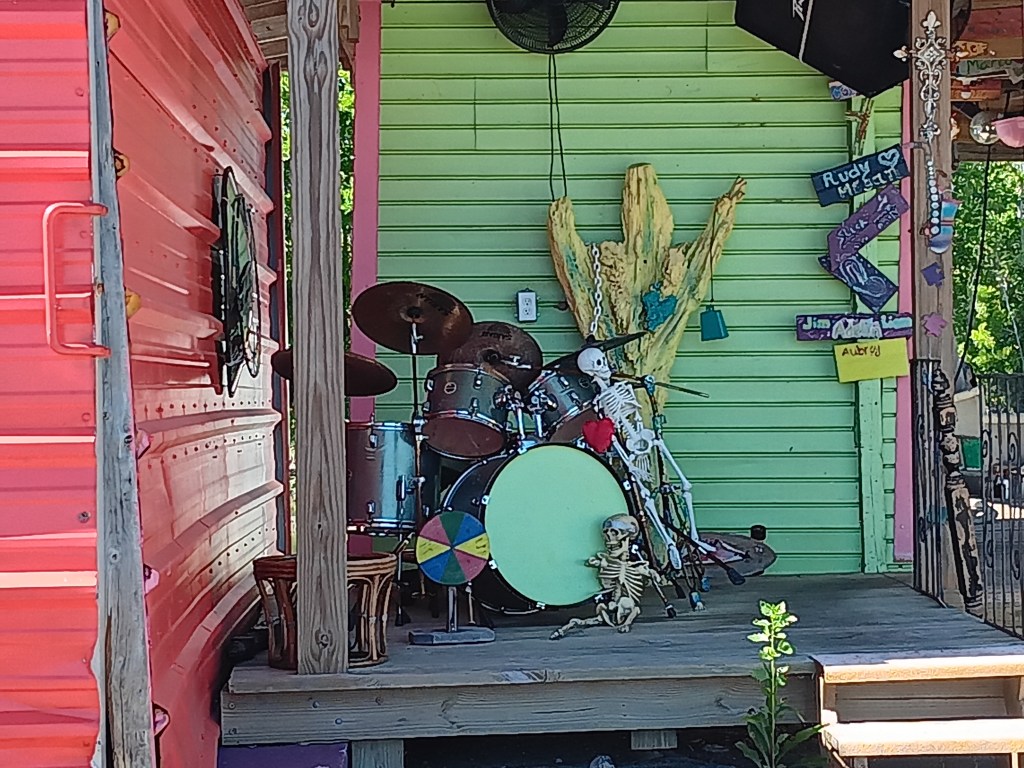
We ended at the tiny fishing village of Shell Beach, a funny little place that’s pretty much just one street, with a quirky sense of humor.
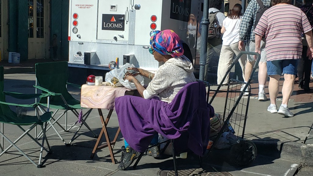
We took another drive through the French Quarter hoping for a stop at Café Du Monde or Beignet Café, but again, it was a no-go. But this visit turned into a reminder that you never know what you’re going to see, and we saw some stuff.
This lady set up some sort of fortune-teller opportunity, right in the street.
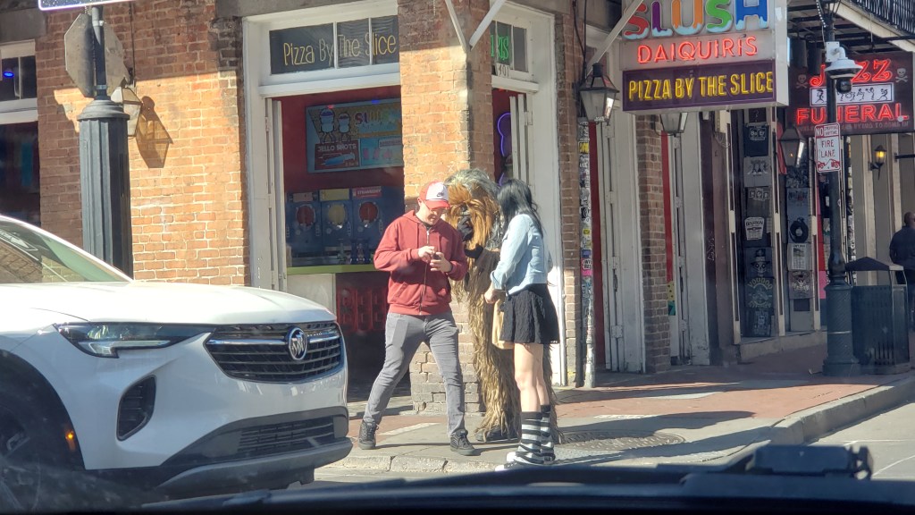
We don’t even know what to say about this. Some poor guy had to stand in the middle of the street to take their photo.
This doesn’t look like much, until you realize that’s Chewbacca in between these two people.
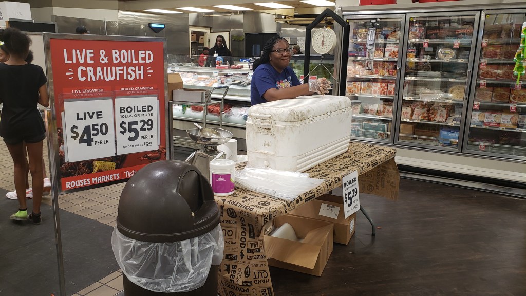
Instead, we stopped at Rouse’s grocery store to pick up something for dinner, and discovered Louisiana is even more serious about its crawfish than we thought. Cookin’ ‘em up in the parking lot, sellin’ ‘em inside the store, fresh and ready to devour. What a wonderful world we live in!
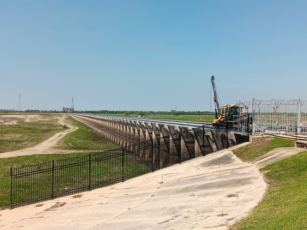
Our next road trip was out to swamp country, starting at Norco, home to the Bonnet Carre Spillway flood control operation. Now, we’re not engineers, so maybe this is an important feature for flood control, but we did wonder how the big spaces between the spillway’s wooden slats were going to stop much water.
You can’t see the wooden slats in this photo, but they had gaps.
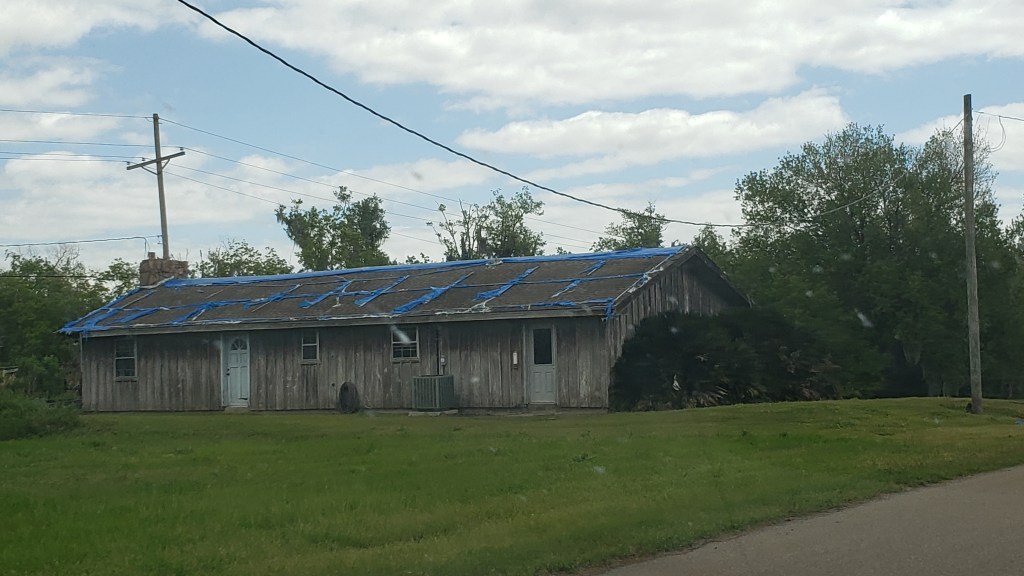
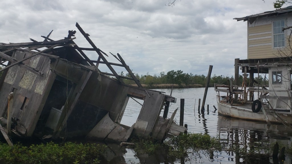
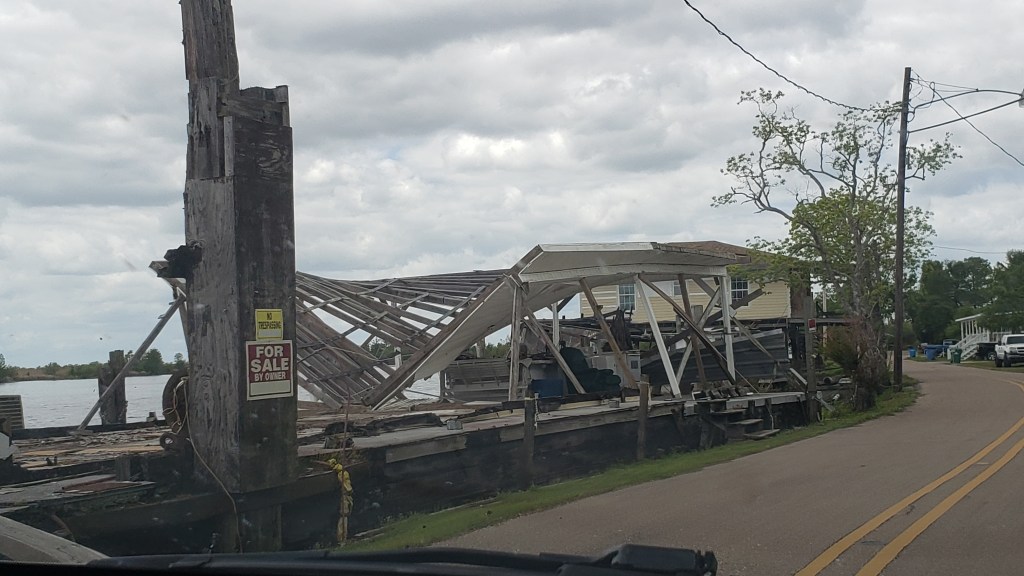
So many homes and businesses we saw along our drives still stand as stark reminders of the hurricanes’ power.
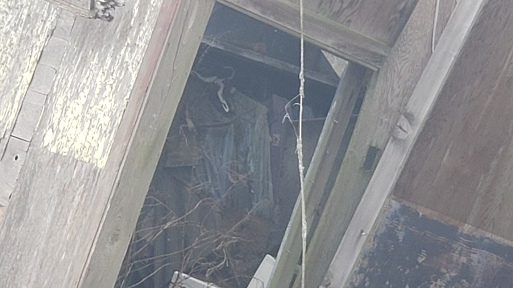
This destroyed home still had clothing in the closet.
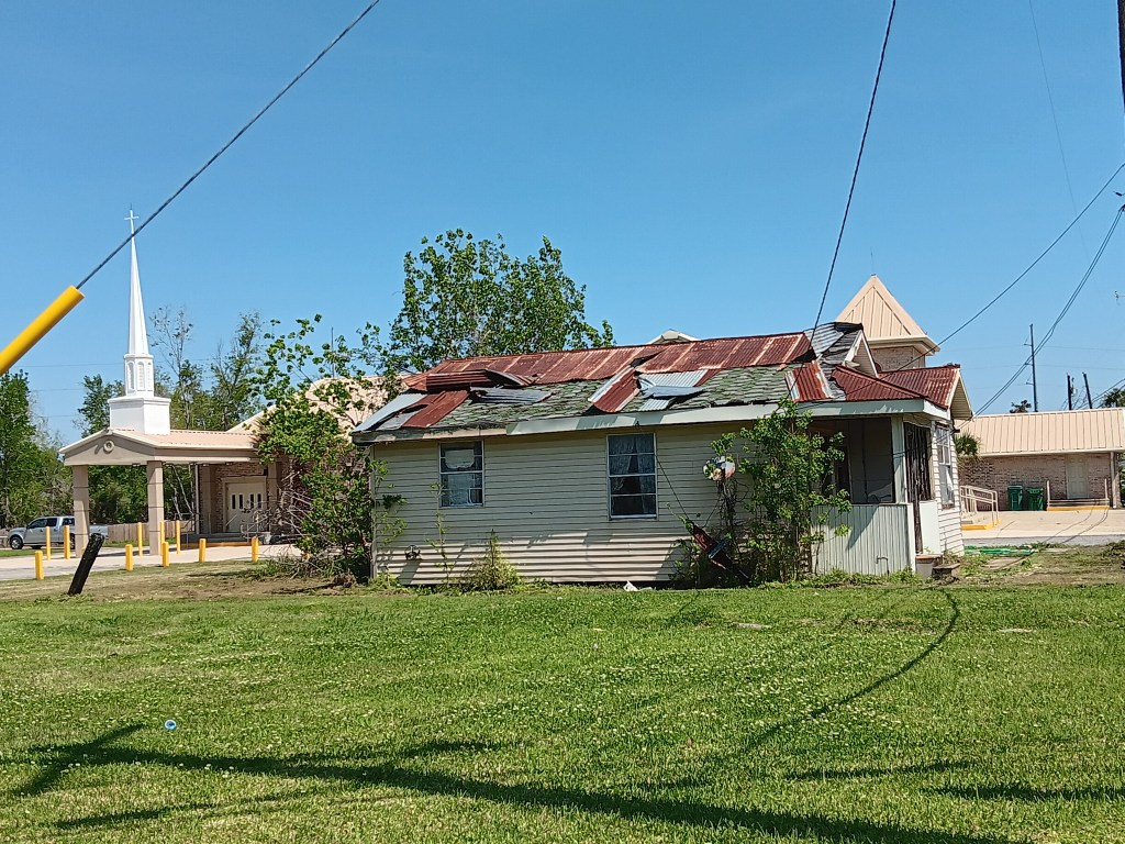
A few metal roofs told such a detailed story that it was easy to imagine every moment as the roof panels were being tortured and stripped away by the wind.
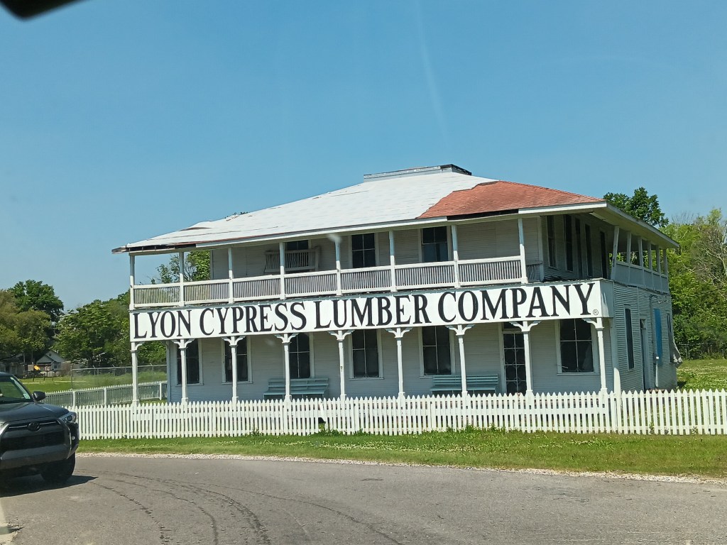
We then passed through Garryville hoping to find the Timbermill Museum Pond Trail, but when we arrived it seemed the museum and its trail packed up and went home a decade or two ago, and were nowhere to be found.
It was supposed to be here, but it’s not.
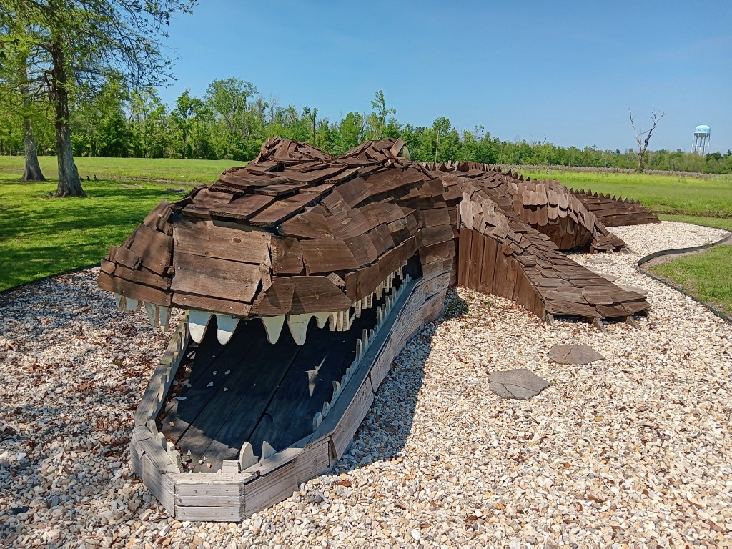
But no matter. Our next adventure was a giant gator hunt, so our excitement level remained high. When we found it, we snapped a dozen photos like the tourists we are.
Note the gator’s eyeball. Menacing or comical? You decide!
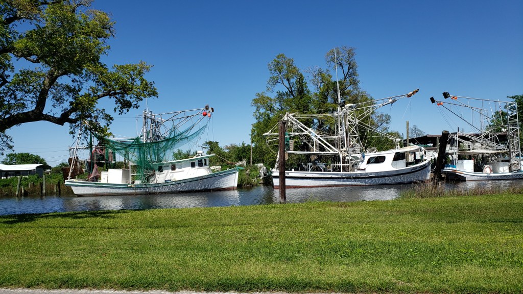
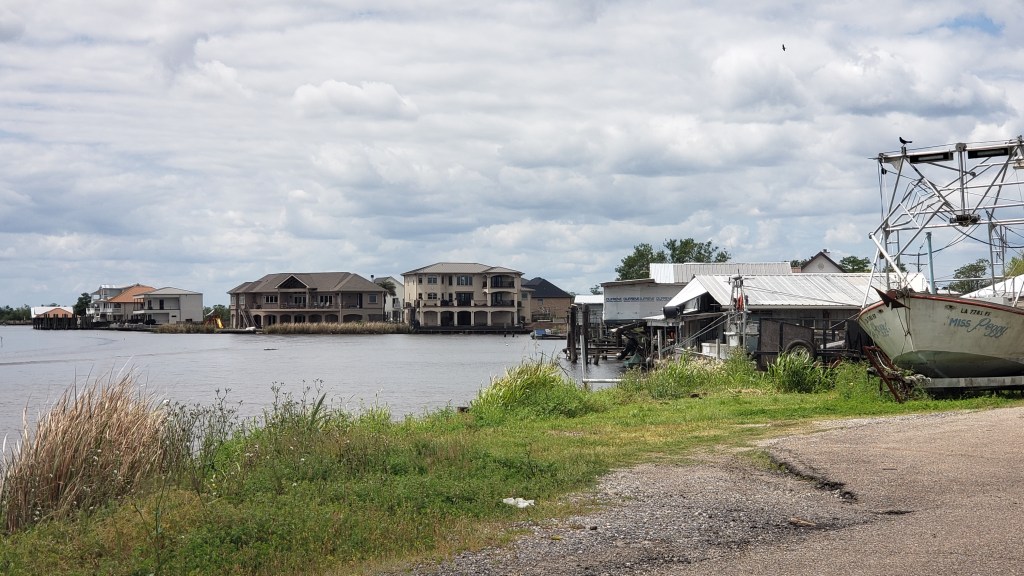
The next day found us heading south on 310 and 90 through series of small, rural towns, with random ships on one of the canals. Much of the area south of New Orleans is strips of land with water on both sides, so fishing, crabbing, and shrimping are the main ventures, along with big industrial refineries.
Bayou Gauche prompted a little detour off our path, mainly because we liked the name.
Most of the photos of destroyed homes (above) were taken in Bayou Gauche. It’s an area experiencing dramatic change, as you can see by the mansions just across the bayou.
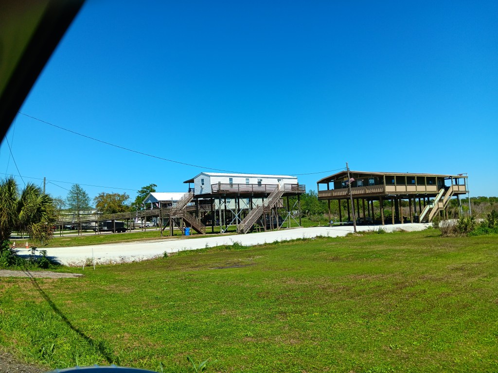
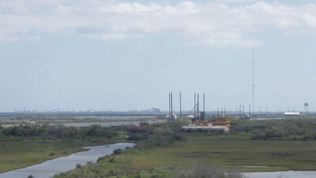
We drove on to Leeville, where we veered onto a massively long bridge to Port Fourchon, the furthest south we could go and still be on terra firma.
There have been many, many times during our trip that we’ve “felt” how hard-working our fellow Americans are, and how much our own lives are surrounded by conveniences of every kind. The rural, coastal areas of Louisiana impressed us with the level of self-sufficiency they require, and the ability to survive in such harsh and natural locations.
We’d packed a lot of New Orleans into just a few days, but we weren’t done yet.